Heart of Wales Line Trail
How would you rate Heart of Wales Line Trail?
Tap a star to share your experience and help other hikers.
Heart of Wales Line Trail: Rail-linked walking across mid Wales
HikeList Score
Heart of Wales Line Trail scored 89/100 on HikeList's trail-quality metrics.
See score breakdownHide breakdown
- Ideal length 91
- Balanced challenge 100
- Scenery & wildness 58
- Varied terrain 100
- Accommodation 100
- Food & support 94
- Path quality 98
- Season flexibility 89
Computed from length, challenge, scenery & wildness, terrain variety, accommodation, food & support, path quality and season flexibility.
The Heart of Wales Line Trail is a 229 km point-to-point walk from Craven Arms in Shropshire to Llanelli in Carmarthenshire, usually walked in 10-14 days. It is a moderate long-distance route, but expect strenuous upland sections, many stiles and gates, and 5,637 m of total ascent. The trail suits hikers who want a rural through-walk with unusually good rail access for section walking. For more routes in the same country, see our Wales hiking guide, the Beacons Way and the Anglesey Coastal Path.
Route Overview
This is a linear trail, best planned north-to-south from Craven Arms to Llanelli, finishing at the Millennium Coastal Park / Llanelli station rather than Swansea. In order, the route links Craven Arms, Broome, Bucknell, Knighton, Knucklas, Llangynllo, Llanbister Road, Penybont, Llandrindod Wells, Builth Wells, Llanwrtyd Wells, Cynghordy, Llandovery, Llangadog, Llandeilo, Pontarddulais and Llanelli. It crosses the Shropshire Hills, Radnorshire uplands, Radnor Forest, the Tywi valley and the Loughor estuary saltmarshes. The key practical advantage is the Heart of Wales railway line, which shadows the route and gives car-free access, bail-out options and station-to-station day-walk possibilities.
How the trail developed
The Heart of Wales Line Trail was officially opened on 28-29 March 2019 after roughly four years of planning, which began with a 2015 meeting between rail enthusiasts and walkers. It was developed by volunteers and crowdfunding, then later supported by the Friends of the Heart of Wales Line Trail, a charity formed in 2023. The route is closely tied to the working, 150-year-old Heart of Wales railway line, using stations and station-link paths as part of its identity and logistics.
Notable highlights
- Cynghordy Viaduct: An 18-arch curved sandstone-and-brick railway viaduct, built in 1867-68, about 31 m high over the Afon Bran near Llandovery. The trail passes beneath or near it, making it one of the clearest railway landmarks on the route.
- Sugar Loaf uplands: Between Llanwrtyd Wells and Cynghordy, the path climbs brackened hills around Sugar Loaf while the railway runs below through the Sugar Loaf Tunnel. This is one of the more exposed and scenic upland sections.
- Llandovery: A historic Welsh drovers' town, also known as Llanymddyfri, with a small ruined castle. It is a useful mid-route resupply and rest stop.
- Tywi (Towy) valley: A broad fertile river valley around Llandovery and Llandeilo, lined with oak and ash. Walkers may see dippers and grey wagtails along the river corridor.
- Knighton / Offa's Dyke: Knighton, or Tref-y-clawdd, sits on the England-Wales border and on Offa's Dyke. The trail shares ground with the 8th-century earthwork here.
- Loughor estuary and Millennium Coastal Park: The final approach follows saltmarshes of the Loughor valley to Llanelli's Millennium Coastal Park on Carmarthen Bay, a reclaimed industrial shoreline now used as a green coastal route.
Challenges to expect
The overall grade is moderate, but do not treat it as flat valley walking. The route includes upland moorland, brackened hills, rolling farmland, woodland, river valleys and estuary paths, with 5,637 m of total ascent. Expect many stiles and gates, some strenuous exposed sections, and mixed surfaces from grass and dirt to gravel, quiet lanes and short urban paths. Waymarking is in place, but signs can be missing, so carry a map or GPX.
HikeList Score
Heart of Wales Line Trail scored 89/100 on HikeList's trail-quality metrics.
See score breakdownHide breakdown
- Ideal length 91
- Balanced challenge 100
- Scenery & wildness 58
- Varied terrain 100
- Accommodation 100
- Food & support 94
- Path quality 98
- Season flexibility 89
Computed from length, challenge, scenery & wildness, terrain variety, accommodation, food & support, path quality and season flexibility.
 United Kingdom
 Wales
WalesShow more data Show less
- Upland Moorland
- River Valleys
- Rolling Farmland
- Ancient Woodland
- Saltmarsh / Estuary Near Llanelli
- Dirt
- Grass
- Gravel
- Some Quiet Lanes And Short Urban Paths
- Guesthouses
- B&Bs
- Campsites
- Hostels
- Family Friendly
- Dog Friendly On Leash
- Restrooms
- Potable Water Sources
- Established Campsites
- Public Transport Access Points
Download Our Full Guide to Heart of Wales Line Trail FREE!
Get our comprehensive guide to this hike for free. Save it for later reading or print out at home.
Photos from hikers
Taken on the trail by people who've reviewed Heart of Wales Line Trail.
Heart of Wales Line Trail: The Complete Guide
 i
Image by Wikipedia
i
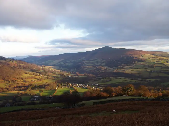
Image by Wikipedia The Heart of Wales Line Trail is a rare long-distance walk built around a working rural railway. It runs from Craven Arms in Shropshire to Llanelli on Carmarthen Bay, crossing quiet border country, upland Wales and the Tywi (Towy) valley before reaching the Loughor estuary.
This is not a railway-side stroll or a coastal path in disguise. The route uses field paths, moorland tracks, woodland, lanes and station-link paths, with the line never far enough away to lose its practical value.
Its strongest appeal is flexibility. Fit walkers can take it on as a 10-14 day through-walk, while section walkers can build it gradually between stations such as Knighton (Tref-y-clawdd), Llandrindod Wells, Llanwrtyd Wells, Llandovery (Llanymddyfri), Llandeilo and Llanelli.
The walking is moderate rather than technical, but it still asks for proper hill-walking habits. Expect many stiles and gates, exposed upland sections around Radnor Forest and Sugar Loaf, occasional vague ground, patchy waymarking and the need to plan around sparse train services.
This guide covers stages, realistic walking days, accommodation, food, transport, terrain and the common planning mistakes to avoid.
Stage-by-Stage Guide
Distances are approximate. The Heart of Wales Line Trail uses station-link paths in places and does not pass every station platform directly, so allow time for signed links, accommodation detours and any route updates. A map or GPX is needed throughout; waymarking is useful but can be patchy, particularly on upland and field-path sections.
Stage 1: Craven Arms to Bucknell — 17 km
The opening stage leaves the railway town of Craven Arms and heads into the Shropshire Hills on a mix of pastoral field paths, quiet lanes and valley walking. The route shadows the railway through or near Broome and Hopton Heath before continuing by Hopton Castle towards Bucknell.
Expect many gates and stiles, with muddy field margins likely after rain. This is not technically hard walking, but the early farmland sections need careful attention to waymarks, especially where paths cross enclosed fields or leave lanes.
Food and water are best sorted before leaving Craven Arms. Do not rely on facilities in the smaller places along the way without checking opening times, and carry enough water for the full stage.
Bucknell has rail access on the Heart of Wales line, making this a straightforward first day or a useful section-walk endpoint. Accommodation at the end of this stage is more limited than in the larger market and spa towns, so book ahead or plan a rail transfer if needed. Train times are sparse and should be checked before travelling.
Stage 2: Bucknell to Knighton (Tref-y-clawdd) — 14 km
This is a shorter but rewarding day through the border country between Shropshire and Powys, finishing in Knighton (Tref-y-clawdd), the only town actually on Offa’s Dyke. The trail meets both Offa’s Dyke Path and Glyndŵr’s Way here, so expect a stronger long-distance-trail feel near the end of the stage.
Terrain is mainly rural: field paths, tracks, lanes and rolling hill country. Underfoot conditions are usually straightforward, but stiles, livestock fields and wet grass can slow the pace.
Bucknell is the last dependable place to organise supplies before setting out. Knighton is a much better overnight stop, with more scope for food, accommodation and resupply than the villages north of it.
Both Bucknell and Knighton are served by the Heart of Wales line. Because trains are infrequent, this stage works well for rail-based section walking only if the day is planned around the timetable rather than treated as a turn-up-and-go option.
Navigation is generally manageable, but the approach to Knighton has several important path junctions because of the meeting long-distance routes. Keep checking the map rather than following another trail’s waymarks by assumption.
Stage 3: Knighton (Tref-y-clawdd) to Llangynllo (Llangunllo) — 21 km
This is one of the more significant upland stages on the trail. From Knighton the route heads south-west towards Knucklas (Cnwclas), where the railway’s 13-arch viaduct and Castle Hill are the main landmarks, before continuing into the Radnorshire uplands around Llangynllo (Llangunllo).
The character changes from settled border country to more open, exposed ground. The route shares ground with Glyndŵr’s Way on high moorland in the shadow of Radnor Forest, among the highest parts of the whole trail, with existing route data giving the high point as 477 m.
Food and water should be carried from Knighton. Knucklas is a useful landmark and rail-access point, but small-place facilities cannot be assumed; this should be checked before travelling. Llangynllo is not a large service centre, so evening food and accommodation need advance planning.
Rail access is available at Knighton, Knucklas and Llangynllo, though the service pattern is sparse. This makes the stage viable as a long day walk, but only with a realistic exit plan if weather or navigation slows progress.
This is a stage where map and GPX use matters. Open moorland can be wet, windy and locally unclear underfoot, and mist would make the high ground more serious than the distance alone suggests. Carry an extra layer even in settled weather.
Stage 4: Llangynllo (Llangunllo) to Llandrindod Wells — 22 km
This stage continues across Radnorshire country before dropping towards Llandrindod Wells, the largest settlement on the line and one of the trail’s most important resupply points. The route passes through or near Llanbister Road, Penybont and Dolau, giving several railway-linked reference points along the way.
The walking is a mixture of upland edge, field paths, drovers’ tracks, lanes and rural valleys. It is not technical, but the distance, stiles and exposed sections make it a full day rather than an easy transfer between stations.
Start with enough food and water for most of the day. Small settlements on this stage should not be treated as guaranteed refreshment stops unless opening times and locations have been checked in advance.
Llandrindod Wells is the natural overnight base, with a broader choice of accommodation and services than the smaller communities to the north. Rail access is available at Llangynllo, Llanbister Road, Penybont/Dolau and Llandrindod, but station links may add time and distance.
Navigation can be awkward where the route leaves lanes for fields or open tracks. In poor visibility, take particular care on higher ground before the approach to Llandrindod Wells.
Stage 5: Llandrindod Wells to Builth Wells (Llanfair-ym-Muallt) — 19 km
Leaving Llandrindod Wells, the trail heads through the country around the River Ithon and passes the earthworks of Cefnllys Castle, one of the most distinctive historic features on the central section. The day then continues towards Builth Wells (Llanfair-ym-Muallt), with Builth Road providing the nearby railway access point.
The terrain is varied but typical of the middle trail: field paths, high ground, river-valley walking, quiet lanes and sections that can become muddy. The castle earthworks and the surrounding landscape are highlights, but the route still demands steady navigation rather than sightseeing alone.
Llandrindod Wells is the best place to stock up at the start. Carry lunch and water, as facilities between the two towns should not be assumed. Builth Wells is a sensible overnight stop with accommodation and town services, while Builth Road is important for rail connections.
Public transport planning needs care because the railway station is at Builth Road rather than in the centre of Builth Wells. Allow time for the link between the trail, the town and the station if using the train at the end of the stage.
Watch for livestock, wet fields and unclear field exits. The route around river loops and castle earthworks is not technically difficult, but it is a place where a GPS track or detailed map prevents wasted time.
Stage 6: Builth Wells (Llanfair-ym-Muallt) to Llanwrtyd Wells — 22 km
This is a long rural stage through the quieter heart of the route, moving from Builth Wells towards Llangammarch Wells and on to Llanwrtyd Wells. It links two useful overnight towns but has a more remote feel between them.
Expect a practical mix of farm paths, lanes, tracks and upland-fringe walking. The cumulative effect of stiles, gates and rougher wet ground can make progress slower than the distance suggests.
Start with enough food and water for the day. Llangammarch Wells is a named place and railway stop on the route corridor, but any shop, pub or café availability should be checked before travelling. Llanwrtyd Wells is the key overnight target and should be booked ahead in busy periods.
Rail access is available at Builth Road, Llangammarch and Llanwrtyd, giving possible bailout options if the timetable works. The railway is useful here, but the sparse service means missing a train can have a major impact on the day.
Navigation is mostly about staying disciplined through farmland and on less obvious tracks. Carry waterproofs and a warm layer; this is not a high-mountain stage, but exposed rural Welsh weather can still make it tiring.
Stage 7: Llanwrtyd Wells to Cynghordy — 18 km
This is the Sugar Loaf stage: the trail climbs over the brackened Carmarthenshire hills between Llanwrtyd Wells and Cynghordy while the railway passes below through the Sugar Loaf Tunnel. This is the trail’s Sugar Loaf near Llanwrtyd Wells and Cynghordy, not the better-known peak near Abergavenny.
The walking is more upland in character, with bracken, rough tracks, wet ground and exposed slopes. Red kites are common over the nearby Epynt hills, and the views can be excellent in clear weather.
Carry all food and water from Llanwrtyd Wells unless a specific stop has been planned. Sugar Loaf and Cynghordy are railway points rather than large service centres, so accommodation and evening meals at or near Cynghordy must be arranged in advance.
The Heart of Wales line serves Llanwrtyd, Sugar Loaf and Cynghordy, which gives useful access for section walkers. Timetable planning is essential, especially if using Sugar Loaf as a shorter day endpoint.
This is one of the stages where exposure and navigation matter most. Low cloud, bracken growth and wet moorland can make the line less obvious; a map or GPX should be treated as essential rather than optional.
Stage 8: Cynghordy to Llandovery (Llanymddyfri) — 11 km
This is a shorter stage, but it contains one of the trail’s clearest railway landmarks: Cynghordy Viaduct, the 18-arch curved viaduct over the Afon Bran. From there the route continues towards Llandovery (Llanymddyfri), a historic drovers’ town with the remains of Llandovery Castle.
The terrain eases compared with the Sugar Loaf hills, with more valley and farmland walking, quiet lanes and gentler approaches into town. It is still a proper walking stage, with stiles and potentially muddy sections, but the shorter distance makes it a useful recovery day.
Do not assume food at the start unless it has been arranged. Llandovery is the practical focus of the day, with better options for food, accommodation and resupply than Cynghordy.
Rail access at both Cynghordy and Llandovery makes this one of the simpler stages to organise by train, subject to the limited timetable. It can also be combined with an adjacent stage by strong walkers, but that removes a useful rest point before the longer Tywi valley section.
Navigation is generally less demanding than on the high ground, though care is still needed around field boundaries and lane-to-path transitions. The viaduct area is a landmark, not a substitute for route-finding.
Stage 9: Llandovery (Llanymddyfri) to Llandeilo — 27 km
This is the longest stage in the standard schedule and should be treated as a major day. It follows the broad Tywi (Towy) valley south-west, passing through or near Llangadog and Bethlehem before the hard climb to Carn Goch, a vast Iron Age hillfort on ground shared with the Beacons Way, then continues towards Llandeilo.
The stage combines valley walking, woodland, farmland, lanes and a more strenuous hillfort ascent. The Tywi corridor is one of the most attractive parts of the route, with oak and ash woodland and a strong river-valley character, but the distance and climb after Bethlehem make pacing important.
Start early and carry enough food and water to remain independent between settlements. Llangadog is the main intermediate place on the route corridor, but refreshment and shop availability should be checked before travelling. Llandeilo is a key overnight town with a wider choice of accommodation and services.
Rail access is available at Llandovery, Llangadog and Llandeilo, so this stage can be split for section walking if the timetable works. For a continuous through-walk, booking Llandeilo accommodation ahead is strongly advised.
Navigation is important around Carn Goch and where the trail shares or crosses other waymarked routes. Do not underestimate this day because the terrain is not technical; 27 km with stiles, field paths and a significant climb is demanding with a multi-day pack.
Stage 10: Llandeilo to Pontarddulais — 24 km
From Llandeilo the trail moves into a more settled south-western section, passing Ffairfach and Ammanford (Rhydaman) before continuing towards Pontarddulais. The character begins to shift from the open rural valleys of mid-Wales towards a more mixed landscape of farmland, quiet lanes and short urban or town-edge paths.
Llandeilo itself is one of the most useful bases on the route, with Dinefwr castle and parkland nearby for those building in extra time. On the walking stage, the practical interest is in linking the railway towns and keeping the route line through a more developed corridor.
Food and water are easier to plan than on the upland stages, with Llandeilo and Ammanford the main service points. Even so, opening times should be checked before depending on any intermediate stop, and enough water should be carried for the full stage in warm weather.
Rail access is available at Llandeilo, Ffairfach and Ammanford. Transport at Pontarddulais and accommodation at or near the stage end should be checked before travelling, as this is not listed among the main accommodation clusters for the trail.
Navigation can become less intuitive in and around towns, where waymarks may be harder to spot among road signs, paths and street furniture. Keep the map or GPX active through built-up edges and lane junctions rather than relying on the general direction of travel.
Stage 11: Pontarddulais to Llanelli — 17 km
The final stage leaves the inland valley-and-fell character behind and approaches the Loughor estuary, passing the saltmarshes of the Loughor valley and Bynea before finishing on the foreshore at Llanelli’s Millennium Coastal Park. This is the only genuinely coastal-feeling part of the route, ending on the reclaimed industrial shoreline of Carmarthen Bay rather than continuing to Swansea.
The terrain is generally lower and more estuarial, with a mixture of paths, reclaimed parkland, urban edges and green coastal-route walking. The National Wetland Centre sits on this final approach, and the Millennium Coastal Park gives the route a clear, satisfying finish.
Carry food and water from Pontarddulais unless specific stops have been planned. Llanelli has the best end-of-route services, and Bynea is a useful railway point before the finish, but small intermediate facilities should not be assumed.
Rail access is available at Bynea and Llanelli, and the official finish is near Llanelli station. If starting this stage from Pontarddulais by public transport, current options should be checked before travelling.
Navigation is mainly about staying on the intended line through estuary-edge paths, urban approaches and the final parkland. Keep to the waymarked route around saltmarsh and wetland edges, and remember that the trail finishes at Llanelli’s Millennium Coastal Park on the Loughor estuary foreshore, not in Swansea.
Recommended Itinerary
The most practical continuous schedule is an 11-day walk from Craven Arms to Llanelli, using the market and spa towns on or near the line as the main overnight stops. Distances are approximate: check the official route mapping, GPX and any station-link paths before booking accommodation, especially where the trail does not pass directly through a station.
Standard 11-day itinerary
| Day | From | To | Approx. distance | Why this stage makes sense | Services/accommodation notes |
|---|---|---|---|---|---|
| 1 | Craven Arms | Bucknell | 17 km | A manageable first day out of Craven Arms, with time to settle into the waymarking and the field-and-valley walking of the Shropshire Hills. | Craven Arms has rail access and is the logical start. Bucknell is on the Heart of Wales line; accommodation and food options should be checked before committing to this overnight stop. |
| 2 | Bucknell | Knighton (Tref-y-clawdd) | 14 km | A shorter day into one of the route’s key towns, useful after the opening stage and before the longer upland days that follow. | Knighton is a strong overnight stop, with rail access and better services than the smaller rural settlements. It is also a natural place to resupply. |
| 3 | Knighton (Tref-y-clawdd) | Llangynllo (Llangunllo) | 21 km | This is a more serious day, moving from the border country towards the Radnorshire uplands and the higher, more exposed ground shared with Glyndŵr’s Way. | Llangynllo has rail access, but village services are limited. Accommodation should be booked well ahead or arranged using the railway. |
| 4 | Llangynllo (Llangunllo) | Llandrindod Wells | 22 km | A long but logical push off the uplands to the largest settlement on the line, making Llandrindod Wells a sensible recovery and resupply point. | Llandrindod Wells is one of the best-served overnight stops on the trail, with rail access and a wider choice of accommodation and supplies. |
| 5 | Llandrindod Wells | Builth Wells (Llanfair-ym-Muallt) | 19 km | A moderate-length day through the central section, with the route passing high ground around Cefnllys before dropping towards Builth Wells. | Builth Wells is a useful town stop, but rail access is via Builth Road rather than the town centre. If relying on the train, the link should be checked before travelling. |
| 6 | Builth Wells (Llanfair-ym-Muallt) | Llanwrtyd Wells | 22 km | Another full rural day, linking two recognised service towns and setting up the following crossing of the Sugar Loaf hills. | Llanwrtyd Wells is a key overnight halt with rail access. Accommodation is more practical here than in the smaller intervening places. |
| 7 | Llanwrtyd Wells | Cynghordy | 18 km | This stage crosses the brackened upland around Sugar Loaf while the railway passes beneath through the tunnel, so it is best treated as a hill day rather than an easy railway-side walk. | Cynghordy has rail access, but services and accommodation are limited. Check where you will sleep before planning this as an overnight stop. |
| 8 | Cynghordy | Llandovery (Llanymddyfri) | 11 km | A deliberately short day, useful after the Sugar Loaf section and allowing time for Cynghordy Viaduct and the approach into Llandovery. | Llandovery is a strong mid-route hub with rail access and better town services, making it a good place for laundry, resupply or a half rest day. |
| 9 | Llandovery (Llanymddyfri) | Llandeilo | 27 km | The longest standard day, following the Tywi (Towy) valley area and taking in the hard climb from Bethlehem towards Carn Goch before finishing in a well-served town. | Llandeilo is one of the better overnight stops, with rail access nearby at Llandeilo and Ffairfach. Book ahead, as this is a demanding day to end with accommodation uncertainty. |
| 10 | Llandeilo | Pontarddulais | 24 km | A full southern-stage day, continuing through the more settled but still undulating countryside towards the Loughor valley. | Services thin between the main towns, so carry food for the day. Accommodation at Pontarddulais should be checked before booking the previous night. |
| 11 | Pontarddulais | Llanelli | 17 km | A moderate final day across the Loughor estuary approach to the finish at Llanelli’s Millennium Coastal Park. | Llanelli has rail access and is the practical finish point for onward travel. The trail finishes on the foreshore at Millennium Coastal Park, near Llanelli station rather than in Swansea. |
Slower 12–14 day option
A slower schedule suits walkers who prefer shorter days, want more time in the towns, or are carrying camping gear. It also makes sense in poor weather, because the exposed upland sections around Llangynllo, Radnor Forest and Sugar Loaf are less pleasant when rushed.
The easiest way to slow the route is not necessarily to find extra accommodation in every small village. Instead, use the Heart of Wales line to split stages and return to a larger overnight base such as Knighton, Llandrindod Wells, Llanwrtyd Wells, Llandovery or Llandeilo.
Good places to consider splitting or easing the standard itinerary include:
| Section to ease | Practical approach |
|---|---|
| Craven Arms to Bucknell | Break the opening day using rail-served points such as Broome or Hopton Heath, then return by train if accommodation is limited. Timetables are sparse, so this must be planned carefully. |
| Knighton to Llangynllo | Use Knucklas as a possible rail-access split on the approach to the higher Radnorshire ground. This is a sensible place to reduce exposure to a long upland day. |
| Llangynllo to Llandrindod Wells | Consider using intermediate rail access around Llanbister Road, Penybont or Dolau to shorten the day, especially if weather is poor. Station-link details should be checked before travelling. |
| Builth Wells to Llanwrtyd Wells | Llangammarch Wells gives a logical way to divide this longer rural section if accommodation and train times work. |
| Llanwrtyd Wells to Cynghordy | Sugar Loaf station can help split the upland crossing, but the train service is sparse and the surrounding area is remote. Do not rely on this without a firm timetable plan. |
| Llandovery to Llandeilo | This 27 km day is one of the most obvious to shorten. Llangadog is the key intermediate place on the line, and can be used to make the Tywi valley stages more manageable. |
| Llandeilo to Llanelli | Ffairfach, Ammanford (Rhydaman) and Bynea give options for station-to-station walking across the southern end of the trail. |
Faster 10-day option
A 10-day through-walk is realistic for fit walkers who are comfortable with consecutive long days, stiles, wet upland ground and limited services between towns. The cleanest compression is to combine the short Cynghordy to Llandovery stage with the previous day, making a long Llanwrtyd Wells to Llandovery day of roughly 29 km.
That faster plan would normally keep the rest of the 11-day itinerary intact:
| Faster change | Result |
|---|---|
| Combine Day 7 and Day 8 | Walk Llanwrtyd Wells to Llandovery via Cynghordy in one long day, around 29 km. |
| Keep Llandovery to Llandeilo | Still a demanding stage at around 27 km, so this should not follow a late finish if weather or ground conditions are poor. |
| Keep Llandeilo to Pontarddulais | Another long southern day at around 24 km. |
This faster version is not the best choice for a first long-distance walk. It leaves less margin for patchy waymarking, train-timetable constraints, tiredness from repeated stiles, or slow going on exposed moorland.
Planning the Route
How many days to allow
For a continuous end-to-end walk, allow 10–14 days rather than treating the route as a fast railway-side stroll. The trail’s promoters suggest around 10 days, but the ground makes a little extra time worthwhile: many stiles and gates, exposed uplands, occasional pathless sections, station-link detours and patchy waymarking all slow progress.
A 10–11 day itinerary suits fit walkers who are comfortable with repeated 18–27 km days and can keep moving over rougher upland ground. A 12–14 day itinerary is more forgiving, especially if carrying full kit, relying on train connections, or wanting shorter days around the more remote sections.
The route is not naturally suited to rushing. Its main advantage is flexibility: the railway allows a walker to break the route into manageable station-to-station sections, but the sparse train service means daily plans still need to be built around actual departure times.
How the stages are usually shaped
Daily stages are mostly dictated by the line of settlements and accommodation. The useful overnight bases are concentrated in the larger market and former spa towns, especially Knighton (Tref-y-clawdd), Llandrindod Wells, Builth Wells (Llanfair-ym-Muallt), Llanwrtyd Wells, Llandovery (Llanymddyfri), Llandeilo and Llanelli.
Between these places, options become thinner. That matters most on the upland stretches around Llangynllo (Llangunllo), Radnor Forest, Sugar Loaf, and the longer southern days between Llandovery, Llandeilo, Pontarddulais and Llanelli.
A typical continuous plan broadly follows these practical chunks:
| Route section | Planning notes |
|---|---|
| Craven Arms to Knighton (Tref-y-clawdd) | A manageable opening section over two days via Bucknell, with rail access at several points including Broome, Hopton Heath, Bucknell and Knighton. |
| Knighton to Llandrindod Wells | More exposed and upland in character, with high ground around Llangynllo and the Radnorshire uplands. Navigation and weather matter more here. |
| Llandrindod Wells to Llanwrtyd Wells | Town-to-town planning is important, with Builth Wells and Builth Road useful in the middle of the section. Expect rural walking and limited services between settlements. |
| Llanwrtyd Wells to Llandovery | Includes the brackened Sugar Loaf hills and Cynghordy. This is one of the sections where the railway is close in concept but not always directly beside the path. |
| Llandovery to Llandeilo | One of the longer standard days if walked in a single stage, including the hard climb to Carn Goch from Bethlehem. Strong walkers may keep it as one day; others should plan alternatives carefully. |
| Llandeilo to Llanelli | The route becomes more settled towards Ammanford, Pontarddulais, Bynea and Llanelli, ending on the Loughor estuary and Millennium Coastal Park. Rail access remains useful, but train times still need checking. |
Walking it quickly vs slowly
A quick schedule works best for walkers who can handle consecutive full days without depending on late starts or flexible evening transport. The main risk is not technical difficulty, but the accumulation of slow ground: stiles, gates, wet upland paths, route-finding and short links to or from stations.
A slower schedule gives more room for poor weather on the exposed moors, awkward train timings and accommodation availability. It also makes the longer southern stages easier to manage, especially the section between Llandovery and Llandeilo.
If time is limited, it is better to plan a shorter section well than to force the whole trail into too few days. The Heart of Wales railway makes that unusually practical.
Section hiking and station-to-station walking
Section hiking is one of the strongest reasons to choose this trail. The route shadows the Heart of Wales line, with stations at or near Craven Arms, Broome, Hopton Heath, Bucknell, Knighton, Knucklas, Llangynllo, Llanbister Road, Penybont, Llandrindod, Builth Road, Llangammarch, Llanwrtyd, Sugar Loaf, Cynghordy, Llandovery, Llangadog, Llandeilo, Ffairfach, Ammanford and Llanelli.
This makes it realistic to walk the route in day or weekend sections without a car. It also gives useful bail-out points in poor weather or if a long stage proves too ambitious.
The limitation is frequency. The Heart of Wales service is sparse, with only a handful of trains each day, so a missed train can turn a straightforward section into a long wait or a changed plan. Always build the walking day around the current timetable, not the other way round.
Some stations are not passed directly by the main trail and require signed station-link paths. These links can add time and distance, so they should be included when calculating a day’s walk.
Accommodation planning
Accommodation should be booked ahead for a continuous through-walk. The larger towns give the most choice, while smaller rural places and upland edges have fewer options.
The most useful accommodation hubs are generally Knighton, Llandrindod Wells, Builth Wells, Llanwrtyd Wells, Llandovery, Llandeilo and Llanelli. Bucknell, Llangynllo, Cynghordy, Pontarddulais and other smaller stops may work for particular itineraries, but availability should be checked before building a day around them.
Do not assume that every station or village has suitable overnight accommodation. This is especially important on longer rural days, where the trail may pass through small settlements without the services needed by a through-walker.
Food and water
Plan food around the towns, not the railway stations. Resupply is most reliable in the larger settlements such as Knighton, Llandrindod Wells, Builth Wells, Llanwrtyd Wells, Llandovery, Llandeilo and Llanelli.
Carry enough food for the full day whenever the route leaves a town for upland or rural ground. On the more remote sections, do not rely on finding shops, cafés or pubs en route unless they have been checked in advance.
Water planning is straightforward in towns but more uncertain between them. Carry enough for exposed upland sections, especially in warm weather, and check refill opportunities at accommodation or settlements before setting out each morning.
Navigation and route information
Waymarking uses the trail’s train-crossing-a-viaduct logo on roundels, fingerposts and signs, but it should not be treated as the only navigation tool. A map or GPX is essential because waymarking can be patchy and some upland sections are open, wet or locally pathless.
The highest and most exposed ground lies in the Radnorshire uplands near Llangynllo, in the shadow of Radnor Forest, where the route shares ground with Glyndŵr’s Way. Poor visibility here can make navigation slower than the mileage suggests.
The official trail route PDFs and the Heart of Wales Line Trail guidebook are useful planning tools. OS mapping covers many sheets across Shropshire, Powys and Carmarthenshire, so digital mapping or carefully prepared paper map extracts are more practical than relying on a single sheet.
Transport planning
Transport is central to planning this route. The trail begins at Craven Arms, where walkers commonly start from the station, and finishes at Llanelli, near the station and the Millennium Coastal Park.
For end-to-end walkers, the railway removes the need for a car shuttle. For section walkers, it allows short, linear days that would be difficult on many other long-distance trails.
The important caveat is timing. Check the current Heart of Wales line timetable before booking accommodation or committing to a section, and allow for station-link paths where the trail does not pass directly through a station.
Weather and ground conditions
This is an inland route of river valleys, farmland, moorland, woodland and quiet lanes, not a level railway path. Even where the railway is nearby, the trail often climbs away onto higher ground.
Spring, summer and autumn are the main walking seasons. In any season, the exposed uplands around Radnor Forest and Sugar Loaf can feel much more committing than the valley sections, particularly in wind, rain or low cloud.
After wet weather, expect muddy field paths, wet moorland and slow going through gates and stiles. Build slack into the itinerary rather than assuming that every kilometre will be walked at lowland path speed.
Permits and access
Permits are not the main planning constraint for this trail. The practical issues are accommodation, sparse train times, navigation, weather and the spacing of services.
Before travelling, check current route updates, station-link information, any temporary diversions and the latest train timetable. These details can change and are important on a route that depends so heavily on rail access.
Towns, Villages and Overnight Stops
Accommodation on the Heart of Wales Line Trail is uneven. The reliable planning pattern is to use the larger market and former spa towns as anchors, then treat smaller villages and station stops as places where accommodation, evening meals and shop opening hours must be checked before committing to a day.
The railway makes this easier than on many rural long-distance routes, but the service is sparse. A village with a station is not automatically a convenient bail-out unless the day’s train times work, and some stations are reached by signed station-link paths rather than by the main trail itself.
Craven Arms
Craven Arms is the usual start point and the most straightforward place to begin by public transport, with the trail commonly started from Craven Arms station. It is an old railway town where the Heart of Wales line branches off the main line, so it works well for an arrival night before starting south-west.
For through-walkers, this is the place to make sure the first day is fully provisioned before heading into the quieter Shropshire Hills section towards Bucknell. Accommodation and food options should be booked or checked in advance, especially if arriving late by train.
Broome
Broome is an early rail-access point between Craven Arms and Bucknell. It is more useful for section walkers than as a core overnight stop, because the first full trail stage normally continues beyond it.
Do not assume services here. If using Broome to shorten a first day or to start a station-to-station walk, check the current train timetable and any station-link details before travelling.
Hopton Heath and Hopton Castle
Hopton Heath has a station and sits on the early Shropshire section before the trail reaches Bucknell. Hopton Castle is nearby on the route corridor and is a useful landmark, but it should be treated as a small rural stop rather than a dependable resupply point.
This part of the route is best planned with food already carried from Craven Arms or Bucknell. Accommodation and evening food in or around the villages should be checked before travelling.
Bucknell
Bucknell is a practical first overnight stop on the standard 11-day itinerary, reached after the opening section from Craven Arms. It also has a station, making it useful for a short break, a bail-out or a weekend section.
The village sits before the trail turns towards Knighton (Tref-y-clawdd), so it is a sensible place to reset before the border-country walking that follows. Accommodation is likely to be more limited than in the larger towns later on the trail, so book ahead and check food arrangements rather than relying on arrival-day availability.
Knighton (Tref-y-clawdd)
Knighton is one of the most important overnight stops on the northern half of the trail. It has a station, sits astride the England–Wales border, and is the only town actually on Offa’s Dyke, where the Heart of Wales Line Trail meets both the Offa’s Dyke Path and Glyndŵr’s Way.
For hikers, it is a natural place to overnight after Bucknell and to prepare for the longer, more exposed upland stage towards Llangynllo (Llangunllo). It is one of the better places on this part of the route to look for accommodation, meals and supplies, but booking ahead remains wise.
Knucklas (Cnwclas)
Knucklas (Cnwclas) lies between Knighton and Llangynllo and has a station, making it a useful section-walking point. The trail passes the area of Knucklas Viaduct and climbs towards Castle Hill, with views from the grassy former ramparts.
It is not the usual end point for the standard day from Knighton, but it can help split the stage if accommodation or train timings make that preferable. Treat local services as limited and check food, accommodation and train times before relying on them.
Llangynllo (Llangunllo)
Llangynllo is a key logistical stop because the standard itinerary ends the long Knighton stage here before continuing to Llandrindod Wells. It has a station and sits close to some of the trail’s highest, most exposed ground on the open Radnorshire uplands below Radnor Forest.
This is not a place to reach without a firm overnight plan. Accommodation and food options are thinner than in the larger towns, so walkers should book ahead, carry enough food for the evening and next day if needed, and check the sparse train timetable as a back-up.
Llanbister Road
Llanbister Road is a rail access point on the rural section between Llangynllo and the Llandrindod Wells area. It is most useful for breaking the route into shorter station-linked outings rather than as a main through-walk overnight.
Because this part of the trail crosses open upland and quiet countryside, do not plan on casual resupply. If using Llanbister Road as an exit or start point, check the timetable and the route between the trail and station before travelling.
Penybont and Dolau
Penybont and Dolau sit on the approach towards Llandrindod Wells, with rail access at or near this part of the line. They can be useful for section walkers or for adjusting the long Llangynllo to Llandrindod Wells day.
For a continuous walk, most hikers will still aim for Llandrindod Wells because it is a much stronger accommodation and resupply base. If stopping around Penybont or Dolau, confirm accommodation, meals and station-link logistics in advance.
Llandrindod Wells (Llandrindod)
Llandrindod Wells is the largest settlement on the Heart of Wales line and one of the most useful stops on the whole trail. It is a well-preserved Victorian spa town, has a station, and is a natural resupply, laundry and rest-point candidate after the Radnorshire uplands.
Accommodation is concentrated here compared with the smaller villages on either side, with the general mix on the trail including guesthouses, B&Bs, inns, hostels and campsites. It is a sensible place to build in a shorter day or a rest night if walking the route in 10–14 days.
Cefnllys
Cefnllys is passed for its castle earthworks on high ground near a loop of the River Ithon, rather than as a primary accommodation base. It sits close to the Llandrindod Wells to Builth Wells section and is best thought of as a route feature, not a services stop.
Carry what is needed for the day from Llandrindod Wells. Any local accommodation or access arrangements around Cefnllys should be checked before travelling.
Builth Wells (Llanfair-ym-Muallt) and Builth Road
Builth Wells is a standard overnight stop after the Llandrindod Wells stage and one of the named towns where accommodation is more concentrated. It is a useful place to plan food, an evening meal and a reset before the longer rural day towards Llanwrtyd Wells.
Rail access for this part of the route is associated with Builth Road, which is a separate rail point on the Heart of Wales line. If using the train here, check the link between Builth Wells, Builth Road and the trail before travelling, as not every station sits directly on the main walking line.
Llangammarch Wells (Llangamarch)
Llangammarch Wells is a rail-served point between Builth Wells and Llanwrtyd Wells. It can be useful for section walkers or as a way to reduce a long day if accommodation and trains align.
It should not be treated as a guaranteed full-service stop. Check accommodation, food and train times in advance, and carry supplies from Builth Wells or Llanwrtyd Wells if the day’s plan depends on them.
Llanwrtyd Wells (Llanwrtyd)
Llanwrtyd Wells is one of the main overnight towns on the route and a practical base before the trail climbs into the brackened Sugar Loaf hills. It has a station and is one of the places where the trail’s accommodation options are more concentrated.
This is a good stop for walkers who want to enter the next stage with food, water and wet-weather gear sorted. The following ground towards Cynghordy is more exposed and rural, so check onward accommodation and do not leave evening-meal arrangements to chance.
Sugar Loaf
Sugar Loaf is a hill and rail-access area rather than a conventional overnight village. The walking here is significant because the trail climbs over the hills while the railway passes beneath through the Sugar Loaf Tunnel.
Use it as a route and transport reference point, not as a dependable resupply stop. Train times are sparse, and any station-link or exit plan should be checked before relying on it.
Cynghordy
Cynghordy is a standard overnight point on the itinerary between Llanwrtyd Wells and Llandovery, and it has a station. The area is strongly associated with Cynghordy Viaduct, the 18-arch curved railway viaduct over the Afon Bran north of Llandovery.
For logistics, Cynghordy needs advance planning. It is a useful place to shorten the run into Llandovery, but accommodation and evening food are not something to assume without booking or checking first.
Llandovery (Llanymddyfri)
Llandovery is one of the best mid-route hubs on the Heart of Wales Line Trail. It is a historic Welsh drovers’ town with a station and the remains of Llandovery Castle, and it sits before the long stage through the Tywi (Towy) valley towards Llandeilo.
Accommodation is one of the route’s stronger prospects here compared with the small rural stops. It is a sensible place to resupply, organise food for the next day and check the weather before the longer onward section.
Llangadog
Llangadog lies between Llandovery and Llandeilo and has a station, making it valuable for section walkers and for anyone needing to split the long Llandovery to Llandeilo day. It sits in the Tywi (Towy) valley section, where the route moves through broader valley country.
If using Llangadog as an overnight or exit point, check accommodation and food before travelling. It may be a useful staging option, but the larger service bases remain Llandovery and Llandeilo.
Bethlehem and Carn Goch
Bethlehem is the village below the hard climb to Carn Goch, the large Iron Age hillfort reached on ground shared with the Beacons Way. This is an important route landmark rather than a core logistics hub.
Walkers should approach this section with supplies already sorted from Llandovery, Llangadog or Llandeilo, depending on the day plan. Do not assume food or accommodation at Bethlehem without checking in advance.
Llandeilo
Llandeilo is a major overnight stop and one of the route’s best places to pause. It is a hilltop market town above the Tywi (Towy), with a station and good onward rail usefulness for section walkers.
Accommodation is one of the stronger prospects here on the southern half of the route, and it is a logical place to plan meals and supplies before the longer stage towards Pontarddulais. Dinefwr castle and parkland are nearby, but for through-walkers the main value is that Llandeilo breaks the route at a practical point with transport.
Ffairfach
Ffairfach sits close to Llandeilo and has a station, giving another rail access point in the Tywi (Towy) valley. It is mainly useful for section planning or for walkers whose accommodation is arranged south of Llandeilo.
Because Llandeilo is the stronger town base, most through-walkers will plan services there. If starting or finishing a section at Ffairfach, check train times and the exact walking line before travelling.
Ammanford (Rhydaman)
Ammanford is a rail-served town on the southern part of the route corridor before the final approach towards the Loughor valley. It can be useful for transport, section walking and adjusting the long Llandeilo to Pontarddulais stage.
It is not listed among the main accommodation clusters in the trail brief, so overnight plans should be checked rather than assumed. For walkers trying to reduce day lengths, Ammanford may be worth investigating alongside Pontarddulais.
Pontarddulais
Pontarddulais is the standard overnight stop before the final day to Llanelli. It is a practical staging point because it keeps the last section to the Loughor estuary and Millennium Coastal Park to a manageable length.
Accommodation, food and onward transport details should be checked before travelling, as the trail information is stronger on the railway spine than on specific local services here. If no suitable overnight is available, use the Heart of Wales line access points elsewhere on the southern section to reshape the itinerary.
Bynea
Bynea lies on the final approach towards Llanelli and the Loughor estuary. It is best treated as a local route point rather than a main overnight stop for most continuous walkers.
The walking changes character here as the trail approaches saltmarshes and the reclaimed coastal landscape near Llanelli. Carry what is needed for the final day unless a definite stop has been planned and checked.
Llanelli
Llanelli is the finish point, with the trail ending on the Loughor estuary foreshore at Millennium Coastal Park on Carmarthen Bay, near Llanelli station. It is the natural place for onward rail travel or a final overnight after completing the route.
The finish is at Llanelli, not Swansea, so accommodation and train plans should be made around Llanelli unless deliberately extending the trip. Check current train times before booking onward connections, particularly if finishing late in the day.
Getting to the Start
By train
Craven Arms is the natural start point for the Heart of Wales Line Trail. Walkers commonly begin from Craven Arms station, where the Heart of Wales line branches off the main line.
Rail is the simplest and most route-appropriate way to reach the start. The Heart of Wales line runs between Shrewsbury and Swansea, and the trail is designed around rail access, but services are sparse — only a handful of trains each way per day — so the first walking day should be planned around the timetable rather than assumed.
If travelling from elsewhere in the UK, route planning will usually involve reaching the national rail network and connecting for Craven Arms, commonly via Shrewsbury. Current train times, engineering works and connections should be checked before travelling.
By bus
Bus access is not the main strength of this trail; the railway is far more useful for both the start and later section-walking logistics. If a bus is needed to reach Craven Arms from nearby towns or accommodation, current local services should be checked before travelling.
For walkers arriving late, on a Sunday, or outside the sparse train pattern, a pre-booked local taxi may be the safer option. Taxi availability in rural Shropshire and mid-Wales should not be assumed at short notice.
By car
Driving to Craven Arms is possible, but it creates the usual problem of a point-to-point walk: the finish is at Llanelli, 229 km away by trail. The railway makes it practical to return by train from Llanelli towards the Heart of Wales line, but the service is limited and the return journey needs planning before committing to leaving a vehicle at the start.
Do not rely on informal parking for a 10–14 day through-walk. Long-stay parking rules, charges and security in Craven Arms should be checked before travelling. For many walkers, parking at home or near a convenient rail connection and taking the train to Craven Arms will be simpler.
From the nearest airport
There is no airport-based access that is especially integral to this route. International or domestic arrivals should be planned around onward rail travel to Craven Arms, with connections checked carefully against the limited Heart of Wales line timetable.
If flying in, allow generous time between the airport train journey and the final connection to Craven Arms. Missing the last practical train can easily mean needing an overnight stop or a pre-booked taxi. This should be checked before travelling.
Where to stay before starting
Staying in or near Craven Arms gives the cleanest start, especially if aiming for the first stage to Bucknell. It also avoids beginning the walk tired after a long rail journey and then immediately committing to a rural day with limited fallback options.
If Craven Arms accommodation is full, look at rail-connected alternatives and build the morning transfer into the walking plan. Any accommodation and first-train assumptions should be checked before booking, particularly outside the main walking season or when starting on a weekend.
Getting Home from the Finish
By train
The trail finishes on the Loughor estuary foreshore at Llanelli’s Millennium Coastal Park, near Llanelli station. This makes the finish straightforward for car-free walkers: leave the coast, walk into Llanelli, and use the railway for onward travel.
Llanelli is on the Heart of Wales railway, which runs between Swansea and Shrewsbury via the same rural line the trail has shadowed for most of the walk. This is also the simplest way to return towards intermediate trail stations such as Llandeilo, Llandovery (Llanymddyfri), Llanwrtyd Wells, Llandrindod Wells, Knighton (Tref-y-clawdd) and Craven Arms.
The important caveat is frequency. Heart of Wales services are sparse, with only a handful of trains each way per day, so do not assume there will be a convenient train after finishing. Check the current timetable before committing to a final-day plan, especially if walking in from Pontarddulais or expecting delays on the Loughor estuary approach.
If returning to the start at Craven Arms, build the finish day around the train rather than treating it as an afterthought. Missing the last practical service may mean staying in Llanelli overnight.
By bus
Bus travel from the finish is a secondary option rather than the defining transport link for this trail. Specific routes, stops and evening/Sunday services vary and should be checked before travelling.
For most walkers, buses are most useful for local movement within Llanelli or as a fallback if staying away from the station. For longer onward journeys, the train is usually the more natural fit because the trail is designed around the Heart of Wales line.
By car/taxi
This is a point-to-point walk, so leaving a car at the start in Craven Arms means arranging a return journey from Llanelli, most logically by train. If a support driver is collecting at the finish, agree a precise meeting point in Llanelli rather than assuming easy pick-up directly on the foreshore path.
Taxis can be useful for short transfers between the Millennium Coastal Park, accommodation and Llanelli station, particularly if finishing tired, in poor weather or after dark. Late-day and rural taxi availability should not be assumed; pre-book where possible and confirm the pick-up location clearly.
From the nearest airport
Airport access is not a key planning feature of the Heart of Wales Line Trail, and no trail-specific airport connection is built into the route. Walkers flying in or out should plan via the rail network and check current airport-to-rail links before booking flights.
For an end-of-walk departure, allow generous time between leaving Llanelli and any flight. The sparse Heart of Wales timetable makes tight same-day connections risky.
Where to stay at the finish
Staying in Llanelli is the safest option if the final walking day is likely to end late, if the weather is poor, or if the next suitable train is the following morning. It also avoids turning the last section into a race against the timetable.
Book ahead if finishing at weekends or during busy holiday periods, and check the accommodation’s position in relation to both the Millennium Coastal Park finish and Llanelli station. If relying on an evening train instead, confirm the current timetable before travelling and have an overnight fallback plan.
Which Direction Should You Walk?
The usual and most logical direction is north-east to south-west: Craven Arms to Llanelli. This follows the trail as it is normally described, starting where the Heart of Wales line branches off the main line at Craven Arms and finishing on the Loughor estuary foreshore at Llanelli’s Millennium Coastal Park.
Walking in reverse is entirely possible. The route is point-to-point, waymarked in the landscape, and shadowed by the railway throughout, so there is no inherent access problem with starting at Llanelli and finishing at Craven Arms. The main issue is whether the reverse direction fits your accommodation bookings, train times and preferred finish.
Craven Arms to Llanelli: the standard direction
This direction gives the strongest sense of progression. The trail begins in the Shropshire Hills and border country, crosses the Radnorshire uplands and Radnor Forest area, then moves through the Tywi (Towy) valley before finishing on the Loughor estuary and the reclaimed coast at Llanelli.
It also gives a satisfying psychological finish. After many days of inland field paths, moorland, quiet lanes and river valleys, reaching the open estuary and Millennium Coastal Park feels like a clear end-point rather than simply arriving in another railway town.
The harder upland walking arrives relatively early. The sections around Knighton (Tref-y-clawdd), Knucklas (Cnwclas), Llangynllo (Llangunllo) and the Radnor Forest uplands come before the middle of the walk, so southbound walkers need to be ready for exposed ground, stiles, patchy waymarking and navigation from the first few days.
Accommodation flow also works well in this direction, because the common stage pattern links established towns and rail-served settlements such as Bucknell, Knighton, Llandrindod Wells, Builth Wells, Llanwrtyd Wells, Llandovery (Llanymddyfri), Llandeilo and Pontarddulais. Options still thin out on the more rural upland stretches, so bookings should be planned before committing to daily distances.
Llanelli to Craven Arms: the reverse direction
Walking north-east from Llanelli gives a different rhythm. The route starts with the estuary and lower ground, then works inland through the Tywi (Towy) valley before tackling the Sugar Loaf hills, the Radnorshire uplands and the Shropshire border country later in the walk.
This can appeal if you prefer to build into the rougher upland sections after several days on the trail. However, it also means the exposed and sometimes pathless ground around the Radnor Forest area comes towards the end, when tiredness may be a factor.
The reverse direction can be useful for section-hikers if train times, accommodation availability or weekend logistics work better from Llanelli, Ammanford (Rhydaman), Llandeilo or Llandovery. Because the Heart of Wales line shadows the whole route, direction is usually less important than matching each day to the sparse train service.
Transport and practical logistics
Both ends have railway access: Craven Arms is commonly used as the northern start, while Llanelli station is near the southern finish at Millennium Coastal Park. Intermediate stations and station-link paths make either direction workable for a through-walk or station-to-station section walking.
The key constraint is not direction but frequency. The Heart of Wales train service is sparse, with only a handful of trains each day, so missed connections can disrupt a walking day. Current timetables, station-link paths and any planned engineering work should be checked before travelling.
Are the climbs easier one way?
There is no direction that makes the Heart of Wales Line Trail easy. The total ascent remains substantial whichever way it is walked, and the route still includes the Radnorshire uplands, the Sugar Loaf hills, many stiles and the hard climb from Bethlehem towards Carn Goch.
Direction changes the feel of individual climbs and descents, but it does not remove the main effort. Daily stage length, weather, ground conditions and navigation will matter more than whether the walk is northbound or southbound.
Recommendation
For most walkers, walk from Craven Arms to Llanelli. It follows the standard line of the trail, gives the best landscape progression from border uplands to the Tywi (Towy) valley and the Loughor estuary, and ends with the clearest natural finish at Millennium Coastal Park.
Choose the reverse direction only if accommodation, rail timings or section-walking logistics make it simpler. In either direction, plan around the train timetable rather than assuming frequent bail-outs.
Accommodation Along the Route
Accommodation is one of the main planning constraints on the Heart of Wales Line Trail. The route is well suited to B&B, inn, guesthouse, hostel and campsite-style itineraries, but the choice is uneven: stronger in the market and former spa towns, much thinner through the Radnorshire uplands, Radnor Forest approaches, Sugar Loaf hills and smaller railway villages.
For a continuous through-walk, book accommodation before setting out rather than relying on finding a bed each evening. This is especially important where a stage ends away from one of the larger towns, and on spring, summer and autumn weekends when rural rooms can be taken by non-walking visitors as well as walkers.
Best overnight bases
The strongest accommodation hubs on or near the route are Knighton (Tref-y-clawdd), Llandrindod Wells, Builth Wells, Llanwrtyd Wells, Llandovery (Llanymddyfri) and Llandeilo. These are the places most likely to work for rest days, resupply, laundry, evening meals and itinerary adjustments.
The more awkward overnight points are the smaller settlements and station-linked stops such as Llangynllo (Llangunllo), Cynghordy and Pontarddulais, plus rural breaks around Llanbister Road, Penybont, Dolau, Llangammarch Wells and Llangadog. These can be useful for sensible stage lengths, but availability should be checked before building an itinerary around them.
| Place | Accommodation level | Best for | Notes |
|---|---|---|---|
| Craven Arms | Limited | Night before starting, or same-day rail arrival | The trail commonly starts from Craven Arms station. If arriving late or wanting an early start, check and book accommodation in advance. |
| Bucknell | Limited | End of Day 1 on an 11-day schedule | A useful first-night stop between Craven Arms and Knighton, but not one of the main accommodation hubs. Secure a bed before committing to this stage plan. |
| Knighton (Tref-y-clawdd) | Good | First major hub, restocking, flexible staging | One of the strongest early bases, and a natural overnight after the Shropshire Hills section. Also useful if combining the trail with Offa’s Dyke Path or Glyndŵr’s Way logistics. |
| Llangynllo (Llangunllo) | Limited | Remote upland staging | An important but potentially awkward stop after the exposed high ground above Knighton. Book ahead or plan a rail/taxi transfer if accommodation is not available. |
| Llanbister Road / Penybont / Dolau | Limited | Breaking up the approach to Llandrindod Wells | These smaller railway-linked places can help adjust stage lengths, but should not be treated as guaranteed overnight stops without checking. |
| Llandrindod Wells | Good | Major rest stop, resupply, itinerary reset | The largest settlement on the line and one of the most useful places for a rest night or practical admin. A strong anchor for the middle of the walk. |
| Builth Wells (Llanfair-ym-Muallt) / Builth Road | Good | Overnight between Llandrindod Wells and Llanwrtyd Wells | Builth Wells is a key accommodation town; Builth Road is the railway access point. Allow for the logistics between the town, route and station when planning. |
| Llangammarch Wells | Limited | Shortening the Builth Wells to Llanwrtyd Wells section | Potentially useful for reshaping the middle stages, but availability is more limited than in the larger spa towns. This should be checked before travelling. |
| Llanwrtyd Wells | Good | Strong rural hub before the Sugar Loaf hills | A sensible base before the more exposed walking towards Sugar Loaf and Cynghordy. Book ahead in busy periods. |
| Cynghordy | Limited | Short staging before Llandovery | Useful for avoiding an overlong day from Llanwrtyd Wells to Llandovery, but accommodation choice is limited. If no bed is available, consider using the railway or a pre-booked transfer. |
| Llandovery (Llanymddyfri) | Good | Major overnight hub, restocking, recovery | One of the best accommodation anchors on the southern half of the route. A practical place to regroup before the long onward stage towards Llandeilo. |
| Llangadog | Limited | Possible stage adjustment between Llandovery and Llandeilo | Can help reduce pressure on the long Llandovery–Llandeilo day, depending on availability and route timing. Check current options before relying on it. |
| Llandeilo | Good | Major hub before the final southern stages | A strong accommodation and resupply stop above the Tywi valley. Also a sensible place to split or pause the walk before continuing towards Ammanford and Pontarddulais. |
| Ammanford (Rhydaman) | Limited | Itinerary adjustment on the southern section | A useful railway-linked settlement for section walkers or those reshaping the final stages. Accommodation availability should be checked before travelling. |
| Pontarddulais | Limited | Penultimate overnight on an 11-day schedule | A practical staging point before the final walk to Llanelli, but not listed among the main accommodation hubs. Book before committing to a through-walk schedule. |
| Llanelli | Limited | Finish night, onward rail travel | The trail ends at Millennium Coastal Park near Llanelli station. If staying after finishing, check current town accommodation before booking transport home. |
| Remote upland sections between settlements | None | Not suitable as assumed overnight stops | Do not rely on finding accommodation on the open moorland, forest-edge or hill sections. Plan to walk through to a booked village or town, or arrange transport off-route. |
Booking strategy
A 10-day schedule is possible, but it leaves less room to avoid awkward accommodation gaps. An 11–14 day plan usually makes booking easier because it can use smaller stops such as Bucknell, Llangynllo (Llangunllo), Cynghordy and Pontarddulais, while still anchoring the itinerary around the stronger towns.
The most important nights to secure early are the limited-choice rural stops. If accommodation is unavailable at Llangynllo (Llangunllo), Cynghordy or another small settlement, the railway can sometimes be used to reach a larger base and return the next day, but the Heart of Wales service is sparse, so this must be planned around the timetable rather than left to chance.
Campsites form part of the overall accommodation mix on the trail, but spacing should not be assumed. A camping itinerary still needs the same nightly planning as an inn-to-inn walk, particularly through the upland and smaller-village sections.
Luggage and transfer options
The trail can work well for inn-to-inn walkers, provided accommodation is booked ahead and stage lengths are adjusted around real availability. The railway makes this easier than on many rural long-distance trails because it offers bail-out points and the possibility of returning to a previous or larger overnight base.
Do not assume that every accommodation provider will accept luggage, offer transfers or arrange pick-ups from station-link paths. Baggage transfer and taxi arrangements should be made directly with providers or local operators, and current availability should be checked before travelling.
Where a stage end has limited accommodation, a pre-booked taxi or a carefully timed train can solve the gap. This is most useful around the smaller stops between Knighton and Llandrindod Wells, between Llanwrtyd Wells and Llandovery, and on the southern approach towards Pontarddulais and Llanelli.
Camping and Wild Camping
Camping is possible on the Heart of Wales Line Trail, but it needs more planning than on routes with a dense chain of trail-side campsites. The route crosses long stretches of working farmland, open Radnorshire upland, moorland near Radnor Forest and the Sugar Loaf hills, then lower valley and estuary ground, so legal overnight stops are not something to improvise at the end of each day.
Most walkers who camp should expect to mix campsites with occasional indoor accommodation, especially where rural options thin out between the main towns. The Heart of Wales railway helps: if a campsite is not close to the day’s finish, a station link and a train can sometimes widen the choice, but the service is sparse and must be planned around the timetable.
Campsites and camping-friendly bases
The best chance of finding formal camping is around the larger market and former spa towns on or near the line, particularly Knighton (Tref-y-clawdd), Llandrindod Wells, Builth Wells (Llanfair-ym-Muallt), Llanwrtyd Wells, Llandovery (Llanymddyfri) and Llandeilo. These are also the most useful places for food, drying kit and resetting after wet upland sections.
Do not assume every stage-end village has a campsite. Places such as Llangynllo (Llangunllo), Cynghordy and other rural stops may have limited or no convenient camping provision, so accommodation should be booked and checked before committing to an all-camping itinerary.
A camping plan works best when built around the actual services available, not just the mileage. The following sections need particular care:
| Section | Camping planning note |
|---|---|
| Craven Arms to Knighton (Tref-y-clawdd) | More settled country, but still book ahead and do not rely on finding a pitch at small villages. |
| Knighton to Llandrindod Wells via Llangynllo | One of the more awkward camping stretches, with exposed upland ground and thinner services. Plan a legal stop before leaving Knighton or be ready to use indoor accommodation. |
| Llandrindod Wells to Llanwrtyd Wells via Builth Wells | Better resupply opportunities at the towns, but rural ground between them still requires confirmed overnight arrangements. |
| Llanwrtyd Wells to Llandovery via Sugar Loaf and Cynghordy | Exposed hill ground and small settlements make this a section to plan carefully. Cynghordy is not a place to assume camping will be available without checking. |
| Llandovery to Llandeilo | A longer stage in the standard itinerary; camping can help split it only if a lawful pitch or accommodation is arranged in advance. |
| Llandeilo to Llanelli | More lowland and urban-fringe walking later on, with less scope for discreet rural camping and a final approach through the Loughor estuary and Millennium Coastal Park area. Use established accommodation rather than trying to camp near the finish. |
Wild camping legality and practical reality
There is no general right to wild camp in England or Wales without the landowner’s permission. That applies to the Shropshire and Welsh sections of this route, including open upland, farmland, woodland edges and riverside fields. Access rights do not normally include pitching a tent overnight.
The trail is therefore not a route where wild camping should be treated as the default plan. Much of the walking is through enclosed pasture, grazing land, moorland and valley farms, with many gates and stiles; camping without permission risks disturbing livestock, blocking access or causing problems for the trail’s relationship with local landowners.
If a landowner gives permission, keep the camp small, late and brief. Avoid pitching near homes, farm buildings, livestock, gates, tracks, railway infrastructure, woodland operations, riverbanks used by animals, and the sensitive saltmarsh and estuary ground near the Loughor valley.
Water and cooking
Reliable water planning should be based on towns, villages, accommodation and campsites, not on assuming safe natural sources. The route follows or crosses river valleys including the Teme, Clun, Redlake, Tywi (Towy), Afon Bran and Loughor, but livestock, farmland runoff and settlement mean untreated water should not be considered safe.
Carry enough water for the longer upland sections, particularly between Knighton, Llangynllo and Llandrindod Wells, and between Llanwrtyd Wells, Sugar Loaf and Cynghordy. Any natural water used in an emergency should be treated, and estuary or saltmarsh water near the finish is not a practical drinking source.
Use a stove only where it is safe and permitted. Open fires should be avoided: they are inappropriate on farmland, moorland, woodland edges and dry bracken, and they leave damage even when small.
Leave No Trace on this route
A low-impact approach is essential because the trail depends heavily on access through working rural landscapes. Pack out all litter, food waste and hygiene products, and leave gates exactly as found.
Toilet stops need care on farmland and near watercourses. Go well away from streams, rivers, ditches, paths, gates and buildings, and pack out toilet paper and wipes.
Keep any permitted camp out of sight of paths and properties, arrive late, leave early and remove every trace of the pitch. Do not camp on castle earthworks, hillforts, viaduct viewpoints, station approaches, the Millennium Coastal Park, or other places where overnight use would damage heritage, wildlife or public access.
When camping makes sense
Camping suits this trail best for walkers who are already comfortable carrying a heavier pack over stiles, wet fields and exposed upland. It is less suitable for anyone expecting a simple chain of serviced pitches every 15–20 km.
The most practical camping itinerary is flexible: book known campsites where available, use B&Bs or inns where the gaps are too long, and use the railway to adjust plans when weather or accommodation availability changes. Current campsite availability, permission to camp, train times and any local restrictions should be checked before travelling.
Food, Water and Resupply
This is a rural railway-shadowing trail, not a route with constant village services. Food planning is straightforward in the larger towns, but several stages cross farmland, open upland and small settlements where a shop, pub or café cannot be assumed.
The safest approach is to leave each overnight stop with a full day’s food unless the next resupply has been checked in advance. Rural opening hours can be short, seasonal and affected by Sundays, bank holidays and local staff shortages, so do not rely on arriving late in the day and finding food available.
Main resupply points
The most useful resupply and meal stops are the larger settlements on or near the line: Craven Arms, Knighton (Tref-y-clawdd), Llandrindod Wells, Builth Wells (Llanfair-ym-Muallt), Llanwrtyd Wells, Llandovery (Llanymddyfri), Llandeilo, Ammanford (Rhydaman), Pontarddulais and Llanelli. Llandrindod Wells is the largest settlement on the route and is the strongest mid-route resupply point.
Smaller places such as Broome, Hopton Heath, Bucknell, Knucklas (Cnwclas), Llangynllo (Llangunllo), Llanbister Road, Penybont, Dolau, Llangammarch Wells, Sugar Loaf, Cynghordy, Llangadog, Bethlehem, Ffairfach and Bynea should be treated cautiously for food planning unless current facilities have been checked before travelling.
Because the Heart of Wales railway shadows the trail, it can be used to reach services or shorten a day if food plans fail. The service is sparse, with only a handful of trains daily, so this is not a casual backup unless the timetable has been checked.
Water planning
Reliable water is easiest at accommodation, cafés, pubs and shops in towns. Start each stage with bottles full, especially before the open Radnorshire uplands near Llangynllo, the ground around Radnor Forest, and the Sugar Loaf hills between Llanwrtyd Wells and Cynghordy.
There are rivers and streams along the route, including the Teme, Clun, Redlake, Ithon, Tywi (Towy), Afon Bran and the Loughor estuary corridor, but natural water should not be treated as ready to drink. Much of the trail crosses farmland and moorland, so any water taken from streams or springs should be filtered or treated. Do not rely on estuary or saltmarsh water near the finish.
For most stages, carry enough water for a full half-day to full day of walking. Around 1.5–2 litres is a sensible starting point for moderate conditions, with more needed in warm weather, on the longer 22–27 km days, or where no certain refill has been arranged.
Stage-by-stage resupply notes
| Section | Food availability | Water availability | Notes |
|---|---|---|---|
| Craven Arms to Bucknell | Start with food from Craven Arms. Broome, Hopton Heath and Hopton Castle should not be relied on without checking current services. Bucknell may be useful, but confirm what is open before depending on it. | Fill up in Craven Arms. Refill only where services or accommodation allow; natural water needs treatment. | Carry lunch and snacks from the start. This is a rural first day rather than a service-rich approach. |
| Bucknell to Knighton (Tref-y-clawdd) | Knighton is the key target for meals and resupply. Do not assume frequent food options between the two. | Fill in Bucknell or at accommodation. Refill in Knighton. | A shorter stage, but still best walked with a packed lunch. |
| Knighton to Llangynllo (Llangunllo) | Leave Knighton fully supplied. Knucklas (Cnwclas) and Llangynllo should be checked before relying on food. | Fill in Knighton. Natural upland and valley water should be filtered or treated. | This is one of the sections where carrying a full day’s food is prudent. |
| Llangynllo to Llandrindod Wells | Food is limited until Llandrindod Wells, the strongest resupply point on the route. Llanbister Road, Penybont and Dolau should be checked before use as food stops. | Start full. Refill options are most dependable at services or accommodation; treat natural water. | Plan to arrive in Llandrindod Wells with time to shop or eat, allowing for rural opening hours. |
| Llandrindod Wells to Builth Wells (Llanfair-ym-Muallt) | Good planning section between two useful towns. Cefnllys is not a resupply point. | Fill before leaving Llandrindod Wells and refill in Builth Wells. | A straightforward food day if supplies are bought before departure. |
| Builth Wells to Llanwrtyd Wells | Leave Builth Wells with a full day’s food. Builth Road and Llangammarch Wells should be checked before being treated as resupply points. | Fill in Builth Wells. Natural water on rural ground should be treated. | A longer 22 km stage with limited certainty between towns. Avoid depending on late-opening food at the end without checking. |
| Llanwrtyd Wells to Cynghordy | Food is limited on the Sugar Loaf hills; carry everything needed for the day. Sugar Loaf and Cynghordy should be checked before relying on services. | Fill in Llanwrtyd Wells. Carry enough for the upland section; filter or treat any natural water. | This is one of the more exposed and thinly serviced stages. Take extra snacks and water in warm weather. |
| Cynghordy to Llandovery (Llanymddyfri) | Llandovery is the main resupply point. Do not rely on Cynghordy for food unless current services are known. | Fill where staying in Cynghordy or before travelling. Refill in Llandovery. | Shorter distance, but food should still be carried from the start. |
| Llandovery to Llandeilo | Stock up in Llandovery. Llangadog and Bethlehem may break the day, but current food options should be checked. Llandeilo is the main end-of-day resupply. | Fill in Llandovery. Natural water in the Tywi (Towy) valley and upland sections should be treated if used. | At about 27 km, this is the longest listed stage, so carry a proper lunch, snacks and more water than on shorter town-to-town days. |
| Llandeilo to Pontarddulais | Start from Llandeilo with food. Ffairfach and Ammanford (Rhydaman) give better chances of services than the upland villages, but opening times still need checking. | Fill in Llandeilo and use town/village services where available. Treat natural water if taken en route. | A long 24 km day; do not assume every settlement will have suitable food at the time of passing. |
| Pontarddulais to Llanelli | Food availability improves towards Llanelli, but Bynea and intermediate stops should still be checked if needed. Llanelli is the final full resupply and meal stop. | Fill in Pontarddulais. Do not use estuary or saltmarsh water near the Loughor corridor. | The final approach is less remote, but carry enough to reach Llanelli comfortably. |
Terrain, Conditions and Difficulty in Practice
The Heart of Wales Line Trail is best treated as a long rural hill-and-valley walk, not as an easy railway-side path. It shadows the railway for access, but the walking itself ranges across farmland, river valleys, open upland, moorland, woodland, quiet lanes and the final estuary approach into Llanelli.
There is no technical scrambling or sustained rocky mountain ground. The difficulty comes from accumulated distance, repeated climbs and descents, wet or indistinct upland going, many stiles and gates, and the need to navigate accurately when waymarking is patchy.
Surfaces underfoot
Expect a mixed surface throughout the route rather than one consistent trail tread. Much of the walking is on grass and dirt field paths, moorland and drovers’ tracks, woodland paths, gravel tracks, quiet lanes and short urban sections through or near settlements.
The Shropshire Hills and early valleys around the Teme, Clun and Redlake are typically pastoral: field paths, hedgerows, lanes, gates and stiles. These sections can be straightforward in dry weather but slow when fields are wet or recently churned.
The Radnorshire uplands around Llangynllo (Llangunllo), in the shadow of Radnor Forest, are among the most exposed parts of the whole trail. Here the route shares ground with Glyndŵr’s Way and reaches its highest ground, with open moorland where the line of the path can be less obvious.
Between Llanwrtyd Wells and Cynghordy, the Sugar Loaf hills bring another rougher upland section. Expect bracken, open hillside and more effort than the map distance alone may suggest, while the railway takes the easier line below through the Sugar Loaf Tunnel.
Further south, the Tywi (Towy) valley gives broader valley walking, woodland and farmland, but it is not flat throughout. The climb from Bethlehem to Carn Goch is a notable effort on the Llandovery to Llandeilo part of the route, especially on a long day.
The final approach through the Loughor valley to Llanelli changes character again, with estuarial saltmarsh landscapes and the reclaimed Millennium Coastal Park. Underfoot is generally less upland in feel here, but the walk is still a continuation of a long-distance route rather than a separate easy promenade until the finish is reached.
Climbs, descents and daily effort
The route’s total ascent is about 5,637 m, spread over 229 km rather than concentrated into a few mountain passes. That makes it easy to underestimate: most individual climbs are moderate, but the repeated undulation adds up over a continuous 10–14 day walk.
The hardest days in practice are usually those combining distance, rural going and ascent. The 21–22 km stages around Knighton (Tref-y-clawdd), Llangynllo (Llangunllo), Llandrindod Wells, Builth Wells and Llanwrtyd Wells can feel more demanding than their distances suggest because of upland ground, stiles and slower paths.
The Llandovery (Llanymddyfri) to Llandeilo stage is longer at around 27 km and includes the Carn Goch climb, so it needs an early start and realistic pacing. The shorter Cynghordy to Llandovery stage is less committing by distance, but should not be used as a benchmark for the whole trail.
Mud, bog and wet ground
The route crosses a lot of grassland and upland, so wet conditions can slow progress significantly. Field paths become slippery, gateways can be muddy, and open moorland can hold water after rain.
The Radnorshire uplands and the Sugar Loaf area are the places to treat most cautiously in poor weather. These are not technical mountains, but they are exposed, can be wet underfoot and may be tiring when visibility is poor or wind is strong.
Waterproof boots or robust trail shoes with good grip are more appropriate than lightweight urban footwear. Gaiters are useful in wet grass, muddy fields and bracken, especially outside high summer.
Navigation and waymarking
The trail is waymarked with the train-crossing-a-viaduct logo, but navigation should not rely on waymarks alone. Patchy waymarking, field boundaries, woodland turns and open moorland sections make a map or GPX essential.
This matters most away from towns and stations, particularly on upland or semi-open ground. In farmland, the challenge is often finding the correct gate, stile or field edge; on moorland, it is staying aligned with the intended route when the trod fades.
Station-link paths add another practical navigation point. The trail does not pass every railway station directly, so walkers using the line for day sections or bail-outs should know where the signed link leaves the main route before setting off.
Stiles, gates and farmland
Many stiles and gates are part of the character of this walk. They make daily progress slower than on a surfaced trail and can be tiring with a heavy pack, especially on long rural days.
Farmland sections require normal countryside care: keep to the right of way, leave gates as found, and take particular care around livestock. Dogs, where taken, need to be managed conservatively through fields and near stock.
After rain, expect the slowest going around gateways, field corners and shaded woodland paths. These small delays matter over 20 km-plus days, so timings should allow for more than simple distance divided by walking speed.
Road walking and built-up sections
There are quiet lanes and short urban paths on the route, especially around towns, villages and station approaches. The trail is not dominated by road walking, but lane sections are part of the mix and are useful for linking field paths, valleys and settlements.
Take normal care on narrow rural roads where verges may be limited. In poor visibility or late in the day, a small light or reflective detail is sensible, particularly if finishing a stage near dusk.
Seasonal conditions
Spring, summer and autumn are the natural seasons for the trail. Spring can bring lush growth and wet fields; summer gives the longest daylight but bracken and vegetation can make some paths feel narrower or slower; autumn often brings softer ground, shorter days and more changeable weather.
Winter is possible for experienced walkers, but the route’s exposed uplands, sparse daylight, muddy farmland and reliance on accurate navigation make it less forgiving. Train times are sparse at any time of year, so poor weather cannot be treated casually: a missed service can mean a long wait or a forced change of plan.
Overall difficulty in real terms
For a fit walker carrying sensible kit, the Heart of Wales Line Trail sits firmly in the moderate category. It is not technically hard, but it is a proper long-distance route with enough ascent, rough ground and rural navigation to punish under-planning.
The railway makes the logistics unusually flexible, which reduces commitment compared with many rural through-walks. The walking itself still needs respect: plan for slow sections, carry navigation, allow time for stiles and wet ground, and treat the Radnorshire and Sugar Loaf uplands as exposed hill country rather than casual lowland paths.
Weather and Best Time to Walk
The Heart of Wales Line Trail is best treated as a spring, summer or autumn walk. It is an inland upland-and-valley route rather than a low-level railway path, so conditions on the open Radnorshire uplands, around Radnor Forest and over the Sugar Loaf hills can feel much rougher than the modest high point suggests.
For most walkers, late spring to early autumn gives the best balance of daylight, accommodation availability and manageable ground conditions. Summer gives the longest days for the 22–27 km stages, while spring and autumn can be quieter and more comfortable for sustained walking.
Seasonal overview
| Season | Practical implications for walkers |
|---|---|
| Spring | A good time for a through-walk if the ground has begun to dry. Expect wet field paths, muddy gateways and slower going over stiles after rain. Daylight is improving, but early starts still help on the longer rural stages. |
| Summer | The easiest season for daylight and logistics. Longer days suit the more remote sections and give more margin if waymarking is missed. Accommodation in towns such as Knighton (Tref-y-clawdd), Llandrindod Wells, Llanwrtyd Wells, Llandovery (Llanymddyfri) and Llandeilo should still be booked ahead, especially at weekends. |
| Autumn | Often a practical choice for experienced walkers, but shorter days make the 24–27 km stages less forgiving. Wet grass, leaf litter in woodland and churned field paths can slow progress. Mist and low cloud are more significant on the open uplands. |
| Winter | Possible as day sections for well-equipped walkers in settled weather, but not the best season for a continuous end-to-end. Short daylight, wet ground, wind exposure, occasional snow or ice on higher ground, and sparse train services all reduce the margin for error. |
Weather risks that matter on this route
Rain and wet ground are the main planning issue. The trail uses grass and dirt field paths, moorland, drovers’ tracks, woodland, quiet lanes and some gravel, with many stiles and gates. After prolonged rain, expect slower progress through fields, slippery descents, wet bracken and muddy gateways.
Wind and poor visibility matter most on the exposed sections: the high Radnorshire ground above Llangynllo (Llangunllo), the open moorland in the shadow of Radnor Forest, and the Sugar Loaf hills between Llanwrtyd Wells and Cynghordy. These areas can be disorientating in mist, especially where the route is less defined or locally pathless, so a map or GPX should be carried even in good weather.
Cold, snow and ice are mainly winter and shoulder-season concerns on the higher and more open parts of the trail. The route is not technically mountainous, but exposed ground at around 477 m can still be unpleasant or unsafe in strong wind, freezing rain or poor visibility.
Heat is less often the limiting factor than rain or wind, but summer sun can still make long valley and field sections tiring. Carry enough water between settlements and do not assume frequent services on the more rural stages.
Daylight and stage planning
Daylight is a real factor because several stages are long and rural, including Llangynllo (Llangunllo) to Llandrindod Wells, Builth Wells to Llanwrtyd Wells, Llandovery (Llanymddyfri) to Llandeilo, and Llandeilo to Pontarddulais. In spring and autumn, start early and avoid relying on finishing navigation in fading light.
The railway is an excellent safety net, but trains on the Heart of Wales line are sparse, with only a handful of services each day. In bad weather, do not assume it will be easy to abandon a stage without planning around the current timetable. This should be checked before travelling.
Accommodation and seasonal logistics
Accommodation is concentrated in the market and spa towns on or near the line, while options thin out on the remote upland sections. In the main walking season, book ahead rather than expecting to find a room at the end of each day.
In winter or outside the main season, some smaller accommodation providers, campsites or food options may reduce opening hours or availability. This should be checked before travelling, particularly if planning long stages between towns.
Ticks and vegetation
The route crosses farmland, woodland, bracken and long grass, so tick checks are sensible from spring through autumn. This is especially relevant after sections through bracken or rough pasture, including the more upland and wooded parts of the route.
Vegetation can also affect pace in late spring and summer. Long grass and bracken may obscure narrow trods, wet your legs quickly after rain, and make waymarking easier to miss in places.
Safety Notes
The Heart of Wales Line Trail is not technically difficult, but it is a long rural route with exposed upland sections, many stiles and gates, quiet lanes, and some places where waymarking can be patchy. Treat it as a proper hill-and-valley walk rather than an easy railway-side path.
In an emergency in the UK, call 999 or 112 and ask for the appropriate service. In remote upland areas, give a clear location using a grid reference, GPS coordinates, nearby named feature, or the last settlement/station passed.
Navigation and remote ground
Carry a paper map, compass and/or a reliable offline GPX route. Phone mapping is useful, but batteries fail and signal may be unreliable away from the towns and railway stations.
The most exposed and potentially awkward ground is on the open Radnorshire uplands around Llangynllo (Llangunllo) and Radnor Forest, and on the brackened Sugar Loaf hills between Llanwrtyd Wells and Cynghordy. These areas can feel remote, are more exposed to wind and poor visibility, and may be locally pathless or harder to follow than the valley sections.
Do not rely on the waymarks alone. The trail is waymarked with its train-crossing-a-viaduct logo, but signs can be missed, hidden by vegetation or absent at key junctions.
Weather exposure
Although the high point is modest by mountain standards, the route reaches open upland at around 477 m and includes long stretches without much shelter. Wind, rain, mist and cold can make navigation and comfort significantly harder, especially on the Radnorshire uplands and Sugar Loaf sections.
Carry waterproofs, an insulating layer, hat and gloves outside high summer. In warm weather, exposed lanes, fields and bracken-covered hills can be hot and tiring, so carry enough water between settlements and start longer days early if necessary.
Mobile signal and bail-out planning
The railway is a major safety advantage on this trail, but the service is sparse, with only a handful of trains each day. A station nearby does not always mean there is an immediate exit option.
Before setting off each day, check the current train timetable, identify the realistic bail-out stations, and know whether the route passes the station directly or uses a signed station-link path. Do not leave this planning until tired, wet or delayed late in the day.
Roads, lanes and built-up sections
The trail uses quiet lanes and short urban paths as well as field paths and tracks. On lanes, walk facing oncoming traffic where there is no pavement, use verges where safe, and take extra care on bends, narrow sections and in poor visibility.
Wear something visible in dull weather. A small headtorch is sensible for late finishes, station-link detours or unexpected delays.
Livestock, stiles and gates
Much of the route crosses pastoral farmland, so expect livestock, gates and many stiles. Move calmly through fields, give animals space, and never get between cows and calves.
Leave gates as found and avoid damaging fences or hedges if a stile is awkward. Dogs should be kept under close control, particularly around livestock; local signs and landowner instructions should always be followed.
Rivers, wet ground and the estuary
The trail follows or crosses several river valleys, including the Teme, Clun, Redlake, Ithon, Tywi (Towy), Afon Bran and the Loughor estuary area near Llanelli. After heavy rain, paths, fields and riverside ground can be muddy, slippery or waterlogged.
Use bridges and established paths. Do not enter fast or swollen water, and take care on wet wooden structures, muddy banks and stone steps.
On the final approach near the Loughor estuary and Millennium Coastal Park, stay on the recognised route and avoid wandering onto saltmarsh or soft foreshore ground.
Solo walking
Solo walkers should be comfortable navigating independently and managing a delayed finish. Share the day’s intended route, start and finish points, and expected check-in time with someone reliable.
A spare power bank is strongly recommended. On quieter upland days, do not assume another walker will pass soon if help is needed.
Daily safety checks
Before leaving each morning, check:
- the weather forecast, especially wind, rain, mist and heat;
- the day’s distance, ascent and likely time on trail;
- whether the route includes exposed upland, remote farmland or long lane sections;
- current Heart of Wales Line train times and realistic bail-out points;
- accommodation check-in arrangements and food availability at the finish;
- water carried, especially on longer rural stages;
- offline maps/GPX, phone battery and a backup navigation option;
- any local diversions, path closures or station-link changes. This should be checked before travelling.
Gear Recommendations
The Heart of Wales Line Trail does not need specialist mountaineering kit, but it does need reliable hillwalking gear. The main challenges for packing are long rural days, many stiles and gates, wet upland ground, exposed moorland around Radnor Forest and Sugar Loaf, and navigation where waymarking becomes patchy.
Footwear
Choose footwear for mixed Welsh hill and field walking rather than for a smooth railway-side path. Expect grass and dirt field paths, moorland and drovers’ tracks, woodland, gravel, quiet lanes and occasional urban sections.
Waterproof walking boots or robust trail shoes with good grip are both viable, but lightweight road-style shoes are a poor match for the wetter upland sections. Boots give better ankle support when carrying a multi-day pack and when crossing uneven moorland or rough field edges; trail shoes suit experienced walkers moving light in settled weather.
Gaiters are useful after rain, especially on wet grass, bracken and moorland. They also help keep trousers cleaner through farmland and reduce irritation from vegetation on the Sugar Loaf and Radnorshire upland sections.
Waterproofs and warm layers
Pack full waterproofs even in summer. The route reaches exposed upland ground above Llangynllo (Llangunllo) in the shadow of Radnor Forest and crosses the brackened Sugar Loaf hills between Llanwrtyd Wells and Cynghordy, where wind and rain can feel much harsher than in the valley towns.
A sensible layering system is better than one heavy jacket: base layer, warm mid-layer or fleece, windproof or waterproof shell, and hat or gloves outside high summer. Spring and autumn walkers should treat the upland days as proper hill days, not just countryside rambles between stations.
Navigation kit
A map or GPX is essential. The trail is waymarked with its train-crossing-a-viaduct logo, but waymarking can be patchy and some upland sections are locally pathless.
For most walkers, the best setup is:
| Item | Why it matters on this route |
|---|---|
| Offline digital mapping or GPX | Useful where signs are missing, at field exits, and on open moorland |
| Paper map extracts or official section PDFs | Backup if a phone fails or battery runs low |
| Compass | Simple backup for poor visibility on upland sections |
| Power bank | Important for navigation, rail timetables and accommodation details |
OS mapping for the full trail spans many sheets, so through-walkers should plan how they will carry mapping without overloading the pack. Printing or saving only the relevant daily sections is often more practical than carrying every full paper sheet.
Water and food carry
Do not rely on frequent services between the main towns. Accommodation and resupply are concentrated in places such as Knighton (Tref-y-clawdd), Llandrindod Wells, Builth Wells, Llanwrtyd Wells, Llandovery (Llanymddyfri) and Llandeilo, while the rural upland sections between them can feel remote.
Carry enough water for the full walking day, especially on warm days and on the longer stages. A capacity of around 1.5–2 litres will suit many walkers in moderate conditions, with more needed in hot weather or if moving slowly with a heavy pack.
Carry lunch and emergency snacks every day. This is particularly important on the longer and more rural sections, including Knighton to Llangynllo, Llangynllo to Llandrindod Wells, Builth Wells to Llanwrtyd Wells, Llandovery to Llandeilo, and Llandeilo to Pontarddulais.
Trekking poles
Trekking poles are useful but not essential. They help on the cumulative ascent of roughly 5,600 m, on wet grass descents, and during longer days with a pack.
Because the route has many stiles and gates, poles should be easy to collapse or stow. Fixed-length poles can become awkward when repeatedly climbing stiles or passing through farmland.
Electronics and rail-day essentials
The railway is one of the trail’s biggest logistical advantages, but the service is sparse, with only a handful of trains each day. A charged phone matters for checking current train times, station links, accommodation details and weather.
Carry a power bank on multi-day trips and on any day where navigation depends on a phone. Section hikers using the train should also keep a saved copy of the day’s timetable, as missing one train can mean a long wait.
Sun, insects and vegetation
The trail includes open uplands, river valleys, woodland, bracken and grassland, so pack sun cream, sunglasses or a brimmed cap in settled weather. The final approach through the Loughor estuary and Millennium Coastal Park can also be exposed to sun and wind.
Insect repellent is useful in warmer months, especially in still, grassy or wooded areas. Long trousers or gaiters are sensible where bracken and rough vegetation are heavy, and walkers should check for ticks after days through long grass, bracken or woodland.
Gear by hiking style
| Hiking style | Recommended approach |
|---|---|
| Inn-to-inn through-walkers | Keep the pack moderate and prioritise waterproofs, spare socks, blister care, navigation backup and a power bank. Book accommodation ahead where options thin out between towns. |
| Campers | Use a compact, weather-resistant shelter and keep weight under control, as the many stiles and upland sections make an overloaded pack tiring. Campsites are part of the accommodation mix but not evenly spaced, so overnight stops should be planned before setting off. |
| Fast or section hikers | A lighter daypack is realistic thanks to the Heart of Wales railway, but do not strip kit too far. Carry waterproofs, warm layer, map or GPX, food, water, power bank and the current rail timetable. |
Seasonal extras
Spring and autumn walkers should carry a headtorch, warmer gloves and an extra insulating layer in case a long rural stage or missed train pushes the day later than planned. Paths can be wetter after prolonged rain, so waterproof footwear and spare socks become more important.
Summer walkers should still pack waterproofs, but sun protection and extra water become the priorities on exposed upland and valley sections. In hot weather, do not assume that every village or station link will provide food, drink or shade exactly when needed.
Budget and Costs
The Heart of Wales Line Trail is not an expensive route in terms of permits or access fees, but it can become costly because it runs through small rural towns where accommodation choice is limited. The biggest variables are how many nights you take, whether you use B&Bs/inns or campsites, and how often you rely on taxis around sparse train times or off-route accommodation.
Use GBP (£) throughout, and confirm current prices before booking. Rural accommodation, rail fares, taxi availability and campsite opening periods can change between seasons.
Main cost factors
| Cost | What to budget for | Route-specific planning note |
|---|---|---|
| Accommodation | 10–14 nights for most through-walkers | Options are best in places such as Knighton (Tref-y-clawdd), Llandrindod Wells, Builth Wells, Llanwrtyd Wells, Llandovery and Llandeilo. They thin out on the more remote upland sections, so booking ahead matters. |
| Food and drink | Breakfasts, packed lunches, evening meals, snacks | Resupply is easiest in the larger market and spa towns. Do not assume useful shops or evening food at every small station or village. |
| Rail travel | Getting to Craven Arms, returning from Llanelli, and any section-walking trips | The Heart of Wales line is the route’s major budgeting advantage, but services are sparse, with only a handful of trains daily. Missed trains may mean a long wait or a taxi. |
| Local taxis | Short transfers to accommodation, bail-outs, or timetable gaps | In rural Powys and Carmarthenshire, taxis should be arranged in advance where possible. This should be checked before travelling. |
| Campsites | Lower-cost nights where available | Campsites are part of the accommodation mix, but they are not guaranteed at every logical stage end. Plan each night individually rather than assuming a continuous camping itinerary. |
| Luggage transfer | Optional bag movement between overnight stops | No route-wide baggage-transfer cost should be assumed without checking current operators. This should be checked before travelling. |
| Guided or self-guided packages | Accommodation booking, route notes and sometimes luggage support | Package availability and pricing change. This should be checked before travelling. |
Budget approach
The lowest-cost approach is to use the railway for access, carry your own kit, self-cater where shops allow, and use campsites or the cheapest available accommodation. This works best for flexible walkers who can adapt stages around where affordable beds or pitches actually exist.
The limitation is that this is not a trail with a dense campsite network at every overnight point. Some stages cross exposed, rural upland ground, and accommodation may be off the line of walk or concentrated in the larger towns. A budget plan still needs advance booking, especially between Knighton (Tref-y-clawdd), Llandrindod Wells, Builth Wells, Llanwrtyd Wells and Llandovery.
Rail-accessed section walking can also reduce accommodation costs. Many walkers use the Heart of Wales line for day walks or weekend sections, paying more in repeated travel but avoiding a long block of overnight stays.
Mid-range approach
A typical mid-range plan uses B&Bs, inns or guesthouses in the main overnight towns, with pub meals or café meals where available and packed lunches bought during resupply stops. This is the simplest way to walk the trail continuously, but it requires early accommodation planning on the thinner rural sections.
The main cost risk is having to use taxis because the sparse train timetable does not fit the walking day, or because the only suitable accommodation is away from the trail. Build in a contingency for at least occasional local transfers rather than assuming every night will be directly on route.
Comfortable approach
A more comfortable budget allows for private rooms throughout, shorter days where accommodation permits, occasional rest or half-days in larger stops such as Llandrindod Wells, Llandovery or Llandeilo, and taxis where they avoid awkward station links or long waits for trains.
This approach is the least stressful logistically, but it is also the most dependent on early booking. Rural rooms can be limited, and the best-located options near the trail or railway may fill first in busy periods.
Transport costs
Craven Arms and Llanelli are both rail-accessible, so a car-free end-to-end walk is practical. The Heart of Wales line also gives unusually good options for breaking the route into station-to-station sections, with stations at or near places including Broome, Hopton Heath, Bucknell, Knighton, Knucklas, Llangynllo, Llanbister Road, Penybont, Llandrindod, Builth Road, Llangammarch, Llanwrtyd, Sugar Loaf, Cynghordy, Llandovery, Llangadog, Llandeilo, Ffairfach, Ammanford, Pontarddulais, Bynea and Llanelli.
The key budgeting issue is frequency, not access. With only a handful of trains a day, a missed connection can create extra food costs, taxi costs or an unplanned overnight. Check current timetables before fixing accommodation.
Practical budgeting tips
- Book accommodation before committing to a fixed 10-day itinerary; the cheapest rooms may not match the neatest stage plan.
- Carry enough food for the quieter rural stretches, particularly where the day ends at a small village or station rather than a larger town.
- Keep a taxi contingency for bad weather, injury, missed trains or accommodation set back from the trail.
- If camping, confirm opening dates, pitch availability and distance from the route before relying on a site.
- If using luggage transfer or a self-guided package, confirm exactly which overnight stops are covered and whether remote stages incur extra charges.
- Rail fares, accommodation prices and local services should all be checked before travelling.
Luggage Transfer, Guided Tours and Support Services
The Heart of Wales Line Trail is unusually easy to support by rail, but it is not a heavily packaged walking-holiday route in the way that some National Trails are. Plan it as an independent walk unless a bespoke arrangement has been made with accommodation hosts, local taxis or a walking-holiday company.
Because the route shadows the Craven Arms–Llanelli railway, many walkers can avoid formal support altogether by walking station-to-station and returning by train. The important caveat is that the Heart of Wales service is sparse, with only a handful of trains each day, so support plans must be built around the current timetable rather than treated as a flexible fallback.
Luggage transfer
There is no trail-wide luggage-transfer network that can be assumed for the full Craven Arms to Llanelli route. If walking the route continuously and wanting bags moved each day, arrange this in advance through accommodation providers, local taxi firms or a bespoke walking-holiday organiser. This should be checked before travelling.
Baggage transfer is most useful on the longer rural days where accommodation options thin out, especially around the upland sections between Knighton (Tref-y-clawdd), Llangynllo (Llangunllo), Llanbister Road, Penybont, Builth Wells, Llanwrtyd Wells and Cynghordy. These stretches involve exposed ground, many stiles and sometimes wet or pathless going, so reducing pack weight can make the walking significantly easier.
When arranging luggage moves, give providers the exact overnight address, not just the nearest village or station. Some sections use signed station-link paths and the walking route does not always pass directly through every railway stop, so assumptions based only on station names can cause problems.
Check all of the following before booking:
- whether the accommodation will accept luggage before check-in;
- whether a taxi or host will move bags between specific addresses;
- cut-off times for collection and delivery;
- maximum bag weight and number of bags;
- whether weekend or bank-holiday transfers are available;
- what happens if a train delay or route diversion changes the day’s plan.
Self-guided walking packages
A self-guided package would suit walkers who want accommodation booked, daily route notes and possibly baggage movement without joining a guided group. On this trail, such arrangements are likely to be more bespoke than standardised, because the route passes through small rural settlements and accommodation is clustered in larger towns such as Knighton, Llandrindod Wells, Builth Wells, Llanwrtyd Wells, Llandovery and Llandeilo.
Typical self-guided arrangements may include accommodation booking, a day-by-day itinerary, luggage transfer where available, and advice on using the Heart of Wales railway for starts, finishes or shorter walking days. Current prices, availability and inclusions should be checked before booking.
Independent walkers can also build a practical self-guided trip using the official trail section PDFs, the published Heart of Wales Line Trail guidebook from the Offa’s Dyke Association, OS mapping or GPX, and the current Transport for Wales timetable. A map or GPX remains essential because waymarking can be patchy and some upland sections are open and exposed.
Guided walking
There is no need for a guide on most of the route if you are a competent hillwalker with navigation skills. The trail is waymarked and non-technical, and the railway gives good options for splitting it into manageable station-based days.
A guide may be worthwhile for groups, walkers who want local interpretation, or anyone uneasy about the more remote upland sections around the Radnorshire uplands, Radnor Forest and the brackened hills around Sugar Loaf between Llanwrtyd Wells and Cynghordy. Guided availability, group sizes and costs vary, so current details should be checked before booking.
Taxis, trains and bail-outs
The railway is the main support service for the Heart of Wales Line Trail. Stations at or near places including Craven Arms, Broome, Hopton Heath, Bucknell, Knighton, Knucklas, Llangynllo, Llanbister Road, Penybont, Llandrindod, Builth Road, Llangammarch, Llanwrtyd, Sugar Loaf, Cynghordy, Llandovery, Llangadog, Llandeilo, Ffairfach, Ammanford, Pontarddulais, Bynea and Llanelli make section walking and bail-outs far easier than on most rural long-distance routes.
Do not rely on the train as an instant escape option. Missed connections can mean a long wait, and some stations require a station-link walk from the main trail. Check the current timetable before each stage and know the last practical train for the day.
Local taxis can be useful for short transfers between accommodation, stations and the trail, particularly where beds are not available directly on the route. Book ahead rather than expecting availability in small rural settlements, especially in the evening or on Sundays and bank holidays. Fares and availability should be checked directly when booking.
When support is unnecessary
For many walkers, the best support strategy is simply to use the railway well. Day walkers and weekend section-hikers can carry a light day pack, walk between stations, and return by train if the timetable works.
Through-walkers on a budget can also complete the route without luggage transfer by carrying overnight gear and choosing accommodation in the larger towns where possible. The trade-off is a heavier pack over stiles, wet fields and exposed uplands, so daily distances should be kept realistic and accommodation should be booked ahead.
Shorter Hikes and Best Sections
The Heart of Wales Line Trail is particularly well suited to short trips because it shadows the railway for its full length. The main constraint is not access, but timing: the Heart of Wales train service is sparse, so every station-to-station walk should be planned around the current timetable before accommodation or return travel is booked.
Approximate distances below use the standard stage breakdown and do not include station-link paths, which can add extra walking where the trail does not pass a station directly.
| Best for | Section | Approx. distance | Why choose it | Transport notes |
|---|---|---|---|---|
| Best day walk | Cynghordy to Llandovery (Llanymddyfri) | 11 km | The shortest standard stage and a strong introduction to the trail’s railway character, with Cynghordy Viaduct over the Afon Bran and a useful finish in historic Llandovery. | Stations at Cynghordy and Llandovery. Check train times carefully, as missing the return train can mean a long wait. |
| Best weekend | Llanwrtyd Wells to Llandovery via Cynghordy | 29 km over 2 days | A compact two-day route with the brackened Sugar Loaf hills, the railway disappearing through the Sugar Loaf Tunnel while the trail goes over the uplands, and the landmark Cynghordy Viaduct. | Stations at Llanwrtyd Wells, Cynghordy and Llandovery. Accommodation is more reliable in Llanwrtyd Wells and Llandovery than on the hill section, so book the overnight stop before travelling. |
| Best 3-day section | Knighton (Tref-y-clawdd) to Builth Wells (Llanfair-ym-Muallt) | 62 km over 3 days | One of the most varied central sections: Knighton and Offa’s Dyke, Knucklas (Cnwclas), the exposed Llangynllo (Llangunllo) uplands below Radnor Forest, Llandrindod Wells and Cefnllys Castle. | Start from Knighton station. Intermediate rail access includes Llangynllo and Llandrindod Wells; Builth Wells is served via Builth Road and local station links. This should be checked before travelling. |
| Best 3–5 day scenic section | Llanwrtyd Wells to Llandeilo | 56 km over 3 days | A demanding but rewarding run through the southern half: Sugar Loaf, Cynghordy Viaduct, Llandovery, the Tywi (Towy) valley, the climb to Carn Goch and the finish in Llandeilo. | Stations at Llanwrtyd Wells, Cynghordy, Llandovery, Llangadog, Llandeilo and nearby Ffairfach give useful escape points. The Llandovery to Llandeilo stage is long at about 27 km, so start early. |
| Best for beginners | Bucknell to Knighton (Tref-y-clawdd) | 14 km | A shorter stage by this trail’s standards, with a proper town finish at Knighton and the added interest of Offa’s Dyke and the England–Wales border. It still requires normal hill-walking preparation, especially in poor weather. | Stations at Bucknell and Knighton make this one of the simpler station-to-station options. Do not rely on frequent trains; plan the day around the timetable. |
| Best for public transport flexibility | Llandeilo to Llanelli | 41 km over 2 days | The final two stages have several rail-accessible places and a clear change of character, from the Tywi valley and Ammanford (Rhydaman) towards Pontarddulais, Bynea and the Loughor estuary approach to Llanelli’s Millennium Coastal Park. | Rail access at Llandeilo, Ffairfach, Ammanford, Pontarddulais, Bynea and Llanelli gives the best scope for shortening, bailing out or splitting the walk. Current stopping patterns should be checked before travelling. |
| Best for villages and accommodation | Llandrindod Wells to Llanwrtyd Wells via Builth Wells | 41 km over 2 days | A practical town-to-town section linking two former spa towns and Builth Wells, with better chances for rooms, meals and resupply than on the remoter upland stretches. | Stations at Llandrindod Wells, Builth Road, Llangammarch Wells and Llanwrtyd Wells are useful, but Builth Wells itself may require a station link or local transfer. Book accommodation ahead. |
| Best for camping, where using booked sites | Llandrindod Wells to Llanwrtyd Wells via Builth Wells | 41 km over 2 days | Campsites are part of the accommodation mix on the route, but they are concentrated around towns rather than guaranteed on the remote sections. This central section keeps the itinerary close to larger settlements where planned overnight options are more realistic. | Do not assume pitches will be available on arrival. Campsite locations, opening dates and any required station links should be checked before travelling. |
For the easiest logistics, build shorter trips around places that have both a station and accommodation: Knighton, Llandrindod Wells, Llanwrtyd Wells, Llandovery, Llandeilo and Llanelli are the most useful anchors. Remote upland sections such as the Llangynllo high ground and the Sugar Loaf hills are better walked in settled weather, with a map or GPX rather than relying solely on waymarks.
Highlights and Points of Interest
The Heart of Wales Line Trail is strongest as a journey of changing landscapes: border earthworks, railway engineering, remote Radnorshire upland, spa and drovers’ towns, the Tywi (Towy) valley and finally the Loughor estuary. The highlights below are listed broadly north to south, so they can be used when choosing rest stops, shorter section walks or places to leave extra time.
| Highlight | Why it matters | Planning note |
|---|---|---|
| Knighton (Tref-y-clawdd) and Offa’s Dyke | Border history, trail junctions and a useful town stop | Worth allowing time for the town and the Offa’s Dyke connection, especially on a section-walk itinerary |
| Knucklas (Cnwclas) Viaduct and Castle Hill | One of the early railway landmarks, with a climb to grassy former ramparts | Good short viewpoint above the village and viaduct |
| Radnor Forest and the Llangynllo uplands | Among the highest, most exposed ground on the trail | Save clear-weather time for this section if possible; navigation matters here |
| Llandrindod Wells | Largest settlement on the line and a Victorian spa town | One of the best places for resupply, accommodation and a rest day |
| Cefnllys Castle | Medieval earthworks above a loop of the River Ithon | A quieter historical stop near Llandrindod Wells |
| Sugar Loaf, Carmarthenshire | Brackened upland between Llanwrtyd Wells and Cynghordy | This is the Carmarthenshire Sugar Loaf near the railway tunnel, not the Monmouthshire hill near Abergavenny |
| Cynghordy Viaduct | The trail’s clearest railway landmark: an 18-arch curved viaduct over the Afon Bran | A natural photo stop and a strong reason to spend time around Cynghordy |
| Llandovery (Llanymddyfri) | Historic Welsh drovers’ town with castle remains | A natural mid-route hub before the Tywi valley stages |
| Tywi (Towy) valley | Broad river valley, oak and ash woodland, river wildlife | The walking changes character here, with dippers and grey wagtails along the river corridor |
| Carn Goch | Vast Iron Age hillfort above Bethlehem, reached by a hard climb | One of the most rewarding historical viewpoints on the southern half |
| Llandeilo and Dinefwr | Hilltop market town above the Tywi, with nearby castle and parkland | A strong candidate for an overnight stop or extra half-day |
| Loughor estuary and Millennium Coastal Park | Final saltmarsh and reclaimed coastal landscape into Llanelli | The only genuinely coastal-feeling part of the route, and a distinctive finish |
Knighton (Tref-y-clawdd) and Offa’s Dyke
Knighton is one of the most significant stops on the route because it sits directly on Offa’s Dyke, the 8th-century earthwork associated with the England–Wales border. The Heart of Wales Line Trail meets both the Offa’s Dyke Path and Glyndŵr’s Way here, making the town a rare junction of long-distance routes.
It is also a practical place to slow down. Walkers tackling the trail in rail-accessed sections often use Knighton as a logical break point, while through-walkers get a proper town stop before the more open Radnorshire stages ahead.
Knucklas (Cnwclas) Viaduct and Castle Hill
Knucklas gives one of the first strong examples of the trail’s railway-and-hills character. The 13-arch railway viaduct below the village is paired with a climb onto Castle Hill, where grassy former ramparts give views across the surrounding hills.
This is not just a passing landmark: it is a good place to pause if the day’s timing allows. The combination of railway engineering, village setting and hilltop earthworks neatly explains why the trail works best when walked slowly rather than treated as a simple station-to-station transfer.
Radnor Forest and the Llangynllo uplands
The open uplands above Llangynllo (Llangunllo), shared with Glyndŵr’s Way, are among the highest and most exposed parts of the whole route. The high ground sits in the shadow of Radnor Forest, with broad views across moorland rather than a single named summit as the focus.
This is one of the sections where good weather makes the biggest difference. It is also a place to take the walking seriously: the brief upland grandeur comes with wet, exposed and sometimes indistinct ground, so a map or GPX is more than a back-up.
Llandrindod Wells and Cefnllys Castle
Llandrindod Wells is the largest settlement on the Heart of Wales line and one of the most useful service points on the trail. Its Victorian spa-town character makes it more than a resupply halt, and it is one of the better choices for a rest day or a shorter walking day.
Near Llandrindod, the route passes Cefnllys Castle, the earthworks of a medieval castle on high ground by a loop of the River Ithon. It is a quieter historical highlight than the better-known border sites, but worth noting when planning the Llandrindod to Builth Wells section.
Sugar Loaf and the high ground to Cynghordy
Between Llanwrtyd Wells and Cynghordy, the trail crosses the brackened upland of Sugar Loaf while the railway takes a very different line beneath the hill through the Sugar Loaf Tunnel. This contrast between walker and train is one of the most distinctive moments on a route built around the railway.
The nearby Epynt hills are good red kite country, so the sky is worth watching as much as the path. This section also feels more remote than the station names might suggest, so it should be treated as an upland walk rather than a casual railway-side stroll.
Cynghordy Viaduct
Cynghordy Viaduct is the standout railway structure of the trail. The curved viaduct has 18 arches, is built of sandstone and brick, and carries the line 102 ft (31 m) above the Afon Bran over a length of 850 ft (260 m).
For many walkers this is the clearest visual symbol of the Heart of Wales Line Trail: rural valley, working railway and upland backdrop in one place. It is a strong candidate for extra time, especially if walking the shorter Cynghordy to Llandovery stage.
Llandovery (Llanymddyfri)
Llandovery is a historic Welsh drovers’ town and a natural mid-route hub. The remains of Llandovery Castle add interest without needing a major detour, and the town makes a practical pause before the longer southern stages towards Llandeilo and Pontarddulais.
It is also one of the places where the trail’s character begins to change. North of here the route has dealt heavily in border hills, spa towns and exposed upland; southwards it increasingly follows the broader landscapes of the Tywi (Towy) valley.
Tywi (Towy) valley
The Tywi (Towy) valley around Llandovery and Llandeilo brings a broader, more fertile feel to the walk. Oak and ash woodland line parts of the valley, and the river corridor is a good place to watch for dippers and grey wagtails.
This is one of the more attractive stretches for walkers who prefer valley landscapes to open moorland. It also offers a useful contrast after the higher, rougher ground earlier in the trail.
Carn Goch and Bethlehem
Carn Goch is one of the major historical sites on the southern half of the route. The trail reaches the vast Iron Age hillfort by a hard climb from Bethlehem, on ground shared with the Beacons Way.
The climb is a real effort, especially as part of the long Llandovery to Llandeilo stage, but it is one of the places where the route rewards slower pacing. If choosing a day to avoid rushing, this is one of the strongest candidates.
Llandeilo and Dinefwr
Llandeilo is a hilltop market town above the Tywi and one of the most appealing overnight stops on the route. Its heritage, town services and position before the push towards Ammanford (Rhydaman) and Pontarddulais make it useful as well as attractive.
Nearby Dinefwr castle and parkland add a substantial point of interest for walkers with spare time. Anyone planning a rest stop on the southern half should consider whether Llandeilo fits better than simply passing through at the end of a long day.
Loughor estuary and Millennium Coastal Park
The final approach changes the trail again, moving through the saltmarshes of the Loughor valley towards Llanelli. After so much inland hill and valley walking, the estuary gives the route its first real coastal feel.
The finish is on the foreshore at Llanelli’s Millennium Coastal Park, part of a reclaimed industrial shoreline on Carmarthen Bay. The route also passes the National Wetland Centre area, making the final stage a worthwhile section in its own right rather than just an urban run-in to the station.
Common Mistakes and Planning Tips
| Common mistake | Better plan |
|---|---|
| Treating the Heart of Wales Line Trail as a railway-side path | Expect a proper rural long-distance walk: field paths, lanes, woodland, wet moorland, drovers’ tracks, many stiles and around 5,600 m of cumulative ascent. The railway is a logistics advantage, not a guarantee of easy walking. |
| Planning the whole route in exactly 10 days | The promoted 10-day schedule is achievable for fit walkers, but 10–14 days is more realistic for many. Build in margin for stiles, station-link detours, upland weather and the longer days such as Llandovery (Llanymddyfri) to Llandeilo and Llandeilo to Pontarddulais. |
| Assuming trains are frequent enough to improvise | The Heart of Wales line is extremely useful, but services are sparse, with only a handful of trains each day. Plan each day around the current timetable, especially if using the railway for bail-outs, day walks or returning to accommodation. This should be checked before travelling. |
| Assuming every station is directly on the trail | Some stations are reached by signed station-link paths rather than sitting directly on the main route. Allow extra time and distance for these links, particularly when catching a specific train. |
| Leaving accommodation until late | Accommodation is concentrated in places such as Knighton (Tref-y-clawdd), Llandrindod Wells, Builth Wells (Llanfair-ym-Muallt), Llanwrtyd Wells, Llandovery (Llanymddyfri) and Llandeilo. Options thin out on the more remote upland stretches, so book ahead and shape stages around where beds actually exist. |
| Assuming every village has food, water and evening meals | The route passes many small rural places where services may be limited or seasonal. Use the larger market and former spa towns for dependable resupply, and carry enough food and water for full rural days. Opening days and evening food availability should be checked before travelling. |
| Relying only on waymarks | The trail is waymarked with the train-crossing-a-viaduct logo, but waymarking can be patchy and parts of the uplands are open or locally pathless. Carry OS mapping and/or a current GPX, and do not depend on signs alone. |
| Underestimating the Radnorshire uplands | The high ground above Llangynllo (Llangunllo), in the shadow of Radnor Forest and shared with Glyndŵr’s Way, is among the most exposed walking on the route. Check the forecast, carry proper waterproofs and insulation, and be ready to navigate in poor visibility. |
| Treating Sugar Loaf as an easy named-summit diversion | The Sugar Loaf on this trail is the brackened Carmarthenshire hill country between Llanwrtyd Wells and Cynghordy, near Sugar Loaf station and the Sugar Loaf Tunnel. It is not the better-known Sugar Loaf near Abergavenny, and route planning should use the Heart of Wales Line Trail mapping rather than generic summit information. |
| Forgetting that the finish is Llanelli, not Swansea | The trail finishes on the Loughor estuary foreshore at Llanelli’s Millennium Coastal Park, near Llanelli station. Do not plan onward travel, accommodation or collection on the assumption that the walking route continues to Swansea. |
| Making station-to-station sections too ambitious | Rail access makes the trail excellent for day and weekend sections, but the gaps between usable start and finish points are not always short once station links, ascent and field furniture are included. Check the exact section PDF or mapping before committing to a train home. |
| Ignoring the effect of stiles and gates on pace | Much of the route crosses pastoral farmland, so progress can be slower than the map distance suggests. This matters most on the 20 km-plus days and when there is a fixed train to catch. Start early and avoid planning tight connections. |
| Using old route notes without checking for changes | Rural rights of way, signage, station links, accommodation and rail times can change. Use current official trail information, current mapping and the latest train timetable before setting out. |
Final Advice
The Heart of Wales Line Trail is best suited to walkers who enjoy rural, low-key long-distance walking more than big-name mountain objectives. It rewards steady fitness, comfort with stiles and field navigation, and the ability to deal with wet, exposed upland ground without expecting continuous engineered paths.
The main planning issue is not technical difficulty, but logistics. Accommodation is concentrated in places such as Knighton (Tref-y-clawdd), Llandrindod Wells, Builth Wells (Llanfair-ym-Muallt), Llanwrtyd Wells, Llandovery (Llanymddyfri) and Llandeilo, while the railway service is sparse. Book overnight stops ahead, check current train times before committing to any station-to-station plan, and do not assume a missed train can be easily replaced later the same day.
Navigation also deserves proper attention. The route is waymarked, but waymarking can be patchy and the upland sections around the Radnorshire hills and Sugar Loaf should be treated as real hill country in poor weather. Carry current mapping or a reliable GPX, and expect the occasional slow kilometre through gates, stiles, damp fields and indistinct moorland trods.
For a continuous walk, 10 days is possible for strong walkers with well-placed accommodation, but 11–14 days is a more forgiving schedule. That allows time for the cumulative ascent, station-link detours, resupply, and the slower going that comes with rural rights of way. Anyone short on time should not hesitate to walk it in sections: the Heart of Wales railway is the trail’s greatest practical advantage, provided the timetable is planned around carefully.
The most rewarding stretches are the ones where the railway-and-landscape idea really comes together: the open ground above Llangynllo (Llangunllo) below Radnor Forest, the Sugar Loaf hills between Llanwrtyd Wells and Cynghordy, the approach to Cynghordy Viaduct over the Afon Bran, and the transition through the Tywi (Towy) valley towards Llandeilo. The final Loughor estuary and Millennium Coastal Park section gives a very different finish, but this is an inland hill-and-valley route for most of its length, not a coastal walk.
Treat the trail as a serious rural through-route with unusually good rail access, rather than as an easy railway-side stroll. With accommodation booked, timetables checked, and navigation sorted, it is one of the most practical car-free long-distance walks in Wales and the Welsh Marches.
Reviews
How would you rate Heart of Wales Line Trail?
Tap a star to start your review — you could be the first.