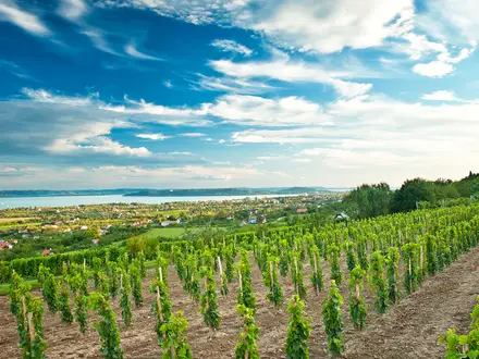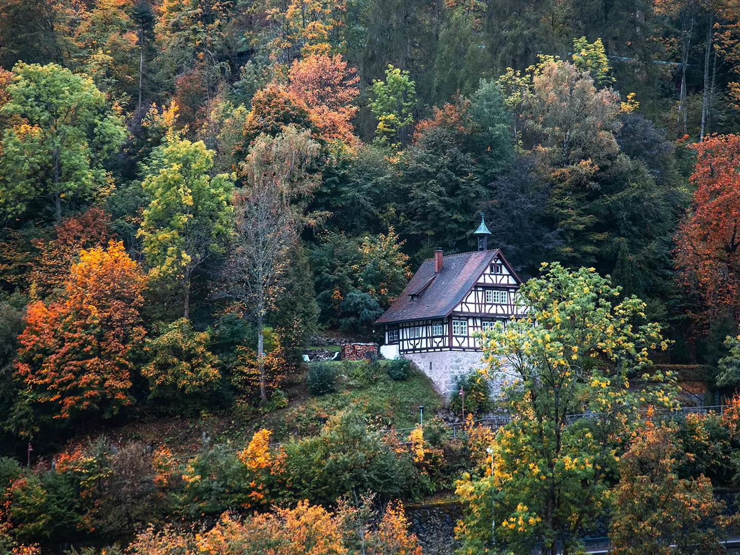
Mittelweg
How would you rate Mittelweg?
Tap a star to share your experience and help other hikers.
Mittelweg: Black Forest Middle Way Hiking Guide
HikeList Score
Mittelweg scored 88/100 on HikeList's trail-quality metrics.
See score breakdownHide breakdown
- Ideal length 96
- Balanced challenge 100
- Scenery & wildness 74
- Varied terrain 94
- Accommodation 83
- Food & support 88
- Path quality 80
- Season flexibility 89
Computed from length, challenge, scenery & wildness, terrain variety, accommodation, food & support, path quality and season flexibility.
The Mittelweg is a 230 km waymarked north–south trail through Germany’s Black Forest, linking Pforzheim with Waldshut on the High Rhine in 9 days. It is the central, gentler line of the three classic Schwarzwaldverein traverses, alongside the Westweg and Ostweg. Expect a moderate, sustained town-to-town hike on forest tracks, plateau paths, raised bogs and valley sections, with about 4,980 m of ascent and no alpine scrambling. See more long-distance routes in Germany.
Route Overview
This linear point-to-point route starts in Pforzheim, the “Gateway to the Black Forest”, and runs south over the central spine of the Schwarzwald to Waldshut-Tiengen on the Swiss border. Key places in order include Bad Wildbad, Kaltenbronn, Besenfeld, Freudenstadt, Schiltach, St. Georgen, Kalte Herberge, Furtwangen, Lenzkirch and the Hochfirst. From Lenzkirch the Mittelweg splits: a western branch runs via Schluchsee and Häusern, while an eastern branch goes via Rothaus and Grafenhausen before both reach Waldshut. If you want a higher-profile German upland route, compare the Goldsteig or the Albsteig in the Swabian Jura.
History of the Mittelweg
The Mittelweg was laid out in 1903 by the Schwarzwaldverein, the Black Forest Club, which created and still maintains many of the region’s long-distance walking paths. It is the middle member of the three classic north–south Black Forest traverses: the Westweg from 1900, and the Mittelweg and Ostweg from 1903. These routes belong to the period when organised rambling associations opened the German uplands to walkers with signed, maintainable footpaths.
Notable highlights
- Kaltenbronn raised bogs: The trail skirts the high moors of the Northern Black Forest, with boardwalk sections over peat and the dark glacial Wildsee. It is one of the key landscape changes on the northern half of the route.
- Bad Wildbad and Freudenstadt: Bad Wildbad is a spa town in the Enz valley, while Freudenstadt is a planned grid town known for its large market square. Both are useful stage towns for beds, food and resupply.
- Schiltach: A half-timbered town where the Schiltach meets the Kinzig, historically linked with timber rafting and tanning. Its steep market square and Fachwerk houses make it one of the most memorable town stops.
- St. Georgen and clock-making: This central Black Forest town is tied to the region’s precision-craft history, from clock-making to the gramophone and record-player industry. The German Phono Museum tells that story.
- Hochfirst, 1,196 m: The high point of the Mittelweg rises above Lenzkirch and Titisee-Neustadt. Its lookout tower gives wide views over the southern Black Forest and, in clear weather, towards the Alps.
- Schluchsee: On the western branch, the route passes the Schluchsee, a large Black Forest lake and reservoir. It is a practical and scenic stop for hikers taking that branch to Waldshut.
Challenges to expect
The Mittelweg is moderate rather than technical, but it is still a sustained 9-day walk with long stages of roughly 13–31 km. Most surfaces are gravel, asphalt or natural paths, so footing is generally straightforward. The main challenges are cumulative ascent, forest navigation in poor visibility, damp bog plateaus, and winter snow or cloud on higher central and southern sections. Use the red diamond with a white vertical bar for waymarking.
HikeList Score
Mittelweg scored 88/100 on HikeList's trail-quality metrics.
See score breakdownHide breakdown
- Ideal length 96
- Balanced challenge 100
- Scenery & wildness 74
- Varied terrain 94
- Accommodation 83
- Food & support 88
- Path quality 80
- Season flexibility 89
Computed from length, challenge, scenery & wildness, terrain variety, accommodation, food & support, path quality and season flexibility.
 Germany
Show more data Show less
- Forest
- Plateau
- Raised Bog
- River Valleys
- Agricultural Landscape
- Gravel
- Paved
- Dirt
- Guesthouses
- Hotels
- Holiday Apartments
- Family Friendly
- Pet Friendly
- Restrooms
- Water Sources
- Campsites
- Shelters
- Picnic Areas
Download Our Full Guide to Mittelweg FREE!
Get our comprehensive guide to this hike for free. Save it for later reading or print out at home.
In these collections
Photos from hikers
Taken on the trail by people who've reviewed Mittelweg.
Mittelweg: The Complete Guide
 i
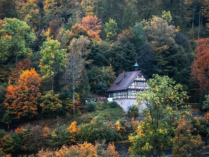
Image by SNEHIT PHOTO
i
Image by SNEHIT PHOTO The Mittelweg is the Black Forest’s central north–south traverse: a 230 km waymarked walk from Pforzheim to Waldshut on the High Rhine. It suits hikers who want a long, sustained German trail with forests, plateau paths and historic valley towns, rather than exposed ridges or technical mountain ground.
From the Enz and Nagold heights above Pforzheim, the route heads through Bad Wildbad, Kaltenbronn’s raised bogs and the Hohloh before reaching the Middle Black Forest. Freudenstadt, Schiltach and St. Georgen make it a practical town-to-town journey as much as a forest crossing.
South of Lenzkirch the Mittelweg reaches its high point on Hochfirst at 1,196 m, with wide views from the Hochfirstturm in clear weather. The final two days split into western and eastern variants, either via Schluchsee and Häusern or via Rothaus/Grafenhausen, before both lines descend to Waldshut.
What the walk asks for is stamina and sensible planning: nine stages, about 4,900 m of ascent, some long days and changeable Black Forest weather. The waymarking is strong, but low cloud, snow outside the main season, wet bog sections and quieter accommodation stops can still catch out underprepared walkers.
This guide covers stages, daily planning, accommodation, food, transport, terrain and the common mistakes to avoid.
Stage-by-Stage Guide
Stage distances on the Mittelweg are approximate. Different accommodation stops and the western/eastern split after Lenzkirch can change the measured total, so treat the daily figures as planning distances rather than exact GPS lengths.
Stage 1: Pforzheim to Bad Wildbad — approx. 24 km
The opening stage leaves Pforzheim, the Tor zum Schwarzwald, and climbs away from the town onto the northern Black Forest heights between the Enz and Nagold valleys. It is a proper first day rather than a gentle prologue: expect a mix of town-edge walking, forest tracks, natural paths and stretches of asphalt as the route gains the wooded upland.
The red diamond with a white vertical bar is the waymark to follow from the start. In the early stages, be careful not to confuse Mittelweg signs with other local Black Forest walking routes leaving Pforzheim.
Bad Wildbad is the key end point: a spa town in the Enz valley with a much better range of beds, food and resupply than the smaller settlements higher up. It is a sensible place to check kit, buy missing supplies and start the second day with enough food and water.
Public transport is strongest at both ends of this stage. Pforzheim has its Hauptbahnhof with frequent regional and S-Bahn services from Karlsruhe and Stuttgart, while Bad Wildbad is served by the Enztalbahn. Current train and local bus times should be checked before travelling.
The main practical warning is the cumulative height gain from leaving Pforzheim rather than any technical difficulty. In wet weather, forest paths can be muddy, and in low cloud the wooded sections can feel repetitive, so keep map or GPX navigation to hand even though the waymarking is good.
Stage 2: Bad Wildbad to Besenfeld — approx. 31 km
This is one of the longest days of the standard itinerary and one of the defining northern Black Forest stages. From Bad Wildbad the route climbs out of the Enz valley towards the higher plateau country around Kaltenbronn, with long forest sections and open moorland terrain.
Kaltenbronn and the Wildseemoor are the main highlights. The route crosses sensitive raised bog landscape on boardwalks, with Wildsee as the dark moorland lake set among low pines and peatland. Stay on the constructed paths through the bogs; the ground beside them is fragile, wet and unsuitable for shortcuts.
The Hohloh area and the Kaiser-Wilhelm-Turm give a higher, more open point on the day, around 988 m. In clear weather this is one of the best viewpoints in the northern half of the route; in poor visibility it is also a place where careful waymark and map checking matters.
Food and drink should be planned conservatively. Bad Wildbad is the reliable service point at the start, and Besenfeld is the end-of-stage settlement, but the high forest and bog plateau between them should not be treated as a place to improvise resupply. Carry enough water and food for the full day.
Accommodation around Besenfeld is more limited than in Bad Wildbad or Freudenstadt, so book ahead rather than arriving without a bed. Road access exists at Kaltenbronn and Besenfeld, but mountain bus services can be infrequent; timetables should be checked before relying on them.
Seasonal conditions matter here. Boardwalks can be slippery after rain or frost, bog sections stay damp, and snow or low cloud can affect the higher plateau outside the main summer season.
Stage 3: Besenfeld to Zwieselberg / Freudenstadt — approx. 25 km
This stage continues through the northern and central Black Forest uplands, gradually shifting from the wilder bog-and-forest feel of Kaltenbronn towards the more settled landscape around Freudenstadt. The walking is mainly on forest tracks, natural paths and some minor asphalt, with no technical ground.
Zwieselberg and Oberzwieselberg are practical intermediate or end-stage points depending on the itinerary. Many walkers use Freudenstadt as the main overnight hub because it has a far wider range of accommodation, food and resupply.
Freudenstadt is one of the most useful towns on the whole Mittelweg. Its large Marktplatz, shops and transport links make it a good place for laundry, restocking, replacing small items of kit and adjusting plans before the more rural middle stages.
The day is not as long as Stage 2, but it still needs steady pacing. Forest navigation remains the main issue: the Mittelweg is well signed, but in commercial forest and at track junctions it is easy to drift onto local routes if walking on autopilot.
Public transport and road access are best around Freudenstadt. If staying in Zwieselberg rather than Freudenstadt, check accommodation location and onward transport carefully before booking, as the exact overnight point can affect the next morning’s distance.
Stage 4: Zwieselberg / Freudenstadt to Schiltach — approx. 25 km
This stage leaves the Freudenstadt area and heads into the Middle Black Forest, where the route becomes more valley-orientated and rural. Expect a mixture of forest, open cultural landscape, tracks and descending paths as the trail works towards the Kinzig and Schiltach valleys.
Schiltach is the standout place on the day. The half-timbered town sits where the Schiltach river meets the Kinzig, with a steep historic market square and a strong timber-rafting and tanning heritage. It is one of the most memorable overnight stops on the route.
Services are strongest at Freudenstadt at the start and Schiltach at the end. Between them, carry enough food and water for a normal full walking day, especially if starting from Zwieselberg rather than central Freudenstadt.
Schiltach has public transport on the Kinzigtalbahn corridor, making it one of the better escape or joining points on the middle section. Current train and local bus times should be checked before travelling, especially for evening arrivals.
The practical caution is the descent into the valley. After rain, wooded paths can be slippery, and the lower valley approach may include harder surfaces that can be tiring late in the day. There is no exposure, but poles can help on wet descents.
Stage 5: Schiltach to St. Georgen — approx. 31 km
This is another long, stamina-heavy stage. From Schiltach the route leaves the Kinzig/Schiltach valley setting and climbs back into the central Black Forest uplands, with sustained forest walking and a cumulative ascent that makes the distance feel significant.
The character is less about single dramatic landmarks and more about steady progress through wooded ridges, rural clearings and Black Forest working landscape. Path conditions are generally straightforward: gravel tracks, forest roads, natural paths and some asphalt.
St. Georgen is the main end-stage town and a useful service stop. It is associated with clock-making and later gramophone and record-player manufacturing, reflected in the Deutsches Phonomuseum, and it offers the practical advantages of a town rather than a small hamlet.
Start from Schiltach with enough food and water for the full stage. Do not assume frequent cafés or shops through the forested middle of the day; opening times in smaller Black Forest settlements can be limited or seasonal.
St. Georgen has regional rail access on the Black Forest network, giving this stage better public transport options than some of the high rural sections. As always, mountain and local bus services should be checked before relying on them.
The main warning is fatigue. At around 31 km, this is a long day with climbing, and it comes after several previous stages. Wet forest tracks, low cloud and junction-heavy woodland make it important to keep checking the red diamond-with-white-bar waymark.
Stage 6: St. Georgen to Kalte Herberge — approx. 25 km
The route now enters the higher central Black Forest, where the sense of remoteness increases again. The walking remains non-technical, but the day is more exposed to hill weather than the lower valley stages and can feel quiet outside the main walking season.
Expect forest tracks, open upland sections, farmed cultural landscape and some asphalt links. The route is still a practical Mittelweg line rather than a high ridge traverse, but the cumulative height and weather can make it a serious walking day.
Kalte Herberge is a smaller, more isolated overnight point than Freudenstadt, Schiltach or St. Georgen. Accommodation should be booked well ahead, and check exactly where the bed is in relation to the trail before committing, as small deviations matter at the end of a long day.
Food and water planning should be conservative. St. Georgen is the reliable place to stock up before setting out; Kalte Herberge is the end-of-stage target rather than a major resupply hub.
Public transport is less convenient than in the valley towns. Road access exists, but buses in the high Black Forest can be sparse, so escape plans and luggage-transfer arrangements should be checked before travelling.
In poor weather, navigation can be more demanding on this stage because forest and plateau junctions can look similar. Snow, low cloud and wet ground are realistic concerns outside settled spring-to-autumn conditions.
Stage 7: Kalte Herberge to Lenzkirch — approx. 26 km
This stage continues across the high southern Black Forest approach, passing through the upland landscape around Furtwangen before heading towards Lenzkirch. It is a sustained rural day with forest, open plateau paths and working countryside rather than technical mountain terrain.
The walking underfoot is mostly on the familiar Mittelweg mix of forest roads, gravel tracks, natural paths and some asphalt. After rain, muddy forest sections are likely, and exposed upland stretches can feel cold or disorientating in low cloud.
Furtwangen is the main named place on the way and can be useful for food or a break, depending on the exact line and opening times. Lenzkirch is the practical end-stage town before the route reaches its high point and then splits into western and eastern variants.
Accommodation in Lenzkirch and the wider Titisee-Neustadt area should be arranged before arrival, especially in busy holiday periods. Wild camping is not permitted in Baden-Württemberg, so an indoor bed is part of the plan rather than a fallback.
Transport options improve again towards the Lenzkirch/Titisee-Neustadt area, with regional links in the Dreiseenbahn and Höllentalbahn area, but the final connection from the walking route may involve local buses. This should be checked before travelling.
The key planning issue is the next day’s variant choice. Decide before leaving Lenzkirch whether to take the western route towards Schluchsee and Häusern or the eastern route towards Rothaus/Grafenhausen, and book the corresponding accommodation.
Stage 8: Lenzkirch to Häusern or Rothaus-Grafenhausen — approx. 20 km
Stage 8 is shorter on paper but important, because it includes the route’s highest point and the western/eastern split. From Lenzkirch the Mittelweg climbs towards Hochfirst, 1,196 m, the high point of the trail, with the Hochfirstturm lookout tower above Lenzkirch, Saig and Titisee-Neustadt.
In clear weather, Hochfirst gives wide views over the southern Black Forest and towards the Alps. In poor visibility it becomes a navigation and weather-management point rather than a viewpoint: carry warm layers and do not underestimate wind, low cloud or lingering snow outside the main season.
After this section the route choice matters. The western variant heads towards the Titisee-Neustadt / Schluchsee side and continues via places including Schluchsee, Blasiwald, Althütte and Häusern. The eastern variant takes the quieter line towards Rothaus and Grafenhausen.
For the western variant, Häusern is the practical end-stage settlement in this itinerary, with Schluchsee as the major lake feature and a useful landmark on the way. For the eastern variant, plan the night around Rothaus-Grafenhausen, where accommodation availability should be checked early.
Food and water are best planned from Lenzkirch, with resupply depending on the chosen variant and local opening times. Do not assume that the shorter distance makes the day effortless: the high point, weather and variant navigation deserve attention.
Public transport differs by variant. The Titisee-Neustadt / Schluchsee side has stronger regional rail context through the Dreiseenbahn and Höllentalbahn area, while the Rothaus/Grafenhausen line is quieter and may depend more on buses. This should be checked before travelling.
Navigation is especially important where the variants divide. Make sure the booked accommodation matches the chosen line; following the wrong branch late in the day could create a long and awkward transfer.
Stage 9: Häusern or Grafenhausen to Waldshut — approx. 25 km
The final stage descends out of the southern Black Forest to Waldshut on the High Rhine. Both variants finish in the same town, but they approach it by different lines: the western variant comes from the Häusern / Höchenschwand side, while the eastern variant comes from the Grafenhausen side through the Mettma valley and towards Gurtweil.
The character changes during the day from high Black Forest settlement and wooded valley walking to the lower Rhine-edge landscape. Expect a mix of forest paths, tracks, minor roads and harder surfaces as the route approaches Waldshut.
On the western variant, Höchenschwand and Indlekofen are the key named places before the descent to Waldshut. On the eastern variant, Rothaus/Grafenhausen, the Mettma valley and Gurtweil define the line. Do not mix western and eastern place names when checking accommodation or transport; they are separate final approaches.
Food and water should be carried from the overnight stop, with any intermediate services treated as a bonus unless opening times have been checked. Waldshut itself has the best end-of-route facilities, including accommodation, food and onward transport.
Waldshut sits on the Hochrheinbahn, with frequent direct trains to Basel and onward connections towards Singen/Konstanz. This makes it a straightforward finish by public transport, though exact train times and any engineering works should be checked before travelling.
The main warnings are tired legs, downhill strain and navigation through the final valley and town approach. The walking is not technical, but after nine days the descent and harder surfaces can be surprisingly wearing. Keep following the Mittelweg waymark until Waldshut rather than assuming the route is finished when the Rhine corridor first comes into view.
Recommended Itinerary
The standard Mittelweg schedule is a 9-day town-to-town crossing from Pforzheim to Waldshut. It suits fit walkers who are comfortable with repeated 25–31 km days, moderate cumulative ascent and the need to keep moving even when forest tracks are wet or visibility is poor.
Distances are approximate. Accommodation availability, especially around smaller places such as Besenfeld, Zwieselberg / Oberzwieselberg and Kalte Herberge, should be checked before travelling.
Standard 9-day itinerary
| Day | From | To | Approx. distance | Why this stage makes sense | Services/accommodation notes |
|---|---|---|---|---|---|
| 1 | Pforzheim | Bad Wildbad | 24 km | A practical first day that leaves the northern edge of the Black Forest and reaches a proper spa town in the Enz valley. It is long enough to make progress without starting with one of the route’s biggest days. | Pforzheim has rail access at the start. Bad Wildbad is one of the better early stops for beds, food and resupply, and is served by the Enztalbahn. |
| 2 | Bad Wildbad | Besenfeld | 31 km | One of the harder days on the standard schedule, crossing the Kaltenbronn high ground, the Wildseemoor area and the Hohloh / Kaiser-Wilhelm-Turm section before continuing towards Besenfeld. Start early and allow time for slower going on damp bog-boardwalk and forest sections. | Accommodation is thinner than in Bad Wildbad, so book Besenfeld well ahead. This is not a stage to leave to chance, as wild camping is not permitted in Baden-Württemberg. |
| 3 | Besenfeld | Zwieselberg / Freudenstadt | 25 km | A steady central Black Forest stage that brings the route towards the Freudenstadt area, a useful resupply and transport hub. Some itineraries use Zwieselberg or Oberzwieselberg, while others overnight in Freudenstadt depending on accommodation. | Freudenstadt has a much wider choice of beds and services than smaller forest villages. If booking in Freudenstadt rather than directly on the walking line, check the exact access arrangement before committing. |
| 4 | Zwieselberg / Freudenstadt | Schiltach | 25 km | This stage links the Freudenstadt area with the Kinzig / Schiltach valley landscape and finishes in one of the most attractive town stops on the trail. The descent into a valley town also makes it a natural overnight point. | Schiltach has guest accommodation and regional rail access on the Kinzigtalbahn. It is a strong place for food, recovery and a more characterful overnight than a small roadside stop. |
| 5 | Schiltach | St. Georgen | 31 km | Another long day, climbing away from the Kinzig / Schiltach valley towards the central Black Forest high ground. It is demanding mainly because of distance and cumulative ascent rather than technical difficulty. | St. Georgen is a practical overnight town with services and rail access on the Kinzigtalbahn. This is a good point to reassess weather and energy before the higher southern stages. |
| 6 | St. Georgen | Kalte Herberge | 25 km | A sustained upland stage across the central spine of the Black Forest. Kalte Herberge works as a logical staging point before continuing towards Furtwangen and Lenzkirch. | Accommodation choice is limited compared with larger towns, so this night should be secured early. Check food availability at the same time as booking the bed. |
| 7 | Kalte Herberge | Lenzkirch | 26 km | This stage carries the route into the Hochschwarzwald approach and sets up the final two-day split towards Waldshut. Lenzkirch is a useful base before the Hochfirst and the western/eastern variant decision. | Lenzkirch and the Titisee-Neustadt area have more accommodation options than the smaller upland stops, but demand can be high in holiday periods. Regional links in the Titisee-Neustadt area connect with the Höllentalbahn / Dreiseenbahn network. |
| 8 | Lenzkirch | Häusern via the western variant / Rothaus-Grafenhausen via the eastern variant | 20 km | A shorter day after several longer stages, but an important one because the route splits after Lenzkirch. The western line goes towards Schluchsee and Häusern; the eastern line goes via Rothaus / Grafenhausen. | Choose the variant before booking the final two nights. The western option gives access to the Schluchsee area; the eastern option is quieter and uses Rothaus / Grafenhausen as the practical overnight area. |
| 9 | Häusern / Grafenhausen | Waldshut | 25 km | The final stage descends out of the southern Black Forest towards the High Rhine and the finish at Waldshut. Both variants end in the same town. | Waldshut has rail access on the Hochrheinbahn, with onward connections towards Basel and Singen / Konstanz. Book the last night if arriving late or if onward trains are not convenient. |
Choosing the western or eastern finish
After Lenzkirch, the Mittelweg divides into two legitimate finishes to Waldshut. The western variant is the better choice if Schluchsee is a priority or if accommodation in the lake and Häusern area fits the plan. The eastern variant suits walkers looking for the Rothaus / Grafenhausen line and a quieter approach towards the Mettma valley and Waldshut.
Do not book the final two nights until the variant has been chosen. Some operators and mapping platforms measure the variants differently, so check official mapping before booking if exact daily distances matter.
Slower itinerary
A slower plan suits first-time long-distance walkers, anyone carrying a heavier pack, or hikers who want more margin for poor weather on the Kaltenbronn bogs and higher southern sections. The simplest slower version is to add one or two extra nights in the larger service towns rather than trying to create unsupported half-stages in small forest settlements.
Good places to slow the schedule include Bad Wildbad, Freudenstadt, Schiltach, St. Georgen and Lenzkirch / the Titisee-Neustadt area. These places are more useful than remote intermediate stops because they have better accommodation, food and transport options. Exact split distances should be checked on official mapping before booking.
A practical slower structure is:
| Plan | Best for | How to adapt the standard itinerary |
|---|---|---|
| 10 days | Walkers who want one recovery day or a buffer for weather and transport | Add a rest or short-transfer day in a larger hub such as Freudenstadt, Schiltach, St. Georgen or Lenzkirch. This keeps the standard stage sequence intact but reduces pressure. |
| 11–12 days | Walkers who prefer shorter daily effort and more time in towns | Break one or both of the 31 km days where accommodation and transport allow, or add rest nights in service towns. Check official mapping, bus/train timetables and accommodation before relying on a split. |
| Section-hike format | Walkers using public transport to complete the trail over several trips | Use rail-linked towns such as Pforzheim, Bad Wildbad, Schiltach, St. Georgen, the Titisee-Neustadt area and Waldshut as practical entry/exit points. Mountain bus services can be infrequent, so current timetables matter. |
Faster itinerary
A faster schedule is only sensible for strong walkers who are already comfortable with consecutive long forest and upland days. The trail has no scrambling or alpine ground, but the repeated ascent, long distances and occasional poor-visibility forest navigation make compression tiring.
Most hikers should not compress the route below the standard 9 days unless accommodation and transport line up cleanly. If planning a faster crossing, check official mapping before booking, as combining stages can create very long days and may leave few indoor overnight options in the right places.
A realistic faster approach is to keep the route to the main accommodation towns and use public transport only as a backup, not as the foundation of the itinerary. The longest standard days already reach about 31 km, so any 7–8 day plan requires strong fitness, early starts and firm reservations at the end of each day.
Planning the Route
The Mittelweg is easiest to plan as a town-to-town walk using the established nine-stage structure, then adjusting the longest days around accommodation and transport. The waymarking is strong and the terrain is non-technical, so the main planning challenge is not route-finding in normal conditions; it is making the stage lengths, beds, food stops and onward transport fit together.
Most walkers should allow the full 9 days for the through-hike. Faster walkers can compress parts of the route, but the official pattern already includes several sustained days of around 25–31 km, so shortening the itinerary is more realistic than rushing it.
How many days to allow
A 9-day plan gives a practical rhythm from Pforzheim to Waldshut, with either the western or eastern variant walked over the final two days. This suits fit walkers who are comfortable with repeated full days on forest tracks, plateau paths and valley descents.
Allowing 10–11 days makes the walk more forgiving, especially if booking constraints push an overnight away from the usual stage towns. Extra time is also useful in poor weather on the higher central and southern sections, where low cloud, wet ground or snow outside the main season can slow progress.
A faster schedule is possible only for strong walkers who are happy with long back-to-back days and minimal sightseeing time in places such as Freudenstadt, Schiltach and St. Georgen. The route is not technical, but the cumulative ascent of about 4,900 m is enough to make a rushed itinerary feel harder than the headline difficulty suggests.
| Planning style | Best for | Notes |
|---|---|---|
| 9 days | Most fit through-hikers | Matches the standard stage pattern, but includes long days of about 31 km. |
| 10–11 days | Walkers wanting a steadier pace | Useful where accommodation is limited or when adding time in larger towns. |
| Section hikes | Walkers using public transport | Practical because several stage towns have regional rail or bus links, but timetables must be checked. |
| Faster than 9 days | Very strong walkers | Possible in principle, but not the best use of the route for most hikers. |
Stage planning and overnight stops
The daily stages are strongly shaped by where beds are available. Larger places such as Bad Wildbad, Freudenstadt, Schiltach, St. Georgen and the Titisee/Lenzkirch area give more choice, while quieter central and southern stops can be thinner for accommodation.
The longest standard days are Bad Wildbad to Besenfeld and Schiltach to St. Georgen, both around 31 km. These should be treated as key planning points: book the overnights early, start promptly, and check whether food is available at the end of the day before relying on it.
Zwieselberg / Oberzwieselberg and Freudenstadt can function differently depending on the itinerary and where accommodation is available. If a bed is not available exactly at the usual stage end, use local transport or adjust the previous and following days rather than assuming a short detour will be trivial. This should be checked before travelling.
Kalte Herberge is another stage point where planning matters because it sits in a more rural section between St. Georgen, Furtwangen and Lenzkirch. Accommodation and evening food should be arranged in advance rather than left to chance.
The variant after Lenzkirch
After Lenzkirch the Mittelweg splits into two signed lines before both finish at Waldshut. Choose the variant before booking the final two nights, as the accommodation and transport logic differs.
The western variant runs towards the Titisee-Neustadt / Schluchsee side, then via Blasiwald, Althütte, Häusern and Höchenschwand before descending towards Waldshut. This is the better choice if Schluchsee is a priority.
The eastern variant runs via Rothaus / Grafenhausen and the Mettma valley towards Gurtweil and Waldshut. This is the better choice if the quieter Rothaus and Grafenhausen line is preferred.
Do not book the final nights until the chosen variant is clear. Stage distances and exact overnight points vary between itineraries, so treat the final two days as flexible within the overall 9-day structure.
Shortening, extending and section hiking
The Mittelweg is practical to section-hike because both ends have rail access and several interior towns sit on Black Forest regional lines. Pforzheim Hauptbahnhof is the usual access point at the northern end, while Waldshut is on the Hochrheinbahn along the High Rhine.
Useful rail-linked areas include Bad Wildbad on the Enztalbahn, Schiltach and St. Georgen on the Kinzigtalbahn, and the Titisee-Neustadt / Lenzkirch area via the Dreiseenbahn and Höllentalbahn network. The KONUS guest card can give free regional bus and train travel for guests staying in participating Black Forest accommodation, but eligibility, validity and current services should be checked before travelling.
Mountain bus services can be infrequent, especially away from the larger towns and rail valleys. A stage that looks easy to escape on the map may have limited departures in practice, so public-transport days need timetable planning rather than improvisation.
Extending the route is usually a matter of adding rest time or shorter days in larger towns, not adding distance. Freudenstadt, Schiltach, St. Georgen and the Titisee / Lenzkirch area are the most logical places to slow the itinerary because they are more useful for beds, food and onward connections.
Accommodation strategy
Wild camping is not permitted in Baden-Württemberg, so the Mittelweg should be planned around indoor accommodation: hotels, Gasthöfe, Pensionen and Ferienwohnungen. This makes advance booking important, particularly in smaller stage towns and on weekends or holiday periods.
Book the constrained nights first: Besenfeld, Zwieselberg / Oberzwieselberg if used, Kalte Herberge, and the chosen final-variant stops around Häusern or Rothaus / Grafenhausen. Larger spa and resort towns give more flexibility, but they can still fill during busy periods.
If using luggage transfer, check coverage before committing to accommodation. Availability can vary by operator and by exact overnight location, especially where the route uses smaller settlements rather than major tourist hubs.
Food, water and resupply
Food planning is straightforward in the larger towns but should not be casual on the quieter stages. Bad Wildbad, Freudenstadt, Schiltach, St. Georgen and the Titisee / Lenzkirch area are the natural resupply hubs; smaller places may have limited opening hours or fewer evening meal options.
Carry lunch and snacks for each stage unless a definite stop has been planned. On long forest and plateau sections, do not assume frequent shops or cafés between overnight towns.
Water is normally managed by starting each day with enough for the full stage and refilling only where a reliable service is available. Natural water should not be treated as automatically drinkable, and dry or hot spells can make water planning more important on the longer days.
Navigation and waymarking
Follow the red diamond with a white vertical bar on a white background — the Mittelweg waymark used by the Schwarzwaldverein. It is distinct from the Westweg’s plain red diamond, which matters in a region with many intersecting marked routes.
The waymarking is a strength of the trail, but a map or offline GPX is still sensible. Forest tracks, forestry junctions, bog boardwalks and low-cloud sections can all make navigation less obvious than it feels in clear weather.
Before departure, check the current Schwarzwaldverein route information for diversions or temporary closures. Forestry work, storm damage or local path repairs can affect individual sections.
Weather and season planning
Spring, summer and autumn are the normal walking seasons. Summer gives the simplest logistics, while spring and autumn can be quieter but bring more variable weather and shorter daylight.
The higher parts of the route, including the Kaltenbronn / Hohloh area and the southern high ground around Hochfirst, can be affected by low cloud, wet ground and snow outside the main season. The raised bog sections around Kaltenbronn and Wildseemoor are especially worth treating with care after rain: stay on the marked path and boardwalks.
Pack for damp forest walking rather than alpine exposure. Waterproofs, warm layers, reliable footwear and offline navigation matter more here than technical mountain equipment.
Permits and formalities
No hiking permit is required for the Mittelweg. The key rule affecting planning is accommodation: because wild camping is not permitted in Baden-Württemberg, each night needs a booked legal place to stay.
The route remains in Germany all the way to Waldshut on the Swiss border. Euros are used throughout the trail; Swiss travel or spending only becomes relevant if continuing beyond the route into Switzerland.
Towns, Villages and Overnight Stops
The Mittelweg is a town-to-town walk, but services are not evenly spaced. Bad Wildbad, Freudenstadt, Schiltach, St. Georgen, the Lenzkirch/Titisee-Neustadt area and Waldshut are the strongest practical hubs; smaller places such as Besenfeld, Zwieselberg, Kalte Herberge, Blasiwald, Althütte or parts of the eastern variant need earlier booking and a more cautious food plan.
Wild camping is not permitted in Baden-Württemberg, so overnight planning should be based on hotels, Gasthöfe, Pensionen and holiday apartments. In the quieter central and southern sections, do not assume late availability or evening meals without checking directly with the accommodation.
Pforzheim
Pforzheim is the northern trailhead and the place to arrive the night before if starting early. The route begins in the town before climbing south onto the heights between the Enz and Nagold valleys.
It is a practical start point rather than just a symbolic one: Pforzheim has a Hauptbahnhof with regular regional and S-Bahn services from Karlsruhe and Stuttgart, making it one of the easiest points on the route to reach by public transport. Food shops, bakeries, pharmacies and outdoor basics are much easier to find here than in the smaller Black Forest villages further south.
Accommodation choice is better than in the small stage stops, though booking ahead is still sensible if arriving at a weekend or during holiday periods. Pforzheim is the best place to sort last-minute supplies before committing to the first long day to Bad Wildbad.
Bad Wildbad
Bad Wildbad is the first major overnight stop, reached after the opening stage from Pforzheim. It sits in the Enz valley and is one of the most useful early logistics points on the Mittelweg.
As a spa town, it has a stronger accommodation base than the smaller upland villages: hotels, guesthouses and holiday accommodation are more realistic here than in the forest settlements above. It is also a good place to eat properly, resupply and review kit after the first day.
Bad Wildbad is on the Enztalbahn, which makes it a useful access or exit point for section-hikers. Current timetables should be checked before travelling, especially if linking a walk with evening transport.
Kaltenbronn
Kaltenbronn comes early on the long second stage from Bad Wildbad towards Besenfeld. It is important more for terrain and timing than as a conventional town stop, because the route enters the raised bog and plateau country of the northern Black Forest here.
Do not treat Kaltenbronn as a guaranteed resupply point unless current opening times and services have been checked. The area around the Wildseemoor and boardwalks is a highlight, but it is still upland forest country where food, water and weather protection should already be sorted before leaving Bad Wildbad.
For overnight planning, most walkers continue to Besenfeld rather than trying to break the stage here. If looking for a shorter day or a bespoke itinerary, accommodation availability in and around Kaltenbronn should be checked directly before committing.
Hohloh and Kaiser-Wilhelm-Turm
Hohloh, with the Kaiser-Wilhelm-Turm lookout tower, is a high point of interest rather than a normal overnight stop. It lies on the same northern upland section as Kaltenbronn and the Wildseemoor.
There should be no reliance on Hohloh for food, beds or transport. It is best planned as a scenic and navigational waypoint on the way to Besenfeld, with enough provisions already carried for the full day.
In poor visibility, the plateau character of this section makes careful waymark-following important. The Mittelweg is well marked, but forest and moorland junctions can still slow progress.
Besenfeld
Besenfeld is the usual end of the long second stage from Bad Wildbad and the start of the following stage towards Zwieselberg or Freudenstadt. It is a key overnight point because the official-style itinerary uses it to break the northern plateau section.
Accommodation and eating options are more limited than in Bad Wildbad or Freudenstadt, so this is one of the places to book early. Check whether the place where you stay serves dinner, and whether any alternative restaurant or shop will be open on the day of arrival.
Besenfeld is useful because it prevents the Bad Wildbad to Freudenstadt section becoming too long for most walkers. If no suitable bed is available, the surrounding itinerary may need adjusting rather than assuming easy alternatives nearby.
Oberzwieselberg / Zwieselberg
Zwieselberg, including Oberzwieselberg, is used by some itineraries as the overnight stop between Besenfeld and the descent towards Schiltach. It sits before or around the Freudenstadt section, depending on the exact stage plan being followed.
This is a quieter stop than Freudenstadt and should be treated as a limited-service overnight. Accommodation may suit walkers wanting to keep the stage pattern close to the traditional route, but beds and meals should be arranged in advance.
The main practical decision here is whether to sleep in Zwieselberg or continue into Freudenstadt. Freudenstadt has more services; Zwieselberg may work better for keeping the following day’s distance in balance.
Freudenstadt
Freudenstadt is one of the best resupply and recovery stops on the Mittelweg. It lies on the eastern edge of the Black Forest and is a practical hub after the smaller northern stage villages.
Accommodation choice is generally better here than in Besenfeld or Zwieselberg, with the usual mix of hotels, Gasthöfe, Pensionen and holiday accommodation. It is also a sensible place for laundry, food shopping, pharmacy needs and a more flexible evening meal.
The large Marktplatz and town centre make Freudenstadt more than just a bed stop, but hikers should use it primarily as a logistics reset before the route continues towards Schiltach. If the previous night was spent in Zwieselberg, Freudenstadt can still be useful for daytime resupply.
Schiltach
Schiltach is one of the most memorable town stops and a strong overnight choice. The route reaches the Kinzig/Schiltach valley area after the stage from Zwieselberg or Freudenstadt.
As a historic half-timbered town, Schiltach has more visitor infrastructure than many of the surrounding forest settlements. It is a good place for a proper meal, accommodation and a practical reset before the long stage to St. Georgen.
Schiltach is on the Kinzigtalbahn, making it useful for section-hikers or anyone needing to leave or rejoin the trail. Check current train times before relying on a same-day connection.
St. Georgen
St. Georgen is the usual overnight stop after the long stage from Schiltach and another important transport and service point. It sits in the central Black Forest and marks the transition towards the higher southern sections.
Accommodation and food options are generally more dependable here than at the smaller upland stops, though booking remains advisable. It is a good place to resupply before the stage to Kalte Herberge, where services are much thinner.
St. Georgen is linked with the Kinzigtalbahn, so it is a practical access or exit point for section walks. The town’s clock-making and precision-craft history, including the Deutsches Phonomuseum, can be a useful low-effort stop if time allows.
Kalte Herberge
Kalte Herberge is a functional stage stop between St. Georgen and Lenzkirch rather than a large settlement. Its value is that it breaks a demanding middle-southern part of the route into manageable days.
This is one of the stops where accommodation must be treated carefully. Beds, dinner and breakfast availability should be checked before travelling, and walkers should not assume multiple fallback options close by.
Because the following stage continues through higher Black Forest terrain towards Lenzkirch, leaving with food, water and weather-appropriate kit matters. If accommodation at Kalte Herberge is unavailable, the whole stage plan may need reworking.
Furtwangen
Furtwangen lies on the southern half of the Mittelweg between the St. Georgen/Kalte Herberge area and Lenzkirch. It is a useful place on or near the day’s line for services, depending on the exact itinerary being walked.
Compared with Kalte Herberge, Furtwangen is more town-like and therefore more useful for food, accommodation enquiries and practical errands. However, exact opening times and transport connections should be checked before relying on it as a guaranteed solution.
For walkers planning shorter stages, Furtwangen may be relevant as an alternative break point. Any adjusted itinerary should be built around confirmed beds rather than assumed availability.
Lenzkirch
Lenzkirch is a key overnight stop before the Mittelweg splits into its western and eastern final variants. It is also the practical base before or after the Hochfirst section, the highest point of the route at 1,196 m.
The Lenzkirch/Titisee-Neustadt area has a stronger visitor infrastructure than many of the smaller upland stops, with accommodation in hotels, guesthouses and holiday apartments. It is a good place to decide final-route logistics: western variant via Schluchsee and Häusern, or eastern variant via Rothaus/Grafenhausen.
Regional rail links in the wider Titisee-Neustadt area connect with the Dreiseenbahn and Höllentalbahn network, while local bus services may be needed depending on the exact overnight location. This should be checked before travelling, especially if using Lenzkirch as a start or finish point for a section walk.
Hochfirst
Hochfirst is the high point of the Mittelweg and a major scenic waypoint above Lenzkirch and Titisee-Neustadt. The Hochfirstturm lookout tower is the main reason to pause here, with wide views in clear weather.
It is not a normal overnight or resupply stop. Food, water and weather protection should be carried from the previous town, and the day should be planned with higher-level conditions in mind: low cloud, wind, snow outside the main season and wet ground can all make progress slower.
Hochfirst is also a useful mental marker. After this high southern section, the route soon commits to one of the two alternatives towards Waldshut.
Titisee-Neustadt area
Titisee-Neustadt sits close to the western-variant side of the route and is most relevant around the Lenzkirch/Hochfirst section. It is not the universal overnight for every itinerary, but it is one of the most useful service areas nearby.
Accommodation and food options in the Titisee-Neustadt area are generally stronger than in the small forest villages. It can be useful if beds in Lenzkirch are limited, or if public transport access is a priority.
The area is linked with the Höllentalbahn and Dreiseenbahn network. Exact station choice, bus connections and walking links depend on the chosen overnight point and should be checked before travelling.
Schluchsee
Schluchsee belongs to the western variant after Lenzkirch. It is the Black Forest’s largest lake, a reservoir, and one of the more practical and scenic stops on the western line towards Häusern.
For walkers choosing the western variant, Schluchsee can work well for accommodation, food and a less isolated overnight than the smaller villages around Blasiwald or Althütte. It is also a sensible place to reassess timing before the final approach towards Waldshut.
Transport in the wider Titisee-Neustadt/Schluchsee area is tied into the Black Forest regional network, but exact services should be checked before relying on them. The KONUS guest card may be useful where issued by accommodation, but eligibility and validity should always be confirmed when booking.
Blasiwald and Althütte
Blasiwald and Althütte are smaller places on the western variant between Schluchsee and Häusern. They are relevant for route planning but should not be treated like full service towns.
Accommodation, food and opening hours may be limited, so these stops suit walkers who have booked precisely and know where the evening meal is coming from. Carrying enough food for the day is sensible, particularly if arriving outside peak hours.
These villages are most useful as waypoints or carefully planned overnight alternatives. If no confirmed bed is available, continuing to a larger hub may be necessary.
Häusern
Häusern is the practical overnight target for the western variant on the penultimate day. It positions walkers for the final stage towards Waldshut, often via the southern Black Forest villages before the descent to the High Rhine.
Accommodation should be booked ahead, especially because the final two days divide between western and eastern variants and availability can shape the better choice. Food and breakfast arrangements should be confirmed with the accommodation rather than assumed.
Häusern is useful because it breaks the western route cleanly before the last day. If staying elsewhere nearby, check how that affects the next morning’s return to the waymarked Mittelweg.
Höchenschwand and Indlekofen
Höchenschwand and Indlekofen are on the western approach towards Waldshut. They are relevant for walkers following the western variant after Häusern.
Höchenschwand is the more obvious service point of the two, but exact accommodation, shops, restaurants and onward transport should be checked before relying on it. Indlekofen is best treated as a smaller route settlement rather than a guaranteed resupply point.
These places are mainly important for pacing the final descent to Waldshut. Keep enough food and water for the day rather than assuming frequent stops.
Rothaus
Rothaus is on the eastern variant after Lenzkirch and is known for the Badische Staatsbrauerei Rothaus. It is one of the defining stops on the quieter eastern line towards Grafenhausen and the Mettma valley.
For hikers, the practical question is whether Rothaus is a pause, a resupply opportunity or part of an overnight plan. Accommodation and food arrangements should be checked before travelling, especially outside the main visitor season.
The eastern variant is a good choice for walkers who prefer the Rothaus/Grafenhausen line over the Schluchsee/Häusern line. Once committed to it, plan the final two days around confirmed beds rather than trying to switch casually between variants.
Grafenhausen
Grafenhausen is the main practical overnight area on the eastern variant, paired with Rothaus in the standard final-stage planning. It sets up the last day towards Waldshut via the Mettma valley and Gurtweil.
Accommodation is likely to be more important here than casual resupply, so book ahead and check evening meal options. If staying outside the village centre or in a nearby hamlet, confirm how far it is from the waymarked route and whether a transfer or extra walking is involved.
Grafenhausen is the eastern-variant equivalent of using Häusern on the western line: a staging point for the final push to the High Rhine. It should be planned as part of the whole Lenzkirch-to-Waldshut decision.
Mettma valley and Gurtweil
The Mettma valley and Gurtweil belong to the eastern variant’s final approach to Waldshut. This section is more about moving through the landscape towards the High Rhine than about finding major overnight infrastructure.
Do not rely on the Mettma valley as a place to solve food or accommodation problems at short notice. Gurtweil is useful as a named settlement on the approach to Waldshut, but exact services and transport should be checked before travelling.
By this point, most walkers will already have booked the previous night in Grafenhausen or nearby and will be aiming to finish in Waldshut. Carry what is needed for the full final day.
Waldshut
Waldshut, part of Waldshut-Tiengen, is the finish for both the western and eastern variants. The trail descends out of the southern Black Forest to the High Rhine at the Swiss border.
It is the best place to finish with accommodation, food and onward transport. The old gated Kaiserstraße gives a clear town-centre endpoint, but the practical priority is usually a meal, a bed or a train connection.
Waldshut is on the Hochrheinbahn, with frequent direct trains to Basel and onward connections towards Singen/Konstanz. Current train times should be checked before booking a tight onward journey, especially after a long final walking day.
Getting to the Start
By train
Pforzheim is the simplest and most reliable access point for the Mittelweg. Use Pforzheim Hauptbahnhof (Pforzheim Hbf) as the arrival station, then begin from the town, where the route climbs south onto the heights between the Enz and Nagold valleys.
Pforzheim has frequent regional and S-Bahn services on rail links from Karlsruhe and Stuttgart, so most walkers arriving from elsewhere in Germany will change through one of those cities. Book or check journey options to Pforzheim Hbf rather than trying to reach a smaller outlying stop.
From the station, allow time to locate the correct waymark: the Mittelweg is signed with the red diamond with a white vertical bar on a white background. Do not confuse it with the Westweg’s plain red diamond, as both classic Black Forest routes begin from Pforzheim.
Train engineering works and regional timetable changes are common enough to matter, especially if arriving on a Sunday or public holiday. This should be checked before travelling.
By bus
Bus travel is not usually the main way to reach the start, because Pforzheim already has a well-connected railway station. Buses may be useful for local access within and around the town, or if staying away from the centre the night before starting.
For a long-distance hiker, the practical plan is normally: arrive at Pforzheim Hbf by train, then walk, use local public transport or take a taxi to accommodation or to the start area if needed. Local bus routes and evening/Sunday services should be checked before travelling.
By car
Driving to Pforzheim is possible, but it is not the neatest option for a point-to-point walk ending far to the south in Waldshut on the High Rhine. Anyone leaving a car at the start must plan how to return to Pforzheim after finishing, using rail connections from Waldshut and onward regional services.
Long-stay parking is the key issue. Do not assume that city-centre parking near the station or accommodation will allow a vehicle to be left for the full hike without restrictions or high charges. Long-stay rules, prices and any hotel parking arrangements should be checked before travelling.
If using a car purely to reach the start, a more flexible option can be to get dropped at Pforzheim and return home by train from Waldshut. Taxi use is best kept for short local transfers around Pforzheim rather than as a substitute for the inter-city rail approach.
From the nearest airport
For international arrivals, choose an airport that gives a straightforward rail connection into the German rail network, then route to Karlsruhe or Stuttgart and onward to Pforzheim Hbf. The useful planning point is not the airport itself, but whether the onward rail journey to Pforzheim is simple enough to arrive the evening before the first stage.
Late flights can create a poor start to the hike, especially with a 24 km first day to Bad Wildbad. If arrival into Pforzheim would be late, stay overnight in Pforzheim rather than trying to travel on and start walking the same day. Airport-to-rail connections and final train times should be checked before travelling.
Where to stay before starting
The most practical pre-hike base is Pforzheim. Staying in the town keeps the first morning simple: breakfast, supplies if needed, and a direct start onto the signed route.
Accommodation close to Pforzheim Hbf is useful for rail arrivals, but a bed closer to the route out of town can also work if it avoids a long urban start in the morning. Check whether your accommodation allows a late arrival if travelling from overseas or across Germany.
Do not plan to camp at the start or along the route as a default strategy: wild camping is not permitted in Baden-Württemberg. The Mittelweg is best planned as an indoor-accommodation walk, with hotels, Gasthöfe, Pensionen or holiday apartments booked ahead in the stage towns.
Getting Home from the Finish
The Mittelweg finishes in Waldshut, part of Waldshut-Tiengen, on the High Rhine at the Swiss border. This is a practical finish point: unlike many Black Forest stage villages, Waldshut has rail services and enough town facilities to make onward travel straightforward, provided you finish with daylight and timetable margin.
If arriving late, tired or after poor weather on the final descent, staying overnight in Waldshut is often the simplest option. It avoids rushing for the last useful train and gives flexibility if the final stage takes longer than expected.
By train
Waldshut is on the Hochrheinbahn, the railway running along the High Rhine. Direct trains run frequently to Basel, with typical journey times of around 36–47 minutes, and there are onward connections in the other direction towards Singen and Konstanz.
Basel is the most useful rail hub for many onward journeys, including long-distance connections within Germany and international services. If returning to the start at Pforzheim, plan this as a multi-leg rail journey and check the current timetable before booking accommodation or fixed onward tickets.
Do not assume that a late finish will still leave good onward options. Train times, engineering works and cross-border connection patterns can change, so check live timetables before the final walking day.
By bus
Local buses may be useful for short hops around Waldshut-Tiengen or nearby settlements, but rail is the main onward transport from the finish. Bus times should be checked before travelling, especially on weekends, public holidays and in the evening.
The wider Black Forest transport network is useful during the hike, and the KONUS guest card can give free regional bus and train travel where it applies. Its coverage, validity and any finish-day use from Waldshut should be checked with your accommodation or the local transport operator before relying on it.
By car/taxi
For a point-to-point walk, leaving a car at Waldshut can work if you are happy to travel to Pforzheim by public transport at the start, or if someone is collecting you at the end. Parking rules, duration limits and any charges in Waldshut should be checked before leaving a vehicle for several days.
Taxis are most useful if accommodation is away from the station, if you finish in bad weather, or if you arrive too late for a convenient bus or train connection. Book ahead where possible rather than assuming immediate availability at the end of a long stage.
From the nearest airport
For flights after the hike, first plan the rail leg from Waldshut, most commonly towards Basel for onward long-distance and airport connections. Airport transfer times, cross-border ticketing and current flight-day train times should be checked before travelling.
Avoid booking a flight too tightly after the final stage. The last day into Waldshut is still a full walking day, and delays from weather, tiredness or missed connections can easily make same-day flights stressful.
Where to stay at the finish
Waldshut is the sensible place to stay at the end of the Mittelweg. It is the official finish for both the western and eastern variants, has town services, and puts you close to the Hochrheinbahn for onward travel the next morning.
An overnight stop is particularly worthwhile if you want a relaxed finish, need to dry kit, or have a long rail journey the following day. Book ahead in busy periods rather than arriving late and relying on last-minute availability.
Which Direction Should You Walk?
The Mittelweg is best planned in its standard direction: north to south, from Pforzheim to Waldshut. This is the traditional line of the route, matches the usual nine-stage structure, and follows the red diamond with a white vertical bar south through the Black Forest to the High Rhine.
Walking in reverse is entirely possible. The route is waymarked and non-technical in either direction, but most practical advantages still sit with the standard Pforzheim → Waldshut itinerary.
Standard direction: Pforzheim to Waldshut
Starting in Pforzheim gives a clean, logical beginning at the northern edge of the Black Forest. Pforzheim Hauptbahnhof has frequent regional and S-Bahn services from Karlsruhe and Stuttgart, so it is one of the easiest places on the route to reach by public transport.
The scenery also builds well in this direction. The route leaves the urban edge, climbs between the Enz and Nagold valleys, crosses the Kaltenbronn raised bogs and Hohloh area, then moves through the Middle Black Forest via Freudenstadt, Schiltach and St. Georgen before reaching the higher southern section around Lenzkirch and Hochfirst.
The final approach has a strong sense of completion. After the western or eastern variant beyond Lenzkirch, the trail descends out of the southern Black Forest to Waldshut on the High Rhine, giving a clear end point on the Swiss border.
Accommodation planning is also most straightforward north to south because the common stage sequence is built that way: Pforzheim, Bad Wildbad, Besenfeld, Zwieselberg / Freudenstadt, Schiltach, St. Georgen, Kalte Herberge, Lenzkirch, then either the western or eastern variant towards Waldshut. Smaller stage towns should still be booked ahead, especially where accommodation choice is thinner.
Reverse direction: Waldshut to Pforzheim
Walking south to north can work for hikers with a transport reason to start at Waldshut, or for anyone wanting to finish at Pforzheim with onward travel towards Karlsruhe or Stuttgart. Waldshut has good rail links on the Hochrheinbahn, including direct trains to Basel and onward connections towards Singen and Konstanz.
The reverse direction changes the feel of the walk. Instead of gradually working towards the High Black Forest, you begin at the Rhine and climb into the southern uplands early, with Hochfirst and the Lenzkirch area reached near the start rather than as a late-stage high point.
There is no major technical advantage either way. The Mittelweg has no scrambling or alpine ground, and the cumulative ascent remains substantial whichever direction you walk. In reverse, the psychological rhythm is simply different: the bigger southern upland section comes early, while the final days move back through the northern Black Forest towards Pforzheim.
Waymarking should not be a reason to avoid the reverse, but navigation always needs attention in forest, low cloud and damp upland sections. Current diversions and transport timetables should be checked before travelling.
Weather, wind and gradients
Prevailing wind is not a major planning factor on this inland, heavily forested Black Forest route. Weather matters more in terms of season, visibility, mud, wet bog sections and the chance of snow or low cloud on the higher central and southern stretches outside the main walking season.
Neither direction clearly avoids the climbing. The route totals about 4,900 m of ascent over roughly 230 km, with long stages in both halves, so pacing, accommodation spacing and fitness matter more than direction.
Recommendation
For most walkers, walk the Mittelweg north to south from Pforzheim to Waldshut. It follows the traditional direction, fits the standard stage pattern, starts from an easy rail hub, gives the best landscape progression through the Black Forest, and finishes decisively at the High Rhine on the Swiss border.
Choose the reverse only if onward travel, accommodation availability or a section-hiking plan makes Waldshut the more convenient starting point.
Accommodation Along the Route
The Mittelweg works well as an inn-to-inn walk, with nights normally spent in hotels, Gasthöfe, guesthouses (Pensionen) or holiday apartments (Ferienwohnungen). Wild camping is not permitted in Baden-Württemberg, so the accommodation plan is a core part of the hike rather than an optional comfort.
Choice is strongest in the recognised spa, resort and larger towns: Bad Wildbad, Freudenstadt and the Titisee/Lenzkirch area are the most useful accommodation hubs. The quieter central and southern stages have thinner choice, especially around Besenfeld, Zwieselberg / Oberzwieselberg, Kalte Herberge and the final variant sections towards Waldshut.
Book the smaller overnight stops well ahead, particularly if walking the standard 9-day itinerary. The long stages to Besenfeld and St. Georgen leave little margin for discovering late in the day that the intended stop is full.
Best overnight strategy
Most walkers should plan around the established stage towns rather than trying to improvise each evening. A practical 9-day accommodation chain is:
- Pforzheim
- Bad Wildbad
- Besenfeld
- Zwieselberg / Freudenstadt
- Schiltach
- St. Georgen
- Kalte Herberge
- Lenzkirch
- Häusern on the western variant, or Rothaus / Grafenhausen on the eastern variant
- Waldshut
Where a listed overnight point has limited beds, nearby larger towns may be more practical. Freudenstadt is the obvious stronger base around the Zwieselberg stage, while the Titisee-Neustadt / Lenzkirch area gives more flexibility before the route splits.
After Lenzkirch, choose the western or eastern variant before booking the final two nights. The western line uses the Schluchsee / Häusern side; the eastern line runs via Rothaus / Grafenhausen and the Mettma valley. Do not book both variants unless deliberately adding extra days.
Accommodation by place
| Place | Accommodation level | Best for | Notes |
|---|---|---|---|
| Pforzheim | Good | Pre-walk night, late arrival by rail | Practical start base before climbing out between the Enz and Nagold valleys. Staying here avoids beginning the first stage after a long journey. |
| Bad Wildbad | Good | First overnight, resupply, comfortable early stop | Spa town in the Enz valley with one of the stronger choices on the route. A sensible place to book early on popular weekends. |
| Kaltenbronn | Limited | Possible intermediate stop or shorter-stage planning | Useful only if deliberately breaking the long Bad Wildbad–Besenfeld stage. Availability should be checked before building an itinerary around it. |
| Hohloh / Kaiser-Wilhelm-Turm | None | Daytime landmark only | A high-point viewpoint area on the stage, not a normal overnight base. Continue to a booked settlement. |
| Besenfeld | Limited | Standard second overnight | One of the places where advance booking matters most, because the preceding stage is long and alternatives may involve transport. |
| Zwieselberg / Oberzwieselberg | Limited | Rural overnight near the official stage line | Check availability carefully. If beds are scarce, Freudenstadt is the stronger practical base nearby. |
| Freudenstadt | Good | Accommodation hub, resupply, rest or schedule adjustment | One of the best-supported towns on the Mittelweg. Useful if splitting stages or recovering from a delayed start. |
| Schiltach | Limited | Overnight in a memorable valley town | A natural stage town where the Schiltach meets the Kinzig. Book ahead rather than assuming same-day availability. |
| St. Georgen | Limited | Standard overnight after the Schiltach stage | A practical central Black Forest stop with rail access on the Kinzigtalbahn area, useful for joining or leaving the route. |
| Kalte Herberge | Limited | Essential high-stage overnight | Treat this as a critical booking. If accommodation is unavailable, the day’s plan may need changing rather than simply walking on. |
| Furtwangen | Limited | Alternative or nearby support point | Useful in stage planning around the central section, but do not rely on it without checking location and transport against the day’s route. |
| Lenzkirch | Good | Key pre-variant overnight | Stronger choice in the Titisee/Lenzkirch area. This is the point to finalise western versus eastern variant bookings. |
| Hochfirst | None | Summit / viewpoint only | The trail’s high point above Lenzkirch and Titisee-Neustadt is not an overnight stop. Plan accommodation before or after the summit section. |
| Titisee-Neustadt / Schluchsee area | Good | Western variant flexibility | Useful for walkers taking the western line via Schluchsee, especially if adjusting the final two days. Stay only where it fits the chosen variant. |
| Häusern / Höchenschwand | Limited | Final western-variant overnight before Waldshut | Book ahead, as this is one of the smaller southern-section stops. Check onward transport options if shortening or escaping the stage. |
| Rothaus / Grafenhausen | Limited | Final eastern-variant overnight before Waldshut | The practical eastern-variant stop before the descent towards Waldshut. Reserve early, especially in the main walking season. |
| Gurtweil | Limited | Late eastern-variant support point | Useful as a place on the approach to Waldshut, but not a substitute for a booked overnight unless availability is arranged. |
| Waldshut | Good | Finish night, onward rail travel | Historic finish town on the High Rhine with rail on the Hochrheinbahn. Sensible for a final night before travelling on to Basel, Singen/Konstanz or elsewhere. |
Booking pressure and seasonality
Spring, summer and autumn are the normal walking seasons. Accommodation pressure is highest in good-weather periods, school-holiday weeks and weekends in popular Black Forest towns and resorts, especially Bad Wildbad, Freudenstadt and the Titisee / Schluchsee / Lenzkirch area.
The smaller overnight points are the greater risk. Besenfeld, Kalte Herberge, Häusern and Rothaus / Grafenhausen should be treated as fixed bookings, not places to sort out on arrival.
Holiday apartments can help in some towns, but many are less convenient for one-night stays. Check minimum-stay rules before relying on Ferienwohnungen for a through-hike itinerary.
Luggage transfer, taxis and awkward gaps
Do not assume a continuous route-wide luggage-transfer service unless it is part of a booked walking package or has been arranged directly. Baggage-transfer coverage should be checked before travelling.
Taxi transfers can solve occasional awkward gaps where the preferred overnight stop is full, but they should be arranged in advance in the quieter sections. This is most relevant around Besenfeld, Zwieselberg / Oberzwieselberg, Kalte Herberge and the southern variant stages.
The KONUS guest card can be very useful where accommodation participates, as it gives free regional bus and train travel in the Black Forest area. Mountain bus services can be infrequent, so current timetables should be checked before using public transport as part of an accommodation workaround.
Camping and Wild Camping
Wild camping is not permitted in Baden-Württemberg, so the Mittelweg should be planned as an indoor-accommodation walk unless you have pre-arranged legal camping for specific nights. In practice, most walkers use hotels, Gasthöfe, Pensionen and holiday apartments in the stage towns rather than carrying full camping kit.
This matters on the Mittelweg because several stages are long, with official daily legs of roughly 13–31 km and about 4,900 m of total ascent over the route. Carrying a tent, stove and sleep system adds weight without solving the main overnight problem unless legal pitches are booked in advance.
Campsites and designated pitches
Do not assume there is a campsite at every stage end. The route passes useful towns and resorts such as Bad Wildbad, Freudenstadt, Schiltach, St. Georgen, Lenzkirch, Titisee-Neustadt, Schluchsee, Häusern, Rothaus/Grafenhausen and Waldshut, but the standard Mittelweg itinerary is built around towns and inns, not a chain of campsites.
Any campsite, trekking pitch or designated forest camping place must be checked before travelling. This is especially important on the quieter central and southern sections, where accommodation choice is thinner and alternatives may require a detour or public transport.
If planning a camping-based itinerary, book legal pitches first and then build the walking days around them. Do not arrive assuming a field edge, forest clearing or shelter will be an acceptable overnight stop.
Wild camping and bivvying
Wild camping is not allowed in Baden-Württemberg. That includes pitching a tent in forest, on open plateau ground, beside lakes, on farmland or near the raised bogs.
A discreet late-night tent pitch is still illegal if it is not on an authorised site or agreed private land. Bivvying rules can be treated differently from camping in some places, but for this route it should not be relied on as a planning strategy; check local rules before travelling and use legal accommodation.
The Kaltenbronn and Wildseemoor area is particularly sensitive. Stay on the marked paths and boardwalks through the Hochmoore, and do not step off into bog vegetation to camp, cook or collect water.
Private land, shelters and forest huts
Much of the Mittelweg crosses managed forest, rural land and protected upland environments. Land that looks empty is still owned or managed, and permission is required for overnight camping on private land.
Forest shelters and picnic huts should be treated as rest stops, not accommodation. Sleeping in them can create problems for other walkers and may breach local rules, especially in protected or managed forest areas.
Fire, cooking and stoves
Open fires should be treated as prohibited unless you are at a clearly designated legal fireplace where fires are currently allowed. Forest-fire risk, dry summers and local restrictions can change quickly.
If using a stove at a legal campsite, keep it stable, away from dry vegetation and boardwalks, and follow campsite rules. Do not cook in bog areas, on wooden boardwalks or inside informal shelters.
Water and food planning if camping
Do not rely on untreated surface water. The route passes rivers, bogs, forest streams, lakes and reservoirs, including the Enz, Nagold, Kinzig, Schiltach, Wildsee and Schluchsee, but that does not make the water safe or legal to take.
Plan to refill from accommodation, towns, cafés or other reliable public sources. On longer stages such as Bad Wildbad to Besenfeld and Schiltach to St. Georgen, carry enough water for the full day if the next dependable refill is uncertain.
Food resupply is easiest in larger towns such as Bad Wildbad, Freudenstadt, Schiltach, St. Georgen, Lenzkirch and Waldshut. Smaller places, including stage ends on quieter sections, may have limited shops or opening hours, so evening meals and breakfast should be arranged in advance when booking.
Does the Mittelweg suit camping?
The Mittelweg is not an ideal camping thru-hike. It is better suited to light-pack walking between villages, inns and guesthouses, using public transport where needed and booking smaller overnight stops ahead.
Camping can work only as a carefully planned variant using legal campsites or agreed private pitches. For most walkers, the more practical approach is to carry standard hill kit, book beds in advance, and avoid the extra weight and legal complications of a tent.
Food, Water and Resupply
The Mittelweg is a town-to-town Black Forest walk rather than a wilderness route, but food planning still matters. Larger towns and resort stops make resupply straightforward, while the long forest stages, upland plateaus and smaller overnight places can leave you with little or nothing available during the walking day.
Plan to buy breakfast supplies, lunch food and snacks whenever you are in a larger town. Bad Wildbad, Freudenstadt, Schiltach, St. Georgen, Furtwangen, Lenzkirch and Waldshut are the most useful named stops for practical resupply; Pforzheim is the obvious place to start with a full food bag. Smaller places such as Besenfeld, Zwieselberg / Oberzwieselberg, Kalte Herberge, Blasiwald, Althütte, Häusern, Höchenschwand, Rothaus, Grafenhausen and Gurtweil should be treated as places where services may be limited and opening times need checking.
Most overnight stops will have some combination of hotels, Gasthöfe, guesthouses or holiday apartments, but that does not guarantee a shop, a hot meal on arrival, or an early breakfast. In small villages, contact the accommodation before booking to ask about evening meals, breakfast times and whether a packed lunch is possible.
Shops, cafés and meal stops
Food is easiest at the start and finish, in the bigger valley towns, and in recognised spa or resort areas. Bad Wildbad is a useful early resupply point after the first stage, and Freudenstadt is one of the best places on the route to reset food supplies before the central Black Forest stages.
Schiltach, St. Georgen, Furtwangen and Lenzkirch are also important practical stops because the route between them includes long days and quieter forest sections. On the western variant, the Titisee-Neustadt / Schluchsee area gives better chances for food than the smaller places beyond it. On the eastern variant, Rothaus and Grafenhausen are useful named stops, but do not assume full supermarket-style resupply without checking current opening times.
German rural opening hours can catch walkers out. Many shops close on Sundays, smaller village shops may close early or for part of the afternoon, and restaurants or Gasthöfe often have a weekly rest day. Petrol stations should not be relied on as a resupply strategy unless their location and opening hours have been checked before travelling.
Carrying food
For most stages, carry a full day’s walking food: lunch, snacks and an emergency reserve. This is especially important on the 31 km days from Bad Wildbad to Besenfeld and from Schiltach to St. Georgen, and on the higher or more rural sections around Kaltenbronn, Hohloh, Kalte Herberge and the final two variant days to Waldshut.
A sensible pattern is to leave each overnight stop with enough food to finish the stage even if every café or inn en route is closed. Where accommodation offers breakfast or a packed lunch, arrange it the evening before rather than assuming it will be available in the morning.
Water
Start each stage with enough water for several hours of walking. On cool, damp days 1.5–2 litres may be sufficient for many walkers; in warm weather, on the longer stages, or if you drink heavily, carry more. The Mittelweg has plenty of settlements across the full route, but not always at convenient points during the day.
The safest refill points are accommodation, cafés, restaurants and staffed public facilities in towns and villages. Ask before filling bottles, especially in small guesthouses or Gasthöfe.
The route passes rivers, valleys, bogs, lakes and reservoirs, including the Enz, Nagold, Kinzig, Schiltach, the Kaltenbronn bogs, Schluchsee on the western variant and the High Rhine at Waldshut. These are not automatic drinking-water sources. If using natural water, filter or treat it, and avoid taking water from bogs, stagnant pools, agricultural runoff areas or busy lakeside locations.
| Section | Food availability | Water availability | Notes |
|---|---|---|---|
| Pforzheim to Bad Wildbad | Good at both ends; start fully supplied in Pforzheim. | Fill before leaving Pforzheim; refill in Bad Wildbad. | Do not rely on finding frequent food once the route climbs away from town. |
| Bad Wildbad to Besenfeld via Kaltenbronn / Hohloh | Bad Wildbad is a key resupply stop; services on the upland section may be limited. | Carry enough for the long stage; refill options should be checked before setting out. | One of the longest stages, with bog and forest terrain. Leave Bad Wildbad with lunch and spare snacks. |
| Besenfeld to Zwieselberg / Freudenstadt | Better food options at Freudenstadt than in smaller places. | Fill at accommodation; do not assume convenient mid-stage taps. | If staying outside Freudenstadt, check evening meal and breakfast arrangements in advance. |
| Zwieselberg / Freudenstadt to Schiltach | Freudenstadt is a strong resupply point; Schiltach is a useful town stop. | Fill before leaving; refill on arrival in Schiltach. | Use Freudenstadt to stock up before the central stages. |
| Schiltach to St. Georgen | Food at both towns; limited reliability during the walking day. | Carry enough water for a full long stage. | Another 31 km day, so start with lunch, snacks and a proper water load. |
| St. Georgen to Kalte Herberge | St. Georgen is the practical resupply point; Kalte Herberge should be checked for meals before relying on it. | Fill in St. Georgen and at accommodation. | A quieter upland section where booked accommodation and meal arrangements matter. |
| Kalte Herberge to Furtwangen / Lenzkirch | Furtwangen and Lenzkirch are the useful food stops; availability before them may be limited. | Start full; refill where services are open. | Check whether your exact overnight stop provides dinner and breakfast. |
| Lenzkirch to western variant: Titisee-Neustadt / Schluchsee / Häusern | Lenzkirch and the Titisee-Neustadt / Schluchsee area are the best chances for food; smaller later stops need checking. | Refill in towns and accommodation; do not treat Schluchsee as drinking water without filtration. | Stock up before leaving the busier resort area for smaller places such as Blasiwald, Althütte and Häusern. |
| Lenzkirch to eastern variant: Rothaus / Grafenhausen | Lenzkirch is the secure resupply point; Rothaus and Grafenhausen may have services but opening times should be checked. | Carry a full bottle load from Lenzkirch; refill where staffed services are open. | The eastern line is quieter, so avoid depending on unplanned café stops. |
| Häusern / Grafenhausen to Waldshut | Food at the start depends on the overnight village; Waldshut has finish-town services. | Start with enough water for the final stage; refill on arrival in Waldshut. | The route descends towards the High Rhine, but river water is not a practical drinking-water plan. |
Terrain, Conditions and Difficulty in Practice
The Mittelweg is a moderate hill walk rather than a technical mountain route. There is no scrambling, no alpine exposure and no need for specialist equipment beyond normal hillwalking kit, but the route is still a sustained 230 km traverse with about 4,900 m of cumulative ascent. The difficulty comes from repeated climbs and descents, long forest sections, changeable upland weather and several full walking days of 25–31 km.
Underfoot: mostly forest tracks, paths and some asphalt
Expect a practical mix of gravel forestry tracks, natural woodland paths, open plateau tracks and stretches of asphalt through towns, villages and connecting lanes. The going is generally good and efficient, which is one reason the Mittelweg is considered the gentlest of the three classic Black Forest north–south traverses.
After rain, natural paths and shaded forest sections can become wet or muddy. The northern raised bogs around Kaltenbronn and the Wildseemoor are crossed on boardwalk where the route passes over sensitive peat, but damp ground and slippery timber are still worth allowing for.
Asphalt is part of the walk, especially when entering or leaving places such as Pforzheim, Bad Wildbad, Freudenstadt, Schiltach, St. Georgen, Lenzkirch and Waldshut. It is not a wilderness route; it repeatedly links forest and upland sections with valley towns and resort settlements.
Climbs, descents and daily effort
The route does not feel hard because of any single technical obstacle. It feels hard because the Black Forest is a sequence of valleys, shoulders, plateaus and forested heights, and the trail has to gain and lose height repeatedly.
The first day leaves Pforzheim and climbs onto the heights between the Enz and Nagold valleys. Later stages move through deep wooded valleys such as the Kinzig and Schiltach, then climb again towards the higher central and southern Black Forest. The high point is Hochfirst at 1,196 m, above Lenzkirch and Titisee-Neustadt.
The longest stages are the ones most likely to decide whether the walk feels comfortable or demanding. Bad Wildbad to Besenfeld and Schiltach to St. Georgen are both around 31 km, so pacing, early starts and realistic accommodation planning matter more than technical ability.
Forest navigation and visibility
The Mittelweg is well waymarked with the red diamond and white vertical bar, but long forest sections can still be mentally tiring. In dense spruce and fir woodland, many tracks can look similar, and poor visibility or low cloud on the higher central and southern sections makes it easier to miss a turn.
A map, GPX track or offline navigation app is sensible even though the waymarking is strong. This is especially useful where forestry tracks meet at shallow angles, where snow or leaf litter may obscure smaller paths, or where temporary diversions are in place. Current Schwarzwaldverein route notices should be checked before travelling.
Bog, mud and wet ground
The Kaltenbronn and Wildseemoor area is the clearest place where ground conditions affect the walking. The raised bogs are not technically difficult, but the route crosses peatland on boardwalk and damp upland ground can be slippery after rain.
Stay on the boardwalk where provided. It protects the Hochmoore and avoids damaging fragile peat, and it also prevents unnecessary wet feet. Waterproof footwear is useful in spring and autumn, when shaded forest tracks and bog-edge paths can stay wet for longer.
Rocky ground and exposure
There is rocky valley terrain in the southern Black Forest as the route descends towards the High Rhine, but the Mittelweg is not a rocky scrambling route. There are no technical ridges, exposed traverses or alpine-style hazards in normal conditions.
Walking poles can still be useful on long descents, particularly after rain when forest paths and stones may be greasy. The main risk is ordinary slip-and-fatigue risk rather than objective mountain danger.
Roads, villages and developed sections
The trail is a town-to-town traverse, so expect regular transitions between forest, plateau, rural landscape and built-up areas. Road and lane walking is part of the route, especially around accommodation hubs and valley towns, but the character remains predominantly forest and upland walking.
The developed sections are useful rather than a weakness: they provide food, beds, transport options and places to shorten or leave the route. They also mean the Mittelweg is more forgiving than a remote mountain traverse, provided accommodation has been booked and stage lengths are realistic.
Livestock, gates and field walking
Livestock fields, stiles and fenced field systems are not a defining feature of the Mittelweg. The practical obstacles are much more likely to be forestry junctions, wet woodland paths, boardwalks and long climbs than repeated field crossings.
Where the route passes through the rural cultural landscape of the Middle Black Forest, normal countryside care still applies: close any gates encountered, keep to the marked path and avoid disturbing farm or forestry operations.
Seasonal conditions
Spring, summer and autumn are the main walking seasons. In spring, expect wetter ground, cool mornings and lingering damp in shaded forest and bog areas. Higher sections can still feel wintry outside the main season, particularly around the central and southern Black Forest.
Summer usually gives the fastest underfoot conditions, but the long stages still require enough water and food between settlements. Forest shade can make hot days easier, though it also means some tracks remain damp after rain.
Autumn can be excellent for walking, but shorter daylight makes the 25–31 km stages less forgiving. Low cloud, rain and slippery leaves can make navigation and descents slower, especially in forest.
Snow is possible on the higher central and southern sections outside the main season. If snow or low cloud is forecast, the route should be treated as a winter hill walk in practice: navigation, footwear, insulation and escape options become more important than the moderate grade suggests.
Weather and Best Time to Walk
The Mittelweg is best planned as a spring, summer or autumn walk. It is not technical or alpine, but the route spends long periods on forested uplands and open plateaux, with the highest ground on Hochfirst at 1,196 m, so weather can still affect navigation, pace and comfort.
The main problems to plan for are wet forest tracks, muddy natural paths after rain, damp boardwalk sections around the raised bogs, low cloud on the higher central and southern stages, and possible snow outside the main walking season. The route is well waymarked, but poor visibility in forest and on open plateau sections can make it much easier to miss turns.
Best season
Late spring to early autumn is the most practical window for most walkers. Conditions are generally better for a nine-day point-to-point walk: longer daylight, more reliable accommodation patterns in stage towns, and less chance of snow on the higher sections.
Summer gives the longest days and the easiest logistics, but do not treat the Mittelweg as a lowland stroll. Long stages of up to roughly 31 km, forest humidity, exposed plateau stretches and afternoon storms can still make early starts worthwhile.
Autumn can be a very good time for the Black Forest, especially if the weather is settled. The main trade-offs are shorter daylight and a higher chance of cold, damp mornings, low cloud and slippery leaf-covered paths in wooded valleys.
Seasons at a glance
| Season | What to expect | Planning advice |
|---|---|---|
| Spring | Variable conditions, with wet ground likely after rain and possible lingering cold higher up. | Check the forecast carefully before committing to the higher central and southern stages. Waterproof footwear and warm layers matter even if the valleys feel mild. |
| Summer | Best daylight and generally the easiest season for a full thru-hike. Heat, humidity and thunderstorms can still affect long days. | Start early on the 25–31 km stages, carry enough water between services, and avoid relying on late finishes in stormy weather. |
| Autumn | Often suitable, but daylight shortens and wet forest paths, fog and low cloud become more important. | Build in time margins, especially on the longer stages into Besenfeld, St. Georgen and the southern approach toward Lenzkirch and Waldshut. |
| Winter | Snow, ice, low cloud and short days can affect the higher Black Forest sections. | Not recommended as a normal long-distance itinerary unless you are equipped for winter hill walking and have checked accommodation, transport and trail conditions before travelling. |
Rain, mud and bog sections
The Mittelweg is mostly on gravel tracks, forest roads, natural paths and some asphalt, but it should not be assumed to stay dry underfoot. After rain, wooded sections can be muddy and the raised bog areas around Kaltenbronn and the Wildseemoor can feel particularly damp.
Boardwalk helps protect the peat bogs, but wet timber can be slippery. Footwear with reliable grip is more useful than lightweight town shoes, even though the route is non-technical.
Fog, low cloud and navigation
Low cloud and poor visibility matter most on the higher central and southern parts of the walk, including the approach to and around Hochfirst. The red diamond with a white vertical bar is the key waymark, but in misty forest it is easy to lose concentration at track junctions.
A phone map or GPS file is useful, but should not replace basic navigation. Carry enough battery capacity for long stages, and keep an offline map available where mobile signal is weak or intermittent.
Thunderstorms and exposed plateaux
In warm weather, thunderstorms are a practical risk on long Black Forest walking days. The Mittelweg is not an exposed alpine ridge, but it does cross open plateau sections and lookout points, and several stages are long enough that a slow start can leave you on high ground late in the day.
If storms are forecast, shorten the day where public transport allows, start early, and avoid committing to exposed viewpoints or towers in deteriorating weather.
Accommodation and seasonal logistics
Accommodation is generally based on hotels, Gasthöfe, Pensionen and holiday apartments in stage towns. Choice is better in larger spa and resort stops such as Bad Wildbad, Freudenstadt and the Titisee/Lenzkirch area, but thinner in quieter central and southern sections.
In busy holiday periods, book ahead. Outside the main walking season, do not assume every inn or food stop will be open on the day you arrive. This should be checked before travelling, especially for smaller overnight places and for the final two-day western or eastern variant after Lenzkirch.
Is the Mittelweg realistic in winter?
As a summer-style long-distance hike, winter is a poor choice. The trail has no scrambling or technical ground, but snow, ice, low cloud, cold rain and short daylight make nine sustained stages much harder, particularly over the higher Black Forest sections.
A winter attempt should only be considered with appropriate cold-weather kit, conservative stage planning, current forecasts and checked accommodation and transport. For most walkers, the Mittelweg is best treated as a three-season route.
Safety Notes
The Mittelweg is a non-technical, well-waymarked Black Forest traverse, but it is still a sustained multi-day hill walk. The main safety issues are distance, cumulative ascent, wet forest and bog ground, poor visibility, changing weather on the higher sections, and the limited practical options once committed to a long stage.
Emergency help
In Germany, call 112 for emergency medical help or fire and rescue. Use 110 for police emergencies.
Do not assume that a mobile signal will be reliable everywhere, particularly in wooded valleys, on high forest plateaux and in poorer weather. Carry an offline map or downloaded GPX, keep enough battery in reserve, and make sure someone knows the day’s intended destination if walking alone.
Navigation and remoteness
The Mittelweg is marked by the red diamond with a white vertical bar (rote Raute mit weißem Balken), but forest junctions can still be confusing when visibility is poor or when forestry tracks look similar. This matters most on the longer, more enclosed stages, where a small navigation mistake can become a long detour late in the day.
Carry a map or offline navigation in addition to following waymarks. Before leaving each morning, check the intended stage, the next accommodation point, any realistic exit options and current Schwarzwaldverein diversion notices.
Mountain bus services can be infrequent, so do not rely on being able to abandon a stage at any road crossing. This should be checked before travelling, especially outside peak holiday periods and at weekends.
Weather, cold and visibility
The route reaches higher Black Forest ground around Kaltenbronn, Hohloh, Kalte Herberge, Lenzkirch and Hochfirst, with the high point at Hochfirst, 1,196 m. These are not alpine heights, but they are high enough for low cloud, wind, cold rain and, outside the main walking season, snow or wintry patches.
Pack waterproofs, an insulating layer and gloves or a hat whenever the forecast is unsettled, even in spring or autumn. In low cloud, keep closely to the waymarks and avoid pushing on late in the day if navigation is becoming uncertain.
Heat, sun and long stages
Several official stages are around 25–31 km, so fatigue is a more realistic risk than technical terrain. In warm weather, start early, carry enough water and do not underestimate how tiring forest tracks and repeated climbs can become over a nine-day itinerary.
Resupply is straightforward in larger towns such as Bad Wildbad, Freudenstadt, Schiltach, St. Georgen and Lenzkirch, but quieter sections should not be treated as having guaranteed daytime food and drink stops. Carry enough food and water to finish the stage if cafés or shops are closed.
Wet ground, bogs and boardwalks
The Kaltenbronn and Wildseemoor area includes raised bog terrain with boardwalks. Stay on the constructed path: peatland is fragile, wet ground can be unstable, and stepping off the boardwalk damages the bog environment.
After rain, forest tracks, natural paths and wooden sections can be muddy or slippery. Footwear with good grip is more important here than lightweight town shoes, particularly on descents into wooded valleys.
Roads, villages and mixed surfaces
The Mittelweg is mainly on forest tracks, natural paths, plateau ways and some asphalt. Where the route uses roads through villages or links short road sections, walk facing traffic where appropriate, use pavements where available, and stay visible in poor light or rain.
A small rear light or reflective detail is useful if a long stage ends later than planned. This is especially relevant on the 31 km stages, where tiredness and fading light can overlap.
Livestock and rural land
Livestock is not a major defining hazard of the Mittelweg, but the route crosses rural Black Forest landscapes as well as forest. If passing animals, give them space, keep dogs under close control and leave gates as found.
Do not approach cattle, horses or fenced animals for photographs or feeding. If animals block a path, wait or make a calm, wide detour only where this is safe and permitted.
Water safety
There are no tidal sections, ferries or river fords on the Mittelweg. The relevant water hazards are wet bog ground, slippery boardwalks, lakes such as Wildsee and Schluchsee on the western variant, and the High Rhine at Waldshut.
Do not rely on untreated streams, lakes or bog water for drinking. Carry sufficient water from towns and accommodation, especially before longer forested stages.
Solo hiking
The Mittelweg is suitable for competent solo walkers, but the long stages make conservative planning important. Book accommodation ahead, avoid starting late, and carry enough clothing, food, water and navigation backup to cope with a slower-than-expected day.
If walking alone, leave the day’s route and overnight stop with someone else, and check in after arrival where possible. On days with bad weather, poor visibility or snow risk, shortening the stage or using public transport is often the safer choice.
Check before setting off each day
- Weather forecast for the full stage, including wind, thunderstorms, low cloud, heat and cold.
- Daylight available versus the expected walking time, allowing for rests and navigation errors.
- Current trail diversions or closures from the Schwarzwaldverein or local information points.
- Accommodation, food and water availability at the day’s end point.
- Public transport options if the stage needs to be shortened; mountain buses may be sparse.
- Offline map, GPX or paper map, plus enough phone battery for navigation and emergencies.
- Waterproofs, warm layer and suitable footwear, especially for bogs, wet forest paths and higher sections.
Gear Recommendations
The Mittelweg is not a technical mountain route, so gear should be chosen for long, repeated walking days rather than alpine difficulty. The main demands are sustained mileage, around 4,900 m of cumulative ascent, wet forest ground, exposed bog boardwalks around Kaltenbronn and changeable conditions on the higher central and southern sections.
Footwear
Choose comfortable walking shoes or lightweight boots with a reliable tread. Much of the route uses gravel forest tracks, plateau paths, natural woodland paths and some asphalt, so heavy mountain boots are usually unnecessary unless preferred for ankle support.
Waterproof footwear is useful in spring and autumn, after rain, and across the northern Hochmoore where paths and boardwalk approaches can be damp. Breathable trail shoes can work well in settled summer weather, but they should still have enough grip for muddy forest sections and long descents into valley towns such as Schiltach and Waldshut.
Carry blister treatment from day one. The official itinerary includes several long stages of roughly 25–31 km, so foot comfort matters more than ruggedness.
Waterproofs and Warm Layers
A proper waterproof jacket belongs in the pack in every season. The Black Forest is wooded and sheltered in places, but the route crosses high plateaus and exposed upland sections where rain, wind, low cloud and cool temperatures can arrive quickly.
Waterproof trousers are strongly recommended outside high summer and useful on wet boardwalks, long forest days and cold rain around higher ground such as Hohloh, Kalte Herberge and Hochfirst. A lightweight insulated layer or warm fleece should be carried even in summer, especially for early starts, pauses, and the higher southern stages.
A hat and gloves are sensible in spring and autumn. Snow is possible on higher central and southern sections outside the main season, so late-autumn or early-spring walkers should pack for cold, wet ground rather than relying on town-weather forecasts alone.
Navigation
The Mittelweg is well waymarked with the red diamond and white vertical bar, but navigation should not rely on signs alone. Carry an offline map or GPX track on a phone or GPS device, plus enough battery to use it throughout the day.
Forest tracks can be confusing in poor visibility, after forestry work, or where several waymarked routes meet. The split near Lenzkirch also needs attention: the western variant heads towards the Schluchsee / Häusern line, while the eastern variant goes via Rothaus / Grafenhausen before both finish at Waldshut.
Check current Schwarzwaldverein route and diversion information before travelling, especially if walking outside the busiest season.
Water and Food Carry
Carry enough water for a full stage, not just for the next village. The route passes useful towns such as Bad Wildbad, Freudenstadt, Schiltach, St. Georgen and Lenzkirch, but services are thinner on quieter central and southern stretches, and opening hours in small places can be limited.
A packed lunch is a good default on the longer days, especially the stages of around 31 km between Bad Wildbad and Besenfeld, and between Schiltach and St. Georgen. Keep emergency snacks accessible; long forest sections can feel slow if conditions are wet or visibility is poor.
Trekking Poles
Trekking poles are useful rather than essential. They help on the cumulative climbs and descents, on muddy woodland paths, and during long consecutive days when knee and foot fatigue build up.
Use rubber tips where appropriate on asphalt and hard forest tracks. On boardwalks across bog areas, place poles carefully to avoid damaging the structure or catching tips between planks.
Power, Phone and Documents
A power bank is strongly recommended for anyone using a phone for navigation, accommodation details, train times or weather forecasts. Keep route files available offline, as forested valleys and upland sections can have patchy mobile reception.
Carry a charging plug suitable for Germany, accommodation booking details, bank card and some cash in euros. Do not rely on being able to buy specialist outdoor gear once away from the larger towns.
Sun, Insects and Small Essentials
Sun protection is still needed despite the forest cover. Open plateaus, road sections, bog boardwalks and the approach to Hochfirst can be exposed in clear weather.
Insect repellent is useful in warmer months, particularly around damp woodland and boggy areas. A small first-aid kit, tick remover, head torch, sit mat and lightweight pack cover or dry bags are all practical additions for a multi-day Black Forest walk.
Inn-to-Inn Hikers
Most walkers will pack for indoor accommodation in hotels, Gasthöfe, Pensionen or holiday apartments. A compact 25–35 litre rucksack is usually enough if no camping equipment is carried.
Prioritise dry spare socks, one change of walking clothes, light evening clothes, toiletries, chargers and a small repair kit. Avoid overpacking: the Mittelweg’s difficulty comes from repeated long days, so carrying unnecessary weight for nine stages will be felt quickly.
Campers
Wild camping is not permitted in Baden-Württemberg, so the Mittelweg should not be planned as a wild-camping route. Standard thru-hikers should book indoor accommodation rather than carry a tent, stove and full sleep system.
Camping gear only makes sense if using legal, pre-arranged campsites or other permitted overnight options off or near the route. Availability, location and rules should be checked before travelling, as this can change the daily distances and logistics.
Fast and Section Hikers
Fast walkers and section hikers can go lighter, particularly where using rail-linked towns such as Pforzheim, Bad Wildbad, Freudenstadt, Schiltach, St. Georgen, Titisee-Neustadt-area connections and Waldshut. Even then, carry waterproofs, warm layer, navigation, food and water for the whole day.
Do not strip the pack down to fair-weather running kit unless conditions are settled and transport escape options have been checked. Mountain bus services can be infrequent, and a missed connection after a long forest stage can turn a light day into a cold wait.
Budget and Costs
The Mittelweg is an indoor-accommodation hike, so the nightly bed is the main cost. Wild camping is not permitted in Baden-Württemberg, and the standard nine-stage itinerary is built around towns and villages with hotels, Gasthöfe, Pensionen and some Ferienwohnungen rather than campsites.
For a straight nine-stage walk, budget for at least 8 nights on the route if you start walking from Pforzheim on day one and leave Waldshut after finishing. Add one or two extra nights if travelling to Pforzheim the day before, staying in Waldshut after the finish, adding rest days, or shortening the longer 31 km stages.
All costs should be planned in euros (€). The ranges below are practical planning allowances, not fixed prices; check current prices before booking, especially in resort towns and during busy holiday periods.
Typical daily budget
| Style | Likely spend per person per walking day | What this usually means |
|---|---|---|
| Budget independent | €85–€120 | Simple Pension or Gasthof room where available, supermarket/bakery lunches, modest evening meals, limited taxis or extras |
| Mid-range independent | €120–€170 | Comfortable guesthouses or hotels, regular restaurant dinners, paid breakfasts where not included, occasional local transport |
| Comfortable | €170–€240+ | Better hotels in spa/resort towns, private rooms throughout, more flexible meal choices, taxis or luggage support where arranged |
As a full-route allowance, excluding travel to Pforzheim and home from Waldshut, many walkers should plan roughly:
| Style | Approximate total for the 9-stage hike |
|---|---|
| Budget independent | €800–€1,150 |
| Mid-range independent | €1,150–€1,700 |
| Comfortable | €1,700–€2,400+ |
These totals assume a normal pace with route nights only. Start/finish hotel nights, rest days, baggage transfer, taxis, museum visits, drinks and upgraded rooms can push the total higher.
Accommodation costs
Accommodation is the largest and least flexible expense. Bad Wildbad, Freudenstadt and the Titisee/Lenzkirch area usually offer more choice, while smaller overnight points such as Besenfeld, Kalte Herberge and the quieter southern sections need earlier booking.
A simple rural room in a Pension or Gasthof is normally the cheapest practical option. Hotels in spa towns and resorts are more likely to raise the nightly spend, particularly for solo walkers paying for single occupancy.
Ferienwohnungen can work for slower itineraries or rest stops, but they are not always ideal for a one-night stage-to-stage schedule. Minimum-stay rules and cleaning fees should be checked before booking.
Food and drink
Allow more for food than on a camping route, because evenings will usually be in inns, restaurants or hotel dining rooms. A typical low-cost pattern is a bakery or supermarket breakfast/lunch, snacks carried from the previous town, and one hot meal in the evening.
Larger stops such as Bad Wildbad, Freudenstadt, Schiltach, St. Georgen, Lenzkirch and Waldshut are the best places to resupply. On quieter plateau and forest stages, carry lunch and enough snacks rather than assuming there will be a café or shop at the right point in the day.
As a planning allowance, budget around €25–€45 per day for simple food, or €45–€75+ if eating most meals in cafés, Gasthöfe and restaurants. Drinks, packed lunches supplied by accommodation, and hotel breakfasts can change this noticeably.
Transport costs
Pforzheim has rail access via Pforzheim Hauptbahnhof, and Waldshut is on the Hochrheinbahn with direct trains towards Basel and onward connections. Inland rail and bus links also serve several stage towns, including Bad Wildbad, Schiltach/St. Georgen and the Titisee-Neustadt/Lenzkirch area.
The KONUS guest card can make regional bus and train travel free for eligible overnight guests in the Black Forest, which is useful for section hiking, shortening a stage, or returning to an off-route bed. Its exact validity, participating accommodation and current conditions should be checked before travelling.
Long-distance fares to Pforzheim and back from Waldshut vary too much to budget accurately without dates and origin. Book rail tickets early where possible, and check whether regional tickets or the KONUS card cover the exact journeys needed.
Taxis and escape costs
The route is not remote in an alpine sense, but taxis can become expensive if used between valleys, plateau villages and off-route accommodation. They are best treated as a contingency cost rather than part of the normal budget.
Taxis may be useful where accommodation is away from the trail, if a long stage needs shortening, or if poor weather makes a high forest section unattractive. Agree the fare or get an estimate before travelling.
Camping costs
Camping is not a useful budgeting strategy for the Mittelweg. Wild camping is not permitted in Baden-Württemberg, and the standard stage plan is not designed around campsites.
Plan and book indoor accommodation instead. If considering official campsites or other low-cost stays near an individual stage town, their location, opening dates and rules should be checked before travelling.
Luggage transfer and packages
Baggage transfer may be available through walking-holiday providers or individual accommodation arrangements, but coverage should not be assumed across every stage and both final variants. This should be checked before travelling.
Self-guided packages can simplify accommodation booking and luggage movement, especially on the thinner central and southern sections. Compare what is included carefully: route notes, accommodation grade, breakfasts, packed lunches, luggage transfer, transfers from off-route hotels, and whether the western variant via Schluchsee/Häusern or the eastern variant via Rothaus/Grafenhausen is used.
Guided or self-guided package prices change by season, room type and itinerary length, so current prices should be confirmed before booking.
Luggage Transfer, Guided Tours and Support Services
The Mittelweg is straightforward enough for most independent walkers, but support services can make the 9-day traverse much easier if you do not want to carry a full pack. The key point is that this is a town-to-town Black Forest walk, not a hut-to-hut route with a single standard baggage system, so support should be arranged before travel rather than assumed on arrival.
Luggage transfer
End-to-end luggage transfer may be available through walking-holiday companies or by arrangement between accommodation providers, but coverage should be checked carefully before booking. The quieter overnight points and the route split after Lenzkirch are the main planning issues: a provider must know whether the final two days follow the western variant via Schluchsee / Häusern or the eastern variant via Rothaus / Grafenhausen.
If booking accommodation independently, ask each hotel, Gasthof or Pension whether it can help forward a bag to the next night’s stop. This is more likely to be workable between established stage towns such as Bad Wildbad, Freudenstadt, Schiltach, St. Georgen, Lenzkirch and Waldshut, and less certain around smaller or more rural stops such as Besenfeld, Zwieselberg / Oberzwieselberg and Kalte Herberge. This should be checked before travelling.
For luggage transfer, confirm all of the following in writing:
- exact pickup and drop-off accommodation names and addresses;
- whether the driver will collect from reception or needs a labelled bag left by a set time;
- maximum bag weight and number of bags;
- what happens if a stage is changed because of weather, illness or a missed connection;
- whether the service covers the chosen western or eastern variant after Lenzkirch;
- current price and payment method.
Do not rely on same-day taxi baggage forwarding unless the stage is short and the next accommodation has already agreed to receive the bag. Mountain and rural taxi availability can be limited, especially outside the larger towns and outside the main holiday season.
Self-guided walking packages
A self-guided package is the easiest supported format for this route. These usually bundle accommodation reservations, luggage transfer, route notes or GPX files, and a local contact for problems, while leaving you to walk each stage independently.
This suits walkers who want the Mittelweg’s full point-to-point experience without carrying more than a daypack. It is also useful if German-language booking calls, variant logistics or smaller-stage accommodation are likely to be a barrier.
Before booking, check exactly which itinerary is being sold. Some operators may use slightly different overnight stops from the classic 9-stage line, and the last two days must be clear: western variant via Schluchsee / Häusern or eastern variant via Rothaus / Grafenhausen. Confirm current prices, luggage conditions and cancellation terms before booking.
Guided options
A guide is not normally necessary for navigation on the Mittelweg. The trail is well waymarked with the red diamond and white vertical bar, the terrain is non-technical, and the main challenge is sustained daily distance rather than route-finding difficulty.
Guided walking may still suit groups, less experienced multi-day hikers, or walkers who prefer language support, fixed accommodation and someone else managing transport problems. Availability is likely to depend on scheduled group departures or bespoke arrangements rather than a daily guiding setup. This should be checked before travelling.
Taxi and public-transport support
Taxi transfers are most useful for shortening or recovering from the longer stages, particularly the roughly 31 km days from Bad Wildbad to Besenfeld and from Schiltach to St. Georgen. They can also help if accommodation is not available directly on the stage line and a night has to be booked slightly off-route.
Public transport is often the better first option where it fits the stage. Pforzheim has a Hauptbahnhof, Waldshut is on the Hochrheinbahn, Bad Wildbad is served by the Enztalbahn, and central Black Forest rail links include the Kinzigtalbahn plus the Höllentalbahn / Dreiseenbahn area around Titisee-Neustadt. The KONUS guest card can give free regional bus and train travel when staying with participating accommodation, but mountain bus services can be infrequent, so current timetables should be checked before relying on them.
When support is unnecessary
Fit walkers carrying a light pack and booking accommodation ahead can walk the Mittelweg without organised support. There is no technical ground, no camping logistics to manage, and the route passes regular towns and villages for food, beds and transport links.
Support becomes much more valuable if walking in a tight 9-day schedule, travelling in peak holiday periods, using the smaller overnight stops, or wanting to keep the pack light through the longer 25–31 km stages. Book accommodation and any bag transfer before committing to travel dates, especially for Besenfeld, Zwieselberg / Oberzwieselberg, Kalte Herberge and the final variant section toward Waldshut.
Shorter Hikes and Best Sections
The Mittelweg works well as a section hike because many stage towns have public transport access, especially at the northern end, in the Kinzig valley area and at Waldshut. The main limitation is that some upland villages and passes have infrequent mountain buses, so do not assume a late-afternoon exit without checking current timetables.
Distances below use the standard stage distances from the full route and should be treated as approximate.
| Best for | Start → End | Approx. distance | Why choose it | Transport notes |
|---|---|---|---|---|
| Best day walk and easiest logistics | Pforzheim → Bad Wildbad | 24 km | A clean first taste of the Mittelweg: town start, forested climb onto the Black Forest heights between the Enz and Nagold valleys, and a practical finish in the spa town of Bad Wildbad. It is still a proper full-day walk rather than a casual half-day outing. | Pforzheim has its own Hauptbahnhof with regional and S-Bahn links from Karlsruhe and Stuttgart. Bad Wildbad is on the Enztalbahn. |
| Best scenery in a single stage | Bad Wildbad → Besenfeld | 31 km | The strongest northern Black Forest stage: the route climbs from the Enz valley towards Kaltenbronn, crosses the Wildseemoor raised bogs on boardwalk, passes the dark Wildsee and continues over the Hohloh area with the Kaiser-Wilhelm-Turm. It is long, so start early. | Bad Wildbad is on the Enztalbahn. Besenfeld onward transport is less straightforward than the main rail towns; local bus times should be checked before travelling. |
| Best weekend section | Pforzheim → Besenfeld, overnight in Bad Wildbad | 55 km over 2 days | A compact north Black Forest weekend with a strong progression: urban gateway, wooded uplands, Bad Wildbad, then the Kaltenbronn bogs and Hohloh plateau. This is a demanding weekend because the second day is around 31 km. | Start from Pforzheim Hbf. Bad Wildbad is a practical overnight and rail point. Finish transport from Besenfeld should be planned in advance. |
| Best 3-day section | Bad Wildbad → Schiltach via Besenfeld and Freudenstadt / Zwieselberg | 81 km over 3 days | This gives the most varied short traverse: high bogs, forest plateau, Freudenstadt as a useful service town, then the descent towards Schiltach, one of the most memorable half-timbered towns on the route. | Bad Wildbad has rail access on the Enztalbahn. Schiltach is on the Kinzigtalbahn. Accommodation in smaller overnight points should be booked ahead. |
| Best 4-day section | Pforzheim → Schiltach | 105 km over 4 days | The best self-contained northern-to-central Mittelweg section, using the first four official stages. It suits walkers who want a substantial trip without committing to the southern variant choice after Lenzkirch. | Pforzheim Hbf is straightforward by rail. Schiltach is on the Kinzigtalbahn. The intermediate stop at Besenfeld needs more careful accommodation and transport planning. |
| Best southern high-point section | Kalte Herberge → Lenzkirch → Häusern or Rothaus-Grafenhausen | 46 km over 2 days | A short, upland-focused section that includes the approach to the High Black Forest and the trail’s high point at Hochfirst, with the Hochfirstturm lookout tower above Lenzkirch and Titisee-Neustadt. From Lenzkirch, decide whether to follow the western variant towards Schluchsee and Häusern or the eastern variant towards Rothaus and Grafenhausen. | Public transport around Kalte Herberge and the upland villages may be sparse. Connections in the Lenzkirch / Titisee-Neustadt area use the Black Forest regional network, but exact links should be checked before travelling. |
| Best for public transport | Pforzheim → Bad Wildbad | 24 km | The simplest point-to-point section to arrange without a car, and a good option if poor weather, limited time or first-day uncertainty make a shorter commitment sensible. | Rail at both ends: Pforzheim Hbf at the start and Bad Wildbad on the Enztalbahn at the finish. |
| Best for villages, food and indoor logistics | Pforzheim → Freudenstadt / Zwieselberg | About 80 km over 3 days | This section links several of the route’s most useful early service points: Pforzheim, Bad Wildbad and Freudenstadt, with Besenfeld as the quieter middle stop. It is a practical choice for walkers who want more accommodation and resupply confidence than the remoter southern sections. | Pforzheim and Bad Wildbad have good rail access. Freudenstadt is a major overnight and resupply hub; current onward public transport should still be checked when booking. |
Notes on choosing a shorter Mittelweg hike
For first-time multi-day hikers, the northern stages are usually the easiest place to start because Pforzheim and Bad Wildbad have the clearest transport. The walking is still sustained, with stages around 24–31 km, so a beginner-friendly section means simple logistics rather than easy mileage.
For scenery, the Bad Wildbad to Besenfeld stage is the standout short option because it includes Kaltenbronn, the Wildseemoor and Hohloh. In wet weather, expect boardwalk, damp bog paths and muddy forest tracks rather than fast dry trail.
For a southern section, choose the variant before booking accommodation. The western line goes towards Schluchsee, Blasiwald, Althütte, Häusern and Höchenschwand; the eastern line goes towards Rothaus, Grafenhausen, the Mettma valley and Gurtweil. Both finish at Waldshut.
Camping and bivouac options
A camping-based section is not recommended for the Mittelweg. Wild camping is not permitted in Baden-Württemberg, and the route is planned around indoor nights in hotels, Gasthöfe, Pensionen and holiday apartments.
No campsite-based itinerary should be assumed without checking current locations, opening periods and public transport. For practical purposes, book indoor accommodation, especially in smaller stage towns and on the quieter central and southern sections.
Highlights and Points of Interest
The Mittelweg is strongest on quiet forest-and-plateau walking, historic Black Forest towns and a few excellent high viewpoints rather than dramatic exposed ridges. The highlights below run north to south, with the final two-day split treated separately so you can choose between the western and eastern variants.
Pforzheim — Goldstadt and gateway to the Black Forest
Pforzheim gives the route a distinctive urban start. Known as the Goldstadt and the Tor zum Schwarzwald, it has long been associated with jewellery and watchmaking, before the Mittelweg climbs out towards the wooded heights between the Enz and Nagold valleys.
It is not the wildest part of the walk, but it is worth allowing enough time to start unhurriedly, especially if arriving by train at Pforzheim Hauptbahnhof on the same day.
Bad Wildbad and the Enz valley
Bad Wildbad is one of the key early stops: a spa town in the Enz valley, with the Sommerberg rising above it. For walkers, its value is practical as well as scenic — it is a useful place for accommodation, food and resupply before the longer northern Black Forest stages.
If adding time early in the route, Bad Wildbad is the best candidate before the walk becomes more remote around Kaltenbronn and the high bogs.
Kaltenbronn, Wildseemoor and the Hohloh
Kaltenbronn and the Wildseemoor are among the most memorable natural sections of the whole Mittelweg. This is the raised-bog landscape of the northern Buntsandstein Black Forest, with boardwalk over peat and the dark Wildsee, one of Germany’s largest moorland lakes.
The route also climbs past the Hohloh, around 988 m, with the Kaiser-Wilhelm-Turm lookout. In good visibility this is one of the first major viewpoints of the walk; in poor weather, the open bog plateau is also one of the places where careful navigation and respect for the marked boardwalks matter most.
Freudenstadt — large market square and reliable services
Freudenstadt is one of the most useful towns on the Mittelweg. It is a planned grid-pattern town on the eastern edge of the Black Forest and is known for having Germany’s largest Marktplatz.
For planning purposes, Freudenstadt is a good place to build in flexibility: resupply is easier here than in the smaller stage settlements, and it works well as an overnight or rest-point option depending on how the Zwieselberg / Freudenstadt stage is arranged.
Schiltach — Fachwerk, rivers and Black Forest history
Schiltach is one of the best town stops on the route. The town sits where the Schiltach river meets the Kinzig, with a steep market square and a strong half-timbered Fachwerk character.
Its history is tied to timber rafting and tanning, which gives it more cultural depth than a simple overnight halt. If choosing one smaller town for extra time rather than just passing through, Schiltach is the obvious candidate.
St. Georgen and the Deutsches Phonomuseum
St. Georgen adds a different side of Black Forest history. The town is linked with clock-making and later with the gramophone and record-player industry, a story told in the Deutsches Phonomuseum.
This is a good stop for walkers interested in the region’s craft and industrial heritage, especially after several days dominated by forest tracks, valleys and rural uplands.
The Middle Black Forest cultural landscape
Between Freudenstadt, Schiltach, St. Georgen, Kalte Herberge and Furtwangen, the Mittelweg shows its more rural middle line through the Black Forest. Expect a mixture of forest, open plateau paths, settled valleys and working upland landscapes rather than the higher, more ridge-focused character of the Westweg.
This is not a single landmark section, but it is central to the character of the trail. The interest comes from the accumulation of villages, wooded valleys, farmed clearings and long-distance continuity.
Hochfirst — highest point of the Mittelweg
Hochfirst, at 1,196 m, is the high point of the Mittelweg and the main summit viewpoint of the route. It rises above Saig, Lenzkirch and Titisee-Neustadt and is crowned by the Hochfirstturm lookout tower.
In clear weather, the views extend across the southern Black Forest and towards the Alps. If the forecast is good, this is one of the places where it is worth starting early or allowing time at the top rather than treating it as just another stage marker.
Western variant: Schluchsee, Blasiwald, Häusern and Höchenschwand
The western variant after Lenzkirch is the lake-and-resort option. Its main highlight is Schluchsee, the largest lake in the Black Forest, a reservoir that also makes a scenic and practical stopping point before the route continues via Blasiwald, Althütte, Häusern and Höchenschwand.
Choose this variant if the appeal is a more classic scenic Black Forest finish with a major lake and established resort infrastructure. Accommodation should still be booked ahead, especially in smaller places beyond the main lake area.
Eastern variant: Rothaus, Grafenhausen and the Mettma valley
The eastern variant gives a quieter line towards Waldshut. It passes Rothaus and Grafenhausen, with Rothaus known for the Badische Staatsbrauerei Rothaus and its Tannenzäpfle beer.
This variant then continues towards the Mettma valley and Gurtweil before reaching the High Rhine. It is the better choice for walkers who prefer a less lake-focused finish and are more interested in quieter uplands and valley walking.
Waldshut and the High Rhine
Waldshut is a satisfying finish because the route visibly leaves the southern Black Forest and reaches the Hochrhein at the Swiss border. The historic town centre, including the old gated Kaiserstraße, gives the walk a defined end point rather than simply fading out at a transport hub.
Both variants finish here, so it is the natural place to spend a final night if onward train timings are awkward or if the last descent from the southern Black Forest deserves an unhurried finish.
Common Mistakes and Planning Tips
The Mittelweg is a well-waymarked, non-technical trail, but it is still a nine-day crossing of the Black Forest with long stages, limited overnight options in places and changeable upland conditions. Most problems come from treating it like a string of easy day walks rather than a committed point-to-point route.
| Common mistake | Better plan |
|---|---|
| Leaving accommodation until late | Book the smaller stage towns well ahead, especially Besenfeld, Zwieselberg / Oberzwieselberg, Kalte Herberge, Lenzkirch and the final variant stops. Wild camping is not permitted in Baden-Württemberg, so an indoor bed is not optional. |
| Underestimating the long official stages | Days of around 31 km occur on the Bad Wildbad–Besenfeld and Schiltach–St. Georgen stages. Build in shorter alternatives only where transport and accommodation make them realistic. |
| Treating the ascent as minor because the route is “moderate” | The Mittelweg has about 4,900 m of total ascent. The climbs are not technical, but the cumulative effort matters, especially with a full pack over consecutive days. |
| Assuming every village has reliable food and supplies | Use larger places such as Bad Wildbad, Freudenstadt, Schiltach, St. Georgen and the Lenzkirch / Titisee-Neustadt area for dependable resupply. Smaller settlements and pass locations should not be treated as guaranteed shop stops. This should be checked before travelling. |
| Relying only on the red diamond waymarks | The red diamond with a white vertical bar is generally good, but forest junctions, poor visibility and temporary diversions can still cause mistakes. Carry an offline map or GPX as a backup and check current Schwarzwaldverein diversion notices before setting off. |
| Using an old GPX without understanding the Lenzkirch split | After Lenzkirch the Mittelweg divides into western and eastern variants. The western line goes towards Schluchsee, Häusern and Höchenschwand; the eastern line goes via Rothaus / Grafenhausen and the Mettma valley. Choose one before booking the final two nights. |
| Booking the wrong final-stage accommodation | Häusern is relevant to the western variant; Rothaus / Grafenhausen belongs to the eastern variant. Both finish at Waldshut, but the overnight stops are not interchangeable without extra transport or route changes. |
| Assuming transport is equally easy everywhere | Pforzheim Hbf and Waldshut have good rail access, and several stage towns connect with Black Forest regional lines. Mountain bus services can be infrequent, so escape plans and section-hike logistics need current timetable checks. |
| Forgetting to use the KONUS guest card where available | Many overnight stays in the Black Forest include the KONUS guest card, which can cover regional bus and train travel. Ask accommodation providers before arrival and check exactly which journeys are covered. |
| Planning the finish too tightly | Waldshut is on the Hochrheinbahn with frequent direct trains to Basel and onward connections, but long-distance connections still depend on the day’s timetable. Leave enough time after the final descent rather than booking an onward train too close to the expected walking finish. |
| Ignoring weather on the higher central and southern sections | Hochfirst reaches 1,196 m and the route crosses high forest and plateau terrain. Outside settled summer weather, low cloud, snow patches or cold rain can make navigation and timing harder. |
| Treating the Kaltenbronn bogs like ordinary forest track | The Wildseemoor area includes wet raised bog terrain and boardwalk. Stay on the marked route and expect damp underfoot after rain. |
| Carrying town shoes but not proper hill kit | The surface is often forest track or gravel, but there are also natural paths, muddy sections and long wet days are possible. Waterproof footwear, layers, rain protection and a reliable navigation setup are more important than lightweight town-walking comfort. |
| Confusing the Mittelweg with the Westweg | The Mittelweg is the gentler central Black Forest traverse, not the higher western ridge route. Do not use Westweg waymarks, stages or accommodation assumptions when planning this trail. |
| Treating Waldshut as “Switzerland” for budgeting | The trail finishes at Waldshut on the German side of the High Rhine. Budget in euros for the hike itself; Swiss francs only become relevant if travelling onward into Switzerland after the route. |
Stage-planning tips that make the route easier
Book the first three nights before committing to the start date. Pforzheim to Bad Wildbad is manageable for many walkers, but the following Bad Wildbad to Besenfeld stage is one of the longest on the route and is not a good place to discover that accommodation is full.
Keep Freudenstadt flexible in the plan where possible. Some itineraries use Zwieselberg / Oberzwieselberg, while others use Freudenstadt as the overnight hub, and the practical choice depends on beds, transport and the desired stage length.
Make a firm variant decision by Lenzkirch. The western option suits walkers who want the Schluchsee side of the route; the eastern option suits those heading via Rothaus / Grafenhausen. Once accommodation is booked, changing variant late can complicate the final two days.
Carry enough food for the quieter middle and southern sections without overloading the pack. The route is not remote in an alpine sense, but long forest stretches and small settlements mean that a missed shop or closed Gasthof can leave a long gap before the next reliable meal.
Check transport before relying on it for a bailout. Rail-linked places such as Bad Wildbad, Schiltach, St. Georgen, Titisee-Neustadt and Waldshut are useful anchors, but buses between higher villages and passes can be sparse. Current timetables should be checked before travelling.
Final Advice
The Mittelweg is best suited to walkers who want a proper Black Forest crossing without the more exposed, higher-ridge character of the Westweg. It is a strong choice for a first long-distance thru-hike in Germany: the waymarking is good, the terrain is non-technical and the stage towns make indoor accommodation realistic, but the repeated climbs, long 25–31 km days and wet forest or bog sections still demand solid hill fitness.
The main planning priority is accommodation. Wild camping is not permitted in Baden-Württemberg, and while places such as Bad Wildbad, Freudenstadt and the Titisee/Lenzkirch area have more choice, smaller overnight stops such as Besenfeld, Kalte Herberge and some southern variant points should be booked well ahead. Build in flexibility if relying on buses from higher or quieter villages, as mountain services can be infrequent; current timetables should be checked before travelling.
The most rewarding sections are the varied middle of the route: Kaltenbronn and the Wildseemoor, the long forest-and-plateau walking over the central Black Forest, the descent into Schiltach, and the final high ground around Hochfirst before the route divides toward Waldshut. The western variant gives the Schluchsee line; the eastern variant gives the Rothaus/Grafenhausen line. Choose this split before booking the last two nights.
As a full thru-hike, the Mittelweg works well because it has a clear north–south progression from Pforzheim to the High Rhine at Waldshut and enough public transport access to avoid feeling remote. It also sections well, especially using rail-linked hubs such as Pforzheim, Bad Wildbad, Freudenstadt, Schiltach, St. Georgen, the Titisee-Neustadt/Lenzkirch area and Waldshut, with the KONUS guest card potentially useful for regional transport where available.
Do not underestimate the route because it is described as the gentler classic Black Forest traverse. Carry reliable navigation in addition to following the red diamond with white vertical bar, expect mud or wet boardwalk areas after rain, and allow for low cloud or snow on higher central and southern sections outside the main season. Before setting off, check current Schwarzwaldverein route notices, accommodation availability, rail and bus timetables, and any baggage-transfer arrangements being used.
Reviews
How would you rate Mittelweg?
Tap a star to start your review — you could be the first.