Vanoise National Park Trails
How would you rate Vanoise National Park Trails?
Tap a star to share your experience and help other hikers.
Vanoise National Park Trails: Tour des Glaciers Guide
HikeList Score
Vanoise National Park Trails scored 82/100 on HikeList's trail-quality metrics.
See score breakdownHide breakdown
- Ideal length 85
- Balanced challenge 80
- Scenery & wildness 98
- Varied terrain 71
- Accommodation 67
- Food & support 72
- Path quality 98
- Season flexibility 76
Computed from length, challenge, scenery & wildness, terrain variety, accommodation, food & support, path quality and season flexibility.
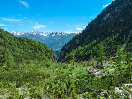
The Vanoise National Park Trails are high-alpine routes in Savoie, in the French Alps. The flagship trek is the Tour des Glaciers de la Vanoise: a hard 70 km loop from Pralognan-la-Vanoise, usually walked in 5 days, with about 4,400 m of ascent. It suits fit, experienced mountain walkers who are comfortable with rocky cols, refuge nights and changeable alpine weather. It is one of the major protected-area treks in France, with shorter day walks available from valley bases.
Route Overview
The classic Tour des Glaciers de la Vanoise starts and finishes in Pralognan-la-Vanoise at 1,400 m, linking sections of the GR5 and GR55 through the core of Parc national de la Vanoise. Published versions run over 4–7 days; the central planning figure is 5 days. The route passes key places such as Lac des Vaches, Col de la Vanoise, Refuge de l'Arpont, Refuge de Péclet-Polset and Refuge de la Valette, with variants starting from Modane. The park is also crossed end to end by the GR5 and GR55, and the Pralognan to Col de la Vanoise route works as a demanding out-and-back day walk. For other French mountain routes, compare the Chartreuse Trail GR9 segment and Cirque de Gavarnie Trails.
Vanoise: France's First National Park
Vanoise National Park was created in 1963 as the first national park in France, largely to protect the Alpine ibex after it had been driven close to extinction in the French Alps. The park covers high-mountain Savoie between the Tarentaise and Maurienne valleys. In 1972 it was twinned with Italy's Gran Paradiso National Park. The walking routes also follow older lines of passage, including the historic salt-trading route over the Col de la Vanoise.
Notable highlights
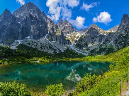
- Grande Casse (3,855 m): The highest summit in the Vanoise massif dominates the skyline above the Col de la Vanoise. It is a glaciated mountaineering objective, not a hiking summit.
- Col de la Vanoise & Lac des Vaches (2,517 m): The classic pass is reached past Lac des Vaches, where flat stepping stones cross the shallow lake. The Refuge du Col de la Vanoise sits just beyond.
- Alpine ibex — bouquetin: The ibex is the emblem of the park and is regularly seen on high trails, alongside chamois and marmots.
- Vanoise glaciers: The trail threads below the glaciers and moraines that give the Tour des Glaciers de la Vanoise its name.
- Col de Chavière (2,796 m): A stark, mineral pass on the GR55 between Pralognan and Modane, with views towards both the Tarentaise and Maurienne.
- Gran Paradiso border: On its eastern edge, Vanoise adjoins Italy's Gran Paradiso National Park, forming a large protected area across the Graian Alps.
Challenges to expect
Expect sustained high-mountain walking: several cols around 2,500–2,900 m, long 5–8 hour days and roughly 4,400 m of cumulative ascent on the full circuit. Terrain includes meadow paths, rocky moraine, loose stone, short chained passages and possible lingering snow into early summer. Refuges need advance booking. National-park rules are strict: no dogs, fires or drones, and camping is limited to regulated bivouac near refuges.
HikeList Score
Vanoise National Park Trails scored 82/100 on HikeList's trail-quality metrics.
See score breakdownHide breakdown
- Ideal length 85
- Balanced challenge 80
- Scenery & wildness 98
- Varied terrain 71
- Accommodation 67
- Food & support 72
- Path quality 98
- Season flexibility 76
Computed from length, challenge, scenery & wildness, terrain variety, accommodation, food & support, path quality and season flexibility.
 France
Show more data Show less
- Mountainous
- Forest
- Dirt
- Rocky
- Snow
- Huts
- Campsites
- Wild Camping Spots
- Family Friendly
- Pet Friendly
- Restrooms
- Water Sources
- Campsites
- Shelters
Photos from hikers
Taken on the trail by people who've reviewed Vanoise National Park Trails.
Reviews
How would you rate Vanoise National Park Trails?
Tap a star to start your review — you could be the first.