Sentiero Italia (Italy Trail)
How would you rate Sentiero Italia (Italy Trail)?
Tap a star to share your experience and help other hikers.
Sentiero Italia: A Complete Italy Trail Guide
HikeList Score
Sentiero Italia (Italy Trail) scored 76/100 on HikeList's trail-quality metrics.
See score breakdownHide breakdown
- Ideal length 52
- Balanced challenge 44
- Scenery & wildness 98
- Varied terrain 83
- Accommodation 92
- Food & support 81
- Path quality 98
- Season flexibility 89
Computed from length, challenge, scenery & wildness, terrain variety, accommodation, food & support, path quality and season flexibility.
The Sentiero Italia CAI is Italy’s national-scale mountain thru-hike: a point-to-point route between Santa Teresa Gallura in Sardinia and Muggia/Trieste in Friuli Venezia Giulia, crossing all 20 regions. Use around 7,000 km as the planning figure, though the renovated CAI route is quoted closer to 7,900 km. A full end-to-end walk is about 350 days and is an expert undertaking, with huge cumulative ascent, remote Apennine stages, Alpine passes and island traverses. Most hikers sensibly walk it in sections.
Route Overview
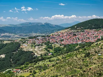
The modern CAI ordering runs from Santa Teresa Gallura on Sardinia to Muggia/Lazzaretto near Trieste, but the trail is walkable either way. It links the island mountains of Sardinia and Sicily with the southern, central and northern Apennines, then the Ligurian Apennines, western Alps, Dolomites and Julian Alps before the north-eastern terminus near the Slovenian border. Across Italy, the route is divided into hundreds of single-day CAI stages between villages, refuges and reception points, so logistics are planned section by section rather than as a fixed itinerary. Expect a true point-to-point mountain traverse, not a compact holiday trail.
How the Sentiero Italia Was Created
The idea dates to 1983, when hiking journalists Teresio Valsesia, Riccardo Carnovalini and Giancarlo Corbellini proposed a single path following Italy’s mountain spine. The Club Alpino Italiano adopted the project, and it was inaugurated in 1995 with Camminaitalia 95, a relay that covered most of the route over about eight months. After years of neglect, CAI restored and relaunched the trail from 2018, re-surveying, re-waymarking and digitising stages; the Va’Sentiero project later documented much of the renovated route.
Notable highlights
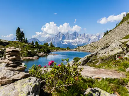
- Dolomites and Julian Alps: The north-eastern sections cross the UNESCO-listed Dolomites and the Julian Alps near the Slovenian border, with long limestone mountain stages and high-pass terrain.
- Gran Paradiso and the western Alps: Near the trail’s high point, the route passes the Gran Paradiso massif area, Italy’s oldest national park and a stronghold of Alpine ibex. For a shorter focused trip here, compare the Gran Paradiso Trek.
- Alta Via dei Monti Liguri and the Ligurian Apennines: This part links the Alps and Apennines through Ligurian ridge country. The Alta Via dei Monti Liguri is one of the key named routes associated with this section.
- Gran Sasso and the central Apennines: The Abruzzo highlands and Abruzzo, Lazio and Molise national park give some of the wildest mainland stages, with important habitat for Marsican brown bear, Apennine wolf and chamois.
- Mount Etna and the Sicilian ranges: The Sicily traverse crosses the Madonie and Nebrodi ranges and the flanks of Etna, Europe’s largest active volcano and a UNESCO World Heritage site. The separate Mount Etna Summit Trail is useful if you want a focused Etna objective.
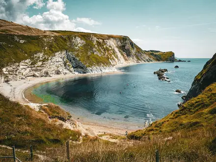
- Gennargentu and Supramonte, Sardinia: The Sardinian section crosses the island’s highest mountains and limestone Supramonte before finishing on the Gallura coast at Santa Teresa Gallura. The coastal Selvaggio Blu is a separate Sardinian challenge with very different logistics.
Challenges to expect
This is an expert trail because of scale: around 350,000 m of cumulative ascent, a high point of about 3,098 m, long remote sections and variable waymarking. Alpine passes are usually a July–September objective, while southern and island sections are better in spring or autumn to avoid heat. Navigation should combine CAI waymarks with maps, GPX and official stage sheets. Wild camping is restricted by region and park, and refuges or local services may require booking and payment.
HikeList Score
Sentiero Italia (Italy Trail) scored 76/100 on HikeList's trail-quality metrics.
See score breakdownHide breakdown
- Ideal length 52
- Balanced challenge 44
- Scenery & wildness 98
- Varied terrain 83
- Accommodation 92
- Food & support 81
- Path quality 98
- Season flexibility 89
Computed from length, challenge, scenery & wildness, terrain variety, accommodation, food & support, path quality and season flexibility.
 Italy
ItalyShow more data Show less
- Mountainous
- Forest
- Coastal
- Dirt
- Rocky
- Gravel
- Huts
- Hotels
- Hostels
- Campsites
- Wild Camping Spots
- Pet Friendly
- Water Sources
- Campsites
- Shelters
In these collections
Photos from hikers
Taken on the trail by people who've reviewed Sentiero Italia (Italy Trail).
Reviews
How would you rate Sentiero Italia (Italy Trail)?
Tap a star to start your review — you could be the first.