Mount Etna Summit Trail
How would you rate Mount Etna Summit Trail?
Tap a star to share your experience and help other hikers.
Mount Etna Summit Trail: Sicily’s Active Volcano Ascent
HikeList Score
Mount Etna Summit Trail scored 81/100 on HikeList's trail-quality metrics.
See score breakdownHide breakdown
- Ideal length 55
- Balanced challenge 74
- Scenery & wildness 98
- Varied terrain 64
- Accommodation 92
- Food & support 88
- Path quality 98
- Season flexibility 89
Computed from length, challenge, scenery & wildness, terrain variety, accommodation, food & support, path quality and season flexibility.
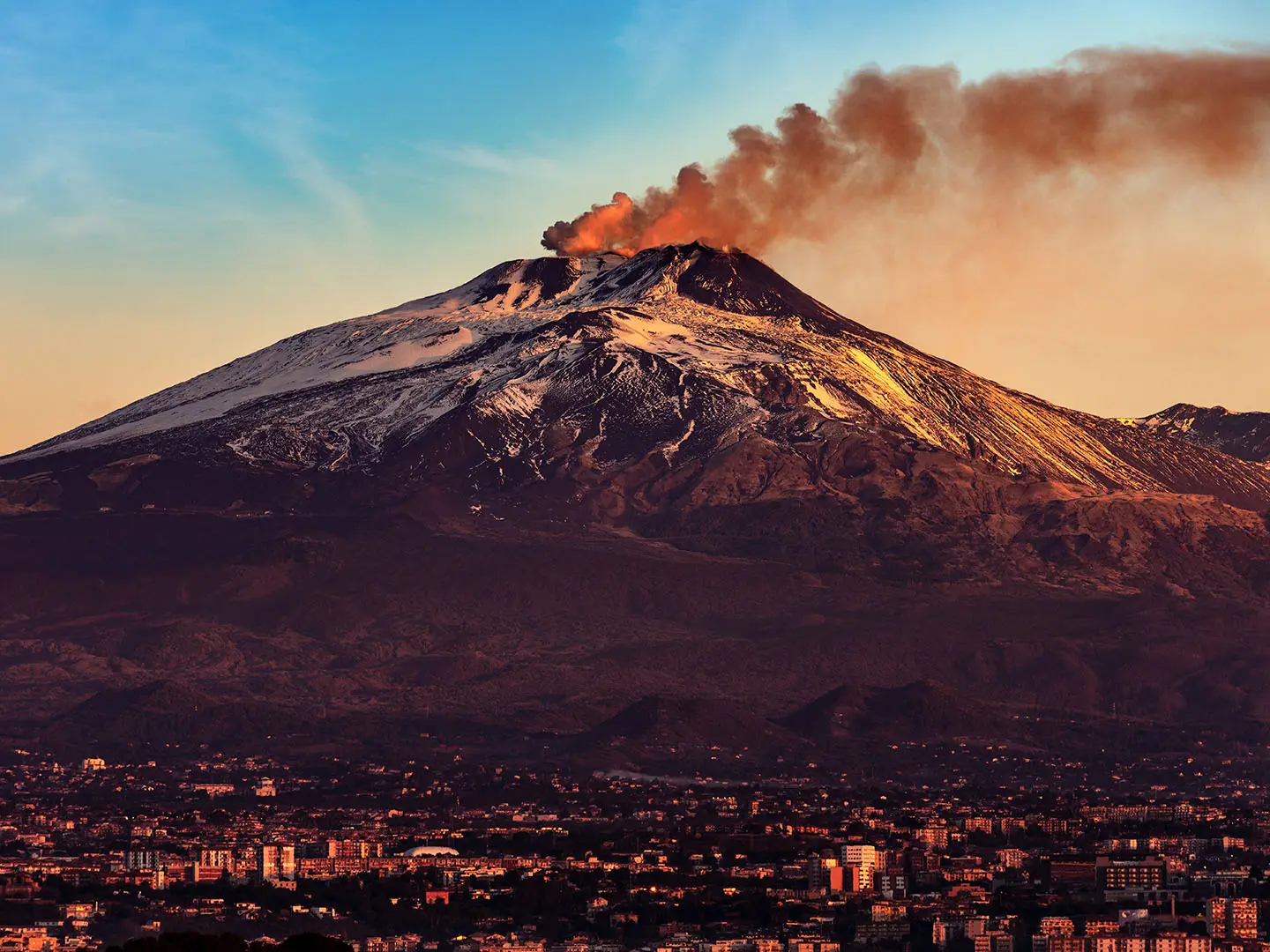
The Mount Etna Summit Trail is a hard, route-dependent day ascent of Mount Etna — Mongibello — on the east coast of Sicily, Italy. The headline outing is about 9 km out and back from Rifugio Sapienza on the southern flank, with up to 1,300 m of ascent to the summit-crater zone around 3,323 m. It suits fit hikers who can handle loose volcanic scree, altitude, exposure and regulated access near an active volcano.
Route Overview
Most walkers start and finish at Rifugio Sapienza, above Nicolosi and reachable from Catania. From there the route climbs the southern slope, either on foot or partly by the Funivia dell’Etna cable car to about 2,500 m, then optionally by 4x4 minibus to the Torre del Filosofo area at about 2,900–2,920 m. Above roughly 2,900 m, access to the active summit craters requires a certified volcanological or Alpine guide. The return normally retraces the ascent. A northern alternative starts at Piano Provenzana and can include the Pizzi Deneri volcanological observatory. For other Italian mountain trips, compare the Gran Paradiso Trek, Alta Via 2 or the volcanic Aeolian Islands Trek.
Mount Etna history and volcanic activity
Etna is one of the world’s most active volcanoes, with activity going back roughly 500,000 years and the present Mongibello edifice forming over about the last 15,000 years. It appears in Greek mythology as the home of Hephaestus/Vulcan and Typhon, while Empedocles is legendarily linked to its crater. Modern eruptions keep reshaping the mountain: the 2002–03 eruption destroyed facilities at Piano Provenzana and the original Torre del Filosofo refuge. Etna was inscribed as a UNESCO World Heritage Site in 2013.
Notable highlights
The summit craters (around 3,300 m): The Voragine/Central Crater, Bocca Nuova and the South-East and North-East craters form Etna’s active summit cluster. This is the high point of the walk, with steam, sulphurous gases and terrain that can change after eruptions.
Torre del Filosofo area (~2,900–2,920 m): This plateau is the usual 4x4 minibus turnaround and staging point for guided summit walks. It marks the practical divide between independent lower hiking and regulated access toward the craters.
Valle del Bove: This huge horseshoe-shaped collapse depression on Etna’s eastern flank is one of the mountain’s most dramatic viewpoints. Many lava flows run into it, making the scale of the volcano obvious.
Lunar lava landscape: Expect black ash fields, cinder cones, fumaroles and sharp lava rock rather than a conventional mountain path. The upper slopes feel stark, exposed and distinctly volcanic.
Rifugio Sapienza cable car: The Funivia dell’Etna links Sapienza at about 1,910 m with the upper station at about 2,500 m. It is the standard shortcut for reducing the lower climb before continuing toward the summit area.
Challenges to expect
The main difficulties are loose ash, scree, gravel and sharp lava rock underfoot, plus a large climb at 2,000–3,300 m altitude. Weather is exposed and can switch quickly between strong sun, cold wind and poor visibility. There is no maintained summit path surface, and access above about 2,900 m is legally regulated. The summit can close at short notice during volcanic activity.
HikeList Score
Mount Etna Summit Trail scored 81/100 on HikeList's trail-quality metrics.
See score breakdownHide breakdown
- Ideal length 55
- Balanced challenge 74
- Scenery & wildness 98
- Varied terrain 64
- Accommodation 92
- Food & support 88
- Path quality 98
- Season flexibility 89
Computed from length, challenge, scenery & wildness, terrain variety, accommodation, food & support, path quality and season flexibility.
 Italy
ItalyShow more data Show less
- Mountainous
- Volcanic
- Dirt
- Rocky
- Hotels
- Lodges
- Huts
- Campsites
- Family Friendly
- Restrooms
- Water Sources
- Campsites
- Shelters
In these collections
Photos from hikers
Taken on the trail by people who've reviewed Mount Etna Summit Trail.
Start at Rifugio Sapienza on Etna’s southern flank. Walk, or use the paid cable car and optional 4x4 minibus, toward the Torre del Filosofo area at about 2,900–2,920 m. With a certified guide, continue to the summit-crater zone around 3,300 m, then return by the same line to Sapienza.
Reviews
How would you rate Mount Etna Summit Trail?
Tap a star to start your review — you could be the first.