Selvaggio Blu
How would you rate Selvaggio Blu?
Tap a star to share your experience and help other hikers.
Selvaggio Blu: Expert Sardinia Coastal Trek
HikeList Score
Selvaggio Blu scored 67/100 on HikeList's trail-quality metrics.
See score breakdownHide breakdown
- Ideal length 85
- Balanced challenge 38
- Scenery & wildness 85
- Varied terrain 76
- Accommodation 49
- Food & support 38
- Path quality 98
- Season flexibility 76
Computed from length, challenge, scenery & wildness, terrain variety, accommodation, food & support, path quality and season flexibility.
Selvaggio Blu is a 40 km point-to-point trek along the Gulf of Orosei in the Baunei district of eastern Sardinia, Italy. The classic route runs from Pedra Longa to Cala Sisine and takes 4-6 days. This is an expert route: T5 hiking, UIAA climbing pitches up to IV+, abseils, exposed limestone, poor waymarking and very scarce water. It suits experienced mountain hikers who are comfortable with ropes, navigation, bivouacs and exposure; it is not suitable for anyone with vertigo.
Route Overview
The canonical Selvaggio Blu runs south to north from Pedra Longa to Cala Sisine, with many parties adding a short approach from Santa Maria Navarrese to Pedra Longa. The line follows wild limestone coast through karst plateaux, bacu and codula gorges, macchia scrub, cliff traverses and small coves such as Cala Goloritze, Cala Mariolu and Cala Biriola. It is a point-to-point trek with no huts, shops or facilities on route; nights are at Municipality of Baunei-designated bivouacs only. For less technical Italian coastal walking, compare the Cinque Terre Coastal Trail or the Cilento Coast Trail.
History of the Selvaggio Blu
Selvaggio Blu was conceived in May 1987 and completed and named in May 1988 by Italian mountaineer-photographer Mario Verin and Sardinian guide Peppino Cicalo. They joined old mule tracks used by charcoal burners with climbing paths used by Supramonte shepherds, including steep passages negotiated by juniper-log scalas e fustes. The result is a continuous coastal line that preserves a strong link with the pastoral history of the Baunei coast.
Notable highlights
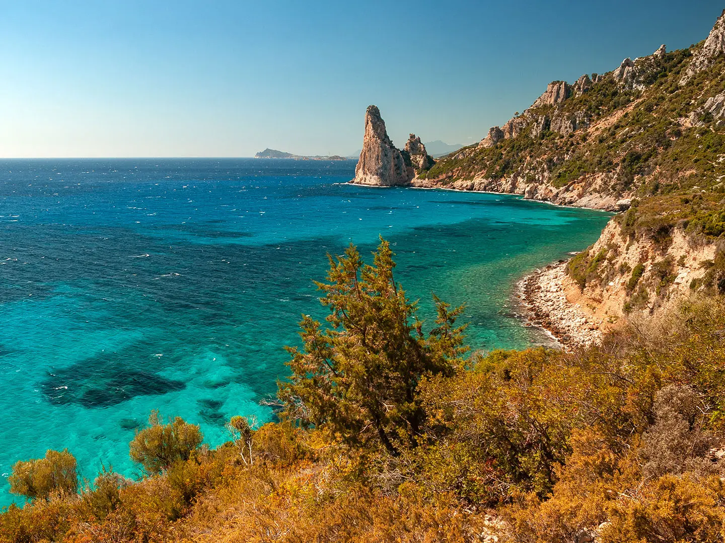
- Pedra Longa (128 m limestone spire): This sea stack marks the official start of the classic trek and is one of the clearest landmarks on the Baunei coast.
- Cala Goloritze: A pebble cove formed by a 1962 landslide and declared an Italian Natural Monument in 1993. The 143 m Aguglia, also known as Monte Caroddi, rises above it.
- Scalas e fustes: These old juniper-log ladders were wedged into cliffs by shepherds and are still part of the route’s steepest passages.
- Cala Mariolu: A white-pebble beach with turquoise water, often used as a swim and rest stop on the route.
- Cala Biriola: A small wild cove backed by juniper woodland and used as a designated bivouac area.
- Cala Sisine: The broad beach at the mouth of the Codula di Sisine gorge marks the classic northern finish.
Challenges to expect
Expect continuous rock, exposure, rough limestone, dense macchia and poor waymarking. Rope work is part of the route: via-ferrata-style climbing, abseils and steep shepherds’ ladders require proper kit and competence. Water is very scarce and rain-dependent, so carry at least 3 litres per person per day. Permits, fees and bivouac bookings with the Municipality of Baunei are mandatory. For a different island trek with less rope work, see the Aeolian Islands Trek.
HikeList Score
Selvaggio Blu scored 67/100 on HikeList's trail-quality metrics.
See score breakdownHide breakdown
- Ideal length 85
- Balanced challenge 38
- Scenery & wildness 85
- Varied terrain 76
- Accommodation 49
- Food & support 38
- Path quality 98
- Season flexibility 76
Computed from length, challenge, scenery & wildness, terrain variety, accommodation, food & support, path quality and season flexibility.
 Italy
ItalyShow more data Show less
- Coastal
- Mountainous
- Karst
- Rocky
- Dirt
- Wild Camping Spots
- None
- None
In these collections
Photos from hikers
Taken on the trail by people who've reviewed Selvaggio Blu.
This first day of the Selvaggio Blu begins at Santa Maria Navarrese and follows a coastal path southward to the striking limestone outcrop of Pedra Longa. The route is relatively moderate compared to later days, featuring gradual ascents through maquis and rocky terrain, with expansive sea views along the way. This stage introduces hikers to the wild beauty of the Supramonte coast and ends at a dramatic cliffside camping area overlooking the water.
Day two is more demanding, with technical ascents and descents over rocky trails. The path heads deeper into isolated terrain and requires the first bit of scrambling. Navigating through fragrant Mediterranean scrub and along dramatic clifftops, hikers pass dramatic overlooks before reaching the small bay of Portu Pedrosu, a pebble-strewn inlet suitable for wild camping.
This stage features steep climbs and breathtaking clifftop passages, weaving between dense vegetation and rocks. Hikers will traverse exposed sections and technical scrambles, requiring careful footing and possibly the use of ropes. The reward is the world-famous Cala Goloritzé, celebrated for its crystalline waters and iconic limestone spire, where you can enjoy a well-earned rest in an extraordinary setting.
The most challenging day of the trek, this segment involves multiple abseils, exposed traverses, and very remote terrain with little to no trail marking. Hikers must negotiate deep bacu (gullies) and negotiate some of the wildest, least accessible parts of the coast. The day ends at the stunning Cala Mariolu, a perfect spot for a swim in the turquoise sea and a well-deserved rest.
This stage continues through complex and wild terrain, featuring technical ascents and rope descents intermixed with scenic ridge walks and occasional encounters with ancient shepherd shelters. Dense vegetation, rocky plateaus, and exceptional sea views typify this day, culminating at the small bay of Cala Biriola.
The final stage of Selvaggio Blu traces a rugged and panoramic route before gradually descending to Cala Sisine. Although challenging, this stretch is less technical than earlier sections and offers more sustained hiking along wild ridges and limestone plateaus. The route concludes at Cala Sisine, a broad beach framed by towering cliffs, marking the triumphant end to the adventure.
Reviews
How would you rate Selvaggio Blu?
Tap a star to start your review — you could be the first.