Schladminger Tauern High Trail
How would you rate Schladminger Tauern High Trail?
Tap a star to share your experience and help other hikers.
Schladminger Tauern High Trail: A 7-Day Alpine Hut Traverse
HikeList Score
Schladminger Tauern High Trail scored 79/100 on HikeList's trail-quality metrics.
See score breakdownHide breakdown
- Ideal length 100
- Balanced challenge 74
- Scenery & wildness 71
- Varied terrain 100
- Accommodation 49
- Food & support 72
- Path quality 98
- Season flexibility 76
Computed from length, challenge, scenery & wildness, terrain variety, accommodation, food & support, path quality and season flexibility.
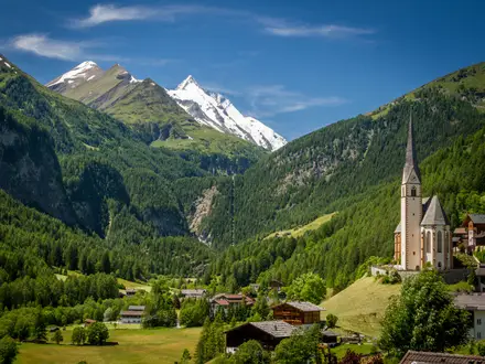
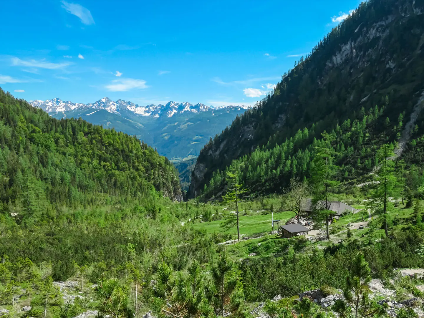
The Schladminger Tauern High Trail is a hard 70 km hut-to-hut traverse through the Schladminger Tauern in Styria, Austria. The full Schladminger-Tauern-Höhenweg takes 7 days from Hochwurzen to St. Nikolai im Sölktal; a popular 5-day classic covers a shorter ~43–46 km. Expect rocky alpine paths, ridges, scree, cable- or rope-secured passages and roughly 1,000 m of ascent and descent on an average day. It suits experienced mountain hikers with surefootedness and a head for heights.
Route Overview
The full route is a linear, point-to-point traverse starting at Hochwurzen, usually from the Hochwurzenhütte or Gipfelbahn Hochwurzen summit station above Rohrmoos-Schladming, and finishing in St. Nikolai im Sölktal. The 7-stage line links Giglachseen, Keinprechthütte, Gollinghütte, the Klafferkessel, Preintalerhütte, Putzentalalm and Rudolf-Schober-Hütte before descending into the Sölktal. The classic 5-day version ends near Steirischer Bodensee or the Planai cableway above Schladming. If you are comparing Austrian alpine routes, the nearby Dachstein Rundwanderweg and Dachstein Glacier Circuit sit in the wider Schladming-Dachstein area, while the Hohe Tauern Panorama Trail is another hut-based mountain option.
Alpine Farming, Mining and Hut Culture
The Schladminger Tauern have long been shaped by alpine farming, high pastures and small-scale mining for silver, copper and other ores in the surrounding valleys. The hut network grew with the Alpine Club movement and the rise of Schladming-Dachstein as a hiking and ski region; Schladming later hosted the 2013 Alpine World Ski Championships. Today the high trail links historic mountain huts into one continuous ridge traverse, with the glacially formed Klafferkessel as its protected scenic centrepiece.
Notable highlights
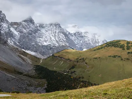
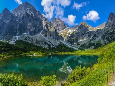
Klafferkessel (around 2,300 m): A glacially carved high plateau scattered with more than 30 clear tarns. It is crossed between Gollinghütte and Preintalerhütte and is the scenic centrepiece of the trail.
Giglachseen: The Upper and Lower Giglach lakes are reached on the opening stage. Giglachseehütte and Ignaz-Mattis-Hütte sit by the water, making this a classic first night.
Greifenberg (2,618 m): The highest point on the main route. It gives the key panorama over the Klafferkessel and surrounding Tauern summits.
Hochgolling (2,863 m): The highest peak of the Schladminger Tauern rises above the Gollingwinkel cirque near Gollinghütte. It is a steep optional summit detour, not part of the main waymarked line.
Österreichisches Wandergütesiegel: The route carries the Austrian Hiking Seal of Quality, reflecting its status as a well-waymarked quality long-distance trail.
Challenges to expect
This is demanding alpine walking, with difficult stretches around T4, exposed ground, scree and some cable- or rope-secured passages. Snowfields can linger early in the season and return in autumn, so late June to mid-September is the usual window. Huts must be booked ahead, cash is useful, and there is no luggage transfer service. Resupply is hut-based, not village-to-village.
HikeList Score
Schladminger Tauern High Trail scored 79/100 on HikeList's trail-quality metrics.
See score breakdownHide breakdown
- Ideal length 100
- Balanced challenge 74
- Scenery & wildness 71
- Varied terrain 100
- Accommodation 49
- Food & support 72
- Path quality 98
- Season flexibility 76
Computed from length, challenge, scenery & wildness, terrain variety, accommodation, food & support, path quality and season flexibility.
Show more data Show less
- Mountainous
- Alpine
- Ridgelines
- Cirques
- Scree
- Alpine Meadows
- Rocky
- Scree
- Dirt
- Meadow Tracks
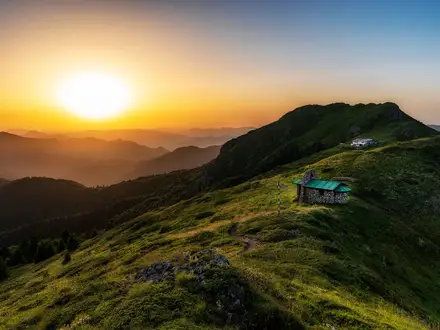
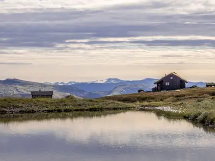
- Huts
- Pet Friendly
- Restrooms
- Water Sources
- Campsites
- Shelters
In these collections
Photos from hikers
Taken on the trail by people who've reviewed Schladminger Tauern High Trail.
Start at Hochwurzen, above Rohrmoos-Schladming, and traverse towards the Upper and Lower Giglach lakes. Overnight is typically at Giglachseehütte or Ignaz-Mattis-Hütte.
Continue on waymarked alpine paths from the Giglach lakes to Keinprechthütte, moving deeper into the Schladminger Tauern hut network.
The traverse continues to Gollinghütte, below the Gollingwinkel cirque and near the optional Hochgolling summit detour.
A key alpine stage crossing the Klafferkessel, the lake-filled glacial plateau, with Greifenberg as the route high point near this section.
Leave Preintalerhütte and continue across high alpine terrain towards Putzentalalm on the full 7-stage route.
Follow the waymarked traverse from Putzentalalm to Rudolf-Schober-Hütte, staying in the hut-to-hut rhythm of the full Höhenweg.
The final stage finishes the linear traverse in St. Nikolai im Sölktal, lower than the high start and after an overall net descent.
Reviews
How would you rate Schladminger Tauern High Trail?
Tap a star to start your review — you could be the first.