Samaria Gorge Trail
How would you rate Samaria Gorge Trail?
Tap a star to share your experience and help other hikers.
Samaria Gorge Trail: Crete’s Classic Gorge Walk
HikeList Score
Samaria Gorge Trail scored 77/100 on HikeList's trail-quality metrics.
See score breakdownHide breakdown
- Ideal length 55
- Balanced challenge 80
- Scenery & wildness 98
- Varied terrain 64
- Accommodation 74
- Food & support 74
- Path quality 98
- Season flexibility 89
Computed from length, challenge, scenery & wildness, terrain variety, accommodation, food & support, path quality and season flexibility.
The Samaria Gorge Trail is a 16 km, one-day, point-to-point hike through Samaria National Park in south-west Crete, Greece. It runs downhill from Xyloskalo near the Omalos plateau to Agia Roumeli on the Libyan Sea. The route is waymarked and non-technical, but rated hard because of its length, rough rocky surface, continuous descent and heat risk. It suits fit day hikers who are comfortable with steep stone steps, riverbed crossings and fixed transport timings.
Route Overview
Walkers enter at the Xyloskalo gate and descend north to south only; uphill walking from Agia Roumeli is not permitted. The first section drops steeply on the Xyloskalo steps, then the path passes Agios Nikolaos, the abandoned village of Samaria, Osia Maria and the Iron Gates before leaving the park. A final walk leads to modern Agia Roumeli, where ferries take hikers out. Most people arrive by bus to Xyloskalo and leave by ferry from Agia Roumeli. For nearby south-coast hiking, compare Agios Pavlos to Agia Roumeli, the Aradena Gorge Trail or the longer E4 Trail Crete section.
Samaria Gorge history and national park status
Samaria Gorge was declared a national park in 1962, mainly to protect the rare kri-kri, or Cretan wild goat. UNESCO later designated it a Biosphere Reserve. The gorge takes its name from the abandoned village of Samaria, settled from the Byzantine period and left when the park was created; its church of Osia Maria gave the place its name. The surrounding Sfakia region was historically a refuge for Cretan rebels and resistance fighters.
Notable highlights
- Xyloskalo descent: The opening 2 km drops steeply from the Omalos plateau on stone steps with wooden rails, giving early views towards Mt Gingilos.
- Iron Gates / Sideroportes: The gorge’s best-known narrows, where high rock walls close in and the walking line squeezes through a gap of about 3–4 m.
- Abandoned village of Samaria: A deserted hamlet near the midpoint, inhabited from Byzantine times until the national park was created in 1962.
- Kri-kri, the Cretan wild goat: This endemic agrimi goat is a key reason the park was established; sightings are possible but not guaranteed.
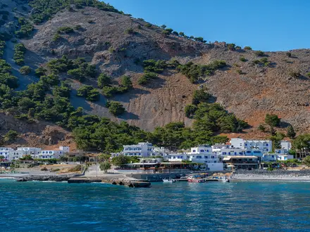
- Agia Roumeli and the Libyan Sea: The walk ends at this small south-coast village, with a pebble beach and ferry pier for onward travel.
Challenges to expect
Expect a long, sustained descent of roughly 1,200–1,250 m on rocky ground. The steep Xyloskalo steps are hardest on knees, while the lower gorge has stepping-stone and small footbridge crossings of the Samaria riverbed. Summer heat can be severe, especially near the exit. There is no overnighting, camping or resupply inside the park, and ferry timing controls the end of the day.
HikeList Score
Samaria Gorge Trail scored 77/100 on HikeList's trail-quality metrics.
See score breakdownHide breakdown
- Ideal length 55
- Balanced challenge 80
- Scenery & wildness 98
- Varied terrain 64
- Accommodation 74
- Food & support 74
- Path quality 98
- Season flexibility 89
Computed from length, challenge, scenery & wildness, terrain variety, accommodation, food & support, path quality and season flexibility.
 Greece
Show more data Show less
- Mountainous
- Forest
- Rocky
- Dirt
- Hotels
- Guesthouses
- Family Friendly
- Restrooms
- Water Sources
Download Our Full Guide to Samaria Gorge Trail FREE!
Get our comprehensive guide to this hike for free. Save it for later reading or print out at home.

In these collections
Photos from hikers
Taken on the trail by people who've reviewed Samaria Gorge Trail.
Samaria Gorge Trail: The Complete Guide
 i
Image by Mindaugas
i
Image by Mindaugas Samariá Gorge is Crete’s classic big day walk: a one-way descent from Xylóskalo on the Omalós plateau to Agía Rouméli on the Libyan Sea. It suits fit day hikers who want a dramatic mountain-to-coast route without technical climbing, but with enough distance, rough ground and heat to demand proper planning.
The walk begins at the high point, around 1,250 m, on the timber-railed stone steps of Xylóskalo. From there the path drops into the White Mountains through pine and cypress forest, passing springs, rest stops and the chapel at Ágios Nikólaos.
Midway through the gorge, the abandoned village of Samariá gives the route its name and a natural pause before the lower canyon tightens. The signature moment comes at Sideróportes, the Iron Gates, where the limestone walls narrow to only a few metres across.
This is not a casual beach excursion with a scenic path attached. The 16 km day is mostly rocky and downhill, with about 1,200–1,250 m of descent, riverbed crossings, exposed lower sections and a finish in roadless Agía Rouméli that depends on the ferry.
This guide covers the route sections, timing, accommodation bases, food and water, transport, terrain, tickets, season rules and common mistakes.
Stage-by-Stage Guide
The Samariá Gorge Trail is a single-day walk, but it is best planned as three distinct sections: the steep upper descent, the deeper middle gorge, and the exposed lower exit to the coast. The high point is the start at Xylóskalo; from there the route loses roughly 1,200–1,250 m to sea level, with effectively no ascent.
Stage 1: Xylóskalo (Omalós) to Samariá village — approx. 7 km
This is the highest, steepest and most knee-testing part of the day. The walk begins at Xylóskalo, on the northern edge of the Omalós plateau, where the timber-railed stone stairway drops sharply into the gorge from about 1,227–1,250 m.
The early path is waymarked and non-technical, but it is rough, stony and continuously downhill. Expect stone steps, loose rock and uneven surfaces through cypress and pine forest, with the descent broken by rest stops and springs at places such as Neroútsiko, Ríza Sikiás, Ágios Nikólaos, Vrýsi and Prinári.
Ágios Nikólaos is the main landmark in this upper section: a small chapel and shaded stopping point about 4 km into the descent. Early in the stage there are views towards Gýngilos (Gingilos), before the gorge walls and forest close the route in.
There are no shops, cafés or accommodation inside the national park, so all food for the day must be carried from the start. Water is available from springs at the official rest points, but availability can be affected by conditions, so start with enough water to cover hot, slow walking as well as the next refill.
Samariá village, the abandoned settlement at the gorge’s midpoint, is the natural major break of the route. It has a first-aid post and is one of the best places to pause before the narrower, hotter lower gorge.
There is no road access at Samariá village and no practical exit from this stage except continuing through the gorge. The route is waymarked, but the fixed direction matters: this is a one-way downhill walk from Xylóskalo to Agía Rouméli, and walking up from the south is not permitted.
The main warning on this stage is the sustained descent. Even fit walkers often find the first 7 km hard on knees and ankles, especially when moving with crowds on polished or loose stones.
Stage 2: Samariá village to Sideróportes (the Iron Gates) — approx. 5 km
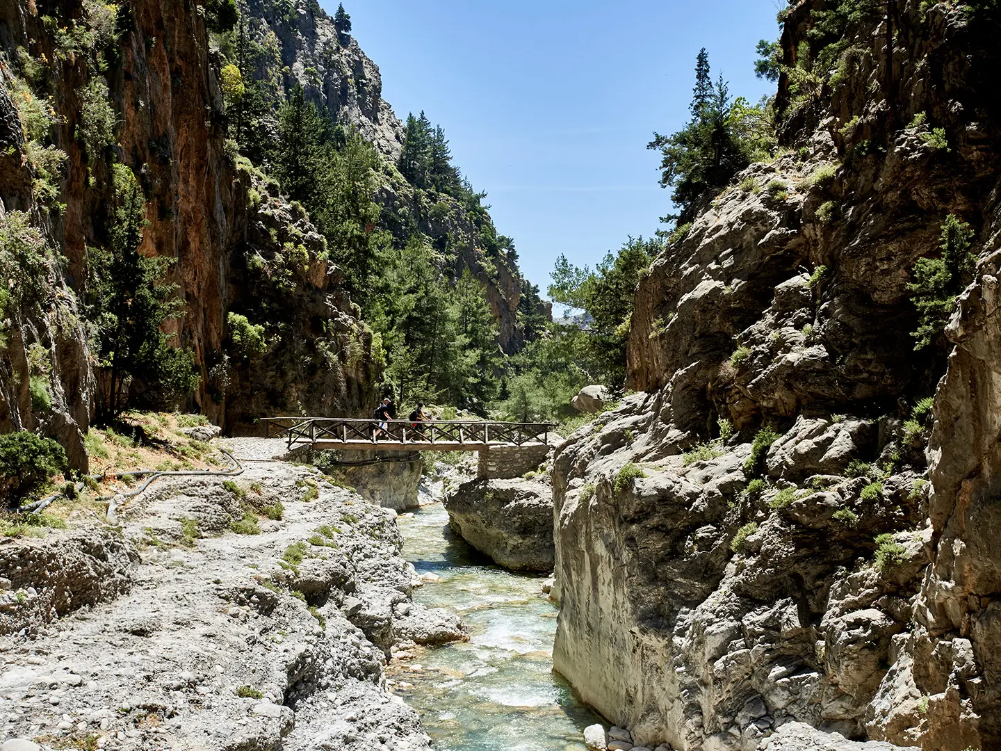
From Samariá village the gorge becomes more enclosed and the walking shifts from steep forest descent to rough riverbed travel. The route follows the Tavronítis/Samariá river corridor, using stepping stones and small wooden footbridges where needed.
Underfoot conditions remain rocky and uneven throughout. The gradient is less dramatic than the upper staircase, but progress can still be slow because of stones, crossings and narrow sections where walkers bunch together.
This section passes rest and water points including Perdíka and Chrístos, with Chrístos noted as the last rest stop before the lower narrows. The abandoned village area is also one of the places where sightings of the kri-kri (Cretan wild goat) are possible, though never guaranteed.
There is still no food or resupply in this stage. Carry lunch or snacks from the start and use the official rest areas rather than stopping in awkward narrow parts of the gorge.
There is no accommodation or road access at Sideróportes. Once beyond Samariá village, the practical plan is still to continue to the park exit and Agía Rouméli in time for the ferry.
Navigation is straightforward in normal open-season conditions because the gorge itself funnels the route and the path is waymarked. Do not leave the marked route: this is a protected national park, and the surrounding slopes are steep, loose and prone to rockfall.
The key hazard here is exposure to falling rock and the limitations of the gorge environment. The park closes outside the official season because of flash-flood and rockfall danger, and same-day closures can occur in poor conditions; opening status should be checked before travelling.
Stage 3: Sideróportes (the Iron Gates) to Agía Rouméli — approx. 4 km
Sideróportes, also known as the Iron Gates or Portes, is the signature narrows of the walk. Here the gorge walls close to only about 3–4 m apart, rising sheer above the stony bed, making this the most photographed section of the route.
After the narrows the character changes quickly. The route leaves the tight limestone corridor and continues over more open riverbed and track towards the park exit, then on past Palaiá Agía Rouméli, the old village, for the final approach to the modern coastal settlement.
This lower section is often the hottest part of the day. Shade is limited, the ground remains stony, and after several hours of descent many walkers are already tired before the final kilometres to the sea.
There are no shops before the park exit, and the national park has no resupply facilities. Carry enough water to finish comfortably in heat, even if using the springs earlier in the gorge.
Agía Rouméli is the finish, with the beach, ferry pier and small-scale accommodation such as hotels, guesthouses and rooms. It is also possible to stay in ferry-connected coastal villages such as Sougiá, Loutró or Chóra Sfakíon, depending on ferry direction and onward plans.
Transport is the controlling issue at the end of the stage. Agía Rouméli has no road access, so walkers leave by ANENDYK ferry east to Chóra Sfakíon or west to Sougiá and Paleóchora, then usually connect with KTEL bus services back towards Chaniá. Ferry and bus times should be checked before travelling, as missing the last boat can force an overnight stay on the coast.
Navigation after the Iron Gates is simple in principle: continue down-gorge to the park exit and onward to Agía Rouméli rather than treating the exit gate as the end of the day. The full walk is 16 km, with roughly 3 km still to go from the park exit to the seafront and ferry pier.
The main warning is heat and timing. In high summer the final exposed kilometres can feel harder than their distance suggests, and the day must be paced around the ferry rather than only the walking time.
Recommended Itinerary
Samariá Gorge is not a multi-day trek. The walking route is a fixed, one-way day hike from Xylóskalo on the Omalós plateau to Agía Rouméli on the south coast, with no accommodation, camping or resupply inside the national park.
Standard itinerary — one-day through-hike
This is the normal way to walk Samariá Gorge independently: reach Xylóskalo early, descend through the gorge, continue from the park exit to Agía Rouméli, then leave by ferry and onward bus.
| Day | From | To | Approx. distance | Why this stage makes sense | Services/accommodation notes |
|---|---|---|---|---|---|
| 1 | Xylóskalo, Omalós | Agía Rouméli | 16 km total: 13 km inside the national park + roughly 3 km to the coast | This is the only full through-route and it must be walked north-to-south, downhill. The high point is the start at Xylóskalo, around 1,227–1,250 m, followed by a long descent of about 1,200–1,250 m to sea level. The day is governed by the park opening, heat, crowds and the ferry out of roadless Agía Rouméli. | No shops, accommodation or camping in the park. Springs, toilets and a first-aid post are available at designated points. Agía Rouméli has rooms, small hotels and food options, but onward travel is by ANENDYK ferry only, usually towards Chóra Sfakíon, Sougiá or Paleóchora, with connecting KTEL buses. Ferry and bus times should be checked before travelling. |
A sensible day starts early. KTEL buses from Chaniá to Omalós/Xylóskalo run early in season, with departures commonly falling between about 05:00 and 08:45, and organised tours also use early hotel pick-ups. Exact timetables change and should be checked before travelling.
The last boat from Agía Rouméli is often the controlling deadline for the whole walk; a common last ferry is around 17:30. Do not plan this as a late-start hike, especially in July or August, when the lower gorge can be severely hot and exposed.
On-day pacing breakdown
These are not separate overnight stages; they are useful checkpoints for managing effort, water and time.
| Section | From | To | Approx. distance | Why this stage matters | Services/accommodation notes |
|---|---|---|---|---|---|
| Upper gorge | Xylóskalo | Samariá abandoned village | 7 km | The steepest and most knee-testing part of the walk begins immediately on the timber-railed Xylóskalo stone steps, then continues through cypress and pine forest past rest points such as Neroútsiko, Ríza Sikiás and Ágios Nikólaos. | Springs and rest stops break up the descent. Samariá village is the main midpoint area and has the first-aid post. No shops or lodging. |
| Middle and lower gorge | Samariá | Sideróportes / the Iron Gates | 5 km | The route follows the stony riverbed deeper into the gorge, with crossings, rough footing and increasingly narrow limestone walls. The Sideróportes are the signature narrows, where the gorge closes to about 3–4 m wide. | Springs/rest points include Perdíka and Chrístos, with Chrístos the last rest stop before the lower narrows. No resupply. |
| Exit to the sea | Sideróportes / the Iron Gates | Agía Rouméli | 4 km | After the narrows, the route continues towards the park exit near Palaiá Agía Rouméli, then carries on roughly 3 km to modern Agía Rouméli, the beach and ferry pier. This final section can feel long because it is lower, hotter and more exposed. | Services begin at Agía Rouméli. Walkers leaving the same day must allow time for the ferry; those staying overnight can avoid rushing this final section. |
Slower variant — overnight before or after the walk
The gorge itself still has to be walked in one day, but the logistics can be made easier by adding a night at either end.
| Day | From | To | Approx. distance | Why this stage makes sense | Services/accommodation notes |
|---|---|---|---|---|---|
| 0 | Chaniá or elsewhere in Crete | Omalós plateau | Travel day only | Staying near Omalós reduces the pressure of a very early transfer from Chaniá and puts you close to Xylóskalo for the morning start. | Accommodation exists on the Omalós plateau. Exact availability and transfer arrangements should be checked before booking. |
| 1 | Xylóskalo, Omalós | Agía Rouméli | 16 km | Same full gorge walk, but with a less rushed start if already based near the trailhead. | No overnighting inside the park. Stay in Agía Rouméli if not taking the ferry out the same day. |
| 2 | Agía Rouméli | Chóra Sfakíon, Sougiá or Paleóchora by ferry, then onward by bus where available | Travel day only | Staying overnight in Agía Rouméli removes the pressure of catching the last ferry after the walk and gives more margin for heat, queues and slower descending. | Agía Rouméli has small hotels, guesthouses and rooms. Ferry and connecting KTEL bus times should be checked before travelling. |
This variant suits walkers who prefer more margin, anyone concerned about the long descent, and those visiting in hotter months. It is also the better approach if accommodation or onward connections are tight.
Faster variant — same-day transfer in and out
There is no meaningful faster walking itinerary, because the route is fixed at 16 km and the park controls access. The efficient version is a same-day trip from Chaniá or another base, using an early bus or organised transfer to Xylóskalo and the ferry-bus combination back after the walk.
| Day | From | To | Approx. distance | Why this stage makes sense | Services/accommodation notes |
|---|---|---|---|---|---|
| 1 | Chaniá / transfer base via Xylóskalo | Agía Rouméli, then ferry and onward bus | 16 km walking, plus transport | This suits fit walkers who are comfortable with a long, rocky descent and fixed transport timings. It avoids extra nights at Omalós or Agía Rouméli but leaves less margin if walking slowly or in strong heat. | Book or plan the full chain: early KTEL bus or organised transfer to Xylóskalo, park ticket, walk, ANENDYK ferry from Agía Rouméli, then connecting bus. All current times should be checked before travelling. |
Planning the Route
Samariá Gorge is planned as a single, fixed-direction day, not as a multi-day trek. The practical challenge is less route-finding and more timing: getting to Xylóskalo early enough, descending at a sustainable pace, leaving a buffer for heat and delays, and reaching Agía Rouméli in time for the ferry.
The walk is best treated as a full-day commitment even by fit hikers. Fast walkers may complete the gorge comfortably before the main ferry departures, but rushing the descent is a poor trade-off: the long stone-and-rubble downhill is hard on knees and ankles, and the lower gorge can be punishingly hot.
How to break up the day
There are no overnight stages inside the national park. Instead, use the natural rest points to structure the day:
| Section | Planning notes |
|---|---|
| Xylóskalo to Samariá | The steepest descent begins immediately on the timber-railed Xylóskalo steps. This is where knees and footing matter most, so start steadily rather than trying to gain time too aggressively. |
| Samariá to Sideróportes (the Iron Gates) | Samariá village is the main midpoint pause, with the first-aid post and space to regroup. After this, the gorge narrows and the walking remains rocky, with riverbed and stepping-stone sections. |
| Sideróportes to Agía Rouméli | The Iron Gates are near the lower end, but the walk is not finished there. Allow time for the open, hotter final stretch beyond the park exit and the roughly 3 km approach to the coast and ferry pier. |
Most walkers should aim to be moving early in the day and avoid spending too long at the first rest stops. A good rhythm is to take short, regular breaks at the springs and shaded stops, then save a longer break for Samariá village or Agía Rouméli once the transport deadline is secure.
Shortening, extending and section hiking
Samariá Gorge is not a flexible route. It is a one-way, downhill traverse from Xylóskalo to Agía Rouméli, and walking up the gorge from Agía Rouméli is not permitted.
There are no road-accessible villages or accommodation stops inside the gorge, so conventional section hiking is not practical. Once committed to the descent, the day should be planned as the full route through the national park and on to Agía Rouméli.
Extending the walk is rarely useful for most hikers because the route already ends at the roadless coast and onward travel depends on the ferry. If staying overnight in Agía Rouméli, any extra walking should be planned separately and with local conditions checked before travelling.
Where to stay before and after
The simplest bases before the hike are Chaniá or the Omalós plateau. Chaniá works well for walkers using the early KTEL bus to Omalós/Xylóskalo, while staying on Omalós puts you closer to the trailhead and reduces the risk of a delayed start.
There is no camping, accommodation or resupply inside Samariá National Park. After the walk, most hikers either take the ferry out the same day or stay in Agía Rouméli, where there are small hotels, guesthouses and rooms.
Other onward overnight options are the ferry-connected coastal villages of Sougiá, Loutró and Chóra Sfakíon. Accommodation in these villages should be booked with ferry times in mind, as Agía Rouméli has no road exit.
Transport is the main planning constraint
The finish at Agía Rouméli is roadless, so the route cannot be treated like a normal point-to-point walk with taxis at both ends. The usual independent plan is:
- KTEL bus from Chaniá bus station to Omalós/Xylóskalo.
- Walk the gorge to Agía Rouméli.
- ANENDYK ferry from Agía Rouméli to Chóra Sfakíon, Sougiá or Paleóchora.
- Connecting KTEL bus back towards Chaniá, where relevant.
Seasonal early buses from Chaniá to Omalós/Xylóskalo typically take about 1–1.5 hours, with departures in the early morning. A common last ferry from Agía Rouméli is around 17:30, but ferry and bus times change by season and weather; these should be checked before travelling.
Leaving a car at Xylóskalo complicates the day because the finish is only reachable by boat. For most independent walkers, public transport or an organised tour with hotel pick-up is logistically easier than trying to retrieve a vehicle from Omalós afterwards.
Tickets, season and closures
Samariá National Park has an entrance ticket. The adult ticket for 2025–2026 is €10, with reduced or free categories for some visitors, including under-18s, over-65s, EU students, disabled visitors with a companion, and some local residents. Tickets can be bought at the entrances or online via NECCA, but the current price and eligibility rules should be checked before booking.
The gorge is normally open only from about 1 May to 31 October. Opening can be delayed into mid- or late May, and the season can end around mid-October in poor conditions. Outside the open season the gorge is closed because of flash-flood and rockfall danger.
Same-day closure notices matter. Heavy rain, high fire risk, rockfall risk or other safety issues can affect access, so check the official Samariá National Park information before setting off.
Food, water and on-route facilities
There are no shops or cafés inside the national park. Carry all food needed for the day, plus enough extra to cover delays before the ferry.
Springs and rest stops are spaced through the gorge, including Neroútsiko, Ríza Sikiás, Ágios Nikólaos, Vrýsi, Prinári, Samariá, Perdíka and Chrístos. Even so, carry enough water from the start, especially in July and August, and refill when available rather than waiting until bottles are empty.
Toilets and a first-aid post are available in the park, with the first-aid post at Samariá village. These facilities do not remove the need to be self-sufficient: the route is rocky, hot in its lower sections, and governed by the ferry timetable.
Navigation and kit priorities
Navigation is straightforward because the route is waymarked and follows the gorge line. A downloaded map is still sensible, but the bigger risks are poor footwear, heat exposure and underestimating the descent.
Wear supportive walking shoes or boots with good grip. Trekking poles are useful for the long downhill if already familiar to the walker, particularly on the Xylóskalo steps and the loose, stony lower sections.
Sun protection is essential. The upper gorge has forested sections, but the lower gorge and the final walk to Agía Rouméli are much more exposed, with no shade in the hottest stretches.
Towns, Villages and Overnight Stops
Samariá Gorge is not a hut-to-hut route. There is no accommodation, camping or resupply inside Samariá National Park, so overnight planning is about where to stay before reaching Xylóskalo and what to do after arriving at roadless Agía Rouméli.
Crete is not a pub-based walking route in the British sense. For this walk, the practical food issue is simple: do not rely on buying food inside the gorge; carry what you need for the day and use the park springs for water where available.
| Place | Best use for hikers | Overnight? | Key transport note |
|---|---|---|---|
| Chaniá (Chania) | Main pre-walk base and bus starting point | Yes | KTEL buses run from Chaniá bus station to Omalós / Xylóskalo in season |
| Omalós | Night-before mountain base close to the trailhead | Yes | Road access to Xylóskalo; useful for an early start |
| Xylóskalo | Official northern trailhead and park entry | No practical overnight role | Road access only; the walk begins here and descends one way |
| Inside the national park | Rest stops, springs and first aid at Samariá | No | No shops, no camping, no accommodation |
| Agía Rouméli | Finish village, beach and ferry pier | Yes | Roadless; leave by ANENDYK ferry only |
| Sougiá, Loutró, Chóra Sfakíon | Ferry-linked post-walk overnight alternatives | Yes | Ferry times and onward KTEL buses must be planned in advance |
Chaniá (Chania)
Chaniá is the most straightforward base before the walk because KTEL buses run from Chaniá bus station up to Omalós / Xylóskalo in season. Early departures are the important ones, with services commonly falling in the early morning window, but current times should be checked before travelling.
Staying in Chaniá suits walkers who want the simplest public-transport arrangement: bus to the start, ferry out from Agía Rouméli, then connecting KTEL bus back towards Chaniá. Organised tours also commonly use hotel pick-up, which can simplify the day if independent bus-and-ferry timing feels too tight.
The drawback is the early start and the transfer up to the Omalós plateau, which takes about 1–1.5 hours by bus. Anyone staying in Chaniá should buy food for the walk before leaving, as there are no shops inside the national park.
Omalós
Omalós is the mountain plateau immediately before the trailhead, with Xylóskalo on its northern edge. It is the best night-before option for walkers who want to remove the early transfer from Chaniá and begin the descent as soon as the park opens.
Accommodation is available on the Omalós plateau, but individual options, seasonal opening and meal arrangements should be checked before travelling. This is a practical overnight stop rather than a place to break the hike itself, because the actual route is still completed in one day.
Omalós works well if you have arranged a lift, a tour transfer or a clear plan for reaching Xylóskalo early. If travelling by car, remember that Agía Rouméli has no road access, so a car left at Omalós must be collected later by a separate arrangement.
Xylóskalo
Xylóskalo is the official start of the Samariá Gorge walk and the highest point of the route, at roughly 1,227–1,250 m. The trail begins immediately with the timber-railed stone stairway dropping steeply into the gorge.
This is a trailhead, not an overnight stop. It is the place to enter the national park, buy or validate the entry ticket if needed, use any available start-area facilities, and begin walking early enough to reach Agía Rouméli before the last ferry.
Do not arrive at Xylóskalo expecting to stock up for the gorge. Once inside the park there are springs, toilets and a first-aid post, but no shops, cafés or accommodation.
Rest stops inside the gorge: Neroútsiko to Chrístos
The named points inside Samariá National Park are rest and water points, not villages for accommodation or resupply. They are useful for pacing the long descent, especially in heat, but they do not change the fact that this is a self-contained day walk.
| On-route place | Practical role |
|---|---|
| Neroútsiko | Spring / rest stop in the upper gorge |
| Ríza Sikiás | Spring / rest stop |
| Ágios Nikólaos | Chapel and shaded rest stop, around the early forested section |
| Vrýsi | Spring |
| Prinári | Spring / rest stop |
| Samariá | Abandoned village at about the midpoint, with the park first-aid post |
| Perdíka | Spring |
| Chrístos | Last rest stop before the lower gorge section |
None of these places has accommodation, camping or shops. Carry lunch and enough food for the full 16 km to Agía Rouméli, even though springs reduce the need to carry all water from the start.
Samariá
Samariá is the abandoned village at roughly the midpoint of the gorge. It is one of the most important stopping points on the walk because it has the national park first-aid post and enough space for a proper pause before the lower gorge.
It is not an overnight stop. The village was cleared when the national park was created in 1962, and walkers must continue through the gorge the same day.
This is also one of the places where sightings of the kri-kri, the Cretan wild goat, are possible, though never guaranteed. Keep food packed away and do not treat wildlife as part of the resupply plan.
Sideróportes (the Iron Gates)
Sideróportes, also known as the Iron Gates, is the narrowest and most photographed part of the gorge, near the lower end of the national park route. It is a landmark rather than a service point.
There is no accommodation, food or transport here. Treat it as a timing checkpoint: if progress has been slow, the priority after the narrows is to keep moving towards the park exit, Palaiá Agía Rouméli and the coast.
Palaiá Agía Rouméli
Palaiá Agía Rouméli is the deserted old village passed after leaving the main national park section, before the final walk to the modern coastal village. It is useful as a mental marker because the formal park exit comes before the finish at the sea.
There is no practical overnight role here. From this point, continue towards Agía Rouméli, where the beach, accommodation and ferry pier are located.
Agía Rouméli
Agía Rouméli is the finish of the walk and the key post-hike logistics point. The modern village sits on the south coast beside the Libyan Sea, about 3 km beyond the national park exit, and has the ferry pier used by gorge walkers.
It is a good overnight stop if you do not want to rush straight onto the last boat, if ferry times do not align with your pace, or if you want a simpler finish after a hot descent. Accommodation is in small hotels, guesthouses and rooms; availability and seasonal opening should be checked before travelling.
The crucial point is that Agía Rouméli is roadless. You cannot get a taxi or bus directly out of the village; departure is by ANENDYK ferry along the coast, commonly towards Chóra Sfakíon eastbound or Sougiá and Paleóchora westbound, with onward KTEL bus connections where applicable.
A common last boat is around 17:30, but ferry times change and the day must be planned around the current timetable. This should be checked before travelling.
Sougiá, Loutró and Chóra Sfakíon
Sougiá, Loutró and Chóra Sfakíon are the main ferry-connected coastal alternatives for walkers who do not stay in Agía Rouméli. They make sense if your onward travel, accommodation booking or bus connection works better from one of these villages.
These are post-walk overnight stops, not places on the walking route itself. The choice depends on the ferry direction you take from Agía Rouméli and the onward KTEL bus plan back towards Chaniá or elsewhere on Crete.
Do not choose one casually at the pier without checking the same-day ferry and bus pattern. Current ANENDYK ferry times, KTEL connections and accommodation availability should be checked before travelling.
Getting to the Start
The trail starts at Xylóskalo, on the northern edge of the Omalós plateau, about 1,227–1,250 m above sea level. This is the high point of the route: from here the path drops one way through Samariá National Park to roadless Agía Rouméli on the south coast.
The main planning point is that the start has road access, but the finish does not. Transport must be arranged as a full chain: Chaniá or Omalós → Xylóskalo → walk → Agía Rouméli ferry → connecting bus back towards Chaniá or onward along the coast.
By train
There is no useful train access for this hike. Plan around road transport to Xylóskalo and the ferry out from Agía Rouméli.
By bus
The standard independent approach is the KTEL bus from Chaniá bus station to Omalós / Xylóskalo. In season, early departures are commonly scheduled between roughly 05:00 and 08:45, with a journey time of about 1–1.5 hours.
This is the simplest way to avoid having a vehicle stranded at the start. It also lines up with the one-day logistics of the gorge: start early, complete the descent, then catch the ANENDYK ferry from Agía Rouméli to Chóra Sfakíon, Sougiá or Paleóchora for onward bus connections.
Timetables matter on this route. The gorge is one-way downhill only, Agía Rouméli is roadless, and a common last ferry is around 17:30. KTEL bus times, ANENDYK ferry times and any same-day park closures should all be checked before travelling.
By car
Driving to Xylóskalo is possible, but it creates a return problem. A car left at Omalós or Xylóskalo will still be there after you finish at Agía Rouméli, which has no road access.
If driving, plan the recovery before setting off. That may mean returning by ferry and bus, then arranging onward transport back to Omalós, or using an organised transfer instead of leaving a car at the trailhead. Parking and long-stay arrangements at the start should be checked before travelling.
A taxi or private transfer to Xylóskalo can work well for an early start, especially if the bus timetable does not suit. It does not remove the need to plan the ferry out of Agía Rouméli.
From the nearest airport
For most walkers, the practical staging point is Chaniá, because the KTEL bus to Omalós / Xylóskalo leaves from Chaniá bus station. If arriving in Crete by air, allow enough time to reach Chaniá and, ideally, stay overnight before the walk rather than relying on same-morning connections.
Airport-to-city transport and any onward intercity connections should be checked before travelling. The key fixed point is the early morning departure from Chaniá towards Xylóskalo.
Where to stay before starting
The usual bases before the hike are Chaniá or the Omalós plateau. Chaniá gives the best access to the KTEL bus and is the most straightforward choice for independent walkers using public transport.
Staying on the Omalós plateau puts you close to Xylóskalo and can make for a less rushed morning. It is also useful if you want to start as early as possible, but onward arrangements to the trailhead and post-walk return transport still need to be planned.
Do not plan to stay inside Samariá National Park. There is no accommodation, camping or resupply in the gorge, and the walk must be completed as a single day through-route to Agía Rouméli.
Getting Home from the Finish
Agía Rouméli is roadless, so leaving the finish is part of the hike logistics, not an afterthought. The only practical way out is by ANENDYK ferry along the south coast, then onward by KTEL bus where services connect.
The key planning point is the last ferry. A common last boat is around 17:30, but ferry and bus times are timetable-dependent and should be checked before travelling.
By train
There is no useful train option from Agía Rouméli. Plan the exit by ferry first, then by bus or road transfer from the ferry port.
By bus
There is no bus from Agía Rouméli itself because the village has no road access. The normal public-transport exit is:
| Leg | Transport | Notes |
|---|---|---|
| Agía Rouméli → Chóra Sfakíon | ANENDYK ferry, eastbound | Common onward route for returning towards Chaniá by KTEL bus. |
| Agía Rouméli → Sougiá or Paleóchora | ANENDYK ferry, westbound | Useful if staying on the south-west coast or connecting onward from there. |
| Ferry port → Chaniá | KTEL bus | Connections are seasonal and timetable-dependent; check ferry and KTEL times together. |
Do not assume that a late finish leaves plenty of options. If the final ferry has gone, there is no road-based fallback from Agía Rouméli; staying overnight in the village is the practical solution.
By car/taxi
A car can get you to Xylóskalo at the start, but it cannot meet you at Agía Rouméli. If a vehicle is left at Omalós/Xylóskalo, it must be collected later after taking the ferry out and arranging onward travel back to the start.
Taxis are only relevant after leaving Agía Rouméli by ferry, from road-connected places such as Chóra Sfakíon, Sougiá or Paleóchora. Availability, cost and late-day options should be checked before travelling.
From the nearest airport
For onward flights, treat Chaniá as the main transport hub. From Agía Rouméli, take the ferry to a road-connected port, then use the connecting KTEL bus back to Chaniá before arranging airport transfer.
Do not book a tight same-day flight after the hike. The walk, ferry and bus are all timing-dependent, and delays or a missed ferry can force an overnight stay on the south coast.
Where to stay at the finish
Agía Rouméli has small hotels, guesthouses and rooms, making it the best place to stay if finishing late, missing the ferry or wanting to avoid a rushed exit after the gorge. This is also the safest backup plan if walking pace, heat or crowds make the day slower than expected.
Other ferry-connected overnight options include Sougiá, Loutró and Chóra Sfakíon. These make sense if they fit the day’s ferry schedule, but exact sailings should be checked before committing to accommodation.
Which Direction Should You Walk?
There is no real directional choice on the Samariá Gorge Trail. The permitted through-walk is north to south, downhill, from Xylóskalo on the Omalós plateau to Agía Rouméli on the Libyan Sea. Walking up the gorge from Agía Rouméli is not permitted.
Standard direction: Xylóskalo to Agía Rouméli
This is the traditional, standard and practical direction. You start at the high point of the route, around 1,227–1,250 m at Xylóskalo, then descend roughly 1,200–1,250 m through the gorge to sea level.
The direction also fits the transport pattern. Most walkers reach Xylóskalo in the morning by KTEL bus from Chaniá, by organised transfer, or by car, then leave roadless Agía Rouméli by ANENDYK ferry to Chóra Sfakíon, Sougiá or Paleóchora, with onward bus connections. The whole day must be planned around the last ferry from Agía Rouméli, so an early start is strongly preferred.
The scenery also builds well in this direction. The walk begins with the steep Xylóskalo stone steps and upper cypress-and-pine forest, passes rest points such as Ágios Nikólaos and the abandoned village of Samariá, then narrows towards Sideróportes (the Iron Gates) before opening out towards Palaiá Agía Rouméli and the sea. Finishing at Agía Rouméli gives a clear psychological end point: beach, food, water and ferry pier.
The main drawback is physical rather than logistical. A continuous rocky descent is hard on knees, ankles and toes, especially in heat and when the lower gorge becomes exposed. Trekking poles, grippy footwear and a steady pace are more useful here than trying to walk fast early on.
Reverse direction: Agía Rouméli to Xylóskalo
The reverse through-walk should not be planned. Walking up the gorge from Agía Rouméli is not permitted, and the route is managed as a one-way downhill passage through the national park.
Even if access rules were ignored, the reverse would be a poor hiking proposition: it would turn the route into a long climb of more than 1,200 m on rough ground, with the steepest sustained section saved for the upper gorge and Xylóskalo steps. It would also work badly with transport, because Agía Rouméli has no road access and depends on ferries.
Recommendation
Walk Xylóskalo → Agía Rouméli. It is the only permitted through-direction, the direction used by the park’s transport flow, and the one that gives the best progression from mountain plateau to gorge narrows to the Libyan Sea. Check the current park opening status, ferry times and KTEL connections before travelling, because the day depends on all three.
Accommodation Along the Route
Samariá Gorge is not an inn-to-inn hike. It is a one-day national park crossing with no accommodation, camping, shops or resupply inside the gorge, so all overnight planning sits before or after the walk.
Most hikers stay in Chaniá (Chania) before the hike and use the early KTEL bus or an organised transfer to reach Xylóskalo. A more start-focused option is to stay on the Omalós plateau, closer to Xylóskalo, which reduces the morning journey but leaves less flexibility for evening travel and onward plans.
At the far end, Agía Rouméli has small hotels, guesthouses and rooms, making it the only place where you can finish the walk and stay without boarding the ferry the same afternoon. Otherwise, the standard exit is by ANENDYK ferry to Chóra Sfakíon, Sougiá or Paleóchora, with onward bus connections; Loutró is another ferry-linked coastal village where walkers may stay.
| Place | Accommodation level | Best for | Notes |
|---|---|---|---|
| Chaniá (Chania) | Good | Easiest pre-hike base | Practical for early KTEL buses to Omalós/Xylóskalo and for organised tours with hotel pick-up. Best for walkers who want the simplest logistics before the gorge. |
| Omalós plateau | Limited | Shortest morning approach to Xylóskalo | Useful if you want to start close to the trailhead. Availability and transport arrangements should be checked before travelling. |
| Xylóskalo | None | Trailhead only | Start of the walk, not an overnight stop. Arrive ready to enter the park and descend. |
| Inside Samariá National Park | None | Not applicable | No huts, camping, shops or overnighting. The rest stops have springs and basic facilities only. |
| Palaiá Agía Rouméli | None | Passing point after the park exit | The old village is passed before the final walk to modern Agía Rouméli; it is not a practical accommodation stop. |
| Agía Rouméli | Limited | Best post-hike overnight stop | Small roadless coastal village with hotels, guesthouses and rooms. Good if you do not want to rush for the last ferry after the walk. |
| Sougiá | Limited | Westbound ferry exit | Ferry-connected coastal village used as an overnight alternative after leaving Agía Rouméli. Ferry times should be checked before booking. |
| Loutró | Limited | Coastal overnight after the hike | Ferry-linked south-coast village option. Check ferry connections carefully, as the whole exit from Agía Rouméli depends on boat timings. |
| Chóra Sfakíon | Limited | Eastbound ferry exit and onward travel | Common ferry destination from Agía Rouméli, with bus connections onward. Suitable if it fits the ferry and KTEL timetable. |
| Paleóchora | Limited | Westbound ferry exit | Another possible ferry-linked finish after leaving Agía Rouméli. Check current ANENDYK ferry schedules before committing. |
Booking strategy
Book ahead if staying in Agía Rouméli, because it is small, roadless and receives walkers at the end of the day. A room there removes the pressure of catching the last ferry and gives more margin if the descent takes longer than expected.
For Chaniá, the key issue is less the bed itself and more the early start: choose accommodation that makes it realistic to reach Chaniá bus station or your organised pick-up point in time. For Omalós, availability is more limited, so check both accommodation and morning access to Xylóskalo before committing.
In July and August, the gorge is hot and busy, and small coastal villages can fill more quickly. Weekends and peak holiday periods are not the time to rely on finding a room on arrival in Agía Rouméli or the ferry-connected villages.
Luggage, transfers and awkward gaps
There is no practical reason to carry overnight luggage through Samariá Gorge. Take only a day pack for the hike and leave larger bags at your base, or arrange your wider Crete itinerary so that luggage does not need to travel through the national park.
Taxi or private transfers can help with reaching Xylóskalo or managing a car left near Omalós, but they do not solve the finish: Agía Rouméli has no road access, so every through-hiker must leave by ferry unless staying there overnight. Any plan involving accommodation beyond Agía Rouméli must be built around the ANENDYK ferry timetable and the connecting KTEL buses. This should be checked before travelling.
Does it work as an inn-to-inn walk?
No. Samariá Gorge is best treated as a single hard day hike with accommodation at either end, not as a staged walking holiday. There are no legal overnight stops inside the park, no huts, and no intermediate villages where walkers can break the route.
Camping and Wild Camping
Camping is not part of the Samariá Gorge Trail. This is a tightly managed, one-day national park walk from Xylóskalo to Agía Rouméli, with no accommodation, campsites, shops or permitted overnight stops inside Samariá National Park.
The practical plan is simple: sleep before the hike in Chaniá or on the Omalós plateau, walk the gorge in a single day, then either take the ferry out from roadless Agía Rouméli or stay in the village in a hotel, guesthouse or room.
Can you camp in Samariá Gorge?
No. Overnighting and camping inside the national park should be treated as off-limits. The gorge is a protected area, the route is controlled by park opening hours and the trail is designed for through-walkers completing the descent in one day.
The park also closes outside its operating season, roughly May to October, because of flash-flood and rockfall danger. Entering or attempting to camp in the gorge when it is closed is not a safe or legitimate fallback option.
Campsites on or near the route
There are no campsites on the trail and no camping facilities at the rest stops, springs, Samariá village or the park exit. The facilities inside the gorge are for daytime use only, such as springs, toilets and first-aid provision.
No campsite at Xylóskalo, Omalós or Agía Rouméli is established from the available route information. If camping elsewhere in the area is being considered, this should be checked locally before travelling, including whether any site is open, legal and reachable with the early start or ferry schedule.
| Area | Camping suitability | Practical note |
|---|---|---|
| Xylóskalo / Omalós | Not on-route camping | Use fixed accommodation if staying nearby before the early start; camping arrangements should be checked locally. |
| Inside Samariá National Park | No | No overnighting, no campsites and no resupply. Walk through in one day. |
| Samariá village / rest stops | No | Daytime rest areas only; not camping places. |
| Agía Rouméli | Not confirmed for camping | The known overnight option is rooms, guesthouses and small hotels; any camping option should be checked before travelling. |
Wild camping and bivvying
Wild camping is not suitable for this route. The gorge is a national park and UNESCO Biosphere Reserve, created to protect the kri-kri (Cretan wild goat) and the wider gorge environment, so independent overnight stops inside the protected area should not be attempted.
A bivvy also makes little logistical sense. The trail is only 16 km in total, all walkers are expected to continue downhill to Agía Rouméli, and the day is governed by park access and ferry times rather than by campsite spacing.
Outside the park, rules can vary by land ownership, village area and local enforcement. If considering any overnight camping away from the official trail corridor, permission and current local rules must be checked before travelling.
Water and cooking considerations
There are springs and rest stops along the gorge, including places such as Neroútsiko, Ríza Sikiás, Ágios Nikólaos, Vrýsi, Prinári, Samariá, Perdíka and Chrístos. These are useful for a hot day’s walking, but they do not make the route appropriate for camping.
Do not plan on cooking inside the gorge. In a hot, dry Cretan national park with heavy visitor pressure, walkers should keep food simple, pack out all rubbish and avoid any behaviour that could damage vegetation, disturb wildlife or create fire risk.
Leave No Trace for day hikers
Even without camping, low-impact behaviour matters on this route because thousands of walkers pass through a narrow protected corridor each season.
- Stay on the marked route and do not cut corners on the Xylóskalo descent.
- Use toilets at designated stops where available.
- Carry out all litter, including food scraps and packaging.
- Do not feed or approach kri-kri or other wildlife.
- Keep noise low around rest stops, the abandoned Samariá village and the narrow lower gorge.
- Leave springs, chapels and historic structures as found.
For this hike, the best camping plan is not to camp: book accommodation before and after if needed, start early, carry enough food and water capacity for a long hot descent, and leave the national park the same day.
Food, Water and Resupply
Samariá Gorge is a one-day walk with no resupply inside the national park. There are rest stops, springs, toilets and a first-aid post, but no shops, cafés, tavernas, huts, camping or accommodation between Xylóskalo and the park exit.
Carry all food for the day from the start. A packed lunch plus high-energy snacks is the right approach, with something spare for the wait at Agía Rouméli if the ferry timing leaves a long gap.
Food planning
Buy food before travelling to Xylóskalo, especially if using an early KTEL bus from Chaniá. Do not rely on buying breakfast, lunch or trail snacks at the national park entrance or anywhere in the gorge; any seasonal facilities outside the park should be treated as a bonus, not a plan. This should be checked before travelling.
There is no meaningful resupply until Agía Rouméli, the roadless coastal village at the finish. Services there are seasonal and tied to the walking and ferry season, so anyone with dietary needs should carry enough food to be self-sufficient until after leaving by ferry.
Water planning
Water is the easier part of the logistics, because the national park has springs and rest stops. Known water/rest points in walking order include Neroútsiko, Ríza Sikiás, Ágios Nikólaos, Vrýsi, Prinári, Samariá, Perdíka and Chrístos, although exact availability should still be treated sensibly in hot weather and checked locally if conditions have been unusual.
Start with full bottles from Xylóskalo. For most walkers, 1.5–2 litres is a sensible minimum at the start; in July–August, for slower walkers, or for anyone who drinks heavily in heat, 2–3 litres is more appropriate even with springs on the route. The lower gorge and the final walk to Agía Rouméli are exposed and hot, so refill before leaving the central/lower rest points rather than waiting until thirsty.
Use the park springs rather than the riverbed as the normal water source. If taking water from any untreated natural source, it should be filtered or treated; do not assume river water is suitable for drinking, and in summer parts of the riverbed may be dry.
| Section | Food availability | Water availability | Notes |
|---|---|---|---|
| Omalós / Xylóskalo before entry | Bring food from your base; do not rely on trailhead resupply. | Start with full bottles. | Early buses and seasonal opening hours make last-minute shopping risky. |
| Xylóskalo to Samariá | None inside the park. Eat carried snacks/lunch at rest stops. | Springs/rest stops include Neroútsiko, Ríza Sikiás, Ágios Nikólaos, Vrýsi and Prinári. | This is the steepest descent section, so keep food and water accessible rather than buried in the pack. |
| Samariá village area | No shop, café, hut or accommodation. | Rest facilities and the park first-aid post are at Samariá; use signed water points rather than assuming every stop has water. | Good place for a longer break, but it is not a resupply point. |
| Samariá to Sideróportes (Iron Gates) | None. | Perdíka is a listed spring; Chrístos is the last rest stop before the lower gorge. | Refill before committing to the hotter, narrower lower section. |
| Sideróportes to Agía Rouméli | No food until the finish village. | No reliable resupply should be assumed after the final park rest points; carry enough for the exposed final kilometres. | The park exit is still about 3 km short of the seafront and ferry pier. |
| Agía Rouméli | Limited village services are at the roadless finish, but seasonal hours should be checked before travelling. | Refill after reaching the village if facilities are open. | Carry a spare snack and water margin in case of heat, queues or a long wait for the ferry. |
Practical resupply tips
Pack food that tolerates heat: sandwiches, nuts, dried fruit, bars and salty snacks are more useful than anything that melts or spoils quickly. The continuous 1,200–1,250 m descent is hard on the body even without climbing, and many walkers underestimate how much salt and fluid they lose in the lower gorge.
Do not plan around Sunday shopping or late-opening rural services. The safe plan is to have breakfast, lunch, snacks and water sorted before the journey to Xylóskalo begins, then treat Agía Rouméli as the first possible place to buy anything after the walk.
Terrain, Conditions and Difficulty in Practice
Samariá Gorge is not technically difficult in the mountaineering sense: the route is waymarked, walked in a single downhill direction and does not require scrambling. The challenge comes from the combination of length, relentless descent, loose stone underfoot, heat and the fixed timing of the ferry from roadless Agía Rouméli.
The high point is the start at Xylóskalo, around 1,227–1,250 m above sea level. From there the walk drops almost continuously to the Libyan Sea, losing roughly 1,200–1,250 m with effectively no significant ascent. That makes the day far harder on knees, quads and ankles than the absence of climbing might suggest.
Underfoot: rocky, stony and uneven throughout
Expect rough limestone walking for most of the day. The surface varies between stone steps, loose stones, compacted dirt, riverbed gravel, stepping-stones and short wooden footbridges, with very little smooth walking until the final approach towards Agía Rouméli.
The opening descent on the Xylóskalo stone stairway is steep and timber-railed, dropping quickly from the Omalós plateau through cypress and pine forest. This section is often where walkers underestimate the route: it is easy to move fast downhill, but braking on steps and stones can punish knees early in the day.
Lower down, the path repeatedly uses or crosses the bed of the Tavronítis/Samariá river. Crossings are normally managed by stepping-stones and small wooden bridges, but the exact feel underfoot changes with seasonal water levels and recent weather. Wet stones can be slippery, and footwear with a firm sole and good grip matters more than on a simple coastal or village path.
The descent is the main physical difficulty
There is no big climb to pace, but the continuous downhill gradient is demanding. Poles are useful for many walkers because they reduce impact on the knees during the long descent from Xylóskalo and help with balance on loose stone and river crossings.
The first half to Samariá village includes the steepest loss of height and the most sustained braking. After Samariá, the gorge floor feels more open in places, but the walking remains stony and tiring rather than easy. By the time the route reaches Sideróportes (the Iron Gates) and the lower gorge, fatigue, heat and sore feet often become more important than gradient.
Heat, shade and exposure
Heat is a major practical factor, especially in July and August. The upper gorge has forested sections and some shade, including around rest stops such as Ágios Nikólaos, but the lower gorge becomes much more exposed and hot.
The final sections after the narrows and towards the park exit can feel harder than their distance suggests because the air is hotter, the ground is open and the walking remains rough. The last roughly 3 km from the park exit via Palaiá Agía Rouméli to Agía Rouméli is not technically difficult, but it comes at the end of a long descent and is often done in strong sun while watching ferry time.
Starting early is therefore not just about avoiding crowds; it is a safety and comfort decision. The day should be planned so the steep upper descent is completed before the worst heat and the lower gorge is not rushed in the afternoon.
Seasonal conditions
The gorge is normally open only around 1 May to 31 October, and dates can shift with conditions. Outside the open season it is closed because of flash-flood and rockfall danger, not simply because services are unavailable. Exact opening dates, closures and same-day notices should be checked before travelling.
Spring, particularly May and June, generally gives cooler walking and more water in the gorge, but river crossings and wet stones may need more care. Autumn, especially September and October, is also a more comfortable time than high summer, though opening dates and weather still need checking.
In high summer the main difficulty is heat rather than navigation. There is little shade in the lower gorge, and the stony ground reflects warmth. Carrying enough water is essential even though springs and rest stops exist along the route.
Narrow gorge hazards: rockfall, crowding and limited escape options
Samariá is a deep limestone gorge, and rockfall risk is one reason the park closes in unsafe conditions. Stay on the marked path, avoid lingering directly below unstable-looking slopes and follow any instructions from park staff.
The Sideróportes (Iron Gates) are the narrowest and most dramatic part of the gorge, where the walls close to only about 3–4 m apart. This section is not technically hard, but it can be slow when busy and the confined terrain means there is little space to pass or pause.
Once committed to the walk, exit options are limited. The route is one-way from Xylóskalo to Agía Rouméli, and the finish has no road access. A late start, slow pace, heat exhaustion or minor injury can quickly become a transport problem because the day is governed by the ferry from Agía Rouméli.
What is not a major issue here
This is not a boggy, muddy or field-walking route in the British long-distance path sense. There are no livestock fields, stiles or pasture-navigation problems to plan around on the main gorge trail.
Road walking is also not a defining feature. The walk is primarily a national-park gorge path, followed by the final open track or riverbed-style approach from the park exit towards the coast at Agía Rouméli.
Who will find it hard
The route is unsuitable for anyone who struggles with long descents, uneven rocky ground or walking for several hours in heat. Children do walk Samariá, but it should not be treated as an easy family stroll: the distance, descent, rough surface and transport deadline make it a demanding day.
For fit hikers with good footwear, enough water and an early start, the trail is straightforward to follow and non-technical. In practice, success depends less on navigation skill and more on managing descent fatigue, foot placement, heat and timing.
Weather and Best Time to Walk
Samariá Gorge is a seasonal hike, not a year-round mountain route. The national park normally opens from about 1 May to 31 October, but the exact opening and closing dates can shift depending on conditions, with late starts into May and earlier closures in October possible. This should be checked before travelling.
Outside the open season, the gorge is closed because of flash-flood and rockfall danger. Winter is therefore not a realistic option for independent hikers, even if the weather on the coast looks settled.
Best months
The best walking windows are May–June and September–October. These months usually give a better balance of cooler temperatures, more water in the gorge and fewer crowds than the high-summer peak.
May and early June are especially useful if you want the gorge to feel less dry, but early-season access depends on the park opening after winter damage and flood risk has been assessed. September and October can be excellent for cooler walking, but late-season dates are more vulnerable to closure in poor conditions.
| Period | What to expect | Planning advice |
|---|---|---|
| May | Good walking conditions if the park has opened; more water and cooler temperatures than summer | Check the official opening date before booking fixed travel |
| June | One of the strongest months for the route; warm but generally more manageable than July–August | Start early and still plan for heat in the lower gorge |
| July–August | Hottest and busiest period; the lower gorge and final approach to Agía Rouméli can be severe in the sun | Only suitable if you cope well with heat; carry enough water and keep moving for the ferry timing |
| September | Better temperatures than high summer and a good late-season option | Still treat the lower gorge as exposed and hot |
| October | Potentially cooler and quieter, but closure risk rises in poor weather | Check park status, ferry times and accommodation before committing |
Heat and exposure
Heat is the main weather hazard during the open season. The route starts high at Xylóskalo, around 1,227–1,250 m, but it descends continuously towards sea level, and the lower gorge becomes much hotter and more exposed.
The section beyond Samariá village towards Sideróportes (the Iron Gates), and the final kilometres out to Agía Rouméli, are the parts where heat management matters most. There is little shade in the lower gorge, and the stony riverbed and open track can feel punishing in July and August.
An early start is strongly recommended, not only for cooler walking but also because the day is tied to the ferry from roadless Agía Rouméli. Slow progress in heat can turn into a transport problem if the last boat is missed.
Rain, storms and closures
Rain is a serious issue in Samariá Gorge because the route follows a narrow river gorge with riverbed sections, stepping-stone crossings and confined narrows. Heavy rain or storm risk can make the route unsafe, even if conditions seem reasonable at the start.
Flash floods and rockfall are the main reasons the gorge is closed outside the official season, and they can also affect opening during the season. Same-day closure notices should be checked before setting off, especially in May, October or after unsettled weather.
Do not enter if the park is closed. Walking up from Agía Rouméli is not permitted, and the normal route is strictly downhill from Xylóskalo to the south coast.
Trail surface by season
Underfoot, Samariá is rough in every season: steep stone steps from Xylóskalo, loose rock, stony track, riverbed walking, stepping-stones and small wooden footbridges. The long descent is hard on knees even in dry weather.
In spring there may be more water in the gorge, which can make crossings and wet stones more awkward. In high summer the surface is usually drier, but the trade-off is intense heat and very exposed walking in the lower sections.
After rain, expect the rocky ground to be slower and more slippery. If poor weather has affected the gorge, access may be delayed or suspended rather than simply unpleasant.
Daylight, ferries and late starts
Daylight is usually sufficient during the main walking season, but Samariá is not a route for a casual late start. The walk commonly takes 4–7 hours, and the finish at Agía Rouméli has no road access.
The practical deadline is the ferry, not just sunset. A common last boat is around 17:30, but ferry and connecting KTEL bus times change and should be checked before travelling.
Accommodation and season edges
Most walkers base themselves in Chaniá or on the Omalós plateau before the hike, then leave Agía Rouméli by ferry or stay overnight there or in a ferry-connected south-coast village such as Sougiá, Loutró or Chóra Sfakíon. At the start and end of the season, accommodation, ferry and bus arrangements should be checked carefully before relying on them.
There is no accommodation, camping or resupply inside the national park. Weather planning therefore has to be settled before entry: once in the gorge, the day is committed to continuing downhill to the exit and on to Agía Rouméli.
Safety Notes
Emergency help and communication
For emergency assistance in Greece, use 112. Save it before leaving Chaniá, Omalós or your accommodation, and keep enough battery for the full day.
Do not rely on constant mobile signal inside Samariá Gorge. The route runs through a deep limestone gorge with steep walls, so coverage may be intermittent or absent in places; a charged phone is useful, but it should not be your only safety plan.
A first-aid post is at Samariá village, around the midpoint of the park section. Outside the staffed/rest areas, help may take time to reach you, so manage pace, heat and foot/knee problems early rather than pushing on until they become serious.
Heat, exposure and timing
Heat is one of the main hazards on this walk, especially in July and August and on the lower, more open sections after the forested upper gorge. The final part towards Agía Rouméli has little shade and can feel much hotter than the start at Xylóskalo.
Start early, carry enough water from the outset, refill where springs are available, and take breaks before fatigue builds. Sun protection is essential: hat, sunglasses, high-factor sun cream and clothing that covers shoulders are practical rather than optional in summer.
The day is also governed by the ferry from roadless Agía Rouméli. Build in enough time to walk the full 16 km, deal with heat and crowds, and still reach the pier before the last boat; ferry and KTEL bus times should be checked before travelling.
Descent, rock and footing
The walk starts with the steep Xylóskalo stone steps and then continues almost constantly downhill for roughly 1,200–1,250 m to sea level. This is demanding on knees, calves and ankles even though there is effectively no ascent.
The surface is rocky, stony and uneven throughout, with riverbed sections, stepping-stones and small wooden footbridges. Wear proper walking shoes or boots with good grip; smooth-soled trainers or sandals are a poor choice for the descent.
Trekking poles can help control the long downhill, particularly on the upper steps and loose stony sections. Keep a steady pace and avoid rushing to overtake in narrow parts of the gorge.
Weather, closures, flash floods and rockfall
Samariá Gorge is open only in the official season, roughly May to October, and is closed outside that period because of flash-flood and rockfall danger. Opening and closing dates shift with conditions, so the current park status should be checked before setting off.
Do not enter the gorge if it is closed or if park staff advise against walking. In a narrow gorge, heavy rain in the mountains can create dangerous conditions downstream, even if the lower route looks dry at first.
Rockfall is a real mountain-gorge hazard. Avoid lingering directly below steep, loose-looking walls, especially in the narrower sections such as Sideróportes (the Iron Gates), and keep moving calmly through confined areas.
Water, springs and river crossings
There are springs and rest stops inside the national park, but there are no shops or resupply points on the trail. Carry water from the start and use springs to top up rather than starting light and relying on the next stop.
Riverbed crossings are part of the route. Use the marked stepping-stones and footbridges, take care on wet or polished rock, and do not try to improvise a shortcut across unstable stones.
Solo hikers and group pace
Solo hikers should treat this as a committed point-to-point mountain walk, not just a tourist path. Leave your plan with someone, know the ferry deadline, and avoid being among the last walkers in the gorge unless your onward transport is secure.
Groups should walk at the pace of the slowest person. The long descent exposes weak knees, unsuitable footwear and heat fatigue; separating widely can turn a simple problem into a transport or safety issue.
Wildlife and the kri-kri
The kri-kri (Cretan wild goat) may be seen around the cliffs and near Samariá village. Keep distance, do not feed them, and secure food when resting; habituated wildlife can become a nuisance and should not be encouraged onto the path.
Road and transport hazards
Road traffic is not a major on-trail issue: the walk starts at Xylóskalo and finishes in roadless Agía Rouméli. The key transport risk is missing the ferry, as there is no road exit from the village.
If leaving a car at Omalós/Xylóskalo, remember that the route is one-way and the finish is on the south coast. A clear plan is needed for ferry and bus connections back, or for collecting the car later.
Final checks before starting
Before committing to the descent at Xylóskalo, check:
- the gorge is open that day and there are no weather-related closure notices;
- the latest ferry times from Agía Rouméli and onward KTEL bus connections;
- the heat forecast for the lower gorge and coast;
- water, food, sun protection and phone battery;
- footwear and knee support for a long rocky descent;
- that everyone in the party is fit for a hard 16 km day with fixed transport at the end.
Gear Recommendations
Samariá is a one-day gorge walk, not a lightweight stroll. Pack for a long, rocky 16 km descent from Xylóskalo at about 1,250 m to sea level at Agía Rouméli, with no shops, no road access once committed, and a ferry-controlled finish.
Footwear
Wear proper walking footwear with good grip. The route begins with steep stone steps at Xylóskalo, then continues over loose rock, stony riverbed, stepping-stones and uneven track, so road trainers, smooth-soled shoes and sandals are poor choices.
Lightweight hiking boots or robust trail shoes both work if they are already broken in. The continuous 1,200–1,250 m descent is hard on toes, knees and calves, so fit matters more than weight.
Clothing and weather protection
Start with a light warm layer, especially for early departures to Omalós/Xylóskalo. The trail begins high in the White Mountains and finishes at the Libyan Sea, so conditions at the start and finish can feel very different.
A light waterproof or windproof shell is still worth carrying, even in the main walking season. The gorge is closed in dangerous conditions, but mountain weather can change, and there is no shelter network inside the park beyond rest stops.
For July and August, prioritise heat management: breathable clothing, a wide-brimmed hat or cap, sunglasses and high-factor sunscreen. The lower gorge and the final section towards Agía Rouméli are exposed and can be severely hot.
Water and food
Carry a generous water capacity from the start. There are springs and rest stops inside the national park, including places such as Neroútsiko, Ríza Sikiás, Ágios Nikólaos, Vrýsi, Prinári, Samariá, Perdíka and Chrístos, but there are no shops or resupply points inside the gorge.
Do not rely on buying food until Agía Rouméli. Carry lunch plus salty snacks or other quick food that is easy to eat during short stops, especially if walking in heat or trying to keep pace with ferry timings.
Trekking poles and knee support
Trekking poles are highly recommended for many walkers. They reduce load on knees during the long descent and help with balance on loose stones and stepping-stone crossings.
Use them carefully on the narrower and busier sections, especially around the Sideróportes (Iron Gates), where space is limited. A simple knee support may also be useful for walkers who know they struggle on sustained descents.
Navigation, phone and documents
Navigation is straightforward: the route is waymarked, follows the gorge, and is walked one-way downhill from Xylóskalo to Agía Rouméli. A full mountain navigation setup is not normally necessary, but an offline map or downloaded route is still sensible.
Carry a charged phone and, ideally, a small power bank. The day depends on transport connections from roadless Agía Rouméli, so keeping enough battery for ferry details, bus information, tickets and calls is practical rather than optional.
Keep your park ticket, money/card, ID and transport details accessible but protected from sweat and water. Current ticket prices, opening dates, ferry times and KTEL bus times should be checked before travelling.
Sun and insect protection
Sun protection is essential, particularly in the lower gorge and on the final walk to the coast. Use sunscreen before starting and carry enough to reapply during the day.
Insect protection is not a major defining gear issue for this route. A small repellent is reasonable if normally affected, but it should not take priority over water, sun protection and reliable footwear.
Camping and overnight gear
Do not carry camping gear for the gorge itself. Samariá National Park has no accommodation, camping or shops on the trail, and the route is designed as a single-day walk.
Walkers staying before or after the hike should leave overnight luggage at their base where possible and walk with a compact daypack. Carrying a large travel rucksack down Xylóskalo and through the rocky gorge will make the descent much harder.
Gear by hiker style
| Hiker style | What to prioritise |
|---|---|
| Hotel or guesthouse-based day hikers | A small daypack, sturdy footwear, water capacity, lunch, sun protection, light warm layer, waterproof shell, phone power and ferry/bus details. |
| Campers | Camping kit is not relevant inside Samariá National Park. Do not plan to camp in the gorge or carry tent/stove/sleeping gear for this walk. |
| Fast hikers | A lighter pack helps on the descent, but do not strip out water, food, sun protection or phone power. The finish is still governed by the ferry from Agía Rouméli. |
| Section hikers | Normal section-hiking is limited by the one-way rule, lack of road access inside the gorge and the roadless finish. Plan for the full Xylóskalo to Agía Rouméli crossing rather than a casual out-and-back. |
Budget and Costs
Samariá Gorge is a one-day hike, so costs are simpler than a multi-day trek: there are no hut fees, campsites, luggage transfers or on-trail resupply costs. The main items are the national park ticket, transport to Xylóskalo, the ferry out of roadless Agía Rouméli, onward bus travel, food for the day and any accommodation before or after the walk.
Fixed and unavoidable costs
| Cost item | What to budget for |
|---|---|
| National park entry | €10 per adult for 2025–2026. Reduced group/family rates and free categories apply, including under-18s, over-65s, EU students, disabled visitors plus a companion, and some local residents. Confirm current prices before booking. |
| Food and drink | There are springs and toilets in the national park, but no shops, cafés, camping or accommodation inside the gorge. Buy food before starting, usually in Chaniá, Omalós or wherever you are staying. |
| Transport to the start | KTEL bus from Chaniá to Omalós/Xylóskalo, private transfer, car, or an organised tour with hotel pick-up. Current fares and departure times should be checked before travelling. |
| Transport from the finish | ANENDYK ferry from Agía Rouméli to Chóra Sfakíon, Sougiá or Paleóchora, then onward KTEL bus if returning to Chaniá. Ferry and bus fares and times should be checked before travelling. |
The entry fee is the only reliable fixed cash figure to plan around here. Transport prices, accommodation rates and package costs change by season and operator, so confirm current prices before booking rather than relying on old trip reports.
Accommodation costs
There is no accommodation in Samariá National Park and no legal overnighting or camping on the route. Any accommodation budget belongs to the night before and, if needed, the night after.
The common low-cost approach is to stay in Chaniá and take the early KTEL bus to Xylóskalo. This keeps choice wider but makes for a very early start and a long transport day.
Staying on the Omalós plateau the night before can make the morning simpler, as the trailhead at Xylóskalo is nearby. Availability is more limited than in Chaniá, so book early in the main season and check how you will reach the start.
After the walk, most hikers leave Agía Rouméli by ferry the same day. Staying overnight in Agía Rouméli, Sougiá, Loutró or Chóra Sfakíon adds accommodation cost but removes pressure from the evening connections and can be a more comfortable choice if ferry and bus timings are tight.
Budget, mid-range and comfortable approaches
| Style | Typical plan | Cost notes |
|---|---|---|
| Budget | Stay in Chaniá, use KTEL buses, take the ANENDYK ferry, carry your own lunch and snacks. | Usually the cheapest independent option. Budget at least for the €10 entry ticket, public transport, ferry and food bought before the hike. |
| Mid-range | Stay in Omalós before the walk or in Agía Rouméli after it, still using bus and ferry connections. | Higher accommodation cost, but less rushed than doing everything from Chaniá in one long day. Useful if early buses or evening ferry-bus connections are awkward. |
| Comfortable | Book an organised day tour with hotel pick-up and return logistics, or use private transport to the start where practical. | More expensive, but simplifies the point-to-point transport. Check exactly what is included: park entry, ferry ticket, bus connection and hotel transfer are not always bundled the same way. |
Transport and taxi budgeting
The route is awkward because it starts on a road at Xylóskalo but finishes in roadless Agía Rouméli. A taxi or private car can help with reaching Omalós/Xylóskalo, but it cannot collect you from the finish.
If leaving a hire car at Omalós, budget time and money to collect it later. This is rarely as simple as a normal point-to-point walk because the exit requires a ferry first, followed by onward road transport.
For most independent hikers, the practical transport budget is: Chaniá to Xylóskalo by KTEL bus, Agía Rouméli ferry to Chóra Sfakíon, Sougiá or Paleóchora, then a connecting KTEL bus. Current ferry and bus prices and the last-boat timing should be checked before travelling.
Costs that do not apply
There are no campsites, mountain huts, paid refuges, luggage transfers or resupply stops inside the gorge. Do not budget for a staged trek: Samariá is a single-day national park walk with a controlled entry, a one-way flow and a compulsory exit from the coast by ferry.
Luggage Transfer, Guided Tours and Support Services
Luggage transfer
Formal luggage-transfer couriers are not a normal part of the Samariá Gorge Trail. This is a single-day, one-way national park walk with no overnight stops, no huts and no road access at the finish, so most walkers should carry only a daypack and leave main luggage at their base in Chaniá or on the Omalós plateau.
If staying in Agía Rouméli after the walk, pack with the roadless finish in mind. Any larger bag needs to reach the south coast by the same ferry-linked logistics that serve the village, so this should be arranged directly with accommodation or transport providers before travelling. Do not assume a bag can be sent independently through the gorge.
Guided day tours
Guided and organised day trips are common for Samariá because the difficult part of the day is often the logistics rather than navigation. The trail itself is waymarked and non-technical, but the start at Xylóskalo, the one-way descent, the ferry from roadless Agía Rouméli and the onward bus connection make timing important.
An organised tour typically suits walkers who want hotel pick-up, a transfer to Xylóskalo and help aligning the ANENDYK ferry with the return transport. It is also useful in high season, when early starts, heat and crowds make a tightly managed day more comfortable.
Before booking, check exactly what is included. The key items are transport to Xylóskalo, the return from the ferry port, the ANENDYK ferry ticket, the Samariá National Park entrance ticket and any guide service. Current prices, pick-up points and cancellation rules should be checked before booking.
Self-guided planning support
A full self-guided walking-holiday package is usually unnecessary for Samariá alone, because the route is completed in one day and has no accommodation stages inside the park. Independent walkers can usually organise the day with a KTEL bus from Chaniá to Omalós/Xylóskalo, a National Park ticket, the ANENDYK ferry from Agía Rouméli and a connecting KTEL bus back towards Chaniá.
Self-guided support may still be worthwhile if Samariá is being built into a wider Crete walking trip. In that case, the useful services are accommodation booking in Chaniá, Omalós, Agía Rouméli or the ferry-connected coastal villages, plus transport timing around the gorge day.
Private transfers and taxis
Private transfers can be useful for reaching Xylóskalo early, especially from Chaniá or accommodation that is not convenient for the first KTEL bus. They do not solve the whole route by themselves, because Agía Rouméli has no road access; all walkers still need to leave by ferry to Chóra Sfakíon, Sougiá or Paleóchora unless staying overnight in Agía Rouméli.
Leaving a hire car at Omalós or Xylóskalo creates a retrieval problem after the walk. The finish is on the south coast and roadless, so a driver must still take the ferry out of Agía Rouméli and then arrange onward transport back to the car. For most walkers, public transport or an organised transfer is simpler.
What to book or check ahead
- National Park opening status: the gorge is seasonal and closes outside the permitted period; same-day closures can occur in unsafe conditions. This should be checked before travelling.
- Entrance ticket: the adult ticket is €10 for 2025–2026, with reduced and free categories. Confirm current prices before booking.
- KTEL bus times: especially the early Chaniá to Omalós/Xylóskalo departure and the return connection after the ferry.
- ANENDYK ferry times: the day is governed by the boat from Agía Rouméli, commonly the last practical exit from the village.
- Tour inclusions: check whether ferry, park ticket and return bus are included or paid separately.
- Accommodation: book ahead if staying in Agía Rouméli after the walk, or in Sougiá, Loutró or Chóra Sfakíon after taking the ferry.
Shorter Hikes and Best Sections
Samariá Gorge is not a route with flexible section-hiking options. Inside the national park the walking direction is fixed from Xylóskalo to Agía Rouméli, and walking up the gorge from Agía Rouméli is not permitted. In practical terms, the shortest proper way to experience the gorge is still the full one-day crossing.
Do not plan an out-and-back, a half-day walk from the coast into the gorge, or a multi-day itinerary inside the park. There is no camping, no accommodation and no resupply inside Samariá National Park.
Best options by hiker type
| Option | Start → end | Approx. distance | Why choose it | Transport notes |
|---|---|---|---|---|
| Best day walk / standard route | Xylóskalo → Agía Rouméli | 16 km | The only complete and normal way to walk Samariá Gorge, taking in the Xylóskalo descent, Ágios Nikólaos, Samariá village, the Sideróportes (Iron Gates) and the Libyan Sea finish. | Reach Xylóskalo by KTEL bus, car or organised transfer. Leave roadless Agía Rouméli by ANENDYK ferry to Chóra Sfakíon, Sougiá or Paleóchora, then onward by bus where needed. Ferry and bus times should be checked before travelling. |
| Best scenic upper section | Xylóskalo → Samariá village | 7 km | The strongest section for the high-mountain start, steep timber-railed stone steps, cypress-and-pine forest, Ágios Nikólaos chapel and the long descent into the gorge. | This is not a standalone walk, as there is no road exit at Samariá village. You must continue through the gorge to Agía Rouméli. |
| Best dramatic lower section | Samariá village → Sideróportes (Iron Gates) → Agía Rouméli | About 9 km | The section with the gorge’s most famous narrows, where the walls close tightly at Sideróportes, followed by the exposed lower riverbed and final approach to the coast. | This can only be walked as the continuation of the full route from Xylóskalo. The lower section is hot and exposed, and the day is still governed by ferry times from Agía Rouméli. |
| Best public-transport version | Xylóskalo → Agía Rouméli | 16 km | This is the most straightforward car-free plan: bus to the high trailhead, walk downhill, ferry out from the roadless coast. | Use the KTEL bus from Chaniá to Omalós/Xylóskalo, then the ANENDYK ferry from Agía Rouméli and connecting bus. Exact seasonal schedules should be checked before travelling. |
| Best weekend-style plan | Omalós/Xylóskalo → Agía Rouméli, with nights before/after off-trail | 16 km walking | Useful if the same-day transport chain feels too tight. Staying on the Omalós plateau before the walk helps with an early start; staying in Agía Rouméli after the walk removes pressure to catch the last ferry. | This is still a one-day hike, not a two-day trail. Accommodation is outside the park, with options on the Omalós plateau and in Agía Rouméli or ferry-connected coastal villages. |
| Best for villages and accommodation | Xylóskalo → Samariá village → Palaiá Agía Rouméli → Agía Rouméli | 16 km | Passes the abandoned Samariá village, the deserted old settlement of Palaiá Agía Rouméli and finishes in the coastal village of Agía Rouméli, where walkers can stay overnight. | No accommodation exists inside the park. Book any overnight stay at the start or finish, and remember that Agía Rouméli is left only by ferry. |
| Best for beginners | No recommended short national-park option | — | The route is waymarked but long, rocky, hot and relentlessly downhill. Beginners should only consider it if fit, sure-footed and comfortable with a hard full-day descent. | An organised transfer can simplify logistics, but it does not shorten the walk or reduce the physical demands. |
| Best for camping | Not applicable | — | Camping is not available inside Samariá National Park, and the gorge is not suitable for a wild-camping itinerary. | Plan accommodation before and/or after the walk instead. |
Weekend and 3–5 day versions
There is no meaningful 3–5 day section of the Samariá Gorge Trail. The gorge is a single regulated day walk through a national park, with no huts, campsites or overnight stopping points on the route.
A practical weekend version is logistical rather than longer: travel to Omalós the day before, start early from Xylóskalo, finish in Agía Rouméli, then either take the ferry out or stay overnight on the coast. This gives more margin around heat, crowds and ferry timings without changing the route itself.
Highlights and Points of Interest
The Samariá Gorge Trail is a one-way descent, so the highlights come in a fixed order. Extra time is best used at the shaded upper rest stops, Samariá village and Sideróportes (the Iron Gates), while still keeping enough margin for the walk out to Agía Rouméli and the ferry.
Xylóskalo and the first views into the gorge
Xylóskalo is both the trailhead and the high point of the walk, at roughly 1,227–1,250 m on the edge of the Omalós plateau. The name means wooden staircase, referring to the timber-railed stone steps that drop steeply into the gorge.
This opening section is one of the most dramatic parts of the day, with the path descending quickly from the plateau into cypress and pine forest. Early views towards Gýngilos (Gingilos) make this a good place to pause before committing to the long descent.
Upper forest and Ágios Nikólaos
The upper gorge is cooler and more wooded than the lower sections, with cypress and pine giving useful shade during the first part of the walk. Underfoot, the descent is steep, stony and hard on the knees, so this is a section for controlled pacing rather than rushing.
Ágios Nikólaos, around 4 km into the descent, is a small chapel and one of the key rest stops in the upper gorge. It is a sensible place to take a proper break before the route continues deeper into the riverbed terrain.
Springs, riverbed and rest stops
The trail follows the bed of the Tavronítis/Samariá river through much of the gorge, using stepping stones and small wooden footbridges where needed. The character of the walk changes as the gorge narrows and dries towards the lower end.
Named rest and water points along the route include Neroútsiko, Ríza Sikiás, Vrýsi, Prinári, Perdíka and Chrístos. These stops break up the long descent, but they should not be treated as shops or resupply points; the national park has springs, toilets and first-aid provision, but no commercial services inside the gorge.
Samariá village and Osía María
Samariá village is the main cultural stop on the route and sits around the midpoint of the national park section. The settlement was inhabited from Byzantine times until it was cleared when the national park was created in 1962.
The gorge takes its name from the old church of Osía María (Saint Mary), from which Samariá derives. This is one of the best places to slow down, refill where available, rest in the shade and look for wildlife before the narrower, hotter lower gorge.
The kri-kri, Crete’s wild goat
The kri-kri, or Cretan wild goat, is the signature animal of Samariá National Park. The park was established in 1962 to protect it, and the wider area is also a UNESCO Biosphere Reserve.
Sightings are possible on the gorge cliffs and around Samariá village, but they are not guaranteed. If seen, the animals should be given space and never fed; treating them as wild animals helps keep both walkers and goats safe.
Sideróportes (the Iron Gates)
Sideróportes, also called Portes or the Iron Gates, is the best-known landmark in the gorge. Here the limestone walls close in to only about 3–4 m apart, rising sheer above the stony riverbed.
This is the single most photographed point on the walk, so it is worth allowing a short stop if conditions and timing allow. The section can feel hotter and more exposed than the upper gorge, and progress may be slower when many walkers are passing through the narrows.
Palaiá Agía Rouméli and the approach to the coast
After the Iron Gates, the route continues towards the park exit and passes near Palaiá Agía Rouméli, the deserted old village before the modern coastal settlement. This final part is less enclosed than the gorge proper and can be very hot, especially in summer.
The official national park walk ends before the coast, but the day continues for roughly 3 km to Agía Rouméli. This last stretch is part of the practical reality of the route: save energy and water for it, rather than treating the park exit as the finish.
Agía Rouméli and the Libyan Sea
Agía Rouméli is the roadless south-coast finish beside the Libyan Sea, with a long pebble beach and the ferry pier. It is the first place after the gorge with village services and the point where most walkers wait for the boat out.
If ferry timing allows, this is the natural place to recover after the descent, swim or sit on the seafront before departure. Because Agía Rouméli has no road access, any extra time here must still be planned around the ANENDYK ferry schedule to Chóra Sfakíon, Sougiá or Paleóchora.
Common Mistakes and Planning Tips
Treating the route as “just downhill”
The biggest physical mistake is assuming a descent is easy. Samariá drops roughly 1,200–1,250 m from Xylóskalo to the sea, mostly on stone steps, loose rock, riverbed and uneven ground; it is especially hard on knees, ankles and tired legs.
Fix: train for long descents, not just distance. Use footwear with good grip, consider poles if normally used, and start conservatively on the Xylóskalo steps rather than racing the upper gorge.
Forgetting that Agía Rouméli has no road
The finish is not a place where a taxi or hire car can simply collect you. Agía Rouméli is roadless, so walkers leave by ANENDYK ferry to Chóra Sfakíon, Sougiá or Paleóchora, then continue by connecting bus if returning to Chaniá.
Fix: plan the whole day backwards from the ferry. A common last boat is around 17:30, but ferry and KTEL bus times change by season and conditions; this should be checked before travelling.
Leaving a car at Omalós without a retrieval plan
Driving to Xylóskalo is straightforward, but the walk finishes on the south coast with no road access. A car left at Omalós still has to be collected after taking the ferry and onward transport.
Fix: most independent walkers avoid this by using the KTEL bus from Chaniá to Omalós/Xylóskalo, or by booking an organised transfer that includes the return logistics. If driving, work out the car retrieval before buying tickets or starting the walk.
Starting too late for the fixed one-way day
The gorge is a one-day, one-way route from Xylóskalo to Agía Rouméli. A late start compresses the walking day and increases the risk of rushing the rough lower gorge to meet the ferry.
Fix: use an early departure to Xylóskalo. Seasonal KTEL buses from Chaniá normally leave early in the morning, with departures around 05:00–08:45 in season, but exact times should be checked before travelling.
Misreading the season
Samariá is not an all-year walk. The gorge is normally open only around 1 May to 31 October, and closures can push the opening into mid- or late May or bring the season to an earlier end in poor conditions. Outside the open season the gorge is closed because of flash-flood and rockfall danger.
Fix: check the official Samariá National Park notices before committing to travel, especially in May, October and after bad weather. Do not plan to enter the gorge when it is closed.
Underestimating heat in the lower gorge
The upper forest can feel manageable early in the day, but the lower gorge and the final walk towards Agía Rouméli are exposed and can be very hot, especially in July and August. Heat becomes a time and safety issue, not just a comfort issue.
Fix: start early, carry enough water, drink regularly and take breaks at the signed rest points and springs. Spring and autumn are generally better walking periods than high summer.
Assuming there are shops or resupply inside the park
There are springs, toilets and a first-aid post, but there are no shops, cafés, huts, camping places or overnight facilities inside Samariá National Park. The abandoned village of Samariá is a rest point and historic site, not a service village.
Fix: carry the day’s food before entering the park. Treat Agía Rouméli as the first place for normal village services after the walk, not as something available during it.
Confusing the 13 km park walk with the full 16 km day
The national park section is about 13 km, but the walking day continues for roughly another 3 km from the park exit past Palaiá Agía Rouméli to the seafront and ferry pier at Agía Rouméli. Many tired walkers mentally finish too early.
Fix: budget time and energy for the full 16 km, including the hot final approach to the coast. Do not use arrival at the park exit as the end of the day when planning ferry margins.
Ignoring the entrance ticket and current fee
Samariá National Park has an entrance fee. The adult ticket is €10 for 2025–2026, with reduced or free categories for some groups.
Fix: buy the ticket at Xylóskalo or Agía Rouméli, or online via NECCA. Current prices and eligibility for free or reduced entry should be checked before booking.
Treating it as family-friendly without considering the actual conditions
Children do walk Samariá, but the route is long, rough, hot and governed by ferry times. The steep descent, rocky footing and lack of mid-route exit options make it unsuitable as a casual family stroll.
Fix: only take children who are already used to long mountain days, uneven ground and sustained downhill walking. Build in a realistic pace and avoid the hottest part of the season where possible.
Wearing light town shoes or sandals
The path is waymarked and non-technical, but the surface is consistently rocky, stony and uneven, with riverbed sections, stepping-stones and small bridges. Poor footwear quickly becomes a problem on the long descent.
Fix: wear proper walking shoes or boots with secure grip and enough support for rough stone. The route does not require technical equipment, but it does require footwear suitable for a hard mountain descent.
Rushing the upper gorge and paying for it later
The Xylóskalo steps drop sharply from the start, and it is easy to lose height quickly while legs are fresh. The knees and quadriceps often feel the damage later, particularly after Samariá village and towards Sideróportes (the Iron Gates).
Fix: keep the first hour controlled, take short breaks at rest points such as Neroútsiko, Ríza Sikiás and Ágios Nikólaos, and save strength for the rougher, hotter lower half.
Expecting to walk up from Agía Rouméli
Samariá operates as a strict one-way downhill route from Xylóskalo to Agía Rouméli. Walking up the gorge from Agía Rouméli is not permitted.
Fix: plan the route north-to-south only. If staying in Agía Rouméli, use the permitted access and ticket arrangements for that day rather than assuming an uphill traverse is possible.
Not allowing for crowds at narrow points
Samariá is Crete’s classic gorge walk and draws large numbers in season. Bottlenecks can form on the Xylóskalo steps, at rest points and at Sideróportes (the Iron Gates), where the gorge narrows to only about 3–4 m.
Fix: avoid relying on a best-case walking time. Build a buffer into the day for pauses, photos and slower movement through the narrow lower gorge, especially when aiming for a specific ferry.
Failing to check same-day closures or weather
The gorge can close for safety reasons, and weather matters more here than on a simple lowland path. Rain in the mountains can create flash-flood risk, while heat in the lower gorge can be severe.
Fix: check official park information and the day’s forecast before setting off. If the park is closed or severe weather is expected, choose another walk rather than trying to force the itinerary.
Final Advice
Samariá Gorge is best for fit day hikers who are comfortable with a long, rough descent, rocky footing, heat and fixed transport timings. It is waymarked and non-technical, but the continuous drop from Xylóskalo to Agía Rouméli makes it harder on knees and ankles than the distance alone suggests.
The most important planning point is transport. Agía Rouméli is roadless, so the day must be built around the ANENDYK ferry from Agía Rouméli to Chóra Sfakíon, Sougiá or Paleóchora, followed by onward bus connections where needed. Ferry, KTEL bus times, park opening status and current ticket prices should all be checked before travelling.
The route works as a single full walk, not a section hike. The park is managed as a one-way downhill route from Xylóskalo, with no camping, accommodation or resupply inside the gorge, and walking up from Agía Rouméli is not permitted.
The finest section is the lower gorge around Sideróportes (the Iron Gates), where the limestone walls close to only a few metres apart. Reaching it still requires pacing the full descent sensibly: start early, carry enough water and sun protection, use the springs and rest stops, and avoid treating the first steep steps as a race.
Do not attempt the walk outside the official season or during closure notices. The gorge is closed in winter and during dangerous conditions because flash floods and rockfall are serious hazards, not administrative inconveniences. In July and August, heat can be the deciding factor; for most walkers, May–June or September–October gives a better chance of a safe and enjoyable day.
Reviews
How would you rate Samaria Gorge Trail?
Tap a star to start your review — you could be the first.