Crna Glava Peak Trail
How would you rate Crna Glava Peak Trail?
Tap a star to share your experience and help other hikers.
Crna Glava Peak Trail: Bjelasica’s High Grassy Loop
HikeList Score
Crna Glava Peak Trail scored 78/100 on HikeList's trail-quality metrics.
See score breakdownHide breakdown
- Ideal length 55
- Balanced challenge 100
- Scenery & wildness 98
- Varied terrain 64
- Accommodation 66
- Food & support 61
- Path quality 98
- Season flexibility 89
Computed from length, challenge, scenery & wildness, terrain variety, accommodation, food & support, path quality and season flexibility.
The Crna Glava Peak Trail is a 16 km moderate day hike in the Bjelasica massif, in and around Biogradska Gora National Park near Kolasin, north-central Montenegro. The standard Vranjak loop climbs from EKO-Katun Vranjak to Zekova Glava and Crna Glava, the highest summit in Bjelasica at 2,139 m, before passing Pesica Lake. It suits hikers wanting a non-technical mountain day on grassy ridges, forest tracks and open pasture, with national-park fees and high-mountain weather to plan for.
Route Overview
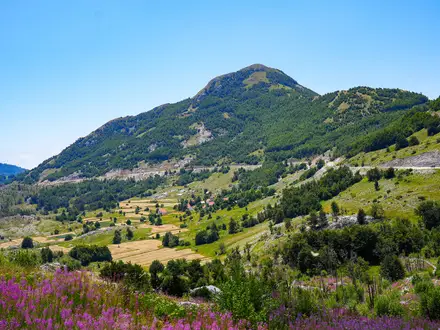
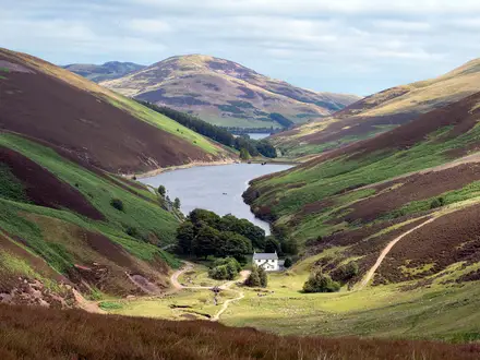
Start from the parking area about 100 m below EKO-Katun Vranjak at roughly 1,671 m and return to the same point on a circular route. The loop crosses Zekova Glava at 2,117 m, continues along open Bjelasica ridges to Crna Glava summit at 2,139 m, then drops by Pesica Lake before returning towards Vranjak. Expect a mix of 4WD or forest track, grassy slopes and some higher, rockier sections. Kolasin is the nearest practical base, with hotels and guesthouses; katuns and huts on Bjelasica offer mountain accommodation. For easier nearby walking, compare the Biogradska Gora Lake Loop; for a more rugged Montenegrin summit, see the Bobotov Kuk Summit Trail.
Pastoral Bjelasica and Biogradska Gora’s Protected Forest
Bjelasica’s high pastures have long been used by shepherds, and seasonal katuns such as Vranjak still shape the way hikers access the massif today. Biogradska Gora’s forest around Lake Biograd was set aside as a reserve in 1878 under Prince Nikola I, before the wider area became one of Montenegro’s national parks. The name Crna Glava, meaning ‘Black Head’, refers to the dark pine crowning the summit.
Notable highlights
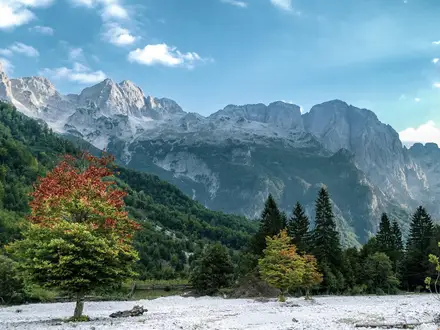
- Crna Glava summit (2,139 m): The highest point of the Bjelasica massif and the main objective of the hike. Its pine-ringed, forested crown gives the peak its ‘Black Head’ name, with views over Pesica Lake and neighbouring summits.
- Zekova Glava (2,117 m): The second-highest Bjelasica peak and a key point on the Vranjak loop. It is marked by a transmission mast and gives a long, open ridge walk towards Crna Glava.
- Pesica Lake: A glacial lake passed on the circuit and one of the lakes scattered across the Bjelasica massif. It is a useful landmark on the descent and a quieter counterpoint to the open ridges.
- Biogradska Gora National Park: The hike runs in and around this protected mountain landscape. The park is known for its old-growth forest around Lake Biograd; if you want a shorter forest-and-lake walk, see the Black Lake Loop (Crno Jezero) for a different Montenegrin lake setting.
- Katun Vranjak: A traditional highland shepherds’ settlement and the practical trailhead for this loop. It gives the route a strong pastoral feel before the climb onto Bjelasica’s grassy tops.
Challenges to expect
This is a moderate, non-technical mountain hike, not a hard alpine route. The main challenges are the 732 m ascent, exposed high ridges, changeable weather and possible snow lingering on the tops into mid-June. Much of the route follows 4WD or forest tracks and grassy ground, but navigation still matters in poor visibility. Biogradska Gora National Park charges an entry fee, and food or lodging should be planned around Kolasin or mountain katuns.
HikeList Score
Crna Glava Peak Trail scored 78/100 on HikeList's trail-quality metrics.
See score breakdownHide breakdown
- Ideal length 55
- Balanced challenge 100
- Scenery & wildness 98
- Varied terrain 64
- Accommodation 66
- Food & support 61
- Path quality 98
- Season flexibility 89
Computed from length, challenge, scenery & wildness, terrain variety, accommodation, food & support, path quality and season flexibility.
 Montenegro
Show more data Show less
- Mountainous
- Forest
- Dirt
- Grass
- Huts
- Hotels
- Pet Friendly
- Campsites
Photos from hikers
Taken on the trail by people who've reviewed Crna Glava Peak Trail.
Begin near EKO-Katun Vranjak, climb towards Zekova Glava, continue over the rounded Bjelasica ridges to Crna Glava summit, then loop past Pesica Lake and return to the Vranjak trailhead. Allow roughly 5.5–8 hours depending on pace and conditions.
Reviews
How would you rate Crna Glava Peak Trail?
Tap a star to start your review — you could be the first.