Sa Calobra to Cala Tuent
How would you rate Sa Calobra to Cala Tuent?
Tap a star to share your experience and help other hikers.
Sa Calobra to Cala Tuent: Mallorca’s Short Coastal Crossing
HikeList Score
Sa Calobra to Cala Tuent scored 78/100 on HikeList's trail-quality metrics.
See score breakdownHide breakdown
- Ideal length 55
- Balanced challenge 100
- Scenery & wildness 98
- Varied terrain 64
- Accommodation 66
- Food & support 68
- Path quality 98
- Season flexibility 76
Computed from length, challenge, scenery & wildness, terrain variety, accommodation, food & support, path quality and season flexibility.
Sa Calobra to Cala Tuent is a short point-to-point coastal hike in the Serra de Tramuntana on Mallorca’s north-west coast, linking two coves in Escorca. The walk is about 6.5 km one way, usually done in half a day, and is moderate rather than long: expect a steady rocky climb to the Coll de Sant Llorenç, then a descent to Cala Tuent. It suits hikers wanting a compact Tramuntana route with sea views, provided they are comfortable with uneven ground and limited shade. See more hikes in Spain.
Route Overview
Start at Sa Calobra port/village and climb steeply away from the houses, gaining most of the height in the first half of the walk. The route heads towards the Ermita de Sant Llorenç and the Coll de Sant Llorenç, the high saddle between the coves, then descends more easily towards Cala Tuent, partly on access road or track. Most walkers do it one way and return by the seasonal Barcos Azules ferry, often via Port de Soller; the alternative is to walk back the same way. For longer Spanish coastal routes, compare the Camí de Ronda on the Costa Brava or the Camino del Norte.
Remote Coves, Watchtowers and the Sa Calobra Road
Sa Calobra and Cala Tuent were once remote fishing anchorages on a rugged part of the Tramuntana coast, reached mainly by boat. The Ermita de Sant Llorenç has been recorded since 1322, and a 16th-century watchtower above Cala Tuent formed part of the coastal warning system against pirate raids. Road access to Sa Calobra arrived only in 1932, when Antonio Parietti’s engineered serpentine road opened this formerly isolated coast. The wider Serra de Tramuntana is a UNESCO World Heritage cultural landscape.
Notable highlights
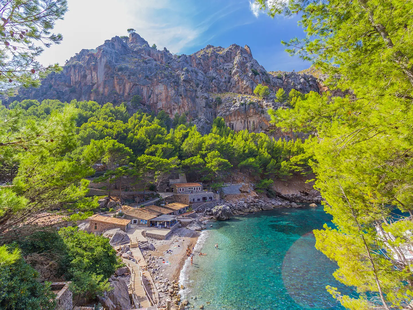
Cala Tuent beach (roughly 180 m): A sand-and-pebble cove in a natural bay, much quieter and less developed than Sa Calobra. It is a good swimming finish if conditions allow.
Ermita de Sant Llorenç (recorded since 1322): A small hilltop sanctuary near the high point of the walk. It gives the Coll de Sant Llorenç its name and marks the transition before the descent towards Cala Tuent.
Coll de Sant Llorenç (about 227 m): The headland saddle between Sa Calobra and Cala Tuent, and the highest point of the route. It gives wide views over the cove and surrounding Tramuntana peaks.
Sa Mola de Tuent / Talaia watchtower: A 16th-century coastal watchtower above Cala Tuent, built to warn of pirate raids. It can be added as a short detour for broader sea views.
Sa Calobra and the Torrent de Pareis: Sa Calobra sits at the mouth of the Torrent de Pareis, a dramatic limestone gorge reached from the village through two short rock tunnels.
Puig Major backdrop: Puig Major, Mallorca’s highest peak at 1,445 m, rises behind Cala Tuent and dominates the skyline.
Challenges to expect
This is a short hike, but not a casual beach stroll. The climb from Sa Calobra is steady and rocky, with uneven footing and slippery sections after rain. Shade is limited, so summer heat can be the main difficulty. There are few facilities once you leave the coves; carry water and food. Way-finding needs care, and a downloaded GPS track is advisable. Mobile signal can be patchy.
HikeList Score
Sa Calobra to Cala Tuent scored 78/100 on HikeList's trail-quality metrics.
See score breakdownHide breakdown
- Ideal length 55
- Balanced challenge 100
- Scenery & wildness 98
- Varied terrain 64
- Accommodation 66
- Food & support 68
- Path quality 98
- Season flexibility 76
Computed from length, challenge, scenery & wildness, terrain variety, accommodation, food & support, path quality and season flexibility.
 Spain
SpainShow more data Show less
- Mountainous
- Coastal
- Rocky
- Dirt
- Hotels
- Wild camping spots
- Family Friendly
- Pet Friendly
- Restrooms
- Picnic Areas
Photos from hikers
Taken on the trail by people who've reviewed Sa Calobra to Cala Tuent.
Walk one way from Sa Calobra to Cala Tuent in about 1 hour 30 minutes to 2 hours. The first half climbs steeply from near sea level towards the Ermita de Sant Llorenç and Coll de Sant Llorenç; the second half descends more gently, partly on access road or track, to Cala Tuent. Return by the seasonal Barcos Azules ferry where operating, or walk back as an out-and-back.
Reviews
How would you rate Sa Calobra to Cala Tuent?
Tap a star to start your review — you could be the first.