Rallarvegen (Navvy Road)
How would you rate Rallarvegen (Navvy Road)?
Tap a star to share your experience and help other hikers.
Rallarvegen (Navvy Road): Norway’s Classic Mountain Road
HikeList Score
Rallarvegen (Navvy Road) scored 87/100 on HikeList's trail-quality metrics.
See score breakdownHide breakdown
- Ideal length 70
- Balanced challenge 100
- Scenery & wildness 88
- Varied terrain 87
- Accommodation 100
- Food & support 88
- Path quality 71
- Season flexibility 76
Computed from length, challenge, scenery & wildness, terrain variety, accommodation, food & support, path quality and season flexibility.
Rallarvegen is a historic gravel road across the high mountains of southern Norway, built for the Bergen Line railway and now best known as Norway’s classic mountain cycling route. Walked as a point-to-point hike, the standard Haugastøl to Flåm route is about 80 km and fits a relaxed 3-day itinerary. Difficulty is moderate: the road is graded and mostly downhill overall, but it is long, exposed, rough in places and has a steep final descent. For a wilder plateau journey nearby, compare the Hardangervidda Traverse.
Route Overview
The classic Rallarvegen runs from Haugastøl, on the edge of Hardangervidda, via Finse, Hallingskeid, Vatnahalsen and Myrdal, then drops sharply into the Flåm valley to Flåm on the Aurlandsfjord. It is a point-to-point route closely shadowing the Bergen Line, so the train is part of the logistics: hikers and cyclists use it to reach Haugastøl, return from Flåm/Myrdal, or bypass snowbound high sections early in the season. Key sections are Haugastøl–Finse, Finse–Hallingskeid, Hallingskeid–Vatnahalsen/Myrdal and Myrdal–Flåm. If fjord-valley hiking is your priority, also look at the Aurlandsdalen Valley Trail.
Built by navvies for the Bergen Line
Rallarvegen was built mostly between about 1895 and 1904 as the construction and supply road for the Bergen Line, the railway linking Bergen with Oslo, then Christiania. The Norwegian Parliament approved the railway in 1894 and it opened fully in 1909. The road was dug and built by hand by the navvies — “rallar” in Norwegian — who also built the railway. After later disuse, it was rediscovered and developed as a cycle route from around 1970 and opened to cyclists in 1974.
Notable highlights
- Finse (1,222 m): The highest station on the Bergen Line and a car-free mountain village reached only by rail. It is the natural overnight stop and service hub on the upper route, with Finse 1222 and the DNT lodge Finsehytta.
- Fagernut high point (~1,343 m): The roof of Rallarvegen near Fagervatn. The old railway guard’s dwelling here is the highest former inspector’s dwelling in Norway and now functions as a small museum/café.
- The 21 hairpin bends below Myrdal: A steep, tight descent down Myrdalsberget into the Flåm valley beside a powerful waterfall. Cyclists are advised to dismount and walk parts to avoid overheated brakes.
- Flåm and the Flåmsbana: The route ends at Flåm on the Aurlandsfjord. At Myrdal it meets the Flåm Railway, a famous steep standard-gauge line used by many travellers to return to the mountains.
- Hardangervidda-edge scenery: The upper road crosses open fell with lakes, snowfields and views towards Hardangerjøkulen near Finse. For a more remote summit objective in the same broad mountain region, see the Hårteigen Peak Trail.
Challenges to expect
Rallarvegen is not technically difficult, but do not treat it as a lowland road walk. The high section is exposed, remote and snowbound outside summer; even in July, Finse–Hallingskeid can remain under snow after heavy winters. The gravel is rougher at altitude, services are limited between settlements, and the Myrdal–Flåm descent is steep. Fit adults should be comfortable, but weather, distance and braking/descent care matter.
HikeList Score
Rallarvegen (Navvy Road) scored 87/100 on HikeList's trail-quality metrics.
See score breakdownHide breakdown
- Ideal length 70
- Balanced challenge 100
- Scenery & wildness 88
- Varied terrain 87
- Accommodation 100
- Food & support 88
- Path quality 71
- Season flexibility 76
Computed from length, challenge, scenery & wildness, terrain variety, accommodation, food & support, path quality and season flexibility.
 Norway
Show more data Show less
- Mountainous
- Plateau
- Fjord Valley
- Forest
- Gravel
- Paved
- Lodges
- Hotels
- Guesthouses
- Wild Camping Spots
- Family Friendly
- Pet Friendly
- Restrooms
- Water Sources
- Campsites
- Shelters
Download Our Full Guide to Rallarvegen (Navvy Road) FREE!
Get our comprehensive guide to this hike for free. Save it for later reading or print out at home.
Photos from hikers
Taken on the trail by people who've reviewed Rallarvegen (Navvy Road).
Rallarvegen (Navvy Road): The Complete Guide
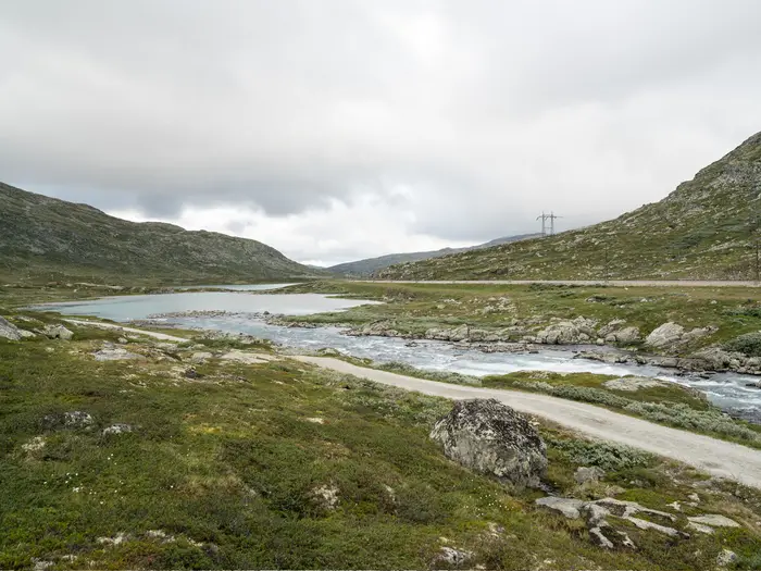 i
Image by A.Film
i
Image by A.Film Rallarvegen is a rare long-distance walk where the logistics are almost as elegant as the line itself: train to the start, follow a historic gravel navvy road across the high mountains, then drop to the fjord and ride the railway back out. The classic route runs from Haugastøl on the Bergen Line to Flåm on the Aurlandsfjord, with Finse and Hallingskeid as the key high-mountain staging points.
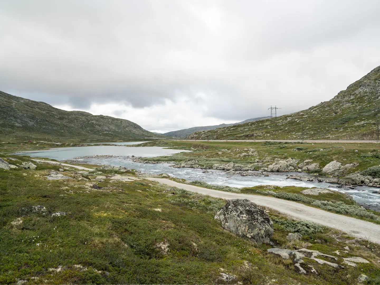
This is not a technical mountain trek, but it is not just an easy valley path either. The road crosses open, exposed fell on the edge of Hardangervidda, passes lakes, bare rock and lingering snowfields, and reaches its high point around Fagernut / Fagervatn before the long descent west.
The character changes sharply after the upper plateau. Beyond Hallingskeid and Myrdal, the route commits to the steep drop into Flåmsdalen, including the tight hairpin bends below Myrdal, before finishing close to sea level in Flåm.
Most walkers will enjoy Rallarvegen as a three-day journey, especially if accommodation is booked carefully at Finse, Hallingskeid or nearby mountain stops. The road is shared with cyclists, who make up most users in the short summer season, so walkers should expect passing bikes as part of the experience.
What Rallarvegen asks for is sound timing, proper mountain clothing and respect for the high section, where snow can linger into July and services are sparse between settlements. This guide covers stages, walking days, accommodation, food, transport, terrain and the common mistakes to avoid.
Stage-by-Stage Guide
Stage 1: Haugastøl to Finse — 27 km
The first stage leaves Haugastøl beside the Bergen Line and heads west on the historic gravel navvy road towards Finse. It is a long but straightforward mountain-road stage, with the walking mostly on graded gravel rather than narrow footpath.
The character is open and exposed from the start. Haugastøl sits at roughly 988–994 m on the eastern edge of Hardangervidda, and the route gradually works into higher mountain country, passing lakes, bare fell and sections of rougher gravel as it follows the railway corridor towards Finse.
There are no major settlements between Haugastøl and Finse, so this stage should be treated as a full mountain day despite the non-technical surface. Carry food for the day and enough water to avoid depending on any intermediate service. Any seasonal cafés or facilities at the start should not be relied on without checking ahead.
Finse is the key overnight hub of the upper route. The car-free village is the highest station on the Bergen Line at 1,222 m and has both Finse 1222 and the DNT lodge Finsehytta, making it the most practical place to break the route before the highest section.
Rail access is excellent at both ends of the stage. Haugastøl is reached by the Bergen Line, and Finse is also on the Bergen Line; Finse is rail-only, so train timings matter for both planned arrivals and any bad-weather escape.
Navigation is generally simple because the route follows the old construction road and stays close to the railway corridor, but it should not be treated as a waymarked national trail. Carry a map or offline route and avoid drifting towards the railway itself, especially in poor visibility.
The main warning on this stage is exposure. There is little shelter in bad weather, and snow can affect the high route outside the short summer season. Check the seasonal opening of Rallarvegen before travelling, particularly in early July after heavy winters.
Stage 2: Finse to Hallingskeid — 19 km
This is the highest and most remote stage of the classic Haugastøl–Flåm route. Although shorter than the other two days, it crosses the roof of Rallarvegen and deserves a cautious mountain-day approach.
From Finse the road continues across open high fell, with views towards Hardangerjøkulen in clear weather. The surface remains a gravel road, but it can be rougher and stonier at altitude, and lingering snowfields are a realistic issue well into the summer in some years.
The main landmark is Fagernut / Fagervatn, generally given as about 1,343 m and the high point of Rallarvegen. The old railway guard’s dwelling at Fagernut is the highest former inspector’s house in Norway and now serves as a small museum/café, known for refreshments such as rallar waffles and sluskesuppe. Opening times are seasonal and should be checked before travelling.
Beyond Fagernut the route continues towards Hallingskeid, still in open mountain terrain. This is one of the least serviced parts of the route, so do not plan the day around buying food en route unless Fagernut is definitely open.
Hallingskeid is a remote Bergen Line stop and the main staging point before the descent towards Flåm. Accommodation is available at the DNT self-service hut, but opening, access arrangements and booking should be checked before travelling.
Public transport is unusually useful here for a mountain route. Finse and Hallingskeid are both on the Bergen Line, and in early season walkers and cyclists use the train to bypass snowbound sections when the road is not fully passable.
Navigation is usually uncomplicated in clear weather, but this is not a section to underestimate. In mist, rain or lingering snow, the road line can become less obvious and distances feel longer than the map suggests. Carry reliable offline navigation and allow enough time to reach Hallingskeid without depending on late-evening rescue by train.
The key hazards are exposure, weather and snow. This section sits high on the Hardangervidda edge with limited shelter and sparse services, so warm layers, waterproofs and spare food are essential even in summer.
Stage 3: Hallingskeid to Flåm via Vatnahalsen and Myrdal — 34 km
The final stage is the longest day of the standard walking itinerary and changes character dramatically. It begins on the high railway corridor, then drops towards Vatnahalsen and Myrdal before the steep descent into Flåmsdalen and the finish at Flåm on the Aurlandsfjord.
The early part remains on the old gravel road through mountain terrain, with the Bergen Line still shaping the route logistics. As the route loses height, the surface becomes less consistently high-mountain gravel, with some paved sections lower down.
Vatnahalsen and Myrdal are the main places before the valley descent. Vatnahalsen has historic mountain hotel and café accommodation above the valley, while Myrdal is the junction with the Flåm Railway, making it the key transport point if the final descent is not being walked.
Below Myrdal, the route tackles the famous 21 hairpin bends of Myrdalsberget. This is a steep, tight zig-zag descent into Flåmsdalen beside a powerful waterfall, and it is the one part of Rallarvegen where the gradient demands particular care. Cyclists are advised to dismount here to avoid overheating their brakes, so walkers should also expect slow-moving bike traffic and keep a clear line on the bends.
Food and drink options are more likely around Vatnahalsen, Myrdal and finally Flåm than on the high plateau sections, but opening times can still vary by season. Carry enough food from Hallingskeid to reach at least Myrdal or Flåm without relying on intermediate services.
Flåm has the broadest range of end-of-route accommodation, including hotels, hostels and campsites. It is the natural place to finish if taking the classic route all the way from Haugastøl to the fjord.
Transport options are strong at the end of the stage. Myrdal is on the Bergen Line and is also the upper station of the Flåmsbana, while Flåm is linked back to Myrdal by the Flåm Railway. Current Bergen Line and Flåmsbana timetables should be checked before booking accommodation or committing to a same-day onward journey.
Navigation remains straightforward in broad terms: continue along the Rallarvegen corridor to Vatnahalsen and Myrdal, then descend into Flåmsdalen to Flåm. The main practical issue is not route-finding but managing the long distance, the sustained descent and shared use with cyclists.
The final descent can be hard on knees, especially after two high-mountain days. Start early enough to take the hairpins slowly, give cyclists room, and do not underestimate how much effort remains after leaving the high plateau.
Recommended Itinerary
Standard 3-day walking itinerary
This is the most practical walking schedule for the classic Haugastøl–Flåm route. It keeps the first two high-mountain days manageable, uses the main overnight points at Finse and Hallingskeid, and leaves the long final descent to Flåm as a full day.
| Day | From | To | Approx. distance | Why this stage makes sense | Services/accommodation notes |
|---|---|---|---|---|---|
| 1 | Haugastøl | Finse | 27 km | A logical first stage from the Bergen Line at Haugastøl to the main high-level settlement on the route. The day is long enough to feel committing but finishes at Finse, the best-served mountain stop on Rallarvegen. | Haugastøl has rail access at the start. Finse has Finse 1222 and the DNT lodge Finsehytta. Finse is car-free and reached only by rail, which also gives a useful exit option if weather or snow conditions are poor. |
| 2 | Finse | Hallingskeid | 19 km | This is the key high section, passing the route’s roof around Fagernut / Fagervatn at about 1,343 m. Keeping this day shorter gives more margin for rougher gravel, lingering snowfields and exposed weather. | Fagernut has a small museum/café with refreshments, but it should not be treated as a guaranteed full resupply point. Hallingskeid has a DNT self-service hut and a Bergen Line stop. Opening, booking and train times should be checked before travelling. |
| 3 | Hallingskeid | Flåm, via Vatnahalsen and Myrdal | 34 km | The longest day, but it is dominated by the descent from the high railway corridor into Flåmsdalen and down to the fjord. The steep hairpins below Myrdal deserve time and care, especially with cyclist traffic on the road. | Vatnahalsen/Myrdal has hotel and café accommodation in the area, and Myrdal gives access to the Bergen Line and Flåmsbana. Flåm has the widest range of end-of-route accommodation and onward transport by the Flåm Railway back up to Myrdal. |
Slower variant
A slower plan suits walkers who want shorter days, families, or anyone carrying camping kit and preferring more margin in poor mountain weather. The main constraint is that serviced accommodation is sparse between the named settlements, so a slower itinerary normally depends on either booking an extra night around Vatnahalsen/Myrdal, using rail access points, or camping where suitable.
| Day | From | To | Approx. distance | Why this stage makes sense | Services/accommodation notes |
|---|---|---|---|---|---|
| 1 | Haugastøl | Finse | 27 km | Still the natural first serviced stage, unless using camping to shorten it. | Book Finse accommodation ahead, especially in the short summer season. |
| 2 | Finse | Hallingskeid | 19 km | Gives a full day for the exposed high point at Fagernut / Fagervatn without rushing. | Hallingskeid has the DNT self-service hut and rail access. Check DNT booking and current road conditions before travelling. |
| 3 | Hallingskeid | Vatnahalsen or Myrdal | Check official mapping before booking | Splits the long Hallingskeid–Flåm day before the steep final descent into Flåmsdalen. This is the most useful extra night for walkers who do not want a 34 km final day. | Vatnahalsen has hotel accommodation above the valley; Myrdal is the junction with Flåmsbana and the Bergen Line. Availability and exact stopping point should be arranged before setting out. |
| 4 | Vatnahalsen or Myrdal | Flåm | Check official mapping before booking | Leaves the 21 hairpin bends below Myrdal and the lower valley approach to Flåm for a shorter final day. | Flåm has the broadest range of accommodation and onward transport. The Flåmsbana timetable should be checked before booking onward connections. |
Where camping is used to slow the route down, food, weather protection and water planning become more important because there are long gaps between services. The high section is exposed, snow-prone outside the main season, and shared with cyclists, so camping plans should not depend on making progress late in the day in poor visibility or cold rain.
Faster variant
A faster walking itinerary is only sensible for very strong walkers who are comfortable with long days on gravel, variable mountain weather and limited services. It reduces flexibility and makes the second day particularly demanding.
| Day | From | To | Approx. distance | Why this stage makes sense | Services/accommodation notes |
|---|---|---|---|---|---|
| 1 | Haugastøl | Finse | 27 km | Keeps the first day standard and finishes at the main high-level accommodation hub. | Finse has hotel and DNT accommodation, plus rail access if plans need to change. |
| 2 | Finse | Flåm, via Fagernut, Hallingskeid, Vatnahalsen and Myrdal | About 53 km | Combines the standard second and third stages. This is a long mountain-to-fjord day with the exposed high section first, followed by the major descent into Flåmsdalen. | Services are limited until Vatnahalsen/Myrdal and Flåm. Hallingskeid and Myrdal provide rail escape options, but train times must be checked before relying on them. |
This faster version is not the best choice if snow remains on the Finse–Hallingskeid section, if weather is unsettled, or if accommodation and transport connections in Flåm are time-critical. The route is widely ridden by cyclists in 1–2 days, but that should not be used as a benchmark for a walking itinerary.
Planning the Route
How many days to allow
Most walkers should plan Rallarvegen as a three-day walk: Haugastøl to Finse, Finse to Hallingskeid, then Hallingskeid to Flåm via Vatnahalsen and Myrdal. This matches the natural spacing of accommodation and railway access points, and avoids making the high-mountain section feel rushed.
Strong walkers can shorten the itinerary, especially by combining the later stages, but the final day into Flåm is already long and includes the steep descent through the hairpins below Myrdal. A slower itinerary is often the better choice if travelling with children, carrying camping gear, or wanting more margin for poor weather on the exposed plateau.
| Stage | Usual walking plan | Planning note |
|---|---|---|
| Haugastøl to Finse | 1 day | A long first day from the Bergen Line start point to the main high-mountain overnight hub. |
| Finse to Hallingskeid | 1 day | The highest and most exposed section, passing Fagernut / Fagervatn. Snow can linger here into July. |
| Hallingskeid to Flåm | 1 day | The longest stage, descending via Vatnahalsen and Myrdal into Flåmsdalen and Flåm. |
Let accommodation dictate the itinerary
Rallarvegen is not a route where accommodation appears every few kilometres. The practical overnight stops are concentrated at Finse, Hallingskeid, Vatnahalsen / Myrdal and Flåm, with Haugastøl serving as the normal start point.
Finse has both Finse 1222 and the DNT lodge Finsehytta, making it the obvious first-night stop. Hallingskeid has a DNT self-service hut and is the key staging point before the long descent towards the fjord. Vatnahalsen and Myrdal can be used to break up or adjust the final section, while Flåm has the broadest range of end-of-route accommodation.
Book accommodation ahead, especially in the short summer season when cyclists make up much of the traffic on the road. DNT hut opening, access arrangements and booking requirements should be checked before travelling.
Shortening, escaping and section hiking
The Bergen Line makes Rallarvegen unusually practical to section-hike for a high-mountain route. Haugastøl, Finse, Hallingskeid and Myrdal all sit on the rail corridor, and Flåm connects back to Myrdal by the Flåm Railway.
This gives several useful options. You can start at Finse instead of Haugastøl, finish at Myrdal rather than descending all the way to Flåm, or use the train to avoid a section affected by snow or bad weather. Early in the season, the Finse–Hallingskeid stretch is the section most likely to need special attention because snow can remain into July after heavy winters.
Rail timetables for the Bergen Line and Flåmsbana are central to the whole plan. They should be checked before booking accommodation, because the train is not just transport to and from the trail — it is also the main bad-weather or snow-condition fallback.
Direction and pacing
The classic direction is Haugastøl to Flåm. It follows the historic road westwards across the high ground and then drops dramatically to the Aurlandsfjord, giving a strong overall net descent.
Walking the route in reverse is possible in principle, but it turns the final fjord descent into a major climb and makes the itinerary feel harder. For most independent walkers, east-to-west is the more practical direction for pacing, scenery and transport flow.
Do not underestimate the last day simply because it is downhill overall. The descent below Myrdal is steep and tight, with 21 hairpin bends on Myrdalsberget, and tired legs can make the lower stage slower than expected.
Food, water and resupply
Plan food as a mountain route, not as a village-to-village trail. Services are sparse between the named stops, and Fagernut is a refreshment stop rather than a full resupply point.
Carry enough food for each day before setting out from Haugastøl, Finse or Hallingskeid. Accommodation meals, packed lunches and café opening times should be arranged or checked in advance where they matter to the itinerary.
Water planning should be conservative. Refill at accommodation and staffed stops where possible, and carry enough to cover the exposed sections between them; do not build the day around assumed intermediate services.
Navigation and route-finding
Rallarvegen follows a historic gravel construction road rather than a foot-only national trail. In clear summer conditions, the line of the road and the nearby railway corridor make the route straightforward, but it still crosses remote, exposed high ground.
Carry offline mapping or a paper map, and know the order of the key places: Haugastøl, Finse, Fagernut / Fagervatn, Hallingskeid, Vatnahalsen, Myrdal and Flåm. Navigation becomes more serious in poor visibility, lingering snow, or when deciding whether to leave the route at a railway station.
The road is shared with cyclists, especially in high season. Keep to the side on narrow or rougher sections, and take particular care on the descent towards Flåmsdalen where cyclists may be managing speed and braking.
Weather and seasonal timing
Seasonal timing is one of the most important planning decisions on Rallarvegen. The route is a high-mountain road and is realistically a summer to early-autumn objective, with the upper sections snowbound outside the short open season.
July to late September is the usual planning window, but snow can linger into July on the Finse–Hallingskeid section after heavy winters. The seasonal opening of the road and current snow conditions should be checked before travelling.
Pack for exposed mountain weather even though the walking is on a gravel road. Waterproofs, warm layers, gloves or a hat, and a reliable navigation setup are sensible kit for the high section, where shelter and services are limited between stops.
Extending the route
For the classic walk, plan on the Haugastøl–Flåm line. Some descriptions of the wider historic Rallarvegen network include the separate Upsete–Voss branch, but that is not part of the standard Haugastøl to Flåm walking itinerary and should be planned as a separate extension if used.
The more practical variation for most walkers is not an extension but a staged finish: ending at Myrdal for the Bergen Line, staying at Vatnahalsen / Myrdal before continuing, or descending fully to Flåm and returning by Flåmsbana.
Towns, Villages and Overnight Stops
Rallarvegen has only a handful of practical stopping places. Accommodation and food are concentrated at Finse, Hallingskeid, Vatnahalsen/Myrdal and Flåm, with very limited support between them, so overnight plans should be fixed before setting off.
The high section is rail-linked but still remote in bad weather. Finse, Hallingskeid and Myrdal all sit on the Bergen Line corridor, which is useful for shortening the route, escaping poor conditions or joining for a shorter section, but train times and seasonal access should be checked before travelling.
Haugastøl
Haugastøl is the eastern start of the classic Haugastøl–Flåm route, beside the Bergen Line at the edge of Hardangervidda. The navvy road sets off west towards Finse from the station area, making it a straightforward rail-led start rather than a trailhead that needs a road transfer.
It is best treated as a start point rather than a key overnight hub unless accommodation has been arranged in advance. Services at the start should be checked before travelling, especially if arriving late or expecting to buy food before walking.
The main transport link is the Bergen Line, which connects Haugastøl with the wider Oslo–Bergen rail corridor. For walkers, this is the simplest way to reach the beginning of the route and avoids the need to retrieve a vehicle after finishing in Flåm.
Finse
Finse is the most important overnight stop on the upper route and the natural end of the first walking day from Haugastøl. It sits at 1,222 m on the Bergen Line and is car-free, reached only by rail.
Accommodation is available at Finse 1222 and the DNT lodge Finsehytta. Both should be booked ahead in the short summer season, particularly because Finse is also a major hub for cyclists on Rallarvegen.
Finse is the last substantial serviced stop before the more exposed high section towards Fagernut and Hallingskeid. Food and overnight arrangements should be sorted here rather than assuming anything will be available on the road.
The railway makes Finse especially useful for flexible itineraries. If the Finse–Hallingskeid section is still affected by snow, walkers and cyclists commonly use the train to bypass or adjust this part of the route; current conditions and timetables should be checked before travelling.
Fagernut / Fagervatn
Fagernut, by Lake Fagervatn, is the high point of Rallarvegen at about 1,343 m. It lies on the Finse–Hallingskeid section and is a useful daytime landmark rather than an overnight stop.
The old railway guard’s dwelling at Fagernut now serves as a small museum/café, known for simple refreshments such as rallar waffles and sluskesuppe. Opening days and times can vary with season and conditions, so it should not be treated as guaranteed resupply.
There is no accommodation listed here for route-planning purposes. Carry enough food, water and bad-weather clothing to cross the high section independently, even if planning to stop at the café.
Hallingskeid
Hallingskeid is the main overnight staging point between Finse and the long descent towards Flåm. It is a remote Bergen Line stop on the high corridor, with limited services and a very different feel from a village with shops and multiple cafés.
The key accommodation is the DNT self-service hut. Opening, booking and access arrangements should be checked before travelling, as this is not a place to arrive casually and expect full-service lodging.
Hallingskeid works well for walkers using the standard three-day itinerary, breaking the route before the longer final stage to Flåm. It is also a useful rail access or exit point if weather, snow or fitness makes a full crossing unwise.
Do not rely on Hallingskeid for normal village resupply. Food planning should be based on what the hut arrangements allow and what is carried from Finse.
Vatnahalsen
Vatnahalsen lies above Flåmsdalen, after the high road has left the most remote mountain section and before the route drops fully towards the fjord. It is close to the Myrdal area and is a practical stopping option for walkers who do not want to continue all the way to Flåm in one long final day.
Accommodation and café facilities are available at the historic mountain hotel at Vatnahalsen. This makes it the main alternative to staying at Hallingskeid or pushing on to Flåm, particularly if the final descent is being split more conservatively.
This is also a useful place to pause before or after dealing with the steep descent into Flåmsdalen. Cyclist traffic can be heavy in season, so walkers should stay alert on shared sections of the road.
Myrdal
Myrdal is a major transport point rather than a typical overnight village. It is the junction between the Bergen Line and the Flåm Railway, making it one of the most useful places on the route for joining, leaving or altering an itinerary.
The route passes through the Myrdal area before the steep descent into Flåmsdalen. The 21 hairpin bends below Myrdal are one of the most demanding practical sections of the walk: steep, tight and shared with cyclists, who are advised to dismount because of the braking demands.
For overnight planning, nearby Vatnahalsen is the better-established stop in the information available for this route. Accommodation directly at Myrdal should be checked before travelling if intending to stay there.
Myrdal’s rail links are extremely useful. Walkers can connect directly with the Bergen Line here or descend/ascend via Flåmsbana between Myrdal and Flåm.
Flåm
Flåm is the finish of the classic route, at the head of the Aurlandsfjord and close to sea level. After several days of sparse high-mountain services, it is the first place with a full range of visitor infrastructure.
Accommodation options include hotels, hostels and campsites. In the main Rallarvegen season, and especially when train and fjord traffic is busy, booking ahead is sensible.
Flåm is the best place on the route for a comfortable final night, a wash, proper meal and onward travel. It also works as a practical buffer if train connections from Flåm or Myrdal do not line up neatly with the walking day.
The classic exit is by Flåmsbana up to Myrdal, where it connects with the Bergen Line. Current Flåm Railway and Bergen Line timetables should be checked before booking accommodation or onward tickets.
Getting to the Start
By train
Train is the cleanest way to reach Rallarvegen. The start is at Haugastøl station on the Bergen Line (Bergensbanen), with the navvy road setting off west towards Finse from beside the station.
This makes the route straightforward from either end of the Oslo–Bergen rail corridor: travel by Bergen Line train to Haugastøl, start walking from the station area, then return after finishing via Flåm, the Flåm Railway (Flåmsbana) to Myrdal, and the Bergen Line onward.
Book rail travel around the walking stages rather than treating it as an afterthought. Haugastøl, Finse, Hallingskeid and Myrdal are all part of the rail-led logistics of this route, and trains can also be useful if snow or weather makes a high section impractical. Current Bergen Line and Flåmsbana timetables should be checked before travelling.
By bus
Bus is not the usual way to start Rallarvegen. The practical access point is the railway halt at Haugastøl, and the route’s intermediate escape points are also tied to the Bergen Line.
If planning to reach Haugastøl by bus from elsewhere in Norway, check current local and regional services before committing to accommodation or train connections. This should be checked before travelling.
By car
Driving to Haugastøl can work for reaching the start, but it is usually less convenient than using the train because Rallarvegen is a point-to-point route ending at Flåm. A car left at the start still has to be collected, normally involving rail travel back up the corridor.
Do not assume long-stay parking is available without checking. Parking arrangements, any fees and whether vehicles can be left for several days at or near Haugastøl should be checked before travelling.
Taxi-based logistics should be treated as a fallback rather than the main plan. The route crosses a remote high-mountain corridor with limited settlements, and rail is the reliable framework for reaching Haugastøl and managing exits at Finse, Hallingskeid or Myrdal.
From the nearest airport
For international or domestic flights, the most practical onward plan is to connect with the Bergen Line and travel by train to Haugastøl. The railway runs between Oslo and Bergen, so either city can be used as a wider access point depending on flight availability and the direction of travel.
Allow enough time between flights and trains, especially if arriving late in the day or carrying outdoor luggage. Current airport-to-rail connections, Bergen Line departures and any required seat or luggage reservations should be checked before travelling.
Where to stay before starting
The simplest pre-start night is at or near Haugastøl, so you can begin the first stage to Finse without relying on a same-day long-distance train arrival. Availability and booking conditions should be checked before travelling.
Another workable approach is to arrive by train on the morning of the first walking day, but this leaves less margin for delays and weather decisions. The first stage is a full day to Finse, so avoid starting late unless there is a clear plan to stop, turn back or use the train.
Finse has more defined route accommodation — including Finse 1222 and the DNT lodge Finsehytta — but it is beyond the Haugastøl start. Staying there before beginning would mean either shortening the walk by starting at Finse or taking the train back to Haugastøl to begin the classic route.
Getting Home from the Finish
By train
The standard way out of Flåm is by rail. From Flåm, take the Flåmsbana (Flåm Railway) up to Myrdal, then change onto the Bergen Line (Bergensbanen) for onward trains towards Bergen, Oslo or back east towards Haugastøl.
This is the most straightforward finish logistics for Rallarvegen because the whole route shadows the railway corridor. It also works well if a car or extra luggage has been left at Haugastøl, Finse or another Bergen Line stop.
Flåmsbana and Bergen Line times are timetable-dependent and should be checked before travelling. Do not assume a late-afternoon finish in Flåm will still leave enough time for a through journey to a major city the same day, especially if connections at Myrdal are tight.
If weather, fatigue or the steep descent into Flåmsdalen slows the final day, it may be more sensible to stay in Flåm and travel the following morning.
By bus
Bus options from Flåm can be useful for some onward journeys, but rail is the core public-transport link for this route. Current bus routes, seasonal services and connection times should be checked before travelling.
For most walkers, the simplest plan is still Flåm → Myrdal on the Flåmsbana, then Bergen Line onward. Use buses only where they clearly improve the connection for the final destination.
By car/taxi
Rallarvegen is a point-to-point route, so leaving a car at Haugastøl and finishing in Flåm creates a return-transport problem. The practical solution is normally to use the Flåmsbana and Bergen Line back towards the start rather than trying to arrange a long taxi transfer.
If being collected by car in Flåm, allow plenty of margin for the final descent from Myrdal and for stops in the valley. The last stage is long, and the 21 hairpin bends below Myrdal can slow progress, particularly in poor weather or when sharing the road with cyclists.
Local taxi availability and prices should be checked before travelling. Pre-booking is advisable if a taxi is needed at a specific time, as Flåm is a small fjord village rather than a large transport hub.
From the nearest airport
There is no airport at the finish. For flights, the practical approach is to leave Flåm by the Flåmsbana to Myrdal, then use the Bergen Line towards either Bergen or Oslo for onward airport connections.
Which airport makes most sense depends on the rest of the trip and the train times available on the day. Rail and airport-transfer timetables should be checked before booking flights, and same-day international departures should not be planned on a tight connection from Flåm.
Where to stay at the finish
Flåm has a full range of accommodation, including hotels, hostels and campsites. Staying overnight at the finish is often the least stressful option if the final walking day is long, the weather is poor, or onward rail connections are limited.
An overnight stop also gives a useful buffer if snow conditions, train timings or accommodation availability earlier on the route force changes to the walking schedule. In the main Rallarvegen season, accommodation in Flåm should be booked ahead rather than treated as a guaranteed walk-up option.
Which Direction Should You Walk?
Standard direction: Haugastøl to Flåm
The normal and most practical direction is east to west, from Haugastøl to Flåm. This follows the classic Rallarvegen flow: start on the Bergen Line at Haugastøl, climb gradually across the high mountain road via Finse and Fagernut, then descend through Hallingskeid, Vatnahalsen and Myrdal to finish at Flåm on the Aurlandsfjord.
This direction makes best use of the route’s overall profile. Haugastøl is already high, at about 988–994 m, while Flåm is close to sea level, so the route has a strong net descent even though there is still climbing to the high point near Fagernut / Fagervatn at about 1,343 m.
It also gives the most satisfying scenery progression. The walk begins on open high ground at the edge of Hardangervidda, passes Finse and the views towards Hardangerjøkulen, then drops from the high railway corridor into Flåmsdalen and finishes at the fjord. Psychologically, ending beside the Aurlandsfjord is a much stronger finish than stepping off the route at Haugastøl.
Transport works naturally in this direction. You can take the Bergen Line to Haugastøl, walk west, then leave Flåm on the Flåm Railway up to Myrdal for onward Bergen Line connections. Current train times should be checked before travelling, especially if tying the final walking day to a specific departure from Flåm.
Walking it in reverse: Flåm to Haugastøl
Walking Flåm to Haugastøl is possible, but it is the harder and less common choice. The main drawback is that the route begins with the steep climb out of Flåm and up past the 21 hairpin bends below Myrdal, instead of saving that section as a descent near the end.
The reverse direction turns the final standard stage into a long uphill mountain approach. If following the usual staging points, Flåm to Hallingskeid is a demanding first section because it climbs from near sea level to the high railway corridor. A shorter first day using accommodation around Vatnahalsen or Myrdal can make the reverse direction more manageable, but availability and opening dates should be checked before booking.
Reverse logistics are still feasible because the route is rail-led. You can reach Flåm via the Flåm Railway from Myrdal, then finish at Haugastøl on the Bergen Line. However, this loses the clean downhill finish to the fjord and front-loads the steepest sustained climbing.
Weather and wind direction
There is no reliable reason to choose a direction on Rallarvegen purely for prevailing wind. The more important planning issue is exposure: the Finse–Fagernut–Hallingskeid high section is remote, open and snow-prone, and conditions can be serious in either direction.
Seasonal snow matters more than compass direction. Early in the season, the Finse–Hallingskeid section can still hold snow into July after heavy winters, and walkers sometimes use the Bergen Line to bypass snowbound sections. Road opening, snow conditions and train options should be checked before travelling.
Accommodation flow
The standard direction fits the most obvious walking stages: Haugastøl to Finse, Finse to Hallingskeid, then Hallingskeid to Flåm via Vatnahalsen and Myrdal. This puts Finse 1222, Finsehytta and the Hallingskeid DNT self-service hut in useful positions on the high route.
In reverse, accommodation still exists along the corridor, but the first day out of Flåm needs more thought. Starting with the full climb to Hallingskeid is a tougher undertaking than descending from Hallingskeid to Flåm at the end of the standard route.
Recommendation
For almost all walkers, walk Rallarvegen from Haugastøl to Flåm. It is the traditional direction, works cleanly with the Bergen Line and Flåm Railway, gives the best high-mountain-to-fjord progression, and uses the route’s overall descent to your advantage.
Choose the reverse only if accommodation, train times or a wider itinerary make it necessary, and be prepared for a much tougher opening climb from Flåm towards Myrdal and the high plateau.
Accommodation Along the Route
Accommodation on Rallarvegen is workable for an inn-to-inn style walk, but only if the high-mountain nights are planned in advance. The route has a few clear overnight hubs rather than continuous village-to-village choice, and there are long stretches with no services beyond seasonal refreshments at Fagernut.
The most natural walking itinerary uses Finse and Hallingskeid as the two key overnights between Haugastøl and Flåm. This fits the classic three-day structure well, but it also means relying on limited high-level accommodation in a short summer season when cyclists make up most of the traffic on the road.
| Place | Accommodation level | Best for | Notes |
|---|---|---|---|
| Haugastøl | Limited / check ahead | Pre-walk night, early start from the Bergen Line | The route starts beside the station. Accommodation and services at the start should be checked before travelling, especially if arriving late by train. |
| Finse | Good for the high route | First overnight, rest stop, weather delay | Finse has Finse 1222 and the DNT lodge Finsehytta. It is car-free and reached only by rail, so bookings and train times need to line up. |
| Fagernut / Fagervatn | None | Daytime refreshments only | The old railway guard’s dwelling operates as a small museum/café at the high point, but it is not an overnight base. Do not plan this as a lodging stop. |
| Hallingskeid | Limited | Second overnight before the descent towards Flåm | Hallingskeid has a DNT self-service hut and a remote Bergen Line stop. This is the main practical staging point between Finse and the lower valley. |
| Vatnahalsen / Myrdal | Limited | Shortening the final day, railway connections | Vatnahalsen has hotel and café accommodation above the valley. Myrdal is the junction for the Flåm Railway and Bergen Line, useful for exit or section logistics. |
| Flåm | Good | Finish night, recovery, onward travel | Flåm has the broadest choice on the route, from hotels to hostels and campsites, and is the easiest place to add a comfortable final night. |
Best overnight pattern
For most walkers, the cleanest plan is:
- Night before starting: Haugastøl or arrive by morning train.
- Night 1: Finse.
- Night 2: Hallingskeid.
- Finish: Flåm, with the option to stay overnight before taking the Flåmsbana back up to Myrdal.
This avoids carrying camping kit while keeping the daily stages logical. The weak point is availability: Finse and Hallingskeid are high, remote stops with limited capacity compared with conventional trail towns.
Booking ahead
Booking ahead is strongly recommended for the whole route, and essential if relying on Finsehytta, Finse 1222 or the Hallingskeid DNT hut. The usable season is short, broadly July to late September, and the same corridor is heavily used by cyclists when snow has cleared.
Weekends and peak summer dates can put pressure on the small number of beds in the high section. DNT hut opening, self-service arrangements and booking requirements should be checked before travelling.
Where choice is limited
The exposed high section between Finse and Hallingskeid is the key accommodation constraint. There is no village choice here, and Fagernut is a refreshments stop rather than a lodging option.
Hallingskeid is useful precisely because it breaks the journey before the long final stage, but it should not be treated like a serviced valley town. Plan food, bedding requirements and hut access according to the current DNT arrangements.
Camping and self-sufficient options
Wild-camping is part of the possible accommodation mix on Rallarvegen, but it changes the character of the walk. The upper route is exposed, snow-prone outside high summer and remote, so camping requires proper mountain equipment and enough food to cover gaps between services.
Campers should still plan around the same settlement pattern: Haugastøl, Finse, Hallingskeid, Vatnahalsen/Myrdal and Flåm. Local rules, restrictions and suitable camping locations should be checked before travelling.
Transfers, taxis and awkward gaps
Rallarvegen is not a route where accommodation gaps are normally solved by casual taxi hops along the road. The practical safety net is the railway corridor: Finse, Hallingskeid and Myrdal are on the Bergen Line, and Flåm connects back to Myrdal via the Flåmsbana.
Using the train can help section-hikers, late-season walkers or anyone needing to bypass a snowbound or weather-affected stretch. Current Bergen Line and Flåmsbana timetables should be checked before booking accommodation around them.
Luggage transfer should not be assumed unless arranged directly with an operator in advance. This should be checked before travelling.
Camping and Wild Camping
Rallarvegen can be camped, but it is not a campsite-to-campsite walk. The high section between Haugastøl, Finse and Hallingskeid is remote, exposed and service-poor, so camping here suits self-contained hikers with proper mountain kit rather than anyone relying on facilities each night.
The route is also a busy cycling corridor in the short summer season. Any tent pitch must be kept well clear of the gravel road, passing places, railway property and obvious stopping points used by cyclists.
Campsites and paid camping
Flåm has campsite accommodation and is the most straightforward place to finish with a paid tent pitch and facilities. Opening dates, prices and whether advance booking is needed should be checked before travelling.
No reliable campsite chain runs along the high part of Rallarvegen. The main serviced overnight options on the upper route are roofed accommodation: Finse 1222 and Finsehytta at Finse, the DNT self-service hut at Hallingskeid, and hotel/café accommodation around Vatnahalsen and Myrdal.
Do not assume that hotels, DNT huts or cafés allow camping on their land. If a pitch is wanted near one of these places, ask the operator directly before setting up.
Wild camping on the route
Wild camping is a realistic option on Rallarvegen, especially across the open high-mountain sections, but local rules must be respected. Camping rights, protected-area restrictions, railway land, private land and any seasonal fire restrictions should be checked locally before travelling.
As a practical rule, pitch discreetly on durable ground, well away from buildings, cabins, stations, cafés, the railway and the road itself. Avoid managed areas around Haugastøl, Finse, Fagernut, Hallingskeid, Vatnahalsen, Myrdal and Flåm unless permission has been given.
Fagernut / Fagervatn is the high point of the route and has the old railway guard’s dwelling operating as a small museum/café. Treat it as a refreshment stop, not as an assumed camping area.
Best sections for camping
| Section | Camping practicality | Notes |
|---|---|---|
| Haugastøl to Finse | Good in principle, weather-dependent | Open fell and lakes make this the first realistic wild-camping section, but it is exposed and can feel remote quickly. Finse is the obvious roofed fallback if conditions deteriorate. |
| Finse to Hallingskeid | Best for a remote high-camp, but most serious | This is the highest and most exposed part of Rallarvegen, with snowfields possible into the season. Choose a sheltered, durable pitch and be prepared for cold, wind and poor visibility. |
| Hallingskeid to Myrdal / Vatnahalsen | Possible but less convenient | The stage is long, and accommodation exists at Hallingskeid and around Vatnahalsen/Myrdal. Avoid pitching near railway infrastructure or built-up stopping points. |
| Myrdal to Flåm | Generally poor for wild camping | The descent includes the steep 21-hairpin section below Myrdal and then drops into the busier Flåmsdalen corridor. It is usually better to continue to Flåm and use formal accommodation or a campsite. |
Water, cooking and waste
Natural water is generally easier to find on the high route than services are, with lakes and mountain terrain along much of the upper road. Do not rely on cafés or huts for all water between settlements; carry enough capacity and treat or filter natural water.
Bring food and stove fuel before committing to the high section. Services are sparse between settlements, and Fagernut should be treated as a limited refreshment stop rather than a resupply point.
Open fires are a poor fit for this route and may be restricted, especially in dry periods or protected areas. Use a camping stove only where permitted, keep cooking away from tents and dry vegetation, and check current local fire rules before travelling.
Pack out all rubbish, including food scraps. Toilet stops should be well away from water, the road, buildings and obvious camping places, with all paper and hygiene products carried out.
Seasonal considerations
Camping on Rallarvegen is mainly a July to late September proposition, matching the normal walking season. The Finse–Hallingskeid section can still hold snow into July after heavy winters, and the road closes once snow returns.
Even in summer, the high route reaches around 1,343 m at Fagernut / Fagervatn, so nights can be cold and windy. A stable tent, warm sleep system and waterproof mountain clothing are more important than campsite-style comfort gear.
Food, Water and Resupply
Rallarvegen is not a village-to-village resupply walk. Food planning is based around accommodation, cafés with seasonal opening, and carrying enough for the long gaps between Haugastøl, Finse, Hallingskeid and Flåm.
There are no dependable supermarket-style resupply points on the high section. Treat Finse, Hallingskeid and Vatnahalsen as accommodation stops rather than places where a walker can automatically buy a full food shop. Opening dates, meal arrangements and any packed-lunch options should be checked before travelling, especially outside the main July–September season.
Food availability by section
| Section | Food availability | Water availability | Notes |
|---|---|---|---|
| Haugastøl to Finse | Do not assume any intermediate food. Carry lunch, snacks and an emergency reserve from the start. | Serviced water at Haugastøl/Finse; natural water is present in the mountain landscape, but treat or filter if using it. | A long first day of about 27 km with no reliable mid-stage resupply listed. Start with enough food for the whole day. |
| Finse to Hallingskeid via Fagernut / Fagervatn | Finse has accommodation at Finse 1222 and Finsehytta. Fagernut has a small museum/café serving refreshments such as rallar waffles and sluskesuppe, but it should be treated as a bonus rather than essential resupply. Hallingskeid has a DNT self-service hut. | Refill before leaving Finse. Natural water is likely along the high mountain section, but use a filter, purification tablets or boil it if taking from lakes or streams. | This is the highest and most exposed section. Carry a full day’s food even if planning to stop at Fagernut. Check DNT opening and booking for Hallingskeid before travelling. |
| Hallingskeid to Flåm via Vatnahalsen and Myrdal | Hallingskeid is not a conventional village resupply point. Vatnahalsen has hotel/café accommodation, and Flåm has the widest range of services at the end of the route. | Refill before leaving Hallingskeid. Further water may be available from accommodation/café stops and natural sources, but untreated natural water should be filtered or purified. | This is the longest stage at about 34 km. Carry lunch and enough snacks for the full day, especially if not stopping at Vatnahalsen. |
How much food to carry
For a standard three-day walk, most hikers should carry each day’s lunch and high-energy snacks before setting off in the morning. Even where accommodation provides meals, do not rely on finding casual food during the day on the high route.
A sensible minimum is:
- breakfast arranged through accommodation or carried;
- packed lunch for each walking day;
- snacks for long exposed sections;
- at least one spare emergency meal or substantial extra food item;
- hot drink or stove supplies if camping or staying somewhere without catered meals.
Fagernut is a useful refreshment stop when open, but it is seasonal and small. It should not be the difference between having enough food and running short.
Water and treatment
Serviced accommodation and cafés are the most reliable places to fill bottles. Refill at Haugastøl, Finse, Hallingskeid if staying there, Vatnahalsen if stopping, and Flåm.
The upper route crosses a wet high-mountain environment with lakes, snowfields and bare rock, including the Fagervatn area. Natural water should not be treated as automatically safe: carry a lightweight filter, purification tablets or the ability to boil water, particularly if camping or walking long stages between staffed places.
On typical summer stages, start with enough water to cover several hours of walking rather than assuming the next café will be open. Capacity of around 1.5–2 litres is a practical baseline for most walkers, with more in warm weather or if moving slowly. In cold, windy conditions, it is still easy to under-drink on the exposed high road.
Seasonal hours and closures
Rallarvegen’s service pattern is strongly seasonal. The high section can hold snow into July, and cafés, huts and hotels may operate on summer schedules rather than year-round walker-friendly hours.
Before committing to a food plan, check:
- whether Finsehytta, Finse 1222, Hallingskeid DNT hut and Vatnahalsen are open for the dates needed;
- whether meals or packed lunches are available where staying;
- whether Fagernut café is open on the walking day;
- any reduced hours around the edges of the season or on quieter weekdays.
There is no need to carry expedition quantities of food for the classic three-day itinerary, but the high section is remote enough that each stage should be self-contained for food and water if a planned stop is closed.
Terrain, Conditions and Difficulty in Practice
Rallarvegen is physically straightforward in the sense that it follows a historic gravel construction road, not a narrow mountain path. There is no scrambling, no technical climbing and no complex field-walking pattern of stiles, livestock fields or footpath furniture to manage.
That can make the route sound easier than it feels. The main challenges are distance, exposure, rough gravel underfoot, changeable high-mountain conditions and the steep final descent into Flåmsdalen.
Underfoot: gravel road, rougher high up
Most of the route is on graded gravel, with rougher and stonier surfaces on the higher sections around Finse, Fagernut / Fagervatn and Hallingskeid. Walking poles are useful less for technical ground than for rhythm, balance on loose gravel and reducing strain during the long descent.
Lower down towards Vatnahalsen, Myrdal and Flåm, the route becomes more valley-like and includes some paved sections. Mud and bog are not the defining difficulty here; hard or loose road surfaces are more relevant for foot fatigue, especially over a three-day itinerary.
Because Rallarvegen is Norway’s classic mountain cycling route, walkers share the road with many cyclists in the short summer season. Keep to a predictable line on bends and listen for bikes approaching from behind, particularly on descents and narrow sections.
Exposure and weather on the high section
The high mountain part between Haugastøl, Finse, Fagernut and Hallingskeid is open, remote and exposed. The road crosses bare fell, lakes, snowfields and rock on the edge of Hardangervidda, with limited shelter between the main stopping points.
This is where the route earns its moderate rating. In settled summer weather the walking can feel simple and road-like; in cold wind, rain, poor visibility or lingering snow it becomes a proper mountain journey requiring waterproofs, warm layers, gloves or hat, map/navigation backup and enough food between settlements.
Snow can remain on the Finse–Hallingskeid section into July after heavy winters, and the high road closes once snow returns. Seasonal opening and current snow conditions should be checked before travelling.
Climbs, descents and effort
Rallarvegen has a strong overall net descent, starting near 1,000 m at Haugastøl, climbing to the high point around Fagernut / Fagervatn at about 1,343 m, then eventually dropping to Flåm near sea level. Do not mistake the net descent for an easy downhill stroll.
The first two days stay high and exposed, and the road still rises and falls as it crosses the mountain terrain. The cumulative effort comes from long gravel-road kilometres rather than steep sustained climbing.
The final day from Hallingskeid to Flåm is the longest standard walking stage at about 34 km. It also includes the most significant descent, so tired legs, sore feet and braking strain on knees become more important than altitude gain.
The Myrdal hairpins
The steepest and most attention-demanding section is below Myrdal, where Rallarvegen drops through the 21 hairpin bends of Myrdalsberget into Flåmsdalen. This is a tight, steep zig-zag descent beside a powerful waterfall, and cyclists are advised to dismount here because of the gradient and brake-heating risk.
For walkers, the issue is controlled descending on a hard surface. Take time here, keep clear of cyclists, and avoid treating the hairpins as a fast finish to the route.
Stage-by-stage terrain feel
| Section | Terrain and conditions in practice |
|---|---|
| Haugastøl to Finse | Long gravel-road walking across open high ground, gradually gaining towards the car-free mountain hub of Finse. The surface is generally straightforward, but the setting is exposed and weather-dependent. |
| Finse to Hallingskeid | The most mountain-like part of Rallarvegen. The route reaches the high point around Fagernut / Fagervatn, where the road can be rougher, stonier and affected by lingering snow early in the season. Services are very limited between Finse, Fagernut and Hallingskeid. |
| Hallingskeid to Flåm via Vatnahalsen and Myrdal | A long final stage with a major descent from the high railway corridor into Flåmsdalen. The road becomes less plateau-like and more valley-based, but the distance and the steep Myrdal hairpins make it a demanding walking day. |
What makes it easier
- A continuous historic road surface rather than a technical mountain path.
- No scrambling or exposed ridge walking.
- Rail access at key points along the Bergen Line, including Haugastøl, Finse, Hallingskeid and Myrdal.
- Accommodation and services at the main staging points when booked ahead.
What makes it harder
- Long distances on hard gravel, which can be tiring on feet and joints.
- High-mountain exposure between settlements, especially around Finse, Fagernut and Hallingskeid.
- Snow lingering into July on the Finse–Hallingskeid section in some years.
- Sparse services between the main stops; Fagernut offers refreshments only.
- Heavy cyclist traffic in peak season, especially on descents.
- The steep 21-hairpin descent below Myrdal before the final approach to Flåm.
Seasonal conditions
The practical walking season is roughly July to late September. Early in the season, snow is the key uncertainty on the upper road, especially between Finse and Hallingskeid; later in the season, shorter days and colder mountain weather become more important.
Outside the main summer window, Rallarvegen should not be treated as an ordinary gravel-road walk. The high sections are snow-prone and can be closed or impractical for walking, so current conditions, transport timetables and accommodation opening should be checked before travelling.
Weather and Best Time to Walk
Best walking window
Rallarvegen is a short-season mountain route. Plan for summer to early autumn, roughly July to late September, and treat the upper road between Finse, Fagernut/Fagervatn and Hallingskeid as the controlling factor for the whole itinerary.
The most reliable period is after the high section has cleared, but snow can linger into July after heavy winters, especially around the Finse–Hallingskeid section and the high point near Fagernut/Fagervatn. The seasonal opening of the road should be checked before travelling.
Late summer is usually the most straightforward time for walking: the road is more likely to be clear, accommodation is operating, and transport links are geared to the short Rallarvegen season. By late September, conditions can turn quickly towards cold, poor visibility and new snow on the high ground.
Month-by-month planning
| Period | What to expect | Planning advice |
|---|---|---|
| Before July | The high road is commonly snowbound or only partly passable. | Not a normal walking season for the full Haugastøl–Flåm route. Use the Bergen Line only for logistics, not as a reason to assume the road is walkable. |
| July | Possible walking window, but lingering snow may still affect the upper route after heavy winters. | Check road/snow conditions before committing. Be ready to use the train to skip snowbound sections, especially around Finse–Hallingskeid. |
| August | Usually the best balance of clearer high ground, operating services and long enough days. | Book accommodation early; this is also peak cycling season, so the gravel road can be busy with bikes. |
| September | Often still possible, but colder and more changeable, with shorter days and increasing risk of early snow. | Carry warmer kit, allow margin for bad weather, and check DNT/hotel opening dates and train times carefully. |
| Winter and spring | The route is not realistic as a normal hike; the road is snowbound across the high mountains. | Do not plan Rallarvegen as an ordinary walking route outside the summer/autumn window. |
Weather risks on the route
The upper half of Rallarvegen is open, high and exposed. Between Haugastøl, Finse, Fagernut/Fagervatn and Hallingskeid, there is little shelter from wind, rain, cold or poor visibility, and the road crosses remote terrain on the edge of Hardangervidda.
Even though the route follows a gravel road rather than a technical mountain path, it should be treated as a mountain journey. Waterproofs, warm layers, gloves, hat, spare food and a reliable navigation method are sensible even in settled summer weather.
Fog and low cloud can make the high plateau feel much more serious, particularly where snowfields, bare rock and lakes reduce visual cues. If visibility is poor, keep close track of position and avoid relying on distant landmarks such as Hardangerjøkulen for orientation.
Thunderstorms, heavy rain and strong winds are all more consequential on the exposed upper road than in the lower valley. If the forecast is poor, the rail corridor is a major advantage: Finse, Hallingskeid and Myrdal give options to stop, shorten or leave the route by train.
Trail surface by season
In good summer conditions the route is mostly graded gravel, though rougher and stonier at altitude. Lingering snow patches can slow progress on the upper sections and may obscure the road in places early in the season.
After rain, expect a colder, more tiring day across the high ground rather than a technical mud problem. Lower down, the descent through Flåmsdalen is steeper and more enclosed, with paved or firmer sections mixed into the route.
Take particular care on the final drop below Myrdal, where the road descends through the tight hairpins of Myrdalsberget. In wet weather this section deserves time and concentration, especially because cyclists also use the road.
Daylight and daily timing
The normal walking season has enough daylight for a three-day itinerary, but the stages are still long enough to require disciplined starts. The final day from Hallingskeid to Flåm is the longest stage and includes the steep descent into the valley, so it is not a day to begin late in unsettled weather.
By September, shorter days reduce the margin for delays caused by wind, rain, snow patches or transport changes. Carry a headtorch even if the plan is to finish in daylight.
Accommodation and seasonal services
Accommodation and services follow the short mountain season. Finse has the main high-route facilities, including Finse 1222 and Finsehytta, while Hallingskeid has a DNT self-service hut and Vatnahalsen/Myrdal and Flåm provide later-stage options.
Do not assume that every service is open throughout the whole July–September window. DNT hut access, hotel availability, cafés and the small refreshment stop at Fagernut should be checked before travelling, especially early or late in the season.
Because Rallarvegen is also Norway’s classic mountain cycling route, beds can fill quickly in the best summer window. Booking ahead is the safest approach unless carrying camping equipment and being fully prepared for high-mountain weather.
Safety Notes
Rallarvegen is technically straightforward, but it is still a high-mountain route. The main risks are exposure, lingering snow, long gaps between services, shared use with cyclists and the steep descent into Flåmsdalen.
For emergencies in Norway, call 112. Do not rely on being able to solve problems quickly by phone on the high sections; carry the kit and judgement needed to wait safely if weather, injury or snow slows progress.
Weather, snow and exposure
The exposed upper route between Haugastøl, Finse, Fagernut and Hallingskeid can feel far more serious than the gravel-road profile suggests. It reaches about 1,343 m at Fagernut / Fagervatn, and snow can linger on the Finse–Hallingskeid section into July after heavy winters.
Carry waterproofs, warm layers, gloves and a hat even in summer. Cold rain, wind and poor visibility are the key hazards up high; heat and sun exposure can also be an issue on still days because much of the route is open and offers limited shelter.
Check the seasonal opening and current snow conditions before setting off, especially early in the season. If the high road is snowbound, walkers sometimes use the Bergen Line to skip affected sections; train times should be checked before travelling.
Remoteness and mobile signal
Services are sparse between the main stopping points: Haugastøl, Finse, Hallingskeid, Vatnahalsen, Myrdal and Flåm. Fagernut may offer refreshments in season, but it should not be treated as a guaranteed safety net.
Mobile coverage should not be assumed across the open mountain sections. Carry an offline map, spare battery power, food for the day and enough clothing to stop safely if progress is delayed.
Shared use with cyclists
Rallarvegen is best known as a cycling route, and cyclists form the majority of users in the short summer season. Walkers should expect bikes from both directions, particularly on descents and bends.
Stay predictable, avoid walking spread across the full width of the road, and take extra care where the surface is rough or visibility is limited. Headphones are a poor idea on this route because fast-approaching bikes may be difficult to hear in wind or near water.
The descent below Myrdal
The steep section below Myrdal into Flåmsdalen is one of the places where caution matters most. The route drops through the tight 21 hairpin bends of Myrdalsberget, beside a powerful waterfall, and cyclists are advised to dismount there to avoid overheating their brakes.
Walkers should take their time, keep clear of the outside of bends and be ready for cyclists managing the same steep descent. Poles can be useful if carrying a heavy pack, as the long downhill can be hard on knees and ankles.
Water, lakes and waterfalls
The high route passes lakes, snowfields and wet mountain ground, but there are no specific river-fording logistics for the classic Rallarvegen line. The bigger water-related risks are cold water, slippery margins and the powerful waterfall area on the descent towards Flåmsdalen.
Do not step onto unstable snow beside lakes or watercourses, and avoid shortcutting near waterfalls or steep wet ground. In poor visibility, stay on the road rather than following informal lines across snow or rock.
Solo walking
Solo walking is reasonable for a fit, well-equipped hiker in stable summer conditions, but the high section is remote enough that conservative decisions matter. Leave a route plan with someone, including intended overnight stops and whether you plan to finish at Hallingskeid, Myrdal or Flåm.
A solo walker should be especially careful not to push into bad weather between Finse and Hallingskeid without a clear exit plan. The Bergen Line gives useful bailout options at Finse, Hallingskeid and Myrdal, but trains are not a substitute for mountain judgement; current timetables should be checked before travelling.
Livestock and dogs
Livestock is not a defining hazard on this route compared with weather, snow and shared cyclist traffic. If animals are encountered, pass calmly, give them space and keep dogs under close control.
The route may be defensible as family- and dog-friendly in good summer conditions because it follows a gravel road, but the high-mountain exposure should not be underestimated. Children and dogs still need protection from cold wind, rough surfaces, long distances and fast-moving cyclists.
Check before setting off each day
Before leaving each morning, check:
- current weather for the high section, not just Flåm or the valleys;
- snow conditions and whether the road is open through the intended stage;
- Bergen Line / Flåmsbana times if a rail bailout may be needed;
- that accommodation or hut arrangements are secure for the night;
- food, water and warm layers for the full day;
- phone battery, offline mapping and a backup navigation method;
- likely arrival time, especially before the long Hallingskeid–Flåm stage.
Gear Recommendations
Rallarvegen is a gravel-road hike, but it is not a lowland towpath. The upper route between Haugastøl, Finse, Fagernut and Hallingskeid is high, exposed and snow-prone, while the final drop below Myrdal is steep enough to punish feet, knees and tired legs.
Footwear
Choose footwear for long days on rough gravel rather than technical mountain scrambling. Lightweight hiking boots or robust trail shoes with a protective sole work well; very soft road-running shoes can feel inadequate on the stonier high sections and during the long descent into Flåmsdalen.
Waterproof footwear is useful in wet weather and around lingering snow, but breathability matters in summer. Whatever the choice, make sure it is already broken in: three consecutive gravel stages, including about 34 km from Hallingskeid to Flåm on the standard itinerary, can create blisters quickly.
Gaiters are optional, but low gaiters can help keep grit, wet vegetation and snow slush out of shoes early in the season.
Waterproofs and Warm Layers
Carry proper mountain waterproofs, not just a shower jacket. A waterproof jacket and waterproof trousers are sensible on the high section, where weather can change quickly and shelter is limited between settlements.
Even in the July to late September walking season, pack warm layers for stops, wind and bad weather. A fleece or lightweight insulated jacket, warm hat and gloves are all appropriate for Finse, Fagernut and Hallingskeid, where the route is well above sea level and exposed to mountain conditions.
Avoid relying on the net downhill profile as a sign that the route is easy to dress for. The high point near Fagernut / Fagervatn is about 1,343 m, and cold rain or wind there can be serious if clothing is too light.
Navigation and Electronics
Rallarvegen follows a historic navvy road close to the Bergen Line corridor, so navigation is generally straightforward in clear summer conditions. It is still not a waymarked national trail, and cloud, snow patches or poor visibility on the upper road can make a map and GPS track important.
Carry an offline map on a phone or GPS device, plus enough battery capacity for long days away from charging. A small power bank is recommended, especially if using the phone for navigation, train tickets, accommodation details and weather checks.
A paper map or printed route notes are a sensible backup. Do not assume mobile signal will be reliable throughout the high mountain section.
Water and Food Carry
Services are sparse between the main stopping places. Carry enough water and food for each full stage, especially Haugastøl to Finse, Finse to Hallingskeid and Hallingskeid to Flåm.
Fagernut has a small museum/café in season, but it should be treated as a welcome bonus rather than the basis of the day’s food plan. Opening times can vary, and this should be checked before travelling.
Pack lunches, high-energy snacks and an emergency food reserve. This matters most if walking slowly, starting late, travelling with children, or using accommodation where meals need to be arranged in advance.
Trekking Poles
Trekking poles are useful on Rallarvegen, even though the surface is mostly a road. They reduce strain on the long descent towards Flåm and help with balance on rough gravel, wet stones or snow patches.
They are particularly worthwhile for the steep zig-zag descent below Myrdal, where the gradient and repeated bends can be hard on knees after two high-level days.
Gear by Hiking Style
| Hiking style | Route-specific gear priorities |
|---|---|
| Inn-to-inn hikers | Keep the pack light, but do not strip out mountain essentials. Waterproofs, warm layers, navigation, food for the day, a power bank and blister care should still be carried between Haugastøl, Finse, Hallingskeid, Vatnahalsen/Myrdal and Flåm. Check what bedding, meals and facilities are provided at each booked hotel, lodge or hut before travelling. |
| Campers | Use camping kit suitable for exposed Norwegian high-mountain weather: a stable tent, warm sleeping bag, insulated mat, stove and reliable waterproof storage. Wild-camping makes food planning more important because services are limited between settlements. Current local rules and suitable camping locations should be checked before travelling. |
| Fast or section hikers | A smaller pack is realistic if using the Bergen Line or Flåmsbana for access, exit or shortened stages, but the high route still needs waterproofs, insulation, navigation and emergency food. Train timetables and the seasonal condition of the road should be checked before travelling, especially if relying on the train to bypass snowbound sections. |
Sun, Snow and Insects
The upper road is open and exposed, with lakes, bare rock and lingering snowfields in the landscape around Finse and the Hardangervidda edge. Sunglasses, sun cream and a cap are useful even on cool days, as sun exposure can be stronger than expected at altitude.
In still summer weather, insect repellent can be useful around damp ground and lakes. It is a small item, but worth carrying if camping or taking long breaks.
Early in the season, snow can linger on the Finse–Hallingskeid section into July after heavy winters. If the high section is still significantly snowbound, many walkers and cyclists use the train to skip affected parts rather than forcing the route with unsuitable gear. The seasonal opening and current snow conditions should be checked before travelling.
Small Items Worth Carrying
A headtorch is sensible for hut stays, early starts, late finishes or September walking when daylight is shorter. A basic first-aid kit should include blister treatment, pain relief and any personal medication.
Pack dry bags or a pack liner for clothing and electronics. The route’s gravel surface and railway-led logistics make it tempting to pack casually, but the exposed high section deserves the same weatherproofing as a normal mountain walk.
Budget and Costs
Rallarvegen is a short route, but it is not automatically a cheap one. The main costs are accommodation in small mountain settlements, rail travel on the Bergen Line and Flåmsbana, and food in places where there is little competition or no shop alternative.
All budgeting should be in Norwegian kroner (NOK / kr). Current prices for trains, DNT huts, hotels, campsites and seasonal cafés should be checked before booking.
Typical budget approaches
| Approach | What it looks like on Rallarvegen | Main cost risks |
|---|---|---|
| Budget | Carry most food, use wild-camping where suitable and permitted, use campsites where available, keep paid meals and cafés to a minimum, book rail in advance where possible | Weather exposure, heavier pack, limited resupply, campsite availability in Flåm, needing an unplanned lodge/hotel night in bad conditions |
| Mid-range | Mix DNT accommodation with some self-catering, use Finse and Hallingskeid as planned overnight stops, eat one or two paid meals, return by rail via Flåmsbana/Myrdal | DNT hut capacity, seasonal opening, food availability at self-service huts, higher last-minute train fares |
| Comfortable | Stay in hotels or guesthouse-style accommodation at Finse, Vatnahalsen/Myrdal or Flåm, buy most meals, allow an extra night at either end, use flexible rail tickets | Hotel prices in the short summer season, limited beds in small settlements, paying for changes if snow or weather affects the itinerary |
Accommodation costs
Accommodation is the biggest variable. The route has mountain hotels, DNT lodges, guesthouses and campsites, but the choice is limited on the high section and should be booked well ahead for the July–September season.
Finse has Finse 1222 and the DNT lodge Finsehytta. Hallingskeid has a DNT self-service hut, which is often the practical staging point before the long final day towards Flåm. Vatnahalsen and Myrdal give more comfortable options above Flåmsdalen, while Flåm has the widest spread of hotels, hostels and campsites.
Wild-camping can reduce the cost substantially, but it changes the nature of the walk. The high plateau is exposed, snow-prone outside the core season, and has few services, so budget camping still requires proper mountain kit rather than lightweight fair-weather gear.
Food and drink
Food costs depend on how much is carried from the start. The safest low-cost plan is to carry enough food for the high section rather than relying on buying meals between settlements.
Fagernut offers refreshments only and should not be treated as a guaranteed resupply point. Hallingskeid is a remote stop with a DNT self-service hut rather than a village with full shops and restaurants. Flåm has the best range of food options at the end of the route.
A mid-range budget should allow for hut meals or self-service hut food where available, plus snacks and drinks in Finse, Vatnahalsen/Myrdal or Flåm. Opening times and food availability should be checked before travelling.
Transport costs
Transport is rail-led. Most walkers need a train to Haugastøl on the Bergen Line, then a return journey from Flåm via the Flåm Railway to Myrdal and onward on the Bergen Line.
Train fares vary by date, demand and ticket flexibility. The Flåmsbana is a separate, popular tourist railway, so do not assume it will be cheap or available at the last minute in peak season. Current timetables and fares should be checked before booking accommodation around them.
The train is also the main fallback if snow, weather or fitness makes it sensible to skip a section. Building in budget flexibility for an extra rail leg from Finse, Hallingskeid or Myrdal is sensible.
Taxis, luggage transfer and packages
Taxis are not a core part of Rallarvegen logistics. Finse is car-free and rail-only, and the high route is organised around the Bergen Line rather than road pickups. Any taxi use around Haugastøl or Flåm should be arranged in advance and prices should be checked before travelling.
Do not assume luggage transfer is available for walkers on the same terms as cycling services. Rallarvegen is best known as a cycle route, so some visitor services are geared towards bikes and short cycling itineraries. If luggage transfer is essential, this should be checked before travelling.
Guided and self-guided packages may be more common for cycling than for walking. Independent hikers generally budget more accurately by pricing the components separately: trains, two or more nights of accommodation, food, and any contingency night caused by weather or snow conditions.
Practical budgeting checklist
- Price the Bergen Line to Haugastøl and the Flåmsbana/Bergen Line return before fixing dates.
- Book Finse, Hallingskeid, Vatnahalsen/Myrdal or Flåm accommodation early in the short summer season.
- Carry enough food for the remote high section, even if planning café or hut stops.
- Add a contingency amount for an extra rail journey if the Finse–Hallingskeid section is snowbound or unsafe.
- Budget for an extra night at Haugastøl or Flåm if train times do not line up cleanly with the walking schedule.
- Check current NOK prices for huts, hotels, campsites, food and trains before booking.
Luggage Transfer, Guided Tours and Support Services
Rallarvegen is not a heavily serviced inn-to-inn walking trail in the British sense. It is a remote high-mountain gravel road with sparse settlements, and most practical support comes from the railway corridor rather than road vehicles or luggage couriers.
Luggage transfer
Do not assume that standard door-to-door luggage transfer is available between Haugastøl, Finse, Hallingskeid, Vatnahalsen, Myrdal and Flåm. The upper route is remote, Finse is car-free and reached only by rail, and Hallingskeid is a remote Bergen Line stop with limited services.
If walking with accommodation booked at places such as Finse, Hallingskeid, Vatnahalsen or Flåm, ask each accommodation provider directly whether luggage handling is possible. This should be checked before travelling, and it should not be treated as part of the route logistics unless it is specifically arranged in advance.
Most walkers should plan to carry their own overnight kit. A lightweight three-day pack is usually more reliable than trying to build the trip around baggage forwarding, especially on the Finse–Hallingskeid high section where weather, snow and train access can affect plans.
Self-guided packages and local operators
Rallarvegen is best known as a cycling route, so many commercial services are aimed at cyclists rather than walkers. Companies such as Haugastøl 1000 MOH at the eastern end and Norway’s Best around Flåm and the Flåmsbana are useful starting points for current route logistics, seasonal opening information and onward travel arrangements.
For a walking itinerary, a self-guided package is only necessary if you want someone else to coordinate accommodation and transport timings. Independent walkers can usually arrange the route themselves by booking accommodation in advance and using the Bergen Line and Flåmsbana for access and return travel.
Before booking any package, check exactly what is included. Important details are whether it is designed for walkers or cyclists, whether luggage movement is included, which nights are booked, and how changes are handled if the Finse–Hallingskeid section is still snowbound.
Guided options
A guide is not normally required for navigation in settled summer conditions: the route follows a historic gravel road along the Bergen Line corridor. The reason to consider a guide is not technical difficulty, but confidence in high-mountain weather, snow patches, remoteness and decision-making on the exposed upper section.
Guided walking departures should be checked directly with local operators or accommodation providers. Many Rallarvegen services are seasonal and cycling-focused, so availability for walkers can vary.
Families, less experienced mountain walkers and groups travelling early in the season may benefit most from supported arrangements. Fit and well-equipped walkers visiting in the main summer window will usually find independent planning sufficient.
Rail support and bail-out points
The Bergen Line is the most important support service on Rallarvegen. Haugastøl, Finse, Hallingskeid and Myrdal all sit on the rail corridor, while Flåm connects back to Myrdal by the Flåmsbana.
This makes it possible to shorten, delay or exit the route at several points if weather or snow conditions make a stage unsuitable. Early in the season, walkers and cyclists may also use the train to bypass snowbound sections, especially around the higher Finse–Hallingskeid part of the route.
Train times, booking requirements and seasonal availability should be checked before travelling. The same applies to the Flåmsbana from Flåm to Myrdal, which is the usual onward connection after finishing at the fjord.
Taxi transfers
Taxis are not the main support option for this route. The high section is governed by rail access rather than road access, and Finse is car-free.
Road-based transfers may be useful at the beginning or end of a wider trip, but they should not be relied on for mid-route support across the mountain section. Any taxi arrangements around Haugastøl, Myrdal or Flåm should be made locally and checked before travelling.
What to book ahead
| Service | Why it matters |
|---|---|
| Accommodation | Beds are limited on the high route, especially at Finse, Hallingskeid and Vatnahalsen. |
| Bergen Line trains | Essential for reaching Haugastøl and for bail-out or onward travel from Finse, Hallingskeid or Myrdal. |
| Flåmsbana | The usual return link from Flåm up to Myrdal. |
| Any luggage arrangement | Do not assume it exists unless agreed directly with the provider. |
| Guided or package support | Check whether the service is suitable for walkers, not only cyclists. |
| Seasonal route status | Snow can linger on the high section into July, especially between Finse and Hallingskeid. |
Shorter Hikes and Best Sections
Rallarvegen is unusually easy to shorten because the Bergen Line shadows much of the high route. The most practical sections are station-to-station walks between Haugastøl, Finse, Hallingskeid and Myrdal, with Flåm reached by the Flåm Railway connection from Myrdal.
Always check current Bergen Line and Flåmsbana timetables before committing to a shortened itinerary. Seasonal snow can also make the Finse–Hallingskeid section unusable into July, so road-opening and snow conditions should be checked before travelling.
| Best for | Start → end | Approx. distance | Why choose it | Transport notes |
|---|---|---|---|---|
| Best day walk | Finse → Hallingskeid | 19 km | The highest and most distinctive part of Rallarvegen, crossing open fell via Fagernut / Fagervatn and the route high point at about 1,343 m. Strong scenery, but also the most exposed section. | Train to Finse and train out from Hallingskeid on the Bergen Line. Both are remote rail stops; check train times carefully. |
| Best weekend section | Haugastøl → Hallingskeid, overnight at Finse | 46 km | A two-day traverse of the upper road, with a natural overnight at Finse. It includes the approach from the Hardangervidda edge, the car-free mountain village of Finse and the high crossing to Hallingskeid. | Train to Haugastøl; train out from Hallingskeid. Accommodation at Finse should be booked ahead. |
| Best 3-day option | Haugastøl → Flåm | About 80 km | If there are three walking days available, the classic full route is usually more satisfying than cutting it short. It gives the complete transition from high mountain plateau to the Aurlandsfjord. | Train to Haugastøl; return from Flåm on the Flåmsbana to Myrdal, then the Bergen Line. |
| Best section for scenery | Finse → Hallingskeid | 19 km | The best concentration of high-mountain scenery: lakes, snowfields, bare rock, views towards Hardangerjøkulen near Finse, and the historic Fagernut stop. | Bergen Line at both ends. This is the section most affected by lingering snow. |
| Best for fit beginners | Haugastøl → Finse | 27 km | The most straightforward station-to-station introduction to Rallarvegen, with services at both ends and no need to tackle the steep descent into Flåmsdalen. It is still a long high-mountain day, not a casual short walk. | Train to Haugastøl and train out from Finse. Finse is car-free and rail-only. |
| Best for public transport | Finse → Hallingskeid, or Haugastøl → Finse | 19 km / 27 km | Both options use the Bergen Line directly at start and finish, avoiding private transfers. They are the simplest ways to sample the route without walking into Flåm. | Check the day’s train pattern before setting off; missed connections can be awkward at remote stops. |
| Best for villages and accommodation | Finse → Flåm via Hallingskeid, Vatnahalsen and Myrdal | About 53 km | This gives the strongest mix of mountain stops and end-of-route facilities: Finse, the DNT self-service hut at Hallingskeid, accommodation around Vatnahalsen / Myrdal, and the full range of services in Flåm. | Train to Finse; finish at Flåm, then use the Flåmsbana back to Myrdal for the Bergen Line. Book mountain accommodation ahead. |
| Best for camping | Haugastøl → Hallingskeid, or the full Haugastøl → Flåm route | 46 km / about 80 km | Camping makes most sense on the high, sparse middle of the route, where settlements are limited and distances between beds can dictate the itinerary. Conditions are exposed, so shelter choice and weather judgement matter more than on lowland routes. | Rail access at Haugastøl, Finse and Hallingskeid allows flexible entry and exit. Local camping rules, restrictions and current conditions should be checked before travelling. |
Best day walk: Finse to Hallingskeid
For a single day on Rallarvegen, Finse to Hallingskeid is the strongest choice. It is only about 19 km, but it crosses the route’s highest ground and includes Fagernut / Fagervatn, the historic railway guard’s dwelling and the most open Hardangervidda-edge scenery.
This is not the easiest section just because it is shorter. It is high, exposed and snow-prone, with limited shelter and no proper settlement between Finse and Hallingskeid, so it should be treated as a mountain day.
Best weekend: Haugastøl to Hallingskeid
A practical two-day weekend is Haugastøl to Finse, then Finse to Hallingskeid, for about 46 km in total. This keeps the walk entirely on the upper Rallarvegen corridor and avoids the longer final descent to Flåm.
Finse is the obvious overnight stop, with Finse 1222 and the DNT lodge Finsehytta. Hallingskeid has a DNT self-service hut, but if ending there by train, the timetable needs to be planned before setting off.
Best shorter trip with fjord finish: Finse to Flåm
Finse to Flåm is about 53 km and works as a two- to three-day shortened version of the classic route. It keeps the high crossing over Fagernut / Fagervatn, the remote Hallingskeid stage and the dramatic descent through Myrdal and Flåmsdalen to the Aurlandsfjord.
The final approach includes the steep 21 hairpin bends below Myrdal, where cyclists are advised to dismount because of the gradient and braking demands. Walkers should still take care here, particularly when sharing the road with bikes.
Easiest station-to-station sample: Haugastøl to Finse
Haugastøl to Finse is about 27 km and is the most manageable of the main station-to-station sections for fit walkers wanting an introduction. It starts beside the Bergen Line at Haugastøl and finishes at Finse, the highest station on the line and a useful accommodation hub.
The distance is still substantial, and the route remains high and exposed. It is best treated as a full walking day with mountain clothing, food and a plan for the train or an overnight at Finse.
Highlights and Points of Interest
Haugastøl and the start of the navvy road
Haugastøl is worth treating as more than a railway drop-off. The route begins beside the Bergen Line at the eastern edge of Hardangervidda, and the first kilometres set the pattern for the walk: gravel road, open fell, lakes and the railway corridor never far away.
This is the best place to make final practical checks before committing to the high route. Services become sparse once you leave the start, especially between Finse, Fagernut and Hallingskeid.
Finse: the high-mountain hub
Finse is the most important settlement on Rallarvegen and a natural place to pause. At 1,222 m, it is the highest station on the Bergen Line, car-free and reached only by rail.
For walkers, Finse is the main overnight and resupply hub on the upper route, with Finse 1222 and the DNT lodge Finsehytta. It is also the place to reassess weather and snow conditions before the more remote Finse–Hallingskeid section.
The surrounding landscape gives some of the best high-mountain character of the route: open fell, lakes, lingering snowfields and views towards Hardangerjøkulen. If time is available for an extra night, Finse is the most logical place to spend it.
Hardangerjøkulen and the Hardangervidda edge
The upper road west of Finse gives Rallarvegen its classic mountain feel. The route crosses the exposed edge of Hardangervidda, with bare rock, lakes, snow patches and wide views towards the Hardangerjøkulen glacier.
This is not a technical mountain path, but it is the section where the surroundings feel most remote. In poor weather it can be cold and exposed, and snow can linger into July after heavy winters.
Fagernut and Fagervatn: the high point
Fagernut, by Lake Fagervatn, is the roof of Rallarvegen at about 1,343 m. The old railway guard’s dwelling here is the highest former inspector’s house in Norway and now serves as a small museum/café.
It is one of the most worthwhile stops on the whole route, both for the history and for the setting. The traditional refreshments associated with the stop include rallar waffles and “sluskesuppe”; opening times and availability should be checked before relying on it for food.
Hallingskeid: remote railway corridor atmosphere
Hallingskeid is a remote Bergen Line stop on the high section and the main staging point before the long descent towards Flåm. It has a DNT self-service hut, making it important for walkers who split the route into the standard three-day itinerary.
The appeal here is not a village centre or a long list of services, but the feeling of being deep in the railway-built mountain corridor. Accommodation should be planned ahead, as there are few alternatives nearby.
Vatnahalsen and Myrdal
Below Hallingskeid the route begins to move from open high country towards the head of Flåmsdalen. Vatnahalsen has a historic mountain hotel above the valley, while Myrdal is the key railway junction where the Flåm Railway meets the Bergen Line.
Myrdal is also a useful decision point. Walkers can continue down the road into Flåm, or use rail connections if weather, time or legs dictate a shorter finish.
The hairpins below Myrdal
The 21 hairpin bends below Myrdal, on Myrdalsberget, are the most dramatic piece of road engineering on the route. The descent is steep, tight and drops into Flåmsdalen beside a powerful waterfall.
Walkers should take time here rather than treating it as a quick final downhill. Cyclists are commonly advised to dismount on this section to avoid overheating their brakes, so expect slow-moving bike traffic and give others space on the bends.
Flåmsdalen, Flåm and the Aurlandsfjord
The final approach into Flåm is a major change of scenery, leaving the high mountain road for the greener valley landscape of Flåmsdalen. After the exposed plateau, the fjord-head finish feels abrupt and memorable.
Flåm sits on the Aurlandsfjord, an arm of the Sognefjord, and has the widest choice of end-of-route services, including hotels, hostels and campsites. It is also the departure point for the Flåm Railway, the classic way back up to Myrdal and the Bergen Line.
The railway heritage throughout
Rallarvegen is not just a scenic gravel road; it was built by the railway navvies who constructed the Bergen Line through the mountains. The road, railway stops, guard’s buildings and engineered descents all make more sense when viewed as part of that construction history.
The most tangible heritage stops for walkers are Finse, Fagernut, Hallingskeid, Myrdal and the hairpin descent into Flåmsdalen. Allowing time at these points gives the route far more context than simply walking it as an 80 km gravel traverse.
Common Mistakes and Planning Tips
Assuming “gravel road” means easy walking
Rallarvegen is a road, but it is still a high-mountain route. The upper section crosses exposed fell at over 1,200 m, reaches Fagernut / Fagervatn at about 1,343 m, and can be rough, stony and snow-affected even when the lower valleys feel like summer.
Fix: pack and plan as for a mountain walk, not a lowland cycle path. Waterproofs, warm layers, gloves or a hat, reliable navigation and enough food for a delayed day are sensible even in July and August.
Booking the train but not the whole transport chain
This route is rail-led from start to finish. Haugastøl is reached on the Bergen Line, Finse is car-free and rail-only, and the usual finish logistics from Flåm involve the Flåm Railway up to Myrdal, then the Bergen Line onward.
Fix: check the Bergen Line and Flåmsbana timetables before fixing accommodation dates. If using Finse, Hallingskeid or Myrdal as an exit point, check that the train times actually work for the walking day planned. This should be checked before travelling.
Starting before the high section is open
The classic walking season is short. Snow can linger on the Finse–Hallingskeid section into July after heavy winters, and the route closes again once winter snow returns.
Fix: check current road and snow conditions before committing to dates, especially for an early July trip. If the high section is not passable, walkers and cyclists commonly use the train to bypass snowbound sections, but that only works if train times and reservations are planned in advance.
Leaving accommodation too late
Overnights are concentrated in a few places: Finse, Hallingskeid, Vatnahalsen / Myrdal and Flåm. Services are sparse between these points, and Hallingskeid is a remote stop with a DNT self-service hut rather than a village with a wide choice of beds.
Fix: book mountain hotels, DNT huts and Flåm accommodation well ahead for the short summer season. Do not assume there will be a spare bed on arrival, particularly if walking the standard Haugastøl–Finse–Hallingskeid–Flåm itinerary.
Treating Fagernut as a resupply point
Fagernut is a useful high-point stop, with the old railway guard’s dwelling operating as a small museum/café, but it is not a full resupply village. Between settlements, facilities are limited.
Fix: carry the food needed for each walking day before leaving Haugastøl, Finse or Hallingskeid. Use Fagernut as a welcome break if open, not as the basis of the day’s food plan. Opening times should be checked before travelling.
Underestimating the final day to Flåm
The Hallingskeid–Flåm stage is the longest standard walking day at about 34 km. It also includes the steep descent below Myrdal, where the road drops through the 21 hairpin bends of Myrdalsberget into Flåmsdalen.
Fix: start early, keep time in hand, and do not plan tight onward travel from Flåm unless the day’s pace is certain. The descent is not technical walking, but tired legs, loose gravel and shared cyclist traffic make it slower than a simple downhill profile suggests.
Forgetting that cyclists dominate the route
Rallarvegen is Norway’s classic mountain cycling route, and walkers share the road with many bikes in the short summer season. The busiest and most awkward places are narrow bends, rougher high sections and the steep hairpins below Myrdal.
Fix: keep to one side on bends, stay alert for bikes approaching from behind, and avoid stopping in the middle of the track for photos or clothing changes. On the Myrdal descent, expect cautious cyclists and give space where the road tightens.
Relying only on waymarks
Rallarvegen is a historic construction road beside the Bergen Line, not a waymarked national walking trail. In clear summer conditions the line of the road is usually straightforward, but snow patches, low cloud and junctions near settlements can still cause mistakes.
Fix: carry an offline map or reliable GPS track as well as a paper or downloaded overview of the route. Know the order of the key places — Haugastøl, Finse, Fagernut, Hallingskeid, Vatnahalsen, Myrdal and Flåm — and keep an eye on progress between them.
Planning from the net descent alone
The route drops from the high mountains to the fjord, finishing near sea level at Flåm, but it is not simply a downhill stroll. There is still climbing on the upper road, the high point lies west of Finse, and the rougher ground at altitude can make progress slower than the profile suggests.
Fix: plan days by distance, surface and exposure as much as by ascent. The standard three-day walking schedule is a sensible relaxed framework; compressing stages is best left to strong walkers with stable weather and confirmed transport options.
Assuming every named place has full services
Names on the route do not all mean shops, restaurants or transport choice. Finse and Flåm are the main service hubs; Hallingskeid is remote; Fagernut is only a small seasonal refreshment stop; Vatnahalsen and Myrdal are important for accommodation and rail logistics rather than general resupply.
Fix: identify exactly where food, beds and trains are available before setting off. If a meal, packed lunch or shop stop is essential to the plan, confirm it directly with the accommodation or operator in advance.
Making no bad-weather or bailout plan
The high section across the Hardangervidda edge is exposed, and poor visibility, cold rain or fresh snow can turn a straightforward gravel-road day into a serious mountain outing. The Bergen Line is a major advantage, but it only helps if the timetable has been considered.
Fix: build flexibility into the itinerary and know which stations can be used to stop early or skip a section: Finse, Hallingskeid and Myrdal are the key rail points on or near the route. Check the forecast before the Finse–Hallingskeid section, and be prepared to delay, shorten or use the train if conditions are poor.
Final Advice
Rallarvegen is best for walkers who want a high-mountain journey with straightforward navigation, rail-based logistics and the security of settlements at key intervals, rather than a technical trekking route. It suits fit, well-equipped hikers and capable families in settled summer conditions, but it should not be treated as an easy lowland gravel path: the Finse–Hallingskeid section is exposed, remote and snow-prone, and the final descent below Myrdal is steep and demanding on tired legs.
The main planning task is timing. Snow can linger on the high road into July, especially between Finse and Hallingskeid, and the season is short. Check the road opening, Bergen Line and Flåmsbana timetables, and DNT/hotel availability before travelling, particularly if relying on Hallingskeid, Finse or train escape options.
The most rewarding part of the walk is the high corridor around Finse, Fagernut and Fagervatn, where the old navvy road crosses open fell below Hardangerjøkulen and reaches the roof of the route. That section gives Rallarvegen its character; the descent through Vatnahalsen, Myrdal and Flåmsdalen then provides the dramatic finish to the fjord.
As a thru-hike, the classic three-day Haugastøl–Flåm route is the cleanest and most satisfying way to experience it, with the gradual shift from high plateau to fjord valley. It also works well as a section hike because the Bergen Line serves Haugastøl, Finse, Hallingskeid and Myrdal, making it practical to shorten the route, wait out poor weather or avoid snowbound ground.
The final recommendation is simple: book the scarce mountain accommodation early, carry proper mountain layers even in summer, and leave enough time for the long final day if walking from Hallingskeid to Flåm. Expect to share the road with many cyclists, especially in the short high-season window, and take particular care on the tight 21 hairpins below Myrdal.
Start at Haugastøl, a railway halt around 990–1,000 m on the edge of Hardangervidda, and follow the old gravel navvy road towards Finse. This first stage gains height onto open mountain terrain, with lakes, bare fell and railway views. Finse is the main overnight stop, with hotel and DNT lodge accommodation.
Continue from Finse across the highest part of the route, passing near Fagernut/Fagervatn at about 1,343 m. Expect the rougher, more exposed high-mountain feel of Rallarvegen here, with snowfields possible early in the season. Hallingskeid is the next key stop on the Bergen Line corridor.
Follow the road towards Vatnahalsen and Myrdal, the junction with the Flåm Railway, then descend into the Flåm valley. The final section includes the famous 21 hairpin bends below Myrdal before the route finishes at Flåm, close to sea level on the Aurlandsfjord. Strong walkers can do this in one day; others may split near Vatnahalsen or Myrdal.
Reviews
How would you rate Rallarvegen (Navvy Road)?
Tap a star to start your review — you could be the first.