Usk Valley Walk
How would you rate Usk Valley Walk?
Tap a star to share your experience and help other hikers.
Usk Valley Walk: River, Canal and Brecon Beacons Edge
HikeList Score
Usk Valley Walk scored 87/100 on HikeList's trail-quality metrics.
See score breakdownHide breakdown
- Ideal length 78
- Balanced challenge 100
- Scenery & wildness 78
- Varied terrain 100
- Accommodation 83
- Food & support 88
- Path quality 98
- Season flexibility 89
Computed from length, challenge, scenery & wildness, terrain variety, accommodation, food & support, path quality and season flexibility.
The Usk Valley Walk is a 77 km / 48 mile waymarked point-to-point trail in south-east Wales, running from Caerleon near Newport to Brecon. Most hikers take 3 to 5 days. It is a moderate low-level route: mainly riverside paths, fields, woodland and long level sections of the Monmouthshire & Brecon Canal towpath, with two notable ridge climbs. It suits walkers wanting a gentler Welsh thru-hike with historic towns, easy accommodation and a finish in the Brecon Beacons National Park (Bannau Brycheiniog).
Route Overview
The route starts in Caerleon, Newport, and heads north up the River Usk valley to Brecon, Powys. Key places in order include the Kemeys / Wentwood ridge, Usk, Abergavenny, Crickhowell / Glanusk Park / Llangattock, Llangynidr, Talybont-on-Usk, Pencelli and Brecon. It enters the Brecon Beacons National Park near Abergavenny and uses an otter’s-head waymark, with named yellow arrows also noted by the LDWA. This is a linear walk, commonly broken into stages between towns with B&Bs, inns and small hotels. For a higher, tougher national-park crossing, compare the Beacons Way; for another canal-based long-distance option, see the Ashby Canal Trail.
History on the Usk Valley Walk
The Usk Valley Walk is a modern recreational long-distance route linking older settlements along the Usk valley. It is documented in an official route guide published via the national park / Walking Pages in 2003 and waymarked with an otter’s head. Its interest comes from the layers it connects: Roman Caerleon, medieval castles at Usk and Crickhowell, and the industrial-era Monmouthshire & Brecon Canal, built to move materials such as lime and coal.
Notable highlights
- Caerleon Roman fortress: The walk starts at Caerleon, site of the Roman legionary fortress Isca Augusta and associated with Legion II Augusta. The amphitheatre, fortress baths and National Roman Legion Museum make this one of the most historically distinctive trailheads in Wales.
- Monmouthshire & Brecon Canal: Long sections use the canal towpath, giving flat, steady walking through the Usk valley. The canal’s industrial heritage contrasts with today’s quiet waterway, boats and mountain views.
- Abergavenny and the national park boundary: Abergavenny marks where the route enters the Brecon Beacons National Park (Bannau Brycheiniog). The town is ringed by the Sugar Loaf, Blorenge and Skirrid hills.
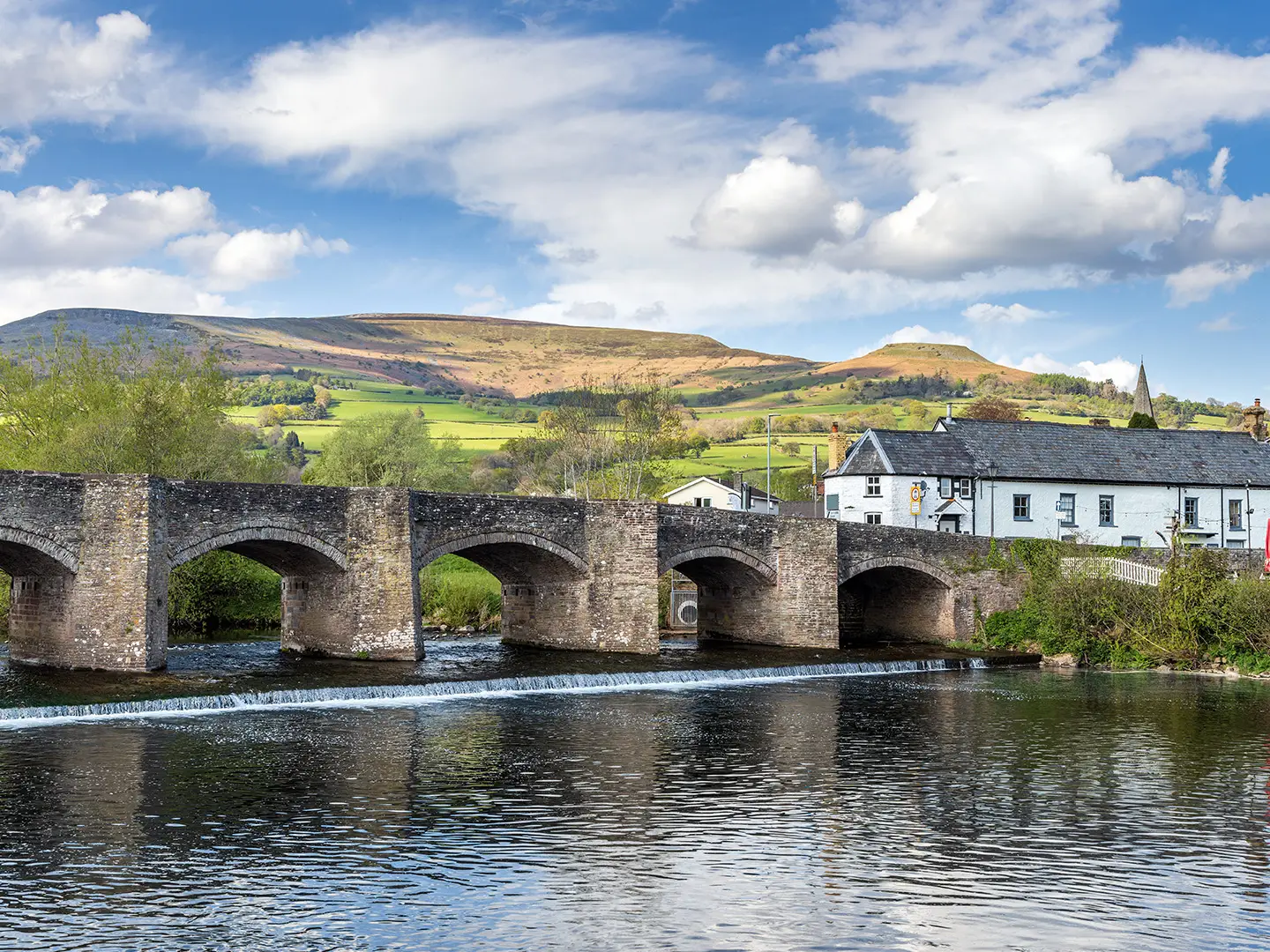
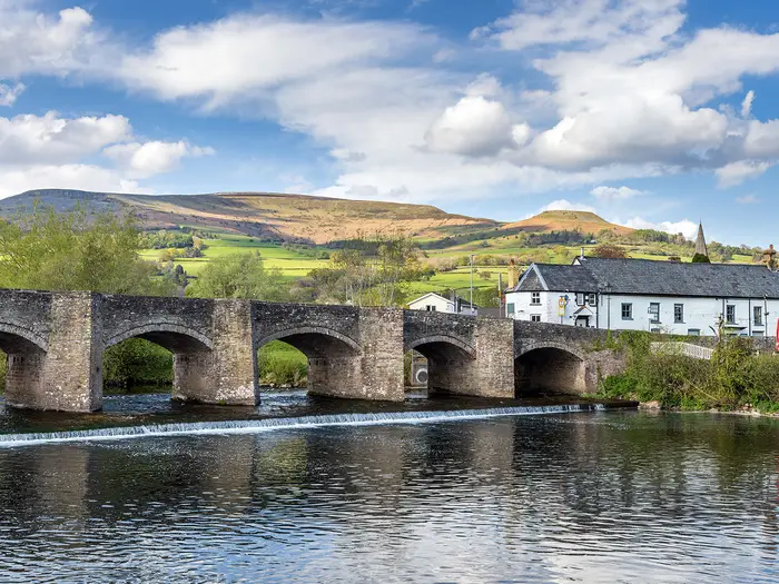
- Crickhowell, Glanusk Park and Llangattock: Near Crickhowell the path climbs towards Glanusk Park, with views towards the Black Mountains. Crickhowell also has a ruined castle and its long bridge over the River Usk.
- River Usk wildlife corridor: The River Usk is noted for salmon and trout and is an important wildlife corridor. The otter waymark reflects the otters that live along the river.
- Talybont-on-Usk to Brecon: The northern stages pass Talybont-on-Usk and Pencelli on the canal before finishing in Brecon, a cathedral town at the head of the valley. If you prefer coast rather than river and canal, the Anglesey Coastal Path is a very different Welsh long-distance walk.
Challenges to expect
The Usk Valley Walk is not mountainous, with a highest point of 311 m, but it is not completely flat. Expect two notable climbs: over the Kemeys / Wentwood ridge north of Caerleon and up towards Glanusk Park west of Crickhowell. Towpaths and field paths can be muddy in winter, and some sections use minor roads. Navigation is generally helped by the otter waymarks, but carry a map or GPX.
HikeList Score
Usk Valley Walk scored 87/100 on HikeList's trail-quality metrics.
See score breakdownHide breakdown
- Ideal length 78
- Balanced challenge 100
- Scenery & wildness 78
- Varied terrain 100
- Accommodation 83
- Food & support 88
- Path quality 98
- Season flexibility 89
Computed from length, challenge, scenery & wildness, terrain variety, accommodation, food & support, path quality and season flexibility.
 United Kingdom
 Wales
WalesShow more data Show less
- Riverside
- Canal
- Field
- Woodland
- Ridge
- Lowland
- Towpath
- Dirt
- Grass
- Minor Roads
- B&Bs
- Inns
- Small Hotels
- Family Friendly
- Dog Friendly On Leash
- Restrooms
- Established Campsites
- Picnic Areas
- Public Transport Access Points
Download Our Full Guide to Usk Valley Walk FREE!
Get our comprehensive guide to this hike for free. Save it for later reading or print out at home.
Photos from hikers
Taken on the trail by people who've reviewed Usk Valley Walk.
Usk Valley Walk: The Complete Guide
 i
Image by Jim
i
Image by Jim The Usk Valley Walk is a gentler Welsh long-distance trail with a clear line to follow: upstream from Caerleon (Caerllion) near Newport (Casnewydd) to Brecon (Aberhonddu), through the valley of the River Usk. It suits walkers who want a satisfying point-to-point journey without committing to a high mountain crossing.
The route links Roman Caerleon, market-town Usk (Brynbuga), Abergavenny (Y Fenni), Crickhowell (Crucywel), Talybont-on-Usk and cathedral-town Brecon. Between them, the walking is mostly on riverside paths, field and woodland tracks, minor roads and long, level sections of the Monmouthshire & Brecon Canal towpath.
This is a walk of water, towns and hill-fringed valley views rather than summits. The otter’s-head waymarks follow a river known for wildlife, while the northern half gains the steady rhythm of canal walking, locks, narrowboats and views towards the Brecon Beacons National Park (Bannau Brycheiniog).
It is still a proper multi-day hike. The two main climbs — over the Kemeys / Wentwood ridge and towards Glanusk Park near Crickhowell — add effort, and muddy field paths, wet towpaths and short road sections can slow progress after rain.
This guide covers stages, daily planning, accommodation, food, transport, terrain and the common mistakes to avoid.
Stage-by-Stage Guide
Stage 1: Caerleon (Caerllion) to Usk (Brynbuga) — approx. 16 km
The opening stage leaves the historic trailhead at Caerleon (Caerllion), beside the Roman fortress of Isca Augusta and the River Usk, then quickly becomes more rural. This is the first of the route’s two more noticeable climbs, crossing the wooded Kemeys / Wentwood ridge before dropping back towards the Usk valley.
Underfoot, expect a mix of riverside paths, field and woodland paths, minor lanes and potentially muddy sections after rain. The ridge is not technically difficult, but it is a clear change of effort compared with the easier valley-floor walking that defines much of the trail.
Key landmarks include Caerleon’s Roman amphitheatre, fortress baths and National Roman Legion Museum at the start, the wooded Kemeys / Wentwood ridge, and the approach to Usk (Brynbuga), a historic market town with a medieval castle and a fine bridge over the River Usk. Views back over the lower Usk valley are the main scenic reward of the day.
Food and water are easiest to arrange in Caerleon before setting off and in Usk at the end. Do not assume reliable refreshment between the two unless checked in advance, especially if walking outside the main season.
Usk is one of the stronger overnight stops on the trail, with town accommodation such as B&Bs, guesthouses and inns. Book ahead in busy periods, as it is a natural first-night stop on the standard five-day itinerary.
Caerleon has no railway station, so most walkers reach the start by bus or taxi from Newport (Casnewydd), which is on the South Wales Main Line. Public transport from Usk is more limited than from Newport or Abergavenny, so any plan to finish or start a section here should be checked before travelling.
Navigation is helped by the Usk Valley Walk’s white otter’s-head waymarks, but the early change from town and riverside walking to woodland and ridge paths makes it worth carrying OS mapping or a reliable GPX. Take care on any minor road sections, and expect field paths to be muddy or waterlogged after prolonged rain.
Stage 2: Usk (Brynbuga) to The Bryn — approx. 16 km
This stage continues up the Usk valley through quieter countryside, with the walk settling into its lower-level pattern after the first-day climb. It is generally a gentler day than Stage 1, but the surface can still be slow where field paths are wet.
The terrain is a practical mix of riverside, field and woodland paths with some minor road walking. The route remains in the valley rather than heading for the higher Brecon Beacons tops, so the main challenge is consistency underfoot rather than steep ascent.
The principal place at the start is Usk (Brynbuga), known for its floral displays, castle and bridge. The stage then heads towards The Bryn, an intermediate stopping point before the route reaches Llanellen and Abergavenny (Y Fenni) on the following stage.
Food and water should be organised in Usk before leaving. The Bryn is not one of the route’s main service towns, so refreshment and evening meal options should not be assumed. This should be checked before travelling.
Accommodation at The Bryn and nearby intermediate locations is thinner than in Usk, Abergavenny, Crickhowell or Brecon. Book this night well ahead, or plan a transfer or adjusted stage if suitable accommodation is unavailable.
Road access is possible at intermediate valley settlements, but local public transport should not be relied on without checking current timetables. This should be checked before travelling.
Navigation is usually straightforward if the waymarks are followed carefully, but field-path walking can be less obvious than towpath or town sections. Watch for waymarks at field exits, lane junctions and woodland edges, and keep OS mapping to hand where paths cross farmland.
Stage 3: The Bryn to Crickhowell (Crucywel) — approx. 18 km
This is the longest stage in the standard five-day split and one of the most varied. It links the quieter middle valley with Abergavenny (Y Fenni), then continues through the canal-and-mountain landscape of the northern half of the walk before reaching Crickhowell (Crucywel).
The route passes Llanellen and Abergavenny, where the walk enters the Brecon Beacons National Park (Bannau Brycheiniog). Abergavenny is a major practical point on the trail, with its own railway station on the Welsh Marches line and a good place to break, resupply or join the route for a section.
Beyond Abergavenny, the route continues through Govilon and Gilwern before the climb towards Glanusk Park. This climb reaches the route’s high point at around 311 m: not a mountain summit, but a noticeable rise on an otherwise valley-based walk, with views towards the Black Mountains.
Terrain varies more here than on the surrounding stages. Expect riverside and field paths, stretches near the Monmouthshire & Brecon Canal, minor roads, and the climb towards Glanusk Park before the descent or approach to Crickhowell.
Food and water are most reliably planned around Abergavenny and Crickhowell. Govilon and Gilwern are named places on the route, but opening times and available services should be checked before depending on them.
Crickhowell is a strong overnight base with B&Bs, guesthouses, inns and small hotels. It is also a useful place to pause if the longer third day has been tiring, with the town sitting beneath Table Mountain (Crug Hywel) and beside the River Usk.
Abergavenny is the key public transport point on this stage because it has a railway station. Public transport at other intermediate villages should be checked before travelling, especially for section-hiking plans.
Navigation needs a little more attention than on the canal-dominated stages. The route changes character several times between fields, settlements, canal-side walking and the higher ground near Glanusk Park, so check waymarks carefully at junctions and on the approach to minor roads.
Stage 4: Crickhowell (Crucywel) to Talybont-on-Usk — approx. 14 km
This stage has a gentler profile than Stage 3 and gives a fuller taste of the Monmouthshire & Brecon Canal. It is a good day for steady walking, with the Usk valley, canal corridor and views towards the higher central Brecon Beacons providing the main interest.
Crickhowell is worth allowing time for before leaving, with its ruined castle and long stone bridge over the Usk. The route then continues by way of Llangattock (Llangatwg) and Llangynidr towards Talybont-on-Usk.
Underfoot, the canal towpath brings long, flat and easy sections, though it can still be muddy or slippery after rain. There may also be field paths and short road sections, so footwear should still suit wet ground rather than just hard-surface walking.
Highlights include the canal corridor, locks and industrial archaeology associated with the Monmouthshire & Brecon Canal, along with the changing views towards the Brecon Beacons. Talybont-on-Usk is a popular canal village, close to Talybont Reservoir and forest.
Food and water are easiest to plan in Crickhowell and Talybont-on-Usk. Llangynidr is a named village on the stage, but any intention to rely on intermediate refreshments should be checked before travelling.
Talybont-on-Usk has accommodation options, but it is smaller than the main towns and should be booked ahead. This is especially important because it is a natural final overnight stop before Brecon on the five-day itinerary.
Public transport in the villages between Crickhowell and Brecon is less straightforward than rail-served Abergavenny. Current bus times and any taxi plans should be checked before travelling.
Navigation is generally easier where the route follows the canal, but do not switch off completely. Watch for waymarks where the path leaves or rejoins the towpath, and check for any canal towpath or footpath diversions before setting out.
Stage 5: Talybont-on-Usk to Brecon (Aberhonddu) — approx. 13 km
The final stage is the shortest in the standard five-day itinerary and is mainly a gentle walk into Brecon (Aberhonddu). It continues through the upper Usk valley, with canal-side walking and open views towards the surrounding hills.
From Talybont-on-Usk the route continues through Pencelli before the approach to Brecon. The walking is generally straightforward, especially where the Monmouthshire & Brecon Canal towpath gives a flat line towards the finish.
Path conditions remain weather-dependent. Canal towpaths and field paths can be muddy after rain, and any short road sections still need normal care, particularly at bends and where verges are narrow.
The main highlight is the gradual arrival at Brecon, a cathedral and market town with Georgian streets and Christ College, set at the head of the Usk valley on the northern edge of the Brecon Beacons. The stage keeps the character of the whole trail: river valley, canal corridor and mountain backdrop rather than high-level fell walking.
Food and water should be available at Talybont-on-Usk before departure and in Brecon at the finish. Do not depend on intermediate refreshments at Pencelli without checking opening times in advance.
Brecon has the best end-of-walk accommodation choice on this part of the route, including B&Bs, guesthouses, inns and small hotels. It is a sensible place to stay after finishing, particularly because onward transport may require a bus connection.
Brecon has no railway station. Leave by bus, including T4 / TrawsCymru and local services towards Abergavenny, Newport or Cardiff, but current timetables should be confirmed before booking onward travel.
Navigation is usually uncomplicated on the final approach, but the same rule applies as throughout the Usk Valley Walk: follow the white otter’s-head waymarks and keep mapping available for path junctions, towpath exits and the urban finish in Brecon.
Recommended Itinerary
For most walkers, the most balanced plan is the 5-day Caerleon (Caerllion) to Brecon (Aberhonddu) itinerary below. It keeps the daily distances moderate, uses the established stage breaks, and avoids forcing the two notable climbs into overlong days.
Standard 5-day itinerary
| Day | From | To | Approx. distance | Why this stage makes sense | Services/accommodation notes |
|---|---|---|---|---|---|
| 1 | Caerleon (Caerllion) | Usk (Brynbuga) | 16 km | A sensible first day with the early climb over the Kemeys / Wentwood ridge before dropping back towards the Usk valley. It gives time to reach Caerleon from Newport (Casnewydd) in the morning if not staying at the start. | Caerleon and Usk both have accommodation options. Caerleon has no railway station, so arrange bus or taxi access from Newport before starting. |
| 2 | Usk (Brynbuga) | The Bryn | 16 km | Another moderate day through the middle Usk valley, keeping the route manageable before the longer stage towards Crickhowell. | The Bryn is a smaller intermediate stop, so accommodation should be booked ahead. If suitable accommodation is unavailable, check alternatives and transfers before committing to this split. |
| 3 | The Bryn | Crickhowell (Crucywel) | 18 km | The longest standard stage, passing through the Abergavenny (Y Fenni) area before the route climbs towards Glanusk Park, the high point of the walk at around 311 m. Finishing in Crickhowell gives a strong overnight base after the main ascent of the northern half. | Abergavenny has a railway station and is the best mid-route public transport point. Crickhowell has good walker-friendly accommodation, but it is a popular base, so book early in busy periods. |
| 4 | Crickhowell (Crucywel) | Talybont-on-Usk | 14 km | A shorter day after the Glanusk Park stage, with easier valley and canal walking through the northern section of the route. The distance allows time for slower towpath conditions if the path is muddy after rain. | Crickhowell and Talybont-on-Usk are both established overnight stops. Talybont-on-Usk is smaller than the main towns, so reserve accommodation ahead. |
| 5 | Talybont-on-Usk | Brecon (Aberhonddu) | 13 km | A short final stage into Brecon, useful because onward travel from Brecon is by bus rather than rail. The easy distance gives more flexibility around bus times. | Brecon has a good range of accommodation and services, but no railway station. Confirm current bus times from Brecon before relying on them for onward travel. |
Slower variant
A slower plan suits families, first-time long-distance walkers, or anyone wanting shorter days around the Abergavenny and Crickhowell section. The most practical way to slow the walk is to split the long third stage by staying in Abergavenny (Y Fenni), which is on the route and has rail access.
| Day | From | To | Approx. distance | Why this stage makes sense | Services/accommodation notes |
|---|---|---|---|---|---|
| 1 | Caerleon (Caerllion) | Usk (Brynbuga) | 16 km | Keeps the first climb over Kemeys / Wentwood ridge as a self-contained opening day. | Arrange access to Caerleon from Newport. Usk is a good overnight stop. |
| 2 | Usk (Brynbuga) | The Bryn | 16 km | Maintains a moderate second day before the busier Abergavenny section. | Accommodation at smaller intermediate stops should be booked ahead. |
| 3 | The Bryn | Abergavenny (Y Fenni) | Check official mapping before booking | Shortens the standard The Bryn to Crickhowell stage and gives a natural overnight in the main mid-route town. | Abergavenny has a railway station, making this the easiest place to pause, join or leave the walk. |
| 4 | Abergavenny (Y Fenni) | Crickhowell (Crucywel) | Check official mapping before booking | Leaves the Glanusk Park climb and approach to Crickhowell for a separate day rather than combining it with the full stage from The Bryn. | Crickhowell is a popular walking base; book ahead. |
| 5 | Crickhowell (Crucywel) | Talybont-on-Usk | 14 km | A manageable canal-and-valley day after the higher ground near Glanusk Park. | Talybont-on-Usk has fewer beds than the larger towns, so secure accommodation in advance. |
| 6 | Talybont-on-Usk | Brecon (Aberhonddu) | 13 km | A relaxed final day with time to connect with buses from Brecon. | Brecon has no railway station; confirm current bus times before travelling. |
Faster variant
A 4-day itinerary suits fit walkers comfortable with one longer final day. The cleanest version keeps the first three standard stages intact, then combines the two shorter northern stages from Crickhowell to Brecon.
| Day | From | To | Approx. distance | Why this stage makes sense | Services/accommodation notes |
|---|---|---|---|---|---|
| 1 | Caerleon (Caerllion) | Usk (Brynbuga) | 16 km | Starts with a moderate day despite the Kemeys / Wentwood ridge climb. | Reach Caerleon by bus or taxi from Newport; book Usk accommodation. |
| 2 | Usk (Brynbuga) | The Bryn | 16 km | Keeps the middle valley section manageable before the longer Crickhowell day. | The Bryn is a smaller stop; accommodation needs planning. |
| 3 | The Bryn | Crickhowell (Crucywel) | 18 km | Covers the main ascent towards Glanusk Park and finishes in a strong service town. | Abergavenny provides a useful rail-access point during the day. Crickhowell has good accommodation but can book up. |
| 4 | Crickhowell (Crucywel) | Brecon (Aberhonddu) | 27 km | Combines the 14 km Crickhowell to Talybont-on-Usk stage with the 13 km Talybont-on-Usk to Brecon stage. This is the best faster-day combination because much of the northern half uses easier valley and canal towpath walking. | This is a long day, so start early and check for canal towpath or footpath diversions before setting out. Finish logistics depend on buses from Brecon, which should be checked before travelling. |
A 3-day crossing is possible for very fit walkers, but it creates long days and gives little margin for mud, diversions or transport delays. Anyone planning a 3-day schedule should build it from the official route mapping and confirm accommodation before booking.
Planning the Route
How many days to allow
Most walkers should plan the Usk Valley Walk over 4 or 5 days. A 5-day schedule gives comfortable daily distances, time for the historic towns, and a gentler pace through the canal and riverside sections. Fit walkers can complete it in 3 days, but that turns a generally accessible valley walk into a more demanding long-weekend route with longer days and less flexibility if paths are muddy.
The route is naturally shaped by its towns and larger villages. Accommodation is easiest to organise around Caerleon (Caerllion), Usk (Brynbuga), Abergavenny (Y Fenni), Crickhowell (Crucywel), Talybont-on-Usk and Brecon (Aberhonddu), with smaller intermediate stops needing more advance planning.
A practical 5-day plan is:
| Day | Stage | Approx. distance | Planning notes |
|---|---|---|---|
| 1 | Caerleon (Caerllion) to Usk (Brynbuga) | 16 km | Includes the first notable climb over the Kemeys / Wentwood ridge after leaving the lower Usk. |
| 2 | Usk (Brynbuga) to The Bryn | 16 km | A more rural day where accommodation and evening food should be arranged ahead. |
| 3 | The Bryn to Crickhowell (Crucywel) | 18 km | Passes through the Abergavenny area and climbs towards Glanusk Park, the route’s high point. |
| 4 | Crickhowell (Crucywel) to Talybont-on-Usk | 14 km | Easier canal-side and valley walking, with Llangattock (Llangatwg) and Llangynidr on the line. |
| 5 | Talybont-on-Usk to Brecon (Aberhonddu) | 13 km | A shorter finishing day on the upper valley approach to Brecon. |
Fast, steady or slow?
A steady 5-day itinerary suits the character of the trail best. The Usk Valley Walk is not a high mountain crossing, but it still has around 1,600 m of ascent, muddy field paths after rain, some minor-road walking, and two climbs that can slow the day more than the map suggests.
A 4-day itinerary works well for walkers used to back-to-back walking days, especially if accommodation is secured in advance at sensible stopping points. A 3-day itinerary is best treated as a fitness challenge rather than the default plan; it leaves little margin for wet paths, transport delays or late starts.
A slower pace is worthwhile if the aim is to visit Caerleon’s Roman sites, spend time in Usk or Crickhowell, or keep daily distances family-friendly. The canal towpath in the northern half makes some days feel straightforward underfoot, but towpaths and riverside paths can still become tiring when wet or churned up.
Accommodation and stage planning
Accommodation is the main planning constraint. The larger towns are the simplest bases, while smaller places such as The Bryn, Llangynidr, Talybont-on-Usk and Pencelli should not be treated as turn-up-and-find-something stops, especially in busy walking seasons.
Book the smaller intermediate stops before fixing transport. If a chosen overnight village is full, it may be easier to adjust the day length around Abergavenny (Y Fenni), Crickhowell (Crucywel) or Brecon (Aberhonddu) than to rely on last-minute options between them.
Some campsites exist along the wider corridor, but the route is generally easiest to organise as an inn, guesthouse or B&B walk. Current availability, campsite opening dates and any minimum-stay rules should be checked before travelling.
Shortening, extending and section hiking
The walk is practical to split into sections because the valley has good transport at key points. Abergavenny (Y Fenni) is the most useful mid-route access point because it has a railway station on the Welsh Marches line, making it a logical place to start, finish or break the route.
The start at Caerleon (Caerllion) has no railway station, so section-hikers normally approach via Newport (Casnewydd) by bus or taxi. The finish at Brecon (Aberhonddu) also has no railway station, so onward travel depends on buses, including TrawsCymru and local services towards Abergavenny, Newport or Cardiff. Current bus times should be confirmed before relying on them.
Shortening the walk is simplest by ending at Abergavenny or Crickhowell rather than trying to improvise from a minor village. Extending it is possible by adding extra local walking around the Brecon Beacons National Park (Bannau Brycheiniog), but that is separate from the Usk Valley Walk itself; the waymarked route remains the 77 km Caerleon-to-Brecon line.
Navigation and route variants
The route is waymarked with a white otter’s-head symbol, and named yellow arrows are also noted for the trail. Waymarking should not be the only navigation plan: carry the relevant OS mapping or a reliable offline route file, particularly where riverside paths, field edges and minor roads meet.
Use mapping that follows the 77 km / 48 mile point-to-point route from Caerleon to Brecon. Some walking holidays and GPS tracks follow longer variants or add detours, so check that any downloaded file matches the standard route before booking accommodation around it.
The OS Explorer sheets covering the route corridor are OL13, OL14 and 152. Check for canal towpath closures, riverside path diversions or temporary access changes before travelling, especially after prolonged wet weather.
Food, water and day-to-day logistics
Plan each day around the next definite town or booked accommodation, not around assumed services in every village. The main towns and larger villages make food planning straightforward, but rural sections between them can be quiet, so carrying lunch and spare snacks is sensible.
Water should be managed as on any lowland UK long-distance path: start each day with enough for the full stage and refill at accommodation or reliable public-facing services where available. Do not rely on the River Usk, canal water or small streams as drinking-water sources.
Road sections are part of the route and need care, particularly in poor visibility or at the end of a long day. Mud is a more common planning issue than altitude: waterproof footwear and a willingness to slow down on wet field paths will matter more than specialist mountain equipment.
Weather, season and access checks
Spring, summer and autumn are the most suitable seasons. In winter or after heavy rain, riverside and field sections can become muddy or waterlogged, and the long canal towpath can be slippery in places.
The Usk Valley Walk stays mainly in the valley and does not cross the Brecon Beacons tops, but the climb over the Kemeys / Wentwood ridge and the rise towards Glanusk Park still make weather relevant. Low cloud, rain and wind can reduce visibility on the higher sections and make road walking less pleasant.
There are no major permit logistics to build the trip around. The important pre-walk checks are accommodation, current buses to Caerleon and from Brecon, and any temporary footpath or canal towpath diversions.
Towns, Villages and Overnight Stops
Accommodation is easiest to organise around the main settlements: Caerleon (Caerllion), Usk (Brynbuga), Abergavenny (Y Fenni), Crickhowell (Crucywel), Talybont-on-Usk and Brecon (Aberhonddu). Smaller places such as The Bryn, Llanellen, Govilon, Gilwern, Llangynidr and Pencelli can be useful for breaking up the walk, but accommodation and evening food should be booked or checked ahead rather than assumed.
The common 5-day itinerary uses Usk, The Bryn, Crickhowell and Talybont-on-Usk as overnight stops. Stronger walkers can shorten the walk to 3 or 4 days by using the larger towns, especially Abergavenny and Crickhowell, but that creates longer days and may reduce flexibility if accommodation is full.
Caerleon (Caerllion)
Caerleon is the trailhead, beside the River Usk near Newport (Casnewydd). It is a practical place to stay the night before starting, especially if travelling in from outside south-east Wales and wanting an unhurried first morning.
Accommodation is part of the route’s main town-and-village mix, with B&Bs, guesthouses, inns and small hotels available in the larger settlements. Food and start-day supplies should be arranged here or in Newport, as the first stage soon leaves the town and climbs over the Kemeys / Wentwood ridge.
Caerleon has no railway station. The usual public-transport approach is by bus or taxi from Newport, which is on the South Wales Main Line; current bus times should be checked before travelling.
The main local interest is Roman Caerleon: the legionary fortress of Isca Augusta, the amphitheatre, fortress baths and National Roman Legion Museum. For walkers, the key practical point is that it is the last sizeable service point before the route heads into quieter country towards Usk.
Kemeys / Wentwood ridge
The Kemeys / Wentwood ridge is not an overnight stop, but it matters when planning the first day. It provides the first notable climb of the route soon after leaving Caerleon, before the walk drops back towards the Usk valley.
Do not plan on services here. Carry water, food and waterproofs from Caerleon, and expect woodland and field paths that may be muddy after rain.
This section is a useful reminder that, although the Usk Valley Walk is a low-level valley route, it is not entirely flat. The climb can make the Caerleon to Usk stage feel more substantial than its distance suggests.
Newbridge-on-Usk
Newbridge-on-Usk sits between the Kemeys / Wentwood ridge and Usk, after the route has returned towards the river. It is more useful as a route marker than as a principal overnight base.
Accommodation and food should not be assumed here without checking in advance. Most walkers using the standard first stage continue to Usk for the night.
If using Newbridge-on-Usk to shorten or modify the first day, onward transport and accommodation details should be checked before travelling. It is not one of the route’s main service hubs.
Usk (Brynbuga)
Usk is one of the most useful overnight stops on the southern half of the walk and is the standard end point for the first stage from Caerleon. It is a historic market town on the River Usk, with a medieval castle and a notable bridge.
This is a sensible place to book the first night on a 5-day itinerary. Accommodation is generally easier to find in the main towns than in the smaller intermediate villages, but advance booking is still recommended.
Usk is also a logical place for an evening meal and basic resupply planning. Specific pub, café and shop opening times should be checked before travelling, particularly outside peak holiday periods.
For walkers, Usk works well because it breaks the route after the first climb and before the quieter section towards The Bryn and Abergavenny. It is also a good point to reassess conditions if heavy rain has made riverside or field paths muddy.
The Bryn
The Bryn is used as the second overnight stop on the common 5-day split, after the stage from Usk. It gives a balanced schedule before the walk continues through Llanellen and Abergavenny towards Crickhowell.
This is one of the places where accommodation is thinner than in the main towns. Book well ahead if planning to stop here, and check evening food arrangements before committing to the stage.
The Bryn is best treated as a functional overnight halt rather than a guaranteed full-service base. If accommodation is not available, using Abergavenny instead may be more practical, but it will change the spacing of the surrounding days.
Llanellen
Llanellen lies between The Bryn and Abergavenny. It is useful for pacing the approach into Abergavenny, but it is not one of the main overnight hubs named for typical itineraries.
Do not rely on finding accommodation, food or shops here without checking first. Most walkers will pass through or near Llanellen on the way to larger services at Abergavenny.
If arranging a custom itinerary, Llanellen may help shorten or lengthen a day, but transport and accommodation should be checked before travelling.
Abergavenny (Y Fenni)
Abergavenny is one of the strongest service points on the Usk Valley Walk and the main transport hub on the route. It has its own railway station on the Welsh Marches line between Newport, Hereford and Shrewsbury.
This makes Abergavenny particularly useful for section-hikers, late starts, early finishes or walkers joining the trail part-way through. It is also the point where the route enters the Brecon Beacons National Park (Bannau Brycheiniog).
Accommodation is generally easier here than in the smaller villages, with the route’s usual mix of B&Bs, guesthouses, inns and small hotels. It is a sensible alternative overnight stop if The Bryn is fully booked or if a 4-day itinerary is being planned.
Abergavenny is known as the “Gateway to Wales” and is ringed by the Sugar Loaf, Blorenge and Skirrid. For Usk Valley Walk planning, its practical value is more important: this is the best rail-access point between Caerleon and Brecon.
Govilon
Govilon comes after Abergavenny as the route continues north-west into the canal-and-valley section of the walk. It is one of the smaller settlements on the way towards Gilwern and Crickhowell.
Treat Govilon as a possible intermediate stopping or refreshment point only if current services have been checked. Accommodation and food options should not be assumed.
Its main planning role is in breaking up the Abergavenny to Crickhowell corridor. Walkers using the standard 5-day itinerary normally continue beyond this area to Crickhowell for the night.
Gilwern
Gilwern lies between Govilon and the climb towards Glanusk Park and Crickhowell. It is part of the northern half of the route where the Monmouthshire & Brecon Canal becomes an important walking line.
Accommodation and food availability should be checked in advance. Gilwern can be useful when creating a shorter day from Abergavenny or The Bryn, but it is not one of the main named overnight stops in the standard schedule.
For walkers, the appeal of this stretch is practical as much as scenic: canal towpath walking is generally steady and level, although towpaths can still be muddy or affected by temporary diversions. Any canal towpath closures or diversions should be checked before travelling.
Glanusk Park
Glanusk Park is not a village stop in the usual accommodation sense, but it is a key route feature west of Crickhowell. The climb towards Glanusk Park reaches the high point of the Usk Valley Walk at around 311 m.
Do not plan on services here. Carry what is needed from the previous settlement, especially if walking in poor weather or linking a longer stage from The Bryn or Abergavenny to Crickhowell.
This is the second notable climb of the route after Kemeys / Wentwood. It is still a valley-route climb rather than a mountain crossing, but it can affect timing late in the day.
Crickhowell (Crucywel)
Crickhowell is one of the best overnight stops on the Usk Valley Walk and a natural base after the stage from The Bryn. It sits on the River Usk beneath Table Mountain (Crug Hywel), with a ruined castle and a long stone bridge over the river.
Accommodation is generally easier here than in the smaller villages, with B&Bs, guesthouses, inns and small hotels forming part of the route’s usual lodging pattern. It is still worth booking ahead, especially because it is a popular walking base in the Brecon Beacons National Park (Bannau Brycheiniog).
Crickhowell is a practical place for an evening meal, breakfast planning and sorting supplies before the canal-heavy stretch towards Talybont-on-Usk. Pub, café and shop opening times should be checked before travelling.
For itinerary planning, Crickhowell works well as a major reset point. It follows the highest ground of the route and comes before a shorter standard day to Talybont-on-Usk.
Llangattock (Llangatwg)
Llangattock lies close to Crickhowell on the route corridor. It is most useful as part of the Crickhowell overnight area rather than as a separate planning hub for most walkers.
Accommodation and food may be possible in or around the village, but this should be checked before travelling. If staying here rather than in Crickhowell, make sure the next morning’s route connection is clear.
Llangattock can be a quieter alternative to Crickhowell if suitable accommodation is available. However, Crickhowell remains the more obvious service base for most itineraries.
Llangynidr
Llangynidr sits between Crickhowell / Llangattock and Talybont-on-Usk, in the canal section of the walk. It can be useful for adjusting the length of the Crickhowell to Talybont-on-Usk stage.
It is not one of the main overnight stops in the standard 5-day itinerary, so accommodation and food should be checked before relying on it. This is especially important if planning to stop short rather than continue to Talybont-on-Usk.
The walking in this part of the route is generally easier underfoot than the earlier climbs, with long towpath sections, but mud and canal diversions can still affect progress. Check current path conditions before travelling if timing is tight.
Talybont-on-Usk
Talybont-on-Usk is the standard fourth overnight stop on the 5-day itinerary and one of the most useful villages on the northern half of the route. It sits on the Monmouthshire & Brecon Canal and is associated with locks, an aqueduct and access towards Talybont Reservoir and forest.
Accommodation is available in the larger village stop pattern of the route, but it is still a smaller base than Abergavenny, Crickhowell or Brecon. Book ahead and check evening food arrangements before setting the day’s finish here.
This is a good place to stop before the final stage to Brecon. It gives a manageable last day and keeps the itinerary from becoming too dependent on transport out of Brecon late in the afternoon or evening.
For walkers wanting a gentler schedule, Talybont-on-Usk is one of the most logical places to protect as a booked overnight. It also gives a strong sense of the canal character of the northern Usk Valley Walk.
Pencelli
Pencelli lies between Talybont-on-Usk and Brecon on the final stage. It is a useful intermediate point if the last day needs to be shortened or paced more gently.
Do not rely on accommodation, food or shops without checking in advance. Most walkers continue through to Brecon, where onward transport and end-of-walk accommodation are easier to organise.
Pencelli is best treated as a passing village unless a specific booking has been made. If using it as a planned stop, onward bus or taxi arrangements should be checked before travelling.
Brecon (Aberhonddu)
Brecon is the finish of the Usk Valley Walk and the main service centre at the head of the valley. It is a cathedral and market town on the northern edge of the Brecon Beacons National Park (Bannau Brycheiniog), with Georgian streets and Christ College.
It is the most practical place to stay after completing the route, especially if finishing late or relying on public transport the next day. Accommodation is generally easier to arrange here than in the smaller villages, but booking ahead remains sensible.
Brecon has no railway station. Onward travel is by bus, including T4 / TrawsCymru and local services towards Abergavenny, Newport or Cardiff; current bus times should be checked before relying on them.
For section-hikers, Brecon is the natural northern access point, but the lack of a station means exit planning matters. Avoid assuming a late connection without checking the current timetable.
Getting to the Start
The Usk Valley Walk starts in Caerleon (Caerllion), near Newport (Casnewydd), beside the River Usk and the Roman legionary fortress of Isca Augusta. Caerleon has no railway station, so most walkers reach the trailhead via Newport, then continue by local bus or taxi.
By train
The practical railhead for the start is Newport (Casnewydd). Newport is on the South Wales Main Line, with services on the Cardiff–Newport–Bristol/London corridor, making it the usual access point from south Wales, south-west England and London.
From Newport station, continue to Caerleon by bus or taxi. Allow enough time for the short onward transfer, especially if starting the walk the same day, and check current rail and local onward connections before committing to a tight schedule. This should be checked before travelling.
Abergavenny (Y Fenni) also has a railway station on the Welsh Marches line, but it lies part-way along the route rather than at the start. It is useful for section-walkers joining or leaving the Usk Valley Walk around the middle of the trail, not for reaching the Caerleon trailhead directly.
By bus
Local buses connect Newport with Caerleon, making bus the normal public-transport link from the railway station to the start. Timetables can change, and evening, Sunday and bank-holiday services may be less frequent. This should be checked before travelling.
If the bus times do not line up with your train arrival or planned start time, a taxi from Newport to Caerleon is the straightforward fallback. Pre-booking is sensible if arriving early, late, with a group, or with multi-day hiking luggage.
By car
Driving to Caerleon is possible, but the Usk Valley Walk is a point-to-point route finishing in Brecon (Aberhonddu), not a loop. Before leaving a vehicle at the start, plan the return journey from Brecon by bus towards Abergavenny, Newport or Cardiff, or arrange a private transfer.
Long-stay parking details for Caerleon or Newport are not fixed route information and should be checked before travelling. For many walkers, parking near a transport hub and using public transport or taxis at one end is simpler than trying to retrieve a car from the trailhead after finishing in Brecon.
From the nearest airport
The trailhead itself has no airport access; the practical target for air travellers is Newport (Casnewydd) railway station, then bus or taxi to Caerleon. Choose flights that allow a straightforward rail journey into the Cardiff–Newport–Bristol/London mainline corridor, then plan the final local connection separately.
Airport-to-rail transfer times, late arrivals and Sunday services can materially affect whether it is realistic to start walking the same day. This should be checked before travelling.
Where to stay before starting
Caerleon is the most convenient place to stay before starting, as it puts you close to the trailhead for an early departure. Newport is the practical alternative if arriving by train late in the day or if accommodation in Caerleon is full.
Staying in Newport usually means a short bus or taxi transfer to Caerleon on the morning of day one. If using a five-day itinerary, the first walking day is typically Caerleon to Usk (Brynbuga), so starting early gives useful time for the first climb over the Kemeys / Wentwood ridge and any muddy field or woodland sections after rain.
Getting Home from the Finish
The Usk Valley Walk finishes in Brecon (Aberhonddu), which has useful bus links but no railway station. Plan the exit from Brecon before starting the walk, especially if aiming to travel home the same day after the final stage from Talybont-on-Usk.
By train
Brecon (Aberhonddu) does not have a railway station. The most practical rail connection is usually to travel by bus or taxi from Brecon to Abergavenny (Y Fenni), which has a station on the Welsh Marches line linking Newport (Casnewydd), Hereford and Shrewsbury.
For longer-distance rail travel, Newport (Casnewydd) is the key South Wales Main Line hub, with services towards Cardiff, Bristol and London. If travelling back towards the trail start at Caerleon (Caerllion), Newport is also the main rail hub for onward bus or taxi connections.
Allow a buffer between the bus from Brecon and any booked train. Bus and train times can change, and this should be checked before travelling.
By bus
Brecon is left by bus, with services including T4 / TrawsCymru and local routes towards Abergavenny (Y Fenni), Newport (Casnewydd) or Cardiff. These are the main public-transport options from the finish.
Do not assume a late-afternoon or evening connection will work after a full walking day. If finishing late, arriving on a Sunday, or needing a fixed onward train, either check the exact timetable in advance or plan to stay in Brecon overnight.
By car/taxi
For a point-to-point walk, leaving a car at Brecon works best if the start transfer to Caerleon (Caerllion) has already been arranged separately. Otherwise, most walkers will find it simpler to reach the start by public transport and travel home from Brecon by bus and train.
Taxis are useful for a direct transfer from Brecon to Abergavenny station, for late finishes, or where bus times do not line up with onward rail travel. Pre-book rather than relying on finding a taxi immediately at the end of the walk, and confirm current fares before travelling.
From the nearest airport
Airport access from the Brecon finish is not direct. The practical approach is to travel first by bus from Brecon towards a larger transport hub such as Cardiff, Newport, Bristol or London, then continue by rail or airport transfer as required.
Flight-day connections need careful timing because the first leg out of Brecon is by bus. This should be checked before travelling, and an overnight stay in Brecon or at the onward rail hub may be safer for early flights.
Where to stay at the finish
Brecon (Aberhonddu) is a good place to stop at the end of the route, with the advantage of being a proper town rather than a remote trailhead. Staying overnight removes pressure from the final walking day and gives more flexibility with buses and onward trains the next morning.
This is especially sensible if walking the final stage from Talybont-on-Usk at a relaxed pace, finishing in poor weather, or relying on public transport after normal daytime hours. Book ahead in busy walking seasons and around local events.
Which Direction Should You Walk?
The Usk Valley Walk is normally walked from Caerleon (Caerllion) to Brecon (Aberhonddu), following the River Usk valley upstream from the lower valley near Newport (Casnewydd) towards the edge of the Brecon Beacons National Park (Bannau Brycheiniog). This is the direction used by the standard point-to-point route description and by common 5-day walking-holiday itineraries.
Walking it in reverse is entirely possible. The route is waymarked and low-level enough that direction is not a technical issue, but the standard west/north-westbound direction has the better overall logic for most independent walkers.
Standard direction: Caerleon to Brecon
This direction gives the strongest sense of journey. You start in Roman Caerleon beside the lower Usk, pass through Usk (Brynbuga), Abergavenny (Y Fenni), Crickhowell (Crucywel) and the canal villages, then finish in Brecon at the head of the valley.
The scenery also builds well. The early route has riverside paths, fields and woodland, while the northern half brings longer Monmouthshire & Brecon Canal towpath sections, views towards the hills and the final approach into Brecon.
Transport is workable rather than perfect. Caerleon has no railway station, but it is close to Newport, which is on the South Wales Main Line; most walkers can reach the start by bus or taxi from Newport. At the finish, Brecon also has no railway station, so onward travel depends on buses, including services towards Abergavenny, Newport or Cardiff. Current bus times should be checked before travelling.
The main climbs are not a strong reason to choose one direction over the other. In the standard direction, the Kemeys / Wentwood ridge comes early, soon after Caerleon, and the high point near Glanusk Park comes later, before the route continues through the upper valley. Neither climb is technical, but both are noticeable on an otherwise gentle valley route.
Reverse direction: Brecon to Caerleon
Walking from Brecon to Caerleon can make sense if accommodation availability, bus timings or onward rail plans work better that way. It also means finishing near Newport, with a short bus or taxi connection from Caerleon to the main-line railway station.
The trade-off is that the route’s natural scenic progression is less satisfying. Instead of walking upstream into the Brecon Beacons edge, you leave Brecon and gradually work down-valley towards Caerleon. Caerleon is an excellent historic endpoint, but the psychological pull of finishing in Brecon is stronger for most walkers.
Reverse itineraries can use the same overnight places — Brecon, Talybont-on-Usk, Crickhowell, The Bryn, Usk and Caerleon — but smaller intermediate stops still need booking ahead. Accommodation is generally easiest in the main towns and thinner between them, whichever way you walk.
Weather and practical considerations
There is no clear weather or prevailing-wind advantage from the route information. The walk is mainly valley-floor, riverside, woodland, minor-road and canal-towpath walking, with limited high exposed ground compared with a mountain crossing.
After rain, muddy or waterlogged field paths and towpaths are more relevant than wind direction. Check for canal towpath or footpath diversions before setting off, particularly if using a fixed accommodation schedule.
Recommendation
For most walkers, the best direction is Caerleon (Caerllion) to Brecon (Aberhonddu). It follows the standard route, gives the best scenery progression, fits common 5-day itineraries and finishes with a satisfying arrival in Brecon at the head of the Usk valley.
Choose the reverse direction only if the transport or accommodation plan works better that way.
Accommodation Along the Route
The Usk Valley Walk works well as an inn-to-inn route. The strongest accommodation bases are the towns and larger villages: Caerleon (Caerllion), Usk (Brynbuga), Abergavenny (Y Fenni), Crickhowell (Crucywel), Talybont-on-Usk and Brecon (Aberhonddu). Expect a mix of B&Bs, guesthouses, inns and small hotels, with some campsites along or near the corridor.
Accommodation becomes thinner between these centres, especially around The Bryn, Llanellen, Govilon, Gilwern, Llangynidr and Pencelli. If using the common 5-day itinerary, book the smaller overnight stops before committing to travel dates, then fill in the easier town nights around them.
Best overnight stops
For a straightforward 5-day walk, the standard pattern is:
- Caerleon (Caerllion) before starting
- Usk (Brynbuga) after Day 1
- The Bryn / Llanellen area after Day 2, or a transfer to/from Abergavenny (Y Fenni)
- Crickhowell (Crucywel) after Day 3
- Talybont-on-Usk after Day 4
- Brecon (Aberhonddu) at the finish
Abergavenny (Y Fenni) is the most useful fallback in the middle of the route because it has a stronger accommodation base and a railway station. It can help solve the awkward stretch between Usk (Brynbuga), The Bryn and Crickhowell (Crucywel), particularly if the smaller village stops are full.
Accommodation by place
| Place | Accommodation level | Best for | Notes |
|---|---|---|---|
| Caerleon (Caerllion) | Good | Start night | Convenient for starting beside the River Usk. There is no railway station in Caerleon, so most walkers reach it from Newport (Casnewydd) by bus or taxi. |
| Kemeys / Wentwood ridge | None | Walking through | Not a practical overnight area; plan to continue to Usk (Brynbuga) or return/transfer to a serviced base. |
| Newbridge-on-Usk | Limited | Possible short-stage adjustment | Treat as an intermediate point rather than a reliable main base unless accommodation has been booked in advance. |
| Usk (Brynbuga) | Good | First overnight stop | One of the key trail towns and a natural stop on a 5-day itinerary. Book ahead for weekends and busy holiday periods. |
| The Bryn | Limited | Standard second-night area on some 5-day schedules | Accommodation choice is thinner than in the towns. Secure this night early, or arrange a taxi transfer to/from Abergavenny (Y Fenni). |
| Llanellen | Limited | Alternative to The Bryn area | Useful only if suitable accommodation is available for the chosen date. This should be checked before travelling. |
| Abergavenny (Y Fenni) | Good | Mid-route base, rail access, fallback night | A strong practical base with its own railway station. Useful if accommodation is unavailable in smaller places nearby. |
| Govilon | Limited | Intermediate canal-side stop | Better treated as a passing or backup location unless accommodation is booked ahead. |
| Gilwern | Limited | Alternative near the canal section | Can work for adjusted itineraries, but do not rely on finding a room at short notice. |
| Glanusk Park area | None | Walking through | The route climbs towards its high point here; it is not a normal overnight stop for independent walkers. |
| Crickhowell (Crucywel) | Good | Major overnight stop | One of the best places to stop on the route, especially after the longer stage from The Bryn area. Book early in peak walking periods. |
| Llangattock (Llangatwg) | Limited | Alternative to Crickhowell | Close enough to function as part of the Crickhowell overnight area, depending on the exact accommodation and access. |
| Llangynidr | Limited | Shorter-stage option | Useful for walkers breaking the Crickhowell to Talybont-on-Usk section differently. Availability should be checked before building an itinerary around it. |
| Talybont-on-Usk | Good | Final overnight before Brecon | A logical stop before the last day into Brecon. Smaller than the main towns, so advance booking is still important. |
| Pencelli | Limited | Alternative before Brecon | May suit a shorter final day or camping-style itinerary, but should not be assumed as a full-service overnight base. |
| Brecon (Aberhonddu) | Good | Finish night | A strong finish base with a broad town-service feel. There is no railway station, so onward travel is by bus or taxi connection. |
Booking strategy
For most walkers, the critical bookings are The Bryn / Llanellen area and Talybont-on-Usk, because these smaller places can constrain the whole schedule. Usk (Brynbuga), Abergavenny (Y Fenni), Crickhowell (Crucywel) and Brecon (Aberhonddu) usually offer more choice, but they are still worth booking ahead rather than treating as walk-up stops.
Weekend dates, school holidays and good-weather periods in spring, summer and early autumn can put pressure on the better-known towns and villages. Crickhowell (Crucywel), Talybont-on-Usk and Brecon (Aberhonddu) are also popular bases for wider Brecon Beacons National Park (Bannau Brycheiniog) trips, not just this trail.
Transfers, luggage and awkward gaps
The route is well suited to baggage-supported walking. Self-guided walking holiday companies on the Usk Valley Walk commonly use a 5-day split and can arrange accommodation and luggage movement between overnight stops.
Independent walkers can also use taxi transfers to make the accommodation work, especially around the thinner middle section. A common solution is to walk the official route but sleep in Abergavenny (Y Fenni) or another better-served town, using a pre-booked taxi to return to the same trail point the next morning.
Do not leave these transfers to chance in the smaller villages. Book taxis in advance, agree the exact pickup point, and allow for muddy paths or slower progress after rain.
Camping and Wild Camping
Campsites and booking
The Usk Valley Walk can be done with camping, but it is not primarily a campsite-to-campsite trail. The route is better served by B&Bs, inns, guesthouses and small hotels in Caerleon (Caerllion), Usk (Brynbuga), Abergavenny (Y Fenni), Crickhowell (Crucywel), Talybont-on-Usk and Brecon (Aberhonddu), with some campsites on or near the wider valley corridor.
Do not assume there will be a convenient campsite at the end of every stage. If planning to camp, identify and book pitches before committing to daily distances, especially around smaller stops such as The Bryn, Llangynidr, Pencelli and the canal-side villages.
| Route section | Camping practicality |
|---|---|
| Caerleon (Caerllion) to Usk (Brynbuga) | Plan carefully. The route uses riverside paths, fields, woodland and minor roads, with private land likely throughout. Do not rely on finding an informal pitch. |
| Usk (Brynbuga) to The Bryn / Llanellen | Accommodation is thinner between settlements, so camping logistics need advance checking. This should be checked before travelling. |
| Abergavenny (Y Fenni) to Crickhowell (Crucywel) | More practical for mixed accommodation planning because the route passes larger settlements, but campsites still need to be booked or checked in advance. |
| Crickhowell (Crucywel) to Talybont-on-Usk | The canal and village corridor makes planning easier than the more rural middle stages, but pitching beside the towpath without permission is not appropriate. |
| Talybont-on-Usk to Brecon (Aberhonddu) | Usually the simplest end of the walk to plan around services, but do not leave the final night to chance in busy periods. |
Wild camping
Wild camping should not be treated as a standard option on the Usk Valley Walk. The route crosses a working rural landscape of riverside fields, woodland, minor roads, canal towpath and settled valley land, much of it private, and the northern section enters the Brecon Beacons National Park (Bannau Brycheiniog).
Do not pitch on farmland, riverbanks, woodland, canal margins or parkland without the landowner’s permission. Where rules or ownership are unclear, ask locally and be prepared to continue to booked accommodation or an official campsite.
The Monmouthshire & Brecon Canal towpath may look tempting for a lightweight tent, but it is a busy recreational corridor and not a suitable place for discreet camping. The same applies to obvious riverside meadows beside the River Usk: they are often grazed, privately owned, flood-prone or environmentally sensitive.
Does the route suit carrying camping gear?
The trail is moderate rather than mountainous, so carrying camping equipment is possible for fit walkers. However, it is still 77 km / 48 miles with around 1,600 m of ascent, muddy field paths after rain, and two more sustained climbs over the Kemeys / Wentwood ridge and towards Glanusk Park.
A lightweight setup is strongly preferable. Heavy camping loads will be most noticeable on the early climb out of Caerleon and on the rise west of Crickhowell, and can make muddy riverside and field sections slower than expected.
For many walkers, the most practical compromise is to use fixed accommodation in the main towns and camp only where a suitable booked site fits the itinerary. This avoids forcing long or awkward stages simply to reach a legal pitch.
Water and cooking
The route is never far from the River Usk or the Monmouthshire & Brecon Canal, but neither should be treated as a guaranteed drinking-water source. Carry enough water between settlements and refill from reliable supplies in towns, villages, accommodation or official campsites.
If water from natural sources is used in an emergency, it should be properly treated. Canal water is a particularly poor choice because of boat traffic, stagnant sections and towpath use.
Use a stove only where permitted and never light an open fire. This is especially important in woodland, on farmland, beside the canal and within the national park landscape.
Low-impact camping rules
If camping is arranged with permission, keep the pitch small, late and discreet, and leave early. Avoid livestock, crops, gateways, access tracks, river margins, canal banks and any ground that could be damaged in wet conditions.
Follow strict Leave No Trace practice:
- take all litter, food waste and toilet paper away;
- use toilets in towns, pubs, cafés, accommodation or campsites wherever possible;
- do not wash directly in the River Usk or the canal;
- keep noise and lights low near villages, farms and moorings;
- never block rights of way, gates, bridges or towpaths;
- avoid disturbing wildlife along the river corridor, including otters and nesting birds.
Seasonal considerations
Spring, summer and autumn are the normal walking seasons, but camping conditions vary sharply with weather. Riverside and field paths can become muddy or waterlogged after rain, and low valley pitches may be damp even when the walking itself remains straightforward.
Summer weekends and holiday periods can make the main towns and canal villages busier, so book pitches early where camping is part of the plan. In autumn, shorter daylight makes it more important to know exactly where the night’s legal accommodation is before setting out.
Food, Water and Resupply
The Usk Valley Walk is one of the easier Welsh long-distance routes for food planning because it links a chain of towns and larger villages rather than crossing remote upland country. The safest approach is still to treat each walking day as self-contained: leave with lunch, snacks and enough water to finish the stage, then use overnight stops for proper resupply.
Food is easiest in Caerleon (Caerllion), Usk (Brynbuga), Abergavenny (Y Fenni), Crickhowell (Crucywel), Talybont-on-Usk and Brecon (Aberhonddu). Smaller places such as The Bryn, Llanellen, Govilon, Gilwern, Llangynidr and Pencelli may have limited or variable options, so they should not be relied on without checking current opening times.
Practical food planning
For a 5-day itinerary, most walkers only need to carry the day’s food plus emergency snacks. A packed lunch is a good idea on every stage, especially where the route spends time on riverside paths, field paths, woodland tracks, minor roads or canal towpath away from town centres.
Rural pubs, cafés and small shops can keep short hours, and Sunday or bank-holiday trading may be reduced. If staying in B&Bs, guesthouses or inns, arrange breakfast times and packed lunches when booking rather than assuming they will be available early in the morning.
Abergavenny is the strongest mid-route resupply point, and is the best place to reset supplies if walking the route in fewer, longer days. Brecon is the obvious place to eat and restock at the finish if travelling onward by bus.
Water and refills
Reliable water should be taken from accommodation, cafés, pubs or other mains sources in settlements. Ask for bottle refills before leaving each overnight stop, as there may be long stretches where the route follows the River Usk or the Monmouthshire & Brecon Canal without a convenient public tap.
The River Usk, canal and other natural water along the route should not be treated as ready to drink. If using natural water in an emergency, filter and/or treat it first. Livestock, agricultural run-off, canal traffic and settlement upstream all make untreated water a poor choice on this valley route.
In normal spring, summer and autumn conditions, carrying around 1.5–2 litres per person is a sensible starting point for a typical stage, with more in hot weather or if walking at a slower pace. Top up whenever a reliable opportunity appears; do not wait until bottles are empty.
| Section | Food availability | Water availability | Notes |
|---|---|---|---|
| Caerleon (Caerllion) to Usk (Brynbuga) | Start well supplied in Caerleon; Usk is the main end-of-day resupply point. Limited options should be assumed once on the trail. | Fill up before leaving Caerleon; refill in Usk. Natural water from the River Usk should be treated if used. | The climb over the Kemeys / Wentwood ridge comes early, so leave with enough drink rather than relying on finding water en route. |
| Usk (Brynbuga) to The Bryn | Buy lunch and snacks in Usk before leaving. The Bryn is a smaller stop, so evening food and breakfast should be arranged with accommodation or checked ahead. | Fill bottles in Usk and again at accommodation if staying at The Bryn. | Do not assume shops or food service will be available late in the day at smaller villages. |
| The Bryn to Crickhowell (Crucywel), via Abergavenny (Y Fenni) | Abergavenny is the best resupply point on this stage. Crickhowell is also a good overnight food stop; smaller settlements between may be variable. | Refill at accommodation before leaving The Bryn, then use Abergavenny and Crickhowell for reliable mains water. | This is the longest standard stage in the 5-day split, so carry food from the start even though Abergavenny provides a useful mid-stage reset. |
| Crickhowell (Crucywel) to Talybont-on-Usk | Crickhowell is the best place to buy lunch. Llangattock and Llangynidr are smaller and should be treated as variable for food. Talybont-on-Usk is the main end-of-day stop. | Fill in Crickhowell; refill from mains sources in villages or at Talybont-on-Usk where available. | Much of the northern half follows the Monmouthshire & Brecon Canal towpath, but canal water is not drinking water unless properly treated. |
| Talybont-on-Usk to Brecon (Aberhonddu), via Pencelli | Start with breakfast and lunch sorted in Talybont-on-Usk. Pencelli should not be relied on for full resupply unless checked. Brecon has the best finish-point food options. | Fill before leaving Talybont-on-Usk; refill in Brecon. Treat any natural or canal water if used. | This is a shorter final stage, but carry enough food and water to finish comfortably, especially if travelling onward from Brecon the same day. |
Terrain, Conditions and Difficulty in Practice
The Usk Valley Walk is moderate in practice because it is varied rather than technically hard. Most of the route stays low in the River Usk valley on riverside paths, field paths, woodland tracks, minor roads and, in the northern half, long sections of the Monmouthshire & Brecon Canal towpath.
There is no scrambling, no sustained rocky ground and no exposed mountain ridge walking. The challenge comes from wet ground, cumulative ascent, occasional road walking and the need to keep moving efficiently over several consecutive days.
Path surfaces
Expect a changing mix of surfaces rather than one consistent trail type:
| Surface | What it means in practice |
|---|---|
| Riverside paths beside the River Usk | Usually gentle underfoot, but can be muddy or waterlogged after rain. Low-lying sections may feel slow in wet conditions. |
| Field paths | Uneven ground, grass, mud and rural footpath conditions. Progress can be slower than the map suggests after wet weather. |
| Woodland paths | Most relevant around the Kemeys / Wentwood ridge and other wooded sections. Roots, leaf litter and mud can make descents slippery. |
| Minor roads | Not technically difficult, but require care. Treat road sections as part of the day’s risk management rather than as rest miles. |
| Monmouthshire & Brecon Canal towpath | Long, flat and easy to follow, especially in the northern half. After rain it can still be muddy or slippery, and the repetitive flat walking can be tiring on feet. |
Do not plan this as a fully surfaced or all-towpath walk. It is a rural valley route with enough grass, mud and field walking to justify proper walking footwear.
Climbs, descents and height gain
The route is low-level, but not flat overall. Total ascent is around 1,600 m, spread across the route, with two climbs that stand out.
The first notable climb comes soon after Caerleon (Caerllion), over the wooded Kemeys / Wentwood ridge. This is the early reminder that the walk is not simply a riverside stroll; it adds height quickly compared with the surrounding valley-floor sections and may be slippery in wet woodland conditions.
The second major rise is towards Glanusk Park west of Crickhowell (Crucywel). This is the high point of the route, at around 311 m, but it is still a valley-side climb rather than a mountain summit. The walking remains non-technical, though the effort is more noticeable if carrying a full pack or compressing the route into three days.
Between these climbs, the route undulates through the Usk valley and links towns, fields, woods and canal sections. On a five-day itinerary the ascent feels manageable for most walkers with reasonable fitness; on a three-day schedule the same terrain becomes a much more sustained endurance walk.
Mud, water and seasonal conditions
Mud is the main condition-related difficulty. Riverside and field paths can become slow, sticky or waterlogged after rain, and towpath sections are not immune from wet ground.
Spring, summer and autumn are the natural seasons for the walk. Spring and autumn are likely to bring the best combination of mild walking temperatures and wetter ground; summer generally gives longer daylight and easier scheduling, though the flat canal miles can feel tiring in warm weather.
After prolonged rain, allow extra time for the field and riverside sections. A day that looks modest on distance can take longer if the ground is heavy underfoot or if minor route diversions are in place. Canal towpath or footpath diversions should be checked before travelling.
Road walking and lanes
The Usk Valley Walk includes some minor-road walking. These sections are not a technical obstacle, but they do change the character of the day and need attention, especially in poor visibility or at busier times.
Use standard road-walking care: stay alert, manage bends cautiously and make yourself visible. Poles can be useful on muddy paths, but should be managed carefully on lanes where traffic awareness matters more than rhythm.
Fields, gates and rural obstacles
Because the route uses field paths, expect normal rural walking obstacles: uneven ground, wet grass, boundary crossings and occasional slower navigation through farmland. Stiles and gates are not the defining difficulty of the walk, but the route should not be treated as step-free or uniformly easy underfoot.
If dog access, mobility limitations or avoidance of stiles is important, this should be checked before travelling. In any field environment, dogs should be kept under close control and local signage followed.
Difficulty by section
| Section | Practical terrain character |
|---|---|
| Caerleon (Caerllion) to Usk (Brynbuga) | The early climb over the Kemeys / Wentwood ridge is the main effort. Expect woodland and valley walking rather than continuous easy riverside path. |
| Usk (Brynbuga) to The Bryn | A gentler valley section overall, but still with field paths, rural surfaces and possible mud. Navigation and underfoot conditions matter more than height gain. |
| The Bryn to Crickhowell (Crucywel) | The route passes through the Abergavenny (Y Fenni) area and towards the national park, with the major rise towards Glanusk Park west of Crickhowell. This is one of the more demanding parts of the walk. |
| Crickhowell (Crucywel) to Talybont-on-Usk | Easier gradients dominate, with canal towpath becoming a major feature. The walking is straightforward but can feel repetitive, and wet towpath mud can slow progress. |
| Talybont-on-Usk to Brecon (Aberhonddu) | A comparatively gentle finish through the upper valley and canal corridor. The main issue is keeping feet comfortable over flat towpath miles rather than dealing with steep ground. |
What makes it easier or harder
The walk is easier than many Welsh long-distance routes because it avoids the Brecon Beacons tops, has frequent settlements and stays mostly in a well-served valley. The waymarked character also helps, although maps or a reliable route file remain sensible for field sections, woodland junctions and town exits.
It becomes harder in wet weather, when field and riverside paths can be slow and the towpath can lose its easy-going feel. It also becomes harder if walked in three days rather than four or five, because the modest terrain then has to be covered in longer daily stages with less recovery time.
For most walkers, waterproof footwear with good grip is more useful than heavy mountain kit. The route does not demand technical equipment, but it does reward practical long-distance basics: comfortable boots or shoes, waterproofs, blister management, and enough time in the schedule for muddy ground and minor road sections.
Weather and Best Time to Walk
The Usk Valley Walk is best treated as a spring, summer or autumn route. It stays mainly on the valley floor beside the River Usk and along the Monmouthshire & Brecon Canal, so it avoids the exposure of a high Brecon Beacons summit crossing, but the surfaces can still become slow and messy after wet weather.
The main weather issue is rain underfoot rather than altitude. Field paths, riverside sections and woodland tracks can be muddy or waterlogged, and the long towpath sections may be slippery in places after prolonged rain. The two notable climbs — over the Kemeys / Wentwood ridge and towards Glanusk Park near Crickhowell — need a little more care in poor visibility, wet leaves or icy conditions.
Seasonal guide
| Season | What to expect | Planning advice |
|---|---|---|
| Spring | One of the better times to walk: longer days, fresh valley scenery and generally manageable temperatures. Paths may still be wet after rain. | A good season for a 3–5 day itinerary, but carry waterproofs and expect muddy field edges and riverside paths. |
| Summer | The easiest season for daylight and relaxed daily timing. Canal towpaths and lowland field paths are straightforward, though warm still days can feel tiring on road and open towpath sections. | Book accommodation ahead, especially in smaller stops such as The Bryn, Llangynidr, Talybont-on-Usk and Pencelli where options are thinner. Start earlier on hot days. |
| Autumn | Often a good walking season, with cooler temperatures and attractive woodland sections. Wet leaves, mud and shorter days become more significant later in the season. | Allow more margin for the 16–18 km days and be realistic about finishing before dark. Waterproof footwear is useful. |
| Winter | The route is low-level and not a mountain traverse, so it is more realistic in winter than many Brecon Beacons walks. However, short daylight, mud, waterlogged ground, cold rain, fog and occasional ice can make it much less enjoyable. | Best for experienced walkers doing shorter sections or using flexible accommodation. Check transport times carefully, as missed buses at either end of the route can be harder to recover from in winter. |
Rain, mud and river conditions
The walk follows the River Usk for much of its length, and several sections use lowland field paths and riverside paths. After sustained rain, expect slower going and wetter ground, especially where the route crosses fields or runs close to the river.
The canal towpath in the northern half gives flatter and steadier walking, but it is not immune to mud or slippery patches. Footpath or canal towpath diversions can also affect the day’s plan; these should be checked before travelling.
Wind, fog, cold and snow
Because the route stays in the valley rather than crossing the Brecon Beacons tops, wind exposure is usually less of a defining problem than on higher national-park routes. The exception is on the two higher sections, particularly the rise towards Glanusk Park, where poor visibility or cold wind can make navigation and clothing choices more important.
Snow is not the normal planning factor for this route, but winter cold, frost and ice can still affect minor roads, woodland paths and shaded towpath sections. In poor visibility, take extra care on road sections and at field crossings where waymarks may be harder to spot.
Daylight and daily timing
The standard 5-day split keeps most days to around 13–18 km, which is comfortable in spring, summer and early autumn. In late autumn and winter, those same distances need more discipline: start promptly, keep lunch stops efficient and avoid relying on walking the final kilometres in fading light.
A 3–4 day schedule is more demanding in bad weather. Longer days leave less margin for mud, route-finding pauses, accommodation check-in times and bus connections at Caerleon (Caerllion), Abergavenny (Y Fenni) or Brecon (Aberhonddu).
Insects and ticks
Insects are not a major defining challenge on this route, but the walk does pass through fields, river margins and woodland. In the warmer months, check for ticks after walking through long grass or brushing vegetation, especially around the Kemeys / Wentwood ridge and other wooded or field sections.
Accommodation by season
Accommodation is generally easier in the main towns — Caerleon (Caerllion), Usk (Brynbuga), Abergavenny (Y Fenni), Crickhowell (Crucywel), Talybont-on-Usk and Brecon (Aberhonddu) — but thinner between them. In summer, at weekends and during good-weather holiday periods, book the smaller intermediate stops well ahead rather than assuming there will be space on arrival.
Winter walking can be limited more by accommodation and transport practicalities than by the route itself. Opening times, availability and bus timetables should be checked before travelling.
Safety Notes
The Usk Valley Walk is a moderate, low-level route rather than a mountain crossing, but it still needs normal long-distance walking discipline. The main practical hazards are mud after rain, short road sections, livestock in fields, slippery waterside paths beside the River Usk and the Monmouthshire & Brecon Canal, and changeable Welsh weather on open valley and ridge sections.
Emergency help and communication
In an emergency in the UK, call 999 or 112. Give the clearest possible location: nearest town or village, grid reference if available, nearby road, bridge, canal feature, waymark or named place.
Do not assume mobile signal will be continuous, especially in wooded sections, in folds of the valley, or away from the larger settlements. Carry a charged phone, a power bank on multi-day itineraries, and either OS mapping or an offline map/GPX that does not depend on data coverage.
Navigation and remoteness
The route is waymarked with a white otter's-head symbol, but waymarks can be missed at field edges, road crossings and through settlements. Carry a map or offline route file and check the line carefully when leaving towns such as Usk (Brynbuga), Abergavenny (Y Fenni), Crickhowell (Crucywel), Talybont-on-Usk and Brecon (Aberhonddu).
This is not a remote wilderness trail: there are regular villages and towns, plus public transport links at key points. Even so, some stretches between settlements can feel quiet, particularly around the Kemeys / Wentwood ridge, field-path sections, and the longer canal towpath sections, so start each day with enough food, water and daylight to finish without relying on a lift or open café.
Road walking and crossings
Some sections use minor roads or cross roads between field and riverside paths. Take extra care on bends, in poor visibility and near village approaches where traffic may be faster than expected.
Where there is no pavement, walk facing oncoming traffic unless the layout makes the opposite side safer. At dusk, in rain or mist, a bright layer or small light is useful even on short road sections.
River, canal and wet-ground hazards
The River Usk and the Monmouthshire & Brecon Canal are central to the walk, but they should be treated with care. Towpaths, bridge approaches, lock areas and riverside paths can be slippery after rain, frost or leaf fall.
Do not enter fast or high water, and do not try to wade flooded sections. If a riverside path is waterlogged or unsafe, turn back and find a safe legal alternative or use local transport; this should be checked before travelling if prolonged wet weather has affected the valley.
Children and dogs need close supervision beside the canal and river, particularly near locks, steep banks and narrow towpath sections.
Mud, footwear and footing
Field paths, woodland sections and towpaths can become muddy or waterlogged after rain. Waterproof footwear with reliable grip is sensible outside dry summer conditions, and walking poles can help on slick descents from the Kemeys / Wentwood ridge and on wet field paths.
The route has no technical ground, but fatigue can make slips more likely late in the day. Keep an eye on pace and daylight, especially on 3-day or 4-day itineraries with longer daily distances.
Weather, heat and cold
Although the high point is only around 311 m near Glanusk Park, the walk still has exposed open sections and two notable climbs: the Kemeys / Wentwood ridge and the rise towards Glanusk Park west of Crickhowell. Conditions can feel colder and windier on these higher or more open stretches than in the sheltered valley.
Carry a waterproof layer even in settled seasons, and add warm layers for spring and autumn starts. In hot weather, the flatter canal and riverside sections can still be tiring over a long day; carry enough water between villages and plan shade and rest stops rather than relying on facilities being open.
Livestock and field paths
The route uses field paths, so expect livestock at times. Give cattle and horses plenty of space, move calmly, and do not get between cows and calves.
Keep dogs under close control and on a lead around livestock. Close gates behind you unless they are clearly fixed open, and use stiles and gates rather than climbing fences or walls.
Solo walking
Solo hikers should leave a simple plan with someone else: intended stage, accommodation, expected arrival time and what to do if contact is missed. This is particularly useful on quieter sections between Caerleon (Caerllion) and Usk (Brynbuga), between smaller villages, and on days with longer road, field or towpath mileage.
A solo walker should avoid pressing on into failing light just to keep to an itinerary. The route is well served overall, so shortening a day or using local transport is usually safer than continuing tired on wet paths or minor roads.
Daily safety checks before setting off
Before each stage, check:
- the weather forecast for the Usk valley and Brecon Beacons National Park (Bannau Brycheiniog);
- daylight remaining for the planned distance;
- current bus or taxi options if the day needs to be shortened;
- accommodation check-in arrangements and food availability at the overnight stop;
- phone battery, offline mapping and emergency contact details;
- whether any canal towpath or footpath diversions are in place — this should be checked before travelling;
- water carried for the gap to the next reliable settlement;
- footwear and waterproofs for mud, rain or cold wind.
None of these checks is unusual for a Welsh low-level long-distance path, but together they make the Usk Valley Walk much easier to complete safely and calmly.
Gear Recommendations
The Usk Valley Walk is a low-level Welsh valley route, not a high mountain crossing, so gear can be lighter than for the Beacons Way or a full Brecon Beacons traverse. The main kit challenge is not altitude or technical ground, but wet grass, muddy field paths, damp woodland, canal towpath mud and changeable Welsh weather over several consecutive days.
Footwear
Waterproof walking shoes or lightweight boots are the best fit for most walkers. The route uses riverside paths, fields, woodland tracks, minor roads and long sections of Monmouthshire & Brecon Canal towpath, so choose footwear that copes with mud but remains comfortable on firm, flat surfaces.
Heavy mountain boots are usually unnecessary unless carrying a camping load or walking after prolonged rain. Trail shoes can work in dry summer conditions, but they should have decent grip and be paired with the expectation that feet may get wet on muddy or waterlogged sections.
Gaiters are useful in spring and autumn, especially on field paths beside the River Usk and through damp vegetation. They are less important in a settled dry spell, but can make multi-day walking much more comfortable.
Waterproofs and layers
Carry a proper waterproof jacket and waterproof trousers, even though the route stays mostly low. The high point near Glanusk Park is only around 311 m, but a wet day in the Usk valley can still become cold and draining, particularly when moving slowly through mud or stopping in exposed fields.
A light fleece or insulated layer is enough for most spring, summer and autumn itineraries, with an extra warm layer for early starts, evening pub-to-B&B walks, or slower-paced days. Pack spare dry socks and use a pack liner or dry bags; several days of damp kit are a bigger problem here than any single difficult climb.
Navigation
The route is waymarked with a white otter’s-head symbol, but navigation should not rely on waymarks alone. Field edges, woodland sections, riverside paths and canal diversions can be confusing, and signs may be missed when leaving towns such as Usk (Brynbuga), Abergavenny (Y Fenni), Crickhowell (Crucywel) and Brecon (Aberhonddu).
Use OS mapping for the corridor: OS Explorer OL13, OL14 and 152 cover the route. A phone with offline mapping or a GPX track is very useful, but carry a backup map and know how to use it if battery or signal becomes unreliable.
Check for canal towpath or footpath diversions before setting off. This should be checked before travelling.
Water and food
The Usk Valley Walk passes regular towns and larger villages, but services are not evenly spaced. Carry enough water for several hours of walking, and more in warm weather on the open towpath or field sections.
A practical approach is to start each day with water, lunch and snacks rather than assuming every small settlement has an open shop or café. This matters most on shorter intermediate stops and between the larger service centres of Caerleon (Caerllion), Usk (Brynbuga), Abergavenny (Y Fenni), Crickhowell (Crucywel), Talybont-on-Usk and Brecon (Aberhonddu).
Trekking poles
Trekking poles are optional but useful. They help on the two notable climbs — the Kemeys / Wentwood ridge and the rise towards Glanusk Park — and are also helpful for balance on muddy field paths after rain.
They are less useful on the long, flat canal towpath and minor road sections, where many walkers will prefer to stow them. Rubber tips are sensible if using poles frequently on hard surfaces.
Power and electronics
A power bank is recommended if using a phone for maps, photos, accommodation details and transport checks. The walk is point-to-point, and public transport at the start and finish involves buses or taxis rather than a railway station directly at Caerleon or Brecon, so keeping a phone charged is practical rather than optional.
Carry charging cables, and keep electronics in a waterproof pouch or dry bag. A small headtorch is useful for early starts, late arrivals, accommodation approaches and unexpected delays, even if the planned itinerary is entirely in daylight.
Sun, insects and seasonal extras
Sun protection is still needed on a low-level route. Canal towpaths and open riverside fields can give long stretches with limited shade, so pack sunglasses, sun cream and a hat in settled weather.
Insect repellent is sensible in warm, still conditions near the River Usk and the Monmouthshire & Brecon Canal. Long sleeves can also help when walking through summer vegetation.
Spring and autumn walkers should prioritise mud management: gaiters, waterproof socks or spare socks, and a dry change of clothing at the end of each day. In summer, carry extra water and do not underestimate reflected heat from towpaths and minor roads.
Inn-to-inn hikers
For B&B, inn and guesthouse itineraries, a small daypack is enough if using baggage transfer; otherwise keep the overnight pack compact. The route’s moderate distance and low-level terrain reward light packing more than heavy mountain equipment.
Essential kit should still include waterproofs, warm layer, map or offline navigation, water, food for the day, phone power, first-aid basics and a dry bag for valuables. Do not remove wet-weather kit just because accommodation is booked each night.
Campers
Camping is possible on this route, but campsites are not as continuous as accommodation in the main towns and larger villages. Plan overnight stops carefully and check current campsite availability before committing to a camping itinerary.
Campers should use a reliable waterproof shelter, robust waterproof packing and footwear that remains supportive under load. The route is not technically difficult, but a heavier pack will make muddy field paths, woodland sections and the Glanusk Park climb noticeably harder.
Cooking and food planning need more attention than on an inn-to-inn trip. Carry enough food between confirmed resupply points, and avoid assuming that every village on the route has evening supplies available.
Fast and section hikers
Fast walkers and section hikers can keep kit light, but should not strip it back to fair-weather running gear unless the forecast is stable and escape options are clear. Waterproofs, warm layer, navigation, water, food and phone power remain the core kit.
Abergavenny (Y Fenni) is the main on-route rail access point, which makes it useful for section walking. If using buses to reach Caerleon (Caerllion) or leave Brecon (Aberhonddu), carry enough warm clothing and phone battery to cope with waiting time or timetable disruption. Current bus times should be checked before travelling.
Budget and Costs
The Usk Valley Walk is a comparatively affordable Welsh long-distance route because it stays close to towns, public transport and low-level accommodation rather than requiring remote transfers. Costs are still highly seasonal, especially in smaller places such as The Bryn, Talybont-on-Usk and the Crickhowell (Crucywel) area, so treat the figures below as planning allowances and confirm current prices before booking.
Most walkers take 3–5 days. A 5-day itinerary usually means four nights between Caerleon (Caerllion) and Brecon (Aberhonddu), unless adding a night at the start or finish. Faster walkers doing it in 3 days may spend less on accommodation but more on taxis if the longer stages do not line up neatly with available beds.
Typical cost ranges
Indicative per-person costs, excluding long-distance travel to Newport (Casnewydd) or home from Brecon (Aberhonddu):
| Style | Typical daily spend | What it usually means on this route |
|---|---|---|
| Budget | £35–£70 per day | Camping where available, simple food, buses rather than taxis, minimal extras |
| Mid-range | £90–£160 per day | B&Bs, guesthouses or inns, packed lunches, pub/café meals, occasional taxi contingency |
| Comfortable | £160–£250+ per day | Better rooms or small hotels, more meals out, baggage transfer or taxis, possible pre/post-route nights |
A self-arranged 5-day walk with B&B or inn accommodation is likely to cost much more than a camping-based trip, but it is the most straightforward way to walk the Usk Valley Walk. Accommodation is generally easy to find in the main towns, but thinner between them, so booking the smaller overnight stops ahead is the main cost-control measure.
Accommodation costs
Accommodation is the largest expense for most walkers. The route has B&Bs, guesthouses, inns and small hotels in Caerleon (Caerllion), Usk (Brynbuga), Abergavenny (Y Fenni), Crickhowell (Crucywel), Talybont-on-Usk and Brecon (Aberhonddu), with fewer choices between these places.
Typical planning ranges are:
| Accommodation type | Planning range |
|---|---|
| Campsite | £10–£25 per person per night, where a suitable site works with the stage plan |
| B&B / guesthouse / inn | £70–£140 per room per night, often more for scarce dates or single occupancy |
| Small hotel / more comfortable room | £120–£200+ per room per night |
Camping can reduce the budget, but it needs more careful stage planning because campsites are not guaranteed at every natural stopping point. A B&B-based itinerary is simpler, especially on the common 5-day split through Usk, The Bryn, Crickhowell and Talybont-on-Usk.
Single walkers should budget carefully. Some accommodation prices are per room rather than per person, so a solo B&B itinerary can be significantly more expensive than two people sharing.
Food and drink
Food costs are moderate because the route passes regular towns and villages rather than remote high ground. The best-value approach is to buy lunch supplies in larger stops and use pubs, cafés or accommodation meals selectively.
Typical daily food allowances:
| Food style | Planning range |
|---|---|
| Mostly self-catered lunches and snacks | £10–£20 per day |
| Packed lunch plus one pub/café meal | £25–£45 per day |
| Café stops, pub meals and drinks | £45–£75+ per day |
Do not assume every smaller overnight stop has late-opening shops or a choice of evening meals. This is particularly important between the larger towns and in intermediate villages, where accommodation should be asked about evening food options when booking.
Transport costs
Public transport keeps the overall budget manageable. The start at Caerleon (Caerllion) has no railway station, so most walkers reach it by bus or taxi from Newport (Casnewydd), which is on the South Wales Main Line. The finish at Brecon (Aberhonddu) also has no railway station, so onward travel is by bus, including T4 / TrawsCymru and local services towards Abergavenny (Y Fenni), Newport (Casnewydd) or Cardiff.
Bus fares are usually a small part of the total trip cost compared with accommodation. Rail fares to Newport or from onward connecting stations can vary widely by booking time, route and ticket type, so check current fares before committing to accommodation.
Abergavenny (Y Fenni) is useful for section walkers because it has a railway station on the Welsh Marches line. It can also reduce transport costs if walking only part of the route, as it sits on the line of the trail rather than requiring a long taxi transfer.
Taxis and contingency costs
Taxis are most useful for the short transfer between Newport (Casnewydd) and Caerleon (Caerllion), for reaching accommodation away from the route, or for shortening a day if weather, mud or timing causes problems. Rural taxi availability should not be assumed at short notice.
For budget planning, allow a taxi contingency even if using buses. A short start transfer is one thing; a rural pickup from an intermediate section or an out-and-back accommodation transfer can add noticeably to the trip cost. Confirm fares directly with local operators before relying on them.
Baggage transfer and packages
The Usk Valley Walk is well suited to independent B&B walking with a daypack, but luggage transfer will increase the budget. Baggage movement may be arranged through self-guided walking holiday companies or, in some cases, by local taxis or accommodation providers. Availability and prices should be checked before booking.
Companies such as Drover Holidays and Contours Walking Holidays offer self-guided Usk Valley Walk holidays, commonly based around a 5-day itinerary. Package prices vary by season, room type, baggage arrangements and transfers, so compare exactly what is included: accommodation, luggage transfer, route notes, emergency support and any transport links.
Be careful when comparing package costs. Some operators market longer variants of walks in the wider area, while the official Usk Valley Walk is the 77 km / 48 mile point-to-point route from Caerleon (Caerllion) to Brecon (Aberhonddu).
Budget tips specific to the Usk Valley Walk
- Book smaller overnight stops early, especially The Bryn and Talybont-on-Usk, where fewer choices can push walkers towards taxis or more expensive rooms.
- Use Abergavenny (Y Fenni) station for section walking or for shortening the route without paying for long transfers.
- Confirm buses to Caerleon (Caerllion) and from Brecon (Aberhonddu) before finalising the first and last day.
- Carry lunch supplies when leaving larger towns, particularly before quieter stages.
- If camping, plan the whole itinerary around actual campsite locations rather than assuming a site will exist near every stage end.
- Check for canal towpath or footpath diversions before travelling, as diversions can affect timing, transport and accommodation logistics.
Luggage Transfer, Guided Tours and Support Services
The Usk Valley Walk is one of the easier Welsh long-distance routes to organise with support. It passes regular towns and larger villages, has good accommodation options at the main stops, and is often sold as a short self-guided walking holiday rather than as a fully guided expedition.
Because the route is only 77 km / 48 miles and mostly low-level, support is optional rather than essential. Fit walkers carrying a light overnight pack can complete it independently, but baggage transfer or a package holiday makes the walk much easier for families, first-time long-distance walkers and anyone using B&Bs or inns each night.
Self-guided walking holidays
Companies such as Drover Holidays and Contours Walking Holidays offer self-guided Usk Valley Walk packages. These typically suit walkers who want the route, accommodation and daily logistics arranged in advance, while still walking independently each day.
A standard supported itinerary commonly uses a 5-day schedule, with daily stages of roughly 13–18 km. That fits the natural stop pattern from Caerleon (Caerllion) to Usk (Brynbuga), The Bryn, Crickhowell (Crucywel), Talybont-on-Usk and Brecon (Aberhonddu).
Check exactly what is included before booking. Package details can vary, but the key points to confirm are:
- overnight accommodation and meal basis;
- baggage transfer between overnight stops;
- route notes, maps or GPX files;
- start and finish transport advice;
- any rest-day, short-day or extra-night options;
- current prices, departure dates and booking conditions.
Self-guided packages are particularly useful where accommodation is thinner between the larger towns. The smaller intermediate stops should be booked ahead rather than left to the day, especially if walking in spring, summer or early autumn.
Luggage transfer
Luggage transfer is most practical if booked through a walking-holiday package. The trail has enough road access and overnight settlements for baggage support to work well, but individual courier arrangements and prices should be checked before travelling.
For an independent booking, ask each accommodation provider whether they can recommend local baggage transfer or taxi support. This is especially useful around the smaller stops such as The Bryn, Llangynidr, Talybont-on-Usk and Pencelli, where options may be more limited than in Abergavenny (Y Fenni), Crickhowell (Crucywel) or Brecon (Aberhonddu).
Before relying on baggage transfer, confirm:
- the exact pick-up and drop-off accommodation names;
- daily bag weight and size limits;
- pick-up deadlines each morning;
- whether bags can be moved to village B&Bs, inns or campsites;
- what happens if accommodation is changed or a stage is shortened;
- payment method and cancellation terms.
Even with luggage transfer, carry waterproofs, warm layers, food, water, medication, phone, map/GPS and any essential documents during the day. Some sections are muddy after rain, and the two main climbs over the Kemeys / Wentwood ridge and towards Glanusk Park are better walked with proper hillwalking basics to hand.
Guided walking options
Fully guided versions are less central to this route than on more remote mountain trails. The Usk Valley Walk is waymarked, low-level and passes frequent services, so most walkers do not need a leader to complete the official 77 km route.
Guided walking may still suit groups wanting interpretation, company or all logistics handled. Be careful when comparing guided holidays: some guided operators sell longer looped variants rather than the official point-to-point Usk Valley Walk. HF Holidays, for example, markets a longer version of about 109 km / 67.5 miles over 6 walking days, with extra ascent, so it should not be confused with the official 77 km Caerleon-to-Brecon route.
Before booking any guided option, check whether the itinerary follows the official Usk Valley Walk or a longer adapted route, and compare the daily distances, ascent, accommodation locations and transport arrangements.
Taxi transfers and local support
Taxis are useful on this trail for three main situations: reaching Caerleon (Caerllion) from Newport (Casnewydd), filling gaps where accommodation is not available exactly on the route, and leaving Brecon (Aberhonddu) if bus times do not suit. No railway station sits at either the start in Caerleon or the finish in Brecon.
Abergavenny (Y Fenni) is the most useful rail-access point on the route, with a station on the Welsh Marches line. It can also work as a practical entry or exit point for section-hikers.
Book taxis ahead for early starts, evening arrivals or small-village pick-ups. This is particularly important if staying off-route or if using a taxi to bridge a stage-end accommodation gap.
When support is unnecessary
Experienced walkers using B&Bs, inns or small hotels can organise the route independently without much difficulty. The stage towns are well spaced, the terrain is moderate, and the route has stronger public-transport access than many Welsh long-distance walks.
Support becomes less necessary if carrying a light pack, walking the standard 5-day itinerary and staying in the main overnight stops. The most important independent-planning tasks are still to book accommodation early, confirm bus times to Caerleon and from Brecon, and check for any canal towpath or footpath diversions before travelling.
Shorter Hikes and Best Sections
Distances below use the standard 5-day stage split for the Usk Valley Walk. If joining or leaving between those stage towns — especially around Abergavenny (Y Fenni), Govilon or Gilwern — check the exact distance on OS mapping or a current GPX before booking transport.
| Best for | Section | Approx. distance | Why choose it | Transport notes |
|---|---|---|---|---|
| Best day walk | Talybont-on-Usk to Brecon (Aberhonddu) via Pencelli | 13 km | A gentle final section with canal-side walking, village stops and a satisfying finish in Brecon. It suits walkers wanting the flavour of the northern half without committing to a long day. | Brecon has no railway station; leave by bus, including T4 / TrawsCymru and local services towards Abergavenny, Newport or Cardiff. Access to Talybont-on-Usk should be checked before travelling. |
| Best weekend section | Crickhowell (Crucywel) to Brecon (Aberhonddu), overnighting around Talybont-on-Usk | 27 km | A compact two-day version of the route’s upper valley character: Crickhowell, Llangattock, Llangynidr, Talybont-on-Usk, Pencelli and the canal corridor into Brecon. Distances are moderate and accommodation is available in the main stopping places. | Crickhowell and Talybont-on-Usk transport should be checked before travelling. Brecon has bus links but no rail station, so confirm current bus times before relying on them. |
| Best 3–5 day section | Usk (Brynbuga) to Brecon (Aberhonddu) | 61 km over 4 days | This omits the first Caerleon to Usk day but keeps much of the route’s variety: Usk, the approach through Monmouthshire, Abergavenny, the canal sections, Crickhowell, Talybont-on-Usk and the finish at Brecon. It works well for walkers who want most of the trail but not the full 77 km. | Usk access should be checked before travelling. Abergavenny is the key rail point on the route, and Brecon is reached or left by bus. |
| Best section for scenery | The Bryn to Crickhowell (Crucywel) | 18 km | This stage gives the strongest mix of valley, hills and views: the approach through Llanellen and Abergavenny, entry into the Brecon Beacons National Park (Bannau Brycheiniog), canal-side walking around Govilon and Gilwern, then the climb towards Glanusk Park and the high point near 311 m before Crickhowell. | Abergavenny has a railway station on the Welsh Marches line and lies on this part of the route, making it the most useful access point. Transport from The Bryn and Crickhowell should be checked before travelling. |
| Best for beginners | Crickhowell (Crucywel) to Talybont-on-Usk | 14 km | A manageable single day with villages, canal interest and less commitment than the remoter-feeling ridge or longer middle sections. It is still a proper linear walk, so allow time for muddy towpath or field sections after rain. | Public transport at both ends should be checked before travelling. Booking accommodation in Talybont-on-Usk ahead is sensible, especially at busy times. |
| Best for public transport | Abergavenny (Y Fenni) to Crickhowell (Crucywel), using the The Bryn–Crickhowell stage as the base | Less than the full 18 km stage if starting at Abergavenny | Abergavenny is the only town on the route with its own railway station, so this is the easiest place to join the walk by train. From there the route continues towards Govilon, Gilwern, Glanusk Park and Crickhowell. | Trains serve Abergavenny on the Welsh Marches line. Onward transport from Crickhowell should be checked before travelling. |
| Best for villages and accommodation | Crickhowell (Crucywel) to Brecon (Aberhonddu) | 27 km | This is the easiest short section to organise around established overnight stops, with Crickhowell, Talybont-on-Usk and Brecon all offering walker-friendly accommodation options. It also keeps daily distances modest. | Book smaller intermediate stops ahead. Brecon has bus services but no station; confirm current times before relying on them. |
| Best for camping | Crickhowell (Crucywel) to Brecon (Aberhonddu), if suitable campsites are available | 27 km | Camping is possible on the wider route, but B&Bs, inns and guesthouses are the simpler default. This upper section is the most practical short camping candidate because it passes the main canal villages and finishes in Brecon, but pitch locations and opening dates need planning. | Campsite availability, booking rules and exact locations should be checked before travelling. Do not assume every overnight village has a convenient camping option. |
For the easiest logistics, choose a section that starts or finishes at Abergavenny or Brecon. Abergavenny gives the route its strongest rail access; Brecon gives a clear northern endpoint but requires a bus connection.
Highlights and Points of Interest
The Usk Valley Walk is strongest as a route of river, historic towns and canal walking rather than big mountain drama. The best places to build in extra time are Caerleon (Caerllion), Usk (Brynbuga), Abergavenny (Y Fenni), Crickhowell (Crucywel), Talybont-on-Usk and Brecon (Aberhonddu).
Caerleon (Caerllion) and Roman Isca Augusta
Caerleon is the most important historic start point on the route. The waymarked walk begins beside the River Usk in a town built around the Roman legionary fortress of Isca Augusta, once the base of Legion II Augusta.
Allow time here before setting off if Roman history is a priority. The town has one of Britain’s best-preserved Roman amphitheatres, the fortress baths and the National Roman Legion Museum. Opening times should be checked before travelling if these are part of the plan.
Kemeys / Wentwood ridge
The first notable climb comes soon after Caerleon, as the route leaves the lower Usk and rises through woodland towards the Kemeys / Wentwood ridge. This is one of the main breaks from the valley-floor walking and gives views back over the Usk valley before the path drops towards the river again.
It is worth treating this section as more than just an early obstacle. In wet weather the woodland and field paths can be muddy, so it is also one of the places where footwear and pace matter more than on the flatter canal sections later in the walk.
Usk (Brynbuga)
Usk is one of the best overnight stops for walkers who want a characterful town rather than a purely functional stage end. It is a historic market town known for floral displays, a medieval castle and a fine bridge over the River Usk.
The town is also a good place to pause and reset after the first day’s walking from Caerleon. If time is limited, the riverside and bridge area give the clearest sense of why the route follows this valley so closely.
The River Usk wildlife corridor
The River Usk is the constant thread of the walk. It is noted for salmon and trout, and the valley forms an important wildlife corridor.
The trail’s white otter’s-head waymark reflects the otters that live along the river. Kingfishers are often seen too, though sightings are never guaranteed; quiet early or late walking beside the water gives the best chance of noticing wildlife.
Abergavenny (Y Fenni)
Abergavenny is a major practical and scenic highlight, especially for section-walkers because it has a railway station on the Welsh Marches line. It is known as the “Gateway to Wales” and marks the route’s entry into the Brecon Beacons National Park (Bannau Brycheiniog).
The town is ringed by the Sugar Loaf, Blorenge and Skirrid hills, giving a much stronger hill-country feel than the lower valley stages. It is also known for its food festival, so accommodation can be busier around major events; book ahead if dates coincide.
Monmouthshire & Brecon Canal
In the northern half of the walk, the Monmouthshire & Brecon Canal becomes one of the route’s defining features. Long, flat towpath sections offer steadier going than the field and woodland paths earlier in the route.
The canal adds industrial and cultural interest as well as easier walking, with lime kilns, restored narrowboats, locks and mountain views along the way. Towpaths can still be wet or muddy after rain, and any canal towpath diversions should be checked before travelling.
Glanusk Park and the views towards the Black Mountains
West of Crickhowell, the route climbs towards Glanusk Park and reaches its high point at around 311 m. This is not a summit or a high mountain crossing, but it is one of the best viewpoints on the Usk Valley Walk.
The reward is the outlook towards the Black Mountains and the sense of being fully within the Brecon Beacons landscape while still following a valley route. It is the second main climb of the walk after the Kemeys / Wentwood ridge.
Crickhowell (Crucywel) and Llangattock (Llangatwg)
Crickhowell is one of the most attractive towns on the route and a strong candidate for an unhurried overnight stop. It sits beneath Table Mountain (Crug Hywel), with a ruined castle and a long 17th–18th-century stone bridge over the Usk, often cited as the longest stone bridge in Wales.
The nearby Llangattock (Llangatwg) area adds to the appeal of this stage, with the river, canal and surrounding hills close together. Walkers choosing where to spend extra time between Abergavenny and Brecon will usually find Crickhowell the most rewarding base.
Llangynidr, Talybont-on-Usk and the canal villages
Beyond Crickhowell, the walk keeps close company with the canal and passes through or near villages such as Llangynidr and Talybont-on-Usk. This is one of the gentlest and most pleasant parts of the route, with level towpath walking and regular canal features.
Talybont-on-Usk is the standout stop. It has locks and an aqueduct, and sits near Talybont Reservoir and forest, with fine views towards the highest part of the central Brecon Beacons.
Brecon (Aberhonddu)
Brecon is a fitting finish because it feels like a proper town rather than a roadside end point. It is a cathedral and market town at the head of the Usk valley, with Georgian streets and Christ College, on the northern edge of the Brecon Beacons.
It is worth allowing time after the final stage rather than rushing straight onto onward transport. Brecon has no railway station, so onward buses should be checked before travelling, especially if finishing late in the day or walking outside the busiest season.
Common Mistakes and Planning Tips
The Usk Valley Walk is a forgiving long-distance route, but several planning errors can still make it awkward. Most problems come from treating it as either a simple riverside stroll with no logistics, or as a high Brecon Beacons route with the wrong expectations.
| Common mistake | Better plan |
|---|---|
| Assuming the route is a loop | Treat it as a linear walk from Caerleon (Caerllion) to Brecon (Aberhonddu). Arrange start and finish transport before booking accommodation. |
| Expecting railway stations at both ends | Use Newport (Casnewydd) for rail access to the start, then bus or taxi to Caerleon. At the finish, Brecon has no railway station, so onward travel depends on buses or a pre-booked taxi. Confirm current bus times before relying on them. |
| Booking the main towns but leaving smaller stops late | Accommodation is easier in Caerleon, Usk (Brynbuga), Abergavenny (Y Fenni), Crickhowell (Crucywel), Talybont-on-Usk and Brecon, but thinner between them. Book smaller intermediate stops before finalising stage lengths. |
| Compressing the walk into too few days | The route is 77 km / 48 miles with around 1,600 m of ascent. Fit walkers may complete it in 3–4 days, but the standard 5-day split gives more realistic stages of roughly 13–18 km and suits walkers carrying overnight kit. |
| Underestimating the two main climbs | Although this is a low-level valley route, the Kemeys / Wentwood ridge north of Caerleon and the climb towards Glanusk Park west of Crickhowell both add effort. Do not plan those days as if they are flat canal walking. |
| Assuming the whole route is dry, level towpath | The northern half includes long, easy sections of the Monmouthshire & Brecon Canal, but the route also uses riverside paths, field paths, woodland tracks and minor roads. After rain, muddy or waterlogged sections can slow progress. |
| Relying only on waymarks | The walk is waymarked with a white otter's-head symbol, and named yellow arrows are also noted, but waymarks can be missed at junctions, road crossings and field exits. Carry OS mapping or a reliable GPX as well as following signs. |
| Using the wrong route file | Some holiday itineraries and GPS tracks follow longer variants rather than the official 77 km / 48-mile Caerleon-to-Brecon route. Check that any GPX or itinerary follows the Usk Valley Walk itself, not a longer loop or detour-based version. |
| Assuming every village has food available | Larger towns are the safer places to plan meals and resupply. Do not depend on finding shops, cafés or evening meals in every smaller village without checking opening times in advance. This should be checked before travelling. |
| Forgetting Sunday or seasonal transport and service gaps | Bus frequencies, food availability and accommodation check-in arrangements can be more limited on Sundays, bank holidays and outside the main walking season. Confirm current times and opening arrangements before setting off. |
| Ignoring canal and footpath diversions | Towpaths, riverside paths and field paths can be temporarily diverted for maintenance, flooding, land management or repair work. Check for current canal towpath and footpath diversions shortly before travelling. |
| Treating it as a Brecon Beacons summit walk | The route enters the Brecon Beacons National Park (Bannau Brycheiniog), but it stays mainly in the Usk valley and does not cross the high Beacons tops. For a harder mountain crossing, compare a different route rather than forcing summit expectations onto this one. |
Best practical tips
Book accommodation first, then fit stages around where beds are available. The neat 5-day split works well on paper, but availability in The Bryn, Talybont-on-Usk or other smaller places may decide the final itinerary.
Keep transport simple by using Newport for the approach to Caerleon and planning the Brecon exit in advance. Abergavenny is a useful rail-access point on the route, but it does not solve the final-stage transport from Brecon unless paired with a suitable bus or taxi.
Carry enough food for the day when leaving each overnight stop. The route passes frequent settlements by long-distance walking standards, but not every village should be treated as a guaranteed resupply point.
Use the official distance as the planning baseline: 77 km / 48 miles. If a route file, holiday description or app shows a much longer distance, check whether it includes detours, loops or an alternative itinerary.
Pack for wet grass, mud and towpath puddles, not just for easy riverside strolling. Waterproof footwear or footwear that copes well with mud is more useful here than mountain kit aimed at high exposed ridges.
Start each day with the key junctions checked on the map. The Usk Valley Walk is not technically difficult, but river corridors, field boundaries, canal sections and minor-road links can all create small navigation errors if the route is followed casually.
Final Advice
The Usk Valley Walk is best suited to walkers who want a manageable Welsh long-distance route without committing to high mountain ground. It works particularly well for a first multi-day walk, a relaxed inn-to-inn trip, or a family-friendly itinerary where daily distances can be kept moderate and overnight stops are in real towns and villages.
The main thing to organise carefully is logistics at the ends and in the smaller intermediate stops. Caerleon (Caerllion) and Brecon (Aberhonddu) do not have railway stations, so check current bus or taxi options from Newport (Casnewydd) at the start and from Brecon at the finish before booking. Accommodation is easiest in places such as Usk (Brynbuga), Abergavenny (Y Fenni), Crickhowell (Crucywel), Talybont-on-Usk and Brecon, but smaller stops should be booked ahead.
The most rewarding part of the walk is the gradual change in character: Roman Caerleon, the wooded Kemeys / Wentwood ridge, historic Usk, the approach to Abergavenny, then the long, steady canal-and-valley walking through the northern half towards the Brecon Beacons National Park (Bannau Brycheiniog). The route is not a summit traverse, but the views towards the Black Mountains and central Brecon Beacons give the final stages a strong sense of arrival.
For most walkers, the full Caerleon-to-Brecon thru-hike is the best way to experience the route, especially over four or five days. It also sections well, with Abergavenny (Y Fenni) the most useful rail-access point for splitting the trail.
Do not underestimate wet ground simply because the route is low-level. Riverside paths, fields and canal towpaths can become muddy or waterlogged after rain, and the road sections need normal traffic awareness. Before setting off, check current bus times, accommodation availability and any canal towpath or footpath diversions.
This first section of the Usk Valley Walk begins in the historic Roman town of Caerleon, following the River Usk northwards through a mix of riverside paths, meadows, and quiet backroads. The route offers glimpses of Roman heritage sites before leaving the town’s outskirts and weaving through tranquil countryside. Passing through Llanhennock and nearby hamlets, walkers will experience gentle valley scenery and pastoral farmland. The day concludes in the small market town of Usk, famous for its award-winning floral displays and medieval castle remains.
From Usk, the route continues alongside the meandering river through open fields and well-trodden footpaths, passing the tranquil hamlet of Llanellen. This section features undulating terrain and a blend of wooded stretches as well as open vistas of the surrounding hills. Walkers will enjoy picturesque river scenes and occasional glimpses of local wildlife before reaching the bustling town of Abergavenny, set against the backdrop of the Black Mountains. This town makes an excellent overnight stop, well-served by amenities.
Departing from Abergavenny, this leg traces the banks of the Usk and briefly joins the Monmouthshire and Brecon Canal. The path passes through lush woodland and open countryside, offering sweeping valley views. Highlights include crossing over the canal aqueducts and skirting the foothills beneath Sugar Loaf Mountain. The stage finishes in Crickhowell, a charming riverside town popular for its traditional shops and the historic 17th-century stone bridge.
Leaving Crickhowell, the walk follows the gentle course of the River Usk and rejoins the Monmouthshire and Brecon Canal for several kilometers. This section features a mix of wooded embankments, canal towpaths, and sections overlooking the river, interspersed with small villages like Llangynidr. A few modest uphill sections provide rewarding views over the valley. The day ends at Talybont-on-Usk, known for its aqueduct, canal locks, and welcoming cafes and pubs.
The final stage leads from Talybont-on-Usk to Brecon, mainly following the scenic canal towpath and passing through remote patches of woodland and open farmland. The route offers picturesque waterway scenes, wildflowers, and regular views of the surrounding Brecon Beacons peaks. As the trail draws nearer to Brecon, the panorama widens, culminating at the historic town famed for its Georgian architecture, cathedral, and lively market streets. This final distance rounds off the Usk Valley Walk in beautiful surroundings.
Reviews
How would you rate Usk Valley Walk?
Tap a star to start your review — you could be the first.