GR213 (Wine Trail of Burgundy)
How would you rate GR213 (Wine Trail of Burgundy)?
Tap a star to share your experience and help other hikers.
GR213 (Wine Trail of Burgundy): Fontenay–Vezelay Guide
HikeList Score
GR213 (Wine Trail of Burgundy) scored 90/100 on HikeList's trail-quality metrics.
See score breakdownHide breakdown
- Ideal length 85
- Balanced challenge 100
- Scenery & wildness 98
- Varied terrain 83
- Accommodation 83
- Food & support 88
- Path quality 80
- Season flexibility 89
Computed from length, challenge, scenery & wildness, terrain variety, accommodation, food & support, path quality and season flexibility.
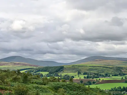
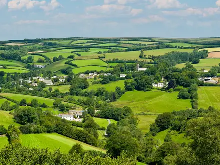
The GR213, officially the Fontenay–Vezelay route and recently re-coded GR213A, is an 84 km, 4–6 day, moderate point-to-point walk in northern Burgundy, France. Despite this page’s old “Wine Trail” label, it is a heritage and pilgrimage trail from the Abbaye de Fontenay near Montbard to Vezelay, not a Côte Chalonnaise wine route. Expect white-and-red GR waymarks, rolling Auxois and Avallonnais countryside, forest tracks, towpaths, quiet lanes and muddy paths after rain.
Route Overview
The promoted core walk runs from the Abbaye de Fontenay near Marmagne/Montbard to the hilltop Basilique Sainte-Marie-Madeleine at Vezelay. It is usually walked inn-to-inn towards Vezelay, passing Montbard, the Grande Forge de Buffon, the Canal de Bourgogne, Epoisses, Montreal, Avallon, the Cousin valley, Pontaubert, Vault-de-Lugny, Saint-Pere-sous-Vezelay and Asquins. The full numbered GR213/213A track starts further east at Chamesson, where it leaves the GR2, and joins the GR13 at Vault-de-Lugny; that longer end-to-end version is about 114 km. Rail access at Montbard, Avallon and Sermizelles-Vezelay helps with section walking. For canal-focused walking, compare the Burgundy Canal Towpath; for a true vineyard trail, see the Alsace Vineyard Trail.
A Burgundy pilgrimage and heritage route
The GR213 links two of Burgundy’s UNESCO World Heritage sites: the Abbaye de Fontenay, founded in 1118 and a model of Cistercian austerity, and the basilica at Vezelay, a major medieval pilgrimage centre associated with Mary Magdalene and the Via Lemovicensis route to Santiago de Compostela. Between them, the path stitches together monastic, military and industrial heritage, including Montreal, Avallon’s ramparts and Buffon’s forge. It is a route of culture and pilgrimage, not a wine trail.
Notable highlights
- Abbaye de Fontenay: A UNESCO-listed Cistercian abbey near Marmagne/Montbard, known for its austere Romanesque church, cloister, dormitory and forge. It is the conventional starting point of the core Fontenay–Vezelay walk.
- Basilique Sainte-Marie-Madeleine, Vezelay: The hilltop basilica is another UNESCO site and the route’s spiritual finish. It remains tied to medieval pilgrimage and the Vezelay Way to Santiago.
- Grande Forge de Buffon: An 18th-century ironworks near Montbard built by the naturalist Georges-Louis Leclerc, Comte de Buffon. It adds an unusual industrial-history stop early in the route.
- Epoisses and Montreal: Epoisses is known for its moated chateau and pungent washed-rind cheese, while nearby Montreal is a fortified medieval hilltop village with a notable collegiate church.
- Avallon and the Cousin valley: Avallon’s fortified old town sits above the wooded gorge of the river Cousin. The shaded valley gives one of the route’s most atmospheric forest sections.
- Canal de Bourgogne: Around Montbard, the GR213 uses stretches of the Burgundy Canal towpath, giving easier, flatter walking beside the waterway.
Challenges to expect
The difficulty is mainly distance and logistics, not technical terrain. Daily stages can be long, the Auxois countryside is rolling, and the cumulative ascent is around 1,200 m despite the low high point of 382 m. Forest and valley paths can be muddy in wet spring or autumn weather. Accommodation exists in towns such as Montbard, Epoisses, Avallon and Vezelay, but book and plan resupply ahead.
HikeList Score
GR213 (Wine Trail of Burgundy) scored 90/100 on HikeList's trail-quality metrics.
See score breakdownHide breakdown
- Ideal length 85
- Balanced challenge 100
- Scenery & wildness 98
- Varied terrain 83
- Accommodation 83
- Food & support 88
- Path quality 80
- Season flexibility 89
Computed from length, challenge, scenery & wildness, terrain variety, accommodation, food & support, path quality and season flexibility.
 France
Show more data Show less
- Forest
- River Valley
- Hills
- Dirt
- Gravel
- Paved
- Hotels
- Hostels
- Campsites
- Family Friendly
- Pet Friendly
- Restrooms
- Water Sources
- Campsites
- Picnic Areas
Download Our Full Guide to GR213 (Wine Trail of Burgundy) FREE!
Get our comprehensive guide to this hike for free. Save it for later reading or print out at home.
In these collections
Photos from hikers
Taken on the trail by people who've reviewed GR213 (Wine Trail of Burgundy).
GR213 (Wine Trail of Burgundy): The Complete Guide
 i
Image by Gilles Oster
i
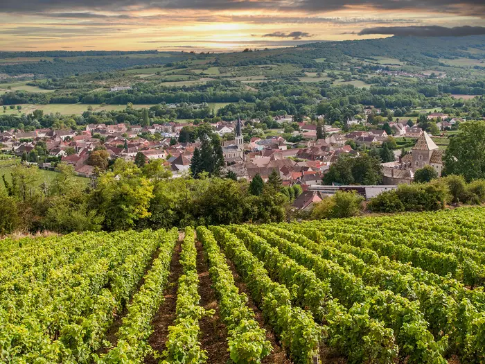
Image by Gilles Oster The GR213 Fontenay–Vézelay is a gentle but rewarding long-distance walk through northern Burgundy, linking the Abbaye de Fontenay near Montbard with the hilltop basilica of Vézelay. It is a heritage and pilgrimage route, not a vineyard tour, with Cistercian stone, medieval villages, canal towpath and quiet Auxois and Avallonnais countryside setting the tone.
The walking is varied rather than dramatic: pasture, farmland, forest tracks, the Canal de Bourgogne, the wooded vallée du Cousin near Avallon and the final climb through Saint-Père-sous-Vézelay or Asquins to Vézelay. Highlights come steadily, from the Grande Forge de Buffon and Époisses to Montréal, Avallon and Vault-de-Lugny.
This is one of Burgundy’s more practical multi-day walks for independent hikers. Montbard, Avallon and Sermizelles-Vézelay give useful rail access, and the 84 km promoted route can be walked comfortably in six stages or compressed by fitter walkers.
The route is moderate, not mountainous: the high point is only around 382 m, and there is no technical ground. What it asks for is sensible day planning, advance accommodation booking in the rural middle, enough food between villages, and readiness for muddy paths after wet weather.
This guide covers stages, days, accommodation, food, transport, terrain and common mistakes.
Stage-by-Stage Guide
The six-stage split below follows the promoted Fontenay–Vézelay itinerary. Distances are approximate and the route is waymarked with white-and-red GR balises, but the recent GR213A to GR213 re-coding in Côte-d'Or means walkers should also carry an up-to-date map or GPX and check current FFRandonnée information before travelling.
Services are uneven. Montbard, Époisses, Avallon and Vézelay are the main places to plan around; the smaller villages should not be treated as guaranteed resupply points unless accommodation or meals have been booked in advance.
Stage 1: Abbaye de Fontenay to Buffon, via Montbard — approx. 12 km
This opening stage links the monastic start at the Abbaye de Fontenay with Montbard and the Canal de Bourgogne before continuing to Buffon. It is a gentle introduction to the route: low gradients, a mix of small paths, quiet lanes and easier towpath walking rather than hard hill country.
The major landmark at the start is the UNESCO-listed Abbaye de Fontenay, a 12th-century Cistercian complex with church, cloister, dormitory and forge. Opening times and ticketing should be checked before travelling, especially if planning to visit before starting the walk.
Montbard is the key practical point of the day. The town has the TGV station for access to the start area, and the abbey lies roughly 5–6 km from the station. The route also passes close to Buffon-related sights in Montbard, including Parc Buffon and the Musée Buffon, as it uses stretches of the Burgundy Canal towpath.
The towpath section is the easiest walking of the day: flat, straightforward and useful for settling into the rhythm of the trail. Away from the canal, expect normal rural Burgundy surfaces — dirt and gravel paths, paved lanes and occasional muddy patches after rain.
Food and water should be planned around Montbard, which is the most reliable service point on this stage. Buffon has accommodation options noted on the route, but evening meals, shops and opening days should be arranged or checked in advance rather than assumed.
At Buffon, the Grande Forge de Buffon is the headline landmark: an 18th-century ironworks founded by Georges-Louis Leclerc, Comte de Buffon. It makes this stage feel more industrial-heritage than pastoral, with the canal, forge and Montbard's Buffon connections giving useful structure to a short walking day.
Public transport is strongest at Montbard. For Buffon and the smaller settlements, local buses and taxis may fill gaps, but current times and availability should be checked before travelling.
Navigation is generally uncomplicated, but take care leaving the abbey area and threading through Montbard, where urban paths, roads and the canal corridor can make waymarks easier to miss. The route is not technical, but wet weather can leave rural paths and canal-side edges slippery or soft.
Stage 2: Buffon to Moutiers-Saint-Jean, via Quincy-le-Vicomte — approx. 13 km
Stage 2 leaves the easier canal-side feel behind and moves into the rolling Auxois countryside. The walking is still moderate rather than strenuous, with quiet lanes, farm tracks and lowland paths through open rural country.
Quincy-le-Vicomte is the main named place between Buffon and Moutiers-Saint-Jean. This is not a stage to depend on frequent services: carry enough food and water for the full day unless a stop has been checked in advance.
The terrain is typical of the middle of the route — farmland, pasture and small rural tracks. After spring or autumn rain, the softer paths can be muddy, especially where farm access routes and shaded sections hold water.
Moutiers-Saint-Jean is the end-point and one of the route's intermediate villages with accommodation possibilities. Because supply is thinner in this rural middle section, beds and meals should be booked ahead rather than left to arrival.
Road access exists through the villages, but this is not a rail-served stage. Local buses and taxis are the practical fall-back if ending or joining here; current services should be checked before travelling.
Navigation is mainly about staying alert at lane junctions and field-track turns. The countryside is gentle and low, but the route can feel quieter and more remote than the short distances suggest, so a map or GPX is sensible even on a waymarked GR.
Stage 3: Moutiers-Saint-Jean to Époisses, via Corsaint — approx. 10 km
This is the shortest of the standard six stages and gives a useful easier day in the middle of the walk. It continues through rolling rural Burgundy, passing Corsaint before reaching Époisses.
The walking remains non-technical, with a familiar mix of dirt paths, gravel tracks and quiet country lanes. Gradients are modest, but the cumulative ups and downs across the route begin to add up over consecutive days.
Corsaint is the main village named on the stage. As with the previous day, do not rely on unplanned food or drink stops in the smaller settlements; carry lunch and enough water from Moutiers-Saint-Jean unless arrangements have been made.
Époisses is a more significant overnight stop and one of the best-known villages on the route. It is associated with its moated Renaissance château and with Époisses AOP cheese, making it a natural place to slow down if accommodation is available.
Accommodation is available in Époisses, but it should still be booked ahead. Rural Burgundy villages can have limited rooms, seasonal opening patterns and restaurant closing days, so confirm evening meal arrangements when booking.
There is road access at both ends, with local buses and taxis the likely options for joining or leaving this section. This should be checked before travelling.
Navigation is straightforward in principle, but muddy paths after rain are the main practical nuisance. The shorter distance makes this a good buffer stage if the previous or following day needs extra time for transport, sightseeing or accommodation logistics.
Stage 4: Époisses to Montréal, via Toutry and Guillon — approx. 14 km
Stage 4 is a longer rural day across the Auxois and towards the Avallonnais, passing Toutry and Guillon before finishing at the fortified hilltop village of Montréal. The walking is still moderate, but the day has more of a point-to-point feel than the shorter Époisses stage.
Expect a mixture of small paths, farm tracks and quiet lanes through rolling countryside. The route contours low hills in this part of Burgundy rather than tackling steep mountain ground, but the approach to Montréal brings a clear change in setting as the village sits above the Serein valley.
Toutry and Guillon break up the day, but they should not be treated as guaranteed resupply stops without checking current services. Start with enough food and water for the whole stage unless a café, shop or meal has been confirmed.
Montréal is one of the major highlights of the route. The village is classed among Les Plus Beaux Villages de France and has a medieval hilltop setting, a 12th-century collegiate church and carved choir stalls.
Accommodation is available in Montréal, but capacity is limited compared with larger towns. Booking ahead is particularly important here because the next day continues through smaller settlements before Avallon.
There is road access through Toutry, Guillon and Montréal, but no major railhead on the stage. Local bus and taxi options should be checked before being built into a plan.
Navigation attention is needed at rural junctions and on the approach to Montréal, where paths and lanes can converge around the hilltop village. After wet weather, farm tracks and shaded paths can be sticky underfoot, so waterproof footwear is useful outside dry summer conditions.
Stage 5: Montréal to Avallon, via Sauvigny-le-Bois — approx. 13 km
This stage moves from the hilltop village of Montréal towards Avallon, passing Sauvigny-le-Bois and gradually entering the Avallonnais landscape. It is a moderate walking day with a practical advantage at the end: Avallon is one of the best service and transport points on the whole route.
The terrain remains varied but gentle, with rolling countryside, quiet lanes, tracks and some woodland influence as the route nears Avallon. The wooded ridges of the Avallonnais and the approach to the Cousin valley give this part of the walk a different character from the more open Auxois stages.
Sauvigny-le-Bois is the named intermediate point. Do not assume food or water will be available there without checking; Montréal and Avallon are the sensible places around which to plan supplies.
Avallon is a major route highlight. Its old town sits above the wooded gorge of the river Cousin, with ramparts and a strong sense of arrival after several quieter rural days.
For accommodation, Avallon offers more choice than the smaller villages and is a good place to reset, resupply and organise transport if walking the GR213 in sections. It is also served by TER regional trains, making it one of the most useful break points on the route.
Public transport planning is much easier here than in the rural middle. Avallon station gives rail access, while local buses and taxis can cover nearby gaps; current SNCF/TER and local timetables should still be checked before travelling.
Navigation can become slightly busier on the approach to Avallon, where rural paths, roads and the edge of town meet. Keep following the GR balises carefully and do not rely only on the visual pull of the town, as the route may use a specific line to enter or skirt the Cousin valley.
Stage 6: Avallon to Vézelay, via Pontaubert, Vault-de-Lugny and Saint-Père-sous-Vézelay — approx. 15 km
The final stage is the longest of the standard itinerary and the most significant in pilgrimage terms, linking Avallon with Vézelay. It is still not technical, but it deserves an early start if planning time for the churches, the final climb and onward transport.
The first part of the day uses the Avallon and vallée du Cousin landscape, one of the most atmospheric sections of the route. Expect shaded riverside and valley walking near the Cousin, with forest and valley paths that can be muddy after rain.
Pontaubert and Vault-de-Lugny are the key places before the final approach to Vézelay. Vault-de-Lugny is especially notable for the 15th-century Église Saint-Germain-d'Auxerre and its large Renaissance Passion fresco running around the nave.
From the Vault-de-Lugny area, the route joins the line that carries walkers towards Vézelay. The full numbered GR213A formally ends at Vault-de-Lugny, where it joins the GR13 for the last kilometres, so waymarks and route labelling may change here.
The final approach usually runs through Saint-Père-sous-Vézelay and may use Asquins on the classic pilgrim line before the climb to Vézelay. Some descriptions also include Domecy-sur-le-Vault as a nearby variant waypoint, so check the intended track before setting out from Avallon.
Saint-Père-sous-Vézelay sits below the Vézelay hill and has the 13th-century Gothic church of Notre-Dame. From here the route has its final climb to the hilltop Basilique Sainte-Marie-Madeleine, the UNESCO-listed finish and the historic starting point of the Vézelay Way to Santiago de Compostela.
Food and water are best secured in Avallon before setting off, with Vézelay the main end-of-day service base. Any intermediate café, shop or meal stop should be checked before relying on it, particularly outside peak season or on weekly closing days.
Accommodation is available at or near Vézelay, with further options in the wider area including Saint-Père-sous-Vézelay. Book ahead: Vézelay is a major heritage and pilgrimage destination and availability can tighten during busy periods.
Transport at the end requires planning. Avallon has TER rail access at the start of the stage, and Sermizelles-Vézelay is the relevant railhead for the Vézelay area; local buses or taxis may be needed between the station and the hilltop village. Current SNCF/TER times and local links should be checked before travelling.
The main warnings on this stage are practical rather than hazardous: mud in the Cousin valley, possible confusion where GR213A/GR213 and GR13 labelling meet, and the final uphill finish to Vézelay when tired. There is no exposed mountain terrain, but the day is long enough that slow sightseeing and late starts can make the finish feel harder than the profile suggests.
Recommended Itinerary
The most practical default plan is the six-day Fontenay–Vézelay split. It keeps daily distances modest, leaves time for the abbey, châteaux, villages and Vézelay finish, and avoids forcing long days through the thinner-serviced rural middle.
Distances below are approximate and rounded from the standard stage breakdown. Accommodation should be booked ahead, especially between Buffon, Moutiers-Saint-Jean, Époisses and Montréal, where options are more limited than in Montbard, Avallon and Vézelay.
Standard itinerary: 6 days
| Day | From | To | Approx. distance | Why this stage makes sense | Services/accommodation notes |
|---|---|---|---|---|---|
| 1 | Abbaye de Fontenay | Buffon, via Montbard | 12 km | A short opening day that allows time to visit Abbaye de Fontenay before walking on towards Montbard and the Canal de Bourgogne section. It also gives an easy first stage if arriving by train at Montbard, which is about 5–6 km from the abbey. | Montbard is the main practical hub at the start, with TGV access and better services than the surrounding villages. Buffon has some accommodation options, but availability should be checked before committing to the stage. |
| 2 | Buffon | Moutiers-Saint-Jean, via Quincy-le-Vicomte | 13 km | Another manageable day through the Auxois countryside, keeping the walk unhurried and avoiding an overly long push into the rural middle. | Moutiers-Saint-Jean has some accommodation, but supply is limited compared with larger towns. Book ahead and do not assume last-minute availability. |
| 3 | Moutiers-Saint-Jean | Époisses, via Corsaint | 10 km | The shortest stage, useful after two travel-and-settling-in days and a good fit for walkers who want time in Époisses rather than simply passing through. | Époisses is one of the better overnight stops on the route, with village services and accommodation, but it is still worth booking in advance in walking season. |
| 4 | Époisses | Montréal, via Toutry and Guillon | 14 km | A steady central stage linking two of the route’s key historic villages without creating a high-mileage day. The terrain remains rolling rather than mountainous, but wet tracks can make progress slower. | Montréal has some accommodation, but it is a small hilltop village rather than a large service centre. Confirm evening meals and breakfast arrangements when booking. |
| 5 | Montréal | Avallon, via Sauvigny-le-Bois | 13 km | A sensible approach into Avallon, with enough time to descend towards the vallée du Cousin and enjoy the old town rather than arriving late. | Avallon is one of the best resupply and accommodation points on the route and has TER rail access, making it a useful place to start, finish or pause a section hike. |
| 6 | Avallon | Vézelay, via Pontaubert, Vault-de-Lugny and Saint-Père-sous-Vézelay | 15 km | The final day is the longest in the standard split but remains moderate. It saves enough distance for a satisfying last stage, including the approach to Saint-Père-sous-Vézelay and the final climb to the basilica at Vézelay. | Vézelay has accommodation and visitor services, but it is a popular destination, so book ahead. Some final-approach descriptions also include Domecy-sur-le-Vault or Asquins as variant waypoints; check official mapping before booking accommodation tightly around this section. |
Slower variant: 7 days or more
A slower schedule suits walkers who want time for Abbaye de Fontenay, Montbard, Époisses, Montréal, Avallon and Vézelay, or anyone relying on chambres d’hôtes with fixed meal times and limited check-in windows. The standard stages are already short, so a slower version usually means adding an extra night at a key place rather than splitting every day into smaller walking stages.
Good places to add time are Montbard or Buffon near the start, Époisses in the middle, Avallon before the final stage, and Vézelay at the finish. Exact short-stage splits depend on available accommodation in the smaller villages; check official mapping before booking.
Faster variant: 4–5 days
A five-day itinerary is the most realistic faster option for fit walkers. The cleanest way to reduce the schedule is to combine two of the shorter middle stages, for example walking Buffon to Époisses via Moutiers-Saint-Jean in one longer day of roughly 23 km based on the standard stage distances.
A four-day itinerary is possible for strong walkers carrying light packs, but it becomes more dependent on accommodation availability and careful resupply. Typical compressed plans involve combining adjacent official stages, such as Abbaye de Fontenay to Moutiers-Saint-Jean, Moutiers-Saint-Jean to Montréal, Époisses to Avallon, or Avallon to Vézelay, but exact distances and overnight options should be checked against official mapping before booking.
The faster variants are best suited to walkers comfortable with back-to-back 20 km-plus days on rolling rural paths, forest tracks and quiet lanes. They are less forgiving after rain, when muddy sections can make the low mileage feel slower than expected.
Planning the Route
How many days to allow
Most walkers should plan the promoted Fontenay–Vézelay walk over six days. The official-style stage pattern keeps the days short enough to visit places such as the Abbaye de Fontenay, Grande Forge de Buffon, Époisses, Montréal, Avallon and Vézelay without turning the route into a march between beds.
A four- or five-day itinerary is realistic for fit walkers, as the standard stages are relatively short and the terrain is not technical. The trade-off is less time for the heritage stops and a greater need to secure accommodation in the right places, because the rural middle of the route has thinner services.
The route rewards a slower plan. It is a heritage and pilgrimage walk across rolling Burgundy countryside, not a high-level mountain traverse where speed is usually dictated by weather windows or pass crossings.
Stage planning and overnight stops
Daily stages are strongly shaped by the villages and towns where accommodation is available. Montbard, Époisses, Avallon and Vézelay have the broadest service base, while smaller places such as Buffon, Moutiers-Saint-Jean and Montréal require more careful booking.
A practical six-day plan follows the natural overnight sequence below:
| Stage | Usual overnight target | Planning notes |
|---|---|---|
| Abbaye de Fontenay to Buffon, via Montbard | Buffon | Montbard is the main railhead near the start and a useful place for pre-walk supplies. |
| Buffon to Moutiers-Saint-Jean, via Quincy-le-Vicomte | Moutiers-Saint-Jean | Rural stage; do not assume frequent shops or cafés en route. |
| Moutiers-Saint-Jean to Époisses, via Corsaint | Époisses | Short enough to allow time in Époisses, but accommodation should still be booked ahead. |
| Époisses to Montréal, via Toutry and Guillon | Montréal | A key middle-stage overnight; check availability before fixing travel dates. |
| Montréal to Avallon, via Sauvigny-le-Bois | Avallon | Avallon is one of the best places on the route for services and rail access. |
| Avallon to Vézelay, via Pontaubert, Vault-de-Lugny and Saint-Père-sous-Vézelay | Vézelay | Leave time for the final climb and for visiting the basilica. Some variants pass Asquins near the finish. |
For a five-day walk, one pair of neighbouring short stages can usually be combined by stronger walkers. For a four-day walk, expect longer days and less flexibility if a booked chambre d’hôtes or gîte is full in the right village.
Shortening, extending and section hiking
This is one of the easier rural French GR routes to break into sections because it has useful railheads. Montbard has TGV access near the start, while Avallon and Sermizelles-Vézelay are served by TER regional trains.
That makes several approaches practical: walk from Fontenay to Avallon, walk Avallon to Vézelay as a shorter final section, or use Avallon as a mid-route exit if weather, time or accommodation plans change. Local buses and taxis cover some of the gaps between railheads and smaller villages, but current SNCF, TER, bus and taxi arrangements should be checked before travelling.
The conventional promoted walk starts at the Abbaye de Fontenay, around 5–6 km from Montbard station. If arriving by train, plan that transfer carefully rather than assuming an immediate onward connection.
The promoted Fontenay–Vézelay route is shorter than the full numbered GR213A/GR213 line. Walkers wanting the full numbered track should plan separately for the Chamesson to Vault-de-Lugny alignment and the GR links at either end, rather than relying only on the six-day Fontenay–Vézelay stage pattern.
Accommodation, food and water
Accommodation is the main planning constraint. The route has hotels, chambres d’hôtes, gîtes d’étape and a few campsites, but they are unevenly spread, with thinner supply through the rural middle.
Book the overnight sequence before committing to train tickets, especially in smaller places such as Buffon, Moutiers-Saint-Jean and Montréal. In busier periods, it may be easier to adjust the walking days around available beds than to find a bed that exactly fits a preferred mileage plan.
Food planning matters more than the modest terrain suggests. Montbard, Époisses, Avallon and Vézelay are the most reliable places to think about supplies, but between them the route passes smaller villages where opening days and hours can be limited. Carry lunch, snacks and enough water for the day unless a specific shop or café has been checked in advance.
Navigation and waymarking
The route is a waymarked GR, using the standard white-and-red balises. In Côte-d’Or, the former GR213A has been re-coded as GR213 “Fontenay–Vézelay”, while some mapping and online tracks may still use GR213A.
Carry a current map or GPX as well as following the paint marks. This is particularly useful where naming differs between GR213 and GR213A, and on the final approach where descriptions may vary around Vault-de-Lugny, Domecy-sur-le-Vault, Saint-Père-sous-Vézelay and Asquins before Vézelay.
Waymarking changes, forestry work or local diversions can affect any GR. Check current FFRandonnée or local trail information before setting out.
Weather and underfoot conditions
The route is best planned for spring, summer or autumn. It is low, rolling country rather than mountain terrain, but forest paths, valley sections and farm tracks can be muddy after rain, especially in spring and autumn.
Footwear with good grip is more useful than heavy mountain gear. In summer, plan for exposed farmland sections as well as shaded woodland and valley walking; carry enough water between villages rather than relying on frequent fountains or services.
Permits and site opening times
The walk itself does not require complex permit-style planning, but key monuments at the start and finish operate to their own visiting arrangements. Check opening hours and any ticketing for the Abbaye de Fontenay and the Basilique Sainte-Marie-Madeleine before building the first and last days around a visit.
If the abbey visit is important, avoid treating day one as only a transfer-and-walk day. Likewise, leave enough time on arrival in Vézelay for the basilica rather than reaching the hilltop late with onward transport still to arrange.
Towns, Villages and Overnight Stops
Accommodation is workable on the GR213, but it is not a route for turning up late and hoping every village has rooms, food and an open shop. The safest overnight pattern is to use the established stops at Buffon, Moutiers-Saint-Jean, Époisses, Montréal, Avallon and Vézelay, with Montbard as the practical access town at the start.
In the rural middle, book ahead and ask accommodation providers about evening meals, breakfast and packed lunches. Opening days for cafés, restaurants and small shops can be limited outside the larger towns, especially outside the main holiday period. This should be checked before travelling.
Abbaye de Fontenay / Marmagne
The Abbaye de Fontenay is the conventional start of the promoted Fontenay–Vézelay walk, just outside Marmagne and about 5–6 km from Montbard. It is best treated as a start-point and major visit rather than as the main logistics base.
Do not rely on the abbey area for full resupply before setting off. Most walkers will be better placed sleeping in or near Montbard, travelling out to the abbey, visiting if time allows, then beginning the first stage towards Montbard and Buffon.
Check abbey opening hours and ticketing before building the first day around a visit. This should be checked before travelling.
Montbard
Montbard is the key start-area town for the route. The GR passes through or close to the town after leaving Fontenay, using stretches around the Canal de Bourgogne, and Montbard has the most useful early logistics on the walk.
It is a good place to stay before day one, particularly if arriving by train. Montbard has a TGV station on the Paris–Dijon line, making it the easiest railhead for the Fontenay start.
Accommodation is available in town, with the broader mix on this route including hotels, chambres d'hôtes, gîtes d'étape and some campsites in the main towns. Montbard is also one of the sensible places to sort food before entering the thinner rural section towards Buffon, Quincy-le-Vicomte and Moutiers-Saint-Jean.
The Musée Buffon and Parc Buffon are worthwhile if time allows, but the practical value of Montbard is transport, beds and supplies. If starting directly from the abbey, allow for the extra positioning distance from the station to Fontenay.
Grande Forge de Buffon / Buffon
Buffon is the usual first overnight stop on the six-stage itinerary from the Abbaye de Fontenay. It sits after Montbard and the canal-side section, making it a manageable first day if starting at Fontenay.
There is accommodation in or around Buffon, but supply is limited compared with Montbard or Avallon. Book ahead and check whether dinner is available locally or through the accommodation.
The Grande Forge de Buffon is the main reason to pause here: an 18th-century ironworks associated with Georges-Louis Leclerc, Comte de Buffon. For hikers, Buffon is also the first point where the route feels more rural, so the next day’s food and water should be planned before leaving.
Quincy-le-Vicomte
Quincy-le-Vicomte is a waypoint between Buffon and Moutiers-Saint-Jean. It is useful for pacing the day, but it should not be assumed to offer reliable overnight options or full services.
If using it for a shorter section or a non-standard itinerary, accommodation and transport must be arranged in advance. This should be checked before travelling.
Moutiers-Saint-Jean
Moutiers-Saint-Jean is the standard overnight stop after Buffon on the official six-day split. It is one of the intermediate villages where accommodation may be available, but it is not a large service centre.
Book before arrival and check food arrangements carefully. A chambre d'hôtes or gîte may be the practical option, and evening meals may need to be arranged when booking rather than assumed on the day.
This is a useful place to break the rural Auxois section before the shorter stage towards Époisses. If walking faster stages, it can also be paired differently with Buffon or Époisses, but only if accommodation and meals line up.
Corsaint
Corsaint lies between Moutiers-Saint-Jean and Époisses. It is mainly a route village rather than a core overnight base.
Do not plan on Corsaint for resupply unless a specific shop, café or host has been checked in advance. For most walkers it is a passing point on the way to Époisses.
Époisses
Époisses is one of the most important overnight stops on the route and a natural place to pause after the rural stretch from Moutiers-Saint-Jean. It is a named accommodation centre on the GR213, with options in the wider mix of hotels, chambres d'hôtes, gîtes d'étape and some camping provision on the route.
The village is known for its moated Renaissance château and for Époisses AOP cheese, so it is one of the better places to build in time for local food rather than treating it as a simple bed stop. Restaurant and shop opening times should still be checked, particularly outside peak season or on quieter weekdays.
There is no railhead specified here for the route, so onward or emergency transport usually means local bus or taxi arrangements. Current local transport times should be checked before relying on them.
Toutry
Toutry is on the Époisses to Montréal stage, before Guillon. It is a useful intermediate point, but not one of the main overnight anchors in the standard itinerary.
Treat services as uncertain unless checked directly. If planning a shorter day ending here, book accommodation first and then arrange meals and any onward transport around that booking.
Guillon
Guillon sits between Toutry and Montréal on the official line towards the Serein valley area. It can help break up the day from Époisses, especially for walkers taking a slower itinerary.
It should not be assumed to have the accommodation range of Époisses, Avallon or Vézelay. If Guillon is used as an overnight or section end, confirm the bed, meal options and any taxi or bus connection in advance.
Montréal
Montréal is a strong overnight stop and one of the most rewarding villages on the GR213. It is the standard stop between Époisses and Avallon and is classed among Les Plus Beaux Villages de France.
Accommodation is available in some intermediate villages on the route, including Montréal, but capacity is limited. Booking ahead is important, particularly because the village’s appeal can make rooms more sought-after in season.
The fortified hilltop setting and 12th-century collegiate church make Montréal worth more than a late arrival and early departure. Practical services may still be limited, so confirm dinner, breakfast and packed-lunch options with the accommodation.
Sauvigny-le-Bois
Sauvigny-le-Bois lies between Montréal and Avallon. It is close enough to Avallon that most walkers continue to the town rather than using it as a principal overnight stop.
It may be useful for route pacing or for an arranged pick-up, but do not rely on it for full hiker services without checking. Avallon is the more practical target for accommodation, food and rail.
Avallon
Avallon is the main service town in the second half of the route. It is a standard overnight stop before the final stage to Vézelay and one of the best places on the walk for accommodation, food and transport.
The town has TER regional rail service, making it valuable for section-hikers, late starts, early finishes or rest-day logistics. Current SNCF/TER times should be checked before booking a section around Avallon.
Accommodation options are broader here than in the rural villages, with the route’s usual mix including hotels, chambres d'hôtes, gîtes d'étape and some camping provision in the larger towns. Avallon is also the sensible place to reset supplies before the final walk through Pontaubert, Vault-de-Lugny and Saint-Père-sous-Vézelay.
The old town above the vallée du Cousin is a major highlight, and the shaded Cousin valley section is one of the more atmospheric parts of the route. If walking a compressed four- or five-day itinerary, Avallon is still the place to avoid skimping on logistics.
Pontaubert
Pontaubert is the first main village after Avallon on the final stage towards Vézelay. It is useful as a pacing point after leaving the town and heading into the final approach.
It is not listed as one of the main accommodation bases for this itinerary, so do not plan around it for an overnight unless a specific booking has been made. Food and transport availability should also be checked before travelling.
Vault-de-Lugny
Vault-de-Lugny is important because the full numbered GR213A formally ends here, where it joins the GR13 for the last few kilometres towards Vézelay. On the promoted Fontenay–Vézelay walk, it is part of the final approach rather than the emotional finish.
The village is worth time for the Église Saint-Germain-d'Auxerre, which holds a major Renaissance Passion fresco around the nave. For logistics, however, it should be treated as a waypoint unless accommodation has been booked in advance.
If ending a section here, arrange onward transport before committing to the plan. This should be checked before travelling.
Domecy-sur-le-Vault
Domecy-sur-le-Vault appears on some final-approach variants between Vault-de-Lugny and the Vézelay area. It should be treated as a variant waypoint rather than a guaranteed overnight stop.
Because the exact final village order can vary by variant, check the current route line and waymarking before relying on Domecy-sur-le-Vault for navigation or logistics. This should be checked before travelling.
Saint-Père-sous-Vézelay
Saint-Père-sous-Vézelay sits at the foot of the Vézelay hill and is one of the last significant villages before the finish. It is a useful place to pause before the final climb to the basilica.
The village has the 13th-century Gothic church of Notre-Dame and good views towards the Vézelay hill. It is close enough to the finish that many walkers continue straight on, but it can also work as a practical holding point if meeting transport or allowing time for the final ascent.
Do not assume accommodation or meal availability without checking. Vézelay itself is the stronger overnight target at the end of the route.
Asquins
Asquins lies on the classic pilgrim/GR approach just before the final climb to Vézelay, though the exact final approach can vary by route variant. It is best understood as part of the last kilometres rather than as a main overnight base.
Check current waymarking and maps where the final approach divides between Saint-Père-sous-Vézelay, Asquins and Vézelay. This should be checked before travelling.
Vézelay
Vézelay is the natural final overnight stop and the strongest place to finish the walk properly rather than rush straight away. The route ends at the hilltop Basilique Sainte-Marie-Madeleine, a UNESCO World Heritage site and a historic pilgrimage church.
Accommodation is available in Vézelay as one of the main towns on the itinerary, but it should still be booked ahead in busy periods. The village is a major visitor and pilgrimage destination, so availability can tighten around holidays, weekends and events.
For onward travel, the relevant rail access is via Sermizelles-Vézelay, which is served by TER regional trains rather than being at the basilica itself. Local buses and taxis cover gaps between railheads and smaller villages, but current SNCF/TER, bus and taxi arrangements should be checked before relying on them.
If time allows, it is worth staying overnight rather than treating the basilica as a quick finish-line photograph. The final climb from Saint-Père-sous-Vézelay or Asquins is part of the route’s pilgrimage character, and arriving with accommodation already secured makes the end much easier.
Getting to the Start
The practical access point for the promoted GR213 Fontenay–Vézelay walk is Abbaye de Fontenay, near Marmagne, about 5–6 km from Montbard. Montbard is the key transport hub for the start: it has a TGV station on the Paris–Dijon line, making this a relatively straightforward rural French trail to reach by public transport.
By train
Travel by train to Montbard. From there, the abbey is close enough for a short taxi transfer, but far enough that most walkers will not want to treat the station-to-abbey link as incidental if starting a multi-day hike with luggage.
Montbard is on the Paris–Dijon rail corridor, so access from major cities is usually via those rail hubs. Current SNCF and TER times should be checked before travelling, especially if planning to arrive and start walking on the same day.
A common arrangement is:
| Step | Practical plan |
|---|---|
| 1 | Take the train to Montbard |
| 2 | Transfer by taxi or local transport to Abbaye de Fontenay |
| 3 | Start the GR213 from the abbey, then walk back via Montbard towards Buffon on the first stage |
Do not confuse the promoted start at Abbaye de Fontenay with the formal longer GR213A line, which begins further east at Chamesson. Most walkers following the Fontenay–Vézelay itinerary start at the abbey.
By bus
Local buses may help with some links around Montbard and the surrounding villages, but services in rural Burgundy are limited and may not line up neatly with a walking itinerary. This should be checked before travelling.
For the final approach to Abbaye de Fontenay, a taxi from Montbard station is usually the simplest option. Book ahead if arriving early, late, on a Sunday or outside the main visitor season.
By car
Driving to the start is possible, but the route is point-to-point and finishes at Vézelay, so leaving a car at Fontenay creates an end-of-walk return problem. Public transport is generally more convenient for this trail than for many rural long-distance walks, because Montbard, Avallon and Sermizelles-Vézelay give useful rail access along or near the route.
Do not assume that Abbaye de Fontenay is suitable for multi-day hiker parking. Parking rules, visitor parking arrangements and any long-stay options should be checked directly before travelling.
If travelling by car, a more practical approach may be to stay in Montbard before the walk, arrange local parking through accommodation if available, and use a taxi or transfer to reach the abbey start. This should be arranged in advance.
From the nearest airport
There is no trailhead airport. For overseas walkers, the simplest plan is usually to fly into a major French gateway, continue by rail to Montbard via the national rail network, then transfer the short distance to Abbaye de Fontenay.
Because airport-to-rail connections, TGV timings and regional services vary by day and season, this should be checked before travelling. Build in extra time if arriving from an international flight and do not rely on a tight same-day connection to the abbey.
Where to stay before starting
Montbard is the most practical pre-start base. It has the rail station, sits close to the abbey, and is on the first walking stage between Abbaye de Fontenay and Buffon.
Staying in Montbard allows a simple morning taxi or transfer to Abbaye de Fontenay, after which the route returns through or near Montbard before continuing towards the Canal de Bourgogne and Buffon. This avoids trying to reach the rural abbey directly after a long rail journey.
Accommodation can be thinner once the route leaves the larger towns, so it is sensible to book the first night on trail as well as the pre-start night before committing to train tickets.
Getting Home from the Finish
By train
Vézelay does not sit on the main rail line, so the practical exit is to reach a nearby TER station after finishing at the Basilique Sainte-Marie-Madeleine. The two useful railheads for this route are Sermizelles-Vézelay and Avallon, both served by TER regional trains.
For most walkers, the simplest plan is to pre-arrange transport from Vézelay down to Sermizelles-Vézelay or back to Avallon, then continue by SNCF/TER. If returning towards the start, build the journey around Montbard, which has a TGV station on the Paris–Dijon line and lies close to the Abbaye de Fontenay end of the walk.
Rural TER services can be limited, especially outside commuting hours, on Sundays and on public holidays. Check current SNCF times before committing to a same-day onward train, and allow a buffer after the final climb into Vézelay.
By bus
Local bus links may cover some of the gap between Vézelay and nearby railheads, but services in this part of rural Burgundy are not something to rely on casually at the end of a long walking day. Timetables can be sparse and may vary by school term, weekday, season and public holiday.
If using a bus, check the current local timetable before booking accommodation or onward trains. For late finishes, Sunday departures or tight connections, a taxi or overnight stay in Vézelay is usually the safer plan.
By car/taxi
A taxi is the most flexible way to leave Vézelay, especially if finishing late, travelling with tired legs, or needing to connect with a specific train from Sermizelles-Vézelay or Avallon. Book ahead rather than assuming a vehicle will be waiting in the village.
If a support driver is collecting you, agree a clear pick-up point in Vézelay rather than trying to meet on the narrow upper streets around the basilica at a busy time. If you left a car at the start near Montbard or Abbaye de Fontenay, plan the rail or taxi transfer back in advance; the route is point-to-point and the rural middle is not suited to improvised transport.
From the nearest airport
There is no airport-style finish logistics at Vézelay itself. If flying home, plan the journey first by local transfer to Sermizelles-Vézelay or Avallon, then by TER/SNCF towards the wider French rail network.
The best airport will depend on current rail connections, flight times and whether you are routing via Paris, Dijon or another hub. This should be checked before travelling, and early flights are best paired with an overnight stay closer to the departure airport rather than attempting to leave Vézelay at dawn.
Where to stay at the finish
Vézelay is one of the best places on the route to stop overnight, with hotels, chambres d’hôtes and gîte-style accommodation in and around the village. Staying at the finish also gives time to visit the basilica without rushing straight into onward transport.
An overnight stay is strongly recommended if you expect to arrive late in the day, if walking the final stage from Avallon at a relaxed pace, or if onward train and bus times do not line up cleanly. Book ahead in the main walking season and around weekends, as Vézelay is both a pilgrimage destination and a major heritage village.
Which Direction Should You Walk?
Standard direction: Abbaye de Fontenay to Vézelay
The natural and most commonly promoted direction is from the Abbaye de Fontenay near Montbard to Vézelay. This follows the official six-stage flow: Fontenay/Montbard, Buffon, Moutiers-Saint-Jean, Époisses, Montréal, Avallon and finally Vézelay.
This direction also gives the route its strongest narrative. The walk begins at a major Cistercian abbey, passes through the Canal de Bourgogne landscape, the villages of the Auxois and Avallonnais, then builds towards Avallon, the vallée du Cousin and the final climb to the Basilique Sainte-Marie-Madeleine on the hill at Vézelay.
For most walkers, this is the better psychological finish. Arriving on foot at Vézelay, after Saint-Père-sous-Vézelay or Asquins, makes much more sense than leaving it behind on the first morning.
Transport and logistics
Starting at Fontenay is straightforward if travelling by rail: Montbard has a TGV station on the Paris–Dijon line, and the abbey is about 5–6 km away. That final link can be handled on foot, by taxi or by local transport where available. Current SNCF, bus and taxi details should be checked before travelling.
Finishing at Vézelay is slightly less direct, because the hilltop village itself is not the main railhead. Avallon and Sermizelles-Vézelay are served by TER regional trains, with local buses or taxis covering the remaining links. This should be checked before travelling, especially outside peak holiday periods or on Sundays.
In reverse, the awkward transfer comes at the beginning rather than the end: you need to reach Vézelay first, then finish at the Abbaye de Fontenay and get back to Montbard. That can work well if onward travel from Montbard by TGV is important, but it is less aligned with the standard walking itinerary.
Accommodation flow
The standard Fontenay-to-Vézelay direction matches the usual stage pattern and the way most itineraries are described. That makes it easier to plan nights in Buffon, Moutiers-Saint-Jean, Époisses, Montréal, Avallon and Vézelay without constantly reversing distances and notes.
Accommodation is thinner in the rural middle of the route whichever way you walk. Direction does not solve that issue: book ahead, especially around the smaller villages, and do not assume a same-day room will be available.
Gradients and weather
There is no major climbing advantage either way. The route is low and rolling, with a high point of only around 382 m and about 1,200 m of total ascent across the walk. The challenge is cumulative distance, rural logistics and potentially muddy paths after wet weather, not steep mountain terrain.
Prevailing wind is not a decisive factor for this route. Much of the walking is through farmland, lanes, woodland, towpath and valley sections rather than exposed high ground, so direction should be chosen for logistics and the quality of the finish rather than weather strategy.
Recommendation
Walk the GR213 from the Abbaye de Fontenay to Vézelay unless there is a specific transport or accommodation reason to reverse it. This is the standard direction, fits the official stage flow, starts conveniently from Montbard’s rail access, and gives the route its best ending: the final approach and climb to the basilica at Vézelay.
Accommodation Along the Route
The GR213 works well as an inn-to-inn walk, but only if accommodation is arranged before setting off. The practical overnight pattern is the 6-stage split through Buffon, Moutiers-Saint-Jean, Époisses, Montréal, Avallon and Vézelay, with Montbard as the most useful base before the start at Abbaye de Fontenay.
Accommodation is mixed: hotels, chambres d'hôtes, gîtes d'étape and a few campsites appear in the main towns and some intermediate villages. Choice is strongest in Montbard, Époisses, Avallon and Vézelay; it becomes much thinner in the rural middle, especially around the shorter village stages.
Best overnight bases
| Place | Accommodation level | Best for | Notes |
|---|---|---|---|
| Abbaye de Fontenay / Marmagne | None to rely on | Trailhead visit and start | Treat the abbey as the start point, not the main accommodation base. Montbard is about 5–6 km away and is the practical place to stay before beginning. |
| Montbard | Good | Night before the walk; rail access | Strongest start-area base, with TGV access and the GR passing through on the first stage towards Buffon. Useful if arriving late or wanting to visit the Abbaye de Fontenay without rushing. |
| Buffon | Limited | End of stage 1 | A sensible first overnight on the standard 6-day itinerary, but do not assume walk-in availability. Book ahead. |
| Moutiers-Saint-Jean | Limited | End of stage 2 | One of the key small-village overnights in the rural middle of the route. Secure a bed before committing to this stage plan. |
| Époisses | Good | End of stage 3; village stop with better services | One of the stronger accommodation stops between Montbard and Avallon, and a useful place to reset food and timing. |
| Montréal | Limited | End of stage 4 | A classic overnight on the 6-day itinerary, but supply is not deep. Booking ahead is important, especially if walking at weekends or in the main spring-to-autumn season. |
| Avallon | Good | End of stage 5; rest or section break | One of the best-served towns on the route, with TER rail access and enough accommodation choice to make it a natural stop, rest point or section-hike endpoint. |
| Vézelay | Good | Finish night | The obvious final overnight after the climb to the basilica. It is a major heritage and pilgrimage village, so reserve early for weekends and holiday periods. |
| Quincy-le-Vicomte, Corsaint, Toutry, Guillon, Sauvigny-le-Bois, Pontaubert, Vault-de-Lugny, Domecy-sur-le-Vault, Saint-Père-sous-Vézelay and Asquins | None to rely on | Passing points, variants or emergency adjustments | Treat these as waypoints unless a current bed has been booked. If using one to alter the standard itinerary, this should be checked before travelling. |
Booking strategy
For the standard 6-day walk, book every night in advance, not just the larger towns. The weakest points in the accommodation chain are the smaller rural stops such as Buffon, Moutiers-Saint-Jean and Montréal, where one closed property or full gîte can break the itinerary.
If walking in 4–5 days, accommodation planning becomes more important rather than less. Longer days may let you aim for the stronger bases, but the distances between dependable stops become less forgiving, and taxi backup may be needed if a village bed is unavailable.
Vézelay and Avallon are the safest places to build flexibility into the itinerary. Both have rail access nearby or in town, making them useful for section hikers, rest days or an early finish if weather, mud or timing becomes awkward.
Campsites, gîtes and budget options
Camping is not the simplest way to walk the GR213. There are a few campsites in the towns, but they are not spaced like a continuous backpacking route, so a tent-based plan still needs careful stage-by-stage checking.
Gîtes d'étape and chambres d'hôtes are often more practical than camping for this route, especially in the rural middle. Opening periods, meal availability and check-in arrangements can vary, so confirm current details before booking.
Transfers and luggage
Do not assume a standing baggage-transfer network on this rural GR. Walkers wanting luggage moved should arrange it through a walking-holiday operator, accommodation provider or local taxi before committing to the itinerary.
Taxi transfers can also solve awkward gaps if a preferred village is full, and local buses may help between railheads and smaller villages. Current SNCF/TER, bus and taxi arrangements should be checked before travelling.
Camping and Wild Camping
Camping is possible on the GR213, but it needs more planning than on a mountain route with regular backpacker campsites. This is lowland Burgundy: the trail passes through farmland, pasture, forest, historic villages and small towns, with accommodation supply clustered around settlements rather than spread evenly along the path.
The most realistic camping strategy is to use established campsites in or near the larger stops and to book or check ahead. Do not rely on being able to turn up and find a legal pitch at the end of every stage, especially in the rural middle of the route.
Where to look for campsites
The briefest planning rule is simple: check camping availability around the main overnight places before fixing your stage plan. Campsites are most likely around the larger towns and visitor centres, with thinner options between them.
| Route area | Camping practicality |
|---|---|
| Montbard / Buffon | One of the more practical early-route areas to look for campsites, with Montbard the main service town near the start. |
| Moutiers-Saint-Jean | Possible intermediate camping area, but availability should be checked before committing to a stage. |
| Époisses | A logical mid-route stop where campsite options may exist, but opening dates and pitch availability need checking. |
| Montréal | Another useful intermediate area to investigate if spreading the route over 5–6 days. |
| Avallon | One of the best places on the route to plan a camping night, with more services than the surrounding villages. |
| Vézelay / Saint-Père-sous-Vézelay | A practical finish-area camping base, especially if staying overnight after the final climb to Vézelay. |
Many French campsites are seasonal. Spring and autumn walkers should check opening dates carefully, while summer walkers should book ahead where possible, particularly around Avallon and Vézelay.
Does the GR213 suit a camping itinerary?
The route can suit camping if the aim is a lightweight, low-cost walk with planned nights at formal sites. The modest gradients, short official stages and good rail access make it physically manageable with camping gear.
It is less suitable as a fully self-sufficient wild-camping trek. The GR213 crosses settled agricultural country, not remote upland, and much of the ground beside the path is private farmland, woodland, village edge or managed heritage landscape. A tent also adds weight on a route where daily distances and logistics, rather than altitude, are the main challenge.
For most walkers carrying camping gear, a 5–6 day schedule is more sensible than compressing the route into 4 days. Shorter stages give more flexibility to reach booked campsites and reduce the pressure to find an informal pitch late in the day.
Wild camping and bivouacking
Do not assume wild camping is permitted along the GR213. Rules in France depend on land ownership, local bylaws and protected or sensitive sites, and the route passes through private farmland, forest, villages and heritage areas. This should be checked before travelling.
In practical terms, wild camping is a poor fit for the most visible parts of this walk: around the Abbaye de Fontenay, the Canal de Bourgogne near Montbard, village approaches, Avallon, Saint-Père-sous-Vézelay and the final climb to Vézelay. These are not places to pitch discreetly, and the UNESCO and pilgrimage setting makes low-impact behaviour especially important.
If considering any form of bivouac, ask permission from the landowner or at the local mairie, arrive late, leave early, use no fire, and leave no trace. If permission is not clear, use a campsite, gîte or other formal accommodation instead.
Water and resupply for campers
Plan to take drinking water from towns, villages, accommodation, cafés or campsites rather than from natural sources. The Canal de Bourgogne, rivers and valley streams should not be treated as reliable drinking water without proper treatment, and access may not always be convenient from the path.
The rural middle of the route has thinner services, so carry enough water before leaving places such as Montbard, Époisses, Montréal and Avallon. In warm summer weather, do not rely on the next village having an open shop or bar.
Fires, stoves and low-impact camping
Open fires are inappropriate on this route unless a formal campsite explicitly permits them. Much of the walk crosses farmland, woodland edges and dry summer grass, where fire risk and landowner concerns matter.
Use a camping stove only where permitted and keep it stable, contained and away from dry vegetation. Dispose of waste in towns or campsites, never in field margins, woodland or beside the canal or rivers.
Seasonal considerations
Spring and autumn can bring muddy paths in forest and valley sections, so campers should carry shelter and footwear that cope with wet ground. Campsites may also have reduced opening outside the main season.
Summer offers the easiest camping conditions but brings heat, busier accommodation areas and greater pressure on campsite availability near popular stops such as Avallon and Vézelay. Book pitches where possible and confirm current opening dates before relying on any campsite.
Food, Water and Resupply
The GR213 is a rural Burgundy walk with short daily stages but uneven services. Montbard, Avallon and Vézelay are the most useful places for proper resupply; Époisses and Montréal are important overnight stops but should not be treated as guaranteed full-shopping points without checking current opening hours.
The smaller villages between them can be very quiet. A café, restaurant, bakery or small épicerie may be available in some places, but rural French opening times are often limited, with lunch closures, weekly closing days, seasonal variation and reduced Sunday trading. Book evening meals with accommodation where possible, and carry lunch rather than assuming there will be a shop on the walking line.
Practical food strategy
Start with at least one full day of food, especially if beginning at the Abbaye de Fontenay rather than in Montbard. The abbey is the conventional start of the walk, but it is not a dependable hiking resupply point; Montbard is the logical place to buy supplies before or just after the start.
For the middle of the route, plan conservatively. The Buffon–Moutiers-Saint-Jean–Époisses–Montréal sequence passes through small settlements where accommodation may exist but food shops and eating options can be limited or closed. Carry breakfast items if staying somewhere without an early service, plus lunch and emergency snacks for the next stage.
Avallon is the best resupply point before the final day to Vézelay. Vézelay is a major visitor and pilgrimage destination, so food is generally easier at the finish than in the rural middle, but opening hours should still be checked outside peak season.
Water
Carry enough water to finish each stage without relying on streams, rivers or the canal. The route passes the Canal de Bourgogne near Montbard and follows valleys such as the Cousin near Avallon, but these should be treated as natural water sources rather than potable supplies. If natural water is used in an emergency, it should be filtered or treated.
For most walkers, 1.5–2 litres is a sensible minimum for the shorter stages in mild weather. In hot summer conditions, or if walking longer compressed stages, carry 2–3 litres and refill whenever a reliable tap, accommodation, café or restaurant is available. This is low, rolling country rather than mountains, but exposed farmland and quiet lanes can still feel dry in warm weather.
Stage-by-stage resupply notes
| Section | Food availability | Water availability | Notes |
|---|---|---|---|
| Abbaye de Fontenay / Montbard to Buffon | Best early resupply is in Montbard. Buffon is a small overnight stop rather than a place to assume full supplies. | Refill in Montbard or at accommodation. Do not rely on the Canal de Bourgogne as drinking water. | If starting directly at the abbey, arrive already supplied or plan the detour/line through Montbard carefully. |
| Buffon to Moutiers-Saint-Jean via Quincy-le-Vicomte | Limited rural section. Carry lunch and snacks from the previous stop unless current services have been checked. | Refill before leaving Buffon and at accommodation in Moutiers-Saint-Jean. | A short stage, but not one to walk with an empty food bag. |
| Moutiers-Saint-Jean to Époisses via Corsaint | Époisses is a recognised village stop, but opening hours and meal availability should be checked before relying on arrival resupply. | Start with enough water for the full stage; refill at accommodation or staffed services in Époisses. | The distance is modest, so logistics matter more than terrain. |
| Époisses to Montréal via Toutry and Guillon | One of the stages where village services may be intermittent. Carry a full day’s food unless accommodation has arranged meals or current shops/restaurants are known to be open. | Carry enough water from Époisses to reach Montréal comfortably. | Sunday and lunchtime closures can easily affect this section. |
| Montréal to Avallon via Sauvigny-le-Bois | Avallon is a key resupply point with the best planning value before the final stage. Do not depend on intermediate options without checking. | Refill at the start and again in Avallon. Natural water in valleys should be treated if used. | Stock up in Avallon for the walk to Vézelay, especially if finishing on a Sunday or public holiday. |
| Avallon to Vézelay via Pontaubert, Vault-de-Lugny and Saint-Père-sous-Vézelay / Asquins | Start from Avallon with lunch and snacks. Vézelay has the strongest finish-point services, but seasonal and Sunday hours still apply. | Carry enough water for the full day from Avallon, topping up only where reliable staffed services are open. | The final climb to Vézelay is not long, but it is better done with water in reserve, particularly in summer. |
Closures and rural opening hours
French rural services often close for part of the afternoon, and many small businesses close one or two days per week. Sundays and public holidays are the main risk for food shopping, particularly outside Montbard, Avallon and Vézelay.
Before leaving each overnight stop, check whether the next village has an open shop, café or restaurant that day. If not, carry dinner supplies or confirm that accommodation can provide an evening meal. This should be checked before travelling, especially in spring and autumn when tourist-area hours can be shorter.
Terrain, Conditions and Difficulty in Practice
The GR213 is moderate because it is a sustained multi-day walk through rolling country, not because the ground is technical. The high point is only around 382 m and the cumulative ascent is roughly 1,190–1,200 m, so the route has no mountain terrain, exposed ridges or scrambling.
The practical difficulty comes from repeated small climbs, rural surfaces that become muddy after rain, and the need to link accommodation and food stops sensibly. Fit walkers can compress the route into 4–5 days, but the official 6-stage split keeps the walking short and makes the terrain feel gentle.
Underfoot: paths, tracks, towpath and lanes
Expect a mix of dirt paths, gravel tracks, forest tracks, field-edge walking, canal towpath and quiet country lanes. Footwear with a grippy sole is more useful than heavy mountain boots in dry weather, but waterproof walking shoes or light boots are sensible in wet spring or autumn conditions.
The easiest walking is around Montbard, where the route uses stretches of the Canal de Bourgogne towpath. This is flat, straightforward and makes the early kilometres less demanding than the overall distance might suggest.
The slower sections are the wooded and valley paths, especially around the vallée du Cousin near Avallon, and any forest or farm tracks after rain. These are not difficult in a technical sense, but wet clay, leaf litter and rutted tracks can make progress slower than on the map.
There is some paved walking on quiet lanes. This is useful in wet weather but can be tiring on the feet over consecutive days, so cushioned footwear and blister management matter more than on a soft woodland-only route.
Climbs and descents
The climbing is mostly rolling rather than steep: short ascents out of valleys, approaches to hilltop villages, and undulating farmland between the Auxois and Avallonnais. There are no long alpine-style climbs.
Montréal sits on a hilltop above the Serein valley, and the route passes through wooded ridges and gently higher ground in the Avallonnais. The final approach to Vézelay is the most symbolic climb, rising from the Saint-Père-sous-Vézelay and Asquins area towards the hilltop basilica.
The descent and valley walking around Avallon and the Cousin can feel more demanding in wet conditions than the elevation figures imply. Shaded paths may stay damp after rain, and poles can be useful for slippery descents or tired legs late in the walk.
Stage-by-stage terrain feel
| Section | Terrain character | What affects difficulty |
|---|---|---|
| Abbaye de Fontenay to Buffon via Montbard | Gentle start with towpath sections around the Canal de Bourgogne and easier lowland walking | Generally straightforward; watch for hard-surface fatigue if using lanes or towpath for longer stretches |
| Buffon to Moutiers-Saint-Jean via Quincy-le-Vicomte | Rolling Auxois countryside with rural tracks and quiet lanes | The difficulty is steady distance and exposure to weather across open farmland rather than steep ground |
| Moutiers-Saint-Jean to Époisses via Corsaint | Shorter stage through rural Burgundy terrain | One of the more manageable days on the standard 6-day split, though mud can still slow tracks after rain |
| Époisses to Montréal via Toutry and Guillon | Undulating farmland and village-to-village walking towards hillier ground | Slightly more cumulative effort, especially if accommodation or services require extra walking |
| Montréal to Avallon via Sauvigny-le-Bois | Rolling country leading towards the Avallonnais and the Avallon area | Expect more varied surfaces; the approach to Avallon leads towards the wooded Cousin valley terrain |
| Avallon to Vézelay via Pontaubert, Vault-de-Lugny and Saint-Père-sous-Vézelay | Shaded valley walking, quiet lanes and the final climb to Vézelay | The most memorable terrain day, but also one where damp valley paths and the final ascent can add effort |
Mud, wet weather and seasonal conditions
Spring, summer and autumn are the normal seasons for this walk. Spring brings fresh countryside but can leave forest tracks, valley paths and field-edge sections muddy, especially after prolonged rain.
Summer usually gives the firmest underfoot conditions, though open farmland and quiet lanes can feel hot with limited shade between villages. Carrying enough water between known services is important, particularly on the rural middle stages.
Autumn is well suited to this kind of lowland Burgundy route, but wet spells can quickly turn shaded paths and farm tracks greasy. Fallen leaves in the Cousin valley and woodland sections can also hide uneven ground.
This is not a route where snow, altitude or exposed weather normally define the difficulty. Bad weather still matters because the trail is rural: a wet day can make a short stage feel slow, and accommodation or transport options are thinner outside the main towns.
Livestock, fields and shared use
The route crosses rolling farmland and pasture country, so expect some sections beside or through agricultural land. Stay on the waymarked line, close any gates encountered, and give livestock and farm machinery plenty of space.
The trail is open to walkers, mountain bikers and horse riders. On narrow tracks or in wooded sections, be ready for shared use and avoid blocking the path, especially where visibility is limited.
There is no indication that stiles, fences or livestock obstacles are a defining difficulty of the GR213. Any local access changes, temporary diversions or waymarking updates should be checked before travelling.
How hard is it in practice?
For a reasonably fit walker, the standard 6-day itinerary is comfortable to moderate: daily distances are modest, gradients are gentle, and the surfaces are varied rather than demanding. The walk becomes harder if stages are combined into 4–5 days, because the repeated undulations and hard lanes add up.
The main planning risk is underestimating logistics. In the rural middle, accommodation and resupply are thinner than in Montbard, Avallon and Vézelay, so a short walking day can still become awkward if beds, meals or transport have not been arranged.
Navigation is helped by white-and-red GR waymarks, but the recent GR213A to GR213 re-coding in Côte-d'Or means maps, signs and digital tracks may not always use identical naming. Check current FFRandonnée information and any diversion notices before relying on a saved route.
Weather and Best Time to Walk
Best months
The GR213 is best planned for spring, summer or autumn, with the most comfortable walking usually in the shoulder seasons. The route stays low — the high point is only about 382 m — so the main weather issues are mud, heat, rain and short daylight, rather than altitude or mountain exposure.
For most walkers, late spring and early autumn offer the best balance: enough daylight for 10–15 km stages, generally pleasant temperatures for the rolling farmland, forest tracks and quiet lanes, and less heat on the more open sections around the Auxois and Avallonnais countryside.
Spring
Spring is a good time for the Fontenay–Vézelay walk, especially if you want green countryside and moderate temperatures. The trade-off is underfoot: the route uses dirt paths, forest tracks, valley paths and rural lanes, and these can be muddy after wet weather, particularly in shaded woodland and valley sections.
Waterproof footwear is more useful than heavy mountain kit. Gaiters can be worthwhile after prolonged rain, especially on the rural middle stages where mud can slow progress more than the modest gradients suggest.
Accommodation should still be booked ahead, particularly between Buffon, Moutiers-Saint-Jean, Époisses and Montréal, where services are thinner than in Montbard, Avallon and Vézelay.
Summer
Summer is realistic and often convenient for a 4–6 day itinerary, but it can make the easier terrain feel harder. The route has open farmland, canal towpath sections near Montbard and paved country lanes, all of which can feel hot with little shade in the middle of the day.
Start early, carry enough water between villages and avoid assuming every small settlement has an open shop or café. The shaded vallée du Cousin near Avallon will feel very different from the exposed lanes and field paths elsewhere on the route.
Summer storms are a practical consideration on any lowland multi-day walk. Check the local forecast each evening and be prepared to adjust start times if heavy rain or thunderstorms are expected, particularly on stages with long rural stretches.
This is also a period when accommodation in places such as Avallon and Vézelay can be busier, so advance booking is strongly advised.
Autumn
Autumn is one of the best seasons for this route, especially for walkers who prefer cooler days and quieter paths. Conditions can still be excellent, but rain becomes more consequential because the forest, valley and farm-track sections can hold mud.
Daylight becomes the main planning constraint later in the season. The official 6-stage split keeps daily distances moderate, but fitter walkers compressing the route into 4–5 days should be careful not to leave long road or forest sections until late afternoon.
Accommodation and visitor opening hours may begin to vary outside the main season. This should be checked before travelling, especially in the smaller villages and for any planned visits at the Abbaye de Fontenay or in Vézelay.
Winter
The GR213 is not a high mountain route, so winter does not bring the same hazards as an alpine or high-level traverse. However, it is not the best season for most walkers: daylight is short, rural paths can be wet and muddy, and services in small villages may be limited.
Snow is not the defining issue on this low route, but cold rain, fog, slippery tracks and reduced opening hours can make the walk less enjoyable and more awkward logistically. A winter crossing is only sensible with flexible plans, booked accommodation and current transport checks for Montbard, Avallon and Sermizelles-Vézelay.
Trail conditions by weather
| Condition | What it means on the GR213 |
|---|---|
| Prolonged rain | Mud on dirt paths, forest tracks and the vallée du Cousin section; slower progress despite modest climbs. |
| Hot weather | Exposed farmland, towpath and lanes can feel tiring; start early and carry enough water. |
| Fog or low cloud | Navigation can be less obvious on rolling rural sections; follow the white-and-red GR balises carefully and carry offline mapping. |
| Storms | Avoid being caught on open farmland or lanes in thunder; check the forecast before committing to long rural stages. |
| Frost or ice | Possible slippery surfaces on shaded lanes, towpaths and woodland tracks; allow extra time. |
Insects and ticks
The route crosses farmland, grass margins, woodland and river valleys, so standard tick precautions are sensible from spring through autumn. Wear long trousers or use repellent in long grass, check skin at the end of each day and remove ticks promptly.
Practical recommendation
For the most straightforward walking, plan the GR213 for late spring or early autumn, book accommodation ahead in the rural middle of the route, and expect mud after rain at any time outside dry summer spells. Summer is entirely workable with early starts and good water planning; winter is possible in principle but requires more caution, shorter-day planning and up-to-date checks on accommodation, transport and visitor opening times.
Safety Notes
The GR213 is a moderate lowland route rather than a mountain trek, but it still needs sensible day-to-day planning. The main risks are not technical terrain: they are getting caught out by weather, mud, long rural gaps between services, navigation errors around route variants, and fatigue over repeated walking days.
Emergency help and mobile coverage
In France, call 112 for emergency assistance. Keep enough battery in reserve to make a call at the end of the day, and carry a power bank if using a phone for navigation.
Do not rely on continuous mobile signal across the whole route. The walk crosses rural Auxois and Avallonnais countryside, with wooded sections such as the vallée du Cousin near Avallon where reception may be less dependable. Download maps and GPX files for offline use before setting off.
Navigation and route finding
The route is waymarked with white-and-red GR balises, but the GR213/GR213A naming has changed in Côte-d’Or and some descriptions still use older wording. Check current FFRandonnée or local route information before travelling, especially if following a printed guide, an older GPX file or the longer Chamesson–Vault-de-Lugny version rather than the promoted Fontenay–Vézelay walk.
Carry a reliable offline map as well as following waymarks. This is especially useful around villages, forest tracks, the approach to Avallon, and the final variants towards Saint-Père-sous-Vézelay, Asquins and Vézelay.
Rural sections and daily logistics
Services are thinner in the rural middle of the trail, particularly between the larger stops such as Montbard, Époisses, Avallon and Vézelay. Start each day with enough food and water to finish the stage, rather than assuming there will be an open shop or café in every village.
Accommodation should be booked ahead on the quieter sections. If a stage depends on a taxi, local bus or train connection, confirm current times before relying on it.
Road walking, shared paths and livestock
The route uses quiet country lanes as well as dirt paths, gravel tracks, forest tracks and canal towpath. On roads, walk facing traffic where there is no pavement, stay visible on bends, and take extra care in poor light or wet weather.
The trail is open to walkers, mountain bikers and horse riders, so expect to share narrower tracks. In pasture country, keep gates as found, give animals space, and do not walk between cows and calves if livestock is present.
Weather, heat and mud
Spring, summer and autumn are the main walking seasons, but conditions can change quickly on open farmland and exposed lanes. Carry waterproofs outside high summer and sun protection in warm weather, as shade is not continuous outside the forest and valley sections.
Forest tracks, valley paths and low-lying sections can be muddy after rain, especially in spring and autumn. Lightweight trail shoes may be enough in dry weather, but footwear with reliable grip is safer after wet spells.
In summer, heat is a more likely issue than altitude or cold. Begin earlier on hot days, carry extra water, and avoid assuming that every village fountain or tap is usable unless it is clearly signed as drinking water.
Canal and river sections
The Canal de Bourgogne towpath near Montbard is easy walking, but wet edges, lock areas and slippery surfaces still deserve care. Keep children and dogs away from canal edges and take care when stopping close to the water.
The vallée du Cousin near Avallon is one of the shadier, more atmospheric parts of the route, but riverside paths can be slick after rain. There are no major water-safety complications such as tides on this inland route, but avoid scrambling down wet banks or entering fast or swollen water.
Solo walking checks
Solo walkers should leave each day’s planned stage and overnight stop with someone reliable, particularly on the quieter rural days. The route is not technically difficult, but a minor injury can become more awkward if it happens between villages with limited services.
Before setting off each morning, check: the weather forecast, the day’s distance, water and food supplies, accommodation access time, the next realistic exit point, and any known waymarking changes or diversions. If relying on trains at Montbard, Avallon or Sermizelles-Vézelay, current SNCF/TER times should be checked before travelling.
Gear Recommendations
The GR213 is a lowland Burgundy walk, not a mountain route, so gear should be light, weatherproof and practical rather than alpine. The main equipment challenges are muddy forest and valley sections after rain, long rural stretches with thinner services, and the need to navigate a recently re-coded GR line between Fontenay and Vézelay.
Footwear
Choose footwear for mixed lowland surfaces: dirt paths, gravel tracks, canal towpath, forest tracks and quiet paved lanes. Lightweight walking boots or sturdy trail shoes with reliable grip are the best fit for most hikers.
In dry summer conditions, trail shoes are usually enough for fit walkers carrying a light pack. In spring or autumn, waterproof shoes or boots are more useful because the forest and vallée du Cousin sections can be muddy, and wet grass or clay paths can stay slippery after rain.
Gaiters are optional rather than essential. They are most useful after wet weather or for walkers who dislike mud and wet vegetation around the ankles.
Waterproofs and layers
Carry a proper waterproof jacket in all seasons. The route is gentle and low, but exposed farmland, lanes and towpaths offer little shelter in poor weather, and rain quickly makes the softer tracks slower and dirtier.
Waterproof trousers are not mandatory for everyone, but they are sensible in spring and autumn, or if walking several days with limited drying time between stages. A pack cover or dry bags are worthwhile if carrying spare clothing or electronics.
A light fleece or insulated layer is normally enough for warmth. There is no high mountain exposure, but cool mornings, shaded woodland and evenings in small villages still call for an extra layer outside high summer.
Navigation
The route is waymarked with white-and-red GR balises, but do not rely on paint marks alone. Carry an offline map or GPX track, especially because the route has been re-coded in Côte-d'Or from GR213A to GR213 “Fontenay–Vézelay”, while older references may still use GR213A.
A phone with offline mapping is adequate for most walkers, provided it is charged and protected from rain. A paper map or printed stage notes are a useful backup where paths leave villages, pass through woodland, or where variants appear near the final approach to Vézelay.
Check current FFRandonnée waymarking or diversion information before travelling.
Water and food carry
Do not treat this as a fully serviced village-to-village route. Montbard, Époisses, Avallon and Vézelay are the most obvious places for supplies, while the rural middle has thinner services and accommodation.
Start each stage with enough water for the full walking day unless a planned refill point is certain. In summer, carry extra, as the open farmland and lane sections can feel hot and exposed.
Carry lunch or substantial snacks every day unless accommodation or a shop has been arranged in advance. This matters particularly on the shorter rural stages between Buffon, Moutiers-Saint-Jean, Époisses and Montréal, where distances are not difficult but services should not be assumed.
Trekking poles
Trekking poles are useful but not essential. The total ascent is modest and the high point is only around 382 m, so poles are not needed for sustained climbing.
They become more valuable after rain, on muddy forest tracks, in the vallée du Cousin, and on tired legs during the final climb from Saint-Père-sous-Vézelay or Asquins up to Vézelay. Lightweight folding poles are a good compromise for walkers who only use them occasionally.
Power and electronics
Carry a power bank if navigating by phone, especially on 4–6 day itineraries or when using accommodation where charging access may be limited. Keep the GPX, accommodation addresses and transport details available offline.
A European plug adaptor is needed for non-European visitors. A small waterproof pouch or dry bag for the phone is sensible, as rain and mud are more likely problems than technical terrain.
Sun, heat and insects
In summer, pack a sun hat, sunglasses and sunscreen. Much of the route crosses rolling farmland, pasture, lanes and towpath where shade can be intermittent.
Insect repellent is worth carrying in warmer months, particularly near the Canal de Bourgogne, riverside sections and shaded valley paths. A lightweight long-sleeved layer also helps with both sun and insects.
For inn-to-inn hikers
Keep the pack small and walk with day-hiking gear plus overnight essentials. Accommodation is mixed — hotels, chambres d’hôtes, gîtes d’étape and a few campsites — so a lightweight towel and basic toiletries are useful, but a full cooking or sleeping system is usually unnecessary if all nights are booked indoors.
Because the rural middle has thinner accommodation, carry booking details and arrival instructions offline. A small amount of spare food is still sensible even when staying indoors, as dinner and breakfast arrangements should be agreed in advance with hosts where services are limited.
For campers
Camping is possible only where planned around available campsites and suitable overnight options; do not assume there is a campsite in every stage village. The better-served towns include Montbard, Époisses, Avallon and Vézelay, with fewer options in the rural middle, so campsite availability and opening dates should be checked before travelling.
A lightweight tent, compact sleeping mat and season-appropriate sleeping bag are enough for this low-altitude route. Prioritise wet-ground protection in spring and autumn, as muddy pitches and damp gear are more likely than cold mountain conditions.
Carry a cooking setup only if it fits a confirmed plan for camping and resupply. Otherwise it can become unnecessary weight on a route where many walkers use indoor accommodation.
For fast or section hikers
Fast walkers and section hikers can travel very light, especially when using rail access at Montbard, Avallon or Sermizelles-Vézelay. A small day pack with waterproofs, water, food, phone navigation and a power backup is usually more appropriate than a heavy trekking pack.
Do not strip the kit down too far on rural stages. Even a short section can become awkward if rain arrives, the ground turns muddy, or the next food stop is closed; carry enough clothing, water and snacks to finish the planned stage without relying on an unverified service.
Budget and Costs
Budgeting for the GR213 is less about expensive mountain logistics and more about accommodation choice. The walking itself is straightforward and there are no hut fees or permit costs, but rural Burgundy has uneven accommodation coverage, so booking the right overnight stops can matter more than finding the absolute cheapest bed.
All figures below are planning ranges in euros, not fixed tariffs. Prices vary by season, room type, meal arrangements and how early you book; confirm current prices before booking.
Daily budget estimates
| Style | Likely daily spend, per person | What this usually means |
|---|---|---|
| Budget | €45–€75 | Camping or simple gîte where available, picnic lunches, supermarket food, limited paid sightseeing, public transport where practical |
| Mid-range | €85–€140 | Chambres d’hôtes or simple hotels, breakfast included or added, picnic lunch, restaurant or table d’hôtes dinner |
| Comfortable | €150–€230+ | Better hotels or character chambres d’hôtes, restaurant meals, taxis for access points or awkward transfers, paid visits and luggage help where available |
A 6-day walk therefore commonly needs a rough on-trail budget of about €270–€450 at the low end, €510–€840 for a mid-range trip, or €900+ for a more comfortable version, excluding travel to and from Burgundy.
Accommodation costs
Accommodation is the main cost on this route. Montbard, Époisses, Avallon and Vézelay offer the best chances of finding hotels or chambres d’hôtes, while smaller stage stops such as Buffon, Moutiers-Saint-Jean and Montréal need more careful planning.
Typical planning allowances are:
| Accommodation type | Indicative cost |
|---|---|
| Campsite pitch | €10–€25 per person or small pitch, where available |
| Gîte d’étape / simple walker lodging | €25–€50 per person |
| Chambre d’hôtes / B&B | €65–€120 per room, often more in popular places |
| Hotel | €80–€160+ per room, depending on standard and location |
Campsites are only available in some towns and should not be assumed at every stage. A fully camping-based itinerary may require longer days, detours or transport links; this should be checked before travelling.
In the rural middle of the route, the cheapest option may not be available on the exact stage you want. Booking ahead is strongly recommended, especially if walking the official 6-stage itinerary and relying on specific overnight villages.
Food and drink
Food costs depend heavily on whether accommodation includes breakfast and whether evening meals are available in the village where you stop. Some chambres d’hôtes may offer a table d’hôtes meal, but this should be arranged in advance rather than assumed on arrival.
Useful planning allowances are:
| Item | Indicative cost |
|---|---|
| Bakery / supermarket breakfast | €5–€10 |
| Accommodation breakfast | €8–€15 |
| Picnic lunch | €8–€15 |
| Café or simple lunch | €12–€25 |
| Evening meal | €20–€40+ |
| Daily snacks and drinks | €5–€15 |
Carry food for lunch when leaving smaller villages, as services are thinner between the main towns. Montbard, Époisses, Avallon and Vézelay are the most useful places to reset supplies; intermediate villages should not be relied on without checking current opening days.
Transport costs
Montbard is the practical railhead for the start, with TGV access and the Abbaye de Fontenay about 5–6 km away at Marmagne. At the finish, Vézelay is linked to the rail network via local transport or taxi connections to nearby stations such as Sermizelles-Vézelay, while Avallon is useful for section hikers.
SNCF and TER fares vary by date, booking window and train type, so they should be priced directly before committing to an itinerary. Local bus times and availability should also be checked before travelling, especially at weekends and outside peak season.
Budget for a taxi if public transport does not align with your start or finish time. The most likely taxi uses are Montbard to the Abbaye de Fontenay, Vézelay or Saint-Père-sous-Vézelay to a rail connection, or a transfer around a missed stage.
Luggage transfer and organised trips
Independent luggage transfer is not something to assume from village to village on this route. Some accommodation owners or local taxis may be able to help, but availability and price should be agreed before booking the walk.
Self-guided packages, where available, usually bundle accommodation booking, route notes and sometimes luggage transfer. They cost more than arranging the walk independently, but can be worthwhile on the thinner rural stages where accommodation choice is limited.
Extra costs to allow for
Allow a small extra budget for heritage visits, especially at the Abbaye de Fontenay and other paid sites along the route. Opening hours and ticket prices should be checked before travelling.
Also keep a contingency fund for taxis, particularly if weather, mud, accommodation gaps or rail timings force a change of plan. On a route with good rail access but patchy village services, that reserve can prevent a minor logistics problem becoming an expensive last-minute scramble.
Luggage Transfer, Guided Tours and Support Services
How much support is realistic on the GR213?
The GR213 Fontenay–Vézelay is a manageable lowland walk, but it is not a route where daily baggage services should be assumed in every village. Accommodation is spread unevenly, with better provision in Montbard, Époisses, Avallon and Vézelay, and thinner options through the rural middle stages.
Most walkers either carry a light pack, book a self-guided package, or arrange ad-hoc taxi support between pre-booked accommodation. Any luggage-transfer plan should be organised before departure, especially around Buffon, Moutiers-Saint-Jean, Époisses and Montréal.
Luggage transfer
A dedicated end-to-end baggage courier network is not something to rely on without booking through an operator or making local arrangements. The practical approach is to ask each accommodation whether it can help receive, hold or forward bags, or to pre-book a local taxi to move luggage between overnight stops.
This is most useful if walking the standard 6-stage itinerary and staying in hotels, chambres d’hôtes or gîtes rather than camping. It is less necessary for strong walkers carrying a compact pack, as the route has modest ascent and no technical terrain.
When arranging luggage movement, give clear details in French where possible: accommodation names, village names, collection times, bag labels and contact numbers. Rural taxi availability can be limited at short notice, particularly outside larger towns, so this should be checked before travelling.
| Service need | Best approach on this route | Notes |
|---|---|---|
| Daily bag transfer | Arrange through a self-guided walking-holiday package, or pre-book taxis/accommodation help | Do not assume same-day availability in smaller villages |
| Occasional pack-free day | Use a taxi transfer for one or two harder logistics days | Most relevant in the rural middle between Montbard and Avallon |
| Bag storage before/after the walk | Ask accommodation in Montbard, Avallon or Vézelay | Confirm current arrangements before booking |
| Start/end access with luggage | Use railheads at Montbard, Avallon or Sermizelles-Vézelay, plus local taxi where needed | Train and bus times should be checked before travelling |
Self-guided walking packages
Self-guided packages suit walkers who want the route planned in advance but do not need a guide on the trail. For this route, a typical package would usually include accommodation booking, route notes or GPX information, luggage transfer where available, and local transfer support where required.
The usual structure follows the promoted 84 km Fontenay–Vézelay walk over 6 walking days, although fitter walkers may choose a 4–5 day version. Shorter itineraries reduce accommodation nights but make the walking days longer and leave less time for visits at Abbaye de Fontenay, Époisses, Montréal, Avallon and Vézelay.
Prices, luggage arrangements, departure dates and what is included vary by operator, so current details should be checked when booking. Pay particular attention to whether transfers are included from Montbard to the Abbaye de Fontenay start, and from Vézelay or nearby rail access at the end.
Guided options
A full guided trek is not essential for navigation: the route is a waymarked GR with white-and-red balises, and the terrain is non-technical. Guided support is more valuable for walkers who want a structured holiday, group logistics, French-language assistance, or historical interpretation of the abbey, canal, medieval villages and pilgrimage heritage.
Guided availability is likely to be more seasonal and less frequent than on major mountain or Camino routes. If a guided departure is important, book well ahead and confirm the exact itinerary, group size, luggage arrangements and start/end transfers before committing.
Taxi and local transfer support
Taxis are the most flexible form of support on the GR213. They are useful for reaching the conventional start at Abbaye de Fontenay from Montbard, filling gaps between accommodation and the trail, moving luggage, or shortening a day if weather, fatigue or transport timing becomes awkward.
Montbard, Avallon and Sermizelles-Vézelay are the key rail access points for starting, leaving or section-walking the route. Local buses and taxis cover some of the gaps between railheads and smaller villages, but timetables and availability should be checked before travelling.
For point-to-point logistics, book taxis in advance rather than assuming one will be available in a village at the end of the day. This matters most in the quieter sections around Buffon, Moutiers-Saint-Jean, Époisses, Montréal and the approach to Vézelay.
When support is unnecessary
Many walkers can complete this route independently with a modest backpack, pre-booked accommodation and careful transport planning. The gradients are gentle, the high point is low, and the main challenge is day-to-day logistics rather than mountain exposure.
Support becomes more worthwhile if walking in hot weather, carrying heavy photography or camping kit, travelling with a group, or wanting extra time for heritage visits. It is also a sensible fallback for walkers using the route as a gentle pilgrimage-style walk rather than a fast lightweight trek.
Shorter Hikes and Best Sections
The GR213 is unusually section-friendly for a rural French route because Montbard, Avallon and Sermizelles-Vézelay have rail access. The gaps between those railheads and the smaller villages still need planning: local buses and taxis may be needed, and current SNCF/TER, bus and taxi arrangements should be checked before travelling.
Distances below use the standard Fontenay–Vézelay stage breakdown, so treat them as planning distances rather than exact GPS totals.
| Best for | Section | Approx. distance | Why choose it | Transport notes |
|---|---|---|---|---|
| Best day walk | Avallon to Vézelay via Pontaubert, Vault-de-Lugny and Saint-Père-sous-Vézelay | 15 km | The strongest single-day taste of the route: Avallon, the wooded vallée du Cousin, pilgrimage villages and the final climb to the Basilique Sainte-Marie-Madeleine. | Avallon has TER trains. From Vézelay, use local bus or taxi access to Sermizelles-Vézelay station; this should be checked before travelling. |
| Best weekend section | Époisses to Avallon via Toutry, Guillon, Montréal and Sauvigny-le-Bois | 27 km over 2 days | A compact weekend with one of the route’s best village sequences: Époisses, Montréal and the approach to Avallon. It gives rolling Auxois/Avallonnais walking without committing to the full trail. | Avallon has TER trains. Époisses is a smaller inland village, so access normally needs local bus or taxi from a railhead; this should be checked before travelling. |
| Best 3-day section | Époisses to Vézelay | 42 km over 3 days | The richest short version if time is limited: Époisses, Montréal, Avallon, the Cousin valley, Saint-Père-sous-Vézelay and the Vézelay finish. | Start logistics into Époisses need arranging by bus or taxi. Finish logistics use Vézelay with onward access to Sermizelles-Vézelay station; check current connections. |
| Best 4–5 day section by public transport | Abbaye de Fontenay to Avallon | About 62 km over 5 standard stages, or faster if combining days | This is the easiest longer section to frame around rail: the Fontenay/Montbard start, Canal de Bourgogne, Grande Forge de Buffon, Moutiers-Saint-Jean, Époisses and Montréal before finishing in Avallon. | Montbard has a TGV station about 5–6 km from Abbaye de Fontenay. Avallon has TER trains. If starting directly at the abbey, arrange the short transfer from Montbard or walk it. |
| Best for beginners | Abbaye de Fontenay to Époisses | About 35 km over 3 days | Short official stages of roughly 10–13 km keep the days manageable, with no technical terrain and several major heritage stops early in the route. | Montbard TGV is the practical access point for Abbaye de Fontenay. Leaving from Époisses requires local bus or taxi arrangements; this should be checked before travelling. |
| Best for scenery | Avallon to Vézelay | 15 km | The route’s most varied final day: ramparted Avallon, the shaded Cousin valley, open countryside, Saint-Père-sous-Vézelay and the hilltop basilica finish. | Same as the best day walk: TER to Avallon, then bus or taxi from Vézelay/Sermizelles-Vézelay for the return. |
| Best for villages and accommodation | Époisses to Vézelay, or Montréal to Vézelay for a shorter version | 42 km from Époisses; about 28 km from Montréal | This keeps to the liveliest western half of the walk, with Époisses, Montréal, Avallon, Saint-Père-sous-Vézelay and Vézelay. Accommodation choice is still limited in places, but these are among the better-supported stops. | Avallon is the most useful railhead mid-route. Époisses and Montréal need local bus or taxi planning. Vézelay requires onward access to Sermizelles-Vézelay or another arranged pickup. |
| Best for camping | Not a natural camping itinerary; use a short town-to-town plan | Varies | There are a few campsites in the larger route towns, but the rural middle is thinner and should not be treated as a turn-up-and-camp route. A camping version works best if stages are built around places such as Montbard, Époisses, Avallon and Vézelay, with pitches checked and booked ahead. | Rail access is best at Montbard, Avallon and Sermizelles-Vézelay. Confirm campsite opening dates and local transfers before committing to a lightweight camping plan. |
Best single-day option: Avallon to Vézelay
For most walkers choosing only one day, Avallon to Vézelay is the obvious pick. It includes the route’s most atmospheric natural section in the vallée du Cousin and ends with the climb to the basilica, so it feels complete rather than merely like a sample.
The day is still a point-to-point walk. Avallon is the straightforward rail access, while the return from Vézelay normally depends on local transport or a taxi connection to Sermizelles-Vézelay.
Best short break: Époisses to Avallon
Époisses to Avallon gives a practical two-day Burgundy section with strong village interest. The route passes through Toutry and Guillon before reaching Montréal, one of the most attractive hilltop villages on the GR213, then continues towards Avallon via Sauvigny-le-Bois.
This is a good choice for walkers who want the character of the full route without taking a full week. The main limitation is access to Époisses, which is not one of the principal railheads, so transfers should be arranged before booking accommodation.
Best 3-day route: Époisses to Vézelay
Époisses to Vézelay is the best condensed version of the whole walk. It links the cheese-and-château village of Époisses, the medieval village of Montréal, Avallon and the final pilgrimage approach to Vézelay.
It also avoids making the trip feel too rushed. Three days is enough to keep the walking moderate while still including the route’s strongest finish.
Best rail-based section: Abbaye de Fontenay to Avallon
For walkers planning around trains, the eastern and central part of the route is simplest: Abbaye de Fontenay to Avallon. Montbard’s TGV station sits close to the start area, and Avallon gives a clear rail exit after about five standard stages.
This section includes the abbey, Montbard, the Canal de Bourgogne, Grande Forge de Buffon, Moutiers-Saint-Jean, Époisses and Montréal. The trade-off is that it misses the Vézelay finale, so walkers with only one rail-based long weekend may prefer to start later and accept more taxi planning.
Camping on shorter sections
Camping is possible only with careful stage planning. The GR213 has mixed accommodation, including a few campsites in the route towns, but the distribution is not dense enough to assume a pitch at the end of every day.
A camping-based short hike should be planned around confirmed overnight points rather than around ideal walking distances. Check opening dates, booking requirements and whether the campsite is close enough to the GR before travelling.
Highlights and Points of Interest
The GR213 is strongest as a heritage and pilgrimage walk: Cistercian architecture, medieval hill villages, industrial history, river valleys and the final approach to Vézelay. It is not primarily a vineyard route, so the best extra time is usually spent in the historic towns and at the major religious sites rather than detouring in search of wine-country scenery.
Key highlights along the route
| Place or section | What to look for | Why allow extra time |
|---|---|---|
| Abbaye de Fontenay, Marmagne | UNESCO-listed 12th-century Cistercian abbey, founded in 1118, with Romanesque church, cloister, dormitory and forge | The conventional start of the walk and one of the route’s two major UNESCO sites. Check opening hours before planning a visit around the first walking day. |
| Canal de Bourgogne around Montbard | Flat towpath walking beside the Burgundy Canal | An easy early section and a useful contrast to the rolling farmland that follows. It also makes Montbard a practical first pause for rail, services and sightseeing. |
| Musée Buffon and Parc Buffon, Montbard | The home town of the naturalist Georges-Louis Leclerc, Comte de Buffon, with hillside park and museum | Worth considering if starting from Montbard station or shortening the first day. It adds cultural interest before the route moves into quieter countryside. |
| Grande Forge de Buffon, Buffon | 18th-century ironworks founded in 1768 by the Comte de Buffon | One of the route’s best industrial-heritage stops, especially useful as Buffon is also a natural overnight point on the official stage split. |
| Moutiers-Saint-Jean and the Auxois countryside | Small-village Burgundy, pasture, farmland and quiet lanes | This is more about atmosphere than a single monument: a good stretch for unhurried walking through the rural middle of the route. Services are thinner, so do not rely on spontaneous food or accommodation stops. |
| Époisses | Moated Renaissance château and the village associated with pungent Époisses AOP washed-rind cheese | A memorable cultural and food stop. It is one of the better places to build in time for a proper meal or a shorter day, depending on accommodation. |
| Montréal | Fortified medieval hilltop village above the Serein valley, classed among Les Plus Beaux Villages de France, with a 12th-century collegiate church and carved choir stalls | One of the most attractive settlements on the walk. Its hilltop position, church and compact historic core make it worth more than a quick pass-through. |
| Avallon and the vallée du Cousin | Ramparted old town above the wooded gorge of the river Cousin; shaded riverside and valley walking | Avallon is the best mid-route town for services and transport, and the Cousin valley gives one of the route’s most atmospheric natural sections. It is a sensible place for a rest night if walking slowly or section-hiking. |
| Vault-de-Lugny | Église Saint-Germain-d’Auxerre, with a large Renaissance Passion fresco running around the nave | A distinctive late-route cultural stop. Build in a little time here if church opening times work with the day’s schedule. |
| Saint-Père-sous-Vézelay | 13th-century Gothic church of Notre-Dame and panoramic views below the Vézelay hill | A worthwhile pause before the final climb. The village also marks the transition from valley walking to the ceremonial approach to Vézelay. |
| Asquins and the final climb to Vézelay | Pilgrim approach to the hilltop finish, with Vézelay rising above the surrounding countryside | One of the most memorable walking moments on the route. Stage timing matters: arriving with enough daylight makes the final ascent and entry into Vézelay far more rewarding. |
| Basilique Sainte-Marie-Madeleine, Vézelay | UNESCO World Heritage basilica on the “eternal hill”, associated with Mary Magdalene and the historic Via Lemovicensis to Santiago de Compostela | The spiritual and architectural climax of the walk. It deserves time at the end of the final day rather than a rushed arrival before onward transport. |
Best places to linger
For most walkers, the strongest candidates for an extra night or longer pause are Avallon and Vézelay. Avallon has the practical advantage of rail access and services, while Vézelay is the natural place to slow down after completing the walk.
Montbard is useful if arriving by TGV and wanting time for the Abbaye de Fontenay, Parc Buffon or the Grande Forge de Buffon before committing to the rural stages. Époisses and Montréal are smaller but highly rewarding if the accommodation plan allows a shorter day.
Natural features and viewpoints
This is low, rolling Burgundy rather than a mountain trail, so viewpoints are mostly from hill villages and ridges rather than summits. The notable scenic moments are the Burgundy Canal towpath near Montbard, the Serein valley around Montréal, the wooded vallée du Cousin near Avallon, and the final views around Saint-Père-sous-Vézelay, Asquins and Vézelay.
The shaded river and forest sections can be muddy after wet weather, particularly in spring and autumn. Good footwear matters more than mountain equipment: the interest is in varied lowland walking, historic places and the gradual build-up to the basilica at Vézelay.
Common Mistakes and Planning Tips
| Common mistake | Better plan |
|---|---|
| Treating this as a Burgundy wine route | Plan for a heritage and pilgrimage walk through the Auxois and Avallonnais, not a vineyard tour. The route links the Abbaye de Fontenay with Vézelay via places such as Montbard, Époisses, Montréal and Avallon; it is not the Côte de Beaune or Côte Chalonnaise. |
| Confusing the 84 km promoted walk with the full numbered GR track | Check exactly which version is being followed. The usual Fontenay–Vézelay walk is about 84 km; the full numbered GR213A line from Chamesson to Vault-de-Lugny is about 114 km. Accommodation, GPX files and stage plans may not all describe the same version. |
| Assuming the start is at Montbard station | The conventional start is the Abbaye de Fontenay, near Marmagne, about 5–6 km from Montbard’s TGV station. Build that transfer or walk-in distance into the first day, especially if also visiting the abbey. |
| Leaving accommodation until the day before | Book ahead, particularly between Buffon, Moutiers-Saint-Jean, Époisses and Montréal. Montbard, Avallon and Vézelay have more options, but the rural middle has thinner supply and fewer easy fall-back choices. |
| Assuming every village has food and water available | Carry enough food and water between planned stops. The route passes small villages as well as larger towns, and a place name on the map should not be treated as a guaranteed shop, café or open bar. Opening days and hours should be checked before travelling. |
| Underestimating the route because the high point is low | The high point is only around 382 m, but the walk still has roughly 1,200 m of cumulative ascent and several consecutive days on tracks, lanes and rolling countryside. The challenge is consistency, stage planning and logistics rather than technical terrain. |
| Compressing the walk too aggressively | Fit walkers can complete the core route in 4–5 days, but the official-style 6-stage split gives more realistic time for the abbey, Montbard, Époisses, Montréal, Avallon and Vézelay. Shorter schedules reduce flexibility if rain, mud, closures or transport delays intervene. |
| Relying only on white-and-red waymarks | Carry an up-to-date map or offline GPX as well as following the GR balises. The Côte-d’Or section has been re-coded from GR213A to GR213 “Fontenay–Vézelay”, and older files or signs may use the older naming. |
| Not checking route variants near Vézelay | The final approach can be described via Vault-de-Lugny, Domecy-sur-le-Vault, Saint-Père-sous-Vézelay and/or Asquins depending on the variant. Check the intended line before leaving Avallon so the final day does not become a navigation puzzle. |
| Forgetting that the finish is on a hill | Vézelay’s basilica is the symbolic finish, but it sits above Saint-Père-sous-Vézelay and Asquins. Leave energy and time for the final climb, especially in warm weather or when catching onward transport. |
| Planning onward travel too casually | Montbard has TGV access, while Avallon and Sermizelles-Vézelay are served by TER regional trains. Local buses and taxis cover some gaps, but rural services can be limited; current SNCF, TER, bus and taxi arrangements should be checked before travelling. |
| Ignoring wet-weather underfoot conditions | This is not mountain terrain, but forest tracks, valley paths and shaded sections such as the vallée du Cousin can be muddy after rain in spring or autumn. Waterproof footwear and a realistic pace are more useful than lightweight town shoes. |
| Treating paved lanes as a reason to overpack | The route includes quiet lanes and canal towpath, but also dirt paths, gravel tracks and forest sections. A comfortable walking pack and broken-in footwear matter more than heavy “just in case” kit. |
| Arriving too late for the main heritage sites | The Abbaye de Fontenay, the Grande Forge de Buffon, churches, museums and the basilica at Vézelay are central to the route’s appeal, but opening hours and ticketing vary. Check times before fixing tight arrival days, especially at the start and finish. |
| Assuming section-hiking removes all logistics | Rail access makes section walking easier than on many rural French trails, but the useful railheads are still spread out: Montbard, Avallon and Sermizelles-Vézelay. Plan how to get between the GR and each station rather than assuming a bus or taxi will be available at short notice. |
Final Advice
The GR213 Fontenay–Vézelay is best for walkers who want a manageable multi-day route with strong cultural interest, reliable waymarking and gentle terrain rather than mountain difficulty. It suits reasonably fit hikers, first-time long-distance walkers who are comfortable with rural logistics, and section-hikers using the rail access at Montbard, Avallon and Sermizelles-Vézelay.
The main planning task is accommodation. The route passes useful towns such as Montbard, Époisses, Avallon and Vézelay, but the rural middle has thinner supply, so stages should be matched to confirmed beds before travel rather than improvised day by day. Current SNCF/TER train times, local bus links, taxi availability and any waymarking changes should also be checked before travelling.
The most rewarding approach is to take the full 6-stage itinerary if time allows. The daily distances are modest, leaving space for the Abbaye de Fontenay, the Canal de Bourgogne, Époisses, Montréal, Avallon’s vallée du Cousin and the final climb to the basilica at Vézelay. Strong walkers can compress the route into 4–5 days, but doing so reduces the value of a walk built as much around villages, churches and history as around kilometres.
As a section hike, the GR213 works unusually well for a rural French trail. Montbard, Avallon and Sermizelles-Vézelay make sensible access points, and the moderate gradients mean individual sections can be chosen without worrying about major mountain exposure. Transport gaps between railheads and smaller villages still need careful checking.
Do not treat this as a Burgundy wine-country route. It is the Fontenay–Vézelay heritage and pilgrimage walk across the Auxois and Avallonnais, with rolling farmland, forest tracks, canal towpath and historic villages. Pack for muddy paths after rain, book the rural nights early, and leave enough time at Vézelay: the hilltop finish is the natural reward for walking the route rather than rushing through it.
Useful Links
Hand-picked external resources for planning and researching the GR213 (Wine Trail of Burgundy) — official trail sites, maps and GPX downloads, baggage transfer and local information. Each link opens in a new tab.
Official & reference
-
 FFRandonnée – GR213A Fontenay–Vézelay ffrandonnee.fr
The French national hiking federation's official page for the trail, confirming the 84 km Fontenay–Vézelay route between the two UNESCO sites, its white-and-red GR waymarking and links to the official topoguide.
-
 France.fr – The GR213 Fontenay–Vézelay (Way of St James in Burgundy) france.fr
The official France tourism board's detailed English itinerary for the GR213, with a day-by-day breakdown of all six stages from Fontenay Abbey to Vézelay, distances and heritage highlights.
Maps & GPX
-
 Côte-d'Or Randonnée – GR213 route maps (downloadable) cotedor-randonnee.com
The Côte-d'Or departmental hiking committee's page for the GR213, offering four downloadable PDF section maps (Chamesson–Vaugimois, Vaugimois–Montbard, Montbard–Moutiers-Saint-Jean and Moutiers-Saint-Jean–Toutry) for the eastern part of the route.
Local area & national parks
-
 Bourgogne Tourisme – GR213 Fontenay–Vézelay overview bourgogne-tourisme.com
The official Burgundy tourist board overview of the trail, with key stats and (importantly for planning) the rail access points at Montbard (TGV), Avallon and Sermizelles-Vézelay (TER) for getting there and section-walking.
-
 Destination Grand Vézelay – tourist office destinationgrandvezelay.com
The official tourist office for the Grand Vézelay area covering Vézelay, Avallon and the surrounding villages at the finish end of the trail, with accommodation, dining and practical visitor information.
-
 Abbaye de Fontenay – official site abbayedefontenay.com
Official website of the UNESCO-listed Cistercian Abbaye de Fontenay, the conventional starting point of the walk, with opening hours, ticket booking and visitor information for the church, cloister and forge.
-
 Basilique Sainte-Marie-Madeleine de Vézelay – official site basiliquedevezelay.org
Official site of the UNESCO-listed basilica at Vézelay, the trail's hilltop finish, with opening hours (from 7am daily), liturgy times and guided-tour information.
External links are provided for convenience and are not affiliated with HikeList. Always check official sources for the latest trail conditions before you set out.
Reviews
How would you rate GR213 (Wine Trail of Burgundy)?
Tap a star to start your review — you could be the first.