Ruta de los Monasterios
How would you rate Ruta de los Monasterios?
Tap a star to share your experience and help other hikers.
Ruta de los Monasterios: GR-236 Through Valencia’s Monastic Valleys
HikeList Score
Ruta de los Monasterios scored 83/100 on HikeList's trail-quality metrics.
See score breakdownHide breakdown
- Ideal length 74
- Balanced challenge 100
- Scenery & wildness 71
- Varied terrain 83
- Accommodation 83
- Food & support 81
- Path quality 98
- Season flexibility 89
Computed from length, challenge, scenery & wildness, terrain variety, accommodation, food & support, path quality and season flexibility.
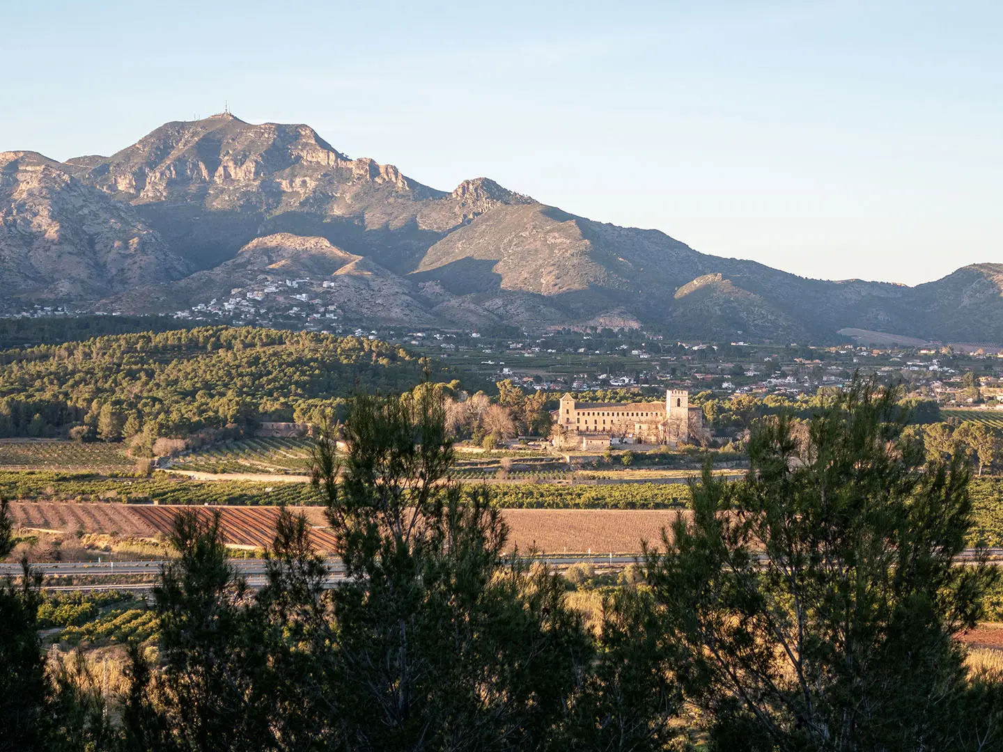
The Ruta de los Monasterios is the GR-236, a 77.3 km point-to-point hike through the interior of Valencia province in Spain. It runs from Gandia RENFE station to Alzira RENFE station in 3–4 days, crossing La Safor, La Vall d’Albaida and La Ribera Alta. The route is moderate: generally low-level, but with steep climbs, rocky tracks and 2,640 m of total ascent. It suits walkers who want a cultural thru-hike linking historic monasteries, rural valleys and train-to-train logistics.
Route Overview
The GR-236 is designed as a linear train-access walk from Gandia to Alzira, both on the RENFE network. The official four-stage itinerary is Gandia–Almiserà, Almiserà–Pinet, Pinet–La Barraca d’Aigües Vives, and La Barraca d’Aigües Vives–Alzira. Along the way it passes places including Alfauir, Llutxent, Barx, Simat de la Valldigna, Carcaixent and the La Murta area near Alzira, using droving roads, rural tracks, mountain footpaths and sections of old railway track. For a much longer Spanish pilgrimage compare the Camino de Santiago Camino Francés; for a coastal alternative, see the Camí de Ronda.
Monastic paths and the Pas del Pobre
Inaugurated in 2008, the Ruta de los Monasterios de Valencia revives medieval pilgrim and monastic paths that once linked five Valencian monasteries. These religious houses were founded between the 13th and 17th centuries and became important centres of religion, agriculture, art and learning. Some were later damaged or abandoned, including after the 1835–36 disentailment, and several have since been partly restored. The route’s alternative name, el Pas del Pobre, refers to the old mountain path used between the valleys.
Notable highlights
Monasterio de Sant Jeroni de Cotalba, Alfauir: A 14th-century Hieronymite monastery and one of the best-preserved sites on the route, noted for its Gothic-Mudéjar cloister.
Convent del Corpus Christi, Llutxent: A Dominican monastery linked to the medieval Miracle of the Corporals tradition, giving this stage a strong religious and local-history focus.
Santa María de la Valldigna, Simat de la Valldigna: A Royal Cistercian monastery founded in 1298 by James II of Aragon; it is a major restored landmark in the Valldigna valley and is open to visitors.
Santa María d’Aigües Vives, La Barraca d’Aigües Vives: A hillside monastery in a wooded setting between Carcaixent and Alzira, reached near the end of the third official stage.
Santa María de la Murta, Alzira: Ruined Hieronymite monastery buildings in the protected La Murta natural area, among limestone hills and woodland near the route finish.
Challenges to expect
Do not treat the GR-236 as a short valley stroll: the verified distance is 77.3 km, with 2,640 m of cumulative ascent. Technical difficulty is normal, but several mountain sections are steep and surfaces are mostly dirt, gravel and rock. Summer heat is the main seasonal issue in this mild Mediterranean area. There are no mountain refuges, so plan accommodation in towns and carry enough water between settlements.
HikeList Score
Ruta de los Monasterios scored 83/100 on HikeList's trail-quality metrics.
See score breakdownHide breakdown
- Ideal length 74
- Balanced challenge 100
- Scenery & wildness 71
- Varied terrain 83
- Accommodation 83
- Food & support 81
- Path quality 98
- Season flexibility 89
Computed from length, challenge, scenery & wildness, terrain variety, accommodation, food & support, path quality and season flexibility.
 Spain
SpainShow more data Show less
- Foothills
- Valley
- Rural
- Dirt
- Gravel
- Rocky
- Hotels
- Hostels
- Casas Rurales
- Family Friendly
- Pet Friendly
- Restrooms
- Water Sources
- Picnic Areas
Photos from hikers
Taken on the trail by people who've reviewed Ruta de los Monasterios.
Leave the coast-side rail hub of Gandia and walk inland through towns including Almoines, Beniarjó, Palma de Gandia, Ròtova and Alfauir before reaching Almiserà.
Continue through the interior of La Vall d’Albaida, passing Llutxent and using rural tracks and mountain footpaths before finishing in Pinet.
The longest official stage crosses hill country via Barx, Simat de la Valldigna and Benifairó de la Valldigna, with the Valldigna monastery as the key cultural stop.
Walk towards Carcaixent and Alzira, visiting the Aigües Vives and La Murta monastic sites before ending at Alzira RENFE station.
Reviews
How would you rate Ruta de los Monasterios?
Tap a star to start your review — you could be the first.