Pyhä-Luosto National Park Trail
How would you rate Pyhä-Luosto National Park Trail?
Tap a star to share your experience and help other hikers.
Pyhä-Luosto National Park Trail: Finnish Lapland Fell Traverse
HikeList Score
Pyhä-Luosto National Park Trail scored 85/100 on HikeList's trail-quality metrics.
See score breakdownHide breakdown
- Ideal length 66
- Balanced challenge 100
- Scenery & wildness 78
- Varied terrain 100
- Accommodation 84
- Food & support 88
- Path quality 98
- Season flexibility 76
Computed from length, challenge, scenery & wildness, terrain variety, accommodation, food & support, path quality and season flexibility.
The Pyhä-Luosto National Park Trail is a 30 km point-to-point hike in Finnish Lapland, linking Pyhä resort with Luosto across the park’s quartzite fell chain. Plan on 2-3 days: it is waymarked and non-technical, but moderate overall, with rocky fell sections, steep stairs around Isokuru and exposed navigation in poor visibility. It suits hikers wanting a short hut-supported Lapland traverse in Finland. For another Finnish multi-day option, compare the Hetta-Pallas Trail.
Route Overview
The official Pyhä-Luosto Summer and Winter Trail runs between Pyhä (Pyhätunturi) resort, beside the Naava Visitor Centre, and Luosto resort at the Luoston Gate / Luosto Visitor Centre. Either direction works; this guide describes Pyhä to Luosto. From Pyhä the trail passes Isokuru gorge, Pyhänkasteenputous waterfall and Karhunjuomalampi, then crosses the fell chain via Noitatunturi and Huttutunturi before Huttujärvi / Huttuloma, Rykimäkero, Pyhälampi/Kapusta, Lampivaara Amethyst Mine and Ukko-Luosto. Because it is point-to-point, plan your return from the opposite resort before starting. For a shorter national-park alternative near southern Finland, see the Nuuksio National Park Trail.
Sámi Sacred Fells and Ancient Quartzite
Pyhä means “sacred” in Finnish, and the Pyhätunturi fells were a holy place for the indigenous Sámi, associated with sieidi sacred natural sites and ceremonial use. Pyhänkasteenputous and Pyhänkasteenlampi preserve the tradition that local Sámi were baptised there. The landscape is also geologically old: the quartzite bedrock is roughly two billion years old. Today’s Pyhä-Luosto National Park was established in 2005, incorporating Pyhätunturi National Park, founded in 1938.
Notable highlights
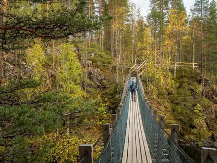
Isokuru gorge (about 220 m deep): Finland’s deepest gorge cuts between Kultakero and Ukonhattu near the Pyhä end. The trail uses boardwalks and steep staircases through this protected zone.
Pyhänkasteenputous and Pyhänkasteenlampi: The “sacred baptism” waterfall and pond sit below Isokuru and are tied to Sámi tradition. They make a natural pause before Karhunjuomalampi.
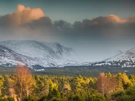
Noitatunturi (540 m): The highest fell in the park is the route’s headline high point. In clear weather it gives broad views over the quartzite fell chain and surrounding taiga.
Lampivaara Amethyst Mine: Beside the trail near Luosto, this active visitor mine offers guided tours and the chance to dig for amethyst crystals formed in ancient bedrock.
Ukko-Luosto (514 m): The fell above Luosto makes a strong final viewpoint if walking from Pyhä, or an immediate ascent if starting in Luosto.
Free wilderness huts and campfire sites: Open huts, lean-tos and Lapp huts appear every few kilometres, giving shelter and simple overnight options in classic Finnish trail style.
Challenges to expect
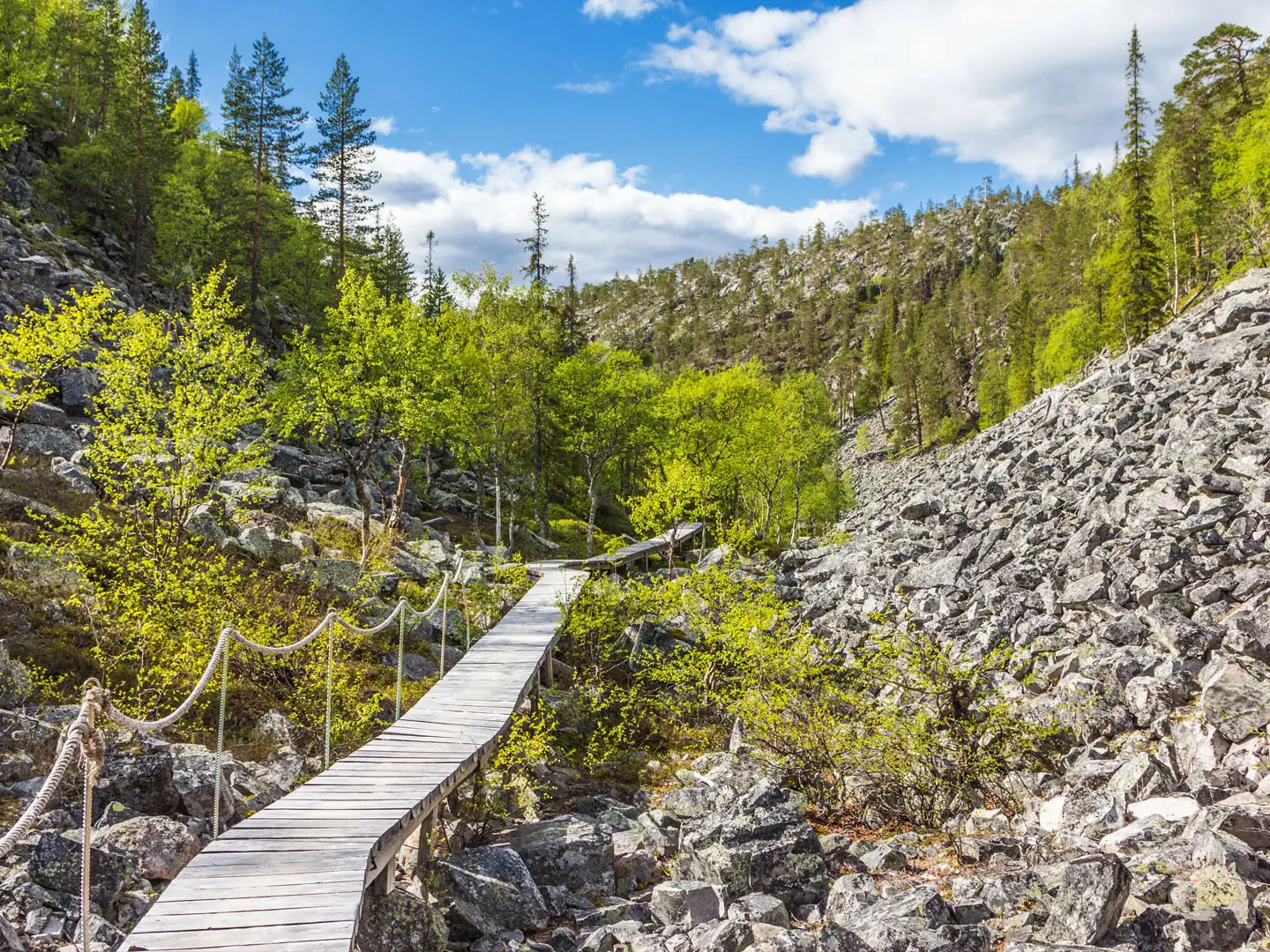
Expect moderate but varied going: rocky fell paths, wet mire crossed on boardwalk, steep staircases around Isokuru and some exposed sections above the treeline. The route is well marked with yellow trail markings, but fog on the open fells can make navigation harder. Snow-free walking is best from June to September; in winter Isokuru gorge is closed because of avalanche risk.
HikeList Score
Pyhä-Luosto National Park Trail scored 85/100 on HikeList's trail-quality metrics.
See score breakdownHide breakdown
- Ideal length 66
- Balanced challenge 100
- Scenery & wildness 78
- Varied terrain 100
- Accommodation 84
- Food & support 88
- Path quality 98
- Season flexibility 76
Computed from length, challenge, scenery & wildness, terrain variety, accommodation, food & support, path quality and season flexibility.
 Finland
Show more data Show less
- Forest
- Fell
- Gorge
- Mire
- Gravel
- Dirt
- Boardwalk
- Rocky
- Huts
- Hotels
- Campsites
- Wild Camping Spots
- Family Friendly
- Pet Friendly
- Restrooms
- Water Sources
- Campsites
- Shelters
- Picnic Areas
In these collections
Photos from hikers
Taken on the trail by people who've reviewed Pyhä-Luosto National Park Trail.
Start at Pyhä beside the Naava Visitor Centre. Follow the marked route into Isokuru gorge, pass Pyhänkasteenputous and Karhunjuomalampi, then continue to a suitable hut, shelter or serviced campfire site depending on pace and conditions.
Continue over the middle section of the quartzite fells, using care on rocky and steeper ground around Noitatunturi and Huttutunturi. Huttujärvi / Huttuloma and nearby huts or campfire sites provide logical shelter options.
Walk the north-western section past Rykimäkero and the Pyhälampi/Kapusta area towards Lampivaara Amethyst Mine. Finish over or near Ukko-Luosto before descending to Luosto resort and the Luosto Visitor Centre area.
Reviews
How would you rate Pyhä-Luosto National Park Trail?
Tap a star to start your review — you could be the first.