Ystwyth Trail
How would you rate Ystwyth Trail?
Tap a star to share your experience and help other hikers.
Ystwyth Trail: Aberystwyth to Tregaron on a Rail-Trail
HikeList Score
Ystwyth Trail scored 82/100 on HikeList's trail-quality metrics.
See score breakdownHide breakdown
- Ideal length 59
- Balanced challenge 100
- Scenery & wildness 71
- Varied terrain 89
- Accommodation 100
- Food & support 88
- Path quality 70
- Season flexibility 89
Computed from length, challenge, scenery & wildness, terrain variety, accommodation, food & support, path quality and season flexibility.
The Ystwyth Trail is a 32 km point-to-point walking and cycling route in Ceredigion, Mid Wales, running from Aberystwyth to Tregaron. It is a moderate 1–2 day hike: mostly low-level, with gentle former railway gradients, but long enough to feel substantial and broken by road diversions, farm tracks and rocky bridleway sections. It suits walkers wanting a practical valley route with river scenery, railway history and an easy approach to Cors Caron National Nature Reserve.
Route Overview
Start on the Aberystwyth seafront, then head inland via Llanfarian, Llanilar and Trawsgoed before leaving the River Ystwyth valley near Ystrad Meurig and the former Strata Florida station. The final approach runs along the edge of Cors Caron to Tregaron. This is a signed multi-use trail: walking is permitted throughout, cycling is possible along the full route, and horse riding is limited to certain sections. Common walking breaks are around Llanilar or Ystrad Meurig. For other Welsh routes, compare the coastal Anglesey Coastal Path, the hillier Beacons Way, or the shorter Aber Falls Walk.
Railway history on the Ystwyth Trail
Much of the Ystwyth Trail uses the former Manchester and Milford Railway branch line, opened in 1867 and later absorbed by the Great Western Railway. The line closed in the 1963 Beeching cuts. The £1.7m Ystwyth Trail was partially completed and opened in September 2008, creating a modern walking, cycling and bridleway corridor that also links with Sustrans National Cycle Network routes Lon Cambria / route 81 and Lon Teifi / route 82.
Notable highlights
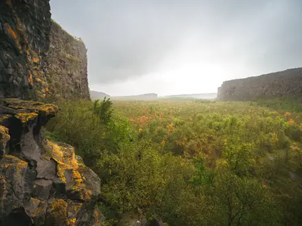
- Cors Caron National Nature Reserve: A major raised-bog peatland reserve north of Tregaron, reached on a flat, fully off-road section. Boardwalks and a bird hide give access to wetland wildlife including red kite, otter and birds.
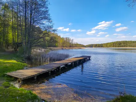
- River Ystwyth: The trail follows the river through its wooded valley for much of the first half. The traffic-free Llanilar–Trawsgoed stretch runs close to the water and passes the Black Covert picnic area.
- Strata Florida Abbey: A short link near Pontrhydfendigaid leads to the ruins of this 12th-century Cistercian abbey, an important medieval religious and cultural centre in Wales.
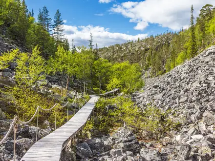
- Former railway trackbed: Long, gentle sections use the old Manchester and Milford Railway route, giving easy gradients and a clear line through the valley landscape.
- Aberystwyth seafront start: The route begins in Aberystwyth, a university and seaside town on Cardigan Bay, before turning inland towards rural Ceredigion.
Challenges to expect
Do not expect a continuous smooth rail-trail. Surfaces vary between tarmac, farm tracks, rocky bridleway and old railway bed, with on-road diversions including a mile near Trawsgoed and about 2 miles on the B4340. Winter can mean wetter going, especially on rural sections. Accommodation is straightforward at Aberystwyth and Tregaron but limited in smaller villages, so book ahead if splitting the walk.
HikeList Score
Ystwyth Trail scored 82/100 on HikeList's trail-quality metrics.
See score breakdownHide breakdown
- Ideal length 59
- Balanced challenge 100
- Scenery & wildness 71
- Varied terrain 89
- Accommodation 100
- Food & support 88
- Path quality 70
- Season flexibility 89
Computed from length, challenge, scenery & wildness, terrain variety, accommodation, food & support, path quality and season flexibility.
Show more data Show less
- River Valley
- Rural
- Wetland
- Paved
- Farm Tracks
- Rocky Bridleway
- Former Railway Trackbed
- Road
- B&Bs
- Guesthouses
- Inns
- Self Catering Cottages
- Family Friendly
- Pet Friendly
- Restrooms
- Water Sources
- Campsites
- Picnic Areas
Photos from hikers
Taken on the trail by people who've reviewed Ystwyth Trail.
Reviews
How would you rate Ystwyth Trail?
Tap a star to start your review — you could be the first.