Moskenesøya Traverse
How would you rate Moskenesøya Traverse?
Tap a star to share your experience and help other hikers.
Moskenesøya Traverse: Lofoten’s Flexible Island Crossing
HikeList Score
Moskenesøya Traverse scored 82/100 on HikeList's trail-quality metrics.
See score breakdownHide breakdown
- Ideal length 70
- Balanced challenge 74
- Scenery & wildness 98
- Varied terrain 77
- Accommodation 84
- Food & support 81
- Path quality 98
- Season flexibility 63
Computed from length, challenge, scenery & wildness, terrain variety, accommodation, food & support, path quality and season flexibility.
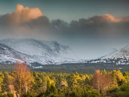
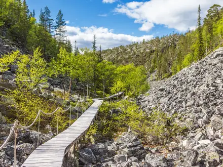
The Moskenesøya Traverse is not an official waymarked trail, but a flexible multi-day trip across Moskenesøya in Lofoten, Northern Norway. Plan on roughly 30 km over about 3 days for a focused version linking Å or Sørvågen, Munkebu, Reine ferries, Horseid and Bunes. Overall difficulty is hard: the beach walks are muddy but non-technical, while Hermannsdalstinden adds steep scrambling, chains, ropes and exposure. It suits experienced hikers who can navigate independently in fast-changing Arctic weather.
Route Overview
Most hikers frame the trip south to north, starting around Å, Sørvågen or Moskenes and finishing around Reine. A mountain-focused version climbs from Sørvågen past lakes such as Sørvågvatnet, Stuvdalsvatnet/Studalsvatnet and Krokvatnet to the DNT Munkebu hut, with Hermannsdalstinden as a demanding optional summit. The coastal highlights are not reached by a continuous overland path: take the passenger ferry from Reine to Kjerkfjord/Kirkefjord for Horseid, and to Vindstad for Bunes. Treat it as a linked network of hikes, short road sections and ferry legs. For a clearer waymarked Lofoten day hike, compare Dronningruta (Queen’s Route).
Fishing Villages, DNT Paths and the Moskstraumen
Å, Sørvågen and Reine grew around the Lofoten winter cod fishery, with drying racks and rorbu cabins still shaping the coast. Å preserves this heritage at the Norwegian Fishing Village Museum. Many footpaths follow older routes between fishing communities, while mountain huts and summit trails reflect later recreational development by the Norwegian Trekking Association and local groups. Offshore, the Moskstraumen tidal maelstrom has long featured in northern literature, including works linked to Edgar Allan Poe and Jules Verne.
Notable highlights
- Hermannsdalstinden (1,029 m): The highest summit on Moskenesøya and an optional, strenuous side trip from Munkebu. Expect fixed chains and ropes, scrambling and an exposed summit ridge.
- Munkebu hut: A DNT self-service cabin among lakes on the Sørvågen approach to Hermannsdalstinden. You need a DNT key, rentable in Moskenes, to stay inside.
- Horseid beach: A remote white-sand beach reached from the Kjerkfjord ferry stop by a muddy valley-and-pass walk of about 6.5 km each way. It is a popular wild-camping objective.
- Bunes beach: A broad white-sand beach below the Helvetestinden wall, reached by an easy walk of about 1 hour from Vindstad. It is the simpler beach option compared with Horseid.
- Reine: The main ferry hub for Kjerkfjord and Vindstad, and one of Lofoten’s most recognisable fishing villages, with red and white houses below jagged peaks.
- Å: The southern road-end village on the E10, known for preserved fishing heritage, rorbuer and the Norwegian Fishing Village Museum.
Challenges to expect
Do not expect a continuous marked thru-hike. Many paths are faint or unmarked, and cloud can make navigation difficult. Beach approaches are very muddy and boggy; peak terrain adds rock, scree, scrambling, fixed chains and exposure. Weather is cool, wet and changeable, with wind and low cloud common on tops. There are no shops once you leave villages, so carry food, waterproof layers and water treatment. For other hard Norwegian mountain days, see Besseggen Ridge or the Hardangervidda Traverse.
HikeList Score
Moskenesøya Traverse scored 82/100 on HikeList's trail-quality metrics.
See score breakdownHide breakdown
- Ideal length 70
- Balanced challenge 74
- Scenery & wildness 98
- Varied terrain 77
- Accommodation 84
- Food & support 81
- Path quality 98
- Season flexibility 63
Computed from length, challenge, scenery & wildness, terrain variety, accommodation, food & support, path quality and season flexibility.
 Norway
Show more data Show less
- Mountainous
- Coastal
- Rocky
- Muddy
- Sandy
- Boggy
- Huts
- Hotels
- Campsites
- Wild Camping Spots
- Pet Friendly
- Water Sources
- Campsites
- Shelters
Photos from hikers
Taken on the trail by people who've reviewed Moskenesøya Traverse.
Reviews
How would you rate Moskenesøya Traverse?
Tap a star to start your review — you could be the first.