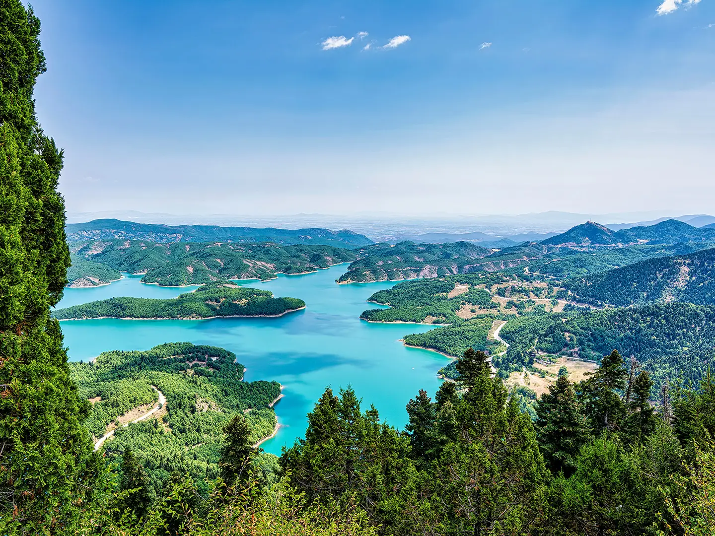
Plastira Lake Circuit
How would you rate Plastira Lake Circuit?
Tap a star to share your experience and help other hikers.
Plastira Lake Circuit: A Practical Hiking Guide
HikeList Score
Plastira Lake Circuit scored 86/100 on HikeList's trail-quality metrics.
See score breakdownHide breakdown
- Ideal length 59
- Balanced challenge 100
- Scenery & wildness 98
- Varied terrain 83
- Accommodation 91
- Food & support 88
- Path quality 80
- Season flexibility 89
Computed from length, challenge, scenery & wildness, terrain variety, accommodation, food & support, path quality and season flexibility.
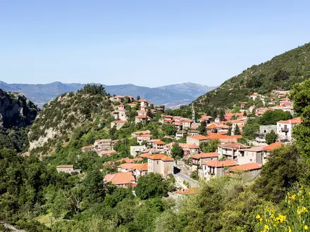
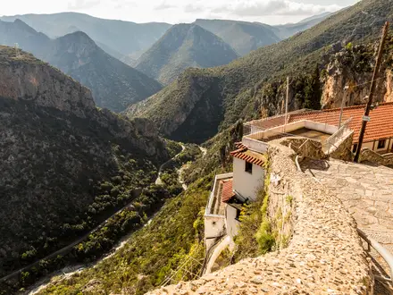
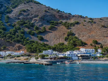
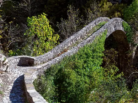
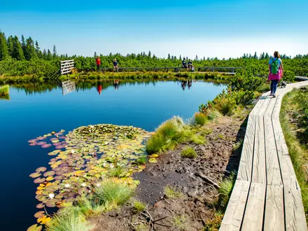
The Plastira Lake Circuit is a roughly 60 km loop around Lake Plastira, also known as the Tavropos Reservoir, in Karditsa, Thessaly, central Greece. Set at about 800 m in the Agrafa mountains, it is a moderate 1–2 day walk, more often cycled or driven, using the lakeside provincial road, forest roads and short local footpaths. It suits hikers who want a village-based lake circuit with oak and fir forest, springs and mountain views, not a remote high-altitude trek or a single continuous waymarked trail.
Route Overview
This is a circular route with no fixed start or finish. Walkers commonly begin in Kalyvia Pezoulas or Neochori on the western shore, the two main tourist bases, and piece together the loop via the lake-perimeter road, forest tracks and signed local trail sections. A frequently described two-day split runs from Kalyvia to Agios Athanasios, then back to Kalyvia. Villages and points around the lake include Pezoula, Belokomiti, Lampero, Kryoneri, Kastania, Neraida, Morfovouni and the Kakavakia arch dam. The loop is often ridden by bicycle or mountain bike; hikers should expect some road walking. For a harder mountain itinerary nearby, see the Agrafa Mountains Circuit.
Lake Plastira and the Tavropos Dam
Lake Plastira is an artificial reservoir created by an arch dam on the Tavropos river, also called the Megdovas, at Kakavakia. Dam construction began in 1955, the dam was inaugurated on 30 October 1960, and the lake filled by about 1962. It was built for irrigation of the Thessalian plain around Karditsa, hydroelectric power and the water supply of Karditsa city. The lake is named after Nikolaos Plastiras, the local-born general and statesman who first envisaged damming the river.
Notable highlights
- Lake Plastira / Tavropos Reservoir: The route circles a large artificial mountain lake at about 800 m, with open water views backed by the Agrafa mountains.
- Kakavakia arch dam: The dam at the southern end of the lake is the structure that created the Tavropos Reservoir and is a key landmark on the circuit.
- Neochori: One of the main tourist villages and a common base, known on the route for its botanical garden and lake views.
- Kalyvia Pezoulas: A frequent start and finish point for the walking circuit, with village-based accommodation and tavernas.
- Belokomiti forest: Forest roads and nearby local paths pass through dense oak and silver fir woodland, with cold springs typical of this well-watered area.
Challenges to expect
The main challenge is not technical terrain but length, navigation and repeated undulation. There is no single continuous waymarked blaze for the full circuit, so expect to combine road, forest road and numbered local paths. Some sections involve paved road walking. Winter can bring snow and freezing temperatures. For more formal long-distance trail planning, compare the E4 European Long-Distance Trail (Greek Section) or E6 European Long-Distance Trail (Greek Section).
HikeList Score
Plastira Lake Circuit scored 86/100 on HikeList's trail-quality metrics.
See score breakdownHide breakdown
- Ideal length 59
- Balanced challenge 100
- Scenery & wildness 98
- Varied terrain 83
- Accommodation 91
- Food & support 88
- Path quality 80
- Season flexibility 89
Computed from length, challenge, scenery & wildness, terrain variety, accommodation, food & support, path quality and season flexibility.
 Greece
Show more data Show less
- Mountainous
- Forest
- Lakeside
- Paved
- Dirt
- Footpath
- Hotels
- Guesthouses
- Lodges
- Family Friendly
- Pet Friendly
- Restrooms
- Water Sources
- Campsites
- Picnic Areas
Download Our Full Guide to Plastira Lake Circuit FREE!
Get our comprehensive guide to this hike for free. Save it for later reading or print out at home.

In these collections
Photos from hikers
Taken on the trail by people who've reviewed Plastira Lake Circuit.
Plastira Lake Circuit: The Complete Guide
 i
Image by akarb
i
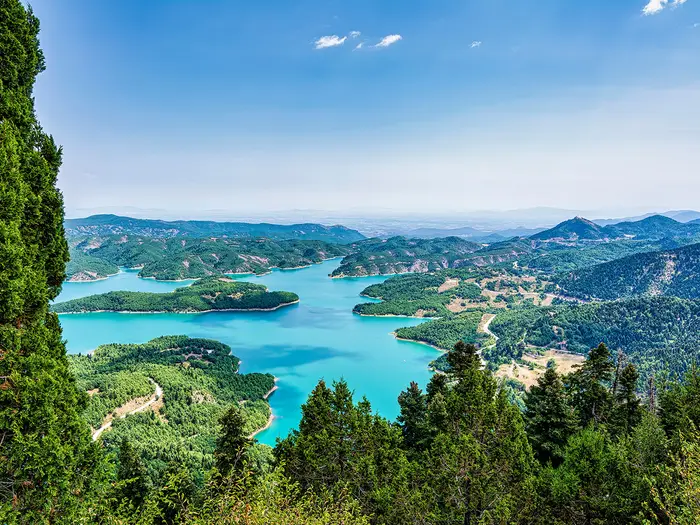
Image by akarb The Plastira Lake Circuit is a rewarding mountain-lake walking area rather than a single signed long-distance trail. Around Λίμνη Πλαστήρα / Lake Plastira, the route links villages, fir and oak forest, springs, viewpoints and the Κακαβάκια / Kakavakia arch dam on a mix of paths, forest roads and paved perimeter road.
Most walkers base themselves at Νεοχώρι / Neochori or Καλύβια Πεζούλας / Kalyvia Pezoulas, then build a route from the genuine marked options nearby. The signature Νεοχώρι / Neochori circular walk and the Μπελοκομίτης / Belokomiti Educational Forest trails give the best footpath walking, with wide views over the reservoir and the Άγραφα / Agrafa mountains.
A full lake “circuit” is possible as a self-assembled two-day walk, but it should be approached with clear expectations. Much of the 50–60 km perimeter is road, so this suits walkers who value scenery, villages and flexible planning more than a continuous wilderness footpath.
The main demands are navigation, route choice and logistics. A map or GPS app is strongly advisable, accommodation is village-based, and private transport or local taxi arrangements are often needed because onward public transport from Καρδίτσα / Karditsa to the lakeside villages is limited.
This guide covers practical route options, stages, days, accommodation, food, transport, terrain and the common mistakes to avoid.
Stage-by-Stage Guide
These two stages describe a practical DIY walking circuit around Λίμνη Πλαστήρα / Lake Plastira, not a continuous signed long-distance trail. Each day mixes local waymarked paths, forest roads, village lanes and sections of the paved perimeter road, so the exact line should be planned in advance with the Anavasi 1:50,000 map or the Plastira topoguide app.
Stage 1: Νεοχώρι / Neochori or Καλύβια Πεζούλας / Kalyvia Pezoulas to the northern shore villages, via Μπελοκομίτης / Belokomiti, Νεράιδα / Neraida and Μορφοβούνι / Morfovouni
Approximate distance: 30 km
Character: the more rewarding walking half of the circuit, with the best access to forest paths and higher lake viewpoints, but still with road and forest-road linking sections.
Most walkers will start from either Καλύβια Πεζούλας / Kalyvia Pezoulas on the lakeshore or Νεοχώρι / Neochori above the western shore. Νεοχώρι / Neochori is the stronger walking start because the Botanical Garden area gives access to the signature marked circular hike, while Καλύβια Πεζούλας / Kalyvia Pezoulas is better for lakeside accommodation and tavernas.
The early part of the stage can use the marked walking options around Νεοχώρι / Neochori, where the terrain is proper hill walking rather than a simple lakeside stroll. The main Neochori loop reaches about 1,165 m and involves real ascent and descent, so any route using this higher ground should be treated as a full mountain-forest day, not just a connector around the reservoir.
North-west of the lake, the most useful genuine footpath terrain is around the Παιδευτικό Δάσος Μπελοκομίτη / Belokomiti Educational Forest. Its six signposted eco-trails, M1–M6, total around 15–16 km and pass through dense oak and silver-fir woodland, cold springs and an observation tower. This is one of the best places on the circuit to spend time on actual marked paths rather than the perimeter road.
Μπελοκομίτης / Belokomiti also works well as a food stop if services are open, with trout tavernas in the village area. Do not rely on every village service being open outside busy periods; carry enough food for the day and enough water to cover the forest and road sections between settlements. Springs are part of the character of the western and northern forests, but water availability and suitability should be checked locally before relying on them.
From the Belokomiti area, the route towards Νεράιδα / Neraida and Μορφοβούνι / Morfovouni becomes a self-assembled line of paths, forest roads and local roads. Νεράιδα / Neraida is a useful mountain-village objective with accommodation and tavernas, while Μορφοβούνι / Morfovouni is an important northern landmark as the birthplace of Nikolaos Plastiras, after whom the lake is named.
Views are strongest where the route rises above the western shore: the lake sits below on the Νευρόπολη / Nevropoli plateau, with the fir-clad Άγραφα / Agrafa slopes framing the water. In good conditions, this side gives the most convincing sense of the reservoir as a mountain lake rather than simply a road loop.
Accommodation is easiest at the start in Νεοχώρι / Neochori or Καλύβια Πεζούλας / Kalyvia Pezoulas, and thinner on the northern side. Νεράιδα / Neraida has rooms and tavernas, but availability should be booked in advance, especially in summer and during the autumn colour season. If accommodation on the northern side is not secured, this stage should not be started as a point-to-point walk without a planned taxi or pick-up.
Road access is possible throughout the wider northern and western shore area, but public transport is not a dependable way to manage the stage. Karditsa has rail and KTEL bus links, yet onward services to lakeside villages are limited and infrequent. A car, pre-arranged taxi or local operator is the practical fallback if weather, daylight or accommodation plans change.
Navigation is the main difficulty. There is no single blaze to follow around the lake, and many junctions require deliberate choices between marked local paths, dirt roads and the perimeter road. Downloaded mapping, a paper map and a pre-planned exit point are strongly advised.
The main warnings are distance, hard-surface road walking and winter conditions. Snow and freezing weather are common in winter, especially away from the lakeshore and in shaded forest, and can make even moderate paths slow or unsuitable. There is no notable technical exposure on the marked routes, but the day is long enough that poor navigation can easily turn it into an over-ambitious stage.
Stage 2: Northern shore villages to Νεοχώρι / Neochori or Καλύβια Πεζούλας / Kalyvia Pezoulas, via the eastern shore, Φυλακτή / Fylakti, Κρυονέρι / Kryoneri, Κερασιά / Kerasia and the Κακαβάκια / Kakavakia dam
Approximate distance: 30 km
Character: the more road-based half of the circuit, with fewer continuous footpath options and a stronger need to manage tarmac walking, village spacing and transport escape points.
This stage links the northern side back to the western and southern bases by working around the eastern and southern shore. Compared with the western side, expect more walking on the paved provincial perimeter road and fewer long stretches of signposted forest path. It is still scenic, but it is less of a classic hiking stage and more of a practical circuit completion day.
From the northern villages, the route can pass towards the north and east shore, where Λαμπερό / Lampero is known for its lakeside beach. Further round, Φυλακτή / Fylakti, Κρυονέρι / Kryoneri and Κερασιά / Kerasia provide the main village anchors on the eastern and south-eastern side. Κρυονέρι / Kryoneri is associated with the chapel of Agios Georgios, while Κερασιά / Kerasia is one of the first lake villages reached when arriving from Karditsa.
Terrain underfoot is a mix of paved road, gravel or dirt forest roads and short village lanes. Any footpath sections should be treated as local additions rather than a continuous route, and the day should be planned around the reality that the road will carry much of the distance. Walking poles can help reduce fatigue on long hard-surface sections, but footwear still needs to cope with both tarmac and rougher forest tracks.
The major landmark of the stage is the Φράγμα Κακαβάκια / Kakavakia arch dam at the southern end of the lake. The dam spans the Ταύρωπος-Μέγδοβας / Tavropos-Megdovas river and is the most obvious navigation anchor on the southern circuit. Μούχα / Moucha lies near this southern end and can be used as another road-access reference point before the route turns back towards Καλύβια Πεζούλας / Kalyvia Pezoulas or Νεοχώρι / Neochori.
Food and drink planning matters more on this stage because there are fewer obvious walking-centred stops than around Νεοχώρι / Neochori and Μπελοκομίτης / Belokomiti. Φυλακτή / Fylakti, Κρυονέρι / Kryoneri and Κερασιά / Kerasia have accommodation and tavernas, but opening times and seasonal availability should be checked before travelling. Carry a full day’s food and water if attempting the full 30 km in one push.
The finish is best planned at Καλύβια Πεζούλας / Kalyvia Pezoulas or Νεοχώρι / Neochori. These are the two most developed bases on the lake, with the broadest choice of guesthouses, small hotels, traditional lodges and tavernas. Ending at Καλύβια Πεζούλας / Kalyvia Pezoulas is especially convenient if the final approach comes from the dam and southern shore.
Road access is good in the practical sense that the stage follows or approaches roads for much of the way. That does not mean public transport is easy: there is no continuous public transport around the lake, and onward buses from Karditsa to the villages are limited and infrequent. If not using a car, arrange a taxi or local transfer in advance rather than assuming one can be found at the roadside.
Navigation is simpler than the forest side only because the perimeter road is a clear reference; it is not simple in the sense of being a signed walking trail. The key decisions are where to leave road sections for local paths or forest roads, and where it is safer or more efficient to stay on the road. A GPS route should be checked carefully so that it does not imply a footpath where only road walking exists.
The principal warning is sustained road walking. Expect harder surfaces, less walking rhythm and the need to stay alert to traffic on narrow local roads. In winter, freezing conditions and snow can affect the higher villages and shaded roads; in summer, long paved sections can feel more demanding than their distance suggests, so an early start and conservative water carry are sensible.
Recommended Itinerary
There is no single continuous waymarked walking trail around Λίμνη Πλαστήρα / Lake Plastira. Any full “circuit” on foot is a self-assembled route using local marked paths, forest roads and sections of the paved perimeter road, so distances and overnight stops should be checked against the Anavasi 1:50,000 map or Plastira topoguide app before booking.
Standard itinerary: 2-day self-assembled lake circuit
This is the most practical way to treat the wider lake loop as a walking route. It suits strong walkers who are comfortable with long days, mixed surfaces and some road walking.
| Day | From | To | Approx. distance | Why this stage makes sense | Services/accommodation notes |
|---|---|---|---|---|---|
| 1 | Νεοχώρι / Neochori or Καλύβια Πεζούλας / Kalyvia Pezoulas | Northern shore villages, via Μπελοκομίτης / Belokomiti, Νεράιδα / Neraida and Μορφοβούνι / Morfovouni | About 30 km | Uses the more walker-friendly western and north-western side first, where the forested terrain around Belokomiti and Neochori gives better access to marked paths and forest tracks. It is still not a continuous footpath, so expect linking sections on forest road and perimeter road. | Νεοχώρι / Neochori and Καλύβια Πεζούλας / Kalyvia Pezoulas have the widest choice of guesthouses, small hotels and tavernas. For the overnight on the northern side, arrange accommodation or a transfer in advance; options are more limited than on the main western/southern tourist shore. |
| 2 | Northern shore villages | Νεοχώρι / Neochori or Καλύβια Πεζούλας / Kalyvia Pezoulas, via Φυλακτή / Fylakti, Κρυονέρι / Kryoneri, Κερασιά / Kerasia and Κακαβάκια / Kakavakia dam | About 30 km | Completes the eastern and southern half of the road loop and brings you past the key southern landmark at the Κακαβάκια / Kakavakia arch dam. This side has fewer genuine footpath options, so the day is likely to involve more perimeter-road walking. | Φυλακτή / Fylakti, Κρυονέρι / Kryoneri and Κερασιά / Kerasia have accommodation and taverna options, but do not rely on turning up without a plan. Returning to Νεοχώρι / Neochori or Καλύβια Πεζούλας / Kalyvia Pezoulas gives the easiest end-of-walk logistics. |
Slower variant: 3 days or more, village-based
A slower plan is better for most hikers who want the best walking rather than simply ticking off the whole perimeter. Base in Νεοχώρι / Neochori or Καλύβια Πεζούλας / Kalyvia Pezoulas and combine the stronger hiking sections with short transfers or local transport where needed.
| Day | From | To | Approx. distance | Why this stage makes sense | Services/accommodation notes |
|---|---|---|---|---|---|
| 1 | Νεοχώρι / Neochori Botanical Garden car park | Νεοχώρι / Neochori | About 20 km | The signature marked walking loop from Νεοχώρι / Neochori is the best first choice for a proper hike: it reaches about 1,165 m, includes real ascent, and avoids making the whole experience a road walk. | Stay in Νεοχώρι / Neochori or nearby Καλύβια Πεζούλας / Kalyvia Pezoulas, both of which have good accommodation and taverna choice. |
| 2 | Μπελοκομίτης / Belokomiti area | Μπελοκομίτης / Belokomiti area, or onward by arranged transfer | Check official mapping before booking | Focuses on the Παιδευτικό Δάσος Μπελοκομίτη / Belokomiti Educational Forest, where the M1–M6 eco-trails total about 15–16 km across several short marked routes. This is one of the most genuinely waymarked walking areas around the lake. | Belokomiti has tavernas and accommodation options. If linking onward to another village, arrange the transfer or overnight stop before setting out. |
| 3 | Eastern or southern shore access point | Κακαβάκια / Kakavakia dam and return/transfer, or back to the western base | Check official mapping before booking | Allows time to include the dam and the eastern/southern shore without forcing a long, road-heavy 30 km day. This stage is best planned around available transport and the amount of road walking you are willing to accept. | Κερασιά / Kerasia, Κρυονέρι / Kryoneri and Φυλακτή / Fylakti have some accommodation and taverna options, but the western bases remain the easiest places to organise a stay. This should be checked before travelling. |
Faster variant: do not force the full circuit on foot
The 2-day plan is already a fast walking itinerary because each day is around 30 km and includes mixed navigation. A 1-day full circuit on foot would mean treating a 50–60 km perimeter road as an endurance road walk rather than a normal hike, so it is not the recommended faster option.
| Day | From | To | Approx. distance | Why this stage makes sense | Services/accommodation notes |
|---|---|---|---|---|---|
| 1 | Νεοχώρι / Neochori Botanical Garden car park | Νεοχώρι / Neochori | About 20 km | For hikers with only one day, the Νεοχώρι / Neochori circular hike is the strongest walking choice: a defined day loop of about 5 hours with substantial ascent and better trail character than the paved perimeter. | Stay in Νεοχώρι / Neochori or Καλύβια Πεζούλας / Kalyvia Pezoulas for the simplest start and finish. |
| Alternative | Any lakeside base | Full perimeter road by bike or car | About 50–60 km by road | If the objective is to complete the whole lake perimeter quickly, cycling or driving fits the nature of the route better than walking. | Bike hire, tours or local transport should be arranged locally and checked before travelling. |
Planning the Route
The key planning decision is whether you want a village-based walking trip or a self-assembled circuit of the lake perimeter. Λίμνη Πλαστήρα / Lake Plastira does not have one continuous waymarked walking trail around the water; a full circuit means joining local paths, forest roads and sections of the paved perimeter road.
For most walkers, the best plan is to base in Νεοχώρι / Neochori or Καλύβια Πεζούλας / Kalyvia Pezoulas and walk selected marked routes from there. Attempting the whole lake circuit on foot is possible as a DIY itinerary, but it is less satisfying if the aim is continuous trail walking, because road walking is unavoidable.
Choosing the right itinerary
| Plan | Best for | Practical notes |
|---|---|---|
| One day: Νεοχώρι / Neochori circular hike | Walkers wanting the main marked day walk | The signature loop is about 20 km and takes around 5 hours, with real ascent to roughly 1,165 m. It starts naturally from the Νεοχώρι / Neochori Botanical Garden car park. |
| One day: Μπελοκομίτης / Belokomiti Educational Forest | Easier forest walking and shorter route options | The M1–M6 eco-trails total about 15–16 km across six short marked trails. This is one of the most genuinely waymarked walking areas around the lake. |
| Two days: full DIY lake circuit | Fit walkers who accept road and forest-road walking | A typical split is roughly 30 km per day: western/northern shore, then eastern/southern shore via Φυλακτή / Fylakti, Κρυονέρι / Kryoneri, Κερασιά / Kerasia and the Κακαβάκια / Kakavakia dam. Treat this as a bespoke route, not a signed long-distance trail. |
| Three days: slower circuit with detours | Walkers wanting more time in villages and forests | A 2–3 day hiking trip can string together forest paths, forest roads and road sections, with more time for the Neochori and Belokomiti paths. Accommodation spacing and transport need arranging in advance. |
| Base-and-walk holiday | Most independent hikers | Stay in Νεοχώρι / Neochori or Καλύβια Πεζούλας / Kalyvia Pezoulas, then use a car, taxi or local operator to reach trailheads. This avoids committing to long paved-road stages. |
How many days to allow
Allow one full walking day for the Νεοχώρι / Neochori loop if that is the main objective. Add a second day for the Μπελοκομίτης / Belokomiti Educational Forest trails, especially if you want a quieter forest-based day rather than more road walking.
For a full lake circuit on foot, allow two long days at minimum. This suits strong walkers comfortable with around 30 km days and mixed surfaces. A three-day version is more practical if you want to use the marked forest paths properly rather than simply following the perimeter road.
The route is generally better walked slowly and selectively than quickly. The strongest walking value is in the forest paths, village links, springs and viewpoints, not in pushing a fast lap of the road perimeter.
Where stages naturally fall
Νεοχώρι / Neochori and Καλύβια Πεζούλας / Kalyvia Pezoulas are the easiest bases because they have the most developed tourist infrastructure on the western and southern shore. They also sit close to the best-known walking options, including the Νεοχώρι / Neochori loop and access towards Μπελοκομίτης / Belokomiti.
A two-day DIY circuit can be split between the western/northern side and the eastern/southern side, but accommodation should not be assumed at exactly convenient walking intervals. Rooms and tavernas are also found in villages such as Φυλακτή / Fylakti, Πεζούλα / Pezoula, Κρυονέρι / Kryoneri, Κερασιά / Kerasia, Μπελοκομίτης / Belokomiti and Νεράιδα / Neraida, but availability varies by season and should be booked ahead.
The Κακαβάκια / Kakavakia arch dam is a natural southern anchor for the road loop, while Μορφοβούνι / Morfovouni gives a logical northern-side objective. These are useful planning points, but they do not create a continuous signed walking stage structure.
Shortening, extending and section hiking
This is an easy area to shorten if you have a car or pre-arranged transfer. You can walk one marked route, return to the same base, and avoid committing to a long end-to-end stage.
Extending is also straightforward, but it should be done by adding named local routes rather than assuming a longer waymarked circuit exists. Practical extensions include the Μπελοκομίτης / Belokomiti M1–M6 trails, the Νεοχώρι / Neochori circular hike, the Tsardaki–Mesenikolas circular route, or paths connected with the Agrafa refuge network.
Section hiking is practical only with transport planning. There is no continuous public transport around the lake, and onward services from Καρδίτσα / Karditsa to lakeside villages are limited and infrequent. A car, taxi or local operator makes individual sections far easier to organise.
Navigation planning
Navigation matters more here than fitness alone. The lake perimeter is simple enough as a road loop, but the best walking uses a patchwork of numbered local paths, forest roads, village lanes and short connecting sections.
Carry proper mapping rather than relying only on road signs. The Anavasi “Northern Agrafa – Lake Plastira” 1:50,000 waterproof hiking map and the Plastira topoguide mobile app are the most useful planning tools for the actual footpaths, because there is no single continuous signed circuit map.
Download offline mapping before arrival. Forest cover, small junctions and unsigned connections can make a planned line less obvious on the ground, especially when moving between a marked trail and a road section.
Accommodation, food and water
Book accommodation ahead in summer and during the autumn colour season. Νεοχώρι / Neochori and Καλύβια Πεζούλας / Kalyvia Pezoulas offer the broadest choice, with additional guesthouses, small hotels and tavernas in other lake villages.
Do not plan long stages on the assumption that every village will have open food options at the exact time you pass through. Carry lunch and enough snacks for the full day, especially on the eastern and southern side where the walking may include longer road sections.
Cold springs are part of the character of the Agrafa forests, but they should not be treated as a guaranteed water plan for a full day. Carry enough water from the start of each stage and check locally which springs are flowing and suitable before relying on them.
Transport planning
The area is car-focused. Καρδίτσα / Karditsa is the main access point, with rail links on the Athens–Thessaloniki line and intercity KTEL bus connections, but the lake villages are about 25 km west and onward public transport is limited.
If walking a full DIY circuit, decide in advance how you will reach the start, return from any bail-out point, and move between accommodation and trailheads. Taxi or local transfer arrangements should be made before the walking day rather than left until late afternoon in a small village.
Weather and season
Spring, summer and autumn are the normal walking seasons. The lake sits at roughly 792–800 m on the Νευρόπολη / Nevropoli plateau, so conditions can feel more mountainous than the map distance from Καρδίτσα / Karditsa suggests.
Winter planning is different: snow and freezing conditions are common, and ordinary walking routes can become slow or unsuitable without winter equipment and local advice. In any season, check the forecast before committing to long road-and-forest stages, because escape options depend on transport rather than a continuous trail network.
Towns, Villages and Overnight Stops
Accommodation around Λίμνη Πλαστήρα / Lake Plastira is village-based rather than trail-stage-based. Because there is no continuous waymarked walking circuit, most hikers choose one or two bases and use a car, taxi or local operator to reach the shorter marked paths and any self-assembled road sections.
Νεοχώρι / Neochori and Καλύβια Πεζούλας / Kalyvia Pezoulas are the most practical bases for a walking trip. The smaller villages can work for quieter overnights, but services should not be assumed without booking and checking ahead.
| Place | Best use for walkers | Overnight practicality |
|---|---|---|
| Νεοχώρι / Neochori | Main walking base; Botanical Garden; signature marked loop | Excellent |
| Καλύβια Πεζούλας / Kalyvia Pezoulas | Lakeside base with guesthouses and tavernas | Excellent |
| Πεζούλα / Pezoula | Quieter village above Kalyvia | Good |
| Μπελοκομίτης / Belokomiti | Access to the Educational Forest trails | Good |
| Νεράιδα / Neraida | Mountain-village stop on the west/north-west side | Good if pre-booked |
| Φυλακτή / Fylakti | East-side mountain village | Good if pre-booked |
| Κρυονέρι / Kryoneri | East-shore stop | Good if pre-booked |
| Κερασιά / Kerasia | East/south approach village | Good if pre-booked |
| Μορφοβούνι / Morfovouni | Northern-side cultural stop | Check before relying on it |
| Λαμπερό / Lampero | Lakeside beach area on the north/east side | Check before relying on it |
| Μούχα / Moucha | South-east village near the dam | Check before relying on it |
| Κακαβάκια / Kakavakia | Dam landmark, not a village base | Not a natural overnight stop |
Νεοχώρι / Neochori
Νεοχώρι / Neochori sits on the western shore and is one of the two strongest bases for walkers. It is the natural choice if the main aim is the signature marked circular hike from the Νεοχώρι / Neochori Botanical Garden car park, the best-known day walk in the area.
Accommodation is concentrated here in guesthouses, small hotels and traditional stone-built lodges. It is a sensible place to stay for two or more nights if you want lake views, access to marked forest walking, and the flexibility to shorten plans in poor weather.
Food is generally easier here than in the smaller villages, with tavernas serving visitors, but do not treat it as a full resupply town. Carry trail food for the walking day, and check opening times outside the main summer and autumn periods.
Public transport should not be relied on for reaching trailheads from Νεοχώρι / Neochori. Most walkers need a car, a pre-arranged taxi, or a local walking/activity operator.
Καλύβια Πεζούλας / Kalyvia Pezoulas
Καλύβια Πεζούλας / Kalyvia Pezoulas is the other main base, on the western/southern shore. It is the most developed lakeside village and has an organised beach area, guesthouses and tavernas close to the water.
For hikers, it works well as a practical start and finish point for a self-assembled circuit because it sits close to several useful lake-side and forest-road links. It is also a good option for anyone mixing walking with easier lake days.
Accommodation choice is among the best around the lake, but popular periods still need advance booking, especially in summer and during autumn colour. Food is more reliable here than in the smaller mountain villages, though opening hours can still be seasonal.
There is no continuous public transport around the lake. If staying in Καλύβια Πεζούλας / Kalyvia Pezoulas without a car, arrange taxis or transfers before committing to walking stages that finish elsewhere.
Πεζούλα / Pezoula
Πεζούλα / Pezoula lies uphill above Καλύβια Πεζούλας / Kalyvia Pezoulas, beside the Μεγάλο Ρέμα / Great River. It is a quieter overnight option for walkers who want a village stay away from the more developed lakeside strip.
Rooms and tavernas are available in the village area, making it a viable base if accommodation in Καλύβια Πεζούλας / Kalyvia Pezoulas is full or if a quieter stop is preferred. Its watermill is a useful local landmark when orientating around the village.
Treat Πεζούλα / Pezoula as a place to sleep and eat, not as a guaranteed resupply point. Check current food options before arriving, and carry enough provisions for the next day’s walking.
Transport remains car-focused. Any onward movement to another trailhead or village should be arranged in advance.
Μπελοκομίτης / Belokomiti
Μπελοκομίτης / Belokomiti is one of the most useful villages for walkers because it gives access to the Παιδευτικό Δάσος Μπελοκομίτη / Belokomiti Educational Forest. This signposted network of six short eco-trails is one of the most genuinely waymarked walking areas around the lake.
The village has accommodation and tavernas, including trout tavernas, so it can work as an overnight stop for walkers focusing on the forest paths rather than the road perimeter. It is also a good place to slow the itinerary down if the aim is to walk several shorter trails instead of pushing a long road-heavy circuit.
The Educational Forest trails total roughly 15–16 km across the M1–M6 routes, so a stay here is best used for flexible day walking. Carry a proper map or the Plastira topoguide app rather than relying only on village signs.
Do not assume easy public transport onward from Μπελοκομίτης / Belokomiti. Arrange a car, taxi or local transfer if linking it with Νεοχώρι / Neochori, Καλύβια Πεζούλας / Kalyvia Pezoulas or other villages.
Νεράιδα / Neraida
Νεράιδα / Neraida is a mountain village on the west/north-west side of the lake area. It can be used as a quieter overnight stop on a self-assembled northern or western circuit, particularly when linking forest roads, local paths and village lanes.
Accommodation and tavernas are available, but this is not as developed a base as Νεοχώρι / Neochori or Καλύβια Πεζούλας / Kalyvia Pezoulas. Book ahead rather than arriving speculatively, especially outside high season.
For walkers, the main value of Νεράιδα / Neraida is its position in the higher, more wooded part of the route network. It suits hikers who are comfortable navigating between local route options rather than following one continuous trail.
Onward transport should be pre-arranged. This is not a place to count on frequent buses or easy same-day public transport connections.
Μορφοβούνι / Morfovouni
Μορφοβούνι / Morfovouni sits on the northern side of the lake area and is best known as the birthplace of Nikolaos Plastiras, after whom the lake is named. It is a worthwhile stop for context on a northern circuit, but it is less obvious as a primary walking base.
Accommodation and food options are not as clearly central to hiking logistics here as they are in Νεοχώρι / Neochori, Καλύβια Πεζούλας / Kalyvia Pezoulas, Μπελοκομίτης / Belokomiti or the other listed overnight villages. If planning to sleep in or near Μορφοβούνι / Morfovouni, this should be checked before travelling.
It may fit a two-day DIY loop as a northern-side pause, but do not build a stage around it without confirming where to stay and eat. Carry food and water from the previous developed stop.
Transport is limited in the wider lake area, and Μορφοβούνι / Morfovouni should not be treated as a guaranteed public-transport exit point.
Λαμπερό / Lampero
Λαμπερό / Lampero is on the north/east side of the lake and is associated with a lakeside beach. For walkers on a full road-based circuit, it is more of a useful shoreline landmark than a key hiking base.
It may provide a practical pause when following the eastern or northern side of the lake, but accommodation and food arrangements should be checked before relying on it. Do not assume that beach-area services will suit an early start, late finish or out-of-season walking day.
Λαμπερό / Lampero is most relevant if your itinerary includes the more road-heavy eastern/northern side of the perimeter. If the focus is marked footpaths, the western villages and Μπελοκομίτης / Belokomiti are usually more useful.
As elsewhere around the lake, plan transport independently. There is no continuous public transport circuit linking the villages.
Φυλακτή / Fylakti
Φυλακτή / Fylakti is a mountain village on the eastern side of the lake area. It can work as an overnight stop on the second half of a self-assembled circuit, where walkers are likely to encounter more perimeter-road and forest-road walking.
Rooms and tavernas are available, but advance booking is sensible. It is not a place to treat casually as a guaranteed walk-in stop, particularly outside busier visitor periods.
For hikers, Φυλακτή / Fylakti is useful mainly because of its position on the eastern side, where accommodation options are less concentrated than around Νεοχώρι / Neochori and Καλύβια Πεζούλας / Kalyvia Pezoulas. It can help break up a long circuit if road walking is being included.
Transport arrangements should be fixed before setting out. If ending a stage here, make sure the next day’s route or transfer is already planned.
Κρυονέρι / Kryoneri
Κρυονέρι / Kryoneri lies on the east shore and is another possible overnight or food stop on a road-based circuit. The chapel of Agios Georgios is a useful local point of reference.
Accommodation and tavernas are available in the village area, making it a practical alternative to Φυλακτή / Fylakti or Κερασιά / Kerasia if stage lengths or availability point that way. Book ahead and confirm food options before relying on it as the end of a walking day.
The surrounding walking is likely to involve more road and forest-road sections than the better-marked western forest routes. This is important when planning footwear, timing and road-safety margins.
Do not assume public transport will solve a missed connection or bad-weather change of plan. Arrange a taxi, transfer or car access in advance.
Κερασιά / Kerasia
Κερασιά / Kerasia is on the east/south side and is one of the first villages encountered when arriving from Καρδίτσα / Karditsa towards the lake area. This makes it useful for access planning as well as for walkers completing the eastern/southern part of a circuit.
Accommodation and tavernas are available, so it can be used as an overnight stop if the southern or eastern shore fits your itinerary. As with the other smaller villages, booking and meal arrangements should be confirmed before travelling.
For walkers, Κερασιά / Kerasia is more practical than scenic in planning terms: it can shorten the approach to the southern dam area or help divide the road-heavy side of the lake. It is not the best base if the priority is the marked forest-trail network.
Onward access remains car-focused. Limited buses beyond Καρδίτσα / Karditsa mean village-to-village walking plans need independent transport back-up.
Μούχα / Moucha
Μούχα / Moucha is on the south-east side, near the Κακαβάκια / Kakavakia dam. It is useful for walkers who want to position themselves close to the southern end of the lake, especially if the dam is part of the next day’s route.
It is not listed among the main accommodation concentrations, so do not rely on it as an overnight stop unless a room has been arranged in advance. This should be checked before travelling.
Food and shop options should also be checked before building a stage around Μούχα / Moucha. Carry enough food and water to continue to the next reliable village if needed.
Its main value is logistical: it sits close to the dam landmark and the southern perimeter-road section. Transport should be arranged privately.
Κακαβάκια / Kakavakia
Κακαβάκια / Kakavakia is the arch dam at the southern end of the lake, not a normal overnight village base. It is one of the key landmarks of the wider road loop and a natural anchor point for anyone tracing the full perimeter.
For hikers, the dam works best as a start, finish, pick-up point or route milestone. It should not be treated as a place where accommodation, food or onward transport will necessarily be available.
If using Κακαβάκια / Kakavakia as a trailhead, arrange drop-off and pick-up in advance. The surrounding southern section can form part of a two-day DIY circuit, but it involves road-based walking and needs careful transport planning.
Practical overnight strategy
For the most straightforward walking trip, stay in Νεοχώρι / Neochori or Καλύβια Πεζούλας / Kalyvia Pezoulas and use them as fixed bases. This gives the best access to accommodation, tavernas and the main marked walking options without depending on uncertain village-to-village transport.
For a two-day self-assembled circuit, a northern or eastern overnight can be made in a smaller village such as Νεράιδα / Neraida, Φυλακτή / Fylakti, Κρυονέρι / Kryoneri or Κερασιά / Kerasia, but this requires confirmed lodging and food. Much of that circuit uses paved or forest road rather than a continuous footpath.
Do not plan this route as if it were a hut-to-hut trek. Book beds ahead, carry food between villages, and confirm taxis or transfers before setting out.
Getting to the Start
There is no single official trailhead for the Plastira Lake Circuit because the “circuit” is a self-assembled mix of local paths, forest roads and the perimeter road. Most walkers base themselves at Νεοχώρι / Neochori or Καλύβια Πεζούλας / Kalyvia Pezoulas, while the common start for the signature Neochori day-loop is the Νεοχώρι / Neochori Botanical Garden car park. The Κακαβάκια / Kakavakia arch dam is the other obvious landmark for the wider road loop.
By train
Καδίτσα / Karditsa is the practical railhead for Λίμνη Πλαστήρα / Lake Plastira. It lies on the Athens–Thessaloniki railway, making it the easiest public-transport gateway before the final road approach to the lake.
The lake is about 25 km west of Καρδίτσα / Karditsa, but onward public transport to the lakeside villages is limited and infrequent. Plan on arranging a taxi, private transfer, local operator or accommodation pick-up from Καρδίτσα / Karditsa to Νεοχώρι / Neochori, Καλύβια Πεζούλας / Kalyvia Pezoulas or your chosen trailhead. Rail times and onward transfer options should be checked before travelling.
By bus
Intercity KTEL buses serve Καρδίτσα / Karditsa, which is the main bus hub for reaching the lake area. This works well for getting close to the route, but not necessarily for reaching the actual start on footpath days.
Onward services from Καρδίτσα / Karditsa to villages around Λίμνη Πλαστήρα / Lake Plastira are limited and may not suit hiking start times or point-to-point plans. If arriving by bus, build the plan around a pre-booked taxi or transfer for the last section to Νεοχώρι / Neochori, Καλύβια Πεζούλας / Kalyvia Pezoulas, Μπελοκομίτης / Belokomiti or the Κακαβάκια / Kakavakia dam. This should be checked before travelling.
By car
A car is the simplest and most flexible way to reach the start and move between trailheads. From Καρδίτσα / Karditsa, the lake is reached by road to the west, with Κερασιά / Kerasia among the first lake-area villages when approaching from that direction.
Driving also solves the main logistical issue with this route: there is no continuous waymarked walking trail around the lake. A vehicle makes it easier to base in Νεοχώρι / Neochori or Καλύβια Πεζούλας / Kalyvia Pezoulas and choose individual walks such as the Neochori loop or the Μπελοκομίτης / Belokomiti Educational Forest trails, rather than committing to long paved-road sections.
For the Neochori walking loop, the Botanical Garden car park is the standard practical start. For multi-day or long-stay parking, agree arrangements with your accommodation rather than assuming that a public car park is suitable for leaving a vehicle unattended. In winter, snow and freezing conditions are common on the Νευρόπολη / Nevropoli plateau and surrounding Άγραφα / Agrafa roads, so road conditions should be checked before travelling.
From the nearest airport
There is no airport at Λίμνη Πλαστήρα / Lake Plastira, and the final approach is by road from Καρδίτσα / Karditsa. For most international travellers, the practical pattern is to arrive in Greece, continue to Καρδίτσα / Karditsa by train or intercity bus, then use a hire car, taxi or arranged transfer for the last section to the lake.
If hiring a car, it is usually best to keep it for the lake portion of the trip rather than relying on village-to-village public transport. If travelling without a car, book the onward transfer from Καρδίτσα / Karditsa before arrival, especially if aiming to start walking the same day. Flight, rail, bus and hire-car arrangements should be checked before travelling.
Where to stay before starting
Νεοχώρι / Neochori and Καλύβια Πεζούλας / Kalyvia Pezoulas are the most useful pre-walk bases. Both have the best concentration of guesthouses, small hotels, traditional lodges and tavernas, and both give straightforward access to the western and southern shore walking options.
Νεοχώρι / Neochori is especially convenient for the Botanical Garden car park and the signature marked day-loop. Καλύβια Πεζούλας / Kalyvia Pezoulas is the most developed lakeside village and works well for walkers who want accommodation close to the shore.
Other possible bases include Φυλακτή / Fylakti, Πεζούλα / Pezoula, Κρυονέρι / Kryoneri, Κερασιά / Kerasia, Μπελοκομίτης / Belokomiti and Νεράιδα / Neraida, but these are better chosen with a car or a pre-arranged transfer plan. Book ahead in summer and during autumn colour, when lakeside accommodation is in higher demand.
Getting Home from the Finish
Because the Plastira Lake Circuit is a loop, most walkers finish where they started: usually Νεοχώρι / Neochori, Καλύβια Πεζούλας / Kalyvia Pezoulas, or the Νεοχώρι / Neochori Botanical Garden car park for the main day-loop. If you have a car at the start point, leaving is simple; without one, plan the exit before walking, as public transport around the lake is limited.
By train
There is no railway station at Λίμνη Πλαστήρα / Lake Plastira. The practical railhead is Καρδίτσα / Karditsa, about 25 km east of the lake, on the Athens–Thessaloniki railway.
From a lakeside finish, arrange a taxi, lift or local transfer back to Καρδίτσα / Karditsa. Do not rely on being able to turn up late in the day and find easy onward transport from villages such as Νεοχώρι / Neochori, Καλύβια Πεζούλας / Kalyvia Pezoulas or Μπελοκομίτης / Belokomiti. Train times and same-day connections should be checked before travelling.
By bus
Καρίτσα / Karditsa has intercity KTEL bus links, but onward services between Καρδίτσα / Karditsa and the lakeside villages are limited and infrequent. There is no continuous public transport circuit around the lake.
For walkers finishing in Νεοχώρι / Neochori, Καλύβια Πεζούλας / Kalyvia Pezoulas, Κερασιά / Kerasia, Μούχα / Moucha or near the Κακαβάκια / Kakavakia dam, the safest plan is to pre-arrange a taxi or local transfer to Καρδίτσα / Karditsa, then continue by KTEL bus from there. Current KTEL timetables should be checked before travelling, especially at weekends, outside summer, or if finishing after mid-afternoon.
By car/taxi
A car is the most reliable way to leave the finish. If walking one of the circular routes from Νεοχώρι / Neochori or Καλύβια Πεζούλας / Kalyvia Pezoulas, park where you intend to finish and return to the vehicle at the end of the walk.
If you build a two-day circuit and finish somewhere other than your accommodation or car, arrange a taxi in advance rather than assuming one will be available at the roadside. This matters particularly on the quieter eastern and southern side of the lake, where much of the route follows the perimeter road through smaller villages and there are fewer walker-specific services.
Late finishes are best avoided unless transport is already fixed. In winter, snow and freezing conditions can also affect local roads, so taxi pick-ups and driving plans should be checked locally before setting out.
From the nearest airport
There is no airport at Λίμνη Πλαστήρα / Lake Plastira or Καρδίτσα / Karditsa. For flying home, first plan the overland leg from the lake to Καρδίτσα / Karditsa, then continue by train or intercity bus towards the relevant airport city.
Airport choice and onward connections depend on the wider Greece itinerary, so this should be checked before travelling. Allow generous time between a lakeside taxi transfer, the Καρδίτσα / Karditsa train or bus connection, and any flight.
Where to stay at the finish
Staying at the finish is often the simplest option, particularly after a long self-assembled lake circuit with road sections. Νεοχώρι / Neochori and Καλύβια Πεζούλας / Kalyvia Pezoulas have the most developed accommodation and taverna provision, with guesthouses, small hotels and traditional stone-built lodges.
There are also rooms and food options in villages including Φυλακτή / Fylakti, Πεζούλα / Pezoula, Κρυονέρι / Kryoneri, Κερασιά / Kerasia, Μπελοκομίτης / Belokomiti and Νεράιδα / Neraida. Book ahead in summer and during the autumn colour season, and consider an extra night if relying on public transport back to Καρδίτσα / Karditsa the next day.
Which Direction Should You Walk?
There is no traditional or official direction for the Plastira Lake Circuit, because it is not a single continuous waymarked walking trail. The full lake circuit is a self-assembled route using local marked paths, forest roads and the paved perimeter road, so direction is mainly a logistics choice rather than a trail convention.
Most walkers should start from Νεοχώρι / Neochori or Καλύβια Πεζούλας / Kalyvia Pezoulas, because these are the most developed bases for accommodation, food and access to the best walking sections. The Κακαβάκια / Kakavakia dam is another logical anchor point, but it is less practical as a walking base unless transport has been arranged.
Clockwise or anti-clockwise?
For a two-day DIY circuit from the western/southern shore, the most logical direction is to head first through the western and northern side — via Μπελοκομίτης / Belokomiti, Νεράιδα / Neraida and Μορφοβούνι / Morfovouni — then return by the eastern and southern side via Φυλακτή / Fylakti, Κρυονέρι / Kryoneri, Κερασιά / Kerasia and the Κακαβάκια / Kakavakia dam.
This puts the strongest walking terrain early: the western and northern side has the most genuine footpath interest, including the Μπελοκομίτης / Belokomiti Educational Forest and the forested routes around Νεοχώρι / Neochori. The return half is likely to involve more perimeter-road walking, so it works better as the more functional second day if the aim is to complete a circuit.
Walking the reverse is perfectly possible. Its main advantage is psychological: the road-heavier eastern/southern side can be dealt with first, leaving the more satisfying forest sections and lake-view villages for the finish. This can be a better choice if accommodation is already booked on the northern side or if a taxi/local transfer makes the reverse direction simpler.
Transport and accommodation flow
Direction has little effect on public-transport logistics, because onward services from Καρδίτσα / Karditsa to lakeside villages are limited and infrequent. Most walkers will need a car, taxi or local operator to reach the start, move between trailheads, or avoid unwanted road sections.
Accommodation should decide the direction more than anything else. Νεοχώρι / Neochori and Καλύβια Πεζούλας / Kalyvia Pezoulas are the safest bases, with further rooms and tavernas in villages including Φυλακτή / Fylakti, Πεζούλα / Pezoula, Κρυονέρι / Kryoneri, Κερασιά / Kerasia, Μπελοκομίτης / Belokomiti and Νεράιδα / Neraida. Do not assume that every village will have suitable rooms, food or late check-in on the exact day required; this should be checked before travelling.
Climbs, weather and underfoot conditions
There is no agreed elevation profile for the full circuit, so one direction cannot be described as objectively easier. The lake sits at about 792 m, and the main Νεοχώρι / Neochori walking loop climbs to around 1,165 m with real ascent and descent, but the wider lake circuit mixes road, forest road and separate paths rather than following one graded trail.
Weather does not create a clear directional advantage. The important point is season and altitude: snow and freezing conditions are common in winter, and any long circuit should be planned with mountain-lake conditions in mind rather than treated as a lowland lakeside stroll.
Recommendation
Start from Νεοχώρι / Neochori or Καλύβια Πεζούλας / Kalyvia Pezoulas and walk first towards Μπελοκομίτης / Belokomiti, Νεράιδα / Neraida and Μορφοβούνι / Morfovouni, returning by the eastern/southern side and the Κακαβάκια / Kakavakia dam if completing a full DIY loop. This direction gives the best walking and forest sections early, keeps the main accommodation bases as the start and finish, and makes the road-heavy parts easier to treat flexibly with a taxi, lift or route adjustment if needed.
Accommodation Along the Route
Accommodation around Λίμνη Πλαστήρα / Lake Plastira is best planned as a village-based stay, not as a conventional hut-to-hut or inn-to-inn trail. There is no single continuous waymarked walking route around the lake, so where you sleep should be chosen around the paths and road sections you actually intend to walk.
The strongest choice is on the western and southern shore, especially Νεοχώρι / Neochori and Καλύβια Πεζούλας / Kalyvia Pezoulas. These are the most developed tourist bases, with guesthouses, small hotels, traditional stone-built lodges and tavernas, and they work well for day walks, the Νεοχώρι / Neochori circular hike and access to the Μπελοκομίτης / Belokomiti forest paths.
Book ahead in summer and during autumn colour, when the lake villages are at their busiest. Weekends in these periods should also be treated as peak demand. Outside the main season there is usually more flexibility, but opening patterns can vary, so this should be checked before travelling.
Best bases for walkers
For most hikers, Νεοχώρι / Neochori is the most practical walking base because the signature marked loop starts from the Botanical Garden area and the village has lake views, food and accommodation close together. It is also a sensible base if the aim is to combine a proper walking day with shorter forest trails rather than force a full road perimeter circuit.
Καλύβια Πεζούλας / Kalyvia Pezoulas is another strong choice, especially for walkers who want to stay closer to the lakeside and tavernas. It is one of the most developed lake villages and gives straightforward access to the western and southern shore.
Πεζούλα / Pezoula, Μπελοκομίτης / Belokomiti and Νεράιδα / Neraida can work well for quieter stays, but accommodation choice is more limited than in the two main bases. They are useful if your walking plan focuses on the western forests, the Belokomiti Educational Forest trails or the higher north-western side of the lake.
Village-by-village accommodation planning
| Place | Accommodation level | Best for | Notes |
|---|---|---|---|
| Νεοχώρι / Neochori | Good | Main walking base; Νεοχώρι / Neochori circular hike; lake-view stays | One of the two most developed tourist villages. Good choice of guesthouses, small hotels and tavernas. |
| Καλύβια Πεζούλας / Kalyvia Pezoulas | Good | Lakeside base; western/southern shore; relaxed village stay | One of the strongest accommodation areas on the lake, with guesthouses and tavernas close to the shore. |
| Πεζούλα / Pezoula | Limited to good | Quieter stay above Καλύβια Πεζούλας / Kalyvia Pezoulas | More limited than the main tourist bases, but useful for walkers wanting a quieter village setting. |
| Μπελοκομίτης / Belokomiti | Limited to good | Belokomiti Educational Forest trails; forest walking | Handy for the M1–M6 educational forest network. Accommodation and tavernas exist, but book ahead rather than assuming availability. |
| Νεράιδα / Neraida | Limited to good | North-western side; mountain-village stay | Useful for walkers piecing together the western and northern shore. Choice is smaller than in Νεοχώρι / Neochori or Καλύβια Πεζούλας / Kalyvia Pezoulas. |
| Φυλακτή / Fylakti | Limited to good | Eastern-side overnight; breaking a longer DIY circuit | One of the villages with rooms and tavernas, but not as strong a base as the western shore villages. |
| Κρυονέρι / Kryoneri | Limited to good | East shore; road-loop walkers needing a stop | Accommodation exists, but treat availability as more limited and check before building a walking itinerary around it. |
| Κερασιά / Kerasia | Limited to good | South-eastern approach; arrivals from the Karditsa side | Has some visitor services, but it is not one of the main walking bases. Check current accommodation before relying on it. |
| Μορφοβούνι / Morfovouni | Limited / check | Northern-side stop on a self-assembled circuit | A useful village on the northern side, but accommodation availability should be checked before planning an overnight there. |
| Λαμπερό / Lampero | Limited / check | North/east lakeside stop; beach area | Better treated as a daytime lake stop unless accommodation has been booked in advance. This should be checked before travelling. |
| Μούχα / Moucha | Limited / check | Southern/eastern side near the dam area | Potentially useful for the Κακαβάκια / Kakavakia end of the lake, but do not assume accommodation without checking. |
| Κακαβάκια / Kakavakia dam | None at the dam itself | Route landmark, not an overnight base | The dam is a key circuit anchor point, but accommodation should be planned in nearby villages rather than at the dam. |
Does it work for inn-to-inn walking?
A village-to-village version is possible, but it is a DIY walking itinerary, not a signed inn-to-inn trail. Any two-day lake circuit will mix footpaths, forest roads and paved perimeter road, with the eastern and southern side generally involving more road walking.
For an easier logistics plan, stay two or three nights in Νεοχώρι / Neochori or Καλύβια Πεζούλας / Kalyvia Pezoulas and use local transfers, taxis or your own vehicle to reach trailheads. This avoids being forced into long road sections simply because accommodation falls in awkward places.
Luggage transfer is not a standard trail service here in the way it is on established long-distance routes. If you want bags moved between villages, arrange it directly with accommodation providers, a local taxi or a local operator; this should be checked before travelling.
Practical booking advice
If walking the full road-perimeter circuit over two days, secure the overnight stop before fixing the route. The most awkward section is not the western shore, where accommodation choice is strongest, but the northern/eastern/southern half where options are more dispersed and road walking is harder to avoid.
For most independent walkers, the simplest and most reliable plan is:
- base in Νεοχώρι / Neochori or Καλύβια Πεζούλας / Kalyvia Pezoulas;
- book ahead for summer, autumn colour and weekends;
- use shorter marked walking routes rather than treating the 50–60 km perimeter road as a continuous footpath;
- arrange taxis or local transfers in advance if starting or finishing away from your accommodation.
Camping and Wild Camping
Formal campsites
Do not plan the Plastira Lake Circuit around a chain of formal campsites. The reliable overnight infrastructure around Λίμνη Πλαστήρα / Lake Plastira is village-based: guesthouses, small hotels and traditional lodges in Νεοχώρι / Neochori, Καλύβια Πεζούλας / Kalyvia Pezoulas, Φυλακτή / Fylakti, Πεζούλα / Pezoula, Κρυονέρι / Kryoneri, Κερασιά / Kerasia, Μπελοκομίτης / Belokomiti and Νεράιδα / Neraida.
For most walkers, booking rooms is the simplest and most sensible option. The route is not a remote hut-to-hut or campsite-to-campsite trek, and any full “circuit” includes a lot of paved perimeter road and forest road rather than continuous backcountry trail.
If a formal campsite is essential, this should be checked before travelling. Do not assume there will be a serviced tent site on the lakeshore or beside the walking routes.
Wild camping
Wild-camping rules and local enforcement around Λίμνη Πλαστήρα / Lake Plastira should be checked locally before relying on a tent or bivvy. Do not pitch without clear permission, especially near villages, tourist areas, the lake shore, the Κακαβάκια / Kakavakia dam, car parks, organised activity areas or private land.
In practical terms, this is not an ideal wild-camping route. Much of a self-assembled lake circuit follows roads and passes close to villages, guesthouses, tavernas and visitor areas, so discreet legal pitches are not the defining feature of the walk.
If camping is being considered as part of a longer Agrafa-style trip, the more plausible ground is away from the busier lakeside villages and road sections, particularly where forest tracks and walking paths run through the fir and oak woodland around Μπελοκομίτης / Belokomiti, Νεράιδα / Neraida and the western/northern side. Even there, permission and current local rules matter.
Water, cooking and impact
The western and northern forest paths are known for cold springs, streams and well-watered woodland, but do not treat every source as guaranteed or safe. Carry enough water between villages and purify or filter natural water unless it is clearly signed and trusted locally.
Do not rely on the lake itself as a drinking-water source. It is a reservoir and an important local water body, and camping practices around it should be especially low-impact.
Open fires are inappropriate in the fir and oak forests and may be restricted, particularly in dry summer conditions. Use a stove only where permitted, keep cooking away from dry vegetation, and check any seasonal fire restrictions locally.
Leave No Trace standards are essential: camp late and leave early if legally permitted, avoid damaging vegetation, keep well away from water edges and springs, pack out all rubbish and toilet paper, and bury human waste only where this is locally acceptable and well away from watercourses.
Seasonal considerations
Spring, summer and autumn are the normal walking seasons. Summer brings the highest need for water planning and fire caution, while autumn can be busy around the lake during colour season, making village rooms worth booking ahead.
Winter camping is not a normal planning choice here. Snow and freezing conditions are common in winter on the Νευρόπολη / Nevropoli plateau and surrounding Άγραφα / Agrafa slopes, and short daylight plus icy roads make a lightweight camping approach much less suitable.
Food, Water and Resupply
Overall resupply picture
Λίμνη Πλαστήρα / Lake Plastira is best planned as a village-based walking area rather than a remote backpacking route. Food is easiest in the main tourist bases, especially Νεοχώρι / Neochori and Καλύβια Πεζούλας / Kalyvia Pezoulas, where accommodation and tavernas are concentrated.
Outside those bases, treat food as opportunistic rather than guaranteed. Villages such as Φυλακτή / Fylakti, Πεζούλα / Pezoula, Κρυονέρι / Kryoneri, Κερασιά / Kerasia, Μπελοκομίτης / Belokomiti and Νεράιδα / Neraida have accommodation and/or tavernas, but opening hours can be seasonal and rural. This should be checked before travelling, especially outside summer, on Sundays and if relying on a specific lunch stop.
There is no continuous serviced walking trail around the lake. A two-day DIY circuit can involve long stretches of forest road and paved perimeter road, so carry enough food for the whole walking day rather than assuming a café or shop will appear at the right time.
Water
The western and northern forest areas are well-watered, with cold springs and streams around the fir and oak woods, particularly on the marked forest paths. Springs can be useful, but any natural source should be treated or filtered if there is uncertainty about quality, recent weather, livestock or maintenance.
Start each day with full bottles from your accommodation. For the shorter marked loops, 1.5–2 litres is a sensible minimum in mild conditions; for a 30 km self-assembled stage, or in hot summer weather on road sections, carry more and refill only where there is a reliable village or spring.
The lake itself should not be treated as a normal drinking-water source for hikers. Use village taps, accommodation, tavernas and known springs where possible, and carry a filter or purification tablets if building a route through the forest networks.
Food and water by section
| Section | Food availability | Water availability | Notes |
|---|---|---|---|
| Νεοχώρι / Neochori and Καλύβια Πεζούλας / Kalyvia Pezoulas | Best availability on the route: guesthouses, small hotels and tavernas are concentrated here. | Refill at accommodation before setting off; tavernas can also be useful when open. | These are the most practical bases for buying meals, arranging packed food and starting with full bottles. Do not leave without the day’s snacks if walking beyond the village loops. |
| Πεζούλα / Pezoula, Μπελοκομίτης / Belokomiti and the western forest paths | Food is more limited but there are trout tavernas at Μπελοκομίτης / Belokomiti and village services in the wider area. | Cold springs and streams are a feature of the forested western side, but natural water should be treated if relied on. | The Belokomiti Educational Forest has the most genuine waymarked walking in the area; carry lunch unless a specific taverna stop has been checked in advance. |
| Νεράιδα / Neraida and Μορφοβούνι / Morfovouni | Village-based food may be available, but do not depend on continuous opening hours. | Refill only where there is a definite village stop or known spring. | On a northern half of a DIY circuit, distances between dependable services can feel longer than the map suggests because the route mixes forest roads, local roads and short path sections. |
| Eastern shore: Φυλακτή / Fylakti, Κρυονέρι / Kryoneri, Κερασιά / Kerasia | More limited and scattered than the main western/southern tourist bases. | Plan refills around villages; do not assume frequent taps or springs on road sections. | The eastern/southern half tends to involve more perimeter-road walking and fewer footpath sections, so carry enough food and water for a full stage. |
| Κακαβάκια / Kakavakia dam and Μούχα / Moucha area | Do not treat the dam as a guaranteed resupply point. | Carry water through this section unless a refill has been arranged or identified in advance. | The dam is a key landmark, not a dependable food stop. This should be checked before travelling if using it as a stage end. |
| Full 2-day self-assembled lake circuit | Meals are easiest at the start/end base and in larger villages; daytime food stops are not guaranteed. | Start each day full, refill in villages and use treated spring water only where suitable. | Carry breakfast supplies if leaving early, a full packed lunch, high-energy snacks and at least a full day’s contingency food if accommodation meals are uncertain. |
Practical resupply advice
For a relaxed village-based trip, eat evening meals in Νεοχώρι / Neochori or Καλύβια Πεζούλας / Kalyvia Pezoulas and carry a packed lunch for each walking day. Guesthouses and tavernas are the most dependable way to organise food; small-village shops, if open, should be treated as a bonus rather than the foundation of the plan.
For a two-day circuit, arrange accommodation and dinner in advance and ask about breakfast or packed food before arrival. If the route uses the less-serviced eastern and southern shore, start with enough calories and water to complete the stage without buying anything en route.
Opening hours around Λίμνη Πλαστήρα / Lake Plastira vary with season and visitor numbers. Summer and autumn-colour periods have more activity, while quieter months can mean reduced hours or closed tavernas in smaller villages. Confirm current opening times before booking a route that depends on a particular stop.
Terrain, Conditions and Difficulty in Practice
The main practical point is that the “circuit” is not a continuous mountain footpath. A full walk around Λίμνη Πλαστήρα / Lake Plastira means assembling a route from paved provincial road, gravel or dirt forest roads, short village lanes and separate waymarked paths around places such as Νεοχώρι / Neochori and Μπελοκομίτης / Belokomiti.
This makes the difficulty feel different from a normal long-distance trail. The walking is generally non-technical, but the route planning, navigation and amount of road walking are more demanding than the word “moderate” suggests.
Underfoot: what you actually walk on
| Surface | Where it matters | Practical effect |
|---|---|---|
| Paved perimeter road | Any attempt at the full 50–60 km lake circuit | Fast underfoot but tiring on feet, with traffic awareness needed. It is more of a road/cycling loop than a dedicated walking trail. |
| Gravel and dirt forest roads | Between forested sections, villages and local trail links | Easier navigation than narrow paths, but exposed to sun in open sections and can become rough or muddy after wet weather. |
| Waymarked forest footpaths | Especially around Νεοχώρι / Neochori and the Μπελοκομίτης / Belokomiti Educational Forest | The most enjoyable walking terrain: shaded silver-fir and oak woodland, springs, streams and shorter marked trails. |
| Village lanes | Around bases such as Καλύβια Πεζούλας / Kalyvia Pezoulas, Νεοχώρι / Neochori and nearby villages | Usually straightforward, but can add hard-surface mileage and require careful route-finding at junctions. |
The Belokomiti Educational Forest is the clearest example of proper waymarked walking in the area, with six short eco-trails totalling about 15–16 km. The signature circular walk from Νεοχώρι / Neochori is also a genuine hiking route, at about 20 km with roughly 822 m of ascent and a high point around 1,165 m.
By contrast, the full lake perimeter is a road circuit. It can be walked, but it should be approached as a self-supported road-and-forest-road itinerary, not as a continuous signed hiking trail.
Climbs, descents and effort
The lake sits on the Νευρόπολη / Nevropoli plateau at roughly 792–800 m, but the walking is not flat if you use the forest paths above the shore. The Νεοχώρι / Neochori loop climbs to around 1,165 m, giving it a real hillwalking feel despite the absence of technical ground.
The main effort comes from repeated ascent and descent between lakeside villages, forest tracks and higher viewpoints. On a two-day self-assembled circuit, the distance can also be significant: around 30 km per day if dividing the wider road loop into two halves.
The eastern and southern side of a full circuit has fewer footpath sections and more perimeter-road walking. That can make it physically easier in terms of surface, but harder mentally and physically because long paved sections are repetitive and harsh on feet.
Technical difficulty and exposure
There is no technical scrambling or exposed ridge walking on the lake circuit options described here. The marked paths are moderate forest and mountain-lake walks rather than alpine routes.
The main hazards are practical rather than technical: taking the wrong forest-road junction, underestimating ascent on the Νεοχώρι / Neochori loop, or committing to long paved sections without transport options. Good mapping is more important here than specialist mountain equipment.
Navigation in practice
Navigation is one of the defining challenges. There is no single blaze or official continuous footpath around the whole lake, so walkers must link numbered local paths, forest roads, village lanes and sections of the provincial perimeter road.
For the marked footpaths, use the Anavasi “Northern Agrafa – Lake Plastira” 1:50,000 hiking map or the Plastira topoguide app. These are more useful than treating the lake road as if it were a normal long-distance trail.
Junctions around villages and forest roads deserve close attention. A GPS track can help, but it should be backed up by a proper map because mobile coverage and waymarking consistency should not be assumed. This should be checked before travelling.
Seasonal conditions
Spring, summer and autumn are the normal walking seasons. In spring, the forests and streams are at their most active, but dirt roads and shaded paths may be wet or muddy after rain.
Summer walking is generally straightforward underfoot, though road sections can feel hot and exposed compared with the shaded fir and oak forest. Carry enough water between villages and springs, especially if extending the walk into a long day around the perimeter.
Autumn is a popular time for the lake and forests, and accommodation should be booked ahead for autumn colour. Shorter daylight makes the navigation issue more important, particularly if attempting long self-assembled stages.
Winter changes the character of the area. Snow and freezing conditions are common, so the lake circuit should not be treated as a simple lowland road walk at that time; road access, icy surfaces and higher forest paths all need checking before travelling.
What makes it feel easier or harder
This hike feels easier when based in Νεοχώρι / Neochori or Καλύβια Πεζούλας / Kalyvia Pezoulas and walking selected marked loops with a light daypack. The Belokomiti and Neochori paths give the best balance of forest terrain, views and manageable logistics.
It feels harder when attempting the whole 50–60 km perimeter on foot. The difficulty then comes less from terrain and more from road mileage, route assembly, limited public transport around the lake and the need to plan exits, accommodation and food stops carefully.
For most hikers, the best approach is to treat Λίμνη Πλαστήρα / Lake Plastira as a walking area with several good marked routes, not as a single waymarked long-distance trail. Anyone set on completing a full circuit should be comfortable with paved-road walking, forest-road navigation and adapting the route on the ground.
Weather and Best Time to Walk
The practical walking season for Λίμνη Πλαστήρα / Lake Plastira is spring, summer and autumn. The lake sits on the Νευρόπολη / Nevropoli plateau at about 792–800 m, and the main Νεοχώρι / Neochori walking loop climbs to around 1,165 m, so conditions are noticeably cooler and more mountain-like than lower Θεσσαλία / Thessaly.
Winter is possible only as a cold-weather outing on carefully chosen lower sections. Snow and freezing conditions are common in winter, and ice can make forest roads, shaded lanes and paved perimeter-road sections unpleasant or unsafe on foot. A full self-assembled lake circuit is not a sensible default winter plan unless current local conditions have been checked and transport escape options are arranged.
Best seasons
| Season | Walking conditions | Planning notes |
|---|---|---|
| Spring | Good for forest paths, springs and cooler walking temperatures. | Check for lingering snow or wet ground on higher/shaded sections before travelling. |
| Summer | Usually the simplest season for dry surfaces and long walking days. | Road sections can feel hot and exposed; start early and carry enough water between villages and springs. Book accommodation ahead. |
| Autumn | One of the best times for the fir and oak forests, especially around Μπελοκομίτης / Belokomiti and Νεοχώρι / Neochori. | Autumn colour is a busy period for the lake villages, so book rooms in advance. Shorter daylight makes long DIY road-and-forest circuits harder to finish comfortably. |
| Winter | Cold, with snow and freezing conditions common. | Treat it as a winter mountain-area visit rather than a normal hiking season. This should be checked before travelling. |
What the weather means on this route
The main issue is not exposure on technical ground; the marked paths are moderate rather than alpine. The issue is combining woodland paths, gravel forest roads, village lanes and paved perimeter road in conditions that can change quickly with altitude, shade and weather.
After rain, the genuine footpath sections through oak and silver-fir forest can be slippery, while dirt and gravel roads may become muddy. On paved road sections, wet weather also reduces visibility for drivers, which matters because any full “circuit” includes significant road walking.
In summer, the forested western and northern areas give more shade than the more road-based eastern and southern side. Even so, a self-assembled 50–60 km perimeter walk has long stretches where heat management, water stops and road safety matter more than classic trail difficulty.
Fog, low cloud or poor visibility can make navigation harder because there is no single continuous waymarked walking trail around the lake. Carry the Anavasi “Northern Agrafa – Lake Plastira” 1:50,000 map or the Plastira topoguide app, and do not rely on following one obvious blaze around the shoreline.
Daylight and timing
For the signature Νεοχώρι / Neochori loop, allow the stated walking time plus breaks, navigation pauses and any detours. For a two-day DIY lake circuit, start early: each day can involve long mixed sections of forest road and paved road, and there may be limited practical exit points without pre-arranged transport.
Autumn and winter days are shorter, so ambitious perimeter stages become less forgiving. If using taxis, local operators or accommodation transfers to link trailheads, agree pickup points and timings in advance.
Accommodation and seasonal services
Νεοχώρι / Neochori and Καλύβια Πεζούλας / Kalyvia Pezoulas have the strongest accommodation base, with further rooms and tavernas in villages such as Φυλακτή / Fylakti, Πεζούλα / Pezoula, Κρυονέρι / Kryoneri, Κερασιά / Kerasia, Μπελοκομίτης / Belokomiti and Νεράιδα / Neraida. Book ahead in summer and during autumn colour.
Outside the main visitor periods, do not assume every taverna, guesthouse or local transport option will be operating daily. This should be checked before travelling, especially if walking point-to-point sections rather than returning to a village base each night.
Safety Notes
Emergency help and communication
For emergencies in Greece, call 112. Save it in your phone before setting out, and make sure accommodation staff or a local contact knows which route you intend to walk that day.
Mobile coverage should not be treated as guaranteed, especially in forested sections around Μπελοκομίτης / Belokomiti, Νεράιδα / Neraida and the higher ground above Νεοχώρι / Neochori. Carry offline mapping rather than relying on live phone data.
Navigation is the main safety issue
The biggest practical risk is not technical terrain; it is assuming there is one continuous, waymarked walking circuit around Λίμνη Πλαστήρα / Lake Plastira. There is not. A full “circuit” combines local footpaths, forest roads and sections of the paved perimeter road.
Use a proper hiking map or GPS route for the specific path being walked, such as the Νεοχώρι / Neochori loop or the Μπελοκομίτης / Belokomiti M1–M6 trails. Do not set off expecting signs to lead you continuously around the lake.
Road walking
Any attempt to walk the full lake perimeter involves paved-road sections. Treat these as road walking, not trail walking: stay visible, walk facing traffic where safe, take extra care on bends, and avoid low-light starts or finishes unless carrying a headtorch and reflective clothing.
The eastern and southern sides of a self-assembled circuit have fewer footpath sections, so road exposure is likely to be higher there. If that is not appealing, use the shorter marked forest paths instead of forcing a full perimeter walk.
Weather, heat and winter conditions
The lake sits at about 792–800 m on the Νευρόπολη / Nevropoli plateau, and the Νεοχώρι / Neochori walking loop climbs to around 1,165 m. Conditions can feel more mountainous than the lakeside setting suggests.
In summer, carry enough water before leaving villages and avoid underestimating exposed road sections. In spring and autumn, expect cooler starts, changeable weather and reduced daylight. In winter, snow and freezing conditions are common, so ordinary three-season walking plans may not be appropriate.
Forest sections, water and solo walking
The marked forest paths pass through dense fir and oak woodland with springs and streams. These are pleasant walking areas, but the tree cover can make it easier to miss a turn and harder to relocate yourself by sight of the lake.
Do not depend on springs as your only water source unless their location and reliability are known for the day’s route. This should be checked before travelling.
Solo walkers should be especially conservative with route choice. The area is village-based rather than wilderness, but a wrong turn onto a forest road or a long road section can still create a tiring day with limited easy escape options.
Around the lake and dam
Λίμνη Πλαστήρα / Lake Plastira is a reservoir, not a beach-to-beach walking route. Keep to paths, roads and established access points, particularly near the Κακαβάκια / Kakavakia dam and steep or engineered edges.
Kαλύβια Πεζούλας / Kalyvia Pezoulas has an organised lakeside area, but elsewhere do not assume the shore is safe, accessible or suitable for entering the water. Water safety and any local restrictions should be checked locally.
Livestock and dogs
This is a rural mountain area, so walkers may encounter village dogs or animals near settlements and tracks. Give animals space, do not walk between livestock and buildings or gates, and keep poles low rather than waving them.
If dogs approach, slow down, stay calm and continue away steadily. Avoid running, shouting or making sudden movements.
Check before setting off each day
Before leaving Νεοχώρι / Neochori, Καλύβια Πεζούλας / Kalyvia Pezoulas or another village base, check:
- the exact route being followed, including where footpaths end and road sections begin;
- expected weather, temperature and daylight for the full walking time;
- whether snow, ice or storm damage affects forest roads or paths;
- water and food availability between villages;
- return transport or taxi options if not finishing where you started;
- battery level, offline maps and a backup navigation method;
- whether accommodation or a local contact knows your plan.
For many walkers, the safest and most enjoyable approach is to choose one of the established marked walks rather than trying to complete the full road perimeter on foot.
Beginning at the historic Plastira Dam on the southern shore, Day 1 leads hikers along the western lakeside. The route passes through the scenic village of Neochori, well-known for its panoramic views and the nearby Botanical Garden. Continuing north, you'll traverse forested stretches before reaching Kalivia Pezoulas, a popular lakeside settlement with amenities for rest and refreshment. From here, the trail continues past bays and through stretches of mixed woodland, ending the day at Morfovouni, one of the oldest and most traditional villages around the lake. This section combines gently rolling terrain, villages rich in local culture, and lakeside tranquility.
Day 2 resumes from Morfovouni, heading east before curving south along the lake’s eastern perimeter. The route passes through lush sections of the Belokomiti forest, offering a peaceful contrast to the previous day's village visits. As you make your way along the quieter eastern shore, you’ll find fewer settlements but plenty of natural scenery, open viewpoints with sweeping vistas of the lake and Agrafa mountains, and inviting picnic areas. The section concludes with a return to the starting point at Plastira Dam, completing the rewarding loop.
Reviews
How would you rate Plastira Lake Circuit?
Tap a star to start your review — you could be the first.