Ortenauer Weinpfad (Ortenau Wine Trail)
How would you rate Ortenauer Weinpfad (Ortenau Wine Trail)?
Tap a star to share your experience and help other hikers.
Ortenauer Weinpfad: Ortenau Wine Trail Hiking Guide
HikeList Score
Ortenauer Weinpfad (Ortenau Wine Trail) scored 88/100 on HikeList's trail-quality metrics.
See score breakdownHide breakdown
- Ideal length 100
- Balanced challenge 100
- Scenery & wildness 66
- Varied terrain 94
- Accommodation 91
- Food & support 88
- Path quality 80
- Season flexibility 89
Computed from length, challenge, scenery & wildness, terrain variety, accommodation, food & support, path quality and season flexibility.
The Ortenauer Weinpfad is a waymarked, point-to-point wine trail in Baden, southwest Germany, running about 101 km along the western edge of the northern Black Forest. Most hikers take 7 days, with moderate difficulty from repeated vineyard climbs, low ridges and village-to-village walking. It suits walkers who want Black Forest foothills, wine villages, forest shade and regular accommodation rather than remote mountain trekking.
Route Overview
The real route runs north to south from Gernsbach in the Murg valley to Diersburg, a wine village south-west of Offenburg. It broadly follows the Ortenau vineyards, parallel to the Badische Weinstrasse, passing Baden-Baden, Bühlertal, Sasbachwalden, Kappelrodeck/Waldulm, Oberkirch, Durbach, Zell-Weierbach, Gengenbach and finally Diersburg. It is a linear trail, not a loop, and is marked by the Schwarzwaldverein with a black-bordered red diamond bearing a grape symbol. No verified transport details are provided here, so check access to Gernsbach and onward travel from Diersburg separately. For longer German comparisons, see the Albsteig or the Eifelsteig.
Wine, monasteries and Margraves in the Ortenau
Ortenau viticulture is long-established, with medieval support from Benedictine monasteries such as Gengenbach abbey and from noble families based in hilltop castles. A key documented milestone came in 1782, when the Margrave of Baden planted a pure Riesling vineyard at Klingelberg by Schloss Staufenberg above Durbach. That helped establish “Klingelberger” as the regional name for Riesling. Today the route links Riesling/Klingelberger areas around Durbach and Oberkirch with Spätburgunder/Pinot Noir villages around Sasbachwalden and Kappelrodeck.
Notable highlights
- Schloss Staufenberg above Durbach: A hilltop castle and wine estate of the Margraves of Baden, with views over the vineyards. The historic Klingelberg vineyard here is tied to the local Riesling name “Klingelberger”.
- Durbach: A major wine stop known for Riesling/Klingelberger and Spätburgunder. It is one of the most useful overnight or tasting bases on the southern half of the trail.
- Sasbachwalden: A half-timbered wine and flower village associated with the Alde Gott winegrowers’ cooperative. The surrounding area is red-wine country, especially Blauer Spätburgunder.
- Kappelrodeck and Waldulm: Red-wine villages linked with the well-known “Hex vom Dasenstein” Spätburgunder. They are good examples of the Ortenau’s vineyard-village walking.
- Gengenbach: A medieval old town with half-timbered houses and a former Benedictine abbey. It sits near the southern end and is one of the route’s strongest cultural stops.
- Views to the Rhine plain and Vosges: The vineyard ridges give frequent open views west towards France and east back across the Black Forest foothills.
Challenges to expect
This is not high mountain terrain, but the cumulative effort is real: about 2,700 m of ascent over repeated vineyard terraces, forest paths and low ridges. Expect some asphalt and paved village or road sections, plus exposed, hot walking in high summer. Navigation should be straightforward thanks to Schwarzwaldverein waymarking, but watch for local variants and the 14 branching Weinschleifen loops.
HikeList Score
Ortenauer Weinpfad (Ortenau Wine Trail) scored 88/100 on HikeList's trail-quality metrics.
See score breakdownHide breakdown
- Ideal length 100
- Balanced challenge 100
- Scenery & wildness 66
- Varied terrain 94
- Accommodation 91
- Food & support 88
- Path quality 80
- Season flexibility 89
Computed from length, challenge, scenery & wildness, terrain variety, accommodation, food & support, path quality and season flexibility.
 Germany
Show more data Show less
- Vineyards
- Orchards
- Forest
- Villages
- Low Mountain
- Dirt
- Gravel
- Paved
- Hotels
- Guesthouses
- Inns
- Family Friendly
- Pet Friendly
- Restrooms
- Water Sources
- Campsites
- Picnic Areas
Download Our Full Guide to Ortenauer Weinpfad (Ortenau Wine Trail) FREE!
Get our comprehensive guide to this hike for free. Save it for later reading or print out at home.
In these collections
Photos from hikers
Taken on the trail by people who've reviewed Ortenauer Weinpfad (Ortenau Wine Trail).
Ortenauer Weinpfad (Ortenau Wine Trail): The Complete Guide
 i
Image by Tanja Voigt
i
Image by Tanja Voigt The Ortenauer Weinpfad is a vineyard-to-village walk through Baden-Württemberg’s Ortenau wine country, following the western foothills of the northern Black Forest from Gernsbach in the Murgtal to Diersburg (Hohberg) south-west of Offenburg. It suits walkers who want a civilised long-distance route: well-waymarked paths, regular inns and wine villages, with enough climbing to make each day feel earned.
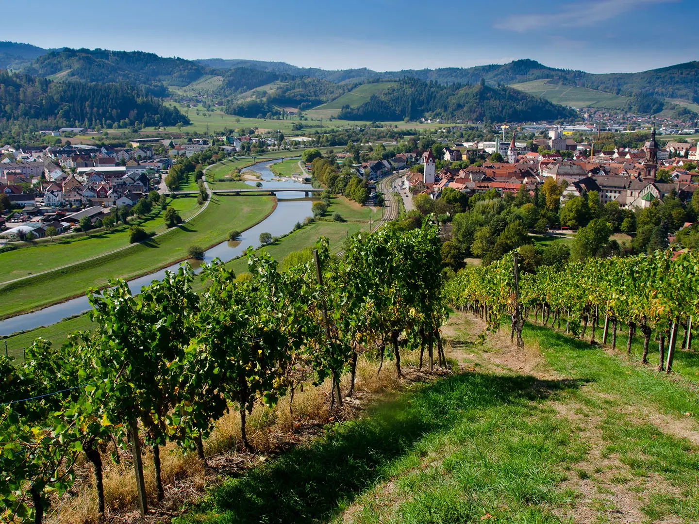
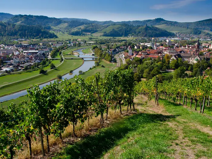
The trail threads between vineyard terraces, orchards, mixed forest and low ridges, often running above the Rhine plain with views west towards the Vosges and east into the Black Forest foothills. Baden-Baden, Sasbachwalden, Kappelrodeck, Oberkirch, Durbach and Gengenbach give the route its rhythm, with wine culture as much a part of the walk as the landscape.
This is not Alpine terrain, and the high point is only about 465 m, but the effort builds over seven days. Repeated climbs out of valleys, stretches of asphalt and open vineyard slopes make it a moderate walk rather than an easy stroll, especially in hot summer weather.
Spring blossom and autumn harvest colour are the classic seasons, while autumn also brings busier accommodation and wine events. The route is straightforward to start by train at Gernsbach, but the finish at Diersburg needs onward bus planning towards Offenburg.
This guide covers stages, daily planning, accommodation, food and wine, transport, terrain, seasons and the common mistakes to avoid.
Stage-by-Stage Guide
Distances below follow the standard 7-stage itinerary. Use the Schwarzwaldverein waymarks — a black-bordered red diamond with a grape — as the main trail identity, but carry a current map or GPX as vineyard tracks, village lanes and the branching Weinschleifen can make junctions busy.
Stage 1: Gernsbach to Baden-Baden — approx. 14 km
The route starts in Gernsbach in the Murgtal and quickly leaves the valley floor for the first vineyard slopes and low wooded ridges. This is a useful introduction to the pattern of the whole trail: short climbs, contouring tracks, village lanes and open viewpoints rather than one sustained mountain ascent.
Underfoot, expect a mix of paved town streets, asphalt vineyard access lanes, gravel tracks and dirt paths. The walking is not technical, but the early climb out of Gernsbach can feel abrupt if starting with a full pack.
The main places are Gernsbach and Baden-Baden, with Baden-Baden making a substantial end-of-stage stop. The highlight is the transition from the Murgtal into the western Black Forest foothills, with the first balcony views out towards the Rhine plain and, in clear weather, the Vosges.
Food and water are straightforward at both ends. Carry enough water for the middle of the day, especially in warm weather, as the open vineyard sections can be hotter than expected and intermediate services should not be assumed.
Accommodation is plentiful in Baden-Baden compared with the smaller wine villages later on the trail. Book ahead if walking in the busier spring, summer or autumn periods.
Gernsbach is one of the easiest access points on the trail, served by the Murgtalbahn / Karlsruhe S-Bahn lines S8/S81. Baden-Baden is also a practical public-transport point for joining or leaving the route, with rail access available; current local connections should be checked before travelling.
Navigation is usually clear, but take care on the way out of Gernsbach and on the approach to Baden-Baden, where town streets and local paths can make the line less obvious than on open hillside. The main warning on this stage is heat and exposure on open slopes in high summer, plus hard surfaces underfoot on lanes and vineyard tracks.
Stage 2: Baden-Baden to Bühlertal — approx. 15 km
This stage keeps to the wine-country fringe below the Black Forest, linking Baden-Baden with Bühlertal through a mixture of vineyard slopes, orchards, forest edges and low ridges. It is a moderate day rather than a difficult one, but the repeated undulations are more tiring than the distance alone suggests.
Path conditions remain varied: asphalt lanes through settled areas, gravel vineyard tracks, dirt paths and sections through woodland. After rain, forest paths can be softer underfoot, while the paved sections can feel hard on feet over consecutive days.
The key place at the end is Bühlertal, a useful overnight stop in the northern half of the trail. The stage gives regular west-facing views across the Rhine plain, with the Black Forest foothills rising immediately behind the route.
Food and drink are best planned around Baden-Baden and Bühlertal. Seasonal inns and wine taverns may be available in the wider area, but opening hours for Straußwirtschaften and smaller places change; this should be checked before travelling.
Bühlertal has accommodation options, though it is smaller than Baden-Baden and should be booked in advance during popular walking and wine seasons. If arranging a shorter section, Baden-Baden is the stronger transport anchor at the start; public transport from Bühlertal should be checked before travelling.
Navigation is mainly a matter of staying with the Weinpfad waymark at vineyard-road junctions. Do not be pulled onto local circular routes unless deliberately adding a Weinschleife. In hot weather, start early or carry extra water, as shade is intermittent on the open vineyard ground.
Stage 3: Bühlertal to Kappelrodeck — approx. 20 km
This is the longest day in the standard 7-stage itinerary and should be treated as one of the more demanding stages, despite the low elevations. The route continues south through classic Ortenau wine country, with Sasbachwalden as the major intermediate village before the finish at Kappelrodeck.
The walking alternates between open vineyard slopes, orchard and village lanes, and mixed woodland. Expect steady up-and-down walking across side valleys rather than a flat traverse, with some long stretches on firm gravel or asphalt.
Sasbachwalden is one of the strongest highlights of the northern half of the trail: a half-timbered wine-and-flower village on the slopes below the Hornisgrinde, associated with Blauer Spätburgunder and the Alde Gott winegrowers’ cooperative. Kappelrodeck is another important red-wine village, linked with the Hex vom Dasenstein Spätburgunder tradition.
Views are a major part of this stage. The open slopes give repeated panoramas over the Rhine plain towards the Vosges, while the route also looks back into the forested Black Forest foothills.
Plan food and water carefully because the stage is longer than the previous two. Sasbachwalden is the logical mid-stage service point, but opening days and hours for inns, wine taverns and smaller shops should be checked before relying on them.
Accommodation is normally planned in Kappelrodeck, with Sasbachwalden also a useful place for those splitting the day or building a shorter itinerary. Rail section access in this part of the route is commonly arranged via nearby transport hubs such as Achern, but local onward connections should be checked before travelling.
Navigation needs attention around Sasbachwalden and Kappelrodeck because local paths, vineyard roads and wine loops create many options. Follow the grape waymark consistently. The practical warnings are distance, heat on open slopes, and the cumulative effect of hard-surface walking.
Stage 4: Kappelrodeck to Oberkirch — approx. 11 km
This is a shorter stage on paper, but it still crosses proper vineyard-and-ridge terrain and should not be dismissed as a rest day. The route links Kappelrodeck with Oberkirch via the Waldulm wine area, staying in red-wine country before entering the Oberkirch section of the Ortenau.
The surface mix is typical of the trail: paved lanes through villages, vineyard access tracks, gravel and dirt paths, with some wooded sections. The high point of the whole Ortenauer Weinpfad lies in the broader Oberkirch area, so expect climbing even on this relatively short day.
Kappelrodeck and Waldulm are associated with the well-known Hex vom Dasenstein Spätburgunder, making this a strong stage for walkers interested in the wine identity of the route. Approaching Oberkirch, the landscape becomes a blend of vineyards, fruit-growing country and low forested ridges.
Food and water are easier to manage than on Stage 3 because of the shorter distance and the presence of wine villages. Even so, carry enough water from Kappelrodeck and check any planned food stops before setting out, particularly outside main holiday periods or outside autumn wine season.
Oberkirch is one of the better overnight bases on the trail and has rail access, making it a practical place to join, leave or pause the route. Accommodation should still be booked ahead during harvest and festival periods.
Navigation is generally straightforward but requires care at vineyard junctions and wherever local wine loops branch away from the main line. The main stage-specific warning is complacency: short distance does not mean flat walking, and the exposed vineyard sections can still be very warm in summer.
Stage 5: Oberkirch to Zell-Weierbach (Offenburg) — approx. 14 km
This is one of the signature wine stages of the southern half of the trail, connecting Oberkirch with the Durbach area and continuing towards Zell-Weierbach, a wine district of Offenburg. It combines working vineyards, village lanes, wooded edges and fine open viewpoints.
Durbach is the main intermediate wine village and an important stop for Riesling/Klingelberger and Spätburgunder. Schloss Staufenberg sits on the Schlossberg above Durbach and is one of the key landmarks of the entire Weinpfad; its Klingelberg vineyard is historically linked with the regional Klingelberger name for Baden Riesling.
Terrain is moderate but continuously varied. Expect climbs between villages and vineyard slopes, then descents on lanes and tracks; the ascent to the castle area above Durbach adds effort even if the overall stage distance is manageable.
The views around Durbach and Schloss Staufenberg are among the best on the trail, with broad sightlines over the vineyards and out across the Rhine plain. In clear conditions, the Vosges form the western skyline.
Food and wine stops are a real attraction on this stage, especially around Oberkirch and Durbach, but do not rely on a Straußwirtschaft being open without checking. Carry water for the exposed sections, as vineyard walking can be hot and there may be long gaps between reliable supplies.
Accommodation can be planned in Durbach if splitting or adjusting the itinerary, or at the stage end around Zell-Weierbach / Offenburg. Zell-Weierbach should not be confused with Zell am Harmersbach, which is a separate place.
Oberkirch has rail access. Zell-Weierbach is part of Offenburg, and Offenburg is the major rail hub for this part of the route, but local connections between the trail and the station should be checked before travelling.
Navigation is busiest around Durbach and Schloss Staufenberg, where local paths and vineyard routes intersect. Stay alert for the main Ortenauer Weinpfad waymark and avoid unintentionally following a Weinschleife. The main warnings are heat, hard lanes underfoot and the short but noticeable climbs around the Durbach vineyards.
Stage 6: Zell-Weierbach (Offenburg) to Gengenbach — approx. 16 km
This stage continues through the southern Ortenau vineyards from the Offenburg wine districts towards Gengenbach. It is a varied day of vineyard tracks, village approaches, low ridges and occasional woodland, with the route passing near Ortenberg before reaching one of the trail’s strongest cultural stops.
Underfoot, expect more of the Weinpfad’s typical mixture: asphalt lanes in and near settlements, gravel access tracks through vineyards and dirt paths on wooded or field-edge sections. The distance is moderate, but by this point in the hike the accumulated ascent and hard surfaces can be felt.
The major highlight is Gengenbach, a well-preserved medieval old town with half-timbered houses around a former Benedictine abbey. Before that, the stage keeps delivering the route’s recurring balcony views west over the Rhine plain and back east to the Black Forest foothills.
Food and water are best secured at Zell-Weierbach / Offenburg before setting out and in Gengenbach at the end. Any intermediate food stop should be treated as a bonus unless its opening hours have been checked.
Gengenbach is a strong overnight base and has rail access, making it a useful point for section hikers. Zell-Weierbach is close to Offenburg in administrative terms, but onward local transport to or from the trailhead should be checked before travelling.
Navigation is usually manageable, but pay attention at road and lane crossings around the Offenburg-side settlements and near Ortenberg. Also make sure the planned start is Zell-Weierbach, not Zell am Harmersbach. Summer exposure and limited shade on vineyard sections remain the main practical concerns.
Stage 7: Gengenbach to Diersburg (Hohberg) — approx. 11 km
The final stage is short by the standards of the route, but it still follows the Ortenau pattern of vineyard slopes, village lanes, tracks and low wooded ground. It leads from the strong service base of Gengenbach to the official southern terminus at Diersburg, part of the municipality of Hohberg.
The terrain is moderate and non-technical, with the same mix of dirt, gravel and paved surfaces found throughout the trail. There is no high-mountain difficulty, but tired legs and warm vineyard exposure can still make the last day feel harder than its distance suggests.
The main landmark is the finish at Diersburg, a wine village south-west of Offenburg. The stage is less about a single major monument and more about closing the traverse through the Ortenau vineyards, with final views across the Rhine plain and back into the Black Forest foothills.
Start with food and water from Gengenbach. Do not rely on extensive services at Diersburg without checking in advance, particularly if finishing late in the day or outside the main visitor season.
Accommodation at the finish should be arranged before walking if planning to stay locally. Many walkers will find it more practical to travel onward to Offenburg after finishing, where wider rail connections and services are available.
Gengenbach has a railway station. Diersburg has no railway station, so the finish requires a regional bus or other onward arrangement to Offenburg, the nearest mainline rail hub; current bus times should be checked before travelling.
Navigation should remain focused until the official terminus, as local vineyard paths and roads can still tempt shortcuts or wrong turns. The key warning for this stage is logistics rather than terrain: do not arrive at Diersburg assuming there will be rail access or frequent onward transport.
Recommended Itinerary
The Ortenauer Weinpfad is most naturally walked in its standard 7 day-stages. This keeps the daily distances moderate, uses established wine-village overnight stops, and leaves enough time for Baden-Baden, Durbach, Gengenbach and occasional wine tastings without turning the route into a forced march.
Standard 7-day itinerary
| Day | From | To | Approx. distance | Why this stage makes sense | Services/accommodation notes |
|---|---|---|---|---|---|
| 1 | Gernsbach | Baden-Baden | 14 km | A manageable opening day from the Murgtal up onto the vineyard slopes, with a major town at the end for a straightforward first night. | Gernsbach is rail-accessible on the Murgtalbahn. Baden-Baden has the strongest accommodation and food choice on the northern part of the route. |
| 2 | Baden-Baden | Bühlertal | 15 km | Another moderate day, continuing through the northern Ortenau foothills without overloading the early part of the walk. | Bühlertal is a practical overnight stop before the longer third stage. Book ahead in busy holiday or wine-season periods. |
| 3 | Bühlertal | Kappelrodeck | 20 km | This is the longest standard day, passing through classic wine country around Sasbachwalden before reaching the red-wine villages around Kappelrodeck. Start early in hot weather, as vineyard sections can be exposed. | Sasbachwalden and Kappelrodeck are useful service points, with guesthouses/inns in the area. Seasonal Straußwirtschaft opening hours should be checked before relying on them for meals. |
| 4 | Kappelrodeck | Oberkirch | 11 km | A deliberately shorter recovery stage after the 20 km day, with vineyard walking through the Kappelrodeck/Waldulm area and time to settle into Oberkirch. | Oberkirch is one of the larger overnight bases on the route, with good provision for accommodation and food. |
| 5 | Oberkirch | Zell-Weierbach (Offenburg) | 14 km | A compact but rewarding stage through important Riesling/Klingelberger country, with Durbach and Schloss Staufenberg above the village as key planning points. | Durbach is a strong wine-village stop for food, wine and accommodation if choosing to shorten or adjust the stage. Zell-Weierbach is a wine district of Offenburg; staying in or around Offenburg may give more options. |
| 6 | Zell-Weierbach (Offenburg) | Gengenbach | 16 km | A steady penultimate day linking the Offenburg-side vineyards with Gengenbach, one of the best cultural overnight stops on the trail. | Gengenbach has good accommodation and food options and is also useful for rail access if section-walking. |
| 7 | Gengenbach | Diersburg (Hohberg) | 11 km | A short final day into the official southern terminus, leaving time to arrange onward travel from a finish without a railway station. | Diersburg has no station. Plan the onward journey by regional bus to Offenburg, the nearest main rail hub; current bus times should be checked before travelling. |
Slower variant
A slower 8-day itinerary suits walkers who want more time for wine villages, warm-weather starts, or shorter daily effort. The simplest adjustment is to split the longest standard stage between Bühlertal and Kappelrodeck by overnighting in Sasbachwalden, which is a well-established accommodation and wine-village stop on the route.
Another relaxed option is to build in an extra night around Durbach or Gengenbach rather than pushing through the southern half too quickly. This works well in autumn, when accommodation can be busy and Straußwirtschaften may be a major part of the trip; opening hours and room availability should be checked before booking.
Use official mapping before fixing any split-stage accommodation, especially if adding one of the 14 Weinschleifen, as these wine loops can change the day’s distance and ascent.
Faster variant
Fit walkers can compress the route, and 5-stage versions of the Ortenauer Weinpfad are also used. This is best suited to hikers comfortable with longer back-to-back days, repeated vineyard climbs and potentially hot, exposed walking.
A straightforward faster plan is to keep the early stages as listed, then combine shorter southern stages, for example Kappelrodeck to Zell-Weierbach via Oberkirch at about 25 km, and Zell-Weierbach to Diersburg via Gengenbach at about 27 km. Those are long days for this terrain, particularly in high summer, and the final day still needs a bus connection from Diersburg to Offenburg.
For any 5-day schedule, check official mapping before booking accommodation. The route is well waymarked, but daily distances can vary if using local variants, access routes to accommodation, or any of the Weinschleifen.
Planning the Route
How many days to allow
The most straightforward plan is the standard 7-day itinerary, using the established overnight stops at Gernsbach, Baden-Baden, Bühlertal, Kappelrodeck, Oberkirch, Zell-Weierbach (Offenburg), Gengenbach and Diersburg (Hohberg). This keeps the daily distances moderate and suits the character of the route: village-to-village walking with time for meals, wine villages and short cultural stops.
Fit walkers can compress the Ortenauer Weinpfad into 5 longer days, but that changes the feel of the hike. The repeated climbs out of side valleys, asphalt sections and exposed vineyard slopes make fast schedules more tiring than the modest altitude might suggest, especially in warm weather.
A slower schedule is also easy to justify. Baden-Baden, Sasbachwalden, Oberkirch, Durbach and Gengenbach are all places where an extra night can make sense if the aim is to enjoy the wine villages rather than simply cover the line.
Natural stage planning
The route is strongly shaped by accommodation and services in the wine villages. Daily planning should start with where beds are available, then adjust walking days around that, rather than assuming every small settlement will have suitable accommodation at short notice.
| Standard stage | From | To | Approx. distance | Planning note |
|---|---|---|---|---|
| 1 | Gernsbach | Baden-Baden | 14 km | Easy to start by train at Gernsbach; Baden-Baden has the widest early-route service base. |
| 2 | Baden-Baden | Bühlertal | 15 km | A manageable day, but still includes the typical vineyard-and-foothill climbing. |
| 3 | Bühlertal | Kappelrodeck | 20 km | One of the longer standard days; start early in hot weather. Sasbachwalden is the key wine village on this section. |
| 4 | Kappelrodeck | Oberkirch | 11 km | A shorter day through classic Ortenau wine country, useful after the longer previous stage. |
| 5 | Oberkirch | Zell-Weierbach (Offenburg) | 14 km | Allows time for the Durbach area and Schloss Staufenberg above the village. |
| 6 | Zell-Weierbach (Offenburg) | Gengenbach | 16 km | Plan carefully around accommodation: Zell-Weierbach is a wine district of Offenburg, not Zell am Harmersbach. |
| 7 | Gengenbach | Diersburg (Hohberg) | 11 km | Short final walking day, but onward travel needs planning because Diersburg has no railway station. |
Shortening, extending and rest days
Shortening the walk is practical because several intermediate towns have rail access, including Baden-Baden, Achern, Oberkirch, Offenburg and Gengenbach. This makes the Ortenauer Weinpfad workable as a series of weekend or 2–3 day sections, particularly for walkers based in Baden-Württemberg or arriving via the Rhine valley rail corridor.
Extending the walk is easiest via the 14 branching Weinschleifen, the local wine loops connected to the main route. These are best treated as optional add-ons from a settled overnight base rather than automatic diversions, because they add distance and ascent to days that may already include repeated climbs.
Rest days are most useful in Baden-Baden, Durbach or Gengenbach, depending on whether the priority is spa-town facilities, wine tasting or historic town time. Autumn harvest and festival season is especially attractive, but accommodation should be booked well ahead.
Section hiking
Section hiking is realistic on this route. The start at Gernsbach is on the Murgtalbahn, part of the Karlsruhe S-Bahn network, and the wider area has useful rail access at several points along or near the trail.
The main complication is the finish. Diersburg (Hohberg) has no station, so the usual exit is by regional bus towards Offenburg, the nearest major rail hub with ICE/IC and regional services on the Karlsruhe–Basel main line. Current bus and train times should be checked before travelling, especially for a same-day connection after the final stage.
Accommodation and food planning
Accommodation is generally based on hotels, guesthouses, Gasthöfe and inns in the wine villages and larger stops. Baden-Baden, Bühlertal, Sasbachwalden, Kappelrodeck, Oberkirch, Durbach, Gengenbach and Offenburg/Zell-Weierbach are the key places to search first.
Do not leave autumn bookings too late. Harvest, wine festivals and weekend leisure travel can reduce availability in the most attractive villages, particularly where accommodation is limited.
Food is usually a manageable part of the route because the trail passes regular settlements, inns and wine villages. Straußwirtschaften and winery taverns can be excellent, but their opening is seasonal and often limited to particular days or periods; this should be checked before travelling.
Water, heat and daily timing
Water planning matters more than the low altitude suggests. The Ortenauer Weinpfad has long open vineyard sections where shade can be limited, and high summer can be hot above the Rhine plain.
Carry enough water to reach the next reliable village stop, and start early on the longer or more exposed days. The Bühlertal to Kappelrodeck stage is the obvious day to treat with extra caution because it is the longest of the standard stages.
Spring and autumn are the most comfortable seasons for most walkers. Spring brings blossom in the orchards, while autumn brings vineyard colour and harvest atmosphere, but both still require normal rain and temperature planning for low-mountain walking.
Navigation and route variants
The main trail is waymarked by the Schwarzwaldverein with a black-bordered red diamond bearing a grape. Navigation is generally straightforward, but the route moves frequently between vineyard tracks, forest edges, village lanes and low ridges, so a map or GPX track remains useful.
Pay attention where the 14 Weinschleifen branch from the main line. They are useful for adding local loops, but they can also create confusion if a walker follows wine-loop signs instead of the through route.
Before departure, check for current route variants, diversions and any local closures. This is particularly sensible where the route passes through working vineyards, forest tracks and village approaches.
What matters most when planning
The key planning tasks are accommodation, transport and heat management. This is not remote trekking, but it is not a route to improvise entirely either, especially in autumn or if relying on public transport at the finish.
Permits are not a major planning factor for the standard waymarked route, but any local event access, winery visits or organised tastings should be arranged separately where needed. This should be checked before travelling.
Towns, Villages and Overnight Stops
Accommodation on the Ortenauer Weinpfad is mainly in hotels, Gasthöfe, Pensionen and wine-village inns rather than campsites or remote huts. The standard 7-day itinerary is well suited to village-to-village walking, but availability varies by stop and season, so book ahead for autumn harvest and festival periods.
Food is usually straightforward in the larger towns and wine villages, with regular inns and seasonal Winzer- and Straußwirtschaften along the route. Opening days and meal times can be limited outside peak periods, especially in smaller villages; this should be checked before travelling.
Gernsbach
Gernsbach is the official northern start of the Ortenauer Weinpfad, in the Murgtal. The Schwarzwaldverein waymarks lead out of town and up towards the first vineyard and foothill sections.
It is a practical place to arrive the day before starting, particularly because it has rail access on the Murgtalbahn, part of the Karlsruhe S-Bahn network on lines S8/S81 between Karlsruhe, Rastatt, Gernsbach and Freudenstadt. Current train times should be checked before travelling.
As a town rather than a small wine hamlet, Gernsbach is the best place to sort out first-night logistics, last-minute supplies and breakfast before the first stage to Baden-Baden. Accommodation should be booked in advance if arriving late or starting at a busy time.
Baden-Baden
Baden-Baden is the first standard overnight stop, reached after the opening stage from Gernsbach. It is one of the easiest places on the route to use as a transport break or alternative start, as Baden-Baden has rail connections and is one of the intermediate stations useful for section-hiking.
Accommodation provision is stronger here than in the smaller wine villages, with hotels and guest accommodation available across the town. It is a sensible stop for hikers who want a reliable bed, evening meal options and easier onward transport if plans change.
The town sits below the early vineyard slopes of the route, so expect a more urban stop than later stages. If staying away from the immediate line of the trail, allow time in the morning to regain the waymarked route.
Bühlertal
Bühlertal is the standard second overnight stop, between Baden-Baden and Sasbachwalden/Kappelrodeck. It is a good practical base because accommodation provision is generally good compared with the smaller settlements on the route.
This is a useful place to break the northern half of the trail into manageable days. Expect a village-valley stop with access to inns and local services rather than the wider choice found in Baden-Baden.
As with all smaller stops on the Ortenauer Weinpfad, check evening food arrangements when booking accommodation. Some guesthouses may not serve meals every night, and seasonal wine taverns can have restricted opening.
Sasbachwalden
Sasbachwalden is one of the most attractive and useful wine-village stops on the route, lying on the slopes below the Hornisgrinde area. It is associated with Blauer Spätburgunder and the Alde Gott winegrowers’ cooperative, making it a natural pause for walkers interested in the wine side of the trail.
Accommodation provision is generally good, and the village works well either as an overnight stop or as a longer lunch and tasting halt depending on how the stage is split. The standard itinerary continues to Kappelrodeck on day 3, but Sasbachwalden is one of the better places to adjust the schedule if shorter days are preferred.
Food and wine options are a strong reason to stop here, but opening times should still be checked, especially outside the main spring-to-autumn walking season. In hot weather, use the village as a reliable point to refill and reset before more open vineyard walking.
Kappelrodeck
Kappelrodeck is the standard overnight stop at the end of the longer third stage from Bühlertal. It is one of the main service points on the middle section of the route, with generally good provision of hotels, guesthouses and inns.
Together with nearby Waldulm, it is associated with the well-known “Hex vom Dasenstein” Spätburgunder, so it is a strong overnight choice for hikers who want a wine-village evening rather than simply a bed. The next standard stage to Oberkirch is shorter, which can make Kappelrodeck a good place to recover after the longer approach.
For logistics, book accommodation before arrival rather than assuming space will be available. Autumn harvest and local wine events can make the best-located rooms harder to secure.
Waldulm
Waldulm lies in the same wine landscape as Kappelrodeck and is part of the red-wine character of this middle section of the Ortenauer Weinpfad. It is more of a route village than a primary stage town, but it is still worth noting when planning food, wine stops and possible itinerary variations.
Accommodation and services should be treated as more limited than in the larger published overnight stops unless booked in advance. If planning to stay here rather than in Kappelrodeck or Oberkirch, confirm both the room and evening meal arrangements before committing to the stage plan.
Waldulm is useful for walkers interested in the Kappelrodeck/Waldulm Spätburgunder area, but it is not the safest place to leave overnight logistics to chance. Carry enough water and snacks for the day’s vineyard sections rather than relying on every small village having open services.
Oberkirch
Oberkirch is the standard fourth overnight stop and one of the strongest practical bases on the route. It has generally good accommodation provision and is one of the intermediate towns with a railway station, making it useful for section-hikers or anyone needing to shorten, pause or restart the walk.
The surrounding area includes the higher vineyard-and-forest ridges of the route, with the trail’s high point in the Oberkirch area at roughly 464–465 m. This is still low-mountain walking, but the repeated climbs in and out of valleys can feel more demanding than the modest elevations suggest.
Oberkirch is also part of the route’s Riesling/Klingelberger story, and it is a practical place to combine a proper resupply, a reliable overnight and a wine-focused evening. Check restaurant and Straußwirtschaft opening times when booking, particularly outside weekends and the main season.
Durbach
Durbach is one of the leading wine villages on the southern half of the Ortenauer Weinpfad and a strong alternative or additional overnight stop, even though the standard itinerary places the end of day 5 at Zell-Weierbach. Accommodation provision is generally good, and the village is particularly useful for walkers who want to slow the route down and focus on the wine villages rather than compress the later stages.
The village is known for Riesling/Klingelberger and Spätburgunder, and it has regular inns and wine-related places to eat and drink. As elsewhere, seasonal Straußwirtschaft opening times should be checked before planning the day around a specific stop.
Durbach is also the base for visiting Schloss Staufenberg above the village. If building in time for the castle and estate setting, it can make sense to stay in or near Durbach rather than pushing on too quickly.
Schloss Staufenberg
Schloss Staufenberg sits above Durbach on the Schlossberg and is one of the key landmark stops on the route. It is a castle and wine estate of the Margraves of Baden, and its Klingelberg vineyard is historically important for Baden Riesling: single-variety Riesling was planted there in 1782, giving the regional name “Klingelberger” to Baden Riesling.
For hikers, the practical point is that reaching the castle involves a climb above the village, so do not treat it as a flat roadside stop. It is best planned as part of the Durbach section, either as a longer pause during the day or as a reason to stay nearby.
Do not rely on Schloss Staufenberg for all food, water or timing needs without checking current opening arrangements. If visiting matters to the day’s plan, confirm opening times before travelling.
Zell-Weierbach (Offenburg)
Zell-Weierbach is the standard fifth overnight stop and is a wine district of Offenburg. It should not be confused with Zell am Harmersbach, which is a separate place and not the same route stop.
This stop is useful because it sits close to Offenburg’s wider transport and service network. Offenburg is the nearest major rail hub for this part of the route, with ICE/IC and regional services on the Rhine valley main line between Karlsruhe and Basel.
For accommodation, check carefully whether the booking is actually in Zell-Weierbach, elsewhere in Offenburg, or outside convenient walking distance of the trail. If using Offenburg for a wider choice of rooms or transport, allow for the transfer back to the route in the morning; local arrangements should be checked before travelling.
Ortenberg
The route passes near Ortenberg between Zell-Weierbach and Gengenbach. It is best treated as a useful landmark and potential service point rather than one of the main published overnight stops.
If planning to stop here for food, accommodation or transport, check details in advance rather than assuming full hiker services. The standard itinerary continues to Gengenbach, which is the stronger and more reliable overnight base at the end of this stage.
Ortenberg can still be helpful for pacing the day, especially if the weather is hot on exposed vineyard sections. Carry enough water and food to complete the stage even if small local venues are closed.
Gengenbach
Gengenbach is the standard sixth overnight stop and one of the best places on the whole route for a comfortable final-night base. It has generally good accommodation provision and a railway station, making it useful both for section-hiking and for anyone ending the route early.
The old town is one of the strongest cultural stops on the Ortenauer Weinpfad, with half-timbered streets around the former Benedictine abbey. For hikers, the main advantage is practical as well as scenic: there is a better chance of finding accommodation, food and onward transport here than in the smaller villages beyond.
Book ahead in busy periods, especially autumn. If completing the trail the next day to Diersburg, remember that the finish itself has no railway station, so Gengenbach is the last major rail-accessible overnight stop on the standard route.
Diersburg (Hohberg)
Diersburg, part of the municipality of Hohberg, is the official southern terminus of the Ortenauer Weinpfad. It is a wine village south-west of Offenburg and marks the end of the waymarked point-to-point route.
The key planning issue is onward transport: Diersburg has no railway station. Leave the finish by regional bus towards Offenburg, the nearest mainline rail hub, and verify current bus times before relying on them.
Do not assume the finish has the same level of accommodation or services as Gengenbach, Oberkirch or Baden-Baden. Many hikers will find it simpler to complete the final stage, travel on to Offenburg, and use Offenburg’s rail connections for the onward journey or final night.
Getting to the Start
By train
Gernsbach is the straightforward railhead for the official northern start of the Ortenauer Weinpfad. It lies on the Murgtalbahn, the Murg Valley Railway, which is part of the Karlsruhe S-Bahn network.
Use S-Bahn lines S8/S81 on the Karlsruhe–Rastatt–Gernsbach–Freudenstadt corridor, then start from Gernsbach itself. The trail is waymarked out of town by the Schwarzwaldverein red diamond with a grape.
For most long-distance arrivals, Karlsruhe and Rastatt are the key interchange points for reaching Gernsbach by rail. Current train times and engineering works should be checked before travelling.
By bus
Bus travel is not usually the main way to reach the start, because Gernsbach has a railway station on the Murgtalbahn. Buses may still be useful for local accommodation transfers or if staying in a nearby village before the first stage.
Local bus times can be sparse outside peak periods, in the evening, on Sundays or on public holidays. This should be checked before travelling.
By car
Driving to Gernsbach is possible, but it is less convenient than arriving by train because the route is a point-to-point walk ending at Diersburg (Hohberg), not back in Gernsbach. Diersburg has no railway station, so returning to a car left at the start requires a bus connection from the finish towards Offenburg, then rail travel back via the Rhine valley/Murgtalbahn network.
Do not assume that multi-day parking will be simple in the town centre. If driving, arrange parking with accommodation in Gernsbach or check local long-stay parking rules before committing to a plan. This should be checked before travelling.
A practical alternative is to travel to Gernsbach by train, then leave the finish logistics for the end: bus from Diersburg to Offenburg, which is the nearest mainline rail hub for onward travel.
From the nearest airport
No single airport is essential for this trail. The simplest flight plan is to choose an airport with good rail access into the Karlsruhe/Rastatt corridor, then continue by Murgtalbahn to Gernsbach.
When comparing flight options, check the full door-to-door journey rather than the map distance alone: airport rail links, late arrivals, Sunday services and the final S-Bahn connection to Gernsbach can matter more than the airport’s straight-line distance. This should be checked before travelling.
Where to stay before starting
Gernsbach is the cleanest overnight base before Day 1, as it avoids a morning transfer and lets you start directly from the official trailhead. It is especially sensible if arriving late or if planning an early start on the first stage to Baden-Baden.
Baden-Baden can also work as a pre-walk base if its wider accommodation choice is useful, but it adds a transfer to Gernsbach before beginning the route. If doing this, check the morning train or local transport times carefully before booking.
In autumn, accommodation in the Ortenau wine villages can be busy around harvest and festival periods, so the first night and the first few stage nights should be booked ahead rather than left to arrival day.
Getting Home from the Finish
The Ortenauer Weinpfad finishes in Diersburg, part of Hohberg, south-west of Offenburg. The key planning point is simple: Diersburg has no railway station, so almost all onward journeys start with a bus or taxi to Offenburg, the nearest major rail hub.
Timetables should be checked before travelling, especially if finishing late in the afternoon, on a Sunday or on a public holiday.
By train
There is no train from Diersburg itself. For rail travel, head first to Offenburg, which is on the Rhine valley main line between Karlsruhe and Basel and has ICE/IC, regional and local services.
From Offenburg you can travel north towards Karlsruhe, south towards Basel, or connect into other regional services. If returning to the start at Gernsbach, plan the journey via the Rhine valley rail corridor and the Murgtalbahn / Karlsruhe S-Bahn network serving Gernsbach; exact routing and timings should be checked before travelling.
If you are ending the walk early, several earlier places on or near the route have rail access, including Baden-Baden, Achern, Oberkirch, Offenburg and Gengenbach. This makes the southern half relatively straightforward to split into shorter rail-accessible sections.
By bus
Diersburg is reached by regional bus, with Offenburg the normal onward connection point. This is the main public-transport link from the official finish.
Do not assume late-evening frequency. If the final walking day from Gengenbach to Diersburg ends after normal daytime services, check the current bus timetable in advance and have a fallback plan.
A sensible strategy is to save the relevant bus times offline before starting the final stage, because route-finding, breaks and vineyard climbs can make arrival time less predictable than the short final-stage distance suggests.
By car/taxi
A taxi from Diersburg to Offenburg is the simplest fallback if the bus timetable does not fit your finish time. This is especially useful for late finishes, bad weather, Sunday travel or walkers with onward long-distance trains from Offenburg.
If using a taxi, book ahead where possible rather than relying on finding one at the trailhead. Agree the pick-up point in Diersburg clearly and confirm the fare before travelling.
For walkers who left a car at the start in Gernsbach, remember that this is a point-to-point walk. The practical return is usually bus or taxi to Offenburg, then rail back towards Gernsbach via the relevant Rhine valley and Murgtalbahn connections. Current connections should be checked before travelling.
From the nearest airport
The trail does not finish at an airport-linked transport node. For flights after the hike, travel first from Diersburg to Offenburg, then use the rail network from Offenburg to reach the airport that best fits your route home.
Airport choice and rail connections are timetable-dependent and should be checked before booking flights. Avoid scheduling a tight same-day flight after finishing in Diersburg unless the bus or taxi to Offenburg and the onward rail journey have been planned in detail.
Where to stay at the finish
Diersburg is a wine village rather than a large transport hub, so accommodation and evening food options may be more limited than in bigger stops on the route. If planning to stay there or nearby, book ahead and check opening days, particularly outside the main season or during autumn wine events.
For onward travel the next morning, Offenburg is usually the most practical place to overnight because of its mainline rail connections. Gengenbach is also a strong option if you prefer to spend the final night before the last stage in a larger, attractive town with a station, then walk to Diersburg the following day and leave by bus or taxi.
Which Direction Should You Walk?
The standard and simplest direction is north to south, from Gernsbach to Diersburg (Hohberg). This is the official direction of the Ortenauer Weinpfad, with Gernsbach as the northern start and Diersburg as the southern terminus, and it matches the usual 7-stage itinerary.
Walking in reverse is entirely possible, but it is less convenient for planning because the published stage sequence, route descriptions and the psychological structure of the trail are generally built around the Gernsbach → Diersburg line.
Standard direction: Gernsbach to Diersburg
Starting in Gernsbach is logistically straightforward. The town is on the Murgtalbahn, part of the Karlsruhe S-Bahn network, so reaching the trailhead by public transport is easier than reaching Diersburg.
The route then builds naturally through the Ortenau wine villages: Baden-Baden, Bühlertal, Sasbachwalden, Kappelrodeck, Oberkirch, Durbach, Zell-Weierbach and Gengenbach before ending in Diersburg. This gives a good progression from the Murgtal and northern vineyard slopes into the heart of the Ortenau wine country.
The main drawback is the finish. Diersburg has no railway station, so onward travel normally means taking a regional bus towards Offenburg, the nearest major rail hub. Current bus and train times should be checked before travelling, particularly if finishing late in the day or on a Sunday/public holiday.
Reverse direction: Diersburg to Gernsbach
Walking south to north can make the final travel day easier, because Gernsbach has direct rail access. However, it means starting with the more awkward transport leg: reaching Diersburg by bus from the Offenburg area before beginning the walk.
The reverse direction also front-loads some of the strongest southern highlights, including Gengenbach, Durbach and Schloss Staufenberg above Durbach. Some walkers may prefer saving these for later rather than passing through them early.
Accommodation can still be arranged in reverse using the same overnight towns, but bookings need to be made carefully because the standard 7-stage flow is usually described north to south. In autumn, harvest and wine-festival season can make availability tighter in the wine villages, whichever direction is chosen.
Are the climbs easier one way?
There is no major directional advantage. The Ortenauer Weinpfad is not an Alpine traverse with one obvious hard side; it is a rolling low-mountain route with repeated climbs and descents through vineyard valleys, orchards, forest edges and low ridges.
The total ascent is about 2,700 m, and that effort is spread across the whole trail. Walking north to south or south to north still means regular short-to-moderate climbs rather than one defining pass.
In high summer, direction matters less than timing. The open vineyard sections can be hot and exposed, so early starts, water planning and sun protection are more important than choosing northbound or southbound.
Recommendation
For most walkers, the best choice is to walk Gernsbach to Diersburg. It follows the official and most commonly published direction, starts with easy rail access, fits the standard 7-day stage plan and gives the route a natural progression through the Ortenau wine villages.
Choose the reverse direction only if finishing at a railway station is the priority, or if onward travel from Diersburg would be awkward for the planned dates. In that case, check the bus connection to Diersburg before booking accommodation.
Accommodation Along the Route
The Ortenauer Weinpfad works well as an inn-to-inn walk. The route links wine villages, spa towns and small Black Forest foothill settlements, so most walkers can sleep in hotels, Gasthöfe, Pensionen and village inns rather than carrying camping equipment.
Accommodation is strongest in Baden-Baden, Bühlertal, Sasbachwalden, Kappelrodeck, Oberkirch, Durbach and Gengenbach. Smaller wine villages can be more limited, and the finish at Diersburg (Hohberg) needs particular planning because it has no railway station and is not the strongest overnight base.
Autumn is the main pressure point. The wine harvest, village festivals and weekend tasting trips can fill smaller inns well ahead of time, especially in Sasbachwalden, Kappelrodeck, Oberkirch and Durbach. Book all stage nights in advance if walking in autumn; in spring and summer, booking ahead is still sensible because the best village options are limited in number.
Best overnight pattern
The standard 7-day itinerary uses the following overnight rhythm:
- Pre-walk night: Gernsbach, or arrive early by train and start the same day.
- Night 1: Baden-Baden.
- Night 2: Bühlertal.
- Night 3: Kappelrodeck, with Sasbachwalden as a possible shorter-stage or alternative stop before it.
- Night 4: Oberkirch.
- Night 5: Zell-Weierbach (Offenburg), or another practical base in Offenburg with a transfer back to the trail.
- Night 6: Gengenbach.
- Finish: Diersburg, then usually onward by bus towards Offenburg unless accommodation has been booked locally.
Durbach is one of the strongest accommodation and wine stops on the southern half of the route. It sits between Oberkirch and Zell-Weierbach, so it can be used to reshape the final stages, add a shorter day, or build in more time around Schloss Staufenberg above the village.
Accommodation by place
| Place | Accommodation level | Best for | Notes |
|---|---|---|---|
| Gernsbach | Limited | Pre-walk night and rail arrival | Official northern start, with easy access by the Murgtalbahn / Karlsruhe S-Bahn. Book ahead if arriving late or starting early. |
| Baden-Baden | Good | First overnight, comfort stop, transport flexibility | The largest and most serviced early stop, useful if starting the route after travelling in. |
| Bühlertal | Good | Standard second overnight | A practical valley stop before the longer Bühlertal to Kappelrodeck stage. |
| Sasbachwalden | Good | Alternative stop, shorter stages, wine village stay | Strong choice for walkers who want to break up the longer third stage or spend more time in the Spätburgunder wine villages. Autumn weekends can be busy. |
| Kappelrodeck | Good | Standard third overnight | A useful and well-established stage end in the Kappelrodeck/Waldulm red-wine area. |
| Waldulm | Limited | Nearby village option | More of a route village than a main accommodation hub; useful only if suitable lodging is available. This should be checked before travelling. |
| Oberkirch | Good | Standard fourth overnight, central route base | One of the most practical mid-route stops, with good onward flexibility because Oberkirch has a station. |
| Durbach | Good | Wine-focused overnight, stage adjustment | A strong alternative or additional overnight between Oberkirch and Zell-Weierbach, especially for time around the Durbach vineyards and Schloss Staufenberg. |
| Schloss Staufenberg above Durbach | None | Visit or meal/tasting stop, not stage lodging | Treat the castle above Durbach as a trail highlight rather than an accommodation base; stay in Durbach or another nearby route settlement. |
| Zell-Weierbach (Offenburg) | Limited | Standard fifth overnight | A wine district of Offenburg and the published stage end. If local rooms are scarce, staying elsewhere in Offenburg may be practical, but the transfer back to the trail should be checked before booking. |
| Ortenberg (near) | Limited | Flexible split on the southern stages | Not a main stage end on the standard 7-day plan, but may help if reshaping the Zell-Weierbach to Gengenbach section. Availability should be checked before travelling. |
| Gengenbach | Good | Penultimate overnight, cultural stop, rail access | One of the best southern bases, with a preserved old town and a station for section-walkers. Book early in busy periods. |
| Diersburg (Hohberg) | Limited | Finish only | The official southern terminus has no railway station. Many walkers plan onward travel by regional bus to Offenburg rather than relying on a final-night bed in Diersburg. Current bus times should be checked before travelling. |
Booking and stage-planning advice
For the easiest logistics, book the whole trail before setting out, then adjust walking days around confirmed accommodation rather than assuming every village will have space. This is especially important on the Bühlertal–Kappelrodeck and Oberkirch–Zell-Weierbach–Gengenbach parts of the route, where attractive wine villages can be busy and the best-located inns may be limited.
If a preferred stage-end is full, the route is flexible enough to use nearby alternatives such as Sasbachwalden instead of Kappelrodeck, or Durbach instead of Zell-Weierbach, provided the daily distance and ascent still suit the walker. Several intermediate towns, including Baden-Baden, Oberkirch, Offenburg and Gengenbach, have rail access, which also helps with section-walking and escape options.
Straußwirtschaften and wine taverns are excellent for food and local wine, but they should not be treated as guaranteed evening-meal stops. Opening can be seasonal and irregular, particularly outside harvest and festival periods, so current hours should be checked before relying on them.
Luggage transfer is not essential, but the trail suits a light daypack approach if baggage movement can be arranged through accommodation providers or local taxi services. Any luggage transfer, taxi pickup or off-route overnight plan should be agreed in advance, including pickup times and whether the property can receive bags before check-in.
Camping and Wild Camping
The Ortenauer Weinpfad is best planned as an inn-to-inn walk rather than a camping trek. The standard stages link wine villages and towns such as Baden-Baden, Bühlertal, Sasbachwalden, Kappelrodeck, Oberkirch, Durbach, Zell-Weierbach and Gengenbach, where hotels, guesthouses and inns are the normal overnight solution.
Camping can work only with extra planning. Treat campsites as occasional on- or near-route options rather than a continuous chain of stage-end places, and check exact locations, opening periods and access before building an itinerary around them. This should be checked before travelling.
Does the route suit camping?
Only partly. The route is not remote, the daily distances are moderate, and the walking repeatedly drops into settled valleys and wine villages, so carrying a full camping load gives limited benefit compared with booking simple guesthouses or pensions.
The terrain also makes spontaneous camping awkward. Much of the line passes through working vineyards, fruit orchards, village lanes and mixed forest, with regular asphalt and track sections; flat, discreet, low-impact tent spots are not something to rely on.
Camping is most realistic for walkers who are happy to leave the waymarked line at the end of a stage to reach a formal campsite, then return to the trail the next morning. Allow extra time and ascent/descent for this, especially where the Weinpfad sits above the valley settlements.
Wild camping
Do not treat wild camping as a normal or default option on the Ortenauer Weinpfad. The trail crosses a settled wine-growing landscape with private vineyard and orchard land, forest tracks, small villages and tourist areas, so pitching without permission is both difficult in practice and potentially problematic.
Local rules in Baden-Württemberg, forest regulations, protected-area restrictions and landowner permission all matter. If considering any overnight outside a formal campsite or accommodation, permission and current local rules must be checked in advance with the relevant municipality, landowner or local tourism office. This should be checked before travelling.
Never camp on vineyard terraces, in orchards, beside working tracks, at viewpoints used by local walkers, or close to wine huts, chapels, village edges or estates. These are working landscapes, not open backcountry.
Water and supplies if camping
Water planning is straightforward only if using accommodation, cafés, restaurants or official campsite facilities. The route passes regularly through villages and towns, but public water points should not be assumed.
Carry enough water for the open vineyard sections, especially in high summer when the slopes can be hot and exposed. Do not rely on natural water sources along the ridges or vineyard sections for drinking water.
Food resupply is generally easier than on remote trails because the route links settled places, but seasonal Straußwirtschaften and wine taverns do not always keep daily or year-round hours. Opening times should be checked before relying on them for an evening meal.
Fire, stoves and low-impact practice
Open fires are inappropriate on this route. The walk passes through vineyards, orchards and forested slopes, and hot summer conditions can make fire risk a serious concern.
Use stoves only where they are permitted, safe and well away from dry vegetation; on formal campsites, follow the site rules. In dry, windy or very hot weather, avoid any flame-based cooking outside designated areas.
Pack out all rubbish, including food scraps, tissues and wine or picnic waste. Keep well away from vines and fruit trees, do not disturb farming equipment or access tracks, and leave any rest spot exactly as found.
Food, Water and Resupply
The Ortenauer Weinpfad is a village-to-village trail, so food planning is straightforward compared with remote Black Forest routes. Most walkers can eat breakfast at accommodation, carry a packed lunch or bakery supplies, and use cafés, inns, Gasthöfe/Pensionen and Straußwirtschaften in the wine villages for evening meals.
The main caution is opening hours, not remoteness. Rural German restaurants often have rest days, many shops close on Sundays, and Straußwirtschaften are seasonal by nature. In autumn, harvest and wine-festival periods bring more activity but also higher demand, so evening meals and accommodation should be booked rather than left to chance.
Food availability
Food is easiest in the larger overnight stops: Baden-Baden, Bühlertal, Sasbachwalden, Kappelrodeck, Oberkirch, Durbach, Zell-Weierbach (Offenburg) and Gengenbach. These are the best places to plan proper meals and pick up supplies for the following day.
Between villages, the trail spends long stretches on vineyard slopes, orchards, forest tracks and low ridges. Do not assume there will be a shop, café or open wine tavern exactly when needed between stage ends, especially on weekdays outside the main season or on Sundays.
For a typical day, carry lunch plus snacks unless a specific open lunch stop has been checked in advance. This is especially sensible on the longer Bühlertal to Kappelrodeck stage, where the distance is around 20 km and the day includes repeated climbing through vineyard and forest terrain.
Water
Use accommodation, cafés and restaurants as the main water-refill points. Public drinking-water points are not something to rely on for this route unless they have been identified on an up-to-date map or locally before setting out.
Natural water should be treated as a backup rather than a plan. The route passes through cultivated vineyard country and forested valleys, so any stream or spring water should be filtered or treated if used. In practice, it is simpler and safer to start each stage with enough water from the village.
In spring and autumn, most walkers should still start with enough water for several hours of walking. In high summer, the open vineyard sections can be hot and exposed, so carrying extra water is important; 1.5–2 litres is a sensible minimum for many walkers, with more on hot days or if lunch stops have not been checked.
Stage-by-stage resupply guide
| Section | Food availability | Water availability | Notes |
|---|---|---|---|
| Gernsbach to Baden-Baden | Good at both ends; Baden-Baden has the strongest range of meal options on the early route. | Refill before leaving Gernsbach and again in Baden-Baden. | Do not count on constant services once the trail leaves town and climbs onto vineyard slopes. |
| Baden-Baden to Bühlertal | Good at Baden-Baden and Bühlertal. | Start full from Baden-Baden; refill at accommodation or cafés in Bühlertal. | A standard village-to-village day, but exposed vineyard walking can feel hotter than the distance suggests. |
| Bühlertal to Kappelrodeck via Sasbachwalden | Food is available in the main villages, especially Sasbachwalden and Kappelrodeck, but opening hours vary. | Carry enough from Bühlertal; refill in villages where cafés, inns or accommodation are open. | This is the longest standard stage, so carry lunch unless a definite stop has been checked. |
| Kappelrodeck to Oberkirch via Waldulm | Good at Kappelrodeck and Oberkirch, with wine-village options around Waldulm. | Refill at the start and end; use village services rather than natural sources. | A shorter stage, but still worth carrying snacks as rural opening hours can be limited. |
| Oberkirch to Zell-Weierbach (Offenburg) via Durbach and Schloss Staufenberg | Good in Oberkirch and Durbach; Zell-Weierbach has village-based options. Seasonal Straußwirtschaften may be useful if open. | Refill in Oberkirch and Durbach where possible. | This is classic wine-country walking; plan tasting stops around hydration, especially in warm weather. |
| Zell-Weierbach (Offenburg) to Gengenbach via the Ortenberg area | Good at Zell-Weierbach and Gengenbach; intermediate options should be checked before relying on them. | Start with a full bottle load from Zell-Weierbach; refill in open businesses or accommodation. | Carry lunch or at least substantial snacks unless a lunch stop has been planned. |
| Gengenbach to Diersburg (Hohberg) | Good in Gengenbach before setting out; Diersburg is a smaller finish village, so onward food options should be checked. | Fill up in Gengenbach before the final stage. | The finish has no railway station, so plan both food and onward bus connections to Offenburg before leaving Gengenbach. |
Practical resupply tips
Ask accommodation the evening before for breakfast times and whether a packed lunch is possible. This is often the simplest solution on stages where restaurant opening hours are uncertain.
Check Sunday and public-holiday opening carefully. Supermarkets and many village shops may be closed, while restaurants and wine taverns can be busy, seasonal or on a weekly rest day. This should be checked before travelling.
Do not rely on wine taverns as essential resupply points. Straußwirtschaften are part of the appeal of the Ortenau wine region, but their opening periods and hours vary, and they are better treated as a bonus than as the only meal plan.
Carry emergency snacks every day: bread, cheese, nuts, fruit or similar high-energy food is enough for this moderate, non-remote trail. There is no need to carry multi-day food, but there is also no reason to start a stage with an empty pack and hope the next village has something open.
Terrain, Conditions and Difficulty in Practice
The Ortenauer Weinpfad is a moderate low-mountain walk rather than a technical mountain route. The high point is only about 465 m near Oberkirch, but the route repeatedly climbs from wine villages onto vineyard and forest ridges, then drops back into the next valley or settlement. Over several days, that pattern is what creates the effort.
Underfoot, expect a mixed surface rather than a continuous natural trail. Dirt and gravel paths are common through vineyards, orchards and forest, but there are also regular stretches of asphalt, paved village lanes and hard vineyard tracks. Footwear should be chosen for long days on firm surfaces as much as for grip on paths.
What the walking feels like
The route is generally straightforward to walk: no scrambling, no exposed ridgelines in the Alpine sense, and no high-mountain weather or terrain. The Schwarzwaldverein waymark — a black-bordered red diamond with a grape — makes navigation easier than on an unmarked route, although care is still needed through towns, junctions, vineyard tracks and places where the 14 branching Weinschleifen join or leave the main line.
The difficulty comes from repetition. A single climb is rarely intimidating, but the trail is rarely flat for long, and the total ascent of about 2,700 m is noticeable by the end of a 7-day itinerary. Walkers compressing the trail into 5 longer stages should expect the climbs, road surfaces and heat exposure to feel significantly harder.
| Factor | Practical effect |
|---|---|
| Vineyard slopes | Frequent short to moderate climbs and descents; often open and sunny. |
| Forested ridges | More shade and softer paths, but still undulating. |
| Villages and lanes | Easier navigation and services, but more asphalt underfoot. |
| Low altitude | No Alpine terrain, but little height does not mean little ascent. |
| Open Rhine-plain viewpoints | Excellent visibility, but also exposure to sun and heat in summer. |
Surfaces and footwear
A lightweight walking shoe or low boot with a firm sole is usually more suitable than heavy mountain boots. The trail includes enough gravel, dirt and forest path to require proper grip, but also enough asphalt that overly stiff footwear can become tiring.
After rain, dirt and forest sections can become muddy or slippery, especially on descents. The route is not a boggy wilderness walk, and the vineyard and village sections generally keep the going firm, but poles can be useful for repeated downhill walking on wet paths or hard surfaces.
Climbs, descents and daily effort
The standard 7-day itinerary keeps the daily distances manageable, with stages ranging from about 11 km to 20 km. The 20 km Bühlertal to Kappelrodeck stage is likely to feel more demanding than the shorter days, not just because of distance but because the same vineyard-and-valley pattern continues.
Shorter stages such as Kappelrodeck to Oberkirch or Gengenbach to Diersburg are not automatically rest days if walked in hot weather or after several accumulated days of ascent. The practical approach is to pace the climbs steadily, avoid overloading the pack, and allow time for village stops without turning the afternoon into a heat trap.
Heat, exposure and shade
High summer is the main condition that can make the Ortenauer Weinpfad harder than its moderate grade suggests. Open vineyard terraces and slopes can be hot and exposed, with reflected heat from stone, gravel and asphalt.
Forest sections provide relief, but they do not remove the need to manage sun exposure. Start earlier in hot spells, carry enough water between villages, and avoid assuming every Straußwirtschaft or inn will be open exactly when needed; seasonal opening hours should be checked before travelling.
Mud, wet weather and slippery ground
This is not a route defined by bog, marsh or rough mountain ground. Wet weather mainly affects the forest paths, dirt tracks and steeper vineyard descents, where mud, wet leaves or smooth hard surfaces can make footing less secure.
Asphalt and paved lanes remain passable in poor weather, but they can be uncomfortable over long distances and slippery on descents. Good tread and walking poles are more useful here than technical mountain equipment.
Roads, lanes and settlement walking
Road walking is part of the character of the trail because it links wine villages, vineyard access tracks and paved lanes. These sections are useful for services and accommodation, but they add cumulative impact on feet and joints.
Navigation also changes in built-up areas. Waymarks can be easy to miss when the route threads through villages such as Baden-Baden, Sasbachwalden, Kappelrodeck, Oberkirch, Durbach, Zell-Weierbach (Offenburg) and Gengenbach, so a map or GPX track is sensible even on a well-marked trail.
Technical hazards, livestock and barriers
There is no technical scrambling, glacier travel, exposed Alpine pass or remote mountain terrain on the Ortenauer Weinpfad. The route is best understood as a waymarked vineyard, orchard, forest and village walk along the western foothills of the northern Black Forest.
Livestock fields, stiles and fence crossings are not a major planning issue for this route. The more relevant practical obstacles are junctions between vineyard tracks, hard-surface walking, seasonal heat and the cumulative ascent over several consecutive days.
Seasonal conditions
Spring and autumn are usually the most comfortable seasons for this style of walking. Spring brings blossom in the fruit-growing areas, while autumn brings vineyard colour and the wine-harvest atmosphere, but autumn is also a busy period for accommodation and local wine events.
Summer is entirely feasible, but it requires more attention to heat, water and sun protection. The open vineyard sections above the Rhine plain can feel much hotter than the route’s modest altitude suggests.
Winter is not the main season for this hike. If planning outside the usual spring-to-autumn window, current local conditions, accommodation, public transport and food opening times should be checked before travelling.
Weather and Best Time to Walk
The Ortenauer Weinpfad is best treated as a spring-to-autumn walking route. It stays in low-mountain terrain, with a high point of about 465 m, so it is not an Alpine route, but the repeated climbs, open vineyard slopes and mixed surfaces make seasonal conditions important.
Best seasons
| Season | What it means for hikers |
|---|---|
| Spring | One of the classic times to walk, especially for fruit-tree blossom in the Ortenau villages and orchards. Expect mixed ground underfoot: dirt and gravel paths can be wet after rain, while forest sections may stay damp longer than the open vineyard tracks. |
| Summer | Feasible, with long daylight for the standard 7-stage itinerary or faster schedules. The main issue is heat and exposure on open vineyard sections, plus hard asphalt through villages and vineyard lanes. Start early, carry enough water and use sun protection. |
| Autumn | Another prime season, with vine colour, harvest atmosphere and wine festivals. This is also the season when accommodation in wine villages can fill quickly, so book ahead, especially around Baden-Baden, Sasbachwalden, Oberkirch, Durbach and Gengenbach. |
| Winter | Not the natural season for this route. The trail is low enough to be more realistic than high Black Forest or Alpine walking, but short daylight, wet or icy paths, shaded forest sections and reduced seasonal hospitality make it less straightforward. This should be checked before travelling. |
Heat, exposure and storms
High summer is the least forgiving period despite the moderate altitude. Much of the route crosses vineyard terraces, fruit-growing slopes and open balcony paths above the Rhine plain, where shade can be limited and reflected heat from asphalt or paved lanes can make stages feel harder than their distance suggests.
On hot days, the practical approach is to leave early, keep pauses for villages or shaded forest, and avoid underestimating the repeated climbs out of the small valleys. The longer middle stages, particularly the 20 km day between Bühlertal and Kappelrodeck, deserve extra care in hot weather.
If thunderstorms are forecast, exposed vineyard ridges and open slopes are poor places to linger. Check the local forecast before each stage and be ready to shorten a day using the larger rail-accessible towns where possible.
Rain, mud and trail surfaces
The trail is not technically difficult, but rain changes the feel of the route. Dirt and gravel paths through forest and vineyard edges can become greasy, while paved lanes and asphalt are straightforward but tiring underfoot on a multi-day walk.
After prolonged wet weather, use footwear with reliable grip rather than lightweight urban trainers. Poles can also be useful on repeated vineyard and forest descents, especially when the ground is slick.
Fog, views and navigation
The route is well waymarked by the Schwarzwaldverein red diamond with a grape, but poor visibility can still matter. Fog, low cloud or haze can hide the expected balcony views across the Rhine plain to the Vosges and make open vineyard junctions feel less obvious.
Carry an offline map or GPX track as a backup to the waymarks, particularly if using any of the branching Weinschleifen wine loops or local variants. Current route information for variants should be checked before travelling.
Daylight and stage planning
The standard 7-day schedule keeps most stages to manageable day lengths, with daily distances from about 11 km to 20 km. In spring and autumn this is usually a sensible rhythm, but late starts and long wine-tasting lunches can still put pressure on the day.
Walkers compressing the trail into 5 longer stages should be more careful with daylight, especially outside high summer. Build in time for the cumulative ascent, village detours, food stops and transport connections at the end of a stage.
Accommodation and seasonal services
Autumn is attractive but busy because of the harvest and wine-festival season. Accommodation in the wine villages should be booked ahead rather than left to chance.
Seasonal Straußwirtschaften, wine taverns and tasting opportunities are part of the appeal of the route, but opening hours vary. Check current opening days before depending on them for meals, especially on quieter weekdays or outside the main visitor season.
Safety Notes
The Ortenauer Weinpfad is a moderate low-mountain route, not an Alpine or remote wilderness walk. The main safety issues are cumulative fatigue from repeated climbs, heat and sun on open vineyard slopes, short road and lane sections, and the need to keep daily logistics tidy on a point-to-point trail.
Emergency and phone signal
In Germany, dial 112 for emergency help. Keep the day’s accommodation address, the next village name and a map location available, as the route often moves between vineyard tracks, forest paths and small settlements where a precise description helps.
Mobile signal should not be treated as guaranteed everywhere, especially in wooded folds and away from the larger towns. Download offline maps or GPX files before setting off, and carry enough battery for navigation and emergency use.
Waymarking and navigation
The route is waymarked by the Schwarzwaldverein with a black-bordered red diamond bearing a grape. It is generally straightforward to follow, but the 14 branching Weinschleifen can make junctions busier than on a simple linear trail.
Check at confusing junctions that the marker is for the main Ortenauer Weinpfad, not a circular wine loop or local variant. A phone map, paper map or saved GPX track is useful for quick confirmation, particularly around villages and where vineyard tracks split.
Heat, sun and weather exposure
High summer can be hot on the open vineyard sections. Much of the walking is on slopes, terraces and tracks with limited shade between villages, so start early in warm weather, carry more water than feels necessary, and use sun protection.
Spring and autumn are often the best walking seasons, but weather can still change across the low forested ridges and exposed vineyard balconies. Carry a waterproof layer and an insulating layer even though the high point is only about 465 m.
Water and food planning
This is village-to-village walking with regular settlements, inns and wine villages, but do not assume every Straußwirtschaft, inn or shop will be open when you pass. Seasonal opening hours matter, especially outside peak periods and during local events.
Carry enough water for the full stage, particularly on the longer days between Bühlertal and Kappelrodeck, and between Zell-Weierbach (Offenburg) and Gengenbach. Refill in villages rather than relying on streams or untreated sources.
Roads, lanes and vineyard tracks
The trail includes asphalt, paved village lanes and working vineyard tracks. Walk on the safe side of narrow lanes, stay alert at bends and junctions, and expect occasional local traffic or vineyard vehicles.
In villages and around wine estates, keep to the signed line and avoid cutting through working vineyard rows or private yards. Wet leaves, gravel, mud and steep vineyard tracks can be slippery after rain, especially on descents.
Alcohol and wine tastings
This is a wine-region trail, but alcohol and long-distance walking do not mix well during the day. Save tastings for after the walking stage, or keep them modest if there is still distance, heat or navigation ahead.
Autumn harvest and festival periods can make villages busier and accommodation scarcer. Book ahead and avoid leaving late-day transport or food arrangements to chance.
Solo hiking
Solo walkers should find this a realistic route because it passes regular villages and towns rather than remote high ground. Even so, leave a simple plan with accommodation or a contact, especially if starting early, finishing late or walking in poor weather.
A small first-aid kit, blister care, charged phone, offline map and enough water are sensible minimums. Trekking poles can be useful on repeated climbs and vineyard-track descents, though the route has no technical mountain terrain.
Daily checks before setting off
Before each stage, check:
- the weather forecast, especially heat, thunderstorms or heavy rain;
- the day’s route and any Weinschleifen or local variants that could cause a wrong turn;
- water and food availability on the stage;
- opening hours for planned inns, Straußwirtschaften or shops;
- onward buses or trains where needed, particularly at Diersburg, which has no railway station;
- daylight remaining, especially if compressing the trail into longer stages.
Transport times, seasonal opening hours and local route details can change. This should be checked before travelling.
Gear Recommendations
The Ortenauer Weinpfad is an inn-to-inn, village-linked trail rather than a remote trekking route, so gear should be light, comfortable and suited to repeated climbs on mixed surfaces. The main kit priorities are footwear for gravel, dirt and asphalt, sun protection for exposed vineyard walking, and reliable navigation for village exits, vineyard junctions and optional Weinschleifen.
Footwear
Choose lightweight walking shoes, trail shoes or flexible hiking boots with good grip and enough cushioning for paved lanes and asphalt sections. The trail is not technical or Alpine, but the constant rise and fall through vineyard valleys and low forested ridges can make tired feet a bigger issue than the headline altitude suggests.
Waterproof footwear is useful in spring and after rain, especially on forest tracks and grassy vineyard margins. In high summer, breathable footwear may be more comfortable, provided it still has a secure sole for dusty tracks, gravel and steeper vineyard paths.
Clothing and weather protection
A waterproof jacket should still be carried, even though the route is low-mountain rather than high-mountain. The trail spends time in open vineyards, forest and villages, and weather can change enough over a full day to make a proper shell more useful than an umbrella alone.
A light warm layer is sensible for cooler mornings, shaded forest sections and autumn walking. The high point is only around 465 m, so heavy mountain insulation is unnecessary in normal three-season conditions, but a fleece or light synthetic layer is worth carrying.
For high summer, prioritise heat management: sun hat, sunglasses, high-factor sun cream and a breathable shirt are more important here than heavy cold-weather gear. Many vineyard sections are open and exposed, with little shade during the hottest part of the day.
Navigation
The route is waymarked by the Schwarzwaldverein with a black-bordered red diamond and grape symbol, but navigation should not rely on signs alone. Carry an offline map or GPX track on a phone or GPS device, particularly for town exits, junctions through vineyards, and places where the 14 Weinschleifen branch from the main trail.
A paper backup or printed stage notes are useful if walking long days, arriving late, or using local variants. Check current route information before travelling if planning to add Weinschleifen or follow a GPX file from a third-party platform, as local variants can affect the line walked.
Water and food carry
Do not overpack food for a wilderness trip: the route links regular wine villages and towns, with inns, guesthouses and Straußwirtschaften part of the appeal. However, opening hours can be seasonal, especially for Straußwirtschaften, so each day should start with enough food for the stage if planned stops are closed.
Water capacity matters most in high summer. Carry enough to cover the full stage between reliable refills, and increase capacity on hot days when walking the exposed vineyard slopes above the Rhine plain. Villages are frequent, but not every service will be open when needed.
Trekking poles
Trekking poles are optional but useful. The Ortenauer Weinpfad has no technical ground, yet roughly 2,700 m of cumulative ascent means repeated climbs and descents, often on hard surfaces, gravel tracks and vineyard lanes.
Poles can reduce knee strain on descents and help maintain rhythm on the rolling vineyard-and-forest sections. Rubber tips are worth using where the route follows asphalt or paved village lanes.
Power and electronics
Carry a power bank if using a phone for navigation, accommodation details, transport checks or photos. This is especially relevant for fast walkers compressing stages, section hikers linking to rail or bus connections, and anyone relying on GPX navigation through vineyard junctions.
Keep key information available offline: maps, GPX, accommodation addresses, booking details and onward transport plans. Current train and bus times should be checked before relying on them, particularly at the finish in Diersburg (Hohberg), which has no railway station.
Gear for inn-to-inn hikers
For the standard seven-day version, a compact daypack or small multi-day pack is enough for most walkers. The route is well suited to hotel, guesthouse and inn accommodation in places such as Baden-Baden, Bühlertal, Sasbachwalden, Kappelrodeck, Oberkirch, Durbach, Zell-Weierbach (Offenburg) and Gengenbach.
Pack light: spare walking socks, simple evening clothing, basic toiletries, waterproofs, a warm layer, sun protection, water and daily food are the essentials. Avoid carrying full cooking gear unless there is a specific personal need, as the route’s village-to-village format makes it unnecessary for most hikers.
Gear for campers
Camping is not the natural style for this trail. The standard approach is accommodation-based, and the brief does not identify route-specific campsites or camping stages.
Anyone planning to camp should identify legal overnight options before setting out and check current rules before travelling. A camping load will make the repeated climbs, descents and asphalt sections more tiring, so keep equipment light and do not assume that every stage has a convenient place to pitch.
Gear for fast and section hikers
Fast hikers compressing the route into longer stages should be stricter about foot comfort, water capacity and power. Longer days increase the impact of asphalt, heat and small navigation mistakes, especially where the route threads between vineyards, forest and villages.
Section hikers using rail-accessible towns such as Baden-Baden, Achern, Oberkirch, Offenburg or Gengenbach should still carry enough kit to finish the day independently. Public transport is useful for breaking the trail into sections, but current train and bus times should be checked before travelling.
Budget and Costs
The Ortenauer Weinpfad is a village-to-village hotel and guesthouse walk, not a low-cost camping trek. Accommodation will usually be the largest expense, followed by restaurant meals, wine stops and transport to and from Gernsbach and Offenburg.
For the standard 7-day itinerary, most walkers need six nights on the trail if they start walking from Gernsbach on day one and leave from Diersburg or Offenburg after the final stage. Add a night in Gernsbach before starting, or in Diersburg / Offenburg after finishing, if train and bus timings do not line up conveniently.
All figures below are broad planning estimates in euros (€). Prices vary by season, day of week, room type and availability, especially in autumn harvest and festival season; check current prices before booking.
Typical daily budgets
| Style | Likely daily spend, per person | What it usually means |
|---|---|---|
| Budget-conscious | €70–€110 | Simple guesthouses or pensions, bakery/supermarket lunches, modest dinners, public transport, limited paid tastings |
| Mid-range | €120–€180 | Comfortable guesthouses or small hotels, restaurant dinners, occasional wine tasting, some flexibility on locations |
| Comfortable | €190+ | Better hotels, single-room supplements, more restaurant meals and wine stops, taxis or luggage support where arranged |
These estimates exclude long-distance travel to the region. They also assume normal independent booking rather than a fully arranged walking package.
Accommodation costs
Expect to use hotels, Gasthöfe, Pensionen and inns in places such as Baden-Baden, Bühlertal, Sasbachwalden, Kappelrodeck, Oberkirch, Durbach, Zell-Weierbach / Offenburg and Gengenbach. Prices are likely to be higher in the better-known and more tourist-focused stops, particularly Baden-Baden and Gengenbach, and availability can tighten around wine events and the autumn harvest period.
As a working estimate, simple rooms in guesthouses are often the best-value option, while single rooms and central hotels push the daily budget up quickly. Couples or pairs sharing a room will usually spend less per person than solo walkers.
Book the smaller wine villages early if following the published stages closely. If a stage-end village is full, nearby accommodation may work, but any extra transfer by bus or taxi should be costed before committing.
Food, wine and daily spending
Many guesthouses and hotels may include breakfast, but this should be checked before booking. If breakfast is not included, budget separately for a café or bakery start.
A practical food budget is:
| Item | Planning estimate |
|---|---|
| Bakery or supermarket lunch | €8–€15 |
| Simple evening meal | €15–€25 |
| Dinner with wine or several courses | €25–€45+ |
| Coffee, cake, snacks, extra drinks | €5–€15 |
The trail passes regular inns, wine villages and seasonal Straußwirtschaften, but opening days and hours can vary. Do not assume every wine tavern will be open on the day you pass; seasonal opening should be checked before travelling.
Wine tastings and bottles to take away are an optional but realistic extra cost on this route, especially around Sasbachwalden, Kappelrodeck / Waldulm, Oberkirch and Durbach. Budget more if the walk is being planned as a wine-focused trip rather than a simple hiking itinerary.
Transport costs
The start at Gernsbach is straightforward by train on the Murgtalbahn / Karlsruhe S-Bahn network. The finish at Diersburg (Hohberg) has no railway station, so budget for a regional bus connection to Offenburg, the nearest mainline rail hub.
Long-distance rail costs will depend heavily on where you are travelling from, how early tickets are booked and whether regional or intercity services are used. Current train and bus times should be checked before relying on them, particularly for the final connection from Diersburg to Offenburg.
Several intermediate places, including Baden-Baden, Achern, Oberkirch, Offenburg and Gengenbach, have rail access, which helps if section-hiking or shortening the route. Using these stations can reduce taxi costs, but may add local bus or rail fares.
Taxis and local transfers
Taxis are not normally needed if the itinerary is planned around accommodation and public transport, but they are useful as a backup where buses are infrequent, accommodation is off-route, or weather and heat make a stage impractical.
The most likely taxi use is at the southern end, if the bus connection from Diersburg to Offenburg does not suit your finish time. Ask the accommodation or a local taxi company for the current fare before relying on this option.
Camping
Camping is not the natural budget model for the Ortenauer Weinpfad. The route is built around wine villages, inns and guesthouses rather than a chain of campsites aligned with the 7 stages.
Do not plan a camping itinerary unless suitable campsites have been identified for each stage and their access from the trail is clear. This should be checked before travelling.
Luggage transfer and walking packages
Independent booking is straightforward for walkers comfortable arranging accommodation, meals and public transport. A luggage transfer can make the repeated climbs through vineyards and low forest ridges more comfortable, but route-wide availability and prices should be checked before booking.
Self-guided packages may be worth comparing if they include accommodation booking, luggage movement and local support. Check exactly what is included: nights, meals, luggage limits, route notes, transfers from Diersburg, and any extra cost for solo travellers or upgraded rooms.
Ways to keep costs down
- Travel by public transport rather than using taxis between stage ends.
- Book early for autumn, weekends and wine-festival periods.
- Share twin or double rooms where possible.
- Use bakeries and supermarkets for lunches rather than relying on full restaurant meals.
- Stay just outside the most expensive centres if public transport or a short transfer makes this practical.
- Avoid adding too many paid tastings, cellar visits or shipped wine purchases unless they are part of the planned budget.
Luggage Transfer, Guided Tours and Support Services
The Ortenauer Weinpfad is a village-to-village route with regular accommodation, road access and public transport in or near several stage towns, so it does not require expedition-style support. Most walkers can complete it independently with a day pack or a modest overnight pack, especially on the standard 7-day itinerary.
Support services are still useful if you want lighter walking through the vineyard climbs, prefer pre-booked accommodation, are travelling in a group, or need a fallback for the finish at Diersburg, which has no railway station.
Luggage transfer
Do not assume there is a single official end-to-end baggage-transfer scheme for the Ortenauer Weinpfad. If walking independently, the most practical approach is to ask each hotel, Gasthof or Pension whether luggage forwarding can be arranged to the next overnight stop, usually via a local taxi or private transfer. This should be checked before travelling.
Luggage transfer is most useful on the longer and hillier days, particularly between Bühlertal and Kappelrodeck, and on hot summer stages through exposed vineyards. It is less essential if using the standard itinerary and staying directly in the main stage towns: Gernsbach, Baden-Baden, Bühlertal, Kappelrodeck, Oberkirch, Zell-Weierbach (Offenburg), Gengenbach and Diersburg.
When booking, ask specifically:
- whether the accommodation can receive and hold bags before check-in;
- whether they can arrange onward transfer to the next named village;
- what the latest luggage drop-off time is each morning;
- whether transfer is still available on Sundays, public holidays and during autumn wine-festival periods;
- whether payment is made to the accommodation or directly to the taxi/driver.
Prices vary by distance, provider and number of bags, so confirm current costs before booking. Autumn is the season when accommodation and local transport capacity can be under most pressure, so luggage arrangements should be made at the same time as rooms.
Self-guided walking packages
A self-guided package suits walkers who want the logistics handled but do not need a guide on the trail. A typical package on a route like this would usually include accommodation reservations, route notes or GPX files, luggage movement and sometimes local transfers where accommodation is slightly off the line. Exact inclusions, prices and dates should be checked before travelling.
This option is particularly useful if walking during harvest and festival season, when rooms in popular wine villages such as Sasbachwalden, Kappelrodeck, Oberkirch, Durbach and Gengenbach can book up early. It can also help if the final stage into Diersburg is awkward for onward transport and a transfer to Offenburg is preferred.
Independent walkers who are comfortable booking German hotels and using trains or buses will not necessarily need a package. The route is waymarked by the Schwarzwaldverein, and several towns on or near the line have rail access, so the main advantage of a package is convenience rather than route safety.
Guided walking and wine-focused support
Guided walking is not necessary for navigation on the main trail, but it can add value for groups who want interpretation of the Ortenau wine villages, vineyards and local wine culture. The route passes through areas associated with Riesling/Klingelberger and Spätburgunder, so a guide or local wine arrangement can be worthwhile if tastings are a major part of the trip.
For wine tasting, book ahead rather than relying on spontaneous stops, especially at seasonal Straußwirtschaften. Opening days and hours vary, and a tasting-heavy day should be planned around shorter walking stages or local transport back to accommodation.
If using a guide, clarify whether the service covers only a day walk, a wine tasting, local transfers, or the whole multi-day trail. Also check the start and finish points carefully, as some services may focus on individual wine villages or the 14 Weinschleifen rather than the full Gernsbach to Diersburg route.
Taxi transfers and public-transport back-up
Taxis are most useful for three situations: moving luggage, reaching accommodation away from the trail, and handling the finish at Diersburg if the regional bus connection to Offenburg does not suit your schedule. Diersburg has no railway station, so onward travel should be planned before the final day.
The stronger public-transport points for section-walking and bail-outs are Gernsbach, Baden-Baden, Achern, Oberkirch, Offenburg and Gengenbach. Gernsbach is on the Murgtalbahn / Karlsruhe S-Bahn network, while Offenburg is the main rail hub for the southern end of the route. Current train and bus times should be checked before travelling.
For taxi use, pre-book where possible rather than assuming immediate availability in smaller wine villages. This matters on Sundays, public holidays, late evenings, and during busy autumn weekends.
What to arrange in advance
| Service | When it is worth booking ahead | Practical note |
|---|---|---|
| Accommodation | Always, especially in autumn harvest and festival season | Ask about luggage storage and onward bag transfer when booking the room |
| Luggage transfer | If walking with more than a day pack | Usually best arranged through accommodation or a local taxi; check availability for each stage |
| Taxi transfers | For Diersburg to Offenburg, off-route accommodation, or group logistics | Pre-book in smaller villages and at weekends |
| Wine tastings / Straußwirtschaften | If a tasting is important to the day’s plan | Seasonal opening varies; do not rely on every venue being open daily |
| Self-guided package | If you want accommodation, luggage and route logistics bundled together | Check exactly what is included and whether the itinerary follows 7 stages or a shorter variant |
| Guided day or group walk | If wine interpretation or group management matters | Clarify whether it covers the main Weinpfad, a local Weinschleife, or a village-based wine walk |
Shorter Hikes and Best Sections
The Ortenauer Weinpfad is easy to shorten because it passes through regular wine villages and several rail-accessible towns. The cleanest sections use the published stage breaks; where a start or finish is not a railway town, local bus or taxi links should be checked before travelling.
Quick picks
| Best for | Start → end | Approx. distance | Why choose it | Transport notes |
|---|---|---|---|---|
| Best single day | Oberkirch → Zell-Weierbach (Offenburg) | 14 km | A compact southern-stage sampler: vineyard walking, Durbach, Schloss Staufenberg above Durbach and classic Ortenau Riesling/Klingelberger country. | Oberkirch has a station. For Zell-Weierbach, use Offenburg as the main rail hub; the local connection between Zell-Weierbach and Offenburg should be checked before travelling. |
| Best easy day / beginners | Gengenbach → Diersburg (Hohberg) | 11 km | One of the shortest standard stages, starting from Gengenbach’s historic old town and finishing in the southern vineyards. Still expect undulating vineyard paths rather than a flat stroll. | Gengenbach has a station. Diersburg has no station; leave by regional bus towards Offenburg. Check times before relying on this. |
| Best weekend / easiest rail logistics | Oberkirch → Gengenbach | 30 km over 2 days | A strong two-day section with Durbach, Schloss Staufenberg, Zell-Weierbach and the approach to Gengenbach. It avoids the less convenient bus-only finish at Diersburg. | Rail at both Oberkirch and Gengenbach. The natural stage split is Zell-Weierbach (Offenburg). |
| Best 3-day section | Baden-Baden → Oberkirch | 46 km over 3 days | Good if time is limited but a proper through-walk is wanted: Baden-Baden, Bühlertal, Sasbachwalden, Kappelrodeck, Waldulm and the ridges towards Oberkirch. | Baden-Baden and Oberkirch have stations. Accommodation is available in the main wine villages, but book ahead in autumn. |
| Best 5-day section for villages and accommodation | Baden-Baden → Gengenbach | 76 km over 5 days | The strongest shortened version for most walkers: it covers the central wine villages, Durbach, Schloss Staufenberg and Gengenbach, while starting and finishing at rail-accessible towns. | Rail access at Baden-Baden and Gengenbach. This is usually simpler than finishing at Diersburg, which needs a bus connection. |
| Best wine-village scenery | Bühlertal → Oberkirch | 31 km over 2 days | A concentrated stretch through Sasbachwalden, Kappelrodeck and Waldulm, with Spätburgunder villages, vineyard slopes and Black Forest foothill views. | Oberkirch has a station. Public transport to or from Bühlertal should be checked before travelling. |
Best day walk: Oberkirch to Zell-Weierbach
For a single day on the Ortenauer Weinpfad, the Oberkirch to Zell-Weierbach stage gives the best balance of scenery, wine context and logistics. It is short enough at about 14 km to allow time in Durbach and at Schloss Staufenberg, rather than simply pushing through the route.
This is also one of the best sections for walkers most interested in the Ortenau wine story. Durbach is associated with Riesling/Klingelberger and Spätburgunder, and Schloss Staufenberg above the village is one of the route’s key wine landmarks.
Transport is straightforward at the Oberkirch end because the town has a station. Zell-Weierbach is a wine district of Offenburg, so Offenburg is the main rail hub for onward travel; the local link from Zell-Weierbach should be checked before travelling.
Best weekend section: Oberkirch to Gengenbach
Oberkirch to Gengenbach is the neatest two-day version of the trail. It uses two published stages — Oberkirch to Zell-Weierbach and Zell-Weierbach to Gengenbach — for about 30 km in total.
This section works well because both ends have rail access and the walking includes several of the southern highlights: Durbach, Schloss Staufenberg, vineyard balcony views and the approach into Gengenbach. It is a better weekend choice than continuing to Diersburg if a railway station at the finish matters.
Accommodation should be planned around Zell-Weierbach or the Offenburg area for the overnight stage break. Availability can tighten in autumn during harvest and wine-festival periods.
Best 3–5 day section
For three days, Baden-Baden to Oberkirch is the most logical shortened through-hike. It covers about 46 km across the Baden-Baden to Bühlertal, Bühlertal to Kappelrodeck, and Kappelrodeck to Oberkirch stages.
This option gives a strong northern and central sample of the trail, including Bühlertal, Sasbachwalden, Kappelrodeck and Waldulm. It is a good choice for walkers who want the Spätburgunder villages and vineyard-forest rhythm without committing to the full route.
For five days, Baden-Baden to Gengenbach is the best longer shortened itinerary. At about 76 km, it includes most of the route’s strongest village and wine highlights, while keeping railway access at both ends.
Best for public transport
Oberkirch to Gengenbach is the simplest short section for public transport because both towns have stations and the distance fits naturally into a weekend. Baden-Baden to Oberkirch is also practical for a three-day walk with rail at both ends.
The full southern finish at Diersburg is less convenient because Diersburg has no railway station. It is reached by regional bus, with Offenburg the nearest mainline rail hub; current bus and train times should be checked before booking around them.
Best for villages, inns and wine stops
Baden-Baden to Gengenbach is the best shortened section if overnight choice, food and village atmosphere matter most. It passes or uses well-served places such as Baden-Baden, Bühlertal, Sasbachwalden, Kappelrodeck, Oberkirch, Durbach and Gengenbach.
This is the section where it is easiest to build a sociable inn-to-inn walk with time for Straußwirtschaften and local wine. Seasonal opening hours vary, so check food and wine-stop opening times before relying on them.
Circular day walks: the Weinschleifen
If the aim is a day walk from one base rather than a point-to-point section, use the 14 branching Weinschleifen, the circular wine loops linked to the main trail. These are especially useful from established wine villages such as Sasbachwalden, Kappelrodeck, Oberkirch or Durbach.
Distances and exact loop choices vary, so select the specific Weinschleife locally and check the current route before setting out. This should be checked before travelling.
Camping
Camping is not the natural way to shorten the Ortenauer Weinpfad. The route is built around villages, guesthouses, inns and wine stops rather than remote trekking stages.
No camping-based section is recommended here. If camping is important, campsite locations and local rules should be checked before travelling.
Highlights and Points of Interest
The Ortenauer Weinpfad is strongest as a vineyard-and-village walk rather than a wilderness route. Its best moments come from the repeated balcony sections above the Rhine plain, the contrast between open vines and wooded Black Forest foothills, and a string of wine villages where an overnight stop can easily become a tasting stop.
Best viewpoints and landscape moments
The route repeatedly climbs out of villages onto vineyard slopes and low ridges, giving open views west across the Rhine plain towards the Vosges in France. These viewpoints are a defining feature of the walk, especially in clear weather, and are also the sections most exposed to sun and heat in high summer.
Eastwards, the scenery changes quickly from vineyard terraces and orchards to the wooded foothills of the Schwarzwald. The walking is low-mountain rather than Alpine, but the constant alternation between valley, village, vine and forest gives the trail much of its character.
Spring brings fruit-tree blossom around the orchards and wine villages. Autumn is the classic season for vine colour, harvest atmosphere and local wine events, though accommodation and popular inns should be booked ahead.
Baden-Baden
Baden-Baden is the first major cultural stop after leaving Gernsbach and the Murgtal. The trail passes below and through the early vineyard slopes above this elegant Belle Époque spa town, making it a natural place to spend extra time if the first stage is not being treated simply as a through-walk.
For hikers, Baden-Baden is also a practical staging point, with more services and accommodation choice than the smaller wine villages. It works well as a first overnight stop, especially for anyone arriving late into Gernsbach and wanting a shorter, logistically simple start.
Sasbachwalden
Sasbachwalden is one of the most attractive village stops on the northern half of the route. It is known as a decorated half-timbered wine-and-flower village on the slopes below the Hornisgrinde, and it sits firmly in Blauer Spätburgunder red-wine country.
The village is linked with the Alde Gott winegrowers’ cooperative, so it is a good place to slow the itinerary if local wine is a priority. The surrounding slopes also deliver the classic Ortenau combination of vines, village lanes and broad views.
Kappelrodeck and Waldulm
Kappelrodeck and Waldulm are key red-wine villages on the central section of the trail. They are associated with the well-known “Hex vom Dasenstein” Spätburgunder, making this one of the best stretches for hikers interested in the Ortenau’s Pinot Noir tradition.
The walking here is typical of the Weinpfad at its best: vineyard tracks, paved village lanes, orchard edges and short wooded sections. Kappelrodeck is also a standard stage end, so it is a practical overnight base rather than just a passing point.
Oberkirch and the high ridge country
The trail’s high point is roughly 464–465 m on the vineyard-and-forest ridges in the Oberkirch area. This is not high-altitude terrain, but it is one of the sections where the cumulative climbing of the route becomes most noticeable.
Oberkirch is part of the Riesling/Klingelberger story of the Ortenau and makes a useful overnight stop on the standard itinerary. It is a good place to pause if the previous day over the central vineyard slopes has been taken slowly or extended with wine stops.
Durbach and Schloss Staufenberg
Durbach is one of the leading wine villages on the route and is especially associated with Riesling/Klingelberger and Spätburgunder. It is among the best places on the southern half of the trail for an overnight stop with tasting opportunities, inns and wine-focused local interest.
Above Durbach, Schloss Staufenberg is one of the route’s standout landmarks. The hilltop castle and wine estate of the Margraves of Baden occupies a prominent position above the village, with the Klingelberg vineyard central to the area’s wine history.
The Klingelberg vineyard was planted with single-variety Riesling in 1782, giving the regional name “Klingelberger” to Baden Riesling. For walkers interested in the wine identity of the route, this is one of the most meaningful stops on the whole trail.
Zell-Weierbach, Ortenberg and the Offenburg edge
The trail approaches the Offenburg area through wine districts rather than through the city centre. Zell-Weierbach is the relevant on-route wine district here; it should not be confused with the separate town of Zell am Harmersbach.
Near Ortenberg and Zell-Weierbach, the route continues the pattern of vineyard slopes above the Rhine plain before turning towards the final southern stages. This is a useful area for breaking the walk because Offenburg is the main regional rail hub nearby, though the trail itself remains focused on the wine villages and slopes.
Gengenbach
Gengenbach is one of the strongest cultural stops on the entire Weinpfad. Its preserved medieval old town, half-timbered houses and former Benedictine abbey make it worth more than a quick overnight if the schedule allows.
It also sits close to the southern end of the route, so it is a good place to build in a final relaxed evening before the last stage to Diersburg. For many walkers, Gengenbach is the most rewarding town stop after Baden-Baden.
Diersburg and the southern finish
Diersburg, part of Hohberg, is the official southern terminus of the trail and a wine village south-west of Offenburg. It is a quieter finish than a major town, so onward transport needs a little more planning than at Gernsbach.
There is no railway station at Diersburg. Plan the end of the walk around regional bus connections to Offenburg, and check current times before relying on them.
Wine loops and local detours
The main Weinpfad is linked with 14 branching Weinschleifen, or wine loops. These are useful if you want to add local circular walks from a village base rather than rush straight through the seven standard stages.
The loops can be particularly helpful for building a rest day around a wine village such as Sasbachwalden, Kappelrodeck, Oberkirch or Durbach. Current routes, opening times for Straußwirtschaften and any local diversions should be checked before travelling.
Common Mistakes and Planning Tips
The Ortenauer Weinpfad is a well-waymarked, village-to-village route, but the planning traps are real. Most problems come from treating it as a casual wine-country stroll rather than a point-to-point walk with repeated climbs, seasonal services and a finish that needs onward transport planning.
| Common mistake | Better plan |
|---|---|
| Underestimating the cumulative effort | Allow for the full pattern of climbs in and out of vineyard valleys and over low forested ridges. The high point is only about 465 m, but the route still adds up to roughly 2,700 m of ascent. |
| Compressing the trail too aggressively | The standard itinerary is 7 stages. Fit walkers can reduce this, but the 5-stage version means longer days and less time for village stops, food, wine tastings and hot-weather pacing. |
| Leaving autumn accommodation too late | Book ahead for the classic autumn season, especially around wine harvest and festival periods. Larger overnight bases such as Baden-Baden, Bühlertal, Sasbachwalden, Kappelrodeck, Oberkirch, Durbach and Gengenbach give the best range of options. |
| Assuming Diersburg has a railway station | Plan the finish before setting off. Diersburg is reached by regional bus, with Offenburg the nearest main rail hub for ICE/IC and regional services. Current bus and train times should be checked before travelling. |
| Relying only on village services during the day | Start each stage with enough food and water for the walking day, especially on warm exposed vineyard sections. Inns and Straußwirtschaften are part of the appeal of the route, but opening days and seasonal hours vary. |
| Treating the waymarking as foolproof | Follow the Schwarzwaldverein mark for the main trail: a black-bordered red diamond with a grape. The 14 Weinschleifen branch from the route, so it is easy to drift onto an attractive loop if attention drops. |
| Using an old or unexamined GPX track | Check that any GPX follows the main Gernsbach to Diersburg line rather than a variant, loop or longer tracked version. Local route variants and Weinschleifen diversions should be checked before travelling. |
| Forgetting how hot vineyard walking can be | In high summer, the open slopes can be exposed and warm, with stretches of asphalt and paved lanes adding to the heat. Start early, carry sun protection and avoid planning the longest climbs for the hottest part of the day where possible. |
| Choosing footwear only for forest paths | The route mixes dirt, gravel, vineyard tracks, asphalt and village lanes. Lightweight walking shoes or boots should have enough cushioning for hard surfaces as well as grip for paths after rain. |
| Building the day around spontaneous wine stops | Wine villages, Winzer venues and Straußwirtschaften are a major part of the route, but they should not be treated as guaranteed refreshment points. Check seasonal opening hours in advance, particularly outside peak visitor periods. |
| Confusing similar place names | Zell-Weierbach is the Offenburg wine district on this route; it is not Zell am Harmersbach. Schloss Staufenberg is the castle above Durbach, on the Schlossberg, and should be planned as part of the Durbach section rather than as a separate distant detour. |
| Ignoring rail-access options for section hiking | The trail can be split into shorter trips using rail-accessible places such as Baden-Baden, Achern, Oberkirch, Offenburg and Gengenbach. This is useful for bad weather, limited time or avoiding over-long stages. |
A good Ortenauer Weinpfad plan is simple: book the key nights early, keep the 7-stage structure unless there is a clear reason to shorten it, check current public transport at both ends, and carry enough supplies not to depend on every vineyard inn being open.
Final Advice
The Ortenauer Weinpfad is best for walkers who want a sociable, village-to-village long-distance route rather than a remote trek. It suits reasonably fit hikers who enjoy vineyards, forested ridges, wine villages, regular inns and cultural stops such as Baden-Baden, Durbach and Gengenbach.
The main planning priority is not navigation or technical terrain, but logistics. Book accommodation ahead in the busy autumn harvest and festival period, check seasonal Straußwirtschaft opening hours, and plan the finish carefully: Diersburg has no railway station, so onward travel normally means taking a regional bus towards Offenburg. This should be checked before travelling.
Do not underestimate the effort because the high point is only about 465 m. The trail repeatedly climbs in and out of vineyard valleys, with around 2,700 m of total ascent, and the open slopes can feel hot and exposed in high summer. Carry enough water between villages, start early on hot days, and expect asphalt and paved lanes as part of the character of the route.
The most rewarding walking comes from the combination of wine-country detail and wide views: Spätburgunder villages around Sasbachwalden, Kappelrodeck and Waldulm; Riesling/Klingelberger country around Oberkirch and Durbach; Schloss Staufenberg above Durbach; and the frequent balcony views west over the Rhine plain towards the Vosges.
As a full 7-day walk, the route has a satisfying rhythm and enough overnight stops to avoid forced long days. It also works well as a section hike, because several intermediate towns, including Baden-Baden, Achern, Oberkirch, Offenburg and Gengenbach, have rail access nearby or in town. Use the official waymark — the Schwarzwaldverein red diamond with grape — as the main guide, and check current mapping if adding any of the 14 Weinschleifen wine loops or local variants.
Reviews
How would you rate Ortenauer Weinpfad (Ortenau Wine Trail)?
Tap a star to start your review — you could be the first.