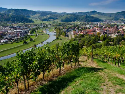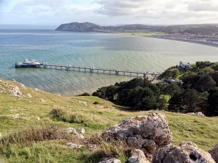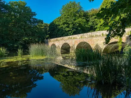
Senda Sursilvana
How would you rate Senda Sursilvana?
Tap a star to share your experience and help other hikers.
Senda Sursilvana: Oberalp Pass to Chur on Route 85
HikeList Score
Senda Sursilvana scored 88/100 on HikeList's trail-quality metrics.
See score breakdownHide breakdown
- Ideal length 85
- Balanced challenge 100
- Scenery & wildness 98
- Varied terrain 89
- Accommodation 100
- Food & support 54
- Path quality 84
- Season flexibility 76
Computed from length, challenge, scenery & wildness, terrain variety, accommodation, food & support, path quality and season flexibility.
The Senda Sursilvana is a waymarked 100 km long-distance hike in Graubünden, Switzerland, following SwitzerlandMobility national route 85. It takes 5 days from the Oberalp Pass to Chur, crossing sunny high terraces above the young Anterior Rhine in the Surselva. Rated moderate, it suits fit hikers comfortable with long mountain days, sustained ascent and descent, and varied footpaths rather than a technical alpine traverse.
Route Overview
This is a point-to-point hike from the Oberalp Pass in the west to Chur in the east, descending overall from about 2,044 m to about 593 m while repeatedly contouring and switching across the Surselva terraces. The official stages are Oberalp Pass to Sedrun, Sedrun to Sumvitg via Disentis/Mustér, Sumvitg to Breil/Brigels, Breil/Brigels to Laax, and Laax to Chur. Key places include Disentis Abbey, Saint Benedict Chapel above Sumvitg, Waltensburg/Vuorz, Falera, Laax, Flims and Chur old town. For higher Swiss hut-to-hut terrain, compare the Bernina Trek or the Alpine Pass Route.
Romansh Surselva and the Young Rhine
The route crosses the Romansh-speaking Surselva, where the Sursilvan idiom gives the trail its name: “the Surselva path”. Local history is tied to Disentis monastery, old Alpine pass routes and the young Rhine rising near the Oberalp Pass. The wider region also holds military history: near Panix, General Suvorov’s retreating Russian army crossed the pass in early October 1799 during the War of the Second Coalition.
Notable highlights
- Saint Benedict Chapel, Sumvitg: This timber chapel above Sumvitg was designed by Peter Zumthor and inaugurated in 1989 after the old chapel was destroyed by a dust avalanche. Its shingle-clad, leaf-like form makes it a major architecture stop directly on the route.
- Disentis Abbey: A working Benedictine monastery with origins in the 8th century and a museum. It is one of the cultural anchors of the upper Surselva and is passed early in the walk.
- Falera megalith park and St Remigius church: Above Falera, the Mutta terrace has a prehistoric menhir site beside the historic church of St Remigius. It is one of the strongest cultural pauses on the later stages.
- Waltensburg/Vuorz church frescoes: The village church contains medieval wall paintings, including work associated with the Waltensburg Master. A museum opposite helps interpret the frescoes.
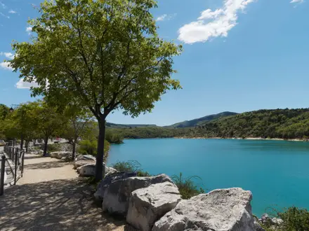
- Lake Cauma, Flims: A turquoise, forest-fringed bathing lake near Flims and Laax, fed by underground springs. It is a worthwhile detour or rest stop near the end of the route.
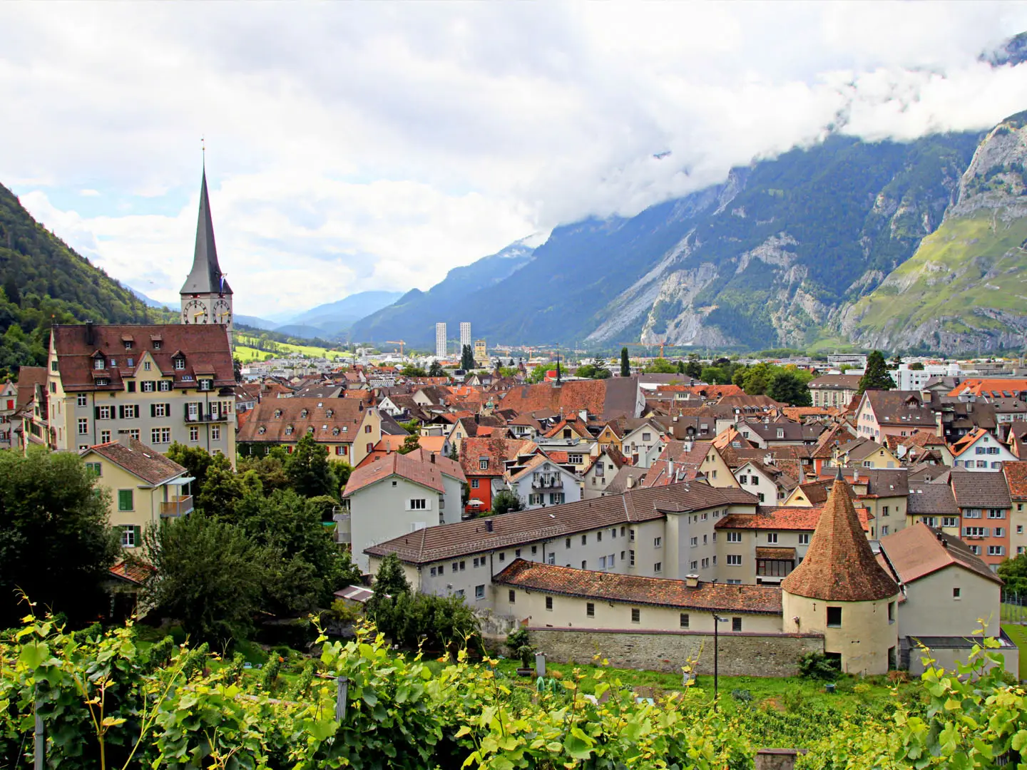
- Chur old town: The route finishes in Chur’s historic centre, with lanes, the episcopal court and Romanesque cathedral. Chur is often described as Switzerland’s oldest city.
Challenges to expect
Expect moderate but sustained mountain walking rather than easy valley paths. The Senda Sursilvana uses natural dirt and gravel tracks, rockier sections, forest and meadow paths, stream crossings, steep slopes and short paved village roads. Daily stages are long, with substantial cumulative ascent despite the overall descent to Chur. Navigation is helped by good waymarking, but mountain weather, footwear choice and fitness matter. For a shorter Graubünden comparison, see the Davos to Arosa Panorama Trail.
HikeList Score
Senda Sursilvana scored 88/100 on HikeList's trail-quality metrics.
See score breakdownHide breakdown
- Ideal length 85
- Balanced challenge 100
- Scenery & wildness 98
- Varied terrain 89
- Accommodation 100
- Food & support 54
- Path quality 84
- Season flexibility 76
Computed from length, challenge, scenery & wildness, terrain variety, accommodation, food & support, path quality and season flexibility.
 Switzerland
Show more data Show less
- Mountainous
- Forest
- Meadow
- Dirt
- Gravel
- Rocky
- Paved
- Hotels
- Guesthouses
- Bed And Breakfasts
- Holiday Rentals
- Hostels
- Campsites
- Family Friendly
- Pet Friendly
Download Our Full Guide to Senda Sursilvana FREE!
Get our comprehensive guide to this hike for free. Save it for later reading or print out at home.
Photos from hikers
Taken on the trail by people who've reviewed Senda Sursilvana.
Senda Sursilvana: The Complete Guide
 i
Image by OlgaMartorell
i
Image by OlgaMartorell The Senda Sursilvana is a high-level traverse of the Romansh-speaking Surselva, following SwitzerlandMobility route 85 from the Oberalp Pass country down the Vorderrhein valley to Chur. It suits walkers who want a real multi-day mountain route without technical ground: waymarked, scenic, cultural and logistically straightforward.
The route links alpine pasture, forest, meadow terraces and old villages above the young Rhine, with the Matterhorn Gotthard Bahn and Rhaetian Railway never far below in the valley. Disentis/Mustér, Sumvitg, Breil/Brigels, Falera, Laax, Flims and Chur give the walk a strong sense of place rather than a hut-to-hut wilderness feel.
Its best days combine walking with distinctive Graubünden landmarks: the Oberalp high country, Disentis abbey, Sogn Benedetg above Sumvitg, the frescoes at Waltensburg/Vuorz, Parc la Mutta at Falera, Caumasee, Conn and the Ruinaulta viewpoint before the finish in Chur old town.
What the trail asks for is fitness and sensible planning. Most of the walking is T1–T2 rather than technical, but the full route is around 105 km with roughly 3,400 m of ascent, a high first stage that depends on snow conditions, and a notably long Breil/Brigels to Laax stage that many walkers will want to split.
This guide covers stages, day planning, accommodation, food, transport, terrain and the common mistakes to avoid on the Senda Sursilvana.
Stage-by-Stage Guide
Stage 1: Andermatt to Sedrun via the Oberalppass
Approx. 14 km. The official Route 85 starts in Andermatt and climbs through the Oberalp Pass area before descending into the upper Surselva to Sedrun. Many walkers shorten the day by taking the Matterhorn Gotthard Bahn to the Oberalppass and starting at 2,044 m, but the full official stage from Andermatt gives the route its proper high-mountain opening.
This is the most alpine-feeling stage of the Senda Sursilvana. The route passes Nätschen, the Oberalppass and Oberalpsee, then crosses high ground in the Oberalp / Fellilücke area before dropping towards Sedrun. The true high point of the route is above the pass, around 2,400–2,470 m, so this stage should not be treated as a simple pass-to-valley stroll.
Underfoot, expect mountain paths, pasture and open high terrain, with a long descent to finish. The walking is not technical in normal summer conditions, but it is exposed to fast-changing mountain weather and can hold snow earlier in the season than the lower valley stages.
The key highlight is the high country around the Oberalppass, close to the source area of the young Vorderrhein / Rein Anteriur. Views open eastwards down the Surselva and back into the Uri side of the pass. Oberalpsee is the main landmark before the route begins its descent towards Sedrun.
Food and drink are most dependable at the stage ends and at major transport points such as Andermatt, Oberalppass and Sedrun. Do not assume there will be regular service once away from the pass and villages; carry enough water and food for a mountain day.
Sedrun is one of the main overnight bases in the upper valley, with hotels, guesthouses, B&B-style accommodation and other visitor services. Booking ahead is sensible in the main summer season, especially if walking the route as fixed stages.
Public transport is excellent on this stage. The Matterhorn Gotthard Bahn links Andermatt, Oberalppass and Sedrun, making it straightforward to shorten the day, delay a start in poor weather or bail out if conditions on the high section are unsuitable. Timetables should be checked before travelling.
Navigation is generally straightforward on the SwitzerlandMobility Route 85 waymarks, but the high first stage deserves proper map attention. Snow patches, low cloud or poor visibility can make waymarks harder to follow, and current snow cover should be checked before committing to the high route.
Stage 2: Sedrun to Sumvitg via Disentis/Mustér
Approx. 18 km. This stage leaves the high start behind and settles into the pattern that defines much of the Senda Sursilvana: terrace walking above the Vorderrhein, linking Romansh villages, meadows, forest and short built-up sections. It is longer than the previous day but less alpine in character.
From Sedrun the route passes through or near Rueras, Bugnei, Mompé Tujetsch, Segnas and Acletta before reaching Disentis/Mustér. Beyond Disentis/Mustér it continues by Disla and Cumpadials towards Sumvitg.
Terrain is mixed: mountain and field paths, farm tracks, meadow edges, forest sections and short paved stretches through villages. There is still meaningful ascent and descent, but the day is more about sustained undulation along the valley side than crossing a high pass.
Disentis/Mustér is the major cultural and service point of the stage. Its Benedictine abbey, with 8th-century origins, is one of the defining landmarks of the upper Surselva. Allow time here if accommodation bookings and daylight permit.
Food and water are easiest to organise in Sedrun and Disentis/Mustér. Smaller villages along the way may not have reliable open services, so carry enough between the main settlements. In warm weather the sunny terraces can feel dry, even though the route is never far from inhabited valleys.
Sumvitg is the stage end, with accommodation possibilities more limited than in larger resort centres. If beds are tight, Disentis/Mustér or other valley villages can work as alternatives using the railway, but this should be arranged before starting the day.
The Vorderrhein valley railway gives useful access along this section, particularly around Sedrun and Disentis/Mustér. It makes the stage practical for section walkers and gives a realistic escape option if weather or fitness becomes a problem.
Navigation is usually uncomplicated, but care is needed leaving and entering villages where local paths, farm tracks and roads intersect. Follow the yellow Swiss hiking signs and the red Route 85 number field rather than simply taking the most obvious track downhill.
Stage 3: Sumvitg to Breil/Brigels
Approx. 14 km. This is a shorter stage on paper, but it includes a substantial amount of climbing and descending between Sumvitg, Rabius, Schlans, Dardin and Breil/Brigels. It is a good example of why the Senda Sursilvana feels hillier than its valley-line map position might suggest.
The official line runs from Sumvitg through the valley-side settlements towards Breil/Brigels. Near the start, Sogn Benedetg is reached by a short signed spur above Sumvitg rather than lying directly on the through-line.
The Sogn Benedetg chapel is worth planning into the day if time and energy allow. Peter Zumthor’s shingle-clad timber chapel was built in 1985–89 after a baroque chapel was destroyed by an avalanche in 1984, and it is one of the route’s most distinctive architectural stops.
The walking combines meadow paths, forest, pasture and connecting tracks between small villages. There are steep-sided sections and terrace climbs, but no technical ground in normal summer conditions. After rain, field and forest paths may be softer and slower than the distance suggests.
Food and water should be planned around Sumvitg, the larger villages passed en route and Breil/Brigels at the end. Services between villages can be thin or seasonal, so do not rely on finding an open café or shop at every settlement.
Breil/Brigels is a more substantial overnight stop than many of the smaller intermediate villages, with a mix of visitor accommodation in and around the resort. It is a sensible place to stay before the long fourth stage.
Public transport access is possible via the Vorderrhein valley and PostAuto links to higher villages such as Breil/Brigels. Exact connections and last services should be checked before travelling, particularly if using this stage as a day walk or planning to sleep away from the official stage end.
Navigation is mainly a matter of staying disciplined through village exits and pasture junctions. The waymarking is good, but the route often uses smaller terrace paths rather than simply following the valley road or the most direct line to the next village.
Stage 4: Breil/Brigels to Laax via Waltensburg/Vuorz, Siat and Falera
Approx. 32 km. This is the crux stage for most walkers, not because of technical difficulty but because of length and cumulative ascent and descent. The official stage runs from Breil/Brigels to Laax via Waltensburg/Vuorz, Andiast, the area near Pigniu/Panix, Siat, Ruschein, Ladir and Falera.
The day is a long traverse of the Surselva terraces, mixing pasture, village paths, forest, farm tracks and mountain footpaths. Expect repeated climbs and descents rather than one single major ascent. Official figures give this stage as roughly 32 km with about 1,100 m ascent and 1,300 m descent, so an early start is sensible.
Many walkers split this stage, commonly around Siat or Falera, to make the route more balanced. Any split depends on accommodation and public transport working on the chosen date; this should be checked before travelling.
Waltensburg/Vuorz is a major cultural stop. The Reformed parish church contains medieval wall paintings, including work associated with the 14th-century Waltensburg Master. Later in the stage, Falera brings another key highlight: Parc la Mutta, Switzerland’s largest megalithic site, with around 34 standing stones from the Middle Bronze Age beside the church of St Remigius.
The views are broad rather than summit-focused: terraces, side valleys, village clusters and the Vorderrhein corridor below. The stage gives a strong sense of the inhabited mountain landscape of the Surselva, but it also demands steady pacing and realistic breaks.
Food and drink are available most reliably in the larger villages and at the end in Laax. Because this is the longest stage, carry a proper day’s supply and do not depend on every village having open services. In hot, sunny weather the exposed terrace sections can feel harder than the altitude suggests.
Laax has a wider range of accommodation than the smaller villages passed earlier in the day, including hotels, guesthouses, holiday apartments and other visitor facilities. Booking ahead is strongly recommended if arriving after the full 32 km stage, as there is little flexibility late in the day.
PostAuto services connect higher villages such as Laax, and the wider Vorderrhein valley railway gives access from lower valley hubs. These links make it possible to split or exit the stage, but the practical details depend on the exact village and day of travel. This should be checked before travelling.
Navigation is usually clear but mentally tiring on such a long day. Pay attention at road crossings, village lanes, pasture gates and forest junctions, where several local walking routes may share short sections. The main warning is underestimating the distance: this is a full mountain-walking day even in good weather.
Stage 5: Laax to Chur via Flims, Conn, Trin, Tamins and Felsberg
Approx. 25 km. The final stage is long but rewarding, linking Laax, Flims, Caumasee, Conn, Trin, Tamins and Felsberg before finishing in Chur. It descends overall from the resort terraces towards the Rhine valley and the old town of Chur.
The first part of the day passes through the Laax and Flims area, then into forest and lake terrain around Caumasee. Lake Cauma is a classic rest or swim stop in warm weather, though it can be busy in the main season.
The stage’s set-piece viewpoint is Conn and the Il Spir platform above the Ruinaulta. From here the Vorderrhein lies far below in the Rhine Gorge, carved through the landscape of the Flims rockslide. Stay on marked paths and signed viewpoints around the gorge edge; this is not terrain for shortcuts.
After Conn the route continues towards Trin, Tamins and Felsberg, with more mixed forest, terrace and connecting sections before the approach to Chur. Near the end, expect more built-up walking, road crossings and paved sections than on the earlier mountain stages.
Food and drink are most dependable in Laax, Flims and Chur, with additional possibilities in the larger villages passed later in the day. Carry enough for the full stage, especially if starting early or walking outside the busiest holiday periods when opening hours may be reduced.
Chur is the best-served accommodation point on the entire route, with a broad range of hotels and other urban options. Finishing in the old town also makes it practical to stay the night rather than trying to connect onward immediately after a long final stage.
Public transport is strong at both ends of the stage. Laax and Flims are served by PostAuto, while Chur is a major rail hub with direct onward connections, including trains towards Zürich and the wider RhB network. Intermediate road access at villages such as Trin, Tamins and Felsberg gives useful exit options, but exact services should be checked before travelling.
Navigation remains well waymarked, but the final approach is more complex because of settlements, roads and valley-floor infrastructure. Keep following Route 85 signs into Chur rather than assuming any downhill road leads to the correct finish. The final stage is lower than the first, but weather, heat and the accumulated fatigue of the previous days still matter.
Recommended Itinerary
The most practical default is the official 5-stage schedule, but the stages are uneven. The key decision is how to handle the long Breil/Brigels–Laax day, and whether to begin at Andermatt or take the train up to the Oberalppass to shorten the first stage.
Distances below use the stage figures in the route brief. If you alter the stopping points, check official mapping before booking.
Standard itinerary — 5 days
Best for fit walkers who are comfortable with one very long day and want to follow the official stage pattern.
| Day | From | To | Approx. distance | Why this stage makes sense | Services/accommodation notes |
|---|---|---|---|---|---|
| 1 | Andermatt, via Nätschen, Oberalppass and the Oberalpsee | Sedrun | 14 km | This follows the official opening stage over the high Oberalp country before dropping into the upper Surselva. It is not long on paper, but it includes the highest and most weather-sensitive ground of the route, so it should not be treated as a casual half-day. | Andermatt and Sedrun are the practical accommodation bases. The Matterhorn Gotthard Bahn runs over the Oberalppass, so many walkers shorten this stage by starting at the pass; train times and snow conditions should be checked before travelling. |
| 2 | Sedrun | Sumvitg, via Disentis/Mustér | 18 km | A balanced valley-and-terrace day with the major cultural stop at Disentis/Mustér and its Benedictine abbey. It keeps the upper Surselva stages manageable before the hillier middle section. | Sedrun, Disentis/Mustér and Sumvitg are on the Vorderrhein valley rail corridor. Accommodation is generally easier in the larger hubs such as Sedrun and Disentis/Mustér; Sumvitg should be booked ahead. Allow extra time if taking the short spur to Sogn Benedetg above Sumvitg. |
| 3 | Sumvitg | Breil/Brigels | 14 km | This is a shorter distance than days 2, 4 and 5, but it climbs back onto the terraces via villages including Rabius, Schlans and Dardin. The shorter day is useful before the demanding Breil/Brigels–Laax stage. | Breil/Brigels is one of the better overnight stops on the route. Options between the villages are thinner, so do not rely on finding accommodation late in the day without booking. PostAuto services serve higher villages such as Breil/Brigels; current timetables should be checked. |
| 4 | Breil/Brigels | Laax, via Waltensburg/Vuorz, Siat and Falera | 32 km | This is the crux stage of the standard itinerary: long, hilly and sustained, with the Waltensburg/Vuorz frescoes and Parc la Mutta at Falera both falling on the line. It is the day most likely to push walkers beyond a comfortable pace. | Start early and book Laax accommodation in advance. If 32 km is too much, split this stage at Siat or Falera rather than forcing it. Accommodation and onward transport for any split point should be checked before committing. |
| 5 | Laax | Chur, via Flims, Caumasee, Conn, Trin, Tamins and Felsberg | 25 km | A long final day, but a logical finish: the route passes Flims, the Caumasee area and Conn with the Il Spir viewpoint over the Ruinaulta before descending towards Chur. | Laax and Flims have a broader range of accommodation than smaller villages. Chur is the easiest finish for onward rail travel. If breaking this day, places such as Tamins require planning rather than a last-minute assumption of availability. |
Slower itinerary — 6 days
Best for walkers who want a more comfortable schedule, more time for the cultural stops, or less pressure on the long fourth stage. The simplest adjustment is to split Breil/Brigels–Laax.
| Day | From | To | Approx. distance | Why this stage makes sense | Services/accommodation notes |
|---|---|---|---|---|---|
| 1 | Andermatt, via Oberalppass | Sedrun | 14 km | Keeps the high first stage intact without rushing the mountain section. | Andermatt and Sedrun are sensible overnight bases. Starting at Oberalppass is a valid shortcut if train times and conditions suit. |
| 2 | Sedrun | Sumvitg, via Disentis/Mustér | 18 km | Leaves enough time for Disentis/Mustér and avoids turning the upper valley into a forced march. | Book Sumvitg ahead, especially if travelling in a busy holiday period. |
| 3 | Sumvitg | Breil/Brigels | 14 km | A moderate day before the longest part of the route. | Breil/Brigels is the natural overnight before the long terrace traverse towards Laax. |
| 4 | Breil/Brigels | Siat or Falera | Part of the 32 km Breil/Brigels–Laax stage; check official mapping before booking | Splitting here removes the main problem with the standard itinerary and gives more time for Waltensburg/Vuorz, Andiast, Siat and Falera. | Siat and Falera are smaller stopping points than Laax or Breil/Brigels. Accommodation and transport should be checked before travelling. |
| 5 | Siat or Falera | Laax | Remainder of the 32 km Breil/Brigels–Laax stage; check official mapping before booking | A shorter continuation to Laax, with time to visit Parc la Mutta at Falera if it was not visited the previous day. | Laax has stronger accommodation options and PostAuto connections than the smaller terrace villages. |
| 6 | Laax | Chur, via Flims, Conn, Trin, Tamins and Felsberg | 25 km | Keeps the final scenic section together, including Caumasee, Conn, Il Spir and the approach to Chur. | This is still a long day. If that is too much, a further split near Tamins or Felsberg should be planned only after checking accommodation and transport. |
Faster itinerary — 4 days, or a shortened 5 days from Oberalppass
A genuine 4-day traverse is only sensible for very fit walkers with light packs, long daylight and settled weather. It creates two days of around 30 km or more and leaves little margin for bad weather, sightseeing or late starts.
| Day | From | To | Approx. distance | Why this stage makes sense | Services/accommodation notes |
|---|---|---|---|---|---|
| 1 | Andermatt or Oberalppass | Sumvitg, via Sedrun and Disentis/Mustér | About 32 km from Andermatt using the official stage totals; less if starting at Oberalppass | Combines the first two official stages. Starting at Oberalppass makes this much more realistic, but the high ground still needs good conditions. | Sedrun and Disentis/Mustér give useful bail-out or alternative overnight options if the day proves too long. The Matterhorn Gotthard Bahn and valley rail services make this the easiest long day to adjust. |
| 2 | Sumvitg | Breil/Brigels | 14 km | A shorter recovery day after the long opening push. | Book Breil/Brigels ahead; it is the practical base before the longest remaining stage. |
| 3 | Breil/Brigels | Laax | 32 km | The major endurance day of the fast schedule, crossing the terrace villages via Waltensburg/Vuorz, Siat and Falera. | This day should not be underestimated. If conditions, fitness or timing are marginal, split at Siat or Falera and revert to the slower plan. |
| 4 | Laax | Chur | 25 km | A long but logical final day over Flims, Conn, Trin, Tamins and Felsberg into Chur. | Chur is the simplest finish for onward rail travel. Do not depend on a late finish if onward connections are tight. |
For most walkers short on time, the better faster option is not a forced 4-day schedule but a 5-day walk starting at Oberalppass rather than Andermatt. That keeps the standard overnight pattern while removing the Andermatt–Oberalppass climb; train times, snow cover and the revised distance should be checked before booking.
Planning the Route
The Senda Sursilvana is straightforward to follow but needs sensible stage planning. The route is not technically difficult, yet the combination of long terrace traverses, repeated climbs and descents, and one very long official stage means it rewards a realistic schedule.
Most walkers should plan on five to six days. Five days follows the official SwitzerlandMobility stage pattern; six days gives a better margin for the long Breil/Brigels–Laax section, weather on the high first stage, and time for cultural stops such as Disentis/Mustér, Sogn Benedetg, Waltensburg/Vuorz and Falera.
Start-point decision: Andermatt or Oberalppass
The official Route 85 starts in Andermatt, climbs via Nätschen to the Oberalppass, then continues through the high Oberalp country before descending to Sedrun. This makes the first day a proper mountain stage, despite its modest distance.
Many walkers instead begin at Oberalppass, reached by the Matterhorn Gotthard Bahn. This removes the Andermatt–Oberalppass approach climb and is a practical option if time is limited, if the first-day weather is poor, or if the aim is to walk the Surselva terraces rather than the full official line.
Starting at the pass does not remove the need for mountain judgement. The true high point of the route is above the pass in the Oberalp/Fellilücke area, around 2,400–2,470 m, so snow cover and weather on this first stage should be checked before travelling.
How many days to allow
| Plan | Best for | Practical notes |
|---|---|---|
| 5 days | Fit walkers following the official stage pattern | Works well if accommodation is booked and long days are acceptable. The key challenge is the Breil/Brigels to Laax stage, which is around 32 km with substantial ascent and descent. |
| 6 days | Most independent walkers | A more comfortable plan, especially if starting in Andermatt. The obvious place to ease the schedule is the long fourth stage, often by breaking the route around Siat or Falera if accommodation and transport work. |
| Section hiking | Walkers using public transport or a valley base | Very practical. The Matterhorn Gotthard Bahn, RhB and PostAuto network make it possible to join, leave or shorten stages at many points, though higher-village bus times must be checked. |
| Faster than 5 days | Strong, experienced walkers travelling light | Possible, but it turns the route into an endurance itinerary rather than a relaxed traverse. The terrain is hilly throughout, and the final two official stages are both long. |
The route is best planned around accommodation rather than arbitrary mileage. Larger centres such as Sedrun, Disentis/Mustér, Breil/Brigels, Laax, Flims and Chur give the easiest overnight logistics. Smaller villages can be useful for splitting stages, but options are thinner and must be arranged in advance.
Stage-planning pressure points
The first stage is the main weather and snow stage. If the high ground between Andermatt, Oberalppass and Sedrun is still carrying snow, delaying the start or using transport to adjust the day may be more sensible than forcing the official line.
The second and third stages are easier to shape around villages and cultural stops. Disentis/Mustér is the main service and transport anchor in the upper valley, while the spur to Sogn Benedetg above Sumvitg is worth allowing time for if the chapel is part of the plan.
The fourth stage from Breil/Brigels to Laax is the route’s biggest scheduling issue. It is long, hilly and passes a string of terrace villages including Waltensburg/Vuorz, Andiast, Siat, Ruschein, Ladir and Falera. Splitting this day can make the whole hike feel more balanced, but accommodation and onward transport in the smaller places should be checked before travelling.
The final stage from Laax to Chur is also long, but has more transport flexibility near Flims and towards the Rhine valley. If time is short, build in enough margin for Caumasee, Conn, the Il Spir viewpoint over the Ruinaulta, and the final approach through Tamins, Felsberg and into Chur.
Accommodation strategy
Book accommodation before committing to flights or long-distance rail tickets. The official stage ends are logical, but they are not evenly spaced, and the best itinerary depends on where beds are available.
The broadest choice is in the resort and transport hubs: Andermatt, Sedrun, Disentis/Mustér, Breil/Brigels, Laax, Flims and Chur. Between these, expect fewer hotels and guesthouses, so do not rely on turning up late in the day without a reservation.
Package operators offer the Senda Sursilvana with luggage transfer. This can be useful because the route has repeated ascent and descent rather than a simple valley-floor profile. Current prices, inclusions and baggage rules should be checked before booking.
Food and water planning
This is not a wilderness route, but it is still a mountain walking route. Villages come regularly enough to keep logistics manageable, yet small-place opening hours and seasonal closures can affect lunch stops.
Carry a full day’s snacks and enough water for each stage, especially on the sunny terrace sections and the high first day. Do not plan a stage on the assumption that every hamlet will have an open shop or café at the time you pass through.
Transport and shortening stages
Public transport is one of the route’s strengths. The Matterhorn Gotthard Bahn links Andermatt, Oberalppass and Disentis/Mustér, while the RhB runs down the Vorderrhein valley through places including Disentis, Trun, Tavanasa, Ilanz and Chur. PostAuto buses serve higher villages such as Breil/Brigels, Laax and Flims.
This makes section hiking practical and gives good bail-out options in poor weather or if a stage proves too long. The important detail is timing: evening and weekend services to higher villages may not suit a casual finish, so current timetables should be checked before travelling.
Navigation and weather checks
Navigation is usually simple because the Senda Sursilvana is SwitzerlandMobility national route 85, waymarked with standard Swiss yellow signposts, red route-number panels and white-red-white mountain waymarks. Even so, carry offline mapping, particularly for the terrace villages where paths, farm tracks and local variants can be close together.
The SwitzerlandMobility app and swisstopo mapping are the most useful planning tools for the line itself. Before setting off, check route diversions, snow conditions on the first stage, and the local mountain forecast.
The reliable walking window is roughly June to October, but the lower valley stages can be viable for longer than the high Oberalp section. Early-season plans should stay flexible until the snow has cleared from the high first stage.
Towns, Villages and Overnight Stops
Accommodation on the Senda Sursilvana is easiest in the larger valley and resort settlements: Andermatt, Sedrun, Disentis/Mustér, Breil/Brigels, Laax, Flims and Chur. Between these hubs, villages are frequent but overnight options can be limited, seasonal or away from the exact line of the trail.
The RhB railway along the Vorderrhein valley and PostAuto buses to the higher terrace villages make this one of the easier Swiss long-distance routes to shorten, split or bail out from. Timetables, accommodation availability and any seasonal closures should be checked before travelling, especially if relying on smaller villages or splitting the long Breil/Brigels–Laax stage.
Andermatt
Andermatt is the official western start of SwitzerlandMobility route 85, before the trail climbs towards Nätschen and the Oberalppass. Many hikers stay here the night before starting, particularly if arriving by rail and walking the full official route rather than beginning at the pass.
It is one of the stronger logistics bases on the route, with a better accommodation spread than the small upper Surselva villages: hotels, guesthouses and other traveller services can be expected. Food shopping and evening meals are also more straightforward here than on the high first stage.
Transport is a major reason to use Andermatt as a start or overnight stop. The Matterhorn Gotthard Bahn links Andermatt with the Oberalppass and Disentis/Mustér, allowing hikers to either walk the climb to the pass or skip it by train.
Nätschen
Nätschen lies above Andermatt on the climb towards the Oberalppass. For most walkers it is a waypoint rather than a planned overnight, useful mainly as part of the first-stage ascent out of Andermatt.
Do not rely on Nätschen as a full resupply stop unless current services have been checked. If walking the complete Andermatt–Sedrun stage, carry what is needed for the high section before leaving Andermatt.
Oberalppass and Oberalpsee
The Oberalppass is the practical alternative start for hikers who want to avoid the initial climb from Andermatt. It sits on the Matterhorn Gotthard Bahn at 2,044 m, close to the Oberalpsee and the source area of the young Vorderrhein / Rein Anteriur.
This is a transport and scenic waypoint more than a normal overnight base for the route. Starting here shortens the first day, but it does not remove all high-level walking: the route still crosses higher ground in the Oberalp / Fellilücke area before descending towards Sedrun.
Food and indoor stops at the pass should not be assumed outside current opening times or season. Check train times and mountain conditions before committing to a pass start, particularly early or late in the June–October walking window.
Sedrun
Sedrun is the first major overnight stop after the high Oberalp stage and the official end of stage 1. It is a practical place to stop because it comes after the route’s highest and most weather-exposed walking.
Accommodation options are better here than in the smaller villages immediately around it, with hotels, guesthouses, B&Bs, holiday apartments and other valley-resort accommodation in the wider area. It is also a sensible place to buy food before the next day towards Disentis/Mustér and Sumvitg.
Sedrun sits on the upper Vorderrhein corridor served by the Matterhorn Gotthard Bahn, giving useful access for stage walkers and for anyone who needs to leave the route after the first day. If starting from Oberalppass instead of Andermatt, Sedrun still works well as the first overnight.
Rueras, Bugnei and Mompé Tujetsch
These smaller settlements sit between Sedrun and the descent towards Disentis/Mustér. They are useful for orientation and for breaking up the upper Surselva walking, but they are not the obvious accommodation hubs for most itineraries.
Any lodging, food or shop plans in these villages should be checked before travelling. For a standard through-hike, Sedrun and Disentis/Mustér are more reliable planning anchors.
Segnas and Acletta
Segnas and Acletta come before Disentis/Mustér on the second stage. They are close enough to Disentis/Mustér that most hikers will treat them as route villages rather than separate overnight targets.
They can be useful if an accommodation search in Disentis/Mustér is tight, but do not assume full village services without checking. This section is better planned around the larger town below.
Disentis/Mustér
Disentis/Mustér is one of the most important stops on the Senda Sursilvana. The route passes through or by it on the Sedrun–Sumvitg stage, and the Benedictine abbey makes it a natural longer break as well as a practical logistics point.
For accommodation, Disentis/Mustér is one of the strongest choices in the upper Surselva, with hotels, guesthouses, B&B-style options and other visitor accommodation. It is a good place to resupply, eat properly and reset after the first two days of mountain and terrace walking.
Transport links are excellent by route standards. Disentis/Mustér is on the Matterhorn Gotthard Bahn corridor from Andermatt and also connects into the RhB network down the Vorderrhein valley towards Chur, making it a very useful start, finish or rest point for section hikers.
Disla and Cumpadials
Disla and Cumpadials sit east of Disentis/Mustér on the way towards Sumvitg. They help link the route through the lower upper-valley settlements, but they are usually not primary overnight stops.
Use them as possible short-break points only if services are open and visible on the day. For booked accommodation and food planning, Disentis/Mustér or Sumvitg are safer anchors.
Sumvitg
Sumvitg is the official end of stage 2 and the start of stage 3, so it is a key overnight stop in the standard five-stage itinerary. It sits in the Vorderrhein valley below the short spur to Sogn Benedetg.
Accommodation is more limited than in the larger resort towns, so booking ahead matters. It is still a logical stop because it avoids pushing the Sedrun–Breil/Brigels section into an unnecessarily long day.
Food and shop arrangements should be checked before arrival, particularly outside peak holiday periods. Sumvitg is also the base for the short detour to Peter Zumthor’s chapel at Sogn Benedetg, which is worthwhile if time and weather allow.
Sogn Benedetg
Sogn Benedetg is not a standard overnight village for the through-route. It is a short signed spur above Sumvitg to the timber chapel by Peter Zumthor, and most hikers visit it as a side trip before continuing or after arriving in Sumvitg.
Do not plan on services at the chapel itself. Carry water and snacks from Sumvitg if making the detour, and allow time for the extra climb and return.
Rabius and Schlans
Rabius and Schlans lie on the Sumvitg–Breil/Brigels stage. They are useful intermediate villages on a day with significant climbing and descent, but most walkers will not plan them as main overnight stops.
If using either village to split the stage, accommodation and food availability should be checked before travelling. They are better treated as small-route settlements rather than guaranteed resupply points.
Dardin
Dardin comes before Breil/Brigels on stage 3. It is a practical waypoint on the approach to the main overnight stop, rather than a natural end-of-day destination for most itineraries.
Services should not be assumed. If accommodation is unavailable in Breil/Brigels, nearby smaller villages may help, but transfers and bus times need checking.
Breil/Brigels
Breil/Brigels is the official end of stage 3 and a major overnight stop before the longest day of the route. It sits on the terrace above the Vorderrhein and is one of the better places to pause before tackling the Breil/Brigels–Laax stage.
Accommodation is among the more dependable on the trail, with resort-style options including hotels, guesthouses, B&Bs and holiday apartments in the wider village area. Because the next official stage is around 32 km, Breil/Brigels is a sensible place to organise an early start, buy food and consider whether to split the following day.
PostAuto services connect higher villages such as Breil/Brigels with the valley transport network. Current bus times should be checked if arriving late, leaving the route, or using luggage transfer.
Waltensburg/Vuorz
Waltensburg/Vuorz is reached early on the long fourth stage from Breil/Brigels to Laax. It is worth allowing time here for the Reformed parish church and its medieval frescoes, but most walkers will continue rather than stay overnight.
As with other terrace villages, services can be thinner than in the resort hubs. If planning a short stage into or out of Waltensburg/Vuorz, confirm accommodation and food in advance.
Andiast and Pigniu/Panix area
Andiast lies after Waltensburg/Vuorz on the high terrace traverse. Pigniu/Panix is near the route area rather than a principal overnight stop on the standard line.
This part of the fourth stage is where careful day planning matters. The official Breil/Brigels–Laax stage is long, and anyone intending to break it in the smaller villages should book accommodation before committing to the split.
Siat
Siat is one of the more useful potential split points on the long Breil/Brigels–Laax stage. It sits before Ruschein, Ladir and Falera on the eastward traverse.
The main reason to stop here is to avoid a 32 km day with substantial ascent and descent. However, accommodation and food options are not as robust as in Breil/Brigels, Laax or Flims, so Siat only works as a stage end if a bed and evening meal are secured in advance.
Transport from smaller terrace villages may involve PostAuto connections rather than the valley railway. Timetables should be checked before relying on Siat for arrival or departure logistics.
Ruschein and Ladir
Ruschein and Ladir are smaller terrace villages between Siat and Falera. They are useful waypoints on the fourth stage, especially for navigation and pacing, but they should not be treated as guaranteed resupply stops.
For most hikers, these villages sit within the day rather than at the end of it. If bad weather, fatigue or time pressure develops on stage 4, use current bus information and accommodation availability rather than assuming an easy unplanned overnight.
Falera
Falera is a strong practical and cultural stop before Laax. Parc la Mutta and the church of St Remigius sit directly on the route, making it one of the best short-stop locations on the long fourth stage.
It is also a sensible place to split the Breil/Brigels–Laax day if suitable accommodation is available. This can turn the hardest official stage into two more manageable sections, while keeping the next day close to Laax, Flims and the Ruinaulta approach.
Falera is one of the higher villages served by PostAuto-style links in the Laax/Flims area. Check current bus times if using it as a start, finish or emergency exit.
Laax
Laax is the official end of stage 4 and one of the best overnight bases on the route. It is a major resort settlement, so accommodation choice is generally stronger than in the smaller terrace villages, with hotels, guesthouses, holiday apartments and other visitor lodging.
This is the natural place to recover after the long Breil/Brigels stage. It is also a useful resupply and meal stop before the final day to Chur via Flims, Caumasee, Conn, Trin, Tamins and Felsberg.
Laax is served by bus connections rather than the main valley railway. This makes it workable for stage walking, but current PostAuto times should be checked carefully, especially for early starts and late finishes.
Flims
Flims comes early on the final stage from Laax to Chur and is another major resort base. It is a good alternative overnight to Laax if accommodation or itinerary shape works better, and it can also be used to shorten the final stage.
Accommodation and food options are generally better here than in the smaller villages beyond Conn and Trin. Flims is also the gateway to Caumasee and the route towards the Ruinaulta viewpoints, so it is a sensible place to build in extra time if swimming, sightseeing or a slower final day is planned.
Flims is served by bus links in the wider Laax/Flims area. Check current timetables if using it as a section start or finish.
Caumasee and Conn
Caumasee and Conn are highlights rather than overnight bases. Caumasee is a classic rest or swim stop near Flims, and Conn gives access to the Il Spir viewing platform above the Ruinaulta.
Do not plan the day around services here without checking current opening times. Carry enough food and water from Laax or Flims for the final-stage traverse towards Trin and Tamins.
Trin
Trin lies after Conn on the final stage towards Chur. It can be a useful place to break the Laax–Chur day, particularly if starting late or wanting more time around Caumasee and the Ruinaulta.
Accommodation and food availability should be checked before relying on Trin as an overnight stop. It is more practical as a planned split than as an improvised end point.
Tamins
Tamins sits near the final approach to Chur and is specifically worth planning around if splitting the last stage. Overnight options are thinner than in the resort hubs, so booking ahead is important.
Stopping here can make sense if the full Laax–Chur day feels too long, or if public transport timing makes a shorter final section into Chur more convenient. Do not assume late availability for beds or meals.
Felsberg
Felsberg is the last village before Chur on the route’s final approach. For most walkers it is a waymark on the way into the city rather than a target overnight.
It may be useful for public-transport flexibility close to Chur, but any specific connections should be checked before travelling. Once this far along, Chur is the stronger option for accommodation, food and onward rail.
Chur
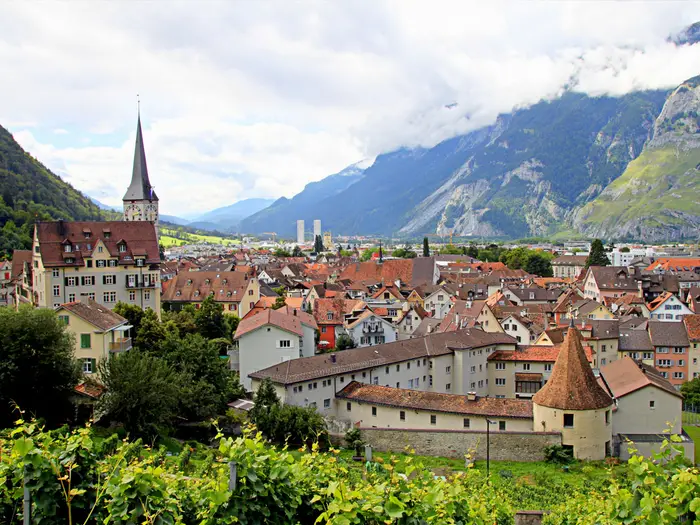
Chur is the eastern finish of the Senda Sursilvana and the easiest place on the route for post-hike logistics. The trail finishes in the old town, with access to a much wider choice of accommodation and food than anywhere else on the walk.
It is the best place to build in a final overnight if onward travel would be rushed after the Laax–Chur stage. Chur is also a major rail hub, with direct trains to Zürich and connections into the RhB network, making onward travel and return to earlier valley points straightforward.
For section hikers, Chur works well as a base because the RhB runs up the Vorderrhein valley through places including Ilanz, Tavanasa, Trun and Disentis/Mustér. This makes it possible to walk individual stages and return by train, provided the daily bus and rail timings line up.
Getting to the Start
By train
Rail is the normal and most reliable way to reach the Senda Sursilvana. The official SwitzerlandMobility Route 85 starts in Andermatt, which is on the Matterhorn Gotthard Bahn network.
Many walkers shorten the first day by taking the Matterhorn Gotthard Bahn one stop higher to Oberalppass and starting at the pass instead. This skips the Andermatt–Oberalppass climb and begins at 2,044 m, but it is a shortcut rather than the official start.
| Start choice | Best rail stop | Practical use |
|---|---|---|
| Official route start | Andermatt | Start Route 85 as signed, climbing towards Nätschen and the Oberalppass. |
| Common shortcut | Oberalppass | Start at the high pass and walk east towards Sedrun, reducing the first stage. |
The Matterhorn Gotthard Bahn links Andermatt, Oberalppass, Sedrun and Disentis/Mustér. From the Graubünden side, the Rhaetian Railway runs through the Vorderrhein valley between Chur, Ilanz, Tavanasa, Trun, Disentis/Mustér and onward connections.
For hikers arriving from Chur or Zürich, the rail approach is straightforward but may involve changes, especially if heading all the way to Andermatt or the Oberalppass. Train times over the Oberalppass and any seasonal timetable changes should be checked before travelling.
By bus
Bus is not the main access method for the western start of the route. Use the train for Andermatt or Oberalppass unless a specific local connection suits your itinerary.
PostAuto buses are more useful later on the Senda Sursilvana, especially for higher villages such as Breil/Brigels, Laax and Flims, or for joining and leaving individual stages. If using buses to create a custom start point, connections and last services should be checked before travelling.
By car
Driving to the start is possible in principle, but it is less convenient than using public transport because this is a point-to-point walk finishing in Chur. If leaving a vehicle near Andermatt or the Oberalppass, you will still need to return from Chur by rail through the Vorderrhein valley and over the Oberalp line.
Long-stay parking, local restrictions and availability at Andermatt or the pass should be checked before travelling. For most walkers, parking at or near a rail hub and using the train to the start is the simpler plan.
Taxi transfers are not normally necessary for reaching the trailhead, as both Andermatt and Oberalppass are served by rail. They may be useful for late arrivals or awkward accommodation locations, but availability and prices should be arranged in advance.
From the nearest airport
There is no airport at the trailhead. International arrivals should plan to connect into the Swiss rail network, then travel onward to Andermatt or Oberalppass by train.
Chur has direct rail connections to Zürich, and the Rhaetian Railway plus Matterhorn Gotthard Bahn provide the onward route through Disentis/Mustér and over the Oberalppass. Airport-to-rail journey times, changes and late-evening connections should be checked before booking flights.
Where to stay before starting
Andermatt is the most practical overnight base if walking the official first stage. Staying there allows an early start for the climb towards the Oberalppass and the high ground beyond.
If starting at Oberalppass, staying in Andermatt and taking the morning train up to the pass is usually the cleanest logistical option. Accommodation directly at or near the pass is more limited and should be booked carefully if required.
A late-arriving walker can also overnight in Sedrun or Disentis/Mustér and adjust the itinerary, but that changes the opening stage plan. Accommodation between the main resort hubs is thinner, so the first night and the following night in Sedrun should be reserved before committing to travel dates.
Getting Home from the Finish
The Senda Sursilvana finishes in Chur, which is the easiest possible endpoint for this route: it is a major rail hub at the eastern end of the Vorderrhein valley and has onward rail connections into the Swiss network. Most walkers should plan to leave by train rather than arrange road transfers.
By train
Chur station is the key departure point. From the old town finish, continue to the station for onward travel by Swiss mainline rail or the Rhaetian Railway (RhB).
Chur has direct trains to Zürich and connections across the RhB network. For returning towards the start, the RhB runs back up the Vorderrhein valley through Ilanz, Tavanasa, Trun and Disentis/Mustér; from Disentis/Mustér the Matterhorn Gotthard Bahn continues over the Oberalppass towards Andermatt.
This makes rail the simplest option if a car has been left near Andermatt or if the route has been walked in sections from a valley base. Check the current SBB/RhB/Matterhorn Gotthard Bahn timetable before committing to a same-day return, especially if finishing late after the long Laax–Chur stage.
By bus
Buses are more useful during the walk than at the finish. PostAuto services serve higher villages on the route, including places such as Breil/Brigels, Laax and Flims, but once in Chur the train is normally the main onward transport.
If accommodation is outside the centre, or if finishing somewhere short of Chur, bus options may be useful. Timetables and final departures should be checked before travelling, particularly at weekends, in shoulder season or after an evening finish.
By car/taxi
Because the route is point-to-point, leaving a car at the finish in Chur usually works better than leaving one high at the start, provided the outward journey to Andermatt or the Oberalppass has been planned by rail. If the car is at the western end, use the rail link back up the Vorderrhein valley via Disentis/Mustér and onward on the Matterhorn Gotthard Bahn.
A taxi is rarely necessary from the official finish if staying in or near central Chur, but it can be useful for outlying accommodation or if arriving tired after a late finish. Taxi availability, pickup points and fares should be checked before travelling.
From the nearest airport
For international departures, the most straightforward public-transport plan is normally to travel by train from Chur towards Zürich and connect onward from there. Exact airport routing, connection times and late-day options should be checked before booking flights.
Avoid tight same-day flight plans after the final stage. The Laax–Chur stage is long enough that weather, tiredness or time spent at Caumasee, Conn or the Ruinaulta viewpoints can easily push the finish later than expected.
Where to stay at the finish
Chur is the best place to stay at the end of the Senda Sursilvana. It has the advantage of a proper transport hub, a compact old town finish and onward trains the next morning.
Staying overnight is the safer choice if the final day is walked in full from Laax, especially if onward travel involves a long rail journey back to Andermatt, the Oberalppass area or an airport connection. Book ahead in busy summer and autumn periods, and check accommodation location against the station if an early departure is needed.
Which Direction Should You Walk?
The Senda Sursilvana is best planned west to east, from Andermatt or the Oberalppass to Chur. This is the official SwitzerlandMobility route direction for national route 85, and the standard stage sequence is built around it: Andermatt–Sedrun–Sumvitg–Breil/Brigels–Laax–Chur.
Walking the route in reverse is possible, especially because the Vorderrhein valley has excellent rail and bus access. However, reverse direction changes the character of the walk: instead of gradually losing height overall towards Chur, you are working steadily back up the valley towards the high Oberalp/Fellilücke country.
| Direction | Main advantages | Main drawbacks |
|---|---|---|
| Andermatt / Oberalppass → Chur | Official direction; overall downhill trend; finishes in a major rail hub; scenery builds from high source country through the Surselva to the Ruinaulta and Chur old town | More total descent than ascent, so long downhill days can be tiring on knees and feet |
| Chur → Andermatt / Oberalppass | Starts from an easy rail hub; less total descent; a dramatic high-mountain finish if weather is good | More total ascent; the hardest high ground comes at the end; finish transport depends on Matterhorn Gotthard Bahn timings over the Oberalppass / to Andermatt |
Why the standard direction works best
The route loses height overall from the Oberalp Pass area to Chur. Official figures give about 3,400 m of ascent and about 4,800 m of descent when walked from Andermatt to Chur, so the reverse direction turns much of that descent into climbing.
That makes the standard direction the more efficient choice for most walkers. There are still substantial climbs between terraces and villages, especially on the long Breil/Brigels to Laax stage, but the route’s overall flow is down the young Vorderrhein / Rein Anteriur valley.
The scenery also develops naturally in this direction. You begin in the high Oberalp country, pass through the Romansh villages and cultural sites of the Surselva, then finish with Caumasee, Conn and the Ruinaulta viewpoint before descending into Chur old town.
Transport and accommodation flow
Both directions are workable by public transport. Andermatt and the Oberalppass are reached by the Matterhorn Gotthard Bahn, while Chur is a major rail hub with onward trains, including direct services to Zürich and connections through the RhB network.
The standard direction has the cleaner finish. After several days of walking, ending in Chur gives the easiest onward travel and the widest choice of accommodation and services.
Accommodation planning also follows the official stage structure more naturally west to east. The same villages can be used in reverse, but the long Breil/Brigels–Laax section remains a key planning point either way and may need splitting around Siat or Falera.
Is there a case for walking it in reverse?
Reverse direction can make sense for walkers who strongly prefer climbing to long descents. It also gives a more alpine-feeling finale, ending high near the Oberalp Pass area rather than in the city.
The trade-off is that the final stage involves the route’s highest ground, around the Oberalp/Fellilücke area. In early summer or during unsettled autumn conditions, putting the highest and most weather-sensitive section at the end is less convenient; snow cover and route conditions should be checked before travelling.
Weather and wind are not a major direction-deciding factor on this route. The more important issues are snow on the high first stage, daily ascent/descent, transport timings and where accommodation is available between the resort hubs.
Recommendation
For most hikers, walk the Senda Sursilvana from Andermatt or the Oberalppass to Chur. It follows the official direction, gives the best overall descent profile, works well with the published stage order, and ends with the simplest onward transport from Chur.
Walk it in reverse only if the accommodation plan or personal preference for uphill walking makes that direction clearly better.
Accommodation Along the Route
The Senda Sursilvana works well as an inn-to-inn walk, but it is not evenly supplied throughout. The strongest accommodation choice is in the larger valley and resort centres: Andermatt, Sedrun, Disentis/Mustér, Breil/Brigels, Laax, Flims and Chur. Between these hubs, options become thinner and some stage plans need booking before travel rather than sorting out on arrival.
Accommodation is mixed rather than hut-based: expect hotels, Gasthäuser, B&Bs, holiday apartments, hostels and a few campsites in the wider valley. This is Switzerland, so budget in Swiss francs and do not assume cheap walk-up beds will be available in peak season.
Best Overnight Stops
The official five-stage pattern uses Sedrun, Sumvitg, Breil/Brigels and Laax as overnight stops between Andermatt and Chur. That works, but stage 4 from Breil/Brigels to Laax is much longer than the other days, so many walkers should look at splitting it around Siat or Falera if suitable accommodation can be found.
Laax and Flims give the broadest choice near the eastern end of the route. Chur is the easiest finish for transport and has the strongest city accommodation base, so it is a sensible place to book for the final night if travelling onward the next day.
| Place | Accommodation level | Best for | Notes |
|---|---|---|---|
| Andermatt | Good | Official start, pre-walk night | Useful if walking the full official route from Andermatt rather than starting at the Oberalppass by train. Book ahead in the main summer walking season. |
| Oberalppass / Oberalpsee area | Limited | Shortcut start, not usually a main overnight | Many walkers reach the pass by Matterhorn Gotthard Bahn rather than sleep there. Current accommodation and transport options should be checked before travelling. |
| Sedrun | Good | Night 1 | One of the stronger upper Surselva bases, with rail access on the Matterhorn Gotthard Bahn. A practical first overnight whether starting in Andermatt or from the Oberalppass. |
| Disentis/Mustér | Good | Alternative night 2, shorter itinerary adjustment | Larger valley centre with good transport links. Useful if reshaping the Sedrun–Sumvitg section or building in time for the abbey. |
| Sumvitg | Limited | Official night 2 | A logical stage stop but not a major resort hub. Accommodation should be booked before committing to the official stage plan. |
| Breil/Brigels | Good | Official night 3 | A key overnight before the long Breil/Brigels–Laax stage. Also a sensible place to pause before deciding whether to split the next day. |
| Waltensburg/Vuorz / Andiast area | Limited | Possible itinerary adjustment | Useful only if accommodation fits the stage plan. Do not rely on finding a room without checking in advance. |
| Siat | Limited | Splitting the long stage 4 | A practical area to investigate if the 32 km Breil/Brigels–Laax stage is too long. This should be checked before travelling. |
| Falera | Limited | Splitting stage 4 before Laax | Well placed before the descent towards Laax and close to Parc la Mutta. Accommodation availability should be checked early. |
| Laax | Good | Official night 4 | Stronger resort choice and a good base before the final stage via Flims, Caumasee, Conn and Trin. |
| Flims | Good | Alternative to Laax, rest night | Another strong accommodation hub. Useful if adapting the last two days or wanting more time around Caumasee and the Ruinaulta viewpoints. |
| Trin | Limited | Shortening the final stage | Potentially useful if not walking all the way from Laax to Chur in one day. Check rooms and onward transport before planning around it. |
| Tamins | Limited | Awkward final-stage stop | Mentioned as a place where overnights need planning. Do not assume late availability. |
| Chur | Good | Finish, onward travel | Best range at the end of the trail and the easiest place for rail connections after finishing. |
Booking Strategy
Book the smaller overnight stops first, especially Sumvitg, any split on stage 4 around Siat or Falera, and any planned stop near Tamins. Once those are secured, it is much easier to fit the larger hubs around them.
For the main resort towns and Chur, choice is better but demand can still be high in summer, autumn weekends and holiday periods. Holiday apartments may not suit one-night stays, so walkers moving daily should prioritise hotels, guesthouses, B&Bs and hostels.
If walking the route in five days, the key accommodation issue is not the number of beds overall but the uneven spacing. The Breil/Brigels to Laax stage is long, and the final Laax to Chur stage is also substantial; booking a split can make the walk much more comfortable.
Luggage Transfer and Off-Route Solutions
Package operators offer the Senda Sursilvana with luggage transfer, which suits walkers who want the logistics handled and prefer not to carry a full pack over the terrace climbs. This is a good option for the official five-stage itinerary, provided the overnight stops are fixed in advance.
Independent walkers can also use the valley railway and PostAuto network to solve awkward accommodation gaps. The RhB line through the Vorderrhein valley and buses serving higher villages such as Breil/Brigels, Laax and Flims make it possible to sleep in a better-served base and return to the route the next morning.
Private taxi transfers may help where public transport timings do not fit, but this should be arranged before relying on it. This should be checked before travelling.
Camping and Budget Options
There are a few campsites in the valley resorts and villages, but this route is primarily planned as a village-to-village lodging walk rather than a wild-camping trek. Campsites may sit below or away from the high terrace line, so allow for extra ascent, descent or transport when using them.
Hostels and simpler guesthouses can reduce costs where available, but the Surselva is still Swiss mountain territory. Confirm current prices, meal availability and check-in times before booking, especially in smaller villages where evening food options may be limited.
Camping and Wild Camping
Camping is possible on the Senda Sursilvana, but this is not the simplest way to walk the route. The trail is better suited to village accommodation, with hotels, guesthouses, B&Bs, hostels and holiday apartments in the main valley and resort stops, and only a few campsites in or near places such as Andermatt, Sedrun, Disentis/Mustér, Breil/Brigels, Laax, Flims and Chur.
If camping, plan each night around an established campsite rather than assuming there will be a legal pitch beside the trail. The route crosses farmed terraces, alpine pasture, forest edges, resort areas and village land, so much of the ground that looks campable on the map is likely to be private, cultivated or unsuitable.
Campsites and route planning
No full campsite-by-campsite itinerary can be assumed from the route itself. Campsites and opening dates should be checked before travelling, especially outside the main summer holiday period.
| Section | Camping practicality |
|---|---|
| Andermatt / Oberalppass to Sedrun | The first stage is high, exposed mountain walking around the Oberalp Pass and Fellilücke area before descending to Sedrun. Camp only where a proper campsite or explicitly permitted pitch has been arranged; do not rely on finding a legal wild pitch high on the stage. |
| Sedrun to Disentis/Mustér and Sumvitg | This section has frequent villages and railway access, making it one of the easier parts for using valley-based services. Check campsite availability in the larger settlements rather than expecting options in every village. |
| Sumvitg to Breil/Brigels | The route climbs and traverses working terraces and smaller settlements. Camping options are thinner between hubs, so this overnight needs planning if not using accommodation in Breil/Brigels. |
| Breil/Brigels to Laax | This is the longest official stage, about 32 km, and is often the awkward camping day. If splitting the stage around Siat or Falera, do not assume there is camping nearby; accommodation or transport back to a valley base may be more practical. |
| Laax / Flims to Chur | The final stage passes resort areas, forest, Caumasee, Conn, Trin, Tamins and Felsberg before Chur. Use established campsites or booked accommodation; avoid any informal camping around lakes, viewpoints, villages and forest recreation areas. |
Because the RhB railway runs along the Vorderrhein valley and PostAuto serves higher villages such as Breil/Brigels, Laax and Flims, a practical camping strategy is to base yourself at one or two campsites and use public transport to reach stage starts and finishes. This can be easier than carrying camping gear over every terrace climb and descent.
Wild camping
Do not treat the Senda Sursilvana as a wild-camping route. Switzerland does not offer a simple blanket right to camp wherever you like, and rules can vary by canton, commune, landowner, forest area and local protection status. This should be checked before travelling.
On this route the practical barriers are as important as the legal ones. The trail repeatedly crosses farm meadows, grazing land, forest, villages and managed resort areas, where camping without permission is inappropriate and may be prohibited. The sunny terraces above the Vorderrhein are lived-in and worked landscapes, not empty backcountry.
If considering any emergency bivouac or locally permitted overnight pitch, ask locally first where possible: the commune, tourist office, accommodation provider or landowner is the right point of contact. Never pitch in hay meadows, fenced pasture, near farm buildings, beside chapels or cultural sites, around Caumasee, at Conn / Il Spir, in village outskirts, or anywhere signs prohibit camping.
Water for campers
The route passes many villages, which are the safest places to plan water refills. Carry enough between settlements, especially on the high first stage and on the long Breil/Brigels–Laax and Laax–Chur stages.
There are stream crossings and mountain watercourses on the route, but they should not be treated as guaranteed drinking water. In pasture country, water can be affected by livestock or farm activity, so filter, treat or refill in settlements where possible.
Fires, waste and low-impact camping
Open-fire rules can change quickly in dry weather, and Graubünden’s sunny terraces can become very dry in summer. Fire bans and local restrictions should be checked before travelling; if in doubt, do not light a fire.
Leave No Trace standards matter here because the route passes close to villages, farms, chapels, forests and popular recreation areas. Pack out all rubbish, avoid soap or washing in streams and lakes, use toilets in villages or campsites, and leave no visible trace of any permitted overnight stop.
Is it worth carrying camping gear?
For most walkers, camping gear adds weight without solving many logistical problems. The Senda Sursilvana has excellent public transport, frequent settlements and enough village accommodation to make a lighter pack more attractive.
Camping can still work if you are deliberately keeping costs down or prefer campsite nights, but it needs advance planning and flexible transport use. The route is not a good choice for an improvised wild-camping itinerary.
Food, Water and Resupply
The Senda Sursilvana is not a wilderness food-carry route, but it should not be treated as a walk with guaranteed cafés every few kilometres. The reliable resupply points are the valley and resort hubs: Andermatt, Sedrun, Disentis/Mustér, Breil/Brigels, Laax, Flims and Chur. Between them, the route often stays on high terraces, field tracks and forest paths above the Vorderrhein / Rein Anteriur, where services are thinner and opening hours can be irregular.
For most walkers, the practical approach is to buy breakfast and an evening meal at accommodation or in the overnight village, then carry a full day’s lunch and snacks. This is especially important on the longer Breil/Brigels–Laax stage and the Laax–Chur stage, where there are villages on or near the route but no guarantee that food will be available exactly when you pass.
Food planning
Expect the best choice in the larger places: Andermatt at the start, Sedrun, Disentis/Mustér, Breil/Brigels, Laax, Flims and Chur. These are the sensible points for stocking up rather than relying on smaller intermediate villages such as Rueras, Sumvitg, Rabius, Schlans, Dardin, Waltensburg/Vuorz, Andiast, Siat, Falera, Trin, Tamins or Felsberg.
Rural Swiss opening hours can be short, and Sunday or public-holiday closures can affect shops. Restaurants and hotel kitchens may also keep seasonal hours, particularly outside the main summer holiday period. If a day depends on buying lunch en route, this should be checked before travelling.
The long fourth stage from Breil/Brigels to Laax is the main resupply risk. It passes several villages and terraces, but it is around 32 km and should be started with enough food for the full day unless a specific stop has been checked in advance. Walkers splitting the stage around Siat or Falera should still confirm food and accommodation arrangements before booking.
Water planning
Start each day with full bottles from accommodation. On warm, sunny terrace sections, carry more than would be needed for a shaded valley walk: the route is exposed in places and has repeated climbs and descents rather than a simple downhill profile.
Public taps and village fountains may be useful where present, but only drink from fountains or taps that are clearly potable. If in doubt, ask locally or treat the water. Do not assume every small hamlet has an accessible drinking-water point.
There are stream crossings and alpine pasture sections on the route, but natural water should be treated or filtered before drinking, especially where livestock may be grazing above the path. The high first stage around the Oberalppass/Fellilücke area should be approached with enough water from the start, as weather and snow conditions can affect what is available on the ground.
How much to carry
For typical summer conditions, most walkers should carry at least a full day’s lunch, high-energy snacks and enough water to cover the longest dry section of the day. On shorter stages with clear resupply in the overnight villages, this usually means food for the walking day rather than multiple days.
On hot days, or if walking the 32 km Breil/Brigels–Laax stage in one go, increase both food and water capacity. Electrolytes or salty snacks are useful on the sunny terrace sections, particularly where climbs come late in the day.
| Section | Food availability | Water availability | Notes |
|---|---|---|---|
| Andermatt / Oberalppass to Sedrun | Best to stock up in Andermatt or Sedrun. Do not rely on the high section for food unless a specific venue has been checked. | Fill before leaving. Natural water in the high country should be treated if used. | The first stage reaches the highest terrain of the route, so carry a proper lunch, snacks and adequate water from the start. |
| Sedrun to Sumvitg via Disentis/Mustér | Good resupply potential in Sedrun and Disentis/Mustér; more limited in smaller places beyond. | Refill from accommodation and clearly potable village taps/fountains where available. Treat natural sources. | Disentis/Mustér is the sensible mid-route food stop on this stage. |
| Sumvitg to Breil/Brigels | Start with lunch from Sumvitg or carry supplies from the previous evening. Breil/Brigels is the main end-of-stage resupply point. | Fill before leaving Sumvitg. Use only potable taps/fountains; filter or treat stream water. | Services between villages are thinner, so do not plan the day around an unverified café or shop. |
| Breil/Brigels to Laax via Waltensburg/Vuorz, Siat and Falera | This is the key stage for carrying food. Breil/Brigels and Laax are the safest resupply points; intermediate options should be checked before relying on them. | Start with generous water. Refill only where potable water is clear; treat natural sources. | Around 32 km with significant ascent and descent. Carry enough food for the whole stage, especially if not splitting it. |
| Laax to Chur via Flims, Conn, Trin, Tamins and Felsberg | Laax, Flims and Chur are the strongest food points. Smaller villages may have limited or seasonal options. | Fill in Laax or Flims. Carry enough for the Ruinaulta/Conn and terrace sections, then refill only from potable sources. | A long final stage, so carry lunch even though settlements are encountered. Check opening hours if planning a meal stop before Chur. |
Terrain, Conditions and Difficulty in Practice
The Senda Sursilvana is not technically hard by Swiss mountain standards, but it is a real mountain and terrace walk rather than a riverside stroll. SwitzerlandMobility rates it easy to medium, broadly in the T1–T2 range, which means marked hiking paths, no scrambling and no specialist equipment in normal summer conditions.
The practical difficulty comes from the length of the stages, the cumulative climbing and the long descents. Over the full official route there is about 3,400 m of ascent and around 4,800 m of descent, so knees and feet often work harder than the headline “mostly downhill to Chur” suggests.
Surfaces underfoot
Most of the route is on natural mountain and rural surfaces: footpaths through alpine pasture and meadow, field tracks, farm lanes, forest paths and mixed woodland trails. The walking is generally well defined and waymarked with standard Swiss yellow hiking signs, red route-number panels for route 85 and white-red-white mountain waymarks where appropriate.
There are short paved sections through villages and on valley approaches, especially as the route gets lower and closer to larger settlements such as Laax, Flims, Tamins, Felsberg and Chur. Road walking is not the character of the trail, but village lanes, access roads and hard-surfaced connectors are part of the route.
After rain, grassy pasture paths, forest tracks and shaded sections can become slippery. This is particularly relevant on descents and on traverses across steeper slopes, where the path may still be straightforward but footing becomes more important.
High ground and mountain weather
The first stage is the most alpine in feel. The route begins in the Oberalp Pass area and reaches its highest ground in the Oberalp/Fellilücke area, around 2,400–2,470 m, before the long descent towards Sedrun.
This high western section is the part most affected by lingering snow, cold wind and fast-changing mountain weather. In early summer, the lower valley may already feel settled while the high traverse above the Oberalpsee still needs a current snow check. This should be checked before travelling.
From Sedrun eastwards the route stays more on the inhabited Surselva terraces, but it remains hilly mountain walking. Even on sunny, open slopes above the Vorderrhein / Rein Anteriur, weather can change quickly enough that waterproofs and warm layers still belong in the pack.
Climbs, descents and stage difficulty
The route descends overall from the high western end to Chur, but each day still includes terrace climbs, forest rises and repeated drops into and out of side valleys and villages. The official five-stage split is uneven, so the hardest day is not necessarily the highest day.
| Stage | Main practical difficulty |
|---|---|
| Andermatt – Sedrun | Highest terrain of the route, mountain weather exposure and a long descent towards Sedrun. Starting at the Oberalppass shortens the approach, but the high-country character still matters. |
| Sedrun – Sumvitg | Longer valley-terrace walking with a mix of villages, tracks and paths, plus continued descent through the upper Surselva. |
| Sumvitg – Breil/Brigels | Shorter in distance but hillier, with a substantial climb on the way towards the Breil/Brigels terrace. |
| Breil/Brigels – Laax | The key endurance stage: about 32 km with roughly 1,100 m ascent and 1,300 m descent. Many walkers will find this the toughest day and may prefer to split it around Siat or Falera if accommodation and transport work. |
| Laax – Chur | Long but varied, with forest, village approaches, the Caumasee/Conn area and the descent towards Chur. Hard surfaces and tired legs can make the final kilometres feel longer than expected. |
The long Breil/Brigels–Laax stage is the main planning issue. It is not a technical obstacle, but 32 km on undulating terrain is a full mountain walking day; an early start, realistic pace and a booking plan are more important here than navigation skill.
Exposure, steep slopes and the Ruinaulta area
The route is a high terrace traverse, not a knife-edge ridge or scrambling route. There are, however, steep hillside sections, stream crossings and places where the path contours above the Vorderrhein valley.
Near Flims, Conn and the Ruinaulta / Rhine Gorge, the scenery becomes more dramatic. The walking remains on marked paths, but normal mountain-path caution is needed around viewpoints, path edges and wet or loose surfaces. The Il Spir platform is a managed viewpoint, not a technical trail feature.
Pasture, fields and livestock
Expect working alpine and rural terrain: meadows, pasture, farm tracks and village-edge fields. Keep to the marked line, close any gates where present and give livestock plenty of space, especially where paths cross open grazing land.
Stiles and complex access obstacles are not a defining feature of this Swiss route. The main issue is less about climbing fences and more about staying on the signed path through farmland, respecting private land and avoiding shortcuts across hay meadows.
Seasonal conditions
The best walking window is roughly June to October, with the most important caveat being snow on the high first stage. Lower Surselva sections generally have a longer season than the Oberalp/Fellilücke area.
In early summer, expect the possibility of snow patches high up, wet ground from meltwater and colder conditions around the pass. In mid-summer, heat and sun exposure can be more noticeable on the open terraces, so water planning matters even though villages occur regularly along the route.
In autumn, the route can be excellent underfoot, but daylight is shorter and shaded forest or high ground can be cold. After heavy rain, descents, forest paths and grassy traverses are the places most likely to slow progress.
What makes it easier — and what makes it harder
The Senda Sursilvana is made easier by excellent waymarking, frequent settlements and the railway in the Vorderrhein valley, which gives useful entry, exit and bail-out options. It is a good route for walkers who are comfortable on marked mountain paths but do not want technical scrambling.
It becomes harder if the official stages are taken at face value without checking the actual length and height gain. The cumulative ascent, long descents and especially the 32 km fourth stage are the factors most likely to catch out otherwise capable hikers.
Good walking shoes or lightweight boots with reliable grip are appropriate for normal summer conditions. Full alpine gear is not usually needed, but a mountain-weather layering system, waterproofs, sun protection and enough capacity for food and water between villages are still sensible.
Weather and Best Time to Walk
The normal walking season for the Senda Sursilvana is roughly June to October, with the key constraint being the high first stage above the Oberalppass. The route reaches about 2,400–2,470 m in the Oberalp / Fellilücke area before descending to Sedrun, so snow cover can linger here after the valley has become walkable.
For most hikers, the most reliable window is mid-summer to early autumn, once the high ground has cleared and before the first significant autumn snowfalls. The lower Vorderrhein valley stages generally have a longer season, but the route is best planned as a complete through-walk only when the first stage is safely snow-free.
Month-by-month planning
| Period | What to expect for planning |
|---|---|
| Early June | Possible on lower stages, but the Oberalp / Fellilücke section may still hold snow. Snow cover on stage 1 should be checked before travelling. |
| Late June to August | Main summer season. Long days help on the bigger stages, especially Breil/Brigels to Laax and Laax to Chur. Expect warm conditions on sunny terraces, but carry layers for cold wind and rapid weather changes on higher ground. |
| September | Often the most practical period for fit walkers: generally cooler than high summer, with enough daylight for the official stages if starts are early. Accommodation should still be booked ahead, especially in smaller villages. |
| October | Can be excellent in settled conditions, but daylight is shorter and early snow or cold rain can affect higher sections. Check the forecast, snow line and any route diversions before committing to the full traverse. |
| November to May | Not a realistic season for walking the whole route as a continuous hiking trail. The high first stage is the limiting factor, and winter conditions can affect paths well below the pass. |
Weather hazards that matter on this route
The Senda Sursilvana is not technically difficult, but it is still a mountain route. The first stage is the most exposed to cold, wind, poor visibility and snow because it crosses the high Oberalp country before dropping to Sedrun.
Summer heat can also be a factor. Much of the route follows sunny terraces above the Vorderrhein, and the long stages to Laax and Chur can feel harder in hot weather than their technical grade suggests. Start early, carry enough water between villages and avoid relying on a late-morning departure for the 32 km Breil/Brigels to Laax stage.
Rain changes the character of the walk. Meadow paths, forest tracks, steep slopes and stream crossings can become slippery, especially on descent. After prolonged wet weather, allow more time and avoid treating the official walking times as fixed.
Thunderstorms are a serious summer planning issue in the Alps. On days with an unstable forecast, cross the high and exposed sections early, and use the railway or PostAuto network to shorten or abandon a stage rather than pushing on into deteriorating weather.
Fog or low cloud is most relevant on the first stage and on higher terrace sections where waymarks are good but navigation still needs attention. Carry offline mapping through the SwitzerlandMobility app or swisstopo mapping, and do not rely only on visibility between signposts.
Trail surface by season
In early summer, expect wet ground, residual snow patches on the highest stage and possible muddy sections where meltwater crosses the path. The lower village, field and forest sections are usually less affected, but they can still be slippery after rain.
In high summer, the main issue is usually exposure rather than footing: sun, heat and the length of the days. The route is predominantly on natural surfaces with some field, farm and village sections, so footwear should still be suitable for mountain paths rather than town walking.
In autumn, fallen leaves in forested sections and damp mornings can make descents slick. Shorter daylight means the longer official stages should be started early, particularly if detours to Sogn Benedetg, Caumasee or the Conn / Il Spir viewpoint are included.
Accommodation and services by season
Accommodation is available in the main valley and resort hubs such as Andermatt, Sedrun, Disentis/Mustér, Breil/Brigels, Laax, Flims and Chur, but options are thinner between them. In the main summer period, booking ahead is sensible; outside peak season, opening days and meal availability can vary.
If walking in June or October, do not assume every guesthouse, restaurant or transport connection is operating to a summer pattern. Mountain transport, PostAuto times, railway connections and accommodation opening dates should be checked before travelling.
Can the Senda Sursilvana be walked in winter?
As a complete long-distance hike, no: it should not be treated as a winter walking route. The high Oberalp / Fellilücke stage is the main barrier, and snow, ice, avalanche terrain and closed or buried paths can affect the route well beyond the pass area.
Some lower valley sections may be possible as separate day walks in suitable conditions, using the RhB railway through the Vorderrhein valley for access. That is a different proposition from walking the signed route end to end, and current local conditions should be checked before setting out.
Safety Notes
The Senda Sursilvana is well waymarked and never far from the Vorderrhein valley for long, but it is still sustained mountain walking. The main risks are ordinary alpine-hiking ones: fast-changing weather, snow on the high first stage, long days, steep grassy or forested slopes, stream crossings and fatigue.
Emergency and communications
In Switzerland, 112 is the general emergency number. Do not rely on UK 999 outside the UK, and save the relevant Swiss rescue and emergency contacts before setting off; this should be checked before travelling.
Mobile signal should not be treated as guaranteed. The route passes frequent villages and has good rail access in the valley, but the high Oberalp/Fellilücke area, forest sections and terrace paths can still leave gaps in reception. Carry offline mapping, ideally SwitzerlandMobility / SchweizMobil route 85 and swisstopo mapping, plus a charged phone and power bank.
Weather, snow and exposure
The first stage is the key weather stage. The route rises above the Oberalppass area to roughly 2,400–2,470 m near the Fellilücke before descending to Sedrun, so snow can linger into early summer. Current snow cover on this stage should be checked before travelling, especially in June or after late-season snowfall.
The Surselva terraces are sunny and often exposed. In settled weather this makes for excellent walking, but it also means strong sun, heat build-up and limited shade on some open sections. Carry enough water, sun protection and a warm layer even on good-weather days.
Mountain weather can change quickly at height. Check the forecast each morning and be prepared to shorten a day or drop to the valley by public transport if thunderstorms, heavy rain, strong wind or poor visibility are forecast.
Terrain, steep ground and navigation
Most of the route is Swiss T1–T2 hiking on marked paths, farm tracks, forest paths and village lanes. It is not technical, but wet grass, muddy forest sections and steep slopes can make easy ground awkward, especially on descents.
Keep to the marked route on exposed terrace paths and around the Ruinaulta / Rhine Gorge area near Conn and Il Spir. Viewpoints and gorge edges should be treated with care, particularly in wet weather or if visibility is poor.
The long Breil/Brigels to Laax stage is a safety issue as much as a fitness issue: around 32 km with significant ascent and descent is a long mountain day. Starting early, carrying enough food and water, and considering a split around Siat or Falera are sensible choices if the full stage looks marginal.
Roads, villages and farm access
There are short paved sections through villages and near the valley floor, plus farm and field tracks. Watch for local traffic, agricultural vehicles and narrow lanes with limited verges. In villages, do not assume drivers can see walkers stepping out from between buildings or bends.
Livestock and pasture
The route crosses alpine pasture and meadow. Give cattle and other livestock plenty of space, slow down when passing animals, and never walk between cows and calves. Gates should be left as found.
Dogs should be kept under close control and on a lead around livestock. If animals become agitated, move away calmly and do not try to force a direct line through the herd.
Water and swimming
There are stream crossings on the route, and these can become more serious after heavy rain or snowmelt. Use bridges and marked crossings, and avoid stepping into fast or swollen water.
Do not rely on every stream as a drinking-water source. Refill in villages where possible and treat natural water if using it between settlements.
Caumasee is a tempting stop on the final stage, but normal cold-water caution still applies. Swim only where permitted and conditions are safe, and allow time to warm up before continuing to Chur.
Solo hiking and daily checks
Solo hiking is realistic on this route because it is waymarked and linked to villages, the Matterhorn Gotthard Bahn, the RhB valley railway and PostAuto services. Even so, leave the day’s plan with someone, especially before the high first stage or the long fourth stage.
Before setting off each morning, check:
- the local mountain forecast and thunderstorm risk;
- snow conditions on the Oberalp/Fellilücke stage if walking early or late in the season;
- any route diversions on SwitzerlandMobility / SchweizMobil;
- train, PostAuto and accommodation timings if using a bail-out or stage split;
- daylight remaining against the length of the stage;
- food and water for the longest gap before the next village;
- phone battery, offline maps and a simple backup navigation option.
Gear Recommendations
The Senda Sursilvana is not a technical alpine route, but it is still sustained mountain walking. Gear should be chosen for long T1–T2 days on natural paths, steep terrace climbs and descents, exposed sunny slopes, forest sections, stream crossings and the high first stage above the Oberalppass area, where the route reaches roughly 2,400–2,470 m.
Footwear
Lightweight hiking boots or robust trail shoes are both suitable, provided they have good grip and are already broken in. The route mixes mountain footpaths, meadow and farm tracks, forest paths and short paved sections, so stiff mountaineering boots are usually unnecessary in normal summer conditions.
Choose footwear with reliable traction for steep grassy slopes, loose mountain path and wet forest ground. Waterproof footwear can be useful after rain or on early-season snow patches, but breathability matters on the warmer, sunnier terrace sections above the Vorderrhein.
Waterproofs and warm layers
Carry a proper waterproof jacket on every stage, even in settled weather. The route is generally sunny by Swiss mountain standards, but the high Oberalp/Fellilücke area and the open terraces are exposed to fast-changing mountain weather.
A light waterproof overtrouser is sensible for a full traverse, particularly in June, September or October. Add an insulating mid-layer or lightweight down/synthetic jacket for cool starts, high-level pauses and delays if using trains or PostAuto connections at the end of the day.
Navigation
The Senda Sursilvana is a waymarked SwitzerlandMobility national route, using standard Swiss yellow signposts, the red route-number field and white-red-white mountain waymarks. Even so, carry offline mapping: terrace routes through villages, forest junctions and farm tracks are exactly where missed turns tend to happen.
The free SwitzerlandMobility / SchweizMobil app and swisstopo 1:50,000 mapping are the most relevant navigation tools for this route. Download maps before setting out, especially if relying on a phone for both navigation and transport planning.
A paper map or printed stage notes are still useful as a backup, particularly on the long Breil/Brigels–Laax stage and the final approach via Flims, Conn, Trin, Tamins and Felsberg to Chur.
Water and food carry
A normal mountain-day water capacity is enough for most walkers, but do not start long stages assuming there will be constant services between the main villages. The route passes regular settlements, yet some stretches between resort hubs and terrace villages are quiet, especially on the longer fourth stage.
Carry enough food for a full walking day unless a stop has been deliberately planned in a named village. This is particularly important on the Breil/Brigels–Laax stage, which is the longest official stage and is often the day where tiredness and timing become the main problems.
In hot weather, increase water capacity for the sunny terrace sections. Sun exposure can be more draining than the route’s technical difficulty suggests.
Trekking poles
Trekking poles are strongly recommended for many walkers. The route has around 3,400 m of total ascent and a larger amount of descent overall, with sustained drops from high terraces towards the Vorderrhein valley and Chur.
Poles are especially useful on the first stage descent towards Sedrun, the hilly middle stages around Sumvitg, Breil/Brigels and the villages towards Laax, and the long final day towards Chur. They also help with balance on wet grass, forest paths and occasional stream crossings.
Sun, insects and seasonal extras
Bring high-factor sun cream, sunglasses and a brimmed cap or sun hat. Much of the walking is on open alpine pasture and sunny terrace terrain rather than shaded valley floor.
Insect protection can be useful in warm, still weather around meadows, forest edges and lakeside stops such as the Caumasee area. It does not need to dominate the kit list, but repellent and bite relief are sensible additions in summer.
For June starts, check snow conditions on the high first stage before travelling and consider light traction only if current conditions make it necessary. For September and October, add warmer gloves, a hat and a stronger insulating layer, as short days and cold high-level weather become more relevant.
Electronics and power
Carry a power bank if using a phone for navigation, accommodation details, train times and weather checks. The route has excellent public transport access, but that only helps if current Matterhorn Gotthard Bahn, RhB and PostAuto information is available when plans change.
A compact head torch is advisable even when staying in accommodation. Long days, late starts, diversions or transport delays can push the final kilometres towards dusk, particularly outside midsummer.
Inn-to-inn hikers
For hotel, guesthouse, B&B or hostel itineraries, a 25–35 litre pack is usually sufficient. Keep weight low: daily comfort matters more than expedition-level self-sufficiency on a route with frequent villages and railway access in the Vorderrhein valley.
Pack spare dry socks, a light evening layer and minimal town clothing rather than carrying duplicate hiking outfits. If using luggage transfer through an operator, still carry waterproofs, warm layer, water, food, map/app, power bank and any medication in the day pack; the luggage may not be accessible until the overnight stop.
Campers
Camping on this route needs more planning than an inn-to-inn traverse. There are campsites in some valley resorts and villages, but options are thinner between the main hubs, and the official stages do not naturally line up with a campsite every night.
A lightweight tent, warm sleeping bag and compact stove setup may be appropriate if an itinerary has been built around known camping stops. Wild camping rules and local restrictions should be checked before travelling; do not assume that camping is permitted on open alpine pasture, near villages or around popular areas such as Flims, Caumasee and the Ruinaulta edge.
Campers should be particularly cautious about pack weight. The Senda Sursilvana has long climbs and descents, and the 32 km Breil/Brigels–Laax stage can become a very demanding day with a heavy load.
Fast and section hikers
Fast hikers and section walkers can travel lighter, especially when using the Matterhorn Gotthard Bahn, RhB and PostAuto network for access and bail-outs. A small running-style vest or day pack can work in stable summer weather, but waterproofs, a warm layer, offline navigation, water and food should still be carried.
Do not strip the kit down as if this were a lowland riverside walk. The high first stage and the long terrace stages remain mountain terrain, and bad weather, missed connections or fatigue can quickly turn a short planned outing into a much longer day.
Budget and Costs
Switzerland is expensive by European hiking standards, and the Senda Sursilvana should be budgeted in Swiss francs (CHF / Fr.), not euros. Accommodation and meals will be the main costs; public transport is excellent and often cheaper and simpler than arranging private transfers.
Exact prices vary by season, village, room type and booking conditions, so current rates should be checked before booking. This is especially important in resort areas such as Andermatt, Sedrun, Disentis/Mustér, Breil/Brigels, Laax, Flims and Chur.
Main cost items
| Cost item | What to expect on this route | Budget advice |
|---|---|---|
| Accommodation | Hotels, Gasthäuser, B&Bs, holiday apartments, hostels and a few campsites are available in the valley resorts and larger villages. Options are thinner between the main hubs. | Book early for the natural stage ends, especially if splitting the long Breil/Brigels–Laax stage. Check current prices before booking. |
| Food | Meals in Switzerland add up quickly. Larger stops such as Sedrun, Disentis/Mustér, Breil/Brigels, Laax, Flims and Chur give the best chance of resupplying or eating out. | Carry lunch and snacks rather than relying on every smaller village having an open shop or restaurant. |
| Rail and bus | The Matterhorn Gotthard Bahn serves Andermatt, the Oberalppass and Disentis/Mustér; the RhB runs down the Vorderrhein valley to Chur; PostAuto buses serve higher villages such as Breil/Brigels, Laax and Flims. | Public transport is the most practical way to reach the start, leave Chur, shorten stages or bail out. Timetables and fares should be checked before travelling. |
| Taxis | Usually unnecessary for the main route because rail and bus coverage is strong. They may be useful for reaching accommodation away from the trail or dealing with a missed connection. | Treat taxis as a contingency cost, not the default transport plan. Local availability and fares should be checked locally. |
| Campsites | A few campsites exist in the valley resorts and villages, but they are not evenly spaced along the route. | Camping can reduce accommodation cost, but it may force awkward stage lengths unless planned carefully. Check opening dates and current prices before relying on campsites. |
| Luggage transfer | The Senda Sursilvana is offered by operators as a package with luggage transfer. | Useful if the long stages and cumulative ascent are the main concern. Prices and inclusions vary and should be checked before booking. |
| Self-guided packages | Organised self-guided versions typically bundle accommodation planning and luggage transfer. | More expensive than booking independently, but can remove a lot of logistics on a route with uneven stages and limited accommodation between hubs. |
Budget approach
The cheapest practical approach is to use hostels, simpler guesthouses or campsites where they fit the stage plan, travel by rail and PostAuto, and buy food from shops in the larger settlements. Starting at the Oberalppass rather than Andermatt can reduce walking time on the first day, but the train fare and timetable still need to be planned.
This approach works best if the itinerary is flexible and accommodation is booked early. The main risk is that cheaper beds may not line up with the official stage ends, especially around the long fourth stage from Breil/Brigels to Laax.
Mid-range approach
A mid-range plan uses small hotels, Gasthäuser and B&Bs in the main overnight villages, with restaurant meals in the evenings and packed lunches during the day. This is the most straightforward independent style for most walkers.
Public transport keeps the logistics manageable: the RhB valley line allows stage access and bail-out, while PostAuto buses help with higher villages. If walking the route stage by stage from a single base, include daily train or bus fares in the budget.
Comfortable approach
A comfortable plan uses better hotel rooms in the resort hubs, shorter walking days where possible, and a luggage-transfer or self-guided package. This is particularly useful if splitting the long Breil/Brigels–Laax stage at a suitable intermediate place such as Siat or Falera, subject to accommodation availability.
This approach costs more but reduces the pressure of carrying a full pack over successive hilly days. It also makes sense for walkers who want time for route highlights such as Disentis/Mustér abbey, Sogn Benedetg above Sumvitg, Parc la Mutta at Falera, Caumasee, Conn and Chur old town.
Where costs can creep up
The biggest budget trap is assuming each stage end will have plenty of cheap accommodation. The Senda Sursilvana passes many villages, but not all of them are equal as overnight bases, and the most convenient places may be in resort areas.
The second common extra cost is transport created by awkward stage planning. If accommodation is off-route, or if the long stages need to be shortened at short notice, extra bus, rail or taxi legs can add up.
Finally, food costs are easier to control if lunches are bought in larger settlements before starting the day. Smaller hamlets may be beautiful places to pass through, but they should not be treated as guaranteed resupply points without checking current services.
Luggage Transfer, Guided Tours and Support Services
The Senda Sursilvana is one of the easier Swiss long-distance routes to walk independently because the Vorderrhein valley has excellent rail and bus access. Many walkers will not need a full support package: the Matterhorn Gotthard Bahn, RhB valley railway and PostAuto services make it practical to shorten stages, skip bad-weather sections or walk several days from a fixed base.
Support services still make sense if you want to walk with only a daypack, have limited time, are splitting the long Breil/Brigels–Laax stage, or are booking during busy summer and autumn periods when accommodation needs more coordination.
Luggage transfer
Hotel-to-hotel luggage transfer is available on package versions of the route, normally moving one main bag each day between booked accommodation. These arrangements are most useful on the longer stages, especially the 32 km Breil/Brigels–Laax day and the final Laax–Chur stage, where carrying a full trekking pack makes the cumulative ascent and descent noticeably harder.
For independent bookings, ask each accommodation whether luggage forwarding can be arranged to the next overnight stop. This is more realistic between the main hubs — Sedrun, Disentis/Mustér, Breil/Brigels, Laax, Flims and Chur — than between smaller villages, where services may be limited or dependent on local taxis. This should be checked before travelling.
Luggage-transfer arrangements normally require:
- accommodation booked in advance;
- clear bag labels and destination details;
- morning collection before a fixed time;
- delivery to staffed hotels or guesthouses rather than unattended holiday apartments;
- payment in Swiss francs, with current prices confirmed when booking.
Do not assume baggage transfer is available for every possible stage split. If breaking the long fourth stage at Siat, Falera or another intermediate village, check both accommodation and luggage logistics before committing to the itinerary.
Self-guided walking packages
The Senda Sursilvana is offered as a self-guided walking holiday by route operators, typically including accommodation, daily luggage transfer, route notes or GPX information, and local support contact details. These packages suit walkers who want the independence of walking alone without having to coordinate several small accommodations and baggage moves across the Surselva.
A self-guided package is particularly useful if following the official 5-stage line from Andermatt to Chur, because the stages are uneven and the accommodation pattern is not as simple as a hut-to-hut route. It can also help if adding a sixth day to soften the Andermatt–Sedrun start or split the Breil/Brigels–Laax stage.
Check exactly what is included before booking. Important details are whether the package starts in Andermatt or at the Oberalppass, whether the long fourth stage is split, whether luggage is transferred every day, and what happens if snow, storms or trail diversions affect the high Oberalp/Fellilücke area.
Guided options
A guide is not normally necessary for navigation on the Senda Sursilvana. The route is a waymarked SwitzerlandMobility national route with standard Swiss yellow signposting and white-red-white mountain waymarks, and most of the walking is T1–T2 rather than technical alpine terrain.
Guided walking may still be worthwhile for groups, less confident mountain walkers, or anyone wanting cultural interpretation through the Romansh-speaking Surselva, Disentis/Mustér, Waltensburg/Vuorz, Falera and the Ruinaulta area. It is also a sensible option if early-season snow remains on the high first stage and the group is unsure about conditions.
Guided dates, group sizes and inclusions vary by operator. Confirm current availability, costs and cancellation terms before booking.
Taxi transfers and stage shortcuts
Local taxis can be useful for awkward accommodation links, late arrivals, or moving between a high village and the valley railway when PostAuto times do not fit. They are best treated as a backup or pre-booked connection rather than something to rely on spontaneously in every village.
The public-transport network is often the better first option. The Matterhorn Gotthard Bahn serves Andermatt, the Oberalppass and Disentis/Mustér, while the RhB runs down the Vorderrhein valley through places including Disentis/Mustér, Trun, Tavanasa, Ilanz and Chur. PostAuto services connect higher villages such as Breil/Brigels, Laax and Flims.
Use taxis selectively for:
- reaching or leaving accommodation away from the exact trail line;
- splitting the long Breil/Brigels–Laax stage;
- returning to a rail station after abandoning a stage;
- avoiding a road or valley-floor link in poor weather;
- managing luggage where no formal baggage service is included.
Taxi availability, PostAuto times and railway connections should be checked before travelling, especially outside the main summer period or if walking on a tight schedule.
When support is unnecessary
Fit walkers with light packs can comfortably walk the Senda Sursilvana without organised support, provided accommodation is booked ahead and transport timetables are understood. The frequent villages and valley railway make this route much easier to manage independently than more remote Swiss traverses.
Support becomes most valuable when convenience matters: walking with only a daypack, travelling as a group, keeping to a fixed 5-day itinerary, or avoiding the administrative work of linking hotels, buses, trains and luggage transfers across the whole route.
Shorter Hikes and Best Sections
The Senda Sursilvana is unusually easy to break into shorter trips because the Vorderrhein valley has strong public transport and regular villages below the trail. The main constraint is that the official stages are uneven: stage 4 from Breil/Brigels to Laax is a long 32 km day and is the first section to split if time or fitness is limited.
Distances below use the official stage figures where available. Local bus and rail times, seasonal services and any route diversions should be checked before travelling.
| Best for | Start → finish | Approx. distance | Why choose it | Transport and logistics |
|---|---|---|---|---|
| Best single-day walk | Sumvitg → Breil/Brigels | 14 km | A compact Surselva day with terrace walking, villages and the option of the short spur to Sogn Benedetg chapel above Sumvitg. Shorter than most other official stages, though still hilly with significant ascent. | Use the Vorderrhein valley public transport for the Sumvitg side and PostAuto connections for Breil/Brigels. Check current connections before fixing the day. |
| Best weekend section | Sedrun → Sumvitg → Breil/Brigels | 32 km over 2 days | A strong two-day introduction to the upper Surselva: Sedrun, Disentis/Mustér and its abbey, Sumvitg, the Sogn Benedetg spur, then the climb and traverse towards Breil/Brigels. It avoids the high Oberalp/Fellilücke section if snow is still an issue. | Sedrun and Disentis/Mustér sit on the Oberalp railway corridor; Breil/Brigels is served by PostAuto from the valley. Accommodation should be booked ahead in the overnight village. |
| Best 3–5 day section | Sedrun → Chur | About 89 km | This gives most of the route’s cultural and scenic content while skipping the highest western start: Disentis/Mustér, Sumvitg, Breil/Brigels, Waltensburg/Vuorz, Falera, Laax, Flims, Caumasee, Conn, the Ruinaulta viewpoint and Chur. Walk it in 4 days on the official stages, or make it more realistic in 5 by splitting the long Breil/Brigels–Laax stage around Siat or Falera. | Works well with the valley railway and PostAuto links to higher villages such as Breil/Brigels, Laax and Flims. The split point on stage 4 must be planned around available accommodation and bus times. |
| Best scenery | Laax → Chur | 25 km | The final stage packs in Caumasee, forested walking near Flims, Conn and the Il Spir platform above the Ruinaulta, then the gradual approach to Chur old town. It is the best choice if one day has to deliver the strongest set-piece views. | Laax and Flims have PostAuto access; Chur is a major rail hub. As a day walk it is long, so consider starting from Flims or arranging a shorter variant only after checking current local transport. |
| Best for fit beginners | Sedrun → Sumvitg | 18 km | A better first taste than the high pass stage or the 32 km Breil/Brigels–Laax day. The walking is still a proper mountain/valley stage, but the route passes Disentis/Mustér, giving a useful cultural stop and a more populated feel. | Rail access in the Sedrun–Disentis/Mustér corridor makes this one of the more straightforward sections to organise. Do not treat it as an easy stroll: allow time for descent, village stops and onward transport. |
| Best for public transport | Sedrun → Sumvitg via Disentis/Mustér | 18 km | The route stays close to the main upper-valley settlement pattern and passes Disentis/Mustér, making it practical for stage entry, exit or a base-based day. It is also a sensible bad-weather alternative to the higher first stage. | Use the Matterhorn Gotthard Bahn / RhB corridor through the Vorderrhein valley. Timetables and any replacement services should be checked before travelling. |
| Best for villages and accommodation | Breil/Brigels → Laax | 32 km if walked in one day | This is the classic village-and-terrace section, passing Waltensburg/Vuorz, Andiast, Siat, Ruschein, Ladir and Falera before Laax. It includes the Waltensburg/Vuorz frescoes and Parc la Mutta at Falera. | The full stage is long and often better split around Siat or Falera. Accommodation is thinner between resort hubs than in Breil/Brigels, Laax and Flims, so booking the split before committing is essential. |
| Best if camping | Laax/Flims → Chur corridor | Up to 25 km on the full Laax–Chur stage | Camping is not the main strength of the Senda Sursilvana, but the resort and valley hubs give the best chance of using established campsites rather than relying on small intermediate villages. This section also gives easy access to the Caumasee, Conn and Ruinaulta highlights. | Campsites are available in some valley resorts and villages, including Laax, Flims and Chur, but exact locations, opening dates and booking rules should be checked before travelling. Plan around established sites and public transport rather than assuming a campsite at every stage end. |
Practical section-hiking advice
For a short trip in early summer, the lower and middle valley stages are usually the safer choice than the high first stage. The Andermatt–Sedrun stage reaches the Oberalp/Fellilücke area and depends on snow clearance; this should be checked before travelling.
For an easier itinerary, avoid treating the official stage plan as fixed. The Breil/Brigels–Laax day is disproportionately long at about 32 km, and splitting it is the most useful adjustment on the whole route.
For a base-based trip, Chur, Ilanz, Disentis/Mustér, Laax/Flims and the Vorderrhein railway corridor make the logistics simplest. Higher villages are reachable by PostAuto in places, but evening and seasonal services can be limited; check the return journey before starting the walk.
Highlights and Points of Interest
The Senda Sursilvana is strongest as a combination of high Rhine-source scenery, Romansh village culture and several unusually good architectural and archaeological stops. The route is not a wilderness trek: many of its best moments are chapels, frescoed churches, old villages and viewpoints reached between long terrace traverses above the Vorderrhein / Rein Anteriur.
Oberalppass, Oberalpsee and the young Vorderrhein
The western end of the walk gives the route its most alpine opening. From Andermatt the official route climbs towards Nätschen and the Oberalppass, while many walkers shorten the first day by taking the Matterhorn Gotthard Bahn directly to the pass.
The Oberalppass sits at 2,044 m beside Oberalpsee, in the source area of the young Vorderrhein. It is not the true high point of the Senda Sursilvana — the route rises higher in the Oberalp / Fellilücke area — but it is the defining high col at the head of the Surselva.
Allow time here if the weather is clear. This is the most exposed high-country section of the route and the place where snow, wind or poor visibility can most affect the day.
Sedrun and the upper Surselva villages
The descent to Sedrun brings the route into the Romansh-speaking Surselva proper. Around Sedrun, Rueras, Bugnei, Mompé Tujetsch and Segnas the interest is less about single set-piece sights and more about the pattern of villages, chapels, meadows and high terraces above the valley railway.
This is a good area to slow the pace if starting from Andermatt rather than the Oberalppass. The first official stage is short in kilometres but includes mountain terrain and a large descent to Sedrun.
Disentis/Mustér and the Benedictine abbey
Disentis/Mustér is one of the main cultural stops on the route and a natural place to spend extra time. Its Benedictine abbey has origins in the 8th century and remains a working monastery, with a baroque church and museum.
The town also works well logistically, with rail access on the Vorderrhein line and more services than the smaller terrace villages. Walkers interested in history should avoid rushing the Sedrun–Sumvitg stage through Disentis/Mustér.
Sogn Benedetg above Sumvitg
The chapel of Sogn Benedetg is one of the most distinctive architectural highlights of the whole walk. Designed by Peter Zumthor and built in 1985–89, the shingle-clad timber chapel replaced a baroque chapel destroyed by an avalanche in 1984.
It sits above Sumvitg on a short spur rather than directly on the through-line of the official stage. The detour is worth planning if architecture is a priority, but it should be allowed for in the day’s timing rather than treated as an automatic roadside stop.
Sumvitg to Breil/Brigels: terrace walking and village landscapes
The stage through Rabius, Schlans and Dardin towards Breil/Brigels is one of the clearest examples of the route’s terrace character. Expect sustained undulating walking rather than a flat valley path, with changes between meadow, forest, farm tracks and village lanes.
Breil/Brigels is a useful overnight halt and a good place to break before the long fourth stage. If the itinerary allows, this is one of the better points to keep an afternoon spare rather than arriving late and leaving early.
Waltensburg/Vuorz church frescoes
Between Breil/Brigels and the onward climb towards Andiast, the church at Waltensburg/Vuorz is a major historical stop. Its medieval wall paintings include work from around 1330 by the anonymous Waltensburg Master.
This is worth building into the day because the Breil/Brigels–Laax stage is long. Anyone intending to visit properly should avoid leaving Breil/Brigels too late, or consider splitting the stage rather than treating every cultural stop as a quick diversion.
Falera, Parc la Mutta and St Remigius
Falera has one of the route’s most unusual points of interest: Parc la Mutta, the largest megalithic site in Switzerland. Around 34 standing stones from the Middle Bronze Age, roughly 1600–1200 BC, stand on the Mutta terrace beside the church of St Remigius, which dates from 1491.
This is directly on the route above Falera and is one of the best reasons to avoid rushing the long fourth stage. Falera is also a practical candidate for splitting the Breil/Brigels–Laax stage if the full distance feels too much.
Laax, Flims and Caumasee
The final stage passes through the Laax and Flims area before reaching the Ruinaulta viewpoints. Caumasee, near Flims and Laax, is a turquoise, forest-fringed bathing lake fed by underground springs.
It is an obvious fair-weather rest stop, especially on a warm day. Time spent here needs balancing against the remaining walk via Conn, Trin, Tamins and Felsberg to Chur, which is still a substantial final stage.
Conn, Il Spir and the Ruinaulta
The viewpoint at Conn is the scenic set-piece near the eastern end of the route. The cantilevered Il Spir platform, opened in 2006 and designed by Corinna Menn, projects above the Ruinaulta / Rhine Gorge.
The gorge was carved by the Vorderrhein through the debris of the huge Flims rockslide, with the river lying several hundred metres below the viewpoint. For many walkers this is the best single viewpoint on the Senda Sursilvana, and it is worth keeping time and energy in reserve for it on the last day.
Trin, Tamins, Felsberg and the approach to Chur
After the Ruinaulta section the walk becomes progressively less alpine as it heads towards Trin, Tamins, Felsberg and the Rhine valley. This is still a walking day, not just a town approach, with the overall descent continuing towards Chur.
Tamins is important for planning because accommodation on the final stage is thinner than in the larger resort hubs. If splitting the last day, availability should be checked before committing to a plan.
Chur old town
The route finishes in Chur, often described as the oldest city in Switzerland. The old town, the episcopal court and the Romanesque cathedral make it much more than a transport endpoint.
Chur is worth an overnight stay if schedules allow, particularly after a direct Laax–Chur final stage. It is also the best place on the route for onward rail connections, so it makes sense to separate sightseeing from a rushed departure where possible.
Common Mistakes and Planning Tips
| Common mistake | Practical fix |
|---|---|
| Treating the Senda Sursilvana as five roughly equal days | Plan around the real stage pattern. The official stages are uneven, with the Breil/Brigels to Laax day around 32 km and the Laax to Chur day around 25 km. If 32 km plus terrace climbing is too much, look at splitting the fourth stage around Siat or Falera, and check accommodation and PostAuto options before committing. |
| Assuming “easy to medium” means an easy valley walk | Expect sustained mountain walking on terraces above the Vorderrhein, with around 3,400 m of ascent and much more descent overall. The route is mostly T1–T2 and well waymarked, but long days, steep slopes, forest paths, field tracks and repeated climbs make fitness more important than technical skill. |
| Underestimating the first stage because the Oberalppass is “only” 2,044 m | The true high point is higher, in the Oberalp / Fellilücke area at roughly 2,400–2,470 m. Check snow cover and the mountain forecast before relying on the Andermatt–Sedrun stage, especially early in the season. Starting at the Oberalppass by train shortens the day, but it also skips the official start from Andermatt. |
| Booking accommodation too casually | The main hubs — Andermatt, Sedrun, Disentis/Mustér, Breil/Brigels, Laax, Flims and Chur — have the broadest choice. Options are thinner between them, and any plan to split long stages, particularly around Siat, Falera or Tamins, needs accommodation checked in advance. |
| Assuming every village has the food, water and opening hours needed | The route passes many villages, but that does not mean every place has a shop, café or reliable opening hours when you arrive. Carry enough food for the day, top up when services are available, and check current opening times before travelling, especially outside the busiest summer period. |
| Relying on the valley railway as if it is always beside the trail | The Matterhorn Gotthard Bahn and RhB make this route very easy to access and escape from, but the path often runs on higher terraces rather than along the valley floor. PostAuto buses serve higher villages such as Breil/Brigels, Laax and Flims, but times should be checked before travelling. |
| Using old GPX files without checking the current route | Follow the SwitzerlandMobility route 85 waymarking and check the current line in the SwitzerlandMobility / SchweizMobil app or on swisstopo mapping. Diversions, forestry work and path closures can affect mountain and forest sections, so the latest official route information matters more than an old downloaded track. |
| Planning the route only by distance, not descent | The Senda Sursilvana descends overall from the Oberalp high country to Chur, but it is not a simple downhill walk. Repeated terrace climbs and long descents can be hard on knees and feet; trekking poles and realistic daily timings are useful, especially on the longer fourth and fifth stages. |
| Leaving the Ruinaulta and final approach too late in the day | The Laax to Chur stage is long and includes Flims, Caumasee, Conn, the Il Spir viewpoint above the Ruinaulta, Trin, Tamins and Felsberg before Chur. Start early if you want time for the lake, the viewpoint and the old town finish without rushing the final kilometres. |
| Treating side sights as automatic without allowing time | Sogn Benedetg above Sumvitg is a short spur rather than the strict through-line. Disentis/Mustér abbey, Waltensburg/Vuorz church, Parc la Mutta at Falera, Caumasee and Conn all reward unhurried stops, but they can turn a long walking day into a very long one if no time has been built in. |
| Forgetting that this is Switzerland, not the Eurozone | Budget in Swiss francs and expect Swiss prices for accommodation, meals, transport and luggage-transfer packages. Costs and inclusions vary by operator and season, so current prices should be checked before booking. |
| Ignoring weather because the Surselva is often sunny and dry by Swiss standards | The route has exposed mountain and terrace sections, especially at the western end, and conditions can change quickly. Carry layers and waterproofs, check the forecast before each stage, and be prepared to use the railway or PostAuto network if a high section is unsafe or unpleasant. |
Final Advice
The Senda Sursilvana is best suited to walkers who want a well-waymarked Swiss mountain route with strong village infrastructure, cultural stops and reliable public transport, but who still have the fitness for long, hilly days. It is not technically difficult in normal summer conditions, yet the cumulative ascent and descent, the high first stage above the Oberalppass area and the long terrace crossings make it more demanding than a simple valley walk.
The main planning issue is the stage structure. Stage 4 from Breil/Brigels to Laax is the outlier at roughly 32 km with significant climbing and descent, so many walkers should consider splitting it around Siat or Falera if accommodation and transport line up. Accommodation is easiest in larger hubs such as Sedrun, Disentis/Mustér, Breil/Brigels, Laax, Flims and Chur, but thinner between them; book ahead in peak summer and check PostAuto, Matterhorn Gotthard Bahn and RhB connections before fixing a short-stage itinerary.
The most rewarding sections are the ones that combine the route’s high-level walking with the Surselva’s cultural landmarks: the descent from the Oberalp high country towards Sedrun, the abbey town of Disentis/Mustér, the short spur to Sogn Benedetg above Sumvitg, the frescoes at Waltensburg/Vuorz, Parc la Mutta at Falera, and the final approach via Caumasee, Conn and the Ruinaulta viewpoint before Chur. The route is especially strong for walkers who like a journey through inhabited mountain landscapes rather than a remote hut-to-hut traverse.
As a full thru-hike, it gives a clear west-to-east progression from the young Vorderrhein to the Rhine valley at Chur and is the most satisfying way to understand the Surselva as a continuous landscape. As a section hike, it also works very well because the Vorderrhein valley railway and PostAuto links make it practical to walk individual stages from a fixed base or to leave the route early if weather, fatigue or timing intervenes.
Before committing to dates, check snow conditions on the high first stage, current SwitzerlandMobility route information, accommodation availability and public transport times. Start early on the longer days, carry enough water between villages, and do not underestimate the descent: the route trends downhill overall, but still includes sustained terrace climbs and roughly 4,800 m of total descent by the official figures. For fit walkers who plan the logistics properly, the Senda Sursilvana is one of Graubünden’s most accessible and rewarding long-distance routes.
Start at the Oberalp Pass, the high point of the official route, and follow the signed Senda Sursilvana east towards Sedrun above the upper Anterior Rhine.
Continue through the upper Surselva, passing Disentis/Mustér and its Benedictine abbey before reaching Sumvitg.
Leave Sumvitg and continue along the sunny terrace route, with Saint Benedict Chapel above the village and further Surselva settlements on the way to Breil/Brigels.
Walk east across varied mountain footpaths, meadow and forest tracks towards Laax, with cultural stops around Waltensburg/Vuorz and Falera.
The final stage continues from Laax towards Chur, with Flims and Lake Cauma nearby, before finishing through Chur old town.
Reviews
How would you rate Senda Sursilvana?
Tap a star to start your review — you could be the first.