Ordesa Valley Circuit
How would you rate Ordesa Valley Circuit?
Tap a star to share your experience and help other hikers.
Ordesa Valley Circuit: A Complete Day Hike Guide
HikeList Score
Ordesa Valley Circuit scored 81/100 on HikeList's trail-quality metrics.
See score breakdownHide breakdown
- Ideal length 55
- Balanced challenge 84
- Scenery & wildness 98
- Varied terrain 64
- Accommodation 83
- Food & support 88
- Path quality 98
- Season flexibility 89
Computed from length, challenge, scenery & wildness, terrain variety, accommodation, food & support, path quality and season flexibility.
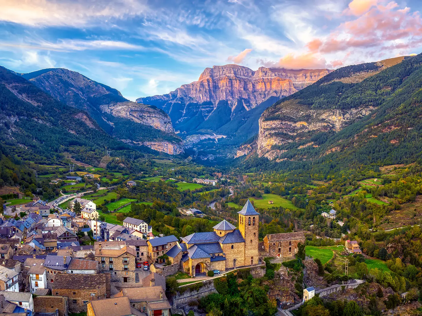
The Ordesa Valley Circuit is a hard 20 km loop in Ordesa y Monte Perdido National Park, in the Aragonese Pyrenees of Spain. It is a full-day mountain hike, typically suited to fit hikers comfortable with steep climbing, exposed ledge walking and 900 m of ascent. The standard circuit links the Senda de los Cazadores, Faja de Pelay, Cola de Caballo waterfall and the Río Arazas valley-floor path in one long, varied day.
Route Overview
Start and finish at Pradera de Ordesa, the road-head trailhead at about 1,305 m. Most hikers go clockwise: climb the steep Senda de los Cazadores first, top out at Mirador de Calcilarruego, traverse the Faja de Pelay for about 7 km, then descend to Cola de Caballo at the head of the Circo de Soaso. The return follows the easier valley-floor path beside the Río Arazas, passing Gradas de Soaso, Cascada del Estrecho and Cascada de las Arripas. In the busy season, private cars cannot drive to Pradera de Ordesa; use the mandatory paid shuttle bus from Torla-Ordesa. For longer Spanish mountain routes, compare the Pyrenean hut circuit Carros de Foc, the pilgrim Camino Aragonés over the same mountains, or the southern Alpujarras Trail.
Ordesa y Monte Perdido National Park
Ordesa y Monte Perdido became one of Spain’s first national parks on 16 August 1918, originally protecting the Ordesa Valley, and was greatly enlarged in 1982. In 1997 it was inscribed by UNESCO as part of the cross-border “Pyrénées - Mont Perdu” World Heritage Site, recognised for its limestone landforms. Monte Perdido, at 3,355 m, is the park’s highest peak, while the Ordesa Valley is a classic U-shaped glacial trough.
Notable highlights
- Senda de los Cazadores (~650 m climb in 2 km): The Hunters’ Path is the crux of the day: steep forest zigzags that gain height fast and lead directly to the high traverse.
- Mirador de Calcilarruego (~1,950 m): A cliff-edge viewpoint at a former hunters’ refuge, reached after the main climb, with views along the Ordesa Valley.
- Faja de Pelay (~7 km ledge traverse): A natural rock ledge running high beneath the limestone walls, airy but non-technical in dry conditions.
- Cola de Caballo waterfall (~1,760 m): The Horsetail falls mark the usual turnaround at the head of the Circo de Soaso.
- Gradas de Soaso and Río Arazas waterfalls: The return passes stepped cascades and the Cascada del Estrecho and Cascada de las Arripas on the easier valley-floor path.
Challenges to expect
Expect a strenuous start: the Senda de los Cazadores gains about 650 m in the first 2 km. The Faja de Pelay is exposed and should be avoided with snow, ice or after heavy rain. The hike is not technical, but 20 km, 900 m of ascent and a long descent make it a serious day. There is no lodging on the loop itself.
HikeList Score
Ordesa Valley Circuit scored 81/100 on HikeList's trail-quality metrics.
See score breakdownHide breakdown
- Ideal length 55
- Balanced challenge 84
- Scenery & wildness 98
- Varied terrain 64
- Accommodation 83
- Food & support 88
- Path quality 98
- Season flexibility 89
Computed from length, challenge, scenery & wildness, terrain variety, accommodation, food & support, path quality and season flexibility.
 Spain
SpainShow more data Show less
- Mountainous
- Forest
- Dirt
- Rocky
- Hotels
- Guesthouses
- Campsites
- Family Friendly
- Pet Friendly
- Restrooms
- Water Sources
- Campsites
- Shelters
- Picnic Areas
In these collections
Photos from hikers
Taken on the trail by people who've reviewed Ordesa Valley Circuit.
Reviews
How would you rate Ordesa Valley Circuit?
Tap a star to start your review — you could be the first.