GR7 (Andalusia Section)
How would you rate GR7 (Andalusia Section)?
Tap a star to share your experience and help other hikers.
GR7 (Andalusia Section): Tarifa to Puebla de Don Fadrique
HikeList Score
GR7 (Andalusia Section) scored 78/100 on HikeList's trail-quality metrics.
See score breakdownHide breakdown
- Ideal length 52
- Balanced challenge 84
- Scenery & wildness 71
- Varied terrain 94
- Accommodation 100
- Food & support 74
- Path quality 92
- Season flexibility 76
Computed from length, challenge, scenery & wildness, terrain variety, accommodation, food & support, path quality and season flexibility.
The GR7 (Andalusia Section) is a waymarked, point-to-point long-distance trail across southern Spain, from Tarifa on the Strait of Gibraltar to Puebla de Don Fadrique in north-east Granada. The full route is about 740 km via the northern variant or about 770 km via the southern variant, typically taking 35–42 days. It is a hard thru-hike: long stages, big cumulative ascent, variable waymarking and hot exposed country make it best for fit walkers with multi-day experience.
Route Overview
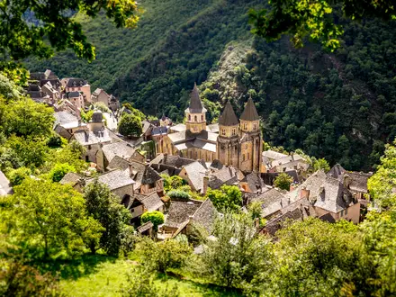
The route starts in Tarifa, Spain’s southernmost town, and heads inland through Cádiz and Málaga before reaching Villanueva de Cauche near Antequera, where it splits. The northern variant continues through Córdoba and Jaén; the southern variant stays in Granada, passing through the Alpujarras beneath the Sierra Nevada before both lines finish at Puebla de Don Fadrique. Expect footpaths, caminos, minor roads, white villages, natural parks, gorges, olive country and high limestone hills. It is usually walked in self-contained sections rather than all at once. For a shorter Sierra Nevada-linked option, compare the Alpujarras Trail; for a very different Spanish long walk, see the Camino de Santiago (Camino Francés).
History of the GR7 and the E4
The GR7 was the first long-distance footpath waymarked in Spain, with work initiated in 1974. The Andalusian section is the south-westernmost part of the European long-distance path E4. Within Spain, the wider GR7 runs for roughly 1,900 km before continuing into France and beyond, making this Andalusian route the opening leg of a much longer trans-European walking line.
Notable highlights
Tarifa and the Strait of Gibraltar: The route begins in Tarifa, mainland Europe’s southernmost point, with Africa visible across the strait. The town is known for wind, kitesurfing and its old Moorish quarter.
- Los Alcornocales Natural Park: Early stages climb through one of the world’s largest cork-oak forests. It gives a humid, wooded start before the route turns deeper into the Andalusian interior.
- Sierra de Grazalema and the white villages: This limestone sierra has deep gorges, pinsapo Spanish fir and whitewashed pueblos blancos. It is also one of the wettest parts of the Iberian Peninsula.
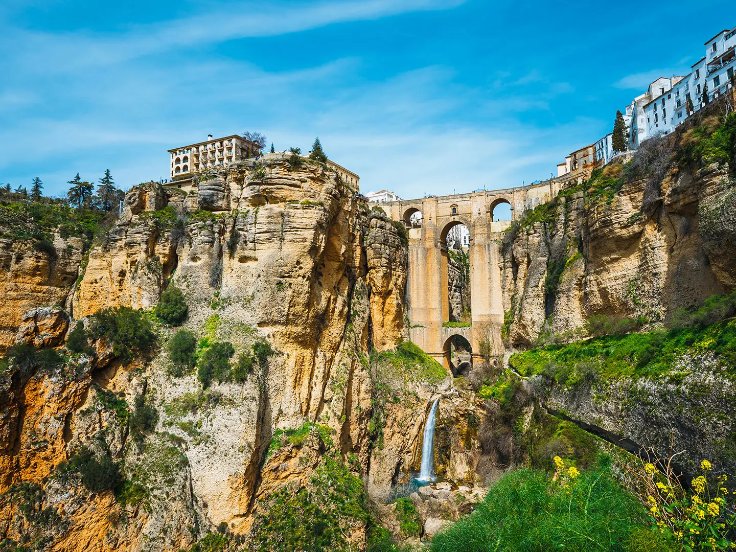
- Ronda: A historic town split by the El Tajo gorge, with Moorish heritage and a dramatic clifftop setting. It is one of the major urban landmarks on the route.
- El Chorro gorge: The Desfiladero de los Gaitanes is a limestone gorge with cliffs up to about 200 m high, beside the restored Caminito del Rey walkway. The area is also well known for rock climbing.
- The Alpujarras and Sierra Nevada: On the southern variant, the route threads terraced white villages such as Lanjarón, Pitres and Trevélez below mainland Spain’s highest mountains. For more walking in this region, see the Alpujarras Trail.
Challenges to expect
This is a hard route because of length, heat, ascent and inconsistent waymarking. Some stages are long, with a few exceeding 1,000 m of ascent, and stages can range from about 9 to 55 km. High summer is very hot; winter can bring snow and cold in the high sierras. Accommodation is settlement-based, so planning village-to-village distances matters.
HikeList Score
GR7 (Andalusia Section) scored 78/100 on HikeList's trail-quality metrics.
See score breakdownHide breakdown
- Ideal length 52
- Balanced challenge 84
- Scenery & wildness 71
- Varied terrain 94
- Accommodation 100
- Food & support 74
- Path quality 92
- Season flexibility 76
Computed from length, challenge, scenery & wildness, terrain variety, accommodation, food & support, path quality and season flexibility.
 Spain
SpainShow more data Show less
- Mountainous
- Gorges
- Forest
- Olive Groves
- Cultivated Terraces
- Semi Desert Highlands
- Footpaths
- Country Tracks
- Minor Roads
- Hotels
- Rural Guesthouses
- Apartments
- Hostels
- Pet Friendly
- Water Sources
- Campsites
Photos from hikers
Taken on the trail by people who've reviewed GR7 (Andalusia Section).
Start your GR7 adventure at the southern tip of Spain in Tarifa. Head inland, leaving coastal views behind as you traverse rolling hills and pass through Mediterranean scrub. The quiet village of Facinas welcomes you at the end of the day, with classic Andalusian charm and small accommodation options.
Walk through peaceful countryside surrounded by oak groves and farmland. The route gently ascends towards the Sierra de Montecoche Natural Park. Reach the market town of Los Barrios, known for its vibrant local life and history.
Head towards Jimena de la Frontera, a fortress town with impressive castle ruins. Enjoy panoramic views across the countryside, with stretches of cork oak forests and river crossings along the way.
Descend into the verdant valley of the Guadiaro River, walking through peaceful forests and remote countryside. Arrive in the small riverside village of El Colmenar, perfect for a restful evening.
Today’s hike climbs steadily into the foothills of the Serranía de Ronda. Enjoy views of wooded hillsides and deep river gorges before reaching the picturesque village of Cortes de la Frontera.
Travel through striking limestone terrain and patches of pine forest as you wind your way into the heart of the Grazalema Natural Park. Arrive in Benaoján, a traditional mountain village famous for its cheese and ham.
Ascend into the heart of the Sierra de Grazalema, enjoying expansive views, lush vegetation, and jagged cliffs. Finish in the town of Grazalema, surrounded by natural beauty and whitewashed buildings.
Trek past dramatic karst formations and across forested ridges. Arrive in Villaluenga del Rosario, a mountain hamlet known for its goats’ cheese and rugged surroundings.
Cross open terrain scattered with wildflowers and descend through rocky gorges to reach the working town of Ubrique, renowned for its leather crafts.
Walk along ancient footpaths through lush valleys and oak woodlands. Arrive in El Bosque, a gateway town to the Sierra de Grazalema and a pleasant spot to sample local cuisine.
Stroll through rolling landscapes with views over the surrounding sierras. The path leads to the pretty town of Prado del Rey, nestled among olive and sunflower fields.
Cross agricultural plains dotted with small farms and rural estates. The route leads gently to Villamartín, a bustling service town with a lively square and good amenities.
Enjoy gentle terrain as you make your way toward the foothills of the Sierra de Líjar. Arrive in Algodonales, famed for its paragliding scene and close proximity to the Zahara-El Gastor reservoir.
Trek across scenic countryside toward the dramatic hilltop town of Olvera, known for its striking church and castle. Olive groves dominate the landscape on this stretch.
Descend from Olvera and follow the rolling river valley to Setenil, built directly into cliffside caves. Take time to explore the cave houses and sample local tapas.
Wander through olive groves and vineyards as you climb steadily to the historic city of Ronda. Famous for its Puente Nuevo bridge and dramatic position atop a steep gorge, Ronda is a highlight of the GR7.
Depart Ronda and ascend into the Sierra de las Nieves. This mountainous stage offers stunning perspectives of the surrounding peaks before descending into El Burgo.
The route continues through rugged terrain, passing rich forests and open pasture. Arrive in Ardales, near the entrance to the famed Caminito del Rey gorge (detour optional).
Travel past turquoise lakes and rolling hills to the historic town of Álora, guarded by its ancient Moorish castle and surrounded by the Guadalhorce valley.
Climb steadily north through wide-open countryside, entering the heart of Andalusia’s fertile landscape. Finish in the tranquil rural village of Villanueva de la Concepción.
Journey through agricultural lands and pastures, gently descending into Antequera. With its dolmens, castle, and historical center, Antequera offers rich opportunities for exploration.
Continue east through olive groves, passing rolling hills and small hamlets. Reach Villanueva de Algaidas, a traditional Andalusian agricultural village with simple, welcoming accommodation.
Swathes of olive trees give way to the turquoise waters of the Iznájar reservoir as you approach this spectacular hillside village, famed for its castle and views over the lake.
Travel along scenic ridges and agricultural plains into the heart of Córdoba province. Priego de Córdoba impresses with its baroque churches, fountains, and stunning old quarter.
Head north through olive groves and hilly terrain, reaching the peaceful village of Almedinilla. Here, Roman remains echo the area’s ancient past.
Undulating tracks bring you to Alcalá la Real, dominated by the imposing Fortaleza de la Mota. Wander the historic alleys and enjoy sweeping countryside views along the way.
Follow rural lanes through vast olive plantations. Alcaudete, with its hilltop castle and traditional Andalusian ambiance, is an inviting place to recharge.
Make your way northeast into the city of Jaén, famous for its Renaissance cathedral and the Santa Catalina castle perched high above. Enjoy sweeping olive groves and city vistas.
Leave Jaén via hillside tracks with panoramic views and steadily ascend toward the foothills of the Sierra Mágina. Arrive in Pegalajar, a small town noted for its spring-fed lake.
Navigate the rugged terrain of the Sierra Mágina foothills, climbing rocky paths to reach Cambil, overlooked by the legendary towers of Zarracotín and Cambil castles.
Steep ascents through wild mountains lead to the town of Huelma, surrounded by olive groves and crowned by a medieval fortress. Expect a rewarding challenge and inspiring scenery.
Tackle high ridgelines and open valleys as you bypass the Sierra de Cazorla. The stage ends in Quesada, a hilltop town with sweeping views and a welcoming atmosphere.
Wander into the Cazorla, Segura y Las Villas Natural Park, following quiet tracks through forests and open meadows. Your destination is Pozo Alcón, a peaceful mountain village.
Today’s stage moves steadily through forested slopes and Mediterranean scrubland as you cross into the province of Granada and reach Puebla de Don Fadrique, near the border with Murcia.
Reviews
How would you rate GR7 (Andalusia Section)?
Tap a star to start your review — you could be the first.