Friese Woudenpad
How would you rate Friese Woudenpad?
Tap a star to share your experience and help other hikers.
Friese Woudenpad: A Complete Hiking Guide
HikeList Score
Friese Woudenpad scored 82/100 on HikeList's trail-quality metrics.
See score breakdownHide breakdown
- Ideal length 94
- Balanced challenge 50
- Scenery & wildness 88
- Varied terrain 94
- Accommodation 83
- Food & support 88
- Path quality 80
- Season flexibility 89
Computed from length, challenge, scenery & wildness, terrain variety, accommodation, food & support, path quality and season flexibility.
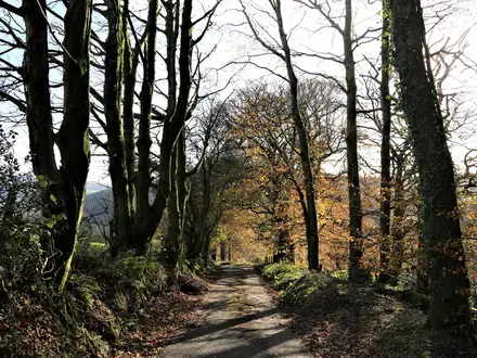
The Friese Woudenpad is a 163 km Dutch long-distance walking path, waymarked LAW 1-1, from Lauwersoog on the Waddenzee to Steenwijk in Overijssel. This easy, flat point-to-point trail usually takes 9-11 days and suits walkers who want lowland distance rather than technical terrain. Expect forest, heath, wetlands and farmland through Friesland and Overijssel, with regular villages and small towns. For similar routes, see more hikes in the Netherlands.
Route Overview
The route starts at Lauwersoog, by the Cleveringsluizen and Nationaal Park Lauwersmeer, then heads inland via Dokkum, Feanwâlden, Eastermar, Rottevalle, Drachten, Ureterp, Beetsterzwaag, Boijl and Wilhelminaoord before finishing in Steenwijk. It is walkable in either direction on white-red LAW waymarks, though the usual description runs north to south. Wandelnet divides the main route into 11 stages, while some walkers combine days into a 9-day itinerary; verified stage distances range from about 11 to 24 km. If you like Dutch lowland walking, compare it with the Drenthepad, the Groene Hart Pad or the coastal Dutch Coastal Path.
From the Zevenwoudenpad to the Colonies of Benevolence
The Friese Woudenpad is the successor to the older Zevenwoudenpad, the “Seven Woods Path”, reworked and lengthened into today’s LAW 1-1. Its southern end reaches the Koloniën van Weldadigheid around Wilhelminaoord, Boschoord and Frederiksoord: planned agricultural colonies founded from 1818 by the Maatschappij van Weldadigheid to resettle the urban poor. That landscape is now UNESCO World Heritage. The route also passes Dokkum, the medieval town associated with Saint Boniface, who was killed nearby in 754.
Notable highlights
- Cleveringsluizen: The imposing sluices near Lauwersoog give a strong coastal start, with wide views over the Waddenzee, the Wadden Islands and nearby bird reserves.
- Dokkum: A historic fortified canal town with bastioned ramparts, closely tied to Saint Boniface and marked by the Bonifatius chapel and holy well.
- Dokkumer Wâlden coulisselandschap: This Frisian “screen landscape” of long narrow plots and alder hedgerows creates enclosed, varied walking and good bird habitat.
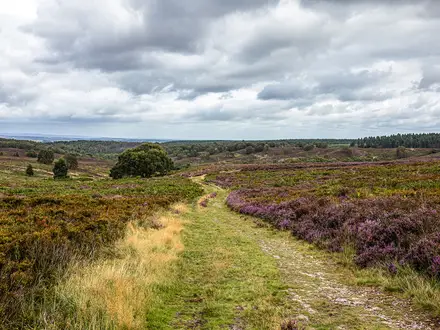
- Duurswouderheide: The largest surviving heathland in Friesland, with small pools and oak-lined banks near the wooded estates around Beetsterzwaag.
- Koloniën van Weldadigheid, Wilhelminaoord: A UNESCO-listed landscape of planned 19th-century agricultural colonies, with straight lanes and smallholdings.
- De Gooyer windmill: An octagonal watermill in the boggy De Lende valley, set among marsh, meadow and bird habitat.
Challenges to expect
The Friese Woudenpad is physically easy, with negligible elevation and no technical ground, but the distance still matters. Some stages run up to about 24 km, so day length is the main challenge. Wetlands, peat areas, fen and marsh near De Weerribben can mean damp paths after rain. Navigation is helped by white-red LAW waymarks, but optional variants of around 87 km make careful route selection useful.
HikeList Score
Friese Woudenpad scored 82/100 on HikeList's trail-quality metrics.
See score breakdownHide breakdown
- Ideal length 94
- Balanced challenge 50
- Scenery & wildness 88
- Varied terrain 94
- Accommodation 83
- Food & support 88
- Path quality 80
- Season flexibility 89
Computed from length, challenge, scenery & wildness, terrain variety, accommodation, food & support, path quality and season flexibility.
 Netherlands
Show more data Show less
- Forest
- Heath
- Wetlands
- Farmland
- Dirt
- Gravel
- Paved
- Hotels
- Hostels
- Campsites
- Family Friendly
- Pet Friendly
- Restrooms
- Water Sources
- Campsites
- Picnic Areas
In these collections
Photos from hikers
Taken on the trail by people who've reviewed Friese Woudenpad.
Reviews
How would you rate Friese Woudenpad?
Tap a star to start your review — you could be the first.