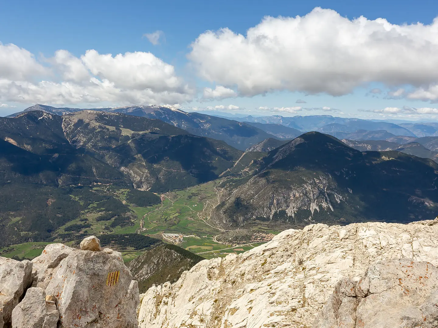
Pedraforca Mountain Loop
How would you rate Pedraforca Mountain Loop?
Tap a star to share your experience and help other hikers.
Pedraforca Mountain Loop: A Hard Catalan Summit Day
HikeList Score
Pedraforca Mountain Loop scored 75/100 on HikeList's trail-quality metrics.
See score breakdownHide breakdown
- Ideal length 55
- Balanced challenge 74
- Scenery & wildness 98
- Varied terrain 71
- Accommodation 58
- Food & support 72
- Path quality 98
- Season flexibility 89
Computed from length, challenge, scenery & wildness, terrain variety, accommodation, food & support, path quality and season flexibility.
The Pedraforca Mountain Loop is a hard 8.5 km circular ascent in Catalonia’s Pre-Pyrenees, within Cadí-Moixeró Natural Park in Spain. It climbs from the Mirador de Gresolet to Pollegó Superior, the highest point of the forked limestone massif at 2,506 m, via Coll del Verdet and a grade I-II scramble. Allow 5-7 hours of walking. This is for confident mountain hikers who are comfortable with exposure, loose scree and sustained ascent, not for beginners.
Route Overview
The loop starts and ends at the Mirador de Gresolet parking above Saldes, reached from Saldes in Berguedà. From the trailhead it is a short approach to Refugi Lluís Estasen, then the route climbs through black pine forest to Coll del Verdet at 2,244 m. The upper mountain is rockier and more exposed, with a final scramble to Pollegó Superior. The descent drops to L'Enforcadura, then down the steep Tartera scree slope on the Saldes side before returning through forest to the refuge and parking. This is a compact summit circuit; for a longer Catalan Pyrenean hut route, compare Carros de Foc, or for a non-alpine coastal walk see the Camí de Ronda.
Pedraforca history: folklore, climbing and Picasso
Pedraforca is one of Catalonia’s emblematic mountains and appears on the coat of arms of Berguedà. Its forked shape is tied to folklore about witches gathering on the summit and a Sant Silvestre midwinter legend in which Saint Michael splits the mountain. Modern climbing history centres on the Vía Estasen on the north face, first climbed on 30 June 1928 by Lluís Estasen, Josep Puntas, Jofre Vila and Josep Rovira. The nearby village of Gósol is also linked to Pablo Picasso, who spent the summer of 1906 there.
Notable highlights
Pollegó Superior (2,506 m): The highest point of the Pedraforca massif and the objective of the loop. In clear weather it gives wide views over the Serra del Cadí, nearby valleys and the high Pyrenees.
Coll del Verdet (2,244 m): The pass where the forested approach gives way to the bare upper mountain. It is the gateway to the exposed summit scramble.
L'Enforcadura: The saddle between Pollegó Superior and El Calderer, forming the distinctive ‘fork’ of Pedraforca. It is the key pivot between the summit and the descent side.
Tartera scree descent: A long, loose slope on the Saldes flank. It is steep, tiring and demands careful foot placement; a helmet is recommended because of rockfall risk.
Refugi Lluís Estasen (1,670 m): A staffed CEC mountain hut at the foot of the north face. It is the natural start, finish and rest point for the loop.
Vía Estasen north face: The imposing wall above the refuge is not part of the hiking loop, but it defines the mountain’s climbing character and history.
Challenges to expect
Expect a hard mountain day: around 1,150 m of ascent in only 8.5 km, exposed grade I-II scrambling near the summit, and a steep loose scree descent. A helmet is recommended. Summer can be hot and busy; winter conditions require crampons and ice axe and turn the route into a mountaineering undertaking. If you want a less technical Spanish long-distance option, consider the Camino Aragonés.
HikeList Score
Pedraforca Mountain Loop scored 75/100 on HikeList's trail-quality metrics.
See score breakdownHide breakdown
- Ideal length 55
- Balanced challenge 74
- Scenery & wildness 98
- Varied terrain 71
- Accommodation 58
- Food & support 72
- Path quality 98
- Season flexibility 89
Computed from length, challenge, scenery & wildness, terrain variety, accommodation, food & support, path quality and season flexibility.
 Spain
SpainShow more data Show less
- Mountainous
- Forest
- Dirt
- Rocky
- Scree
- Huts
- Campsites
- Pet Friendly
- Restrooms
- Water Sources
- Campsites
- Shelters
In these collections
Photos from hikers
Taken on the trail by people who've reviewed Pedraforca Mountain Loop.
Reviews
How would you rate Pedraforca Mountain Loop?
Tap a star to start your review — you could be the first.