Kromme Rijnpad
How would you rate Kromme Rijnpad?
Tap a star to share your experience and help other hikers.
Kromme Rijnpad: Utrecht’s Easy River Walk to Wijk bij Duurstede
HikeList Score
Kromme Rijnpad scored 70/100 on HikeList's trail-quality metrics.
See score breakdownHide breakdown
- Ideal length 55
- Balanced challenge 50
- Scenery & wildness 65
- Varied terrain 100
- Accommodation 74
- Food & support 81
- Path quality 84
- Season flexibility 89
Computed from length, challenge, scenery & wildness, terrain variety, accommodation, food & support, path quality and season flexibility.
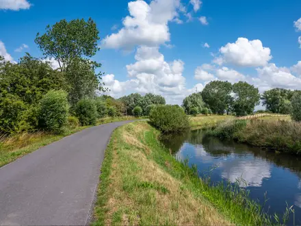
The Kromme Rijnpad is a 29 km waymarked regional walking route in Utrecht province, in the Netherlands. It follows the meandering Kromme Rijn from Ledig Erf in the city of Utrecht to the harbour at Wijk bij Duurstede. This is an easy, essentially flat point-to-point day hike on riverside paths, old towpath, meadows, orchards and estate woodland. It suits walkers who want a low-effort full day with good history, public transport and no technical terrain.
Route Overview
The route starts at Ledig Erf by Tolsteegbrug, about a 15-minute walk from Utrecht Centraal, and finishes at Wijk bij Duurstede harbour beside the Rijn en Lek windmill. It is signposted in both directions with blue Kromme Rijnpad signs, so it can be walked either way, though Utrecht to Wijk bij Duurstede gives a clear downstream-feeling line out of the city. Key places include Amelisweerd and Rhijnauwen estates, Bunnik, Odijk, Werkhoven, Cothen and Wijk bij Duurstede. The central section, from around Fort bij Rijnauwen / Fort Lunet towards Odijk, uses a centuries-old jaagpad. Day walkers commonly return to Utrecht by bus, including line 41. For another Dutch river walk, compare the Amstel River Trail.
Roman Rhine, towpaths and the dam at Wijk bij Duurstede
The Kromme Rijn was once the main channel of the Rhine and formed part of the Roman Empire’s northern frontier, the Limes, with frontier forts along its banks. In the early Middle Ages the river silted up and lost flow to the Lek and Waal. In 1122 Bishop Godebald had it dammed at Wijk bij Duurstede to reduce flooding, which cut Utrecht’s shipping link to the Rhine. Utrecht then began digging the Vaartse Rijn canal from 1127. Parts of today’s walk follow the old towpath used to haul barges.
Notable highlights
- Amelisweerd and Rhijnauwen estates: Historic country estates just east of Utrecht, with old hardwood forest, riverside meadows and manor houses. Rhijnauwen’s well-known tea house makes this one of the easiest early rest stops.
- Fort bij Rijnauwen and the New Dutch Waterline: The route passes fortifications of the Nieuwe Hollandse Waterlinie, a UNESCO World Heritage defensive landscape. Fort Vechten and the Waterliniemuseum are nearby as an optional detour.
- Roman Limes: The Kromme Rijn corridor was part of the Lower German Limes, the Roman frontier along this branch of the Rhine. For hikers, it adds a strong historical thread to an otherwise gentle river walk.
- Kasteel Beverweerd: A castle near Werkhoven with 13th-century origins, set in parkland beside the route. It is one of the clearest medieval landmarks between the estates and the fruit country.
- Cothen and the orchards: Cothen has a village green, the moated Kasteel Rhijnestein and cherry-growing heritage. The surrounding Kromme Rijnstreek is classic Dutch fruit country, especially attractive in spring blossom.
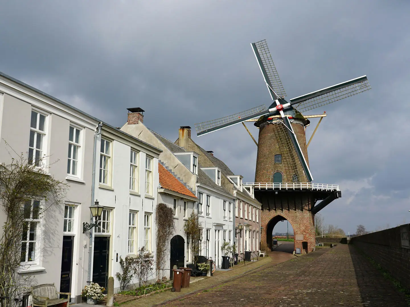
- Kasteel Duurstede and Rijn en Lek windmill: Wijk bij Duurstede ends the route with a medieval castle in a public park and the Rijn en Lek tower windmill beside the harbour. The windmill is famously linked with a Jacob van Ruisdael painting.
Challenges to expect
The Kromme Rijnpad is easy, but not always dry underfoot: unpaved riverside paths and the old jaagpad can be soft or muddy after rain. There is a short urban start and the route briefly skirts the A12 near Utrecht before settling into quieter river country. Navigation is straightforward thanks to blue signs in both directions. Dogs are reported not permitted on the route. For a longer Dutch waymarked option, see the Floris V Trail.
HikeList Score
Kromme Rijnpad scored 70/100 on HikeList's trail-quality metrics.
See score breakdownHide breakdown
- Ideal length 55
- Balanced challenge 50
- Scenery & wildness 65
- Varied terrain 100
- Accommodation 74
- Food & support 81
- Path quality 84
- Season flexibility 89
Computed from length, challenge, scenery & wildness, terrain variety, accommodation, food & support, path quality and season flexibility.
 Netherlands
Show more data Show less
- River Floodplain
- Meadows
- Reed Beds
- Tree Lined Banks
- Orchards
- Estate Woodland
- Unpaved
- Towpath
- Gravel
- Paved
- Hotels
- Guesthouses
- Family Friendly
- Restrooms
- Water Sources
- Picnic Areas
Photos from hikers
Taken on the trail by people who've reviewed Kromme Rijnpad.
Reviews
How would you rate Kromme Rijnpad?
Tap a star to start your review — you could be the first.