Gipping Valley River Path
How would you rate Gipping Valley River Path?
Tap a star to share your experience and help other hikers.
Gipping Valley River Path: Suffolk’s Flat Riverside Walk
HikeList Score
Gipping Valley River Path scored 68/100 on HikeList's trail-quality metrics.
See score breakdownHide breakdown
- Ideal length 55
- Balanced challenge 50
- Scenery & wildness 59
- Varied terrain 89
- Accommodation 74
- Food & support 88
- Path quality 84
- Season flexibility 89
Computed from length, challenge, scenery & wildness, terrain variety, accommodation, food & support, path quality and season flexibility.
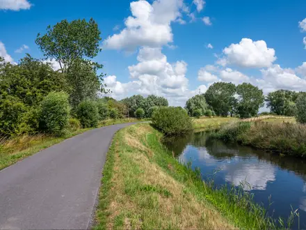
The Gipping Valley River Path is an easy 27 km point-to-point walk in Suffolk, England, following the River Gipping and the old Ipswich & Stowmarket Navigation towpath from Stowmarket to Ipswich. It suits walkers who want a long, flat day with railway escape points rather than a remote expedition. Expect riverside meadows, wetlands, old locks, gravel-pit lakes and short urban sections at either end. Spring to autumn gives the best mix of wildlife and firmer footing.
Route Overview
Walk it conventionally downstream from Stowmarket railway station, near Pickerel Bridge and the Old Maltings, to Ipswich Waterfront at Stoke Bridge, where the Gipping becomes the tidal River Orwell. The route passes Needham Market and Needham Lake, the restored locks at Creeting, Bosmere, Pipps Ford and Baylham, Baylham Mill, Great Blakenham, Bramford Meadows Local Nature Reserve and Sproughton before entering Ipswich. It is linear but logistically simple: Stowmarket, Needham Market and Ipswich are on the Great Eastern Main Line, so half-day sections are easy. For comparable lowland walking, see the Stour Valley Path, Sandlings Walk or canal-side Ashby Canal Trail.
Navigation history on the River Gipping
The River Gipping was canalised under the Ipswich and Stowmarket Navigation Act 1790, with engineering led chiefly by John Rennie after William Jessop. The navigation opened throughout on 14 September 1793, linking Ipswich and Stowmarket via 15 broad locks. Barges carried agricultural produce, coal, corn, hops, gun cotton and later fertiliser, supporting industry in the valley. Trade declined after the railway arrived in 1846; the navigation closed in 1922. Today the River Gipping Trust helps restore locks, bridges and towpath links.
Notable highlights
- Needham Lake and nature reserve: A former gravel pit at Needham Market, now a lake and nature reserve with birdlife, picnic space and refreshments. It is a natural mid-route stop and is reached from Needham Market station via a tunnel under the railway.
- Baylham Mill and lock: Baylham has what is described as the only complete surviving mill on the river, with a Victorian waterwheel beside a restored navigation lock. It is one of the clearest reminders of the Gipping’s milling and barge-trade past.
- Restored navigation locks: The route passes brick lock chambers from the 1793 Ipswich & Stowmarket Navigation. The River Gipping Trust has restored several, including Bosmere, Baylham, Creeting and Pipps Ford.
- Bramford Meadows Local Nature Reserve: A riverside meadow reserve near Bramford, typical of the floodplain habitat along the walk. Look for kingfishers, herons, dragonflies and other wetland wildlife.
- Ipswich Waterfront / Stoke Bridge: The finish reaches the regenerated Ipswich Waterfront at Stoke Bridge, where the freshwater Gipping becomes the tidal River Orwell. It is a lively urban contrast to the quieter rural middle of the route.
- River and wetland wildlife: Willow- and alder-lined banks, reedy margins and old gravel-pit lakes support kingfishers, herons, dragonflies, butterflies and deer, with spring and summer usually best for sightings.
Challenges to expect
This is an easy, low-level walk, but do not expect dry towpath in all seasons. Low-lying riverside and meadow sections can be muddy or occasionally flooded after rain, especially in winter. Waymarking exists, including the promoted trail signage, but a few areas around Great Blakenham can be less obvious. Carry a map or GPX, and use the railway stations if splitting the route.
HikeList Score
Gipping Valley River Path scored 68/100 on HikeList's trail-quality metrics.
See score breakdownHide breakdown
- Ideal length 55
- Balanced challenge 50
- Scenery & wildness 59
- Varied terrain 89
- Accommodation 74
- Food & support 88
- Path quality 84
- Season flexibility 89
Computed from length, challenge, scenery & wildness, terrain variety, accommodation, food & support, path quality and season flexibility.
 United Kingdom
 England
Show more data Show less
- Wetlands
- Rural
- Urban
- Dirt
- Grass
- Gravel
- Paved
- Hotels
- Guesthouses
- Family Friendly
- Pet Friendly
- Restrooms
- Water Sources
- Campsites
- Picnic Areas
Photos from hikers
Taken on the trail by people who've reviewed Gipping Valley River Path.
Reviews
How would you rate Gipping Valley River Path?
Tap a star to start your review — you could be the first.