Kromme Rijn Path
How would you rate Kromme Rijn Path?
Tap a star to share your experience and help other hikers.
Kromme Rijn Path: Easy River Walking from Utrecht
HikeList Score
Kromme Rijn Path scored 71/100 on HikeList's trail-quality metrics.
See score breakdownHide breakdown
- Ideal length 55
- Balanced challenge 50
- Scenery & wildness 74
- Varied terrain 94
- Accommodation 74
- Food & support 88
- Path quality 92
- Season flexibility 63
Computed from length, challenge, scenery & wildness, terrain variety, accommodation, food & support, path quality and season flexibility.
The Kromme Rijn Path, or Kromme Rijnpad, is a 29 km point-to-point walk in the Netherlands, following the Kromme Rijn river valley from Ledig Erf in Utrecht to TOP Stadshaven in Wijk bij Duurstede. It is an easy, flat route on towpaths, field paths and surfaced lanes, with no climbing. Strong walkers can do it in one long day; many split it into the four signed sections of roughly 6–9 km. It suits families, history-minded walkers and anyone wanting a low-effort countryside walk near Utrecht.
Route Overview
The route starts at Ledig Erf, Utrecht, between the Oudegracht and the Singel, and ends at TOP Stadshaven, Wijk bij Duurstede on Havenweg 2. It is waymarked in both directions, so you can also walk it westbound. The signed stages are Utrecht to Fort bij Rhijnauwen (6.7 km), Fort bij Rhijnauwen to Kasteel Beverweerd (8.7 km), Kasteel Beverweerd to Cothen (7.3 km), and Cothen to Wijk bij Duurstede (6.1 km), passing near Bunnik, Odijk and Werkhoven. Bunnik station and Utrecht make logistics straightforward. For another lowland river walk, see the Amstel River Trail; for a longer Dutch route, compare the Floris V Trail.
Roman Rhine, Dorestad and the Waterline
The Kromme Rijn — the “Crooked Rhine” — was once the main northern distributary of the Rhine and carried the Limes Germanicus, the Roman frontier. Utrecht began as a Roman fort on the river. As the Lek took more of the flow, the Kromme Rijn silted up; in 1122 Bishop Godebald had it dammed at Wijk bij Duurstede to reduce flooding. Wijk bij Duurstede stands on the site of Dorestad, a major early-medieval trading emporium along the riverbank.
Notable highlights
- Fort bij Rhijnauwen (New Dutch Waterline): The largest fort of the New Dutch Waterline, with around 31 hectares of earthworks now forming a green nature area just outside Utrecht, beside Stayokay Utrecht-Bunnik.
- Lunetten on the Houtensevlakte: Four crescent-shaped detached forts built in 1822–1828 as part of the Dutch water-defence line on the southern edge of Utrecht.
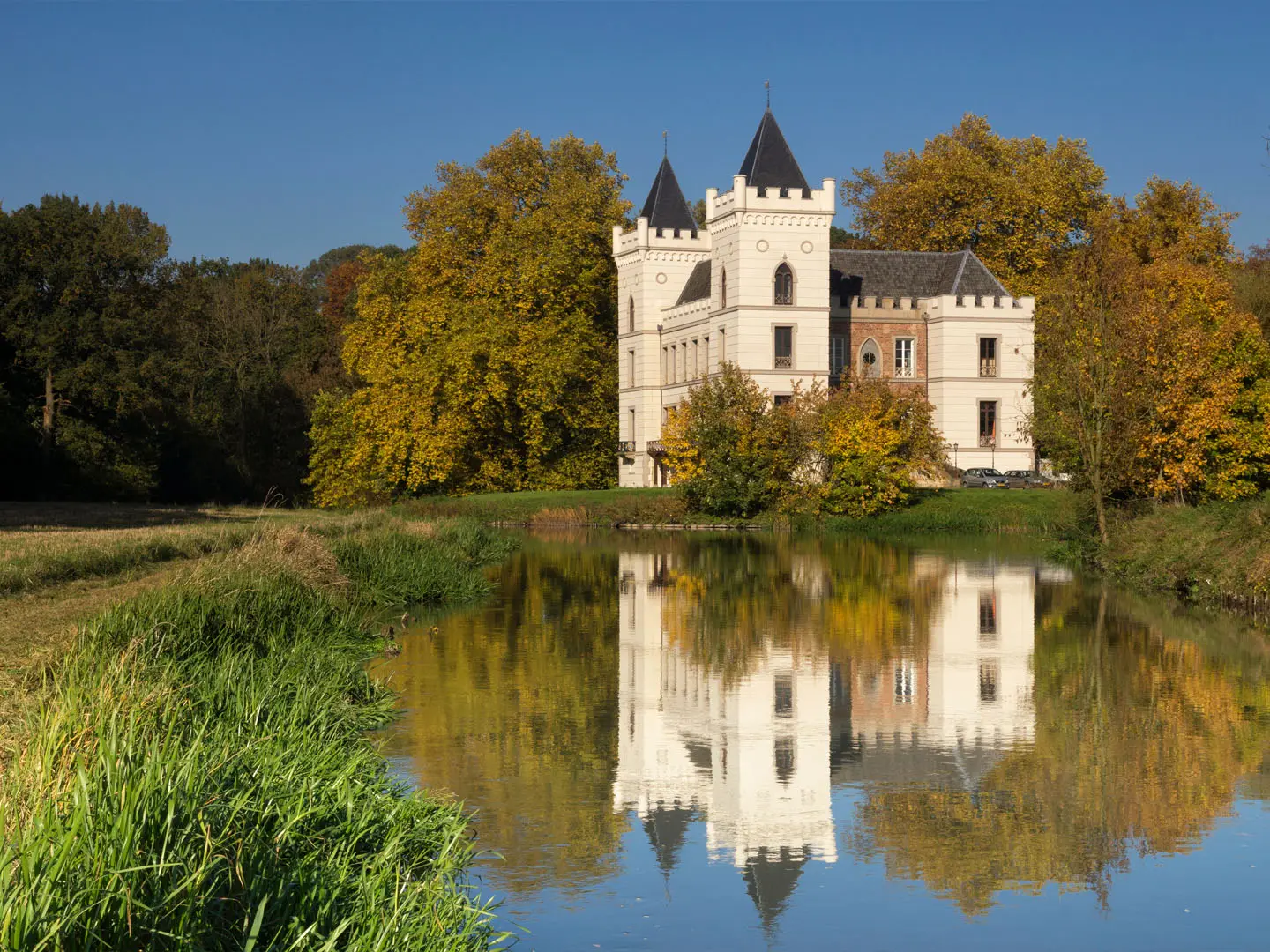
- Kasteel Beverweerd: A moated castle with 13th-century origins, set in parkland near Werkhoven and roughly midway along the walk.
- Dorestad, Wijk bij Duurstede and Duurstede Castle: The finish town stands on the early-medieval trading site of Dorestad; Duurstede Castle is reached by a drawbridge and is among the oldest castles in the Netherlands.
- Molen Rijn en Lek: A working windmill at Wijk bij Duurstede, built over a town gate and known from a Jacob van Ruisdael painting in the Rijksmuseum.
- Orchards and the Kersenmuseum: The Kromme Rijn area is fruit country, with blossom in spring, cherry and fruit harvest in summer and early autumn, and a small Cherry Museum on a fruit farm.
Challenges to expect
This is an easy walk technically: flat, low-lying and generally good underfoot, with no altitude or climbing to plan for. The main challenge is the full 29 km if walked in one push, so use the four signed stages if you want a shorter day. Navigation is helped by Kromme Rijnpad waymarks and the orange node-network shields with blue numbers and arrows.
HikeList Score
Kromme Rijn Path scored 71/100 on HikeList's trail-quality metrics.
See score breakdownHide breakdown
- Ideal length 55
- Balanced challenge 50
- Scenery & wildness 74
- Varied terrain 94
- Accommodation 74
- Food & support 88
- Path quality 92
- Season flexibility 63
Computed from length, challenge, scenery & wildness, terrain variety, accommodation, food & support, path quality and season flexibility.
 Netherlands
Show more data Show less
- River Valley
- Meadows
- Farmland
- Orchards
- Woodland
- Unpaved Towpath
- Field Paths
- Surfaced Lanes
- Hotels
- Hostels
- Family Friendly
- Pet Friendly
- Stroller Accessible
- Restrooms
- Water Sources
- Picnic Areas
- Campsites
Photos from hikers
Taken on the trail by people who've reviewed Kromme Rijn Path.
Leave Ledig Erf in Utrecht and follow the signed Kromme Rijnpad towards Fort bij Rhijnauwen, a major New Dutch Waterline fort just outside the city.
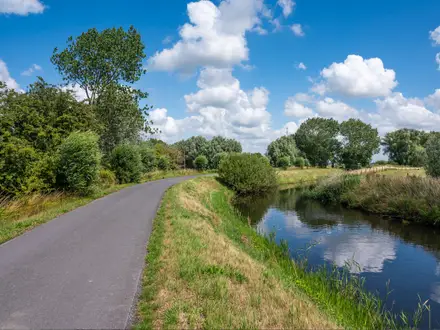
Continue through the Kromme Rijn river valley, using the towpath and rural paths towards the moated Kasteel Beverweerd near Werkhoven.
Walk east from Kasteel Beverweerd through farmland, orchards and riverside country towards Cothen.
Finish the route from Cothen to TOP Stadshaven in Wijk bij Duurstede, the town associated with Dorestad, Duurstede Castle and Molen Rijn en Lek.
Reviews
How would you rate Kromme Rijn Path?
Tap a star to start your review — you could be the first.