HRP (Haute Route Pyrenees)
How would you rate HRP (Haute Route Pyrenees)?
Tap a star to share your experience and help other hikers.
HRP (Haute Route Pyrenees): High Traverse of the Pyrenees
HikeList Score
HRP (Haute Route Pyrenees) scored 74/100 on HikeList's trail-quality metrics.
See score breakdownHide breakdown
- Ideal length 52
- Balanced challenge 44
- Scenery & wildness 98
- Varied terrain 71
- Accommodation 92
- Food & support 81
- Path quality 98
- Season flexibility 63
Computed from length, challenge, scenery & wildness, terrain variety, accommodation, food & support, path quality and season flexibility.
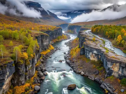
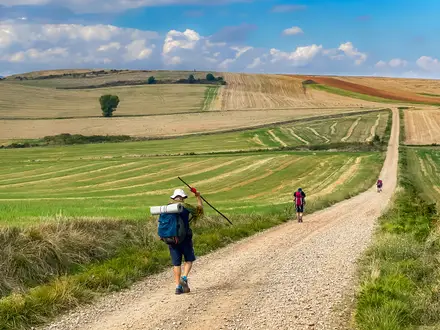
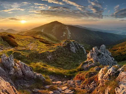
The HRP (Haute Randonnée Pyrénéenne / Pyrenean Haute Route) is an 800 km, roughly 45-day, expert-level high-mountain traverse from Hendaye on the Atlantic to Banyuls-sur-Mer on the Mediterranean. Filed under France, it repeatedly crosses into Spain and passes through Andorra. Unlike the GR10 and GR11, the HRP largely follows the high watershed and is mostly unwaymarked. It suits experienced, self-sufficient hikers with strong navigation, mountain-weather judgement and confidence on scree, snowfields and exposed terrain.
Route Overview
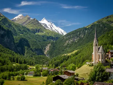
This is a west-to-east point-to-point traverse, starting at Hendaye in French Basque Country and finishing at Banyuls-sur-Mer on the Mediterranean; both ends are reachable by public transport. The line crosses the Basque foothills, Lescun and the Aspe valley, the Ossau valley below Pic du Midi d’Ossau, Cauterets, Vignemale, Cirque de Gavarnie, the Spanish high country near Aneto/Maladeta, the Val d’Aran, Aigüestortes, Ariège, Andorra, Pic Carlit, the Cerdagne and the Canigou massif. For a shorter Pyrenean objective, see the Cirque de Gavarnie Trails; for less committing French routes, compare the Chartreuse Trail (GR9 Segment) or the Canal du Midi Towpath.
How the HRP Became the High Route of the Pyrenees
The HRP was devised by French mountaineer and Pyrenees specialist Georges Véron, who first traversed and described the high-level route in 1968. Its purpose was distinct from the GR10 and GR11: stay close to the high watershed rather than follow lower valley routes. Later guidebook versions, including Ton Joosten’s Cicerone route, describe variants, which is why distance and ascent figures differ. The route also crosses an old frontier landscape of shepherds’ paths, smugglers’ routes and the Camino de Santiago near Col d’Ibaneta.
Notable highlights
- Pic du Midi d’Ossau (2,884 m): A distinctive twin-horned rock peak in the Ossau valley, often called the “Matterhorn of the Pyrenees”. The HRP passes beneath it via Refuge de Pombie.
- Vignemale (3,298 m): The highest summit in the French Pyrenees. The route skirts its flanks and passes Refuge de Bayssellance, the highest staffed hut in the French Pyrenees.
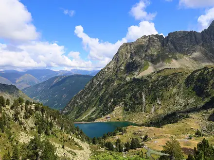
- Cirque de Gavarnie: A vast glacial amphitheatre with sheer walls and the Grande Cascade. It is part of the UNESCO-listed Pyrenees–Mont Perdu World Heritage Site.
- Col Inférieur de Literole (2,983 m): The highest point on the HRP. Its loose, steep descent near the Aneto/Maladeta massif is one of the route’s hardest passages.
- Andorra and Pic Carlit high country: The eastern stages cross Andorra before entering granite Pyrenean terrain around Pic Carlit and the Cerdagne.
- Canigou massif and Banyuls-sur-Mer: The final mountains lead towards Catalan country and the Mediterranean finish at Banyuls-sur-Mer.
Challenges to expect
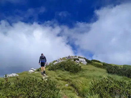
Expect sustained high-mountain travel: long unwaymarked sections, route-finding, loose scree, boulder fields, exposed ground, lingering snowfields and unbridged stream crossings. High passes regularly exceed 2,500 m, with the trail’s high point at 2,983 m. Remote central sections can run several days between huts, so wild-camping or bivouac planning matters. The realistic season is mid/late June to mid-September, with snow risk early and storms or early snow possible later.
HikeList Score
HRP (Haute Route Pyrenees) scored 74/100 on HikeList's trail-quality metrics.
See score breakdownHide breakdown
- Ideal length 52
- Balanced challenge 44
- Scenery & wildness 98
- Varied terrain 71
- Accommodation 92
- Food & support 81
- Path quality 98
- Season flexibility 63
Computed from length, challenge, scenery & wildness, terrain variety, accommodation, food & support, path quality and season flexibility.
Show more data Show less
- Mountainous
- Forest
- Rocky
- Dirt
- Snow
- Huts
- Hotels
- Campsites
- Hostels
- Wild Camping Spots
- Pet Friendly
- Water Sources
- Campsites
- Shelters
In these collections
Photos from hikers
Taken on the trail by people who've reviewed HRP (Haute Route Pyrenees).
Starting from the beachfront at Hendaye, the HRP immediately begins its journey inland, traversing rolling Basque hills and woodlands. The day is characterized by gentle ascents and descents through rural scenery, ending at Olhette with views of the first Pyrenean summits.
Continue over grassy hills and through eucalyptus forests, weaving between traditional Basque villages, before concluding at the historic and picturesque village of Ainhoa.
Ascend steadily through patchwork fields and forests, gaining elevation as the route leaves the lowlands behind. The section finishes at Col des Veaux, with wide views across the valleys below.
Traverse undulating ridges and quiet footpaths, then descend towards the vibrant Basque town of Saint-Étienne-de-Baïgorry, nestled in the heart of the foothills.
The trail heads deeper into the highlands, entering wilder country and ascending the first significant mountain passes. The day ends in the charming mountain village of Lescun, surrounded by limestone peaks.
Climb from Lescun through steep valleys, following trails above tree-line with panoramic Pyrenean views. Finish at the lakeside Refuge d’Arlet, a welcome hut amid alpine scenery.
Traverse rocky passes and meadows, descending gradually with impressive vistas dominated by Pic du Midi d’Ossau as you arrive in the valley village of Gabas.
A direct ascent brings you into high-mountain terrain, passing clear streams and alpine meadows before reaching Refuge de Pombie, nestled below the imposing Pic du Midi d’Ossau.
Cross several high cols and traverse past glittering mountain lakes before a long descent into the green Arrens-Marsous valley, rich with traditional Pyrenean hamlets.
Climb through upper valleys and glacial cirques, skirting the edges of the Pyrenees National Park, then descend to the historic spa town of Cauterets.
A major ascent into high alpine terrain, with waterfalls, dramatic valleys, and proximity to the Vignemale massif. The day ends at Refuge Bayssellance, the highest mountain hut in the French Pyrenees.
Descend through glacial and rocky landscapes as you make your way to Cirque de Gavarnie, a natural amphitheater and one of the Pyrenees’ most iconic features.
Follow valley trails and then ascend steeply, staying well above the tree line, with panoramic mountain views en route to the remote Refuge Barroude.
A rugged traverse across wild ridges and rocky slopes before a descent into Parzan, offering a resupply opportunity on the Spanish side of the border.
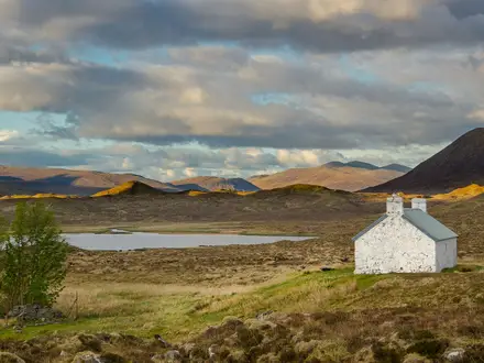
Climb through green valleys and forest before reaching the high and historic Hospital de Viella, an old traveler’s refuge surrounded by panoramic summits.
After a high mountain pass, enter the lush Val d’Aran and descend toward Salardu, a traditional Catalan village with unique character and local amenities.
A challenging day with several cols, offering dramatic ridge views before dropping down to the remote lakeside Refuge de Certascan.
Navigate through rugged high-mountain terrain and over sharp ridges, staying deep within the most isolated part of the central Pyrenees and arriving at Refuge du Pinet.
Descend from the high ridges, through tranquil forests and riverside paths, arriving in the village of Mérens-les-Vals at the heart of the Ariège.
Trek through remote valleys and over challenging terrain, eventually reaching the isolated Refuge d’Araing perched beside a mountain lake.
Make the high and scenic crossing of Col de Serre d’Araing before a rocky descent into the hamlet of Eylie, with reminders of its mining past.
Follow forested and riverside trails as you leave the rugged mining landscape behind and make your way toward the spa village of Aulus-les-Bains.
Ascend steeply above Aulus-les-Bains, walking high ridges and passing ancient stone barns before an atmospheric evening at Gîte d’Etape de Certamière.
Enjoy a varied day through wildflower meadows and gentle scrambles, ending at the enchanting Refuge de Bassiès beside a string of small lakes.
A generally downhill route with views over the Ariège region, following rivers and cattle trails to reach the mountain village of Goulier.
Cross low passes through tranquil forests and open fields to the quiet valley settlement of Siguer, surrounded by rolling hills.
Long hikes through a mix of forested and alpine terrain, ascending above tree line to the scenic lakeside Refuge des Bésines.
A shorter but high-elevation segment, with glacial lakes and granite ridges en route to L’Hospitalet-près-l’Andorre on the edge of Andorra.
Skirt the Andorran border while moving across granite slopes, passing old smuggler trails toward the isolated Refuge du Rhule.
Descend from high Andorran ridges back into the Ariège, following wild and rarely used trails into Mérens-les-Vals.
A mix of river paths and alpine landscapes, ascending once again to a tranquil night at the lakeside Refuge d’en Beys.
Traverse remote granite ridges and forested slopes, entering the Pic Carlit area and ending at the mountain lakes of Refuge de Camporells.
Descend from high lakes and granite terrain to mixed forests, crossing the famous Yellow Train railway and reaching the village of Bolquère.
Travel through pine woods and open pastures, catching early sight of the Mediterranean foothills before a night at Refuge de l’Orri.
A long descent into lower, warmer elevations, passing through Catalan villages and chestnut groves on the way to Amélie-les-Bains.
Ascend again into Mediterranean pine forests and sunny hillsides, ending at the rustic Refuge des Salines near the Spanish border.
Traverse through open meadows and historic border posts with panoramic views as you move east toward Las Illas.
A scenic section through rolling uplands and pine groves leads to Col de l’Ouillat, a popular viewpoint overlooking the Mediterranean.
The final descent crosses vineyards and sunbaked hills, ending at the blue waters and beaches of Banyuls-sur-Mer on the Mediterranean.
Reviews
How would you rate HRP (Haute Route Pyrenees)?
Tap a star to start your review — you could be the first.