GR54 (Tour de l'Oisans and Ecrins)
How would you rate GR54 (Tour de l'Oisans and Ecrins)?
Tap a star to share your experience and help other hikers.
GR54 (Tour de l'Oisans and Ecrins): High Alpine Circuit Guide
HikeList Score
GR54 (Tour de l'Oisans and Ecrins) scored 81/100 on HikeList's trail-quality metrics.
See score breakdownHide breakdown
- Ideal length 90
- Balanced challenge 44
- Scenery & wildness 98
- Varied terrain 64
- Accommodation 84
- Food & support 88
- Path quality 98
- Season flexibility 76
Computed from length, challenge, scenery & wildness, terrain variety, accommodation, food & support, path quality and season flexibility.
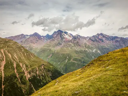
The GR54 (Tour de l'Oisans and Ecrins) is a 176 km waymarked Grande Randonnée loop in France, circling the Ecrins massif southeast of Grenoble through the Parc national des Ecrins. Plan on 10-15 days and an expert-level workload: steep alpine paths, rough rock and dirt, around 12,000 m of ascent and high cols that can hold snow. It suits fit, experienced mountain walkers who want a non-technical but physically serious hut-to-hut or gite-to-gite circuit in the Isere and Hautes-Alpes.
Route Overview
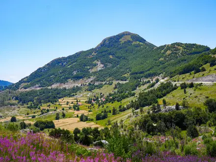
The GR54 is a loop, most commonly started and finished at Le Bourg-d'Oisans in Isere. It can also be joined at La Grave, Vallouise/L'Argentiere-la-Bessee, La Chapelle-en-Valgaudemar and other villages on the circuit, which helps with resupply and exit planning. Key sections pass the Plateau d'Emparis, Villar-d'Arene, Col d'Arsine, Le Monetier-les-Bains, Vallouise, Col de l'Aup Martin, Pre de la Chaumette, Valjouffrey/Le Desert, Valsenestre, Lac de la Muzelle and La Berarde. The route crosses around 14 cols. If comparing other French hiking plans, see the Chartreuse Trail GR9 segment and the Cirque de Gavarnie trails.
How the GR54 Was Created
The GR54 was conceived by Roger Canac, a mountain guide, teacher and writer. In the winter of 1962-63, he and a small group sketched a circuit around the Ecrins on maps and then on the ground, linking existing pastoral and shepherds' paths with refuge and dormitory stops in each valley. The route was officially designated GR54 in spring 1964, inspired by the older Tour du Mont-Blanc. The Parc national des Ecrins was created in 1973.
Notable highlights
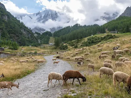
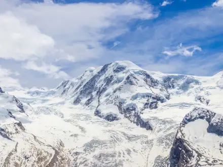
- La Meije and the Barre des Ecrins: The route circles the high core of the Ecrins, with repeated views towards La Meije (3,983 m) and the glaciated Barre des Ecrins (4,102 m), the massif's only 4,000 m summit and the southernmost in the Alps.
- Col de l'Aup Martin (2,761 m): The highest point on the GR54, above Vallouise. Expect a steep climb on slippery schist before the Pas de la Cavale (2,735 m) and the long descent to Pre de la Chaumette.
- Lac de la Muzelle: A glacial lake beneath the Muzelle peak, reached near the end of the loop below the Col de la Muzelle and Col du Vallon. It is one of the classic photo stops on the route.
- Le Monetier-les-Bains: A thermal spa village in the Briançonnais on the Serre Chevalier side of the tour. It is a useful mid-route place for hot baths and resupply.
- Plateau d'Emparis: A high, open balcony above La Grave, giving a direct panorama across to La Meije and its glaciers.
- La Berarde and the Valgaudemar: La Berarde is a historic mountaineering hamlet below the high peaks. The Valgaudemar, including the Haute-Severaisse reserve and La Chapelle-en-Valgaudemar, is one of the wilder, more remote parts of the circuit.
Challenges to expect
This is a demanding mountain route, not a casual hut walk. Several stages involve 1,000-1,600 m of ascent, rough rocky paths and exposed-feeling high cols with slippery schist. Snow can remain on passes into early summer, and refuge opening dates shape the practical season. Navigation is on a waymarked GR, but weather, fatigue, long descents and limited valley services make planning essential. For lower-commitment France ideas, compare the Ballons des Vosges Park trails.
HikeList Score
GR54 (Tour de l'Oisans and Ecrins) scored 81/100 on HikeList's trail-quality metrics.
See score breakdownHide breakdown
- Ideal length 90
- Balanced challenge 44
- Scenery & wildness 98
- Varied terrain 64
- Accommodation 84
- Food & support 88
- Path quality 98
- Season flexibility 76
Computed from length, challenge, scenery & wildness, terrain variety, accommodation, food & support, path quality and season flexibility.
 France
Show more data Show less
- Mountainous
- Forest
- Dirt
- Rocky
- Hotels
- Huts
- Campsites
- Wild Camping Spots
- Pet Friendly
- Restrooms
- Water Sources
- Campsites
- Shelters
In these collections
Photos from hikers
Taken on the trail by people who've reviewed GR54 (Tour de l'Oisans and Ecrins).
Reviews
How would you rate GR54 (Tour de l'Oisans and Ecrins)?
Tap a star to start your review — you could be the first.