GR364 (Mayenne and Sarthe)
How would you rate GR364 (Mayenne and Sarthe)?
Tap a star to share your experience and help other hikers.
GR364 Du Poitou à l'Océan: Western France to the Atlantic
HikeList Score
GR364 (Mayenne and Sarthe) scored 92/100 on HikeList's trail-quality metrics.
See score breakdownHide breakdown
- Ideal length 89
- Balanced challenge 100
- Scenery & wildness 88
- Varied terrain 87
- Accommodation 100
- Food & support 88
- Path quality 98
- Season flexibility 89
Computed from length, challenge, scenery & wildness, terrain variety, accommodation, food & support, path quality and season flexibility.
The GR364 – Du Poitou à l'Océan is a 495 km, point-to-point Grande Randonnée across western France, from La Roche-Posay in Vienne to Les Sables-d'Olonne on the Vendée coast. Allow about 13 days. The walking is lowland and non-technical, but the full distance makes it a moderate thru-hike. It suits hikers who want quiet rural trails, bocage farmland, forest, wetland scenery and an Atlantic finish rather than mountains or high passes.
Route Overview
The route begins at La Roche-Posay, where it branches off the GR48 between La Roche-Posay and Pleumartin, then heads west across Vienne, Deux-Sèvres and Vendée. It crosses the Gâtine and the Marais Poitevin before reaching the Atlantic at Les Sables-d'Olonne on the Côte de Lumière. The Vendée section alone is 252 km in 11 stages of 20–25 km. Expect a rebalanced itinerary through villages with lodging, shops and rail or bus access, following standard red-and-white GR waymarks. If you are comparing other lowland French walks, see the Berry Canal Walk or the Canal du Midi Towpath.
A renovated FFRandonnée route to the Atlantic
The GR364 has existed for around 40 years, but its Vendée section was completely re-routed and re-homologated by the FFRandonnée in a two-year project. That work lengthened the Vendée leg from about 170 km to 252 km and rebranded the trail as “Du Poitou à l'Océan”. The aim was practical as much as scenic: improve access by public transport and pass more reliably through places with accommodation and services.
Notable highlights
- La Roche-Posay: The Vienne spa town marks the start of the GR364, where the route branches away from the GR48. It is long known for its thermal waters.
- Marais Poitevin, the “Venise Verte”: A broad wetland of willow-lined canals straddling Vendée, Deux-Sèvres and Charente-Maritime. The trail threads this flat, watery landscape, known for barque trips on the canals.
- Mervent-Vouvant forest: The largest forest in the Vendée, a hilly oak-and-beech massif cut by gorges and lakes. It gives the GR364 one of its more enclosed, wooded sections.
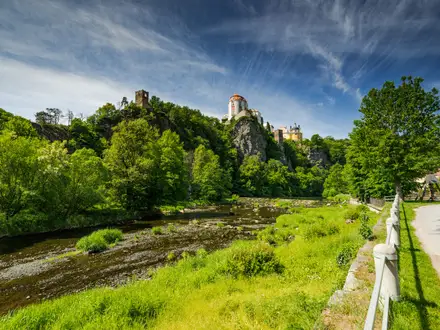
- Vouvant: A fortified medieval village on a loop of the Mère river, classified among Les Plus Beaux Villages de France. The 11th-century Tour Mélusine is the last remnant of the Lusignan castle.
- Les Sables-d'Olonne: The Atlantic finish on the Vendée Côte de Lumière. This seaside resort is also the home port of the Vendée Globe round-the-world yacht race.
Challenges to expect
The GR364 is low and rolling, with a highest point of about 252 m, so the challenge is endurance rather than altitude. Over 495 km there is still around 4,305 m of cumulative ascent. Wet weather can make bocage paths, forest tracks and marshland sections muddy, especially outside the main walking season. Navigation is helped by GR red-and-white balisage, but the FFRandonnée topo-guide and MonGR.fr route information are recommended. For a coast-focused alternative, compare the Bordeaux to Arcachon Trail.
HikeList Score
GR364 (Mayenne and Sarthe) scored 92/100 on HikeList's trail-quality metrics.
See score breakdownHide breakdown
- Ideal length 89
- Balanced challenge 100
- Scenery & wildness 88
- Varied terrain 87
- Accommodation 100
- Food & support 88
- Path quality 98
- Season flexibility 89
Computed from length, challenge, scenery & wildness, terrain variety, accommodation, food & support, path quality and season flexibility.
 France
Show more data Show less
- Forest
- Wetland
- Coastal
- Rural
- Dirt
- Gravel
- Hotels
- Campsites
- Hostels
- Guesthouses
- Family Friendly
- Pet Friendly
- Restrooms
- Water Sources
- Campsites
- Picnic Areas
Download Our Full Guide to GR364 (Mayenne and Sarthe) FREE!
Get our comprehensive guide to this hike for free. Save it for later reading or print out at home.
In these collections
Photos from hikers
Taken on the trail by people who've reviewed GR364 (Mayenne and Sarthe).
GR364 (Mayenne and Sarthe): The Complete Guide
 i
Image by rysan34
i
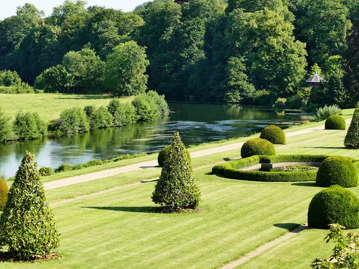
Image by rysan34 The GR364, officially “Du Poitou à l’Océan”, is a 495 km (308 mile) point-to-point crossing from La Roche-Posay in Vienne to Les Sables-d’Olonne on the Vendée coast. It suits walkers who want a long, quiet rural journey with a clear inland-to-sea payoff rather than a mountain route.
The walk starts in Poitou country near the River Creuse, passes through Poitiers and the Gâtine around Parthenay, then works west through bocage farmland, forest, wetland and lake country. Its final reward is the Atlantic at the Côte de Lumière, with Les Sables-d’Olonne bringing the route to a proper seafront finish.
Water shapes much of the trail: river valleys, ponds, the lakes of the Mervent-Vouvant forest and, near the end, the coastal Marais d'Olonne before the ocean. The most enclosed walking comes in the Mervent-Vouvant forest, while villages such as Lusignan and Vouvant add historic stopping points between the longer rural stages.
Underfoot, this is mostly lowland walking on tracks, paths and quiet lanes, with a high point of only about 252 m. The difficulty is not technical terrain or altitude, but linking long days across a rural route where accommodation, shops and transport need planning in advance.
This guide covers stages, daily planning, accommodation, food, transport, terrain and the common mistakes to avoid.
Stage-by-Stage Guide
The stages below use HikeList’s suggested 13-day split for the full GR364. They are planning stages rather than official daily sections: distances are approximate, and the Vendée part has its own official 11-stage structure of roughly 20–25 km per day. Check the latest FFRandonnée topo-guide or MonGR.fr before booking accommodation, especially where a stage is long or ends in a small village.
Stage 1: La Roche-Posay to Archigny — approximately 26 km
The walk starts from the La Roche-Posay area, a well-served thermal-spa town on the Creuse river with hotels, restaurants and shops. The GR364 branches off the GR48 near Plein-Bois, between La Roche-Posay and Pleumartin, so the exact start point should be checked against current GPX data or the FFRandonnée topo-guide before setting off.
This is a gentle introduction to the route: rolling Vienne bocage, meadows, woodland, quiet lanes and small valleys rather than hard climbing. Underfoot is mostly rural track and lane walking, with the usual lowland risk of mud after wet weather.
Archigny is a small rural stage end with limited facilities. Accommodation should be booked before committing to this stop, and food for the evening or next morning may need to be carried if local services are closed.
Navigation is by standard GR red-and-white balisage, but the first day is not one to do casually without the route file. The trailhead sits outside the town centre, and a wrong start could add unnecessary distance at the beginning of a long itinerary.
Stage 2: Archigny to Poitiers — approximately 38 km
This is the longest stage in the suggested 13-day plan and will be too much for many walkers with a full pack. Consider splitting it around villages such as La Chapelle-Moulière or Saint-Georges-lès-Baillargeaux, but accommodation at intermediate stops should be checked before relying on them.
The route continues through Vienne countryside before the approach to Poitiers brings more settlement, urban fringe walking and some road sections. Expect a less remote finish than the previous day, but do not underestimate the cumulative distance.
Poitiers is one of the most useful stops on the whole GR364. It has a major TGV/TER station, a wide choice of hotels, restaurants, supermarkets and pharmacies, and is an obvious place for a rest day or a late start the following morning.
The city’s main landmarks include Notre-Dame-la-Grande, Cathédrale Saint-Pierre, Baptistère Saint-Jean and the medieval quarter. The GR364 also passes through Ligugé on the wider Poitiers section, where the Abbey of Saint-Martin de Ligugé is an important historic stop.
For food and water, start the day self-sufficient unless an intermediate village stop has been planned. Rural shop opening hours can be restrictive, particularly on Sundays and public holidays.
Stage 3: Poitiers to Lusignan — approximately 30 km
Leaving Poitiers, the route returns to gentler countryside through Ligugé, Iteuil and Vivonne, using river-valley landscapes associated with the Clain and Vonne. The walking is moderate rather than difficult, with bocage farmland, quiet lanes and no significant climbing.
Vivonne is a useful small-town stop on the stage and may work as a break point for food or water. As always on this route, check opening hours rather than assuming services will be available when needed.
Lusignan is a strong stage end, with historic interest and better accommodation prospects than many smaller villages. The village is tied to the Mélusine legend and has medieval remains; gîtes d'étape and chambres d'hôtes are available in the area.
Public transport is more practical here than on many rural stages. Lusignan has an SNCF TER station on Line 14 (Poitiers–Niort–La Rochelle), less than 10 minutes’ walk from the route; current timetables should be checked before travelling.
Navigation on this section is generally straightforward where the balisage is intact, and the Lusignan–Poitiers corridor is promoted as an ecomobility walking itinerary. Still carry mapping or GPX, as quiet-lane junctions and field-edge paths can be easy places to miss a mark.
Stage 4: Lusignan to Ménigoute — approximately 30 km
This stage crosses into Deux-Sèvres and the Gâtine, a landscape of hedged farmland, sunken lanes, oak woodland and small rivers. It is not high country, but it feels more enclosed and rural than the early Vienne stages.
Sanxay is the key landmark, known for its Roman amphitheatre and sanctuary. It is worth allowing time if visiting the site, but do not let this compromise the arrival plan for Ménigoute, where services are limited.
The main underfoot issue is mud. The chemins creux — sunken lanes — hold water after rain, and spring or autumn walkers should expect slow, sticky going in places. Waterproof footwear and gaiters are sensible on this section.
Ménigoute is a small village stage end, best known for its annual international nature film festival. Accommodation and evening food should be booked or checked in advance; carry enough supplies to avoid depending on last-minute rural opening hours.
Stage 5: Ménigoute to Parthenay — approximately 32 km
The route continues through the Gâtine bocage towards Parthenay, staying in quiet, rolling rural country. The terrain remains low and non-technical, but the stage is long enough to make pacing and foot care important.
Expect a mixture of farmland tracks, sunken lanes, woodland edges and quiet roads. In wet conditions, this is another stage where mud can turn an apparently moderate day into a slower one.
Parthenay is a major reward after several rural stages. The medieval town sits on a loop of the Thouet river and is known for the Porte Saint-Jacques, ramparts, timber-framed houses and Rue de la Vaux-Saint-Jacques.
Services are good for the GR364: hotels, gîtes, restaurants, shops and a traditional Wednesday morning market. The Gîte de la Tour has limited capacity, while the Halte Jacquaire is reserved for pilgrims with a credential and should not be assumed available to GR364 walkers.
Parthenay also has rail access, making it a useful joining, leaving or rest point. If section-hiking, check current TER arrangements before building a schedule around it.
Stage 6: Parthenay to L'Absie — approximately 32 km
West of Parthenay the GR364 moves into deeper Gâtine country, passing through or near Azay-sur-Thouet and Secondigny before reaching L'Absie. This is quiet, agricultural walking with woodland, hedgerows and scattered villages.
The stage has no major altitude problem, but the distance and sparse services make it a committing day. Food stops between villages can be limited, so carry a full day’s food and at least 2 litres of water.
The same mud warning applies here as on the previous Gâtine stages. Sunken lanes can be wet, rutted and slow, particularly after prolonged rain.
L'Absie is a village stage end with a notable 12th-century Cistercian abbey. Accommodation exists in and around the village, but capacity is not something to leave to chance; book ahead and check where evening meals are available.
Navigation is generally rural GR navigation rather than complex mountain route-finding. The main risk is complacency at field paths, lane junctions and woodland turns, so keep the map or GPX accessible rather than buried in the pack.
Stage 7: L'Absie to Vouvant — approximately 33 km
This is one of the more satisfying transition stages of the GR364, moving from Deux-Sèvres into the Vendée and towards the Mervent-Vouvant forest area. The landscape becomes more wooded and enclosed as the route approaches Vouvant.
At roughly 33 km, it is a long day and should be treated as such. Carry enough food and water for the full stage, particularly if walking outside peak holiday periods when village services may be reduced.
Vouvant is one of the outstanding stops on the trail. It is classified among Les Plus Beaux Villages de France, set on a loop of the Mère river, with medieval fortifications and the Tour Mélusine, a 36-metre keep built around 1240 and the last remnant of the Lusignan castle.
Accommodation options include gîtes and chambres d'hôtes, with Le Relais Mélusine offering several gîtes. Vouvant is also a logical place to slow down or take a rest day before the muddier Vendée stages.
The Vendée section of the GR364 was reworked to improve waymarking and to pass through places with better services and transport links. Even so, use current mapping: local stage divisions in the Vendée may not match this 13-day split exactly.
Stage 8: Vouvant to Chantonnay — approximately 30 km
This stage enters the Vendée part of the route in earnest, with forest, wet paths and bocage replacing the open rhythm of earlier sections. The walking remains low-level, but it can be physically tiring because of mud, damp woodland and repeated small undulations.
The official Vendée staging uses La Caillère-Saint-Hilaire as an intermediate point between Vouvant and Chantonnay. If the day feels too long, or if accommodation is available at La Caillère-Saint-Hilaire, splitting the stage may be the more practical choice.
Key points in this wider section include the Baguenard railway viaduct and the Plessis Franc hamlet, with its château and dovecot. Paths here have a reputation for being very wet, so dry socks and footwear that handles mud matter more than lightweight speed.
La Caillère-Saint-Hilaire has limited services but a Spar grocery store. Evening food and accommodation should not be assumed; check before relying on it as a stopping point.
Chantonnay is a more useful end point, with a TER station and hotel-restaurant provision. It is one of the confirmed rail-access towns on the Vendée section, making it useful for section hikers or for shortening the walk.
Stage 9: Chantonnay to Château-Guibert — approximately 24 km
This is a shorter stage in the suggested split, but it crosses a part of the Vendée where mud and wet ground can still slow progress. The wider official staging in this area uses Bournezeau as a key waypoint, so check the exact day’s line before booking at Château-Guibert.
The terrain alternates between woodland, streams, agricultural fields and rural lanes. Around Lac de Vouraie, the route includes steeper banks with fixed ropes for descent and ascent, which is unusual on this otherwise non-technical lowland trail.
Do not treat the ropes as a climbing section, but do take care in wet weather. Muddy banks, damp leaves and a full backpack can make short slopes awkward.
Bournezeau has guesthouse accommodation, while Château-Guibert should be checked carefully for lodging and food before committing to it as the night stop. Carry food for the day and be prepared for limited services between settlements.
There is no confirmed station at the stage end in the supplied route information. For public-transport planning in this part of the Vendée, Chantonnay behind you and La Roche-sur-Yon ahead are the reliable rail points.
Stage 10: Château-Guibert to La Roche-sur-Yon — approximately 26 km
The route approaches La Roche-sur-Yon through Vendée bocage and the increasingly urban fringe of the département’s prefecture. The L'Yon valley is one of the landscape highlights around this section.
Expect mixed walking: rural tracks, quiet lanes, farmland and more built-up approaches as the day progresses. This is not difficult terrain, but road walking and harder surfaces can be tiring after several muddy rural days.
La Roche-sur-Yon is one of the most practical stops on the GR364. It has hotels, supermarkets, restaurants, pharmacies and a TER station with services towards Nantes and Les Sables-d'Olonne.
This is an excellent resupply point before the final western stages. It is also a sensible place to replace worn kit, take a rest, or adjust the itinerary if the Vendée mud has slowed progress.
Navigation becomes less about remote paths and more about staying attentive through suburban and urban transitions. GR marks can be easier to miss where there are more junctions, signs and street furniture competing for attention.
Stage 11: La Roche-sur-Yon to Beaulieu-sous-la-Roche — approximately 28 km
Leaving La Roche-sur-Yon, the GR364 heads west back into bocage country. The walking becomes quieter again after the urban departure, with farmland and lanes leading towards Beaulieu-sous-la-Roche.
The official Vendée stage distance between La Roche-sur-Yon and Beaulieu-sous-la-Roche is shorter than this suggested split, so check how the day has been arranged if using separate GPX files or tourist-office stage notes. The key planning issue is not technical difficulty but accommodation capacity at the end.
Beaulieu-sous-la-Roche is a small village with shops and limited accommodation. Capacity is tight, so book early and have a fallback plan rather than arriving without a reservation.
There is parking at Place de l'Église for day-walkers, which may help with local access or support logistics. No rail access is listed for the village in the supplied information; La Roche-sur-Yon remains the main transport hub for this part of the route.
Carry enough food and water from La Roche-sur-Yon unless certain of opening hours en route. Rural shop closures, especially on Sundays, can easily disrupt a loosely planned day.
Stage 12: Beaulieu-sous-la-Roche to La Chapelle-Hermier — approximately 24 km
This is one of the better-defined Vendée stages: Beaulieu-sous-la-Roche to the Lac du Jaunay area at La Chapelle-Hermier is around 24.5 km. It is a manageable distance by GR364 standards, but still requires normal full-day planning.
The route follows paths associated with the Jaunay river and passes Ouches du Jaunay and Lac du Jaunay. Expect rural tracks, sunken paths near Chapelle de Garreau, and local features such as wash houses and quarries.
Lac du Jaunay is a strong landscape highlight, and in summer it can be a pleasant place to pause or swim where conditions and local rules allow. The area is more sheltered and varied than the later open coastal marshes.
The stage ends at Le Pré in La Chapelle-Hermier, adjacent to L'Auberge du Jaunay. Accommodation and meals should still be booked ahead, as this is not a large town with unlimited capacity.
Mud remains possible on the sunken paths, even late in the route. The navigation is not especially complex, but lake-edge paths and local leisure trails can make it important to follow the GR balisage rather than simply choosing the most obvious path.
Stage 13: La Chapelle-Hermier to Les Sables-d'Olonne — approximately 35 km
The final stage in the 13-day split is ambitious. The official Vendée staging treats the route from La Chapelle-Hermier to Les Sables-d'Olonne as two days, via Vairé, so many walkers should consider splitting this final approach rather than finishing with a very long day.
The route continues west through Landevieille, the Brétignolles-sur-Mer area, Brem-sur-Mer, Vairé and the Marais d'Olonne. The terrain becomes flatter and more open as the GR approaches the Atlantic.
The Marais d'Olonne brings a different character from the bocage and forest: coastal wetland, birdlife, open views and more exposure to wind. The walking is not technically hard, but Atlantic weather can make a flat final day feel longer than expected.
Food and water planning depends on the chosen split. If walking the full 35 km in one day, start early, carry enough water and do not rely on every small settlement having open services at the right time.
Les Sables-d'Olonne is a major seaside town with hotels, restaurants, shops and a TER station with services towards La Roche-sur-Yon and Nantes. The finish on the Côte de Lumière, at the home port of the Vendée Globe, is also the easiest place on the trail to arrange onward transport and an overnight stop.
Navigation on the last day is generally straightforward with GR balisage, but urban edges, coastal approaches and wetland paths can create more junction choices than expected. Keep the route file active until the actual finish rather than assuming the sea will guide the final kilometres.
Recommended Itinerary
The GR364 Du Poitou à l'Océan is best planned around overnight services rather than equal daily mileage. The standard split below is a practical 13-day framework for fit walkers who are comfortable with repeated 24–38 km days and who can carry their own kit.
Distances are approximate planning figures. Check official mapping before booking, especially where rural accommodation is limited and on the final Vendée approach to Les Sables-d'Olonne.
Standard itinerary: 13 days
| Day | From | To | Approx. distance | Why this stage makes sense | Services/accommodation notes |
|---|---|---|---|---|---|
| 1 | La Roche-Posay | Archigny | ~26 km (16 miles) | A manageable first day out of the Vienne spa town, before the route becomes more rural and services thin out. | La Roche-Posay has hotels, chambres d'hôtes and good town services. Archigny is a small village; accommodation and food should be arranged before arrival. |
| 2 | Archigny | Poitiers | ~38 km (24 miles) | The longest day in this standard schedule, but it reaches a major city rather than stopping short in smaller settlements. Expect farming plains, the northern approaches to Poitiers and some road walking near the city. | Poitiers is the key service hub on the route, with hotels, gîtes, restaurants, supermarkets and TGV/TER rail links. Slower walkers should split this day near Saint-Georges-lès-Baillargeaux or Chasseneuil-du-Poitou. |
| 3 | Poitiers | Lusignan | ~30 km (19 miles) | A solid but straightforward day leaving the city for gentler valleys, the Clain river area and bocage farmland. | Lusignan is a useful small-town stop with some services. Book accommodation ahead, as choice is more limited than in Poitiers. |
| 4 | Lusignan | Ménigoute | ~30 km (19 miles) | Keeps the rhythm across rural Deux-Sèvres and into quieter Gâtine country without making the day excessive. | Ménigoute is a small village with limited services. Check opening times and accommodation before committing to the stage. |
| 5 | Ménigoute | Parthenay | ~32 km (20 miles) | A longer rural day that is rewarded with a full-service overnight in Parthenay, one of the strongest resupply points between Poitiers and the Vendée. | Parthenay has shops, restaurants, hotels, gîtes and a Wednesday morning market. It is a sensible place to restock. |
| 6 | Parthenay | L'Absie | ~32 km (20 miles) | This stage maintains progress across the Gâtine bocage and positions the next day for the approach to Vouvant and the Vendée. | L'Absie is a small village. Treat accommodation and evening food as pre-booking priorities. |
| 7 | L'Absie | Vouvant | ~33 km (21 miles) | A substantial day crossing towards the Vendée and the wooded Mervent-Vouvant area, with Vouvant making a logical and attractive overnight stop. | Vouvant has gîtes, chambres d'hôtes, restaurants, small shops and the central bar Mélusine. There is no train station. |
| 8 | Vouvant | Chantonnay | ~30 km (19 miles) | Links the forested Vendée entry with a rail-served town. This section can include a notable amount of asphalt and exposed walking, so heat and sun matter in summer. | Chantonnay has hotels, restaurants and a train station. It is a useful point for joining or leaving the route. |
| 9 | Chantonnay | Château-Guibert | ~24 km (15 miles) | A slightly shorter stage after several long days. The Chantonnay–Bournezeau area can be very muddy or wet after rain, so this distance is sensibly conservative. | Bournezeau is the main small-town service point on this part of the route. Accommodation around Château-Guibert should be checked before travelling. |
| 10 | Château-Guibert | La Roche-sur-Yon | ~26 km (16 miles) | A practical day into the Vendée capital, with the Vallée de l'Yon providing one of the more scenic inland sections before a full-service city stop. | La Roche-sur-Yon has extensive accommodation, food shops, restaurants and a TGV/TER station. Good place for repairs, laundry or a reset. |
| 11 | La Roche-sur-Yon | Beaulieu-sous-la-Roche | ~28 km (17 miles) | Leaves the urban services of La Roche-sur-Yon and returns to bocage country, while still keeping the day within normal long-distance hiking range. | Beaulieu-sous-la-Roche is a smaller village. Hiker accommodation is available through the commune, with limited capacity, so book early. |
| 12 | Beaulieu-sous-la-Roche | La Chapelle-Hermier / Lac du Jaunay | ~24 km (15 miles) | A shorter and useful penultimate stage through bocage, sunken paths and the Jaunay area, finishing near Lac du Jaunay. | Services are limited. Auberge du Jaunay is a useful food stop at the trail end, but opening times and accommodation should be checked before travelling. |
| 13 | La Chapelle-Hermier / Lac du Jaunay | Les Sables-d'Olonne | Check official mapping before booking | The 13-day version compresses the final approach to the Atlantic. Most walkers should consider splitting this section via Vairé rather than forcing a long final push. | Vairé has La Borderie gîte d'étape and makes the natural intermediate stop. Les Sables-d'Olonne has full coastal-resort services and a train station. |
Slower itinerary: 16–17 days
This is the better choice for walkers who prefer steadier 20–28 km days, want more time in Poitiers or Parthenay, or are unsure about repeated long rural stages.
Useful adjustments:
- Split Day 2: walk Archigny to Chasseneuil-du-Poitou at about 28 km, then Chasseneuil-du-Poitou to Poitiers at about 10 km. Saint-Georges-lès-Baillargeaux is another possible area to check for services on this approach.
- Split the final approach: walk La Chapelle-Hermier / Lac du Jaunay to Vairé at about 25 km, then Vairé to Les Sables-d'Olonne at about 23.5 km.
- Add a rest or half-rest day in Poitiers or Parthenay: these are the most practical inland towns for laundry, resupply, replacement kit and easier accommodation choice.
A 16–17 day plan also gives more flexibility in wet conditions. The Vendée sections around Chantonnay, Bournezeau and the Yon valley can be slow and muddy after rain, so a slightly looser schedule is more reliable than booking every day at maximum distance.
Faster itinerary: about 10 days
A 10-day crossing is only realistic for very strong walkers who are happy with multiple long days, early starts and limited recovery time. The terrain is not technical, but the cumulative load is high and there is no established baggage-transfer service for the GR364, so this should be treated as a self-supported fast itinerary.
Plan faster schedules around the larger service and transport points: Poitiers, Parthenay, Vouvant, Chantonnay, La Roche-sur-Yon and Les Sables-d'Olonne. Do not assume that every small village can provide a bed, evening meal or open shop at short notice.
The most practical way to save time is to remove rest days and combine shorter Vendée stages where accommodation allows. Combining the already long Archigny–Poitiers day with neighbouring stages is not sensible for most walkers; it creates very high mileage and leaves little margin if services, heat or mud slow progress.
Planning the Route
How many days to allow
A 13-day itinerary is a realistic fast-but-reasonable plan for fit walkers carrying their own kit. It works because the terrain is low and non-technical, but it still includes several long days, including an Archigny–Poitiers stage of about 38 km.
Most independent hikers should think in terms of 13–15 days for the full route, with 15–16 days giving more margin for booking around limited rural accommodation. This is not a trail that benefits from rushing: the main constraint is not altitude, but the spacing of villages, beds, shops and public transport.
The Vendée section is the easiest part to plan in a structured way, as FFRandonnée lays it out as 252 km in 11 stages of roughly 20–25 km. The Vienne and Deux-Sèvres sections require more bespoke planning, especially through the Gâtine country between Parthenay, L'Absie, Vouvant and Chantonnay.
| Walking style | Practical duration | Who it suits |
|---|---|---|
| Fast thru-hike | About 13 days | Fit walkers comfortable with repeated 30 km+ days and advance bookings |
| Standard thru-hike | 14–15 days | Most experienced long-distance walkers carrying their own pack |
| More relaxed itinerary | 15–16+ days | Walkers wanting shorter days, easier resupply and more flexibility around accommodation |
| Vendée section only | 11 stages | A manageable standalone section with better transport access |
Stage planning and accommodation
Daily stages are largely dictated by accommodation rather than by terrain. The route passes through towns and villages deliberately, especially on the re-routed Vendée section, but rural spacing is uneven and some stage ends have only one or two realistic places to stay.
Accommodation types include gîtes d'étape, chambres d'hôtes, hotels, hostels and campsites. Poitiers, La Roche-sur-Yon and Les Sables-d'Olonne offer the easiest choice; Parthenay also has a reasonable range for a rural town.
The more awkward bookings are in and around smaller stops such as Ménigoute, Sanxay, Secondigny, L'Absie and Château-Guibert. In these places, assume limited capacity and book ahead, particularly from May to September.
Booking ahead is normal on this route. A deposit is commonly required, and rural hosts may need clear arrival times, especially where key-box access or unmanned gîte arrangements are used.
Off-season planning needs extra care. Some gîtes d'étape and chambres d'hôtes may close or restrict availability from October to March, so each night should be checked before travelling.
There is no established dedicated baggage-transfer service for the GR364. Plan the route as a self-supported walk unless a local arrangement is made directly with accommodation or a taxi provider.
Food, water and resupply
Food planning is straightforward in the larger towns but should not be left to chance in the rural middle of the route. Poitiers has full city services, while Lusignan, Vivonne, Parthenay and La Roche-sur-Yon are useful resupply points with shops, supermarkets and pharmacies.
Smaller places such as Secondigny, L'Absie, Ménigoute and Vouvant may have a boulangerie or small shop, but opening hours can be limited. Carry at least a half-day food buffer through the Gâtine and other rural Deux-Sèvres sections.
Sunday and Monday opening patterns matter in rural France. Many small shops close on Sunday afternoon and Monday morning, so plan Saturday resupply carefully if those closures fall mid-stage.
Do not rely on untreated river, canal or spring water. Bocage farmland and wetland sections can be affected by agricultural run-off, so any natural water should be filtered or treated.
Navigation and route information
The GR364 uses standard GR red-and-white waymarking, known locally as blanc-rouge balisage. The Vendée section was re-marked as part of the recent route redesign, but a map or GPX track is still strongly recommended.
The FFRandonnée topo-guide and MonGR.fr are the key planning tools for the full route. GPX files are also available for the Vienne and Vendée sections through local tourism bodies, including Tourisme Vienne, En Pays de la Loire and the Pays des Achards tourist office.
Navigation is generally low-risk, but the Mervent-Vouvant forest is the area where extra attention is most useful. Expect multiple forest tracks, enclosed woodland and frequent junctions.
Before departure, check for any current diversions or maintenance closures, particularly on the Vendée stages. Local tourist-office route pages are the most useful place to check this before walking.
Transport and section hiking
Section hiking is practical at both ends of the route and around Poitiers, but less straightforward through the rural middle. The best access points are the towns with rail connections: Poitiers, Lusignan, Chantonnay, La Roche-sur-Yon and Les Sables-d'Olonne.
Poitiers is the main hub, with TGV and TER connections towards Paris Montparnasse, Bordeaux and Nantes. It is the obvious place to split the route into eastern and western halves.
La Roche-Posay does not have direct rail access. It is linked to Châtellerault, which has onward TGV connections, by TAC Line 24; current bus and rail times should be checked before travelling.
Lusignan is a useful mid-route access point, with the station less than 10 minutes on foot from the trail and TER services on the La Rochelle–Niort–Poitiers line. Parthenay has no train station; rail access usually means using Niort or Bressuire, then arranging onward bus or taxi travel.
The Gâtine section from Parthenay towards Vouvant and Chantonnay is the hardest part to section-hike without a car. Secondigny, L'Absie and Vouvant are rural villages with no rail station, so exit plans need to be arranged in advance.
The Vendée end is much easier to divide. Chantonnay, La Roche-sur-Yon and Les Sables-d'Olonne all sit on the rail-served part of the route, making shorter sections, weekends and bail-out plans more realistic.
| Section | Planning notes |
|---|---|
| La Roche-Posay to Poitiers | Possible short opening section, but the start requires bus access via Châtellerault |
| Poitiers to Parthenay | Good access at Poitiers; rural planning increases west of Lusignan |
| Parthenay to Chantonnay | Most isolated section for public transport; book accommodation and exits carefully |
| Chantonnay to Les Sables-d'Olonne | Best section for train-based planning, with rail at Chantonnay, La Roche-sur-Yon and the finish |
Shortening or extending the walk
The easiest way to shorten the GR364 is to start or finish at Poitiers, Chantonnay, La Roche-sur-Yon or Les Sables-d'Olonne. These places give the cleanest transport options and avoid complicated rural transfers.
Weekend and day-walk logistics work best from Poitiers, La Roche-sur-Yon, Chantonnay and Les Sables-d'Olonne. The Gâtine section is better treated as a continuous multi-day walk unless local taxi or car arrangements are in place.
At the eastern end, the GR364 branches from the GR48 near Plein-Bois, between La Roche-Posay and Pleumartin. At the Atlantic end, longer coastal walking is possible beyond Les Sables-d'Olonne, but that becomes a separate route-planning exercise rather than part of the GR364 itself.
Seasonal planning
April to June and September to October are the most practical months for the full walk. Temperatures are usually better for long days, accommodation is more available than in winter, and the route avoids the busiest Atlantic resort period.
July and August can be hot on exposed bocage farmland, with limited shade on some lane and field-edge sections. Les Sables-d'Olonne is a busy beach resort in peak summer, so finish-night accommodation should be booked well ahead.
Winter thru-hiking is possible in principle but not ideal. Short days, muddy bocage paths and reduced rural accommodation availability make November to February a poor choice for most walkers.
Spring mud is a real planning factor, especially after wet weather on lowland clay and farmland tracks. Waterproof footwear is sensible even though the route stays low, with no normal snowfall issue under 300 m.
Ticks are a consideration in woodland and tall grass from spring to autumn. Carry repellent, check daily and remove ticks promptly.
Permits and access
No permit is required to walk the GR364. Normal French countryside access rules apply, and private land is generally fenced or signed.
The route passes through the protected Mervent-Vouvant forest and, near the finish, the coastal Marais d'Olonne, but these do not require special walking permits. Stay on the marked route where indicated, particularly through farmland, wetland edges and forestry areas.
Towns, Villages and Overnight Stops
Accommodation is available along the GR364, but the spacing is uneven and many rural villages have very limited capacity. Plan this route around confirmed beds and resupply points rather than assuming every stage-end has a full set of services.
The strongest service towns are La Roche-Posay, Poitiers, Parthenay, Chantonnay, La Roche-sur-Yon and Les Sables-d'Olonne. The most fragile overnight points are the smaller rural stops such as Archigny, Ménigoute, L'Absie, Château-Guibert, Beaulieu-sous-la-Roche and La Chapelle-Hermier, where booking ahead and carrying food is essential.
| Place | Best use for hikers | Services level | Transport |
|---|---|---|---|
| La Roche-Posay | Start base | Good for a small town | No station in town |
| Poitiers | Rest day, resupply, transport | Full city services | Major TGV/TER hub |
| Parthenay | Key mid-route resupply | Good town services | Bus connections; no direct train |
| Vouvant | Scenic overnight stop | Limited but worthwhile | No train; very limited bus |
| Chantonnay | Resupply and exit point | Good town services | TER station |
| La Roche-sur-Yon | Major logistics stop | Full city services | TER station; onward rail links |
| Les Sables-d'Olonne | Finish and onward travel | Full resort-city services | TER station |
For the smaller communes on the route — including Pleumartin, Bellefonds, La Chapelle-Moulière, Saint-Georges-lès-Baillargeaux, Chasseneuil-du-Poitou, Buxerolles, Iteuil, Celle-Lévescault, Jazeneuil, Sanxay, Fomperron, Clavé, Mazières-en-Gâtine, Saint-Pardoux-Soutiers, Azay-sur-Thouet, Saint-Paul-en-Gâtine, Bournezeau, Rives de l'Yon, Venansault, Landeronde, Martinet, Landevieille and Vairé, expect village-level facilities only. A boulangerie may be present, but opening hours can be short and Monday closures are common in rural France. This should be checked before travelling.
La Roche-Posay
La Roche-Posay is the practical start base for the GR364, in the Vienne department on the Creuse river. The route begins nearby where the GR364 branches from the GR48, so most walkers will want to stay in town the night before starting rather than trying to reach the trailhead early from elsewhere.
Accommodation is better than in most villages on the first part of the route because La Roche-Posay is a thermal-spa town. Options include hotels, chambres d'hôtes and apartment-style accommodation such as Appart'Hôtel La Roche-Posay, with much of the local lodging geared towards thermal-cure visitors.
There are bakeries, cafés, boutiques and weekly markets on Tuesday and Friday mornings. It is a sensible place to buy food for the first stage, as the next overnight at Archigny has limited facilities.
La Roche-Posay does not have a direct railway station. Rail access normally means travelling to Poitiers or Châtellerault and arranging a bus, taxi or other local transfer; current connections should be checked before travelling. Accommodation can fill in the spring-to-autumn thermal season, so the start night is worth booking early.
Archigny
Archigny is a small Vienne village and a logical first overnight if following the suggested La Roche-Posay to Archigny stage. It is best treated as a rural waypoint rather than a service town.
Accommodation is limited, with small gîte d'étape-style options rather than a wide hotel choice. Current listings should be checked through the FFRandonnée topo-guide, MonGR.fr or local tourism contacts before committing to this stop.
Food options are very limited. Carry dinner provisions and the following morning's breakfast from La Roche-Posay unless accommodation has explicitly arranged meals.
Poitiers
Poitiers is the only true city on the GR364 and the most useful early logistical stop. It sits after the long rural approach from Archigny and is worth treating as more than just a place to sleep.
Accommodation is broad: hotels, budget chains, chambres d'hôtes, gîtes and hostel-style options are available, including properties near the TGV station. Demand can be higher in summer and during busy periods linked to the wider Poitiers area, so booking ahead is still sensible.
For food and resupply, Poitiers has everything a long-distance walker needs: supermarkets, boulangeries, restaurants, cafés and the covered market at Les Halles. It is the best place on the first half of the route to replace small kit items, sort laundry or take a rest day.
Poitiers is a major rail hub, with TGV and TER services including connections to Paris-Montparnasse, Bordeaux, Nantes, La Rochelle and Tours. Regional buses also connect Poitiers with surrounding towns, including services towards Lusignan and Parthenay; current timetables should be checked before relying on them.
Vivonne
Vivonne lies south of Poitiers on the Vonne river and is a useful optional overnight if the Poitiers to Lusignan stage needs to be shortened. It carries the Village Étape label, which is helpful for walkers because it indicates a settlement set up with visitor services.
Accommodation includes hotel and guest-style options, with Logis Hôtel le Saint Georges in the village centre and Domaine de Dienné nearby offering more unusual lodging. This gives Vivonne a stronger service profile than many smaller communes on this part of the trail.
There are restaurants, cafés and village shops. It is not as complete a resupply point as Poitiers, but it can work well for a shorter day, a late start out of the city or a less demanding approach to Lusignan.
Lusignan
Lusignan is a good overnight stop after Poitiers and has enough services for most walkers, though it remains a small town rather than a full resupply hub. The GR364 passes through the town, making it a straightforward place to plan a night.
Accommodation includes hotel and chambre d'hôtes options, including Le Chapeau Rouge in the centre and higher-end accommodation nearby at Château de La Grange in Celle-Lévescault. Capacity is more limited than in Poitiers, so booking ahead is recommended.
Food options include a small range of restaurants, boulangeries and a weekly market. This is a sensible place to top up snacks and breakfast supplies before the more rural Deux-Sèvres stages.
Lusignan has an SNCF TER station on Line 14 (Poitiers–Niort–La Rochelle), less than 10 minutes on foot from the trail, with several services a day. A regional bus to Poitiers also exists; schedules should be checked with SNCF TER Nouvelle-Aquitaine before travelling.
Ménigoute
Ménigoute is a practical stage-end between Lusignan and Parthenay, but it should be planned as a rural overnight rather than a dependable service centre. It sits in the quieter Deux-Sèvres section where distances between larger towns begin to matter.
Accommodation should be arranged in advance, using the FFRandonnée topo-guide, MonGR.fr or local tourism information. Do not arrive assuming multiple rooms will be available.
Food and shop provision can be limited in this part of the route. Carry provisions from Lusignan, Sanxay or any confirmed shop passed earlier in the day, and check opening hours before relying on a village boulangerie or restaurant.
Parthenay
Parthenay is the main town of the Gâtine region and one of the most important overnight and resupply stops on the GR364. It is the largest settlement between Lusignan and Chantonnay, so it deserves careful use in the itinerary.
Accommodation is relatively good for the size of the town, with hotels, guesthouses and chambres d'hôtes, including options in or near the old town. It is an obvious place to book a proper bed, wash clothes and reset before continuing into the bocage.
Food options are strong compared with the surrounding villages: restaurants, boulangeries, supermarkets and a Wednesday morning market. The market is particularly useful for fresh produce, cheese and local food before heading west.
Parthenay has bus connections, including services towards Poitiers from Parthenay Gare Routière, but no direct train station. For rail, the nearest SNCF TER access is outside the town, so any transport plan should be checked before travelling.
Secondigny
Secondigny is a useful service point between Parthenay and L'Absie. It is not necessarily an overnight for every itinerary, but it is one of the more important resupply stops in this rural section.
The key hiker asset here is the Super U supermarket, which makes Secondigny a good place to buy food for self-catering, camping or a rural gîte stay. Opening hours should be checked before travelling, especially around public holidays.
Accommodation is available through gîte listings, including Gîtes de France Deux-Sèvres, but capacity should not be treated as guaranteed. If staying here to shorten the Parthenay to L'Absie day, book before arrival.
L'Absie
L'Absie sits close to the Deux-Sèvres and Vendée boundary and works as a logical overnight before the route enters the Vendée section towards Vouvant. It is a small rural commune, so planning needs to be tighter than in Parthenay or Chantonnay.
Accommodation is limited, with small gîte d'étape-style options rather than a wide hotel market. Current availability should be checked through the FFRandonnée topo-guide, MonGR.fr or local listings before fixing the stage.
Food is very limited. A village boulangerie may be available, but walkers should carry dinner and breakfast provisions unless meals are arranged with accommodation.
Vouvant
Vouvant is one of the most rewarding overnight stops on the GR364 and a natural place to pause before or after the Mervent-Vouvant forest section. It sits in the Vendée on a loop of the Mère river, at the edge of the forest massif.
Accommodation is mainly in gîtes, apartments and chambres d'hôtes rather than large hotels. Options include Le Hameau de Vouvant, Le Meunier and private gîtes, but capacity is limited and the village is popular, so early booking is strongly advised.
Food provision is modest. Expect a small-village pattern of a bar or café and a boulangerie, with no large supermarket; seasonal hours should be checked before travelling. Carry supplies from Parthenay, Secondigny or another confirmed stop if arriving late.
Vouvant has no railway station and very limited bus access. It is a place to reach on foot and enjoy, not a flexible exit point.
The Tour Mélusine, the Romanesque church and the compact medieval streets make Vouvant worth arriving in daylight. For practical purposes, daylight arrival also matters because services close early and finding rural accommodation is easier before dark.
Chantonnay
Chantonnay is the first major service town after Vouvant and one of the key logistical stops in the Vendée. It is a good place for a proper resupply, a rest, or an exit from the route if needed.
Accommodation is available in and around town, including hotel and gîte options such as Logis Hôtel Le Moulin Neuf and Le Cardoué. The Pays de Chantonnay tourist office is a useful point for local accommodation options.
Food and shopping are much stronger here than in the preceding villages. Supermarkets, restaurants, bakeries and market-day shopping make Chantonnay a reliable place to restock.
Chantonnay has an SNCF TER station, one of the important rail access points on the Vendée section. Services connect with La Roche-sur-Yon and onwards through the regional network; current schedules should be checked on SNCF Connect before booking onward travel.
Château-Guibert
Château-Guibert is a rural Vendée stage-end between Chantonnay and La Roche-sur-Yon. It can work well in a walking itinerary, but it should not be treated as a town with extensive services.
Accommodation should be booked ahead, as options are likely to be limited to gîtes, chambres d'hôtes or nearby rural lodging. Use current FFRandonnée, MonGR.fr or local tourism listings before committing to the night.
Food availability is not dependable. Carry provisions from Chantonnay, especially if staying in self-catering accommodation or arriving after normal shop hours.
There is no rail access here. For transport flexibility, Chantonnay behind and La Roche-sur-Yon ahead are the stronger options.
La Roche-sur-Yon
La Roche-sur-Yon is the major city of the Vendée and the best place on the western half of the GR364 for practical logistics. It is the stop to use for supermarkets, medical services, gear issues, transport changes and a wide choice of accommodation.
Accommodation includes budget and mid-range chain hotels, station-area hotels and other city options. There are several properties near the TGV/TER station, which is useful for walkers joining, leaving or pausing the route.
Food and resupply are straightforward: large supermarkets, boulangeries, restaurants, cafés and a covered market are all available. The Saturday market is one of the largest in the Vendée and is useful if the timing works.
The station has TER services towards Nantes and Les Sables-d'Olonne, with onward TGV connections available through the wider network. Local buses operate within the city, but most central services are close enough for walkers to manage on foot.
Beaulieu-sous-la-Roche
Beaulieu-sous-la-Roche is a small Vendée village and a practical overnight between La Roche-sur-Yon and the Lac du Jaunay area. It marks the transition from a major city stop back into quieter bocage country.
Accommodation is limited, with small-capacity local lodging rather than a broad hotel choice. At least one village accommodation option is noted through local tourism information, but this should be checked before travelling and booked in advance.
Food provision is village-level. A boulangerie may be available, but carry food from La Roche-sur-Yon unless onward meals and breakfast are confirmed.
There is no rail station. If public transport is required, plan from La Roche-sur-Yon rather than relying on this stop.
La Chapelle-Hermier
La Chapelle-Hermier is the usual penultimate inland stop before the final approach to the Atlantic. The route reaches the area around Lac du Jaunay, with the stage endpoint associated with Le Pré on the lake shore.
Accommodation is limited and likely to be in gîtes or small local lodging near the lake rather than a conventional town-hotel choice. Book ahead and check the exact location carefully, as rural lake accommodation may sit outside the village centre.
Food options in the village are very limited. Stock up before arrival, and do not rely on finding an open restaurant or shop without checking current hours.
This is a quiet, rewarding stop if the accommodation is secured. It is also a poor place to improvise late in the day, because the next section towards the coast is long and rural before services increase again.
Brétignolles-sur-Mer, Brem-sur-Mer and Vairé
These coastal and near-coastal settlements are useful on or near the final stage into Les Sables-d'Olonne. They have a very different service pattern from the inland bocage: more accommodation and food in season, but more seasonal closures outside the main holiday months.
Brétignolles-sur-Mer has resort-style services, beaches, dunes and accommodation including hotels, campsites and holiday rentals. Brem-sur-Mer is smaller but still useful for walkers approaching the final coastal stretch.
Vairé is worth noting because La Borderie is described as a hiking stopover lodge at the junction of the GR364, GR8 and the Vélodyssée. This can be useful if the final stage needs to be split or if accommodation in the busier coastal towns is full.
Food options are strongest in season, especially from spring through early autumn, with restaurants, cafés and supermarkets in the coastal towns. Outside the holiday period, opening days and hours should be checked before travelling.
Local bus services connect this coastal area with Les Sables-d'Olonne, but timetables should be checked in advance. Do not assume frequent late-day services after finishing a long stage.
Les Sables-d'Olonne
Les Sables-d'Olonne is the Atlantic finish and the easiest place on the route to arrange onward travel. It has the full range of a major coastal resort: hotels, restaurants, supermarkets, cafés, bars, a covered market and rail access.
Accommodation ranges from budget chain hotels to mid-range and higher-end resort options, including ibis budget, ibis Styles, Originals Boutique Hôtel de l'Amiral and Kyriad Prestige. Book well ahead in July and August, and be especially cautious in Vendée Globe years when demand can be unusually high.
Food is straightforward, with the Halles market, fish restaurants, boulangeries and large supermarkets. After several rural stages, this is a good place to plan an extra night rather than rushing directly to the train.
Gare des Sables-d'Olonne is in the town centre and is walkable from the seafront and central accommodation areas. TER trains run to La Roche-sur-Yon, where onward rail connections are available; current train times should be checked before booking travel.
Getting to the Start
The GR364 starts at La Roche-Posay in Vienne, where the route branches off the GR48 near Plein-Bois between La Roche-Posay and Pleumartin. In practical terms, most walkers travel to La Roche-Posay, stay there the night before, and begin walking from town.
By train
There is no railway station in La Roche-Posay. The most useful railhead is Châtellerault, about 24 km from La Roche-Posay, on the Paris Montparnasse–Bordeaux/Toulouse corridor.
| Railhead | Usefulness for the GR364 start | Typical access |
|---|---|---|
| Châtellerault | Best rail approach for La Roche-Posay | Paris Montparnasse to Châtellerault by TGV in about 1 hr 40 min, or by TER in roughly 2–2 hr 30 min |
| Poitiers | Larger TGV/TER hub, but less direct for the start | Paris Montparnasse to Poitiers by TGV/TGV INOUI from about 1 hr 22 min; onward travel to La Roche-Posay is usually via Châtellerault |
From Paris, take a train from Gare Montparnasse to Châtellerault, then continue by bus or taxi to La Roche-Posay. Tickets and live times are available through SNCF Connect and other rail booking platforms; this should be checked before travelling.
From the UK, the rail journey is straightforward but needs a Paris station transfer. Take Eurostar from London St Pancras to Paris Gare du Nord, allow around 30–45 minutes to transfer to Gare Montparnasse by Métro, then take the TGV towards Châtellerault or Poitiers. With an early Eurostar, London to La Roche-Posay is feasible in a long travel day.
By bus
The key local connection is TAC Line 24, linking Châtellerault with La Roche-Posay. It runs from Châtellerault Hôtel de Ville towards La Roche-Posay, with stops including Pleumartin; the La Roche-Posay stops include the Tourist Office / Pavillon rose area.
The journey is about 28 minutes. Services are roughly every four hours and the single fare is €1.30, payable to the driver. Rural timetables can be sparse in the evening and at weekends, so the current timetable on bustac.com should be checked before travelling.
From Poitiers, the usual public-transport route is to take a TER train to Châtellerault, then change to TAC Line 24 for La Roche-Posay. There is no direct Poitiers–La Roche-Posay bus.
If the bus times do not fit, a taxi is the practical fallback from Châtellerault station. Taxi Tranchant serves the La Roche-Posay / Châtellerault area on +33 6 70 57 30 23; the transfer takes about 21 minutes and is typically estimated at around €55–70. Fares and availability should be checked before travelling, especially for late arrivals.
By car
La Roche-Posay is about 330 km south of Paris. The usual driving approach from Paris is via the A10 autoroute, leaving at exit 26 Châtellerault Nord / La Roche-Posay, then continuing on the D161 towards La Roche-Posay for around 24 km.
Approximate driving times are:
| From | Approximate drive |
|---|---|
| Paris | About 3 hr, depending on traffic |
| Poitiers | About 50 min |
| Tours | About 1 hr |
Driving to the start is simple, but leaving a car there is less useful for a point-to-point walk ending at Les Sables-d'Olonne. La Roche-Posay has public parking around the town centre, but anyone leaving a vehicle for the full walk should ask their accommodation or the Tourist Office about long-stay options before committing.
From the nearest airport
Poitiers–Biard Airport is the closest airport, around 44 km from La Roche-Posay, but it is a small regional airport with limited and seasonal services. It can be useful if a suitable flight exists, particularly from London Stansted or Lyon, but onward travel to La Roche-Posay normally means taxi, hire car, or public transport via Poitiers and Châtellerault.
Tours Val de Loire Airport is about 70 km away and is also small, with a seasonal-heavy schedule including some Ryanair routes. From there, the simplest transfer is by hire car; public transport generally requires reaching Tours city centre first, then continuing by rail and local connection.
For long-haul or more flexible European connections, Paris Charles de Gaulle or Paris Orly are usually more practical. From Paris, transfer to Gare Montparnasse and take the train to Châtellerault or Poitiers, then continue to La Roche-Posay by bus or taxi.
Nantes Atlantique has wider international connectivity, but it is much farther from the trail start. It is better suited to walkers combining arrival logistics with other travel in western France than to those aiming for the quickest start at La Roche-Posay.
Where to stay before starting
La Roche-Posay is a small thermal-spa town, so it has more accommodation than many rural trail starts, but capacity is still limited. Booking ahead is strongly advised, especially in spring and summer.
Options include town hotels, chambres d'hôtes (guesthouses) and seasonal camping. Examples include Le Clos Paillé, a Logis hotel close to the town centre with parking, and Yelloh! Village La Roche Posay, a campsite option with seasonal opening dates. Current availability and opening periods should be checked before booking.
The town has useful pre-walk basics, including shops, cafés and a pharmacy. It is the sensible place to buy food for the first stage and deal with any last-minute supplies before setting off towards Archigny.
Getting Home from the Finish
The GR364 finishes in Les Sables-d'Olonne, a full-service Atlantic town rather than a remote trailhead. The railway station is central and sits within easy walking distance of the beach and promenade at Le Remblai, so onward travel is straightforward once you reach town.
The final stage from La Chapelle-Hermier to Les Sables-d'Olonne is around 35 km, making it one of the more awkward days for same-day onward travel. Unless you start early and have a flexible ticket, it is usually more sensible to sleep in Les Sables-d'Olonne and travel the following morning.
By train
Les Sables-d'Olonne has an SNCF station in the town centre, a few minutes on foot from the seafront. Station facilities include a ticket office, self-service machines, toilets, a Relay newsagent and a defibrillator. There is no standard on-site left-luggage locker provision noted, but a partner left-luggage service operates about five minutes from the station; this should be checked before relying on it.
For most hikers, the train is the best way out. Services link Les Sables-d'Olonne with La Roche-sur-Yon, Nantes and Paris Montparnasse, using TER Pays de la Loire and TGV INOUI services.
| Destination | Typical journey | Notes |
|---|---|---|
| La Roche-sur-Yon | Short TER journey on Line 8 | Useful regional hub and TGV stop, with onward trains towards Nantes and Paris. |
| Nantes | About 1 hr 25 mins direct | TER Line 8, roughly every 2 hours with around 10+ services daily. Good for onward TGV connections. |
| Paris Montparnasse | About 3 hr 31 mins to 3 hr 59 mins | Around 12 trains per day, including a small number of direct TGV INOUI services and other options changing at Nantes. |
For Paris, the fastest services are direct TGV INOUI trains from Les Sables-d'Olonne to Paris Montparnasse. Other services usually involve a short connection at Nantes, so leave a realistic buffer if booking fixed onward travel.
Timetables vary by season and day of week. Check current services on SNCF Connect or the SNCF TER Pays de la Loire / ALÉOP app before committing to accommodation or onward tickets.
By bus
Regional coaches on the Aléop network connect Les Sables-d'Olonne with nearby Vendée towns and coastal settlements. They are useful for local moves, but the train is normally better for longer onward journeys.
| Route | Connection |
|---|---|
| Aléop Line 509 | La Roche-sur-Yon ↔ Les Sables-d'Olonne |
| Aléop Line 550 | Luçon ↔ Les Sables-d'Olonne |
| Aléop Line 568 | Fromentine ↔ Les Sables-d'Olonne |
Long-distance coach options such as BlaBlaCar Bus and FlixBus may run infrequent services towards Nantes, with journey times of roughly 3 hr 10 mins to 3 hr 25 mins and fares sometimes around €11–22. These are timetable-dependent and much slower than the train, so they are best treated as a fallback rather than the main exit plan.
By car/taxi
Taxis are useful if you finish late, stay outside the town centre, need an airport transfer, or have missed the last practical train. Several local operators serve Les Sables-d'Olonne, including station-transfer services.
| Taxi operator | Contact |
|---|---|
| LC Taxi | 06 26 03 13 89 |
| Taxi Les Sables d'Olonne | 06 68 31 46 90 |
| Taxi Sables-d'Olonne | 06 25 19 31 43 |
| Direct Sion Ouest | 06 13 30 46 81 |
Taxi availability and fares should be checked before travelling, especially for early airport departures or late arrivals after the final stage. A local taxi is also the simplest option if accommodation is away from the station or seafront.
From the nearest airport
The most practical airport for most onward travel is Nantes Atlantique, around 90 km north of Les Sables-d'Olonne. A typical public-transport plan is to take the TER train to Nantes, then continue to the airport by airport shuttle or taxi; allow extra time for the cross-city transfer.
A direct taxi from Les Sables-d'Olonne to Nantes Atlantique is possible and is typically the most convenient option for early flights, heavy luggage or small groups. Indicative fares are around €120–180, but current prices should be confirmed with the operator before booking.
La Rochelle – Île de Ré Airport is also around 90 km away to the south and can be useful for some UK and European routes. It is less convenient by public transport from Les Sables-d'Olonne because there is no simple direct train link, so a taxi or car hire arrangement is usually required.
Where to stay at the finish
Staying one night in Les Sables-d'Olonne is strongly recommended. The final day is long, and an overnight stop removes the pressure of reaching a specific evening train after 35 km on foot.
There is a broad choice of hotels and guest accommodation in the town, including central and station-area options such as B&B HOTEL Les Sables-d'Olonne Centre Gare, Ibis Budget Les Sables d'Olonne, Hôtel SABLES D'O and Hotel Vertime. Prices vary sharply with season, weekends and seaside demand, so book ahead if finishing in summer or during major local events.
As a practical finish base, the town works well: the station, beach, harbour, restaurants and shops are all close enough for a low-effort recovery evening. It is also a better place to sort laundry, onward tickets and food than trying to push straight from trail to train after the last stage.
Which Direction Should You Walk?
The GR364 is best walked east to west, from La Roche-Posay to Les Sables-d'Olonne. That is the standard direction, matches the trail’s identity as Du Poitou à l’Océan, and gives the route its strongest practical and psychological shape: inland Poitou first, the Atlantic coast last.
Walking in reverse is possible, but it is usually less convenient for a full thru-hike. It gives you an easier rail-access start at Les Sables-d'Olonne, but leaves the more awkward La Roche-Posay transport connection for the end, when most walkers want the simplest exit.
Standard direction: La Roche-Posay to Les Sables-d'Olonne
This direction follows the way the route is normally presented and waymarked, using the standard GR red-and-white balisage (waymarking). It also makes the logistics cleaner: start with the more complicated access, then finish at a proper rail-connected coastal town.
La Roche-Posay has no train station. The nearest useful rail access is Châtellerault, around 24 km away, with onward bus access to La Roche-Posay on TAC Line 24; services are limited, so this should be checked before travelling. From Poitiers, a major TGV/TER hub, the practical approach is usually TER to Châtellerault, then bus onward.
Finishing at Les Sables-d'Olonne is much easier. The town has an SNCF station with direct TGV INOUI and OUIGO services to Paris Montparnasse, plus TER regional trains. Current timetables and fares should be checked before booking, but as an end point it is far stronger than La Roche-Posay.
| Direction | Start logistics | Finish logistics | Best for |
|---|---|---|---|
| East to west | More awkward: La Roche-Posay has no station; access via Châtellerault and bus | Easier: Les Sables-d'Olonne has mainline rail services | Full thru-hike |
| West to east | Easy: start at Les Sables-d'Olonne by rail | More awkward: finish at La Roche-Posay, with limited onward bus access | Some Vendée section hikes only |
Scenery and route progression
East to west gives the better journey. The route begins in quiet lowland country around La Roche-Posay and the Vienne, passes through Poitiers, then continues into the bocage farmland of Deux-Sèvres and the Gâtine.
The character then changes through Parthenay, the Gâtine bocage, and the Mervent-Vouvant forest, the hilliest and most enclosed part of the route. After the Vendée bocage, the final approach to Les Sables-d'Olonne crosses the coastal Marais d'Olonne and gives the clearest sense of arrival: forest tracks and inland lanes finally give way to the Atlantic coast.
That coastal finish matters on a long, mostly inland walk. Reaching Les Sables-d'Olonne after nearly 500 km provides a much stronger endpoint than walking away from the sea towards the quieter farmland of the interior.
Is one direction physically easier?
There is no major climbing advantage either way. The GR364 is low and rolling throughout, with a high point of only about 252 m and no mountain passes or sustained alpine-style ascents.
The Mervent-Vouvant forest is the most undulating section, but reversing the route does not make it materially easier. The challenge is cumulative distance, uneven service spacing and long days on lowland tracks and lanes, not altitude.
Wind and weather
Prevailing winds on the Vendée Atlantic coast are generally westerly or south-westerly, so an east-to-west walk can mean a headwind on the final coastal stages. This is a minor consideration rather than a reason to reverse the whole route.
Most of the GR364 is inland, with shelter from bocage hedgerows, woodland and forest. Mud in wet weather is more relevant to planning than wind direction, especially on dirt paths, forest tracks and rural lanes.
Accommodation flow
The re-routed GR364 was designed to pass through villages and towns with services, including accommodation and shops. This works well in the standard east-to-west direction, with the route building from the Vienne and Deux-Sèvres into the better-supported Vendée section.
Accommodation density is still uneven, so stages should be planned around confirmed lodging rather than fixed daily distance. Walking east to west has the advantage that the later part of the route, particularly through the Vendée, has stronger tourist infrastructure and more rail-access options at Chantonnay, La Roche-sur-Yon and Les Sables-d'Olonne.
When reverse direction can make sense
For a full thru-hike, reverse direction is usually less attractive. Navigation needs more care, the scenic build is weaker, and the final transport connection from La Roche-Posay is less convenient.
For a shorter Vendée section hike, however, starting from Les Sables-d'Olonne can be practical. Rail access at Les Sables-d'Olonne, La Roche-sur-Yon and Chantonnay gives useful options for joining or leaving the trail, so direction can be chosen around train times and available accommodation.
Recommendation
Walk the GR364 east to west: La Roche-Posay to Les Sables-d'Olonne. It is the standard direction, gives the best transport logic for a full route, follows the strongest scenery progression, and ends with the psychological reward of arriving at the Atlantic.
Accommodation Along the Route
Accommodation is workable along the GR364, but it is not evenly spaced. The route was deliberately re-homologated to pass through villages with lodging and shops, especially in the Vendée, yet several overnight stops remain small rural places where beds can be scarce.
The main accommodation types are gîte d'étape — simple walkers' lodging, often with shared facilities — chambre d'hôtes — a French B&B or guest house — hotels, campsites and occasional holiday gîtes. Holiday rentals are less useful for a fast thru-hike because minimum stays of 2–3 nights are common.
For an inn-to-inn walk, book the full itinerary before setting out. This is particularly important through the Deux-Sèvres bocage, around Vouvant at weekends, and on the Atlantic coast in July and August.
Best-Served Overnight Stops
Poitiers is the strongest accommodation stop on the route. It has hotels across several price levels, chambres d'hôtes, hostels and Gîtes de France options, and it is also the main TGV/TER hub on the walk.
Parthenay is the best-provisioned stop in the Deux-Sèvres section. It has gîtes d'étape, chambres d'hôtes, some hotels and the useful Halte Jacquaire pilgrim hostel in the medieval quarter, with 5 individual beds, a shared kitchen, shower and WC.
La Roche-sur-Yon is the strongest Vendée service town before the coast, with a full choice of hotels and guest accommodation. Les Sables-d'Olonne has the broadest finish-night choice, including hotels, B&Bs, holiday rentals and campsites, but it is a busy Atlantic resort in summer.
Places Where Beds Are Limited
The awkward accommodation points are the smaller villages: Archigny, Ménigoute, L'Absie, Château-Guibert and La Chapelle-Hermier. These places may have only a handful of chambres d'hôtes, gîtes or local rooms, and availability can change seasonally.
Ménigoute needs particular care in late October, when the Festival International du Film Ornithologique increases local demand. La Chapelle-Hermier, near Lac du Jaunay, has very limited provision; check with the Pays des Achards Tourist Office before committing to that stop.
If a planned stage ends in a village with no suitable bed available, adjust the itinerary rather than assuming a late booking will work. Short local transfers may be possible, but taxi availability and prices should be checked before travelling.
Useful Hiker-Specific Options
Beaulieu-sous-la-Roche has a small, low-cost walkers' gîte d'étape in the village, run through the commune near the shops, but capacity is very limited. Details and current prices should be confirmed with the commune or the Pays des Achards Tourist Office before booking.
Vairé, on the final approach to Les Sables-d'Olonne, has La Borderie - Maison des Randonnées et des Loisirs, a dedicated gîte d'étape for walkers and cyclists at the crossroads of the GR364 and GR8. It is open year-round and can be contacted at 09 86 57 00 10 or [email protected].
Vouvant has several options but also strong weekend pressure. Les Remparts is a chambre d'hôtes on the town ramparts, with breakfast included and published prices of €52 single and €62 double; current prices should be checked before booking. Other village gîtes and group-oriented options may have minimum stays or be less suited to a one-night walker stop.
Accommodation Summary by Key Stop
| Place | Accommodation level (good/limited/none) | Best for | Notes |
|---|---|---|---|
| La Roche-Posay | Good | Start-night | Thermal spa town with hotels and chambres d'hôtes; a strong base before setting out. |
| Archigny | Limited | Overnight | Very small village; verify options before departure. |
| Poitiers | Good | City stop or rest day | Best-served city on the route; hotels, chambres d'hôtes, hostels and rail connections. Book summer weekends. |
| Lusignan | Good | Overnight | Small town with some gîtes and chambres d'hôtes; adequate but not abundant. |
| Ménigoute | Limited | Overnight | Small Deux-Sèvres village; book firmly ahead, especially around the October bird-film festival. |
| Parthenay | Good | Rest day or resupply stop | Best Deux-Sèvres base; includes Halte Jacquaire pilgrim hostel plus gîtes, B&Bs and some hotels. |
| L'Absie | Limited | Overnight | Rural stop with limited supply; check local listings and the FFRandonnée topo-guide. |
| Vouvant | Good | Overnight | Attractive and popular village; book well ahead for weekends and summer. |
| Chantonnay | Good | Overnight or logistics stop | Vendée market town with rail station, hotels, chambres d'hôtes and nearby visitor accommodation. |
| Château-Guibert | Limited | Overnight | Very small stop; accommodation should be checked before travelling. |
| La Roche-sur-Yon | Good | City stop | Major Vendée town with rail station and full hotel/guesthouse choice. |
| Beaulieu-sous-la-Roche | Limited | Budget hiker stop | Small village-centre gîte d'étape run through the commune; low cost but very limited capacity. Confirm with the commune or Pays des Achards Tourist Office. |
| La Chapelle-Hermier | Limited | Overnight | Very limited provision near Lac du Jaunay; check with Pays des Achards Tourist Office. |
| Vairé | Good | Flexible final-stage stop | La Borderie dedicated hiker gîte at the GR364/GR8 crossroads; useful before Les Sables-d'Olonne. |
| Les Sables-d'Olonne | Good | Finish-night | Major Atlantic resort with hotels, B&Bs, campsites and holiday rentals; book early in July–August. |
Booking Strategy
For spring and autumn outside French school holidays, the larger towns are usually easier to arrange, but rural guest rooms can still be sparse. In July and August, book every night in advance, especially from Vouvant westwards and at Les Sables-d'Olonne.
Some chambres d'hôtes in the interior may close in winter or operate seasonally from spring to autumn. This should be checked before travelling, particularly for small villages where there may be no immediate alternative.
The official FFRandonnée topo-guide and MonGR.fr are the best places to cross-check current stage-by-stage hébergement listings before booking. Gîtes de France listings by département — Vienne, Deux-Sèvres and Vendée — are also useful for rural rooms and gîtes.
Luggage Transfer and Self-Support
No dedicated baggage-transfer operator is established for the GR364. Treat the route as self-supported and carry everything needed between overnight stops.
Local taxi transfers may help if accommodation is full in a small village, but they should not be assumed as part of the trail infrastructure. Arrange any transfer directly in advance and confirm price, pick-up point and availability before relying on it.
Camping and Wild Camping
Camping is possible on the GR364, but it needs more planning than on busier long-distance routes. The trail crosses a long stretch of rural Vienne, Deux-Sèvres and Vendée where official campsites are unevenly spaced, and much of the surrounding land is private farmland, forest or protected wetland.
The best camping season is May to September, when most municipal and private campsites are open. Outside that window, expect closures and be ready to use gîtes d'étape, chambres d'hôtes or hotels instead.
Does the GR364 suit a camping itinerary?
The GR364 can be walked with camping gear, especially if stages are adjusted around known campsites. It is lowland and non-technical, with generally soft ground and no rocky mountain pitches to worry about.
The limitation is spacing. Some towns on the suggested 13-day itinerary have good camping options, while others have none directly on the route. The weak section for campers is between the Mervent-Vouvant forest area, Chantonnay, Bournezeau and La Roche-sur-Yon, where options are thin and seasonal.
A fully tent-based thru-hike is most realistic in summer, with some nights in official campsites and some nights arranged by permission with landowners. In spring and autumn, plan for more indoor accommodation.
Official campsites on or near the route
The GR364 was re-routed to pass through villages and towns with services, but it does not have a dense chain of dedicated walker campsites. Expect a mix of municipal sites, small private campsites, holiday-park style coastal sites and occasional farm camping.
| Area / stage point | Camping options and notes |
|---|---|
| La Roche-Posay | Several campsites make this a practical place to camp before starting, including Yelloh! Village La Roche Posay Vacances, Camping Renoir and a GCU campsite. Larger sites are generally seasonal, roughly April to October. |
| Lusignan | Camping Municipal de Vauchiron is one of the strongest camping stops on the route. It is a 2-star municipal site with 88 pitches, open May 1 to September 15, set between the Vonne river and the Communal Forest of the Grand Parc. Facilities include showers, laundry, snack/bar services and other leisure facilities. Recent listed prices are very low by French campsite standards, but current prices should be checked before booking. |
| Parthenay / Secondigny | Camping Le Bois Vert in Parthenay is a 4-star site on the Thouet river near the town centre. Around Secondigny, Camping Le Moulin des Effres offers tent pitches and rental units in a large natural setting with lake access. |
| Mervent-Vouvant forest | This is the best camping section of the GR364. Options around Mervent include Camping de La Grande Perrure, Camping de La Joletière and Camping La Jamonière. The forest setting gives more shade and shelter than much of the bocage farmland. |
| Vouvant | Vouvant itself is more useful for gîtes and chambres d'hôtes than for camping. Campers should look towards the Mervent forest campsites for this part of the route. |
| Chantonnay / Bournezeau | There is no campsite directly in Chantonnay town. Nearby options include Camping Municipal La Rivière at Sainte-Cécile, Le Hameau du Petit Lay at Mouchamps, and Camping Municipal Les Humeaux at Bournezeau. Les Humeaux is very small, with 15 bare pitches, and is summer-only from late June to late August. |
| La Roche-sur-Yon | Camping L'Ambois at Mouilleron-le-Captif is open all year but has only a very small number of bare tent pitches available nightly. La Roche-sur-Yon is also the best place on the route for major resupply, outdoor basics, pharmacy needs and supermarket shopping. |
| Brétignolles-sur-Mer / Brem-sur-Mer / Les Sables-d'Olonne | The coastal finish has multiple campsites, including Camping Les Alouettes near Brétignolles-sur-Mer and several holiday-park style sites around Les Sables-d'Olonne. Many are seasonal and tourism-focused rather than budget hiker sites. Beach and dune camping is prohibited. |
Always check opening dates before committing to a stage plan. Municipal campsites can have short seasons, and small sites may close outside summer or reduce reception hours.
Wild camping and bivouac law in France
French rules distinguish between bivouac and camping sauvage. A bivouac is a discreet one-night stop as part of an itinerant journey, with the shelter pitched late and removed early. Camping sauvage usually means a more settled camp, often with a vehicle or multiple nights, and is treated more strictly.
In general, bivouac is allowed only where it is not specifically prohibited and where the landowner consents. On the GR364, that distinction matters because most of the countryside is private bocage farmland, private woodland, farm tracks and small parcels of land.
Bivouac is prohibited or heavily restricted in several situations relevant to this route:
- on private land without the propriétaire's permission;
- within 200 m of drinking-water sources;
- within 500 m of historical monuments;
- on beaches and in dune areas;
- within 500 m of protected marine or coastal zones;
- in classified nature reserves and protected natural heritage zones;
- in regional natural parks unless local rules specifically allow it.
Unauthorised bivouac can lead to fines, with higher penalties where there is damage, litter, fire damage or disturbance.
Practical reality on the GR364
Although bivouac is not automatically illegal everywhere in France, the GR364 is not a route where walkers can simply pitch wherever they like. The Vienne, Deux-Sèvres and Vendée sections are dominated by private farmland, hedged fields, orchards, copses and managed forest.
The coastal marsh near the finish needs particular care. The Marais d'Olonne is a fragile protected wetland and an important natural site near Les Sables-d'Olonne, where bivouac is discouraged or prohibited to protect the ecosystem; use an official campsite or town accommodation instead.
The Mervent-Vouvant forest is the most tempting area for a wild-feeling night, but it is managed forest under ONF control in places. Discreet bivouac in French forests may sometimes be tolerated, but it should not be assumed to be permitted here. Use official campsites around Mervent where possible, or check locally before relying on a bivouac.
On the coastal approach to Les Sables-d'Olonne, do not camp on beaches, dunes or protected coastal land. Use an official campsite or town accommodation instead.
Legitimate ways to camp between official sites
The most practical way to bivouac legally on rural sections is to ask permission from a farmer or landowner. Approach in the late afternoon, explain that you are walking the GR364, ask for one night only, and be clear that there will be no fire, no litter and an early departure.
Farm campsites, known as camping à la ferme, can also work well. These are small rural camping areas, often linked to networks such as Bienvenue à la Ferme or Gîtes de France, and usually provide at least toilets and a shower.
Platforms such as HomeCamper and Welcome to My Garden can be useful for arranging a legal garden or field pitch in advance. Some gîtes d'étape may also allow a tent on a lawn or field if asked when booking.
Do not rely on finding permission camping every night. In busy agricultural areas, near villages, in protected wetlands or close to the coast, a booked campsite or indoor bed is much safer logistically.
Water and camping logistics
The route passes rivers, lakes, streams and wetland areas, but natural water should always be treated or filtered before drinking. Agricultural run-off and livestock make untreated water a poor choice, and small streams in bocage country can be muddy or low in August.
Carry enough water to be independent between villages, especially on warm summer days. Campsites are the most reliable places to refill, wash properly and recharge devices.
Ground is generally soft and easy to peg, but spring and autumn rain can make field edges, woodland tracks and bocage paths muddy. A compact groundsheet footprint is useful, particularly on municipal pitches or farm grass.
Mosquitoes and midges can be an issue around the forest lakes, rivers and the coastal marsh in summer. A tent with good mesh, repellent and the habit of pitching away from still water will make evenings more comfortable.
Fire rules and Leave No Trace
Open fires are not acceptable on this route. That applies even where a landowner has given permission to camp: bocage hedgerows, dry Vendée heath, private farmland and forest edges all carry summer fire risk. Use a camping stove and follow any local fire restrictions.
Keep camps small, quiet and short-lived. Pitch late, leave early, and avoid visible sites beside roads, monuments, water sources, farms, livestock or protected habitats.
Follow these minimum standards:
- pack out all rubbish, including food scraps;
- bury toilet waste at least 200 m from water sources, paths and dwellings;
- do not damage hedgerows, crops, gates, fences or wildflowers;
- never enter a field with livestock unless the route requires it and access is clear;
- leave no flattened camp area, ash, tissue or food waste behind.
Best camping strategy
For most walkers, the most reliable approach is a mixed accommodation plan: camp at La Roche-Posay, Lusignan, Parthenay or Secondigny, the Mervent area, La Roche-sur-Yon if a pitch is available, and the coastal finish, then use gîtes or guesthouses where campsite spacing is poor.
Book the thin sections first, especially Chantonnay, Bournezeau and La Roche-sur-Yon, then build the rest of the camping itinerary around them. If walking outside June to September, assume that several municipal and coastal campsites will be closed unless current opening dates say otherwise.
Food, Water and Resupply
The GR364 is not a wilderness route, but it is a rural French long-distance walk. Food is straightforward in the larger towns, uneven in small communes, and unreliable on Sundays, public holidays and during long lunchtime closures.
Plan the route around proper resupply points rather than assuming every overnight village has a shop. Poitiers, Parthenay, Chantonnay, La Roche-sur-Yon and Les Sables-d'Olonne are the main places to buy several days of food; smaller stops often mean a bakery, café or nothing at all.
Main resupply strategy
A sensible approach is to carry one full walking day of food at all times, plus an emergency meal or high-energy backup. On the quieter central and Vendée sections, leave larger towns with dinner, breakfast and trail snacks already bought, especially if the next overnight stop is a small village.
The most useful full resupply points are:
- La Roche-Posay — full services at the start: bakeries, restaurants, small supermarket and pharmacy.
- Poitiers — major city resupply with large supermarkets, bakeries, cafés and restaurants.
- Parthenay — key mid-route resupply town, with markets, supermarkets, bakeries and restaurants.
- Chantonnay — proper Vendée town with supermarket, bakeries and rail access.
- La Roche-sur-Yon — the best full resupply point in the Vendée section, with hypermarkets, supermarkets and a station.
- Les Sables-d'Olonne — full urban and resort-town services at the finish.
Food and water by section
| Section | Food availability | Water availability | Notes |
|---|---|---|---|
| La Roche-Posay to Archigny | Stock up in La Roche-Posay. Archigny is very small with very limited services. | Fill bottles before leaving La Roche-Posay; use village taps or cafés only where available. | Start this stage with lunch, snacks and anything needed for the evening. |
| Archigny to Poitiers | Services improve towards the Poitiers suburbs, including Bellefonds, La Chapelle-Moulière and Chasseneuil-du-Poitou. Poitiers has full urban resupply. | Refill in settlements and cafés; Poitiers is easy for water. | This is a long stage, so do not rely on late-day shopping before reaching the city. |
| Poitiers to Lusignan | Ligugé and Iteuil have limited small-commune services. Vivonne is a useful mid-stage stop with bakeries and small food shops. Lusignan has restaurants and accommodation. | Refill in Vivonne and Lusignan where businesses are open. | Vivonne makes the best lunch/resupply stop on this day. |
| Lusignan to Ménigoute | Jazeneuil and Sanxay are very small, with limited or no reliable shops. Ménigoute is a small commune; any bakery or épicerie should be checked locally. | Carry enough water between villages; refill only from potable sources. | Buy the day’s food in Lusignan before leaving. |
| Ménigoute to Parthenay | Fomperron, Clavé and Mazières-en-Gâtine are rural and not reliable for food. Parthenay is a major resupply point. | Carry water for the rural middle of the day; refill fully in Parthenay. | Parthenay has markets on Wednesday and Saturday, plus supermarkets, bakeries and restaurants. |
| Parthenay to L'Absie | Secondigny has a bakery and local produce nearby. L'Absie has a bakery and some restaurants/accommodation in the village and surrounding communes. | Refill in Secondigny or L'Absie when open; carry enough for the full stage if walking outside shop hours. | Parthenay is the safer place for a larger shop before this rural section. |
| L'Absie to Vouvant | Saint-Paul-en-Gâtine has a bakery. Vouvant has tourist cafés and restaurants, but no supermarket. | Carry 1.5–2 litres leaving L'Absie; refill only from potable taps or businesses. | Vouvant is good for a meal, not for a full food shop. |
| Vouvant to Chantonnay | Limited food between Vouvant and Chantonnay. Chantonnay has supermarket shopping and bakeries. | Carry enough water for a quiet rural stage; refill in Chantonnay. | Leave Vouvant with food for the day. Chantonnay is a proper resupply stop. |
| Chantonnay to Château-Guibert | Bournezeau has some small-town services. Château-Guibert is limited. | Refill in Chantonnay before leaving; use potable sources in Bournezeau if available. | Stock up in Chantonnay, especially if staying in or near Château-Guibert. |
| Château-Guibert to La Roche-sur-Yon | Rives de l'Yon is a small commune. La Roche-sur-Yon has full urban services. | Carry water from the start; La Roche-sur-Yon is straightforward for refills. | La Roche-sur-Yon is the key Vendée resupply point and a good place to reset food supplies. |
| La Roche-sur-Yon to Beaulieu-sous-la-Roche | Venansault and Landeronde have limited small-commune services. Beaulieu-sous-la-Roche has nearby shops. | Refill in La Roche-sur-Yon before leaving; check local potable sources in villages. | Treat Beaulieu-sous-la-Roche as moderate rather than guaranteed full resupply. |
| Beaulieu-sous-la-Roche to La Chapelle-Hermier | Martinet and La Chapelle-Hermier are small, with limited services. | Carry 1.5–2 litres and more in hot weather; do not rely on forest or lake water. | This is one of the stages where food should be bought in advance. |
| La Chapelle-Hermier to Les Sables-d'Olonne | Services increase towards the coast through Landevieille, Brétignolles-sur-Mer and Brem-sur-Mer. Les Sables-d'Olonne has excellent food options. | Refill in coastal villages and at businesses; finish-town water is easy. | The final stage is long, but food becomes easier as the route reaches the coast. |
Rural opening hours and Sunday planning
Rural opening hours matter on this trail. Small shops commonly close for lunch, often around 12:30–14:00 and sometimes longer, while restaurants may stop serving between lunch and dinner.
Sunday is the biggest trap. Bakeries may open on Sunday morning, but small village shops should not be relied on after midday, and many independent épiceries will be closed. Larger supermarkets in towns such as Chantonnay and La Roche-sur-Yon may open on Sunday morning only; current hours should be checked before travelling.
If a stage falls on a Sunday, plan to start from or finish in a town where at least a bakery is likely to be open in the morning. Never plan a Sunday afternoon resupply in a small village unless it has been checked directly.
Water on the GR364
Water is visually common on the GR364: the route passes rivers, ponds, the forest lakes around Mervent-Vouvant and, near the finish, the coastal Marais d'Olonne. That does not make it drinking water.
River, lake and wetland water should not be drunk untreated. Much of the route crosses bocage farmland, where agricultural runoff from fertilisers, pesticides and livestock slurry is a real concern, and coastal marsh channels are not a drinking source either.
Use village fountains only when clearly marked eau potable. Cafés, restaurants and accommodation will usually refill bottles when open, and public fountains are common in French towns and village squares. Water-mapping tools such as eaupotable.info and watermap.fr are useful for checking likely refill points before a stage.
For most days, carry at least 1.5–2 litres between villages. This is particularly important on the quieter stretches from Lusignan to Ménigoute, L'Absie to Vouvant, Vouvant to Chantonnay and Beaulieu-sous-la-Roche to La Chapelle-Hermier. In hot weather, increase this rather than relying on natural water along the way.
Useful local food to look for
Bakeries are central to food planning on this route: bread, pastries, filled sandwiches and brioche vendéenne are often the easiest walking food. In the Poitou and bocage sections, look for goat’s cheese, charcuterie and locally made bread.
In the Vendée, common regional staples include mogettes white beans, jambon de Vendée and brioche vendéenne. At Les Sables-d'Olonne, the finish has strong seafood options, with markets and restaurants around the harbour and town centre.
Terrain, Conditions and Difficulty in Practice
The GR364 is moderate in practice because it is long, not because it is technical. FFRandonnée rates the route as facile: there is no scrambling, no exposed ridge walking and no altitude problem, with the high point only around 252 m.
The real difficulty is repeating long lowland days on mixed surfaces: farm tracks, dirt lanes, forest paths, grass dyke banks, quiet tarmac lanes and, near the coast, some softer sandy ground. Mud, heat, uneven rural resupply and cumulative fatigue matter more here than steep gradients.
What the Ground Is Like
Most of the route is low and rolling, with gentle climbs and descents through farmland, wooded valleys and bocage. The total ascent is about 4,305 m over 495 km, so it accumulates gradually rather than arriving in big mountain days.
Underfoot, expect a practical rural mix rather than a continuous footpath. Dirt and gravel farm tracks are common, with compacted earth lanes, woodland paths, village tarmac and short quiet-road links between settlements.
The bocage sections include chemins creux: old sunken lanes enclosed by banks, hedges and trees. These are atmospheric and shaded in summer, but they collect water in wet weather and can become muddy channels after heavy rain.
Terrain by Section
| Route section | Typical terrain | Practical difficulty |
|---|---|---|
| La Roche-Posay to Poitiers | Agricultural plains, gentle valleys, farm tracks, dirt lanes and quiet rural roads | Easy underfoot, with little elevation change; distance is the main factor |
| Poitiers to Parthenay and L'Absie | Bocage farmland, hedgerows, sunken lanes, small valleys, ponds and streams | Rolling rather than steep; chemins creux can be muddy and slippery after rain |
| L'Absie / Vouvant to Chantonnay | Mervent-Vouvant forest, wooded valleys, lakes, gorges and enclosed forest paths | The hilliest and most enclosed part of the route; expect the steepest short climbs, descents, mud and large puddles after rain |
| Chantonnay to La Roche-sur-Yon | Vendée bocage, pastureland, hedged lanes and quiet village approaches | Gentler again, but still rolling and agricultural, with gates and livestock fields |
| La Roche-sur-Yon to La Chapelle-Hermier | Bocage, forest tracks, lakeside paths around Lac du Jaunay and quiet lanes | Mixed but generally straightforward; lakeside and woodland paths can be damp after rain |
| La Chapelle-Hermier to Les Sables-d'Olonne | Coastal marsh, dunes, pine/coastal forest and the final approach to the Atlantic | Flatter, but sandy and dune paths can feel slow and tiring, especially in dry summer conditions |
Climbs, Descents and the Hardest Ground
There are no sustained mountain climbs on the GR364. Most gradients are short rises out of valleys, rolling farmland undulations and small wooded descents.
The Mervent-Vouvant forest is the section that feels most like hill walking. Around Vouvant, the route enters a more enclosed landscape of oak-and-beech forest, wooded valleys, gorges, lakes and steeper woodland paths, including ground around the Mère river and Lac de Mervent.
This part is still non-technical, but it asks more of tired legs than the open farmland stages. After rain, forest tracks can hold standing water and the steeper dirt paths may be slippery.
Mud, Wet Ground and Flood-Prone Areas
Mud is a genuine planning issue on this route. The worst places are the sunken bocage lanes, livestock fields, forest tracks and low wetland margins.
On the coastal approach across the Marais d'Olonne, the difficulty is not gradient but water. The area is flat and low-lying; grass dyke banks and meadow paths can become soft or waterlogged after wet weather, and exposure to wind matters more than any climb.
Winter and early spring are the most problematic times for wet ground. By late April and May, conditions usually improve, but recent rain still matters on clay lanes, forest paths and meadow sections.
Road Walking and Hard Surfaces
The route uses quiet lanes and village approach roads where needed, but it is not primarily a road walk. The re-routed Vendée section was designed to reduce road walking and pass through villages, though short tarmac links remain.
Expect some hard-surface fatigue over a full thru-hike. Lightweight trail shoes may be comfortable in dry periods, but footwear still needs enough grip for muddy chemins creux, wet grass, woodland slopes and soft sand.
Livestock, Gates and Field Boundaries
Active farmland is a regular part of the GR364, especially through the bocage sections. Cattle and sheep fields are common, with farm gates and occasional stiles.
Close gates behind you, keep distance from livestock and take standard precautions around farm dogs near rural entrances. Dogs should be under close control wherever livestock is present; local restrictions should be checked before travelling.
Exposure, Shade and Heat
There is no mountain exposure, but weather exposure still matters. Open farmland and the coastal approach across the Marais d'Olonne can be hot, bright and short of shade in summer.
The bocage lanes and Mervent-Vouvant forest provide welcome shade, often forming enclosed green corridors. In hot weather, the hardest parts can be the flat, open sections rather than the hillier forest.
Carry enough water between villages, especially from June to August. Heat and long tarmac or gravel stretches can make otherwise easy terrain feel much harder late in the day.
Seasonal Conditions
Spring: Early spring can be muddy, with waterlogged chemins creux, soft meadows and possible high water in low wetland areas. May is usually one of the better months, with improving ground and less heat than summer.
Summer: Paths are generally firm and fast, but heat becomes the main difficulty. Canal-side and coastal sections can be exposed, and the final sandy/dune ground near Les Sables-d'Olonne is looser and slower when dry.
Autumn: September and early October often give good walking conditions on firm ground. Later in autumn, rain returns, mud builds in sunken lanes and forest tracks, and fallen leaves can obscure paths in woodland.
Winter: The full route is not ideal in winter. Short daylight, sustained mud, waterlogged bocage paths and potential flooding in wetland sections make progress slower and logistics less forgiving.
Weather and Best Time to Walk
The GR364 is a lowland route, so weather planning is less about mountain hazards and more about heat, mud, daylight and rural service availability. The route crosses a temperate oceanic climate, with warmer inland conditions around Poitiers, Deux-Sèvres and La Roche-sur-Yon, then a milder, windier Atlantic finish at Les Sables-d'Olonne.
The best overall window is May to June, followed by September. A full thru-hike is normally most practical between April and October, when accommodation and campsites are more likely to be open and the days are long enough for 25–35 km stages.
Best months at a glance
| Period | Verdict | What to expect |
|---|---|---|
| April | Possible, variable | Longer days and opening services, but cold, grey or wet spells are still possible. Early April can leave bocage paths and forest tracks muddy. |
| May–June | Best choice | Comfortable walking temperatures, improving path conditions, long daylight and fewer holiday crowds than high summer. Tick precautions are important. |
| July–August | Viable but hot | Driest and warmest months. Inland heat can be a serious issue, and accommodation is busiest, especially approaching the Vendée coast. |
| September | Excellent | Warm, quieter after the French school holidays, generally good underfoot and easier for bookings than summer. |
| Early October | Possible | Still walkable, but rain increases and mud becomes more likely. Bookings and campsite openings need checking carefully. |
| Late October–March | Not advised for a thru-hike | Short days, wetter weather, muddy tracks and many rural gîtes d'étape, chambres d'hôtes and campsites closed or limited. |
Spring: the most balanced season
May and early June are the strongest months for the GR364. Average highs around the Poitiers part of the route are roughly 20°C in May and 24°C in June, with lower rainfall than autumn and long enough days to make the route’s longer stages more manageable.
April can work, especially late April, but conditions are less reliable. It can shift quickly between warm sunshine and cold, wet weather, and early-season tracks may still be soft after winter rain. Waterproof footwear and a light rain shell are sensible even when the forecast looks settled.
Spring also brings the main tick season. Ticks are present in bocage hedgerows, grassy margins and the Mervent-Vouvant forest, with April to June the key risk period. Long socks or trousers through long grass, repellent and a full skin check each evening should be treated as routine, particularly through the inland and forested sections.
Summer: dry paths, long days and inland heat
July and August are the driest months on the inland part of the route, with Poitiers averaging about 40 mm of rain per month and typical highs around 26°C. Paths are usually firm, and daylight in June and July reaches roughly 15–16 hours, which makes early starts practical.
The main summer problem is heat. The GR364 is low and often open, with long stretches through bocage farmland, quiet lanes and exposed rural tracks. Inland sections around Poitiers, Deux-Sèvres and La Roche-sur-Yon can exceed 30°C on hot days, and recent heatwaves have pushed Poitiers into the high 30s and even around 40°C.
In high summer, plan to start early, carry more water than usual, and use village stops carefully. The Mervent-Vouvant forest gives useful shade, but much of the route should not be assumed to have continuous cover. The Atlantic approach and Les Sables-d'Olonne are usually cooler than the inland sections because of ocean breezes.
July and August are also peak French holiday months. Coastal Vendée campsites and accommodation near the finish can be very busy, and prices are generally higher. Book well ahead for the final days towards Brétignolles-sur-Mer, Brem-sur-Mer, Vairé and Les Sables-d'Olonne.
Autumn: September is excellent, late October deteriorates
September is the best alternative to late spring. It remains warm, with average highs around 22°C inland and about 21°C near the coast, while crowds drop sharply after the French school holidays. Path conditions are often still good, and accommodation is generally easier to secure than in July or August.
Early October can still be a good walking period, with highs commonly around 15–17°C. However, rain increases through the month, and the trail begins to feel more seasonal: damper mornings, softer ground and a greater chance of muddy sections.
Late October is much less reliable. The bocage clay soils and forest tracks can become slippery, and wetter weather makes long stages more tiring. November is not recommended for a full thru-hike because rainfall is high, daylight is short and rural services become much less dependable.
Winter: not realistic for most thru-hikers
Winter on the GR364 is generally mild rather than severe, but it is still a poor season for a continuous walk. December to February brings highs of about 8–10°C and inland lows around 2–4°C, with grey, wet spells and very short days. Around the winter solstice, daylight can be as little as about 8.5 hours.
Snow is rare and usually brief inland, and even rarer on the coast. Frost is possible inland but not usually the main issue. The greater problems are mud, slippery forest tracks, waterlogged bocage paths and the lack of reliable rural accommodation.
Large towns such as Poitiers, Parthenay and La Roche-sur-Yon have year-round hotels, but many rural gîtes d'étape, chambres d'hôtes and campsites operate mainly from April or May to October. A winter section hike between larger towns may be possible, but a full thru-hike should be treated as impractical unless every night’s lodging is arranged in advance. This should be checked before travelling.
Rain, mud and trail surface
The GR364 is mostly on dirt paths, gravel tracks, forest roads and quiet lanes. It is not technically difficult, but the surface changes noticeably by season.
| Season | Likely underfoot conditions |
|---|---|
| March–April | Post-winter mud on bocage paths and forest tracks; conditions improve through May. |
| May–June | Generally firming up, though rain can still make shaded forest sections muddy. |
| July–August | Usually dry and firm; dusty lanes and hard tracks are common in dry spells. |
| September | Often good, with dry or only lightly damp surfaces. |
| October onwards | Increasing mud, especially on clay soils and in the Mervent-Vouvant forest. |
| Winter | Muddy, slippery and sometimes waterlogged; not recommended for a continuous walk. |
Poitiers gives a useful inland reference point: annual precipitation is roughly 685 mm, spread through the year, with the driest conditions in July and August and wetter weather from October into winter. Autumn and winter rain matters more here than total altitude, because long lowland stages become slower when tracks are greasy.
Wind, storms and coastal weather
The inland route through Vienne, Deux-Sèvres and the Vendée bocage is generally more sheltered than the coast. Wind becomes more noticeable on the Atlantic approach and around Les Sables-d'Olonne, where prevailing westerlies can make the final stretch feel cooler than the inland forecast suggests.
Summer thunderstorms are possible in hot spells, especially after very warm days. On exposed lanes and open farmland, avoid being the highest point in a storm and be prepared to pause in a village or sheltered area if conditions deteriorate. A lightweight waterproof remains useful even in the driest months.
Accommodation season and timing
Weather and accommodation season are closely linked on this route. The GR364 is most straightforward to organise from May to September, when rural accommodation, campsites and tourist services are most likely to be operating.
April and October require more careful booking because some smaller rural places may not yet be open or may already be winding down. Inland campsites can be more variable than coastal ones, and coastal Vendée sites are busiest in July and August. Current opening dates and prices should be checked before booking.
For a full 495 km walk, the most practical choices are:
- Best overall: May to June.
- Best quieter option: September.
- Best for dry paths but with heat risk: July to August.
- Possible with caution: late April or early October.
- Avoid for a thru-hike: November to March.
Safety Notes
The GR364 is a lowland, non-technical trail, so the main risks are not mountain hazards. The safety issues that matter most are long daily distances, rural road sections, heat, muddy enclosed lanes, patchy mobile signal and uneven access to services between villages.
Emergency numbers in France
Use the standard French emergency services rather than looking for any mountain-rescue equivalent. The route’s high point is only about 252 m and emergency response is through the normal services.
| Need help with | Number |
|---|---|
| EU-wide emergency number | 112 |
| Medical emergency / SAMU | 15 |
| Fire and rescue / Pompiers | 18 |
| SMS emergency service | 114 |
112 is the best number to memorise for a visiting walker. 114 can be useful if a voice call fails or speaking is not possible.
Mobile signal and navigation
Mobile coverage is generally usable across much of western France, but the GR364 crosses quiet rural parts of Vienne, Deux-Sèvres and the Vendée where signal can drop. Expect weaker coverage in deep bocage country, in small valleys and in the Mervent-Vouvant forest.
Do not rely on live mapping alone. Download the current GPX before setting off and carry offline mapping, such as IGN-based mapping or another reliable offline app. Older mapping apps may still show parts of the former line of the GR364, as the route has been substantially re-marked in recent years.
Carry a power bank if using a phone for navigation. Solo walkers should leave the day’s route and expected arrival point with someone and check in at the end of each stage.
Road walking and village approaches
The GR364 uses and crosses quiet lanes and routes départementales, especially on approaches to villages and towns. In the Vendée stages the route passes alongside or on roads including the D978 and D42.
Rural roads in bocage country often have no pavement and little verge. Hedgerows can reduce sight lines for both walkers and drivers, so wear a bright or high-visibility layer whenever walking on roads, especially in poor light or rain.
On narrow roads, walk facing oncoming traffic, which in France means using the left-hand side where safe. Step well off the carriageway on blind bends.
Terrain hazards: mud, forest and wetland
Much of the route crosses bocage farmland, where enclosed sunken lanes can become muddy and slippery after rain. This is particularly relevant in spring and autumn, when drainage can be poor and shaded lanes stay wet.
The Mervent-Vouvant forest is the hilliest and most enclosed part of the trail. Paths can be steeper around gorges, lake shores and woodland slopes, and waymarks may be less obvious under dense canopy, so slow down and follow the red-and-white GR balisage carefully.
In and around the coastal Marais d'Olonne, flat paths and channel-side tracks can look similar. Stay with the marked GR route, especially in mist, poor light or after wet weather. Some wetland paths can be affected by flooding in winter and spring; current access should be checked before travelling.
Livestock and farmland
The GR364 crosses cattle-farming country. Pass livestock calmly, stay on the marked path and never get between a cow and her calf.
Close gates after passing through and respect any cross-fenced fields. Dogs must be kept under close control around livestock and through farmland.
Heat, sun and exposed sections
Summer heat is one of the most serious practical risks on this route. Vendée and the wider west of France can see temperatures above 30°C, and heatwave periods can be much hotter.
Open bocage sections may have less shade than expected, with only intermittent cover from hedgerows. Start early in hot weather, avoid the midday heat where possible and reduce the stage if conditions deteriorate.
FFRandonnée advises modifying or cancelling hikes above 30°C in the shade. Check Météo-France and the vigilance météo warnings before committing to a long stage.
Carry sun protection from June to August: hat, sunscreen, sunglasses and light long sleeves. In hot weather, 2–3 litres of water capacity is sensible for longer stages between services.
Water safety
Town tap water — eau du robinet — is potable in France. Natural water on this route is a different matter.
Do not drink untreated from canals, ditches, farm streams or marsh channels. The route passes through agricultural land and wetland areas where runoff is a real concern, so any natural water should be filtered or treated if it has to be used.
Plan water around villages, shops and accommodation rather than assuming reliable safe sources between them. This is especially important on longer stages and in summer.
Ticks
Ticks are a realistic hazard in the bocage, forest edges, long grass and shaded lanes along the GR364. Risk is highest from April to September, though ticks can remain active in mild weather outside that period.
Wear long trousers, consider tucking trousers into socks in grassy areas, and use a DEET- or picaridin-based repellent. Light-coloured clothing makes ticks easier to spot.
Check skin carefully at the end of each day, especially behind knees, around the waist, under arms and along sock lines. Remove ticks promptly with a proper tick remover and seek medical advice if a bullseye rash or flu-like symptoms develop in the following weeks.
Solo hiking
This is not wilderness walking, but some sections are quiet and sparsely populated. The longer bocage stages and the Mervent-Vouvant forest require self-sufficiency for the day.
Solo hikers should carry offline maps, a charged phone, a power bank, spare food and enough water for delays. Let someone know the planned stage, the intended accommodation and when to expect a check-in.
Route changes, closures and daily checks
Parts of the Vendée section have been affected by rehabilitation works in the past, and the GR364 has been re-marked in recent years. Check FFRandonnée or MonGR.fr for current closures, diversions and the latest route line before departure.
Before setting off each morning, check:
- the Météo-France forecast and any vigilance météo heat or storm warnings;
- that the next accommodation booking is secure;
- that the day’s GPX or map section is available offline;
- likely mobile coverage and any long gaps between villages;
- water capacity for the stage;
- any current trail notices from FFRandonnée or MonGR.fr.
Gear Recommendations
The GR364 is not a mountain route, so gear choices should be driven by distance, weather, mud and long lowland stages rather than altitude. The route is low and rolling, with a high point of about 252 m, but 495 km of dirt tracks, gravel paths, quiet lanes, forest sections, bocage farmland and wetland approaches will punish poor footwear and heavy packing.
Aim for practical, light, durable kit that can handle rain, sun and repeated 24–35 km days. There is no established baggage-transfer system for this trail, so plan as self-supported unless a local arrangement has been made directly with accommodation.
Footwear
Trail running shoes or lightweight hiking shoes are adequate for most walkers in dry summer conditions. The terrain is generally non-technical, and stiff mountain boots are unnecessary for the route as a whole.
Grip matters more than ankle height. Sunken bocage lanes can become churned and clayey after rain, and forest tracks in the Mervent-Vouvant section can hold large puddles and slippery mud.
For spring, autumn or any period after heavy rain, waterproof trail shoes or low-cut hiking boots are strongly recommended. Some walkers will prefer ankle-support boots for the Mervent-Vouvant forest, where the route is hillier, more enclosed and includes rooty paths and descents into wooded valleys.
Gaiters are useful in spring and autumn for muddy bocage paths and wet vegetation, but they are not essential in dry summer. The final coastal kilometres towards Les Sables-d'Olonne do not require specialist footwear, though some sandy sections are possible.
Waterproofs and Clothing Layers
A breathable waterproof jacket is essential in every season. Western France can see Atlantic rain at any time of year, and summer thunderstorms can arrive quickly.
Waterproof trousers are recommended for spring and autumn. They are also useful in summer for early starts through dew-soaked bocage lanes and long grass.
Pack a lightweight fleece or insulated mid-layer outside high summer. Spring and autumn mornings can be cool, around 5–12°C, and even in summer there can be a marked difference between a cool morning start and a hot afternoon in open farmland.
For summer walking, use lightweight, breathable clothing. A light long-sleeved shirt is particularly useful on this route because it protects against both sun and ticks without relying entirely on sunscreen or repellent.
Sun, Ticks and Insects
Sun protection is important from June to September. Much of the route crosses open bocage farmland where shade can be limited for long stretches.
Carry a wide-brimmed hat or sun cap, sunglasses and high-SPF sunscreen, ideally SPF 30–50. Reapply sunscreen during the day rather than treating it as morning-only protection.
Ticks are a real consideration in the bocage, woodland and tall-grass sections of Vienne, Deux-Sèvres and the Vendée. Wear long trousers in grassy or forested areas, tuck trousers into socks where vegetation is high, and choose light-coloured clothing so ticks are easier to spot.
Permethrin-treated clothing adds useful protection, and DEET or Picaridin repellent is worth carrying for exposed skin. Do a full tick check at the end of each day, especially after the Mervent-Vouvant forest and any overgrown bocage sections.
Mosquitoes can be present around the forest lakes, river valleys and the coastal Marais d'Olonne in summer. Insect repellent should be part of the warm-weather kit.
Navigation
The GR364 uses standard red-and-white GR balisage, but do not rely on waymarks alone for a 495 km thru-hike. Carry the official FFRandonnée topo-guide and load a GPX file onto a phone or GPS device.
Offline mapping is strongly recommended. Mobile signal is generally useful in towns and villages, but forested and remote bocage sections can have weaker coverage.
Useful navigation options include:
| Item | Why it matters on the GR364 |
|---|---|
| FFRandonnée topo-guide | The key paper reference for stage descriptions and route detail |
| GPX track | Practical backup where lanes, tracks and re-routed sections are confusing |
| Offline phone map or GPS | Useful for day-to-day navigation without mobile data |
| Power bank | Important if using a phone for navigation across long stages |
| Paper IGN 1:25,000 mapping | Helpful supplement for walkers who prefer map-and-compass navigation |
MonGR.fr supports GR route navigation, and GPX files are available from official tourism and route-planning resources for the GR364. Download files before setting off rather than relying on mobile data during the day.
Water and Food Carry
Carry at least 1.5–2 litres of water capacity. In summer heat, or on longer stages between villages, 2 litres or more is more appropriate.
The trail is rural and services are unevenly spaced, so do not assume there will be a shop, café or tap exactly when needed. Start each day with enough water and food for the planned stage, especially on 30 km-plus days.
Natural water sources such as streams and rivers exist along the route, but they should not be treated as reliable drinking water without filtration or purification. Campers and anyone walking remote stretches in hot weather should carry a filter or purification tablets.
For food, carry a proper lunch and high-energy snacks unless the day’s stage has a known and open resupply point. Opening days and hours in small villages can vary; this should be checked before travelling.
Trekking Poles
Trekking poles are optional but useful. The GR364 has little technical terrain, but poles help reduce fatigue across repeated long days, particularly for thru-hikers carrying a full pack.
They are most useful on slippery bocage clay after rain, on the hillier Mervent-Vouvant forest sections, and during long road or track sections where steady rhythm matters. For a 13-day crossing, the weight penalty is usually justified.
Pack Weight Targets
Keep the pack light. The route is long enough that unnecessary weight will quickly become a bigger problem than the terrain.
| Walking style | Sensible target | Notes |
|---|---|---|
| Inn-to-inn | 7–10 kg | No tent or stove; focus on rainwear, spare layers, navigation, water, food and first aid |
| Camping | 12–16 kg | Includes tent, sleeping bag, mat, stove, fuel and extra food/water capacity |
| Fast or section hiking | As light as practical | Works best on shorter sections with known accommodation, transport and resupply |
A pack liner or dry bags are strongly recommended. Rain, wet vegetation and muddy ground make it worth protecting spare clothing, electronics and documents.
Inn-to-Inn Hikers
For hotels, chambres d'hôtes and gîtes d'étape, there is no need to carry full camping equipment. A sleeping bag is normally unnecessary, though some gîtes d'étape may require a sleeping bag liner; check this when booking.
Carry comfortable evening footwear or lightweight sandals, especially if walking consecutive 30 km days. They are also useful in shared accommodation and give wet shoes time to dry.
The essential inn-to-inn kit is waterproof clothing, one warm layer, spare socks, first aid, navigation, power bank, water capacity and a full day’s food if services are uncertain. Avoid packing multiple spare outfits; washing and drying small items overnight is more practical.
Campers
A lightweight three-season setup is suitable for spring to autumn. Summer nights are generally mild, but lowland bocage can still feel cool; a sleeping bag with around a 5°C comfort rating is a sensible minimum.
Use a tent with a reliable groundsheet, and consider a footprint. Wet grass, muddy pitches and damp bocage ground are more relevant than wind or altitude on this route.
A stove and fuel give useful independence, but do not rely on finding gas canisters in small villages. Larger towns such as Poitiers, Parthenay and La Roche-sur-Yon are more realistic places to look for outdoor supplies, though stock should still be checked locally.
Campers should carry extra water capacity and a water filter or purification tablets. This is particularly important on hot days, remote bocage stretches and any stage where the next shop or campsite service is uncertain.
Fast and Section Hikers
Fast hikers can use lighter footwear and smaller packs in dry weather, but should not strip out waterproofs, navigation or water capacity. Long lowland stages can still become slow if paths are muddy or if heat builds through the afternoon.
For short sections near rail-served points such as Poitiers, Chantonnay, La Roche-sur-Yon and Les Sables-d'Olonne, a compact daypack may be enough. Carry the day’s GPX offline, a waterproof layer, sun protection, tick repellent, food and enough water for the full stage.
Section hikers in autumn should add a bright visible layer. Hunting is active in bocage and forest areas from mid-September to the end of February, and high-visibility orange or similar clothing is sensible in wooded sections, especially around Mervent-Vouvant.
Budget and Costs
The GR364 is usually cheaper than the high-profile mountain GR routes, but it is not automatically a low-cost thru-hike. The main budget pressure is accommodation spacing: gîtes d'étape are patchy, campsites are not always directly on the route, and some rural stages may push walkers towards chambres d'hôtes or small hotels.
Use the figures below as planning ranges, not fixed prices. Accommodation, train fares and seaside prices in Les Sables-d'Olonne change by season, so check current prices before booking.
Typical daily budgets
| Style | Likely approach | Daily cost per person | 13-day route estimate |
|---|---|---|---|
| Budget | Camping where possible, occasional gîte d'étape, supermarket food | €25–40 | €325–520 |
| Mid-range | Gîte d'étape or simple lodging, picnic lunches, some restaurant or table d'hôtes meals | €43–70 | €560–910 |
| Comfortable | Chambre d'hôtes or hotels, more restaurant meals | €65–100 | €845–1,300 |
A realistic overall budget, excluding travel to and from the trail, is around €400–600 for a frugal walker, €650–950 for a typical gîte-and-restaurant mix, and €950–1,400 for a more comfortable B&B/hotel-based walk.
Add roughly €80–160 for transport to and from the route if travelling by train within France, depending on booking time and origin.
Accommodation costs
| Accommodation type | Typical cost | Planning notes |
|---|---|---|
| Gîte d'étape dorm bed | €15–30 per person | Usually the best-value indoor option, often with kitchen use and showers. Breakfast may be extra, around €5–7. Availability is uneven on this rural route, so book stage by stage. |
| Chambre d'hôtes | €50–120 per room for two | Breakfast is normally included. Smaller rural B&Bs in Deux-Sèvres and Vendée often sit around €50–90 for two, but popular villages can cost more. |
| Small hotels | €50–100+ per room in towns | Poitiers and La Roche-sur-Yon have budget hotel options. Les Sables-d'Olonne is more expensive in summer. |
| Campsites | €8–20 per tent pitch | Good value where available, but many Vendée sites are holiday parks and not all sit directly on the GR364. Expect higher coastal prices in high season. |
For town planning, Poitiers, Parthenay, Chantonnay, La Roche-sur-Yon and Les Sables-d'Olonne are the most useful places to look for standard hotel supply. Smaller stops such as Lusignan, Vouvant and rural villages are more likely to require advance booking with a chambre d'hôtes or gîte.
Les Sables-d'Olonne is the main budget trap. It is a major Atlantic seaside resort, and July–August prices can be substantially higher than spring or September rates.
Food and drink costs
Self-catering is straightforward in larger towns such as Poitiers, Parthenay and La Roche-sur-Yon, where large supermarkets are available. In smaller villages, expect limited opening hours, small épiceries or bakeries only, and occasional days where carrying dinner from the previous town is sensible.
| Item | Typical cost |
|---|---|
| Supermarket picnic lunch | €4–8 per person |
| Self-catered dinner in a gîte kitchen | €5–10 per person |
| Café breakfast, coffee and croissant | €4–6 |
| Plat du jour in a rural café or brasserie | €10–16 |
| Two-course menu du midi | €15–18 |
| Evening restaurant meal, without drinks | €18–30 |
| Table d'hôtes dinner at a chambre d'hôtes | €20–25 |
| Glass of house wine | €3–5 |
| Beer | €3–4 |
A table d'hôtes can be good value on rural stages where restaurants are absent or closed in the evening. It must normally be booked in advance with the host.
Transport to and from the trail
La Roche-Posay does not have a train station. A practical rail approach is via Châtellerault, then Bus Line 24 on the TAC network to La Roche-Posay.
| Journey | Typical cost |
|---|---|
| Paris to Poitiers by TGV | from about €19 with early OUIGO fares; €25–45 typical advance; €60+ flexible |
| Poitiers to Châtellerault by TER | about €5–12 |
| Châtellerault to La Roche-Posay, Bus Line 24 | €1.30 single paid on the bus |
| Paris to La Roche-Posay via Châtellerault | roughly €25–60 total |
| La Roche-sur-Yon to Les Sables-d'Olonne by TER | from about €7 |
| Les Sables-d'Olonne to Paris | about €40–50 advance; €80–100+ flexible |
Poitiers, Chantonnay, La Roche-sur-Yon and Les Sables-d'Olonne are the key rail points for joining, leaving or shortening the route. Train fares vary heavily by booking date and ticket flexibility, so check current prices before committing to an itinerary.
Local taxis and bail-out costs
Taxis should be treated as a contingency cost rather than part of the normal plan. Poitiers, La Roche-sur-Yon and Les Sables-d'Olonne have reliable taxi availability, but small villages may require advance booking or help from accommodation hosts.
Rural taxi transfers can become expensive quickly; allow €30–80+ if a stage has to be shortened or if accommodation is off-route. This should be checked before travelling, especially for Sunday, public-holiday or evening arrivals.
Luggage transfer and packages
No established baggage-transfer operator is set up specifically for the GR364. Plan to walk self-supported unless an accommodation provider locally arranges a transfer, and verify any luggage movement before relying on it.
There is also no standard guided or self-guided package market for the full GR364 in the way there is on better-known French routes. Walking holiday companies covering western France may occasionally include parts of the Vendée, but current availability and prices should be checked before booking.
Maps and guide costs
Budget for navigation as well as food and beds. The FFRandonnée topo-guide is typically around €20–25 and is a worthwhile purchase for a long, low-profile route with uneven services.
Paper IGN 1:25,000 maps usually cost around €12–15 per sheet, and several sheets are needed for the full 495 km route. Free GPX files are available from route-information platforms, but a phone-only setup still needs a power plan and offline mapping.
Luggage Transfer, Guided Tours and Support Services
How supported is the GR364?
The GR364 is best planned as a self-supported long-distance walk. It does not have the mature daily baggage-transfer network found on busier French routes such as the Chemin de Compostelle or the GR34.
That said, the route is not a wilderness trek. The revised Poitou-to-Atlantic line was designed to pass through towns and villages with lodging and shops, which reduces the need for formal porterage if stages are planned carefully.
Most walkers should expect to carry their own kit between overnight stops. The lowland terrain and modest overall ascent make this realistic, but the long daily distances still reward a light pack and firm accommodation bookings.
Luggage transfer options
There is no established GR364-specific luggage courier with a standard stage-by-stage service. If daily bag transfer is important, arrange it before committing to accommodation, especially through the quieter rural sections.
| Option | How it works | Best for | Planning notes |
|---|---|---|---|
| La Malle Postale | National French baggage-transfer operator covering many GR routes, with custom quotes available | Walkers wanting a single operator to assess a bespoke GR364 itinerary | Contact directly with your exact overnight stops. Prices vary by itinerary, so confirm the current quote before booking. |
| Local taxis | Point-to-point luggage drops between accommodation stops | Shorter supported sections, difficult long days, or one-off bag moves | Most practical where trail towns have taxi firms, notably Parthenay, Chantonnay, La Roche-sur-Yon and Les Sables-d'Olonne. Book ahead and agree price, pick-up time and delivery address. |
| Accommodation-assisted transfers | Some hosts may be willing to help arrange a taxi or local transfer | Walkers using chambres d'hôtes, gîtes d'étape or small hotels | Do not assume this is available. Ask when booking and confirm the arrangement again the evening before. |
La Malle Postale is the most obvious first enquiry for a bespoke baggage plan, but the GR364 should not be treated as one of its routine published routes. Send the full itinerary, including dates, accommodation names, postcodes and contact numbers.
Local taxi transfers are often the more flexible solution. They suit walkers who only need support for one or two long stages, or who want to send a bag ahead around the hilliest and more enclosed Vendée section near the Mervent-Vouvant forest.
Before relying on any taxi or courier transfer, agree the luggage size or weight limit, collection point, delivery point, payment method and what happens if the accommodation reception is closed. Keep essentials for the walking day with you: waterproofs, water, food, medication, documents, phone and charger.
Services focused on other routes should not be assumed to cover the GR364. Transbagages serves trails such as the Chemin de Compostelle, Chemin de Stevenson and Tour des Monts d'Aubrac, while Itirando operates on the GR34 in Brittany; neither is a standard solution for this route.
When luggage transfer is unnecessary
For many walkers, porterage will add cost and admin without solving the main challenge of the GR364: consecutive long days. A compact backpack is usually the simplest approach, especially if accommodation and resupply stops are fixed in advance.
The route's rail access also helps with lighter section-hiking. Poitiers, Chantonnay, La Roche-sur-Yon and Les Sables-d'Olonne all give practical entry or exit points for breaking the route into shorter trips.
Guided and organised walking options
The GR364 is not widely packaged by English-speaking walking-holiday companies. Independent planning remains the norm, using the official topo-guide, GPX data and accommodation lists.
FFRandonnée Vendée / RandoPassion 85 organises an annual Itinérance en Vendée event on the GR364. This covers the 11-stage Vendée section, with walkers following the official balisage at their own pace rather than joining a conventional guided tour; check current dates before planning around it.
Chamina Voyages is a French walking-holiday specialist offering guided and self-guided trips in France. It is a useful contact for walkers wanting a bespoke organised package, typically built around accommodation, route notes and logistical support; ask specifically whether they can create a GR364 itinerary for your dates.
Tourisme Pays de Pouzauges offers regional séjour randonnée walking packages in the southern Vendée, generally on local GR de Pays routes rather than the GR364 itself. These packages are relevant as a model of local support: accommodation within about 2 km of the trail, half-board, a personalised route booklet and optional baggage transfer, with 2–4 night packages around €216–€265 per person; confirm current prices and routing before booking.
Route notes, accommodation lists and planning support
The most important support service for this trail is accurate planning information. FFRandonnée publishes the official GR364 topo-guide for the revised route, and MonGR.fr provides official mapping, accommodation listings and itinerary-planning tools.
GR-Infos is also useful for GPX, KML and elevation-profile data. It can help cross-check stages and services, but it is not a booking platform.
Use these tools before arranging taxis or baggage transfer. A courier plan is only as good as the overnight itinerary behind it, and rural accommodation spacing on the GR364 can be uneven.
Shorter Hikes and Best Sections
The GR364 is easy to shorten because it crosses several useful rail points, especially Poitiers, Lusignan, Chantonnay, La Roche-sur-Yon and Les Sables-d'Olonne. Away from those towns, public transport is thinner, so section walks should be planned around accommodation and return travel before committing.
Always check current TER times at ter.sncf.com before booking, especially at weekends and outside the main holiday season. There is no established baggage-transfer service for the GR364, so treat shorter trips as self-supported unless a local taxi, accommodation provider or tourist office can arrange something directly.
Quick picks
| Best for | Section | Approx. distance | Why choose it | Transport notes |
|---|---|---|---|---|
| Day walk | Vouvant local circuits | 3–13 km (2–8 miles) | Character village, Tour Mélusine, Mère river setting and access to the Mervent-Vouvant forest atmosphere | Best with a car; direct public transport is limited |
| Weekend | Poitiers to Lusignan | 30 km (19 miles) | Gentle valleys, heritage, easy rail access and a natural 2-day split | Poitiers TGV/TER; Lusignan SNCF station on TER Line 14 |
| 3–5 days, villages | Poitiers to Parthenay | 92 km (57 miles) | Poitiers, Vivonne, Lusignan, Ménigoute and Parthenay, with good cultural interest | Start at Poitiers; onward transport from Parthenay is by bus and should be checked before travelling |
| Best scenery | L'Absie to Chantonnay via Vouvant | 63 km (39 miles) | Vouvant and the Mervent-Vouvant forest, the hilliest and most enclosed part of the route | No station at L'Absie; Chantonnay has an SNCF station |
| Best public-transport finish | La Roche-sur-Yon to Les Sables-d'Olonne | About 89 km (55 miles) | Lakes, bocage, Atlantic dunes and the Côte de Lumière finish | Rail at both ends: La Roche-sur-Yon and Les Sables-d'Olonne |
Best day walk: Vouvant and the Mère river
For a single-day taste of the GR364, Vouvant is the strongest choice. The village is classified among Les Plus Beaux Villages de France, sits on a loop of the Mère river, and has the Tour Mélusine, a 36-metre keep built around 1240 and the surviving remnant of the Lusignan castle.
Local circuits from Vouvant give several manageable options, including short walks of around 3 km, 9 km and 13 km. The ramparts walk is about 3 km and takes roughly an hour, while the Ardellière pond walk is an easy option of about 3.3 miles, usually 1–1.5 hours.
This is not the easiest GR364 day walk by public transport. Vouvant is much simpler by car, or as part of a longer GR364 section already passing through the village between L'Absie and Chantonnay.
Best weekend section: Poitiers to Lusignan
Poitiers to Lusignan is the most practical 2-day section on the route. It is about 30 km (19 miles), can be split into two moderate days of roughly 15 km, and has rail access at both ends.
The route is well suited to a first GR364 sampler: gentle bocage and valley walking, meandering rivers, heritage buildings, Ligugé abbey, Poitiers old town and the château associations of Lusignan. Overnight stops can be arranged around Vivonne or Iteuil, but accommodation should be booked in advance.
Poitiers is a major TGV/TER hub, with fast connections from Paris. Lusignan has its own SNCF station on TER Line 14 between La Rochelle, Niort and Poitiers; the station is less than 10 minutes on foot from the GR364, via Rue Carnot for about 400 m before rejoining the red-and-white waymarks.
From Poitiers station, the route can be reached by heading towards Boulevard de Verdun, then via Rue Arthur Ranc, Rue Henri Petonnet, Rue Gaston Huilin and Place Alphonse Lepetit. Check current walking access and station works before travelling.
Best 3–5 day section for villages and services: Poitiers to Parthenay
Poitiers to Parthenay is the best short multi-day section for walkers who want historic towns, regular settlements and a less isolated feel. It covers about 92 km (57 miles) using the Poitiers to Lusignan, Lusignan to Ménigoute and Ménigoute to Parthenay portions of the route.
This section links Poitiers, Vivonne, Lusignan, Ménigoute and Parthenay, with bocage country between them. It is the most useful choice if accommodation, shops and restaurants are a priority, although spacing still needs careful planning.
Poitiers gives the simplest rail start on the entire GR364. Parthenay is not one of the route's rail points, so onward travel relies on bus connections, including Deux-Sèvres Mobilité services to main towns; timetables should be checked before travelling.
Best scenic section: L'Absie to Chantonnay via Vouvant and Mervent-Vouvant
The most memorable landscape section is L'Absie to Chantonnay via Vouvant, about 63 km (39 miles) over two to three days. It combines the character village of Vouvant with the Mervent-Vouvant forest, the largest forest in the Vendée.
Expect the route's most varied and enclosed walking here: wooded valleys, rolling forest tracks, steeper paths by GR364 standards, and viewpoints around the Lac de Mervent area. The terrain is still low-level, but this is the part that feels least like open farmland.
The drawback is access. L'Absie has no rail station, so reaching the start needs a bus, taxi, lift or a longer approach on foot; Chantonnay is the practical rail endpoint, with an SNCF station on the La Roche-sur-Yon–Chantonnay–Pouzauges–Saumur TER corridor.
Best coastal-finale section: La Roche-sur-Yon to Les Sables-d'Olonne
For walkers who want the Atlantic finish without walking the full GR364, La Roche-sur-Yon to Les Sables-d'Olonne is the cleanest option. The section is about 89 km (55 miles) using the HikeList stage split from La Roche-sur-Yon through Beaulieu-sous-la-Roche and La Chapelle-Hermier to the coast.
The route passes Venansault, Landeronde, Beaulieu-sous-la-Roche, Martinet, La Chapelle-Hermier, Landevieille, Brétignolles-sur-Mer, Brem-sur-Mer and Vairé before reaching Les Sables-d'Olonne. It gives a gradual transition from Vendée bocage to lakeside paths, coastal dunes and the Côte de Lumière.
Transport is straightforward compared with many rural sections. La Roche-sur-Yon has an SNCF station, and Les Sables-d'Olonne has TER regional services plus TGV connections; TER Line 8 links Nantes, La Roche-sur-Yon and Les Sables-d'Olonne.
Best for beginners
The Poitiers to Lusignan ecomobility section is the best choice for beginners. It is short enough to walk over two or three days, has low ascent, uses clear GR red-and-white balisage, and starts and ends at rail-served towns.
Another good beginner approach is to pick one of the Vendée stages of around 20–25 km, particularly where accommodation is available at both ends. The re-routed Vendée section was designed around stage walking through towns and villages, but overnight options still need booking ahead.
Avoid making Vouvant the first independent section unless transport has been solved. It is one of the best places on the route, but it is not one of the easiest access points without a car.
Best for public transport
Poitiers to Lusignan is the strongest short section for public transport because both ends have rail access and the walking distance is manageable. It also works well for a weekend based around Poitiers.
La Roche-sur-Yon to Les Sables-d'Olonne is the best longer public-transport section, with rail at both ends and a satisfying Atlantic finish. Chantonnay can also be used as a rail access point for the Vendée section, but distances and accommodation should be planned carefully before choosing stages.
Best for camping or a self-supported feel
The Mervent-Vouvant forest section is the best part of the GR364 for walkers wanting a more self-supported, outdoors-focused trip. The forest, gorges and lake areas give the most enclosed and varied terrain on the route, particularly around Vouvant and towards Chantonnay.
Do not assume that camping will solve all logistics. Campsites, seasonal opening dates and legal overnight options vary by commune and should be checked before travelling; carry food and water planning seriously, especially where services are sparse.
Highlights and Points of Interest
The GR364 is a lowland trail, but it is not monotonous. Its strongest appeal is the way it moves from spa town and historic city to bocage farmland, medieval settlements, forested hills, wetland canals and finally the Atlantic coast.
For walkers with time to spare, the best places to add a half-day or rest day are Poitiers, Parthenay, Vouvant, the Mervent-Vouvant forest and Les Sables-d'Olonne.
La Roche-Posay: spa-town start in the Vienne
La Roche-Posay is the natural place to settle in before starting the long walk west. The GR364 begins where it branches off the GR48 near Plein-Bois, between La Roche-Posay and Pleumartin.
The town is known for its selenium-rich thermal waters, used for dermatological treatments for centuries. Its thermal centre sits in a 20-hectare park, and the older heart of the town has medieval remains and historic buildings alongside more formal spa architecture.
This is worth a short look before leaving, but it is not a large trail town to linger in unless using it as a quiet pre-walk base.
Poitiers: the major historic city on the route
Poitiers is the biggest cultural stop on the GR364 and the most obvious place to spend extra time early in the walk. The route passes through the city, which is built on a limestone plateau and has one of the richest historic centres on the trail.
Key sights include Notre-Dame-la-Grande, especially its 12th-century sculpted façade in pale golden stone. Restoration work runs until 2027, but the façade remains a defining Poitiers landmark; access and any visitor restrictions should be checked before travelling.
The Baptistère Saint-Jean is one of France’s oldest Christian buildings, with origins in the 4th century, an octagonal baptismal pool, Merovingian frescoes and carved sarcophagi. Église Saint-Hilaire-le-Grand is also important: it is part of the UNESCO-listed Santiago de Compostela routes in France.
South of Poitiers, the route follows the Clain valley, where the walking becomes quieter again through river scenery, small gorges, islands, ponds and villages with churches, abbeys and château heritage.
Lusignan: Mélusine, castle remains and the Vonne valley
Lusignan is one of the most distinctive small towns on the route. It stands on a rocky promontory above the Vonne valley and is classified as a Petite Cité de Caractère.
The town was the ancestral seat of the House of Lusignan, whose power extended far beyond Poitou to the crusader kingdoms of Jerusalem and Cyprus. The castle itself was levelled in the 18th century, but its foundations and parkland still anchor the town’s medieval story.
Lusignan is also where the trail’s strongest folklore thread becomes clear: the legend of Mélusine. In the tale, the fairy Mélusine built the château of Lusignan in a single night for Raymondin, before fleeing after he broke his vow not to see her on Saturdays. The same legend reappears later at Vouvant, so this section of the GR364 effectively walks through the geography of the Mélusine myth.
Parthenay and the Gâtine: medieval walls and bocage country
Parthenay is the main historic highlight in Deux-Sèvres. Built on a rocky spur, it is known for its defensive works and has been nicknamed the little Carcassonne of the west.
The old centre contains more than 100 preserved half-timbered houses. Porte Saint-Jacques is a key landmark on the Santiago de Compostela route, reflecting Parthenay’s importance as a medieval pilgrim stopover.
Other worthwhile sights include the Cordeliers Convent and the portal of Notre-Dame-de-la-Couldre. The town has Ville et Pays d'Art et d'Histoire status, making it one of the better places on the GR364 for a proper historic wander rather than a quick resupply stop.
Beyond the town, the Gâtine Poitevine gives the trail some of its quietest rural walking: hedgerow-lined fields, river valleys, stone fords, wash houses, water mills and enclosed bocage farmland. It is not dramatic country, but it is central to the character of this route.
Vouvant: one of the great stops of the GR364
Vouvant is one of the most rewarding villages on the entire trail. It is classified among Les Plus Beaux Villages de France and sits enclosed in a loop of the Mère river.
The village is the only fortified town in the Vendée, with medieval walls, the Poterne gate and a ramparts walk giving views over the Mère valley. Its position also makes it a natural gateway to the Mervent-Vouvant forest.
The landmark is the Tour Mélusine, a circular 36-metre keep built around 1240 and the last remnant of the Lusignan château at Vouvant. Climbing it gives one of the best panoramas of the route, looking out across the Vendée countryside and the Mervent-Vouvant forest.
The Romanesque church of Notre-Dame-de-l'Assomption has an 11th-century foundation and a sculpted portal mixing Romanesque and Gothic details. One capital depicts Mélusine as a double-tailed mermaid, linking Vouvant directly with the Lusignan legend encountered earlier on the trail.
Mervent-Vouvant forest: the hilliest and most enclosed walking
The Mervent-Vouvant forest is the largest forest in the Vendée, covering around 5,000 hectares of protected oak and beech woodland. It is classified Natura 2000 and gives the GR364 its most enclosed, wooded and hilly walking.
This is a real change in feel after the open bocage and farmland. The Mère and Vendée rivers cut through the massif and are dammed to form lakes, including Lac de Mervent, adding gorges, valleys and wooded slopes that are unusual in this otherwise lowland region.
Points of interest in and around the forest include the ruins of Château de Mervent, the Déluge bridge, Pierre Blanche rock and old mill sites. The forest also has notable veteran trees, including an oak associated with the reign of Louis XIV.
Wildlife is one of the reasons to slow down here. Deer, roe deer and extensive birdlife are present, although sightings depend on time of day, season and how quietly the section is walked.
Gâtine bocage: ponds, rivers and quiet farmland
Between Lusignan and the Vendée forest, the trail crosses the Gâtine Poitevine, a landscape shaped almost as much by water as by hedgerows. River valleys, stone fords, wash houses, water mills and farm ponds punctuate days of quiet lane and field-edge walking.
The contrast comes later, at each change of landscape: from open bocage to the enclosed Mervent-Vouvant forest, and finally to the coastal marsh at the end. After days of lanes, hedgerows and village-to-village walking, those transitions are what give the route its rhythm.
Note that the famous Marais Poitevin, the Venise Verte of willow-lined canals and barque (punt) trips, lies well to the south, around Coulon and Niort, and is not on the GR364 itself. It can be visited separately as a regional side-trip, but the trail's own wetland finale is the Marais d'Olonne on the coast, described below.
Lac du Jaunay and the Pays des Achards
The section around Beaulieu-sous-la-Roche, Lac du Jaunay and La Chapelle-Hermier is a quieter highlight before the final approach to the coast. The lake lies in the Pays des Achards area and brings a gentler wooded feel to the later Vendée stages.
This is not a big-town sightseeing section. Its value is as a calmer change of pace: lake, woodland, tracks and small settlements before the route begins to feel increasingly coastal.
Marais d'Olonne and the Atlantic approach
The final section towards Les Sables-d'Olonne gives one of the strongest landscape shifts of the whole walk. Inland woodland and farmland give way to dunes, salt air and the wetland edge of the Marais d'Olonne.
The Olonne marshes are an important natural site near Les Sables-d'Olonne and add a final wildlife-rich landscape before the Atlantic. After nearly two weeks of inland walking, this transition is one of the route’s most memorable moments.
Les Sables-d'Olonne: Atlantic finish on the Côte de Lumière
Les Sables-d'Olonne gives the GR364 a proper coastal finish. The town sits on the Côte de Lumière, with a long sandy beach on the Bay of Biscay and a busy Atlantic harbour.
It is also the home port and start/finish of the Vendée Globe, the solo non-stop round-the-world yacht race founded in 1989 and held every four years. The harbour and race associations give the finish a scale and identity that most lowland long-distance routes do not have.
Allow time here rather than treating it only as a transport point. The beach, harbour and town centre make it the best place to decompress after the full traverse from the Poitou to the ocean, and the station provides onward rail options; current train times should be checked before travelling.
Best places to spend extra time
| Place | Why it is worth extra time |
|---|---|
| Poitiers | Major historic city, Romanesque churches, Baptistère Saint-Jean, UNESCO-listed Saint-Hilaire-le-Grand and strong rail access. |
| Parthenay | Medieval streets, defensive gateways, half-timbered houses and Santiago de Compostela heritage. |
| Vouvant | Plus Beaux Villages de France status, Tour Mélusine, ramparts, Mère river views and access to the Mervent-Vouvant forest. |
| Mervent-Vouvant forest | The most wooded, hilly and enclosed part of the GR364, with lakes, gorges and wildlife. |
| Marais d'Olonne | Coastal marsh and birdlife on the final approach, the trail's wetland finale before the Atlantic. |
| Les Sables-d'Olonne | Atlantic beach finish, harbour, Vendée Globe connection and good post-walk recovery base. |
Common Mistakes and Planning Tips
Using an old GPX file or pre-2022 guidebook
The Vendée section of the GR364 was completely re-routed and re-waymarked in 2022. Older tracks, printed notes and topo-guides may follow a different line from the current waymarked route, especially on the 252 km Vendée section towards Les Sables-d'Olonne.
Fix: use current route data from MonGR.fr, the FFRandonnée topo-guide, En Pays de la Loire, or the Pays des Achards tourist office. Download the GPX and the available PDF stage maps before leaving, and check that any file used is for the current “Du Poitou à l’Océan” alignment.
Assuming the route title means Mayenne or Sarthe
The GR364 covered here is the Poitou-to-Atlantic route from La Roche-Posay to Les Sables-d'Olonne. It does not run through the Mayenne or Sarthe départements, so planning from resources for those areas will put you on the wrong trail.
Fix: search and book using the French route name GR364 Du Poitou à l’Océan. Key places to anchor the plan include La Roche-Posay, Poitiers, Lusignan, Parthenay, Vouvant, Chantonnay, La Roche-sur-Yon and Les Sables-d'Olonne.
Not booking accommodation early enough
This is a rural lowland trail, not a hut-to-hut mountain route with guaranteed nightly infrastructure. Gîtes d'étape, chambres d'hôtes and small hotels can have very limited capacity, particularly through the Gâtine and bocage sections around Ménigoute, Secondigny, L'Absie, Vouvant and Chantonnay.
The Vendée re-route was designed partly to pass through places with more services, but that does not mean beds are plentiful every 20 km. A village name on the map should not be treated as proof of accommodation.
Fix: book every night before starting, especially outside Poitiers, Parthenay, Chantonnay, La Roche-sur-Yon and Les Sables-d'Olonne. Build the itinerary around where beds actually exist, using the current FFRandonnée topo-guide, MonGR.fr and local tourist office information.
Planning stages by distance alone
The terrain is moderate, but 495 km is a substantial thru-hike. A 30–35 km day on lanes, gravel tracks and town approaches can feel harder than the elevation profile suggests, especially when repeated for nearly two weeks.
The suggested 13-day split includes some long days, including Archigny to Poitiers at about 38 km and La Chapelle-Hermier to Les Sables-d'Olonne at about 35 km. The Vendée section itself is structured around 11 stages of roughly 20–25 km, which is a better guide to the intended rhythm there.
Fix: treat 13 days as a demanding schedule, not the default for every walker. Add a spare day if possible, and use Poitiers, Lusignan, Parthenay, Chantonnay and La Roche-sur-Yon as practical places to shorten, rest, resupply or reset the plan.
Assuming every village has a shop, café or boulangerie
The GR364 crosses quiet rural France, and many small settlements between larger towns have few or no services. The risk is highest through the west Vienne, Deux-Sèvres Gâtine and early Vendée bocage stages.
Even where shops exist, rural opening hours can be restrictive. Sunday afternoons, Mondays and lunchtime closures can leave a walker with no realistic resupply option.
Fix: stock up in larger service towns such as Lusignan, Parthenay, Chantonnay and La Roche-sur-Yon. Carry 1–2 days of emergency food, and check shop and restaurant opening days before relying on them for dinner or breakfast.
Underestimating water planning in summer
There are no dedicated water points along the GR364. In July and August, heat across western France and the Vendée can make long open bocage lanes and the final approach to the Atlantic tiring, even though the route is low-altitude.
Streams, canals and lakes should not be treated as reliable drinking-water sources. Resupply depends on cafés, shops, accommodation and public facilities in towns and villages.
Fix: in warm weather, carry at least 2 litres of water and refill whenever a reliable opportunity appears. Do not leave a larger town assuming the next village will have an open café or épicerie.
Ignoring mud and wet-weather conditions
The GR364 is not mountainous, but wet ground can still slow progress. Dirt paths, forest tracks, bocage lanes and the low coastal marsh near Les Sables-d'Olonne can become muddy or waterlogged after rain.
The Mervent-Vouvant forest section is the hilliest, most enclosed part of the route, with forest and gorge terrain that can be slippery when wet. Autumn walking is very feasible, but repeated wet days change the character of the trail.
Fix: check the forecast before committing to remote rural stages, particularly after prolonged rain. Waterproof footwear or gaiters are sensible in autumn and after wet spells, and daily distances should be adjusted if paths are heavy underfoot.
Relying only on red-and-white waymarks
The GR364 uses standard GR red-and-white balisage, but the Vendée section is relatively recently re-waymarked. On rural lanes, in woodland and where paths overlap with local walking routes, it is still possible to miss a turn or follow the wrong line.
Fix: carry the GPX and use it actively at junctions, not only after getting lost. If waymarks disappear for more than a short distance, stop and check the route before continuing; pressing on can add avoidable kilometres.
Treating the coastal marsh as straightforward navigation
The Marais d'Olonne, on the final approach to Les Sables-d'Olonne, is flat, but flat does not always mean simple. Dyke and channel-side paths and similar-looking wetland tracks can make the line harder to read than on rolling farmland, and sections can be waterlogged after wet weather.
Fix: use GPX navigation through the wetland sections and check recent conditions in early spring or after heavy rain. Allow time rather than rushing this part of the route, as detours and slow ground can affect the day’s schedule.
Leaving Sunday and bank-holiday closures out of the plan
Rural France still runs on restricted opening patterns. Shops may close on Sunday afternoons or all day Monday, and restaurants commonly stop lunch service around 14:00 before reopening for evening service.
This matters most on stages where accommodation is in a small village and dinner or breakfast is not guaranteed. It also affects arrival at Les Sables-d'Olonne outside the main summer season.
Fix: check food arrangements for every night when booking accommodation. If arriving on a Sunday, Monday or public holiday, carry dinner and breakfast unless a meal has been arranged in advance.
Planning transport from Les Sables-d'Olonne too late
This is a point-to-point walk. Les Sables-d'Olonne has a railway station, with services towards Nantes and onward connections, but it should not be treated as a turn-up-and-go return to La Roche-Posay.
La Roche-Posay is not on the same rail line as the finish, and returning to the start can require a multi-leg journey via Nantes, Poitiers and onward local transport, taxi or car hire. Summer trains can also be busy.
Fix: plan the return journey before starting the hike. Check current timetables on SNCF Connect or Trainline, book ahead where sensible, and allow a full travel day if returning to the start rather than travelling onward from the coast.
Assuming baggage transfer will be available
No established dedicated baggage-transfer service is associated with the GR364. Some accommodation providers may be able to help locally, but this should not be built into the plan without a direct arrangement.
Fix: plan as a self-supported walk and keep pack weight realistic for consecutive 20–35 km days. Any luggage movement between specific nights should be agreed directly with accommodation providers before booking the itinerary around it.
Final Advice
The GR364 is best for walkers who want a long, quiet, rural French trail rather than a mountain route. The terrain is low and non-technical, with a high point of only about 252 m, but the full 495 km (308 miles) still demands strong endurance, careful pacing and comfort with several back-to-back days of 25–35 km.
Fit beginners can manage the walking surface if they prepare properly, but this is not a casual first long-distance hike. The real difficulty is the cumulative fatigue of hard-packed paths, lanes, forest tracks and rolling bocage, especially when accommodation availability pushes stages longer than planned.
Plan accommodation before anything else
Accommodation is the key planning constraint on the GR364. The route passes through towns, villages and rural service points, but spacing is uneven, and some stretches have limited choice of hotels, chambres d'hôtes, gîtes d'étape, hostels or campsites.
Book ahead rather than assuming something will be available at the end of the day. This matters especially in July and August in the Vendée, when coastal and inland accommodation can fill quickly.
Village shops and cafés may also keep limited hours, particularly on Sundays and Mondays. Carry enough food for quiet days, and do not rely on every village having open supplies when you arrive.
Use current route information
The GR364 uses standard red-and-white GR balisage, but walkers should still carry the latest GPX files and the FFRandonnée topo-guide. The Vendée section was re-marked and re-homologated, so up-to-date route data matters.
Check current trail status on FFRandonnée or MonGR.fr before setting off, especially for temporary closures or safety works. This should be checked before travelling.
There is no established dedicated baggage-transfer system for the whole trail, so plan as a self-supported walk unless a local arrangement has been made directly with accommodation providers or transport services.
The most rewarding sections
The strongest moments come as the route changes character: bocage and medieval towns give way to the enclosed Mervent-Vouvant forest, then the lake country of the Vendée, and finally the coastal marsh and the Atlantic at Les Sables-d'Olonne.
Vouvant is one of the standout stops, with its setting above a loop of the Mère river and the Tour Mélusine. The Mervent-Vouvant forest is the hilliest and most enclosed part of the walk, adding woodland, lakes and a different feel after the open farmland.
The final approach to Les Sables-d'Olonne gives the route its clearest sense of arrival. After many inland days, reaching the Côte de Lumière and the Atlantic is the main emotional payoff of the full hike.
Full thru-hike or section hike?
The full thru-hike is the most satisfying way to experience the GR364, because it gives the complete progression from La Roche-Posay through Poitiers, the Gâtine, the Vendée forests and finally the coast.
Section hiking is also a very practical choice. Poitiers is a major TGV/TER hub, and the Vendée section has useful access at Chantonnay, La Roche-sur-Yon and Les Sables-d'Olonne.
For a standalone shorter journey, the Vendée section from Chantonnay to Les Sables-d'Olonne works well: it is officially structured into 11 stages of roughly 20–25 km and has a strong inland-to-coast arc. For a shorter taste, the Vouvant to Chantonnay to La Roche-sur-Yon stretch combines the forest highlight with accessible exit points.
Final recommendation
Walk the GR364 in May–June or September–October if possible. July and August can be hot, and Vendée accommodation is busier; winter walking is physically possible on the low terrain, but rural services are more likely to be closed or reduced.
Do not over-plan the daily distances simply because the trail is low. The total ascent of about 4,305 m over 495 km is modest, but repeated 30 km days on firm rural surfaces can become wearing.
The best preparation is simple: book beds early, carry current mapping, keep food margins for quiet villages, and pace the first week conservatively. Treated as a long self-supported rural crossing rather than an easy flat walk, the GR364 is a highly rewarding route from the Poitou to the Atlantic.
Useful Links
Hand-picked external resources for planning and researching the GR364 (Mayenne and Sarthe) — official trail sites, maps and GPX downloads, baggage transfer and local information. Each link opens in a new tab.
Official & reference
-
 FFRandonnée: Traverser la Vendée avec le GR364 «Du Poitou à l'Océan» ffrandonnee.fr
The Fédération Française de la Randonnée Pédestre is the trail's managing body. This official page explains the re-homologated route, its 252 km Vendée section in 11 stages of 20-25 km, and the improved public-transport access (three train stations and bus lines).
-
 Sentier de grande randonnée 364 — Wikipédia fr.wikipedia.org
The French Wikipedia article for the GR364, with a town-by-town breakdown of the 495 km route across the three départements it crosses (Vienne, Deux-Sèvres and Vendée) from Plein-Bois / La Roche-Posay to Les Sables-d'Olonne.
Maps & GPX
-
 GR-Infos: GR364 Du Poitou à l'Océan gr-infos.com
A dedicated GR364 planning hub with a downloadable GPX track, IGN maps, Google Maps/Earth links and an elevation profile, plus a registry of accommodation along the trail — handy for plotting the full 495 km route.
-
 GR364 Du Poitou à l'Océan en Vendée — Pays de la Loire tourism enpaysdelaloire.com
The official Pays de la Loire regional tourism page for the Vendée section, offering a downloadable GPX file and an A3 1:30,000 map, stage details and red-and-white waymark guidance.
Local area & national parks
-
 GR 364 La Roche-Posay / Sables d'Olonne — Tourism Vienne tourisme-vienne.com
The official Vienne tourist board's GR364 page covering the start of the trail around La Roche-Posay, with a downloadable route PDF and GPX file and an overview of the Gâtine and Marais Poitevin it passes through.
External links are provided for convenience and are not affiliated with HikeList. Always check official sources for the latest trail conditions before you set out.
Reviews
How would you rate GR364 (Mayenne and Sarthe)?
Tap a star to start your review — you could be the first.