GR3 (Loire Valley Trail)
How would you rate GR3 (Loire Valley Trail)?
Tap a star to share your experience and help other hikers.
GR3 (Loire Valley Trail): A Source-to-Sea Hike Along the Loire
HikeList Score
GR3 (Loire Valley Trail) scored 85/100 on HikeList's trail-quality metrics.
See score breakdownHide breakdown
- Ideal length 52
- Balanced challenge 100
- Scenery & wildness 90
- Varied terrain 100
- Accommodation 84
- Food & support 88
- Path quality 98
- Season flexibility 89
Computed from length, challenge, scenery & wildness, terrain variety, accommodation, food & support, path quality and season flexibility.
The GR3 Loire Valley Trail is a 1,243 km waymarked Grande Randonnée in France, running from Mont Gerbier-de-Jonc in the Ardèche to the Atlantic coast in Loire-Atlantique. Allow about 50 days for the full point-to-point thru-hike. It is moderate overall: the Ardèche/Haute-Loire source area and Forez mountains bring real ascent and exposed upland walking, while the long Loire Valley sections are gentler. It suits hikers who want a long, cultural river journey rather than a hut-to-hut mountain trek.
Route Overview
The GR3 starts at Mont Gerbier-de-Jonc, at the source of the Loire, then heads through the Le Puy-en-Velay area, the Gorges de la Loire and the Forez mountains, reaching its high point at Pierre-sur-Haute. It then follows the Loire corridor through towns and château country including Roanne, Nevers, Gien, Orléans, Blois, Amboise, Tours, Chinon, Saumur, Angers and Nantes. The finish is on the Atlantic side of Loire-Atlantique: historically around Saint-Nazaire and Guérande, with the route now extended through salt marshes to La Baule. For a shorter château-focused option, compare the Châteaux of the Loire Circuit; for easier waterside walking, see the Berry Canal Walk or Burgundy Canal Towpath.
France’s First Waymarked GR Trail
The GR3 is the oldest waymarked Grande Randonnée in France. The idea of a marked path along the Loire was proposed by M. Gauthier of the Orléans naturalists in 1937, but the Second World War delayed the project. On 1 September 1947, the first section between Orléans and Beaugency was inaugurated as France’s first long-distance trail. The full route was assembled and confirmed as GR3 in 1983, later taking the marketing name “La Loire sauvage à pied”.
Notable highlights
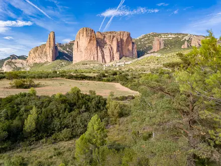
- Mont Gerbier-de-Jonc — the Loire’s source: This distinctive volcanic phonolite dome in the Ardèche marks the start of the GR3 and the spring that feeds France’s longest river.
- Pierre-sur-Haute and the Forez mountains: At 1,634 m, Pierre-sur-Haute is the high point of the route and the summit of the Monts du Forez, giving the GR3 its strongest mountain character.
- Loire Valley châteaux: The trail passes or runs near major Renaissance château sites including Chambord, Amboise, Villandry, Azay-le-Rideau, Chinon and Saumur.
- Orléans — birthplace of the GR: The Orléans–Beaugency section was inaugurated in 1947 as the first marked GR trail in France, making this a key point in European hiking history.
- Guérande and the Atlantic salt marshes: The finale reaches the medieval walled town of Guérande, its salt pans and the extended finish towards the seaside resort of La Baule.
Challenges to expect
The main challenge is scale: 1,243 km and around 50 days demand consistent pacing and self-arranged accommodation. The early Ardèche/Haute-Loire source section and the Forez mountains include rocky, uneven paths, altitude and exposure, with snow possible into spring. After that, walking is generally gentler but still long, with repeated days on levees, tracks, forest paths and quiet lanes. Navigation follows standard white-over-red GR blazes.
HikeList Score
GR3 (Loire Valley Trail) scored 85/100 on HikeList's trail-quality metrics.
See score breakdownHide breakdown
- Ideal length 52
- Balanced challenge 100
- Scenery & wildness 90
- Varied terrain 100
- Accommodation 84
- Food & support 88
- Path quality 98
- Season flexibility 89
Computed from length, challenge, scenery & wildness, terrain variety, accommodation, food & support, path quality and season flexibility.
 France
Show more data Show less
- Mountainous
- Riverside
- Forest
- Vineyards
- Coastal
- Rocky
- Dirt
- Forest Trails
- Levee Paths
- Quiet Lanes
- Hotels
- Campsites
- Gites
- Chambres D'Hotes
- Family Friendly
- Pet Friendly
- Restrooms
- Water Sources
- Campsites
- Picnic Areas
In these collections
Photos from hikers
Taken on the trail by people who've reviewed GR3 (Loire Valley Trail).
Begin the GR3 at the iconic Mont Gerbier de Jonc, where the Loire River rises. The trail descends through lush highland meadows and passes by traditional farmsteads before arriving in the small village of Sainte-Eulalie. Expect some rocky and uneven ground along the volcanic slopes and expansive views across the Ardèche highlands.
Travel from Sainte-Eulalie through woodland and rolling hills, gradually reaching the peaceful shores of Lake Issarlès. The terrain is a mix of forest trail and rural tracks, with opportunities to enjoy beautiful lakeside vistas at the day's end.
This stage guides you through elevated terrain, traversing mixed forest and open plateau. Descend towards the village of Le Béage, passing pastures and enjoying expansive mountain views in clear weather.
Cross the Ardèche highlands towards the historic town of Le Puy-en-Velay, a renowned pilgrimage center. The path weaves through rural communities and offers glimpses of volcanic peaks as you descend into the city.
Leaving Le Puy-en-Velay, head north along the forming Loire River. Walk past ancient bridges and through forested valleys—this section offers a tranquil atmosphere and several riverside picnic spots before reaching Retournac.
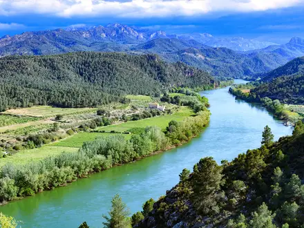
The GR3 follows the evolving river landscape, meandering beside the Loire’s banks. Pass through small villages and undulating farmland to reach the riverside community of Aurec-sur-Loire.
Leave the rural scenery behind and move towards the urban outskirts of Saint-Étienne, a major town with historical and industrial significance. The path transitions through green corridors before entering the city.
Exit Saint-Étienne via parks and garden paths, rejoining the river as it broadens. Today's route is a combination of urban and peri-urban terrain, finishing at Andrézieux-Bouthéon with its riverside château.
Follow gentle riverside paths through open countryside and farmland. The approach to Feurs is peaceful, with many opportunities to observe birds and other wildlife near the river’s edge.
Continue along the wide Loire valley floor, traversing cultivated fields and small villages. The day concludes in Roanne, a lively town known for its culinary reputation.
Depart Roanne and move north into rural Burgundy, with the landscape dotted by hamlets and agricultural land. The trail offers gentle gradients and relaxing scenery before ending at Iguerande.
Follow the canal parallel to the Loire and pass through rolling countryside rich in birdlife. Arrive at the historic river crossing of Digoin, known for its impressive aqueduct.
This long stage traces the Loire’s wandering meanders, passing through wooded areas and small agricultural villages before reaching the fortified town of Decize at the river confluence.
Continue north beside the winding Loire, traversing quiet rural roads and natural reserves. Arrive in Nevers, a city with a grand cathedral and a medieval ducal palace.
Journey along the riverbank and use historic footbridges to cross the Loire. Finish the day at La Charité-sur-Loire, a UNESCO-listed town renowned for its Romanesque priory.
A shorter day's walk through vineyards and gentle hillsides. The trail passes through quaint hamlets and open landscapes before reaching Pouilly-sur-Loire, center of a celebrated wine region.
Traverse some of the Loire’s most famous vineyard valleys to reach Sancerre, a hilltop village famous for its wine and panoramic views over the river and rolling countryside.
Descend through vineyards and along scenic riverbanks, passing through tranquil villages before arriving in the small riverside town of Cosne-Cours-sur-Loire.
Cover pleasant distance along the river, passing through rural settings before reaching Briare, home to the impressive Briare aqueduct, a masterpiece of 19th-century engineering crossing the Loire.
Today’s route follows the upper Loire, offering excellent vantage points of the river and passing through forests and farmlands on the way to Gien and its castle overlooking the water.
Walk through the lush Loire countryside dotted with châteaux and quiet villages. The day’s highlight is the medieval Château de Sully-sur-Loire, marking the beginning of the Loire Valley’s famous UNESCO segment.
Follow the river through forests and across parkland, with excellent birdwatching. Arrive in Orléans, a key city in French history, with its grand cathedral and bustling center.
Depart Orléans along leafy riverbanks and through the Loire’s floodplain forest, finishing at Meung-sur-Loire, known for its literary connections and charming old town.
A short and gentle stage follows river trails between historic towns. Arrive in Beaugency, home to a medieval bridge, fortress, and beautiful city squares.
Walk the classic river route past fields, woods, and flower-filled meadows, ending the day in Blois. Explore the city’s majestic château and medieval streets for an immersive experience.
Today’s route is rich in sweeping views of the Loire and its river islands. Pause at Chaumont-sur-Loire to visit the château and enjoy its internationally renowned gardens.
Continue along the riverside, passing vineyards and tranquil hamlets. End in Amboise, famous for its impressive château and the nearby Clos Lucé, Leonardo da Vinci’s final residence.
A vineyard-dotted route following gentle bends in the river, with panoramic views of the river valley and terraced slopes, finishing at Montlouis-sur-Loire, noted for its white wines.
A short and easy segment, the trail arrives at Tours, a bustling city celebrated for its lively markets, cathedral, and historic old quarter.
Depart Tours along the scenic banks of the Loire. Walk through quiet countryside and end at Villandry, famous for its château and ornate Renaissance gardens.
Follow peaceful rural lanes and riverside paths lined with wildflowers before finishing the day in Langeais, a village crowned by a striking medieval château.
The trail traverses the rural, wine-producing region around Bourgueil. Vineyards, small woodland groves, and welcoming villages define today’s landscape.
Walk through vineyard country and sections of forest before arriving at the elegant riverside city of Saumur, acclaimed for its castle and cavalry traditions.
A picturesque stage following the river closely, with highlights including troglodyte dwellings and the beautiful village of Montsoreau beneath its cliffside château.
This shorter day is centered around the scenic convergence of the Vienne and Loire rivers, with the historic villages of Montsoreau and Candes-Saint-Martin offering plenty to explore.
Vineyards and ancient villages line the way to Chinon, a storied town with a medieval fortress famously linked to Joan of Arc.
Traverse gentle river valleys and pass by vineyards en route to Saint-Patrice, enjoying serene farmland and rural tranquility.
This day covers longer distances, passing the forested banks and peaceful hamlets before reaching Les Ponts-de-Cé near Angers, which boasts a strategic historic bridge.
A short segment brings you into Angers, with plenty of time to explore the city’s grand château, vibrant markets, and well-kept river promenades.
Hike through rich farmland and small riverside villages, with scenic stretches among islands and floodplain landscapes to Chalonnes-sur-Loire.
Continue downstream along the riverbanks, passing picturesque rural landscapes and welcoming small towns until reaching Montjean-sur-Loire.
Travel through open countryside and past scattered hamlets, gradually approaching the historic town of Ancenis, featuring an impressive bridge and castle.
Follow riverside trails alongside the broadening Loire, passing old mills and river ports en route to Oudon, known for its distinctive medieval tower.
The route hugs the riverbanks through peaceful parkland and wetland reserves leading to Mauves-sur-Loire, offering relaxing nature and birdwatching opportunities.
On the final stage, cross into the urban outskirts and busy suburbs of Nantes. The trail ends at the city’s heart, where explorers can visit the Château des Ducs de Bretagne, lively quays, and numerous cultural sites near the river’s end.
Enjoy a rest day or explore extra riverbank loops in Nantes. Optional city walks or an out-and-back along the riverside toward the Loire estuary are possible, with plenty of cultural sites, cafes, and parks for a gentle day.
For those wishing to continue, follow the river from the city center out through urban landscapes and into wilder marshland, ending at Couëron with views of the estuary.
This final extension brings you to the edge of the Loire’s meeting with the Atlantic Ocean—a dramatic finish to your journey. Wetland reserves and wide estuarine panoramas lead to the trail’s ultimate endpoint.
Reviews
How would you rate GR3 (Loire Valley Trail)?
Tap a star to start your review — you could be the first.