Gorges de l’Ardèche Trail
How would you rate Gorges de l’Ardèche Trail?
Tap a star to share your experience and help other hikers.
Gorges de l’Ardèche Trail: A 2-Day Canyon Traverse
HikeList Score
Gorges de l’Ardèche Trail scored 76/100 on HikeList's trail-quality metrics.
See score breakdownHide breakdown
- Ideal length 63
- Balanced challenge 84
- Scenery & wildness 98
- Varied terrain 76
- Accommodation 58
- Food & support 52
- Path quality 98
- Season flexibility 89
Computed from length, challenge, scenery & wildness, terrain variety, accommodation, food & support, path quality and season flexibility.
The Gorges de l’Ardèche Trail is a 24.2 km, 2-day, hard point-to-point hike through the Gorges de l’Ardèche National Nature Reserve in southern France. The Sentier des Gorges de l'Ardèche follows the Ardèche River along the floor of its limestone canyon from Chames, near Vallon-Pont-d'Arc, to Plage de Sauze at Saint-Martin-d'Ardèche. This is a sporty route for fit, experienced hikers: expect rough rock, cliff-ledge passages, fixed equipment and mandatory river fords that are only passable at low water.
Route Overview
The trail starts at the Pont du Tiourre / Parking 3 “Belvédère” trailhead at Chames, just downstream of the Pont d’Arc, and finishes at the lower car park by Plage de Sauze in Saint-Martin-d'Ardèche. It is normally walked downstream over two official segments: the 12.5 km upstream section to Bivouac de Gournier, then the 11.6 km downstream section to Sauze. Key points include Montagne de Sable, Falaise de Saleyron, Bivouac de Gaud, Gué de Guitard, Plage des Templiers and Cirque de la Madeleine. Arrange a second car, summer shuttle on the D290, or a return on foot via the rim path. For other French routes, compare the cliff scenery with Cirque de Gavarnie Trails or a gentler option like the Canal du Midi Towpath.
Geology, Prehistory and Protection
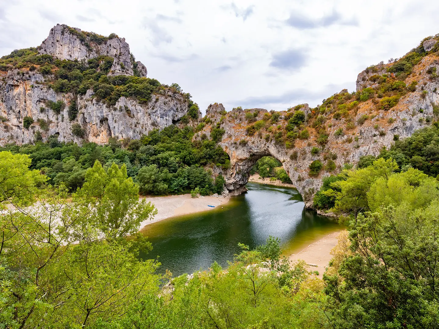
The Ardèche River has cut a limestone canyon of around 30 km through Mesozoic, Cretaceous limestone laid down as ancient sea floors. The Pont d’Arc formed when a meander was cut off, creating the natural arch that marks the canyon entrance. Human history is also close by: the Grotte Chauvet / Pont-d’Arc cave contains around 36,000-year-old paintings, with a replica, Grotte Chauvet 2, open to visitors. The Gorges de l’Ardèche became a National Nature Reserve in 1980.
Notable highlights
- Pont d’Arc (60 m wide, 54 m high): This natural limestone arch spans the Ardèche near the Chames trailhead and marks the iconic entrance to the gorge.
- Bivouac de Gournier: The compulsory overnight stop is roughly halfway through the route and is one of only two legal bivouac areas inside the reserve.
- The fords, ladder and chimney: Two river crossings, fixed handrails, a fixed ladder and a short crawl through a narrow cave make this more than a simple riverside walk.
- Cirque de la Madeleine: A huge natural rock amphitheatre near the downstream end, where the path runs along the foot of the cliffs above the river.
- Grotte Chauvet / Pont-d’Arc cave: Near the start, the original cave holds some of the world’s oldest known cave paintings; the replica Grotte Chauvet 2 is open to visitors.
- Mediterranean flora and raptors: Holm oak, juniper and aromatic scrub line the gorge, while protected cliffs support rare birds of prey including Bonelli’s eagles.
Challenges to expect
This is an official “Difficile” route with very rocky going, exposed heat in summer and no casual camping options. The two mandatory fords are only safe when water levels are low; check with the tourist office before starting. Expect handrails, a ladder, a narrow chimney passage and cliff-ledge corniches. Carry boots, water shoes, poles and at least 2 litres of water. If you want a longer mountain route instead, see the Chartreuse Trail (GR9 Segment).
HikeList Score
Gorges de l’Ardèche Trail scored 76/100 on HikeList's trail-quality metrics.
See score breakdownHide breakdown
- Ideal length 63
- Balanced challenge 84
- Scenery & wildness 98
- Varied terrain 76
- Accommodation 58
- Food & support 52
- Path quality 98
- Season flexibility 89
Computed from length, challenge, scenery & wildness, terrain variety, accommodation, food & support, path quality and season flexibility.
 France
Show more data Show less
- Canyon
- River
- Forest
- Rocky
- Dirt
- Wild Camping Spots
- Campsites
- Pet Friendly
- Campsites
- Picnic Areas
Photos from hikers
Taken on the trail by people who've reviewed Gorges de l’Ardèche Trail.
Follow the upstream official segment from the Pont du Tiourre / Parking 3 “Belvédère” trailhead at Chames into the canyon. The route passes places including Montagne de Sable, Falaise de Saleyron, Plaine de Charmassonnet, Rapide de la Dent Noire, Bivouac de Gaud and Gué de Guitard before reaching Bivouac de Gournier, the standard overnight stop.
Continue downstream on the official aval section from Bivouac de Gournier towards Saint-Martin-d'Ardèche. The day includes Rapide de la Pastière, Plage des Templiers, Cirque de la Madeleine and the final approach to Plage de Sauze. A river ford near the finish is mandatory and must be checked against water levels.
Reviews
How would you rate Gorges de l’Ardèche Trail?
Tap a star to start your review — you could be the first.