High Fens Trail (Hoge Venen)
How would you rate High Fens Trail (Hoge Venen)?
Tap a star to share your experience and help other hikers.
High Fens Trail (Hoge Venen): Belgium’s High Bog Boardwalk Loop
HikeList Score
High Fens Trail (Hoge Venen) scored 85/100 on HikeList's trail-quality metrics.
See score breakdownHide breakdown
- Ideal length 55
- Balanced challenge 100
- Scenery & wildness 98
- Varied terrain 76
- Accommodation 83
- Food & support 88
- Path quality 98
- Season flexibility 89
Computed from length, challenge, scenery & wildness, terrain variety, accommodation, food & support, path quality and season flexibility.
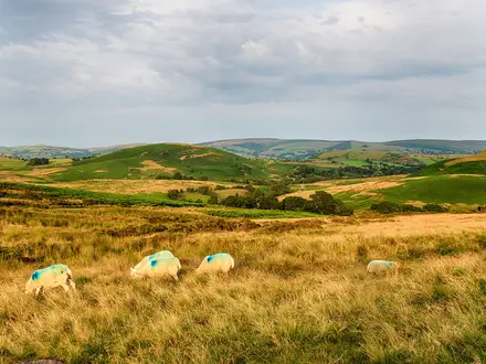
The High Fens Trail is a representative 24 km day loop through the Hoge Venen / Hautes Fagnes peat-bog plateau in eastern Belgium, near the German border. It is a moderate walk: mostly flat and technically straightforward, but long, exposed, wet underfoot and often cold or foggy. Expect raised wooden boardwalks, open moorland, spruce forest and access rules designed to protect the bog. It suits fit day hikers who want a full-day route rather than one of the shorter marked circuits from Signal de Botrange.
Route Overview
This is best treated as a long circular combination of marked paths, not a single official branded trail. Most hikers start at the Botrange Nature Centre beside Signal de Botrange, Belgium’s 694 m high point, or at Baraque Michel. A long loop can link the Fagne Wallonne, Fagne de la Poleur, peat-bog boardwalks, the Croix des Fiances, forest tracks and, on southern circuits, the Bayehon waterfall before returning to the start. Parking, toilets and refreshments are available at Botrange and Baraque Michel; facilities are limited once out on the Fens. The GR 56 and GR/GRP 573 also cross the reserve. For longer Belgian walks, compare the Abbey Trail of Wallonia, Battle of the Bulge Trail and GR 126.
History of the High Fens
The High Fens is Belgium’s largest nature reserve, protected since 1957 and listed as a Ramsar wetland in 2003. Its sphagnum raised bogs have been forming for about 10,000 years. Signal de Botrange is the country’s highest point, with the Tour Baltia built in 1933/34 so visitors could stand at a symbolic 700 m. Baraque Michel long served as a refuge on the open moor, a danger underscored by the Croix des Fiances memorial to Francois Reiff and Marie Solheid, who died in a blizzard in 1871.
Notable highlights
- Signal de Botrange (694 m): The highest point in Belgium and the main gateway to the reserve, beside the Botrange Nature Centre. The Tour Baltia stone tower lets visitors reach a symbolic 700 m.
- Wooden boardwalks (caillebotis): Raised timber walkways cross the fragile, waterlogged peat bogs. They are the signature walking surface of the High Fens and can be slippery in wet weather.
- Baraque Michel (674 m): A historic crossroads inn, chapel and refuge on the exposed plateau. It is a practical rest stop with parking, toilets and refreshments.
- Croix des Fiances: A memorial to Francois Reiff and Marie Solheid, who froze in a blizzard while crossing the Fens in 1871. It is a stark reminder of the plateau’s weather.
- Bayehon waterfall: A roughly 9 m cascade on the Bayehon stream, reached on longer southern loops through the forest below the moor.
- Raised peat bog and wildlife: The reserve protects sphagnum bog, cotton grass, heather, bilberry and sundew, with wildlife including black grouse, roe deer and wild boar.
Challenges to expect
The walking is low-gradient, but the 24 km distance makes this a full day. Expect wet peat paths, muddy forest tracks and slippery boardwalks after rain. The plateau is exposed, with frequent fog, drizzle, cold wind and fast-changing weather. Stay on marked routes and boardwalks: some zones are guide-only or closed to protect the reserve. Dogs must be leashed and are restricted in the protected core.
HikeList Score
High Fens Trail (Hoge Venen) scored 85/100 on HikeList's trail-quality metrics.
See score breakdownHide breakdown
- Ideal length 55
- Balanced challenge 100
- Scenery & wildness 98
- Varied terrain 76
- Accommodation 83
- Food & support 88
- Path quality 98
- Season flexibility 89
Computed from length, challenge, scenery & wildness, terrain variety, accommodation, food & support, path quality and season flexibility.
 Belgium
Show more data Show less
- Wetlands
- Forest
- Moorland
- Boardwalk
- Dirt
- Hotels
- Hostels
- Campsites
- Family Friendly
- Pet Friendly
- Restrooms
- Water Sources
- Campsites
- Picnic Areas
Photos from hikers
Taken on the trail by people who've reviewed High Fens Trail (Hoge Venen).
Reviews
How would you rate High Fens Trail (Hoge Venen)?
Tap a star to start your review — you could be the first.