Maamturks Challenge
How would you rate Maamturks Challenge?
Tap a star to share your experience and help other hikers.
Maamturks Challenge: Connemara’s Tough Mountain Traverse
HikeList Score
Maamturks Challenge scored 71/100 on HikeList's trail-quality metrics.
See score breakdownHide breakdown
- Ideal length 55
- Balanced challenge 38
- Scenery & wildness 85
- Varied terrain 83
- Accommodation 100
- Food & support 54
- Path quality 98
- Season flexibility 89
Computed from length, challenge, scenery & wildness, terrain variety, accommodation, food & support, path quality and season flexibility.
The Maamturks Challenge is a 24.3 km point-to-point traverse of the Maamturk Mountains in Connemara, County Galway, in the west of Ireland. It is an expert mountain day, usually completed in 8–11 hours, with about 2,336 m of cumulative ascent and little to no waymarked trail. It suits experienced, fit and self-sufficient hillwalkers who can navigate with map and compass in poor visibility. For more routes in the country, see our Ireland hiking guide.
Route Overview
The route starts at a pull-in on the R336 at the base of Corcóg, between Maam and Maam Cross, and finishes in Leenane at the head of Killary Harbour. It runs south to north over the Maamturks, crossing summits and checkpoints including Corcóg, Mullach Glas, Knocknahillion, Binn Chaonaigh, Binn idir an dá Log, Letterbreckaun and Binn Mhór before the long descent to Leenane. The crossing of the low, boggy Col of Despondency splits the southern and northern halves of the range. This is a point-to-point mountain traverse, so transport between start and finish must be arranged. For gentler western options, compare the Great Western Greenway or the Achill Island Trails.
A Galway Mountaineering Club Tradition Since 1975
The Maamturks Challenge was first held in 1975, devised by NUIG Mountaineering Club captain Jane Watts and Tony Whild. It has run almost every year since as a voluntary fundraising and endurance event organised by the University of Galway Mountaineering Club. The event typically draws around 200 participants, supported by about 40 volunteers and a chain of 11 checkpoints, including eight on the hills and three finish points.
Notable highlights
- Binn idir an dá Log (702 m): The highest point in the Maamturks and the high point of the traverse, also known as Barrslievenaroy. In clear weather it gives wide views across Connemara, the Twelve Bens and the Atlantic.
- Col of Despondency: A low, boggy saddle dividing the range. Its name reflects the hard re-climb that follows after tired legs have already done a major section of the route.
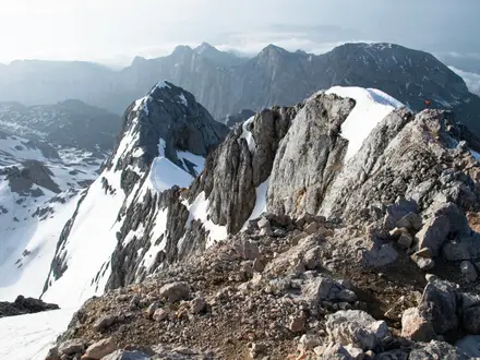
- Quartzite ridges: The Maamturks are built largely of hard, weathered quartzite. The pale, broken ridges make the skyline distinctive but demand careful footwork and route-finding.
- Inagh Valley and Twelve Bens views: The traverse runs parallel to the Twelve Bens, separated by the Inagh Valley. This is one of the classic mountain views of western Ireland when visibility allows.
- Finish at Leenane and Killary Harbour: The route ends in Leenane, the village at the head of Killary Harbour, Ireland’s only true fjord. It is a memorable finish after the long descent from Binn Mhór.
- The 1975 student-club tradition: The organised challenge has been run by the Galway university mountaineering club since 1975, giving the route a strong place in Irish hillwalking culture. For another Atlantic-edge walk, see the Cliffs of Moher Coastal Walk.
Challenges to expect
Expect a hard, committing mountain day with about 2,336 m of ascent, bog and peat hags low down, then steep quartzite ridges, rock, scree and exposed crags higher up. There is no constructed or waymarked trail for most of the route. Navigation is a core difficulty, especially in frequent Atlantic mist and rain. There are no huts, refuges or resupply points on the mountains.
HikeList Score
Maamturks Challenge scored 71/100 on HikeList's trail-quality metrics.
See score breakdownHide breakdown
- Ideal length 55
- Balanced challenge 38
- Scenery & wildness 85
- Varied terrain 83
- Accommodation 100
- Food & support 54
- Path quality 98
- Season flexibility 89
Computed from length, challenge, scenery & wildness, terrain variety, accommodation, food & support, path quality and season flexibility.
 Ireland
Show more data Show less
- Mountainous
- Bog
- Ridge
- Bog
- Rock
- Scree
- Hotels
- Hostels
- Guesthouses
- B&Bs
- Pet Friendly
- None
Photos from hikers
Taken on the trail by people who've reviewed Maamturks Challenge.
Reviews
How would you rate Maamturks Challenge?
Tap a star to start your review — you could be the first.