Elbe Sandstone Mountains Trail
How would you rate Elbe Sandstone Mountains Trail?
Tap a star to share your experience and help other hikers.
Elbe Sandstone Mountains Trail: Malerweg Hiking Guide
HikeList Score
Elbe Sandstone Mountains Trail scored 90/100 on HikeList's trail-quality metrics.
See score breakdownHide breakdown
- Ideal length 100
- Balanced challenge 84
- Scenery & wildness 98
- Varied terrain 71
- Accommodation 83
- Food & support 88
- Path quality 98
- Season flexibility 89
Computed from length, challenge, scenery & wildness, terrain variety, accommodation, food & support, path quality and season flexibility.
The Elbe Sandstone Mountains Trail is the Malerweg, a 112 km loop through Saxon Switzerland in eastern Germany, on the German–Czech border. Officially split into 8 stages and typically walked in 6–8 days, it is a hard hut-to-village style hike for fit walkers who like rocky forest paths, sandstone steps, ladders and constant short climbs. It suits hikers wanting dramatic viewpoints without high alpine altitude. For other German long-distance options, compare the Harzer Hexenstieg and Goldsteig.
Route Overview
The Malerweg starts and finishes at Pirna, with the practical trailhead at the Liebethaler Grund just east of town. Most walkers go anticlockwise: out along the right bank of the Elbe through Stadt Wehlen, Kurort Rathen and the Bastei, Hohnstein, Altendorf, Bad Schandau, the Kirnitzschtal, Neumannmühle and Großer Winterberg to Schmilka on the Czech border. Schmilka is the turning point, not the finish: the trail crosses the Elbe and returns on the left bank via Königstein, Pfaffenstein, Kurort Gohrisch and Weißig to Pirna. Bad Schandau is a useful trail hub and the terminus of the historic Kirnitzschtal tramway. For a different German stage-trail feel, see the Eifelsteig.
Painters, Romantic Views and the Modern Malerweg
The Malerweg follows viewpoints made famous by Romantic-era artists from the late 18th to the 20th century, including Adrian Zingg, Anton Graff, Caspar David Friedrich, Ludwig Richter, Johan Christian Dahl, Carl Gustav Carus and Bernardo Bellotto, known as Canaletto. The modern waymarked route, marked with a stylised “M”, opened in 2006. In 2007 it was voted Germany’s most beautiful hiking trail by Wandermagazin, helping cement its status as the classic long-distance walk through Saxon Switzerland.
Notable highlights
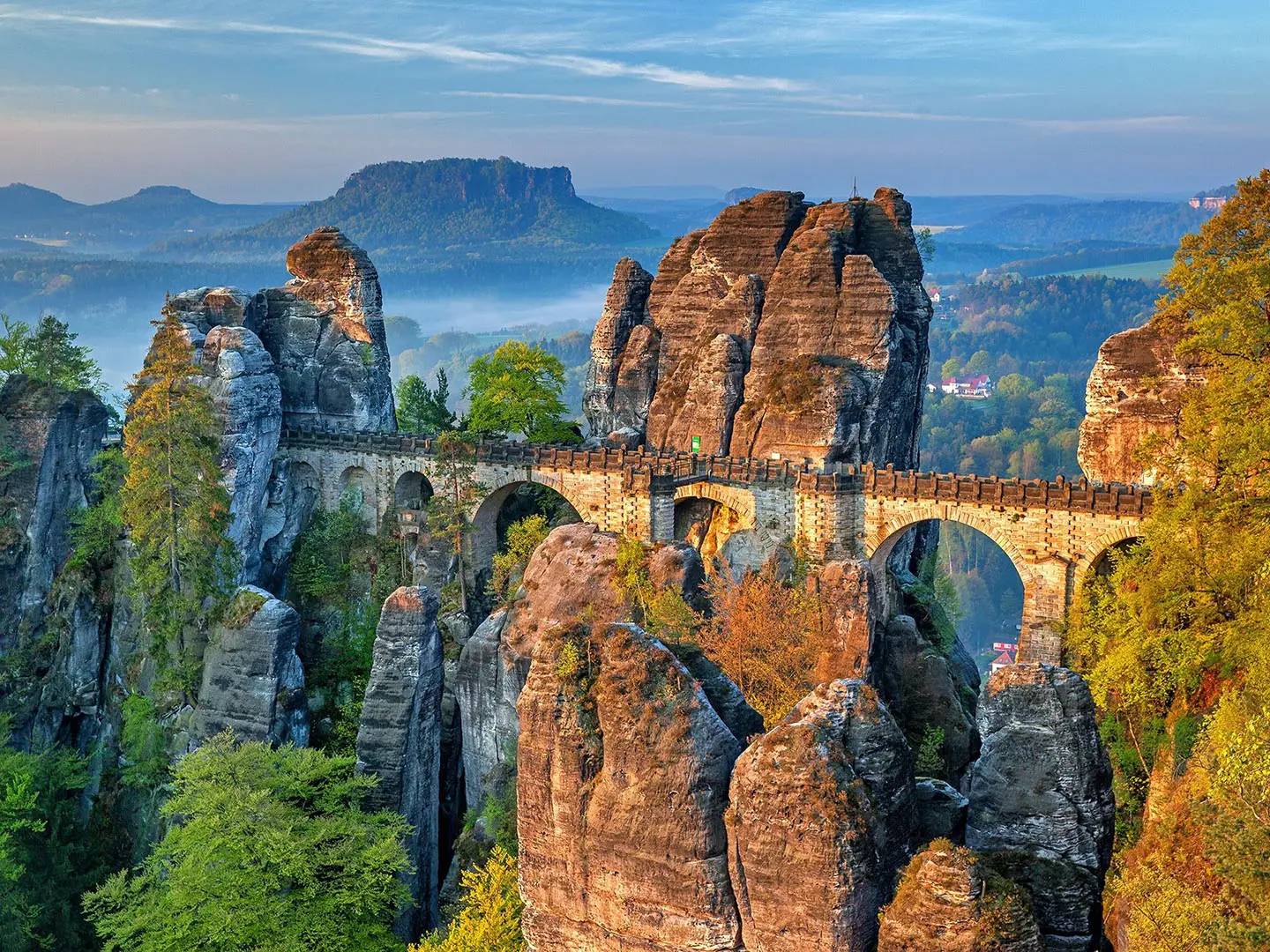
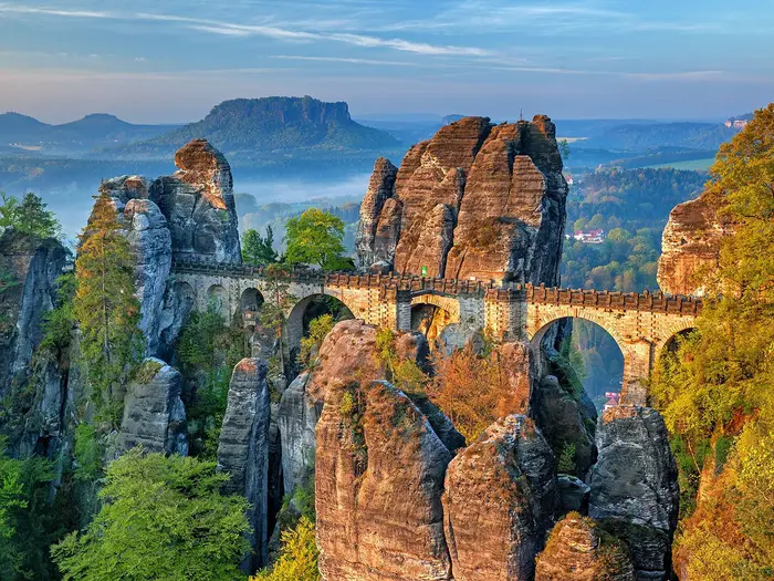
- Bastei Bridge (1851 sandstone footbridge): This iconic bridge spans rock pinnacles about 194 m above the Elbe near Kurort Rathen. It is the trail’s best-known viewpoint and a major Stage 1 highlight.
- Schrammsteine: A jagged wall of sandstone towers above Bad Schandau. The route uses steel steps and ladders here, giving exposed-feeling ridge views without entering alpine terrain.
- Großer Winterberg (556 m): The highest point on the trail and the second-highest summit in Saxon Switzerland. It is climbed on Stage 5 before the steep descent to Schmilka.
- Königstein Fortress: One of Europe’s largest hilltop fortresses, set on a table mountain above the Elbe. It is reached on the left-bank return and has never been taken by siege.
- Kuhstall: A large natural sandstone arch near the Kirnitzschtal. Historically used as shelter and refuge, it is one of the route’s memorable rock features.
- Bad Schandau: A riverside spa town and useful logistics hub on the route. It is also the terminus of the historic Kirnitzschtal tramway into the rock country.
Challenges to expect
Expect a hard walk despite the modest 556 m high point. The difficulty comes from repeated short climbs, sandstone staircases, rock-cut steps, footbridges and ladders, especially around the Schrammsteine. The descent from Großer Winterberg to Schmilka is the steepest section. Rock can be slick after rain, and morning fog is common. Wild camping is not permitted in Saxon Switzerland National Park, so plan village accommodation or campsites.
HikeList Score
Elbe Sandstone Mountains Trail scored 90/100 on HikeList's trail-quality metrics.
See score breakdownHide breakdown
- Ideal length 100
- Balanced challenge 84
- Scenery & wildness 98
- Varied terrain 71
- Accommodation 83
- Food & support 88
- Path quality 98
- Season flexibility 89
Computed from length, challenge, scenery & wildness, terrain variety, accommodation, food & support, path quality and season flexibility.
 Germany
Show more data Show less
- Mountainous
- Forest
- Rocky
- Dirt
- Gravel
- Hotels
- Guesthouses
- Campsites
- Family Friendly
- Pet Friendly
- Restrooms
- Water Sources
- Campsites
- Shelters
- Picnic Areas
Download Our Full Guide to Elbe Sandstone Mountains Trail FREE!
Get our comprehensive guide to this hike for free. Save it for later reading or print out at home.

In these collections
Photos from hikers
Taken on the trail by people who've reviewed Elbe Sandstone Mountains Trail.
Elbe Sandstone Mountains Trail: The Complete Guide
 i
Image by Julius_Silver
i
Image by Julius_Silver The Malerweg (Painters' Way) is a 112 km loop through the Elbsandsteingebirge in Saxon Switzerland, starting and finishing at Pirna. It suits fit, sure-footed walkers who want big sandstone scenery, forested gorges and dramatic viewpoints without alpine altitude.
The route links the Elbe valley with the rocky tableland above it, passing places such as Stadt Wehlen, Kurort Rathen, Hohnstein, Bad Schandau, Schmilka, Kurort Gohrisch and Königstein. Bastei, the Schrammsteine, the Affensteine, Großer Winterberg, Pfaffenstein and Festung Königstein give the walk its distinctive rhythm of climbs, ledges, stairways and wide views.
This is not a high mountain trek, but it is harder than the modest 556 m high point suggests. The challenge is cumulative: repeated steep ascents and descents on sandstone steps, ladders, rock-cut passages, sandy tracks and slick stone after rain.
Logistics are a major strength of the route. The Dresden S-Bahn to Pirna, Elbe valley rail links, ferries at key river crossings and the Kirnitzschtalbahn around Bad Schandau make it unusually easy to join, shorten or adapt stages.
This guide covers stages, daily planning, accommodation, food, transport, terrain and common mistakes.
Stage-by-Stage Guide
Stage 1: Pirna-Liebethal to Stadt Wehlen — 11 km
The Malerweg begins practically at the Liebethaler Grund / Canalettohaus, just north-east of Pirna, rather than in the middle of the town. From there the stylised Malerweg ‘M’ waymark leads into the first sandstone gorge and forest sections before the route works towards Lohmen and Stadt Wehlen.
This is a good settling-in stage: short by Malerweg standards, but already representative of the route’s underfoot conditions. Expect woodland paths, sandy tracks, rocky steps and damp, shaded sections where sandstone can be slippery after rain or in morning fog.
Pirna is the main place to arrive with full provisions, and Stadt Wehlen has accommodation and village services at the end of the stage. Do not depend on natural water sources in the gorges; start with enough drinking water for the day.
Transport is straightforward at both ends compared with many long-distance trails. Pirna is on the Dresden S-Bahn S1 and the Czech-bound regional line, while Stadt Wehlen sits in the Elbe valley and has an Elbe passenger ferry. Current S-Bahn and ferry times should be checked before travelling.
Navigation is usually simple if the Malerweg ‘M’ is followed carefully, but the early route has several local paths and access tracks. Carry a map or GPX track rather than relying only on waymarks in woodland junctions.
Stage 2: Stadt Wehlen to Hohnstein — 13 km
This is one of the classic scenic stages of the Malerweg, linking Stadt Wehlen, Kurort Rathen, the Bastei and Hohnstein. It includes the trail’s most famous viewpoint: the Bastei and Basteibrücke, where sandstone towers rise above the Elbe valley.
The terrain is much more physical than the distance suggests. The route climbs and descends on rock-cut steps, woodland paths and sandstone stairways, with busy paths around the Bastei and narrower, rougher passages away from the main viewpoint areas.
Kurort Rathen and the Bastei area are the key mid-stage landmarks. Near Hohnstein, the Hockstein and Wolfsschlucht add a more enclosed, adventurous section, with rock-cut steps and a narrow stone-and-iron passage through the gorge.
Food and drink are most reliable at the stage towns and at major visitor points, but opening hours can vary by season. Carry lunch and water if walking outside the busiest months or starting early.
Stadt Wehlen and Kurort Rathen both have Elbe ferries, and the Elbe valley is served by the S1 corridor, making this stage one of the easiest to shorten or access. Hohnstein has accommodation, but beds should be booked ahead in the main walking season.
The main warning is exposure and slick rock, especially around stepped sandstone sections after rain. The Bastei area can also be crowded, so keep following the Malerweg markings rather than drifting onto short viewpoint paths unless intentionally taking a detour.
Stage 3: Hohnstein to Altendorf — 12 km
Stage 3 continues through the sandstone tableland from Hohnstein towards Altendorf, with the Brandaussicht as the major highlight. The Brandaussicht is known as the “balcony of Saxon Switzerland” and gives one of the best broad views over the rock country.
The walking is a repeated pattern of forest paths, short climbs, descents into shaded gullies and sandstone viewpoints. There is no major altitude gain in one push, but the constant up-and-down makes the stage more tiring than its length implies.
The Brandaussicht has a hostel/restaurant at the viewpoint, making it a useful planning point if open. Hohnstein is the safest place to start with food and water, and Altendorf is a smaller stage end where current food, water and accommodation options should be checked before travelling.
Accommodation at or near Altendorf needs more planning than in the larger Elbe towns. Bad Schandau, slightly off the high route in the valley below, is the main logistics hub in this part of the trail and is often the practical overnight or resupply alternative.
Road access exists at the stage-end villages, but onward local transport arrangements should be checked before relying on them. The wider area connects well via the Elbe valley and Bad Schandau, but not every upland village has the same level of service.
Navigation remains on the Malerweg ‘M’, but the forested plateau has many local walking paths. In mist or poor light, be especially careful at junctions after viewpoints and descents.
Stage 4: Altendorf to Neumannmühle — 18 km
This is the longest official stage and one of the hardest on the whole Malerweg. It runs from Altendorf through the Kirnitzschtal area and into the Schrammsteine and Affensteine, before reaching the Kuhstall on the Neuer Wildenstein and finishing at Neumannmühle.
The Schrammsteine are the defining challenge of the day. Expect steep sandstone staircases, iron ladders, steps, rungs and the exposed-feeling Schrammsteingratweg ridge path, with big views over the jagged rock walls above Bad Schandau.
The route then continues through more broken sandstone country towards the Affensteine and the Kuhstall. The Kuhstall is an 11 m high and 17 m wide natural sandstone arch, the largest rock gateway in Saxon Switzerland, and is one of the key landmarks of the route.
Lichtenhainer Wasserfall lies in the Kirnitzschtal and is beside the terminus of the historic Kirnitzschtalbahn tramway. This can be useful for access or for shortening the day via Bad Schandau, but current tramway times should be checked before travelling.
Food and water planning matters on this stage. Start with enough from Altendorf or from accommodation, and do not assume frequent services once committed to the rock sections. Bad Schandau is the main nearby resupply hub, but it sits in the valley rather than directly on the high route.
Accommodation at Neumannmühle or nearby should be arranged before setting out. If using Bad Schandau as an overnight base instead, plan the valley transport carefully rather than leaving it to the end of the day.
This stage should not be attempted casually in icy conditions, high winds or heavy rain. The ladders, metalwork and sandstone steps become much more serious when wet, and temporary path or ladder closures after rockfall or winter weather should be checked before travelling.
Stage 5: Neumannmühle to Schmilka — 14 km
Stage 5 takes the Malerweg over its highest point, Großer Winterberg at 556 m, before dropping steeply to the Elbe at Schmilka. It is not an alpine stage, but it is a sustained forest-and-rock day with enough climbing and descending to feel demanding.
From Neumannmühle the route passes the Zeughaus area before climbing via the Wolfsschlüchte, Roßsteig and Katzsteig towards Großer Winterberg. The high point is the highest summit on the German right bank of the Elbe and the highest point on the Malerweg.
The descent to Schmilka is a key part of the day’s difficulty. After rain or in fog, the combination of rock, steps, roots and a steep final drop to the valley calls for careful foot placement.
There are fewer dependable mid-stage services than on the Elbe-valley days, so leave Neumannmühle with sufficient food and water. Schmilka has accommodation and is a logical place to stop before crossing the Elbe to begin the return half of the loop.
Schmilka is the turning point of the Malerweg, not the finish. The route crosses the Elbe here and then returns towards Pirna along the left-bank side of the valley.
The Elbe ferry at Schmilka is an important logistics link, and its current timetable should be checked before travelling. If the weather is poor or legs are tired after the descent, Schmilka’s transport access gives a practical escape point.
Stage 6: Schmilka to Kurort Gohrisch — 17 km
Stage 6 begins with the Elbe crossing at Schmilka and moves onto the left-bank side of the Malerweg. The route then continues through the Schöna and Krippen area before climbing towards Kurort Gohrisch and the Gohrischstein country.
This side of the loop still has the Malerweg’s characteristic sandstone terrain, with forest paths, rocky tracks, table-mountain climbs and short steep sections. It can feel different from the right-bank stages, but the cumulative effort remains significant.
Schmilka is the place to start with water and food, and Kurort Gohrisch has accommodation at the end. Krippen provides useful valley access on the way, but current services and opening times should be checked if relying on it for food.
Public transport flexibility remains good because the route stays tied to the Elbe corridor. The S1 serves the valley, and the Schmilka ferry is the key crossing at the start of the stage.
Navigation is generally helped by the clear Malerweg ‘M’ waymarking, but the change from right bank to left bank can catch out walkers who are using mental bearings from previous days. Check junctions carefully after the river crossing and before leaving valley-side settlements.
Wet sandstone remains the main underfoot hazard. The day is not defined by the same ladder exposure as the Schrammsteine, but steep steps and rocky approaches can still be awkward in rain or fog.
Stage 7: Kurort Gohrisch to Weißig — 15 km
Stage 7 links several of the left-bank highlights: Pfaffenstein, the Barbarine pinnacle, Festung Königstein and the villages towards Weißig. It is a varied stage of table-mountain walking, rock clefts, viewpoints and cultural interest above the Elbe.
Pfaffenstein is the major natural feature of the day. The route includes the narrow Nadelöhr, or “eye of the needle”, and gives access to the Barbarine, the landmark free-standing sandstone needle associated with the mountain.
Festung Königstein is the major built landmark. The fortress sits on a table mountain above the Elbe and is one of Europe’s largest hilltop fortresses, historically never taken by siege.
Kurort Gohrisch is a sensible place to start with supplies, and Königstein is the main service point on or near this stage. Weißig is a smaller stage end, so accommodation and food at the end of the day should be booked or checked in advance.
The Elbe valley transport corridor gives useful access around Königstein, with the S1 serving the valley as a whole. Exact onward connections from Weißig should be checked before relying on them.
The Nadelöhr and other sandstone passages require care with a pack, especially in wet conditions. This is also a stage where short optional visits and viewpoints can add time, so keep an eye on daylight if walking in spring or autumn.
Stage 8: Weißig to Pirna — 12 km
The final stage returns from Weißig to Pirna, completing the Malerweg loop. It is a shorter day on paper, but still includes the mixed woodland, sandstone and valley-edge walking that characterises the route.
There are fewer headline rock landmarks than on the Bastei, Schrammsteine or Pfaffenstein stages, so the main planning focus is a clean finish into Pirna and onward transport. The route returns to the Pirna / Liebethaler Grund-Canalettohaus area rather than ending at Schmilka or another Elbe village.
Start with food and water unless current services in Weißig have been checked. Pirna has the best end-of-walk facilities, accommodation and onward transport options.
Pirna is on the Dresden S-Bahn S1 and the Czech-bound regional line, making it straightforward to return to Dresden or continue onward after finishing. If finishing late in the day, check current train times before setting out.
Navigation at the end of a loop can be surprisingly easy to rush, especially where local paths and access tracks approach Pirna. Stay with the Malerweg ‘M’ until the finish rather than assuming any downhill or valley-bound path leads to the correct endpoint.
The usual Malerweg cautions still apply on the last stage: wet sandstone can be slick, shaded steps stay damp, and autumn or spring fog can make junctions less obvious. The route is not over until back at Pirna.
Recommended Itinerary
The most practical default is the 8-day Malerweg schedule, following the established stage ends. Daily distances look modest, but the repeated staircases, ladders, rocky descents and short steep climbs make this a harder itinerary than the kilometre figures suggest.
Book accommodation before committing to dates, especially in smaller stage-end places. Wild camping is not permitted in Saxon Switzerland National Park, so each day needs a fixed bed or an official campsite plan.
Standard itinerary: 8 walking days
| Day | From | To | Approx. distance | Why this stage makes sense | Services/accommodation notes |
|---|---|---|---|---|---|
| 1 | Pirna-Liebethal | Stadt Wehlen | 11 km | A short first day from the practical trailhead at Liebethaler Grund / Canalettohaus, allowing time to reach Pirna by S-Bahn and settle into the waymarking. | Pirna and Stadt Wehlen are established bases on or near the Elbe corridor. Stadt Wehlen has accommodation options; book ahead in busy months. |
| 2 | Stadt Wehlen | Hohnstein | 13 km | This is the classic Bastei day, linking Stadt Wehlen, Kurort Rathen, the Bastei / Basteibrücke and the rocky approaches towards Hohnstein without overloading the distance. | Stadt Wehlen and Kurort Rathen have Elbe transport links. Hohnstein is a sensible overnight stop before the quieter forest and gorge sections that follow. |
| 3 | Hohnstein | Altendorf | 12 km | A compact stage that still includes serious terrain around Hockstein, Wolfsschlucht and Brandaussicht, so it should not be treated as a half day. | Hohnstein has accommodation. Altendorf is a smaller stage end; check accommodation availability before booking the whole itinerary. |
| 4 | Altendorf | Neumannmühle | 18 km | One of the hardest and most important days: it takes in the Kirnitzschtal, Schrammsteine, Affensteine, Lichtenhainer Wasserfall, Kuhstall and the approach to Neumannmühle. The distance plus ladders and rocky ground make it a full mountain-walking day. | Services are more limited away from the Elbe towns. Bad Schandau is the main logistics hub in the wider area, and the Kirnitzschtalbahn can be useful for access around the Kirnitzschtal; current tramway times should be checked before travelling. |
| 5 | Neumannmühle | Schmilka | 14 km | This stage climbs to Großer Winterberg, the highest point on the Malerweg at 556 m, before the steep descent to the Elbe at Schmilka. It is shorter than Day 4 but still physically demanding. | Schmilka is the loop’s turning point and the place where the route crosses the Elbe. Accommodation should be booked early, especially in peak season. |
| 6 | Schmilka | Kurort Gohrisch | 17 km | After crossing the Elbe, the route begins the return along the left bank, passing through or near Schöna and Krippen before reaching the table-mountain country around Kurort Gohrisch. | Schmilka, Krippen and Kurort Gohrisch are useful overnight areas. Elbe valley transport and ferries make this a flexible section, but current ferry times should be checked before travelling. |
| 7 | Kurort Gohrisch | Weißig | 15 km | A strong but manageable stage over major left-bank landmarks, including Gohrischstein, Pfaffenstein and the area around Festung Königstein. The terrain remains rocky and undulating. | Kurort Gohrisch and Königstein have accommodation options. Weißig is a smaller stage end, so check bed availability before fixing the itinerary. |
| 8 | Weißig | Pirna | 12 km | A final shorter day back to Pirna, useful for onward travel by S-Bahn towards Dresden or for building in buffer time after a week of cumulative climbing. | Pirna is the best finish-point base, with onward rail access. If staying after the hike, book centrally or near the transport link that suits the next journey. |
Slower variant: 8 days plus buffer nights
A slower plan suits walkers who want shorter travel days at either end, more time at viewpoints, or a margin for wet rock, fog or path closures. The walking stages remain the same 8 days, but add one or more non-walking nights in practical bases such as Pirna, Bad Schandau, Schmilka or Kurort Gohrisch.
This is also the better approach for walkers using luggage transfer, as it reduces the risk of missing an overnight booking after a delayed or slippery stage. Current ladder/path closures, ferry times, S-Bahn times and Kirnitzschtalbahn times should be checked before travelling.
Faster variants: 6–7 walking days
A faster itinerary is only sensible for fit, sure-footed walkers who are comfortable with long rocky days and do not mind less time at viewpoints. The easiest compression is usually to combine shorter adjacent official stages, but accommodation availability should decide the exact overnight stops.
| Variant | How it works | Who it suits | Cautions |
|---|---|---|---|
| 7 days | Combine one pair of shorter neighbouring stages, then follow the remaining official stages. A common choice is to combine the opening stages from Pirna-Liebethal to Hohnstein via Stadt Wehlen, about 24 km in total. | Strong walkers starting early from Pirna or already staying near the trailhead. | This makes the Bastei and Hohnstein approach a long first day. Check official mapping before booking, and do not underestimate the staircases and tourist congestion around the Bastei. |
| 6 days | Combine two pairs of stages, keeping the hardest rocky sections as separate days where possible. For example, combining Days 1–2 and Days 7–8 gives approximate long days of 24 km and 27 km, while leaving the Schrammsteine/Affensteine and Großer Winterberg stages intact. | Very fit walkers with light packs, secure footing and a willingness to walk long hours on uneven ground. | The 27 km finish to Pirna is a big day after a week of cumulative climbing. This plan is vulnerable to bad weather, slick sandstone and any path closure; check official mapping before booking. |
Planning the Route
Choose the number of days first
The cleanest way to plan the Malerweg is to use the official eight-stage structure, then adjust only if fitness, accommodation and transport make that sensible. Eight days gives enough time for the sandstone steps, ladders, viewpoints and village logistics without turning the route into a daily race.
Six or seven days is realistic for fit walkers who are comfortable on rough, rocky ground and happy to link stages. This is not usually a route where speed comes from high mileage on easy paths: progress is often slowed by steep staircases, narrow rock passages, ladders, sandy footing and exposed-feeling descents, especially around the Schrammsteine, Affensteine and Großer Winterberg.
A slower schedule is often the better choice if the aim is to visit viewpoints, avoid rushing the ladder sections, or build in flexibility for wet rock and morning fog. The route’s difficulty is cumulative rather than alpine, so fatigue tends to build through repeated short climbs and descents rather than one major pass.
Let accommodation shape the itinerary
Daily stages are naturally dictated by the river and rock villages: Pirna, Stadt Wehlen, Kurort Rathen, Hohnstein, Altendorf, the Kirnitzschtal area, Schmilka, Kurort Gohrisch, Königstein, Weißig and the return to Pirna. In practice, bed availability can matter as much as the stage plan, particularly in summer and at weekends.
Hotels, guesthouses, Gasthöfe, Pensionen and campsites are the normal options. Many places along the route carry the “Wanderfreundlich am Malerweg” mark and may offer useful hiker services such as packed lunches, but this should be checked when booking.
Wild camping is not permitted in Saxon Switzerland National Park. Do not build an itinerary around bivvying in the forest or sleeping at viewpoints; book village accommodation or official campsites instead.
Standard planning framework
The official stage split is still the most practical framework for most walkers:
| Stage | Overnight logic |
|---|---|
| Pirna-Liebethal to Stadt Wehlen | Short first day from the practical trailhead near the Canalettohaus / Liebethaler Grund |
| Stadt Wehlen to Hohnstein | Places you well for the Hockstein, Wolfsschlucht and Brand area |
| Hohnstein to Altendorf | A moderate linking day before the rougher sandstone country intensifies |
| Altendorf to Neumannmühle | One of the key demanding days, taking in Kirnitzschtal, Schrammsteine, Affensteine and Kuhstall |
| Neumannmühle to Schmilka | Climbs to Großer Winterberg before the steep descent to the Elbe |
| Schmilka to Kurort Gohrisch | The loop crosses the Elbe at Schmilka and begins the return along the left bank |
| Kurort Gohrisch to Weißig | Includes major table-mountain scenery around Pfaffenstein and the Königstein area |
| Weißig to Pirna | Final return into Pirna and the Liebethaler Grund / Canalettohaus area |
Schmilka is the turning point of the loop, not the finish. This matters for bookings: the first half stays mainly on the right bank of the Elbe, while the return leg uses the left-bank side through places such as Schöna, Krippen, Kurort Gohrisch, Königstein, Thürmsdorf and Weißig.
Shortening, skipping and section hiking
This is one of the easier German multi-day routes to shorten because the Elbe valley has strong public transport. Pirna is on the Dresden S-Bahn S1, and the route is repeatedly close to the Elbe valley stations, ferries and service villages.
Elbe passenger ferries at Stadt Wehlen, Kurort Rathen, Bad Schandau and Schmilka are especially useful for joining or leaving stages. Bad Schandau is the main logistics hub in the valley, and the Kirnitzschtalbahn gives another useful access option towards the Kirnitzschtal and Lichtenhainer Wasserfall area.
Section hiking is therefore very practical. A walker based in Dresden, Pirna, Bad Schandau or another Elbe-valley base can complete individual stages with public transport links, rather than committing to the full loop in one continuous trip. Current S-Bahn, ferry and Kirnitzschtalbahn timetables should be checked before travelling, especially if planning a late finish or a tight connection.
Food, water and daily supplies
Plan food around village overnights and breakfast arrangements, not around constant services on the trail. The route spends long stretches in forested sandstone country, on ridges, in gorges and around rock plateaus where services are not continuous.
Packed lunches are worth arranging with accommodation where offered. Carry enough water and food for the full walking day, particularly on the longer and rougher stages around Altendorf, Kirnitzschtal, Schrammsteine, Affensteine, Neumannmühle, Großer Winterberg and Schmilka.
Bad Schandau is the most useful wider logistics hub, although it sits below the high route rather than always directly on it. It is the natural place to think about resupply, transport adjustments or a lower-valley overnight if the stage plan needs changing.
Navigation and route finding
The Malerweg is waymarked with the stylised Malerweg “M”, and the official direction is straightforward to follow in settled weather. A map or offline GPX is still strongly recommended because sandstone terrain can be intricate: paths cross in forests, steps and ladders thread through rock gaps, and viewpoints often sit on short spurs.
Do not rely only on mobile signal or signposts when compressing stages. If a path closure, storm damage or icy ladder section forces a diversion, an offline map makes it much easier to drop safely to a village, the Elbe valley or a transport stop.
Weather and path-condition planning
Weather matters more here than the modest altitude suggests. Sandstone steps, ladders, iron rungs, plank bridges and rock-cut passages can become slippery after rain, while morning fog can reduce visibility at viewpoints and make exposed-feeling sections more mentally demanding.
Winter is a poor fit for a normal through-hike because ice on ladders and steps changes the character of the route, and some viewpoint facilities may be closed. The usual walking window is roughly May to October, with spring and autumn generally better for cooler walking and clearer light, and summer busier.
Before setting out, check for current ladder, cliff-path or viewpoint closures caused by rockfall, ice or maintenance. This is particularly important before committing to the Schrammsteine, Affensteine and other narrow sandstone sections.
Luggage and pack strategy
The route is much easier with a light day pack. Ladders, steep rock steps and narrow passages are awkward with a heavy trekking pack, and descents on slick sandstone punish overloaded knees.
Luggage-transfer services operate for the Malerweg, and these are worth considering if staying in booked accommodation each night. Booking conditions, coverage and current prices should be checked before committing, as transfer logistics depend on the accommodation sequence.
What matters most when booking
The key planning priorities are accommodation first, transport links second, and weather/path conditions immediately before travel. Once beds are fixed, the route can usually be adjusted using the Elbe S-Bahn, ferries and the Kirnitzschtalbahn if a stage proves too long or conditions deteriorate.
The main rule to remember is that the Malerweg is not a wilderness camping route. It is a rocky, well-connected village-to-village walk through a protected national park landscape, so successful planning means booked overnights, realistic daily distances, a light pack and enough flexibility to avoid ladders and sandstone steps in poor conditions.
Towns, Villages and Overnight Stops
The Malerweg is easiest to plan as a village-to-village walk using the official stage ends: Stadt Wehlen, Hohnstein, Altendorf, Neumannmühle, Schmilka, Kurort Gohrisch, Weißig and Pirna. Accommodation is a mix of hotels, Pensionen, Gasthöfe and campsites, with the best choice in the Elbe valley towns and the main spa and rock villages.
Wild camping is not permitted in Saxon Switzerland National Park, so overnight stops need to be booked in advance. Many properties along the route use the “Wanderfreundlich am Malerweg” hiker-friendly mark and may offer packed lunches, which is useful on the longer forested stages where food stops are not guaranteed.
| Route position | Main overnight option | Practical note |
|---|---|---|
| Start / finish | Pirna | Best transport access, useful before or after the walk |
| Stage 1 end | Stadt Wehlen | Good Elbe-side first night; ferry links nearby |
| Stage 2 area | Kurort Rathen / Hohnstein | Rathen works for Bastei access; Hohnstein is the official stage end |
| Stage 3 end | Altendorf | Smaller stop; book and check evening food arrangements |
| Stage 4 end | Neumannmühle | Remote-feeling stage end; do not arrive without a plan |
| Stage 5 end | Schmilka | Elbe crossing and turning point of the loop |
| Stage 6 end | Kurort Gohrisch | Good base on the left-bank half of the route |
| Stage 7 end | Weißig | Small final-stage stop; check accommodation and food before relying on it |
| Left-bank alternatives | Königstein / Bad Schandau | Stronger transport and service options, though not always exactly at the stage end |
Pirna
Pirna is the practical start and finish town for the Malerweg. The trailhead is at the Liebethaler Grund / Canalettohaus just north-east of the town centre, and the route is waymarked from there with the stylised Malerweg “M”.
It is the easiest place to reach by public transport, with S-Bahn S1 connections from Dresden and access to the Czech-bound regional line. For walkers arriving late, travelling from outside Saxony or wanting a low-stress start, staying in Pirna before Stage 1 is sensible.
Accommodation and food options are broader here than in the smaller national-park villages. Pirna is also the most straightforward place to recover after finishing the loop, especially if connecting back to Dresden the same day.
Liebethaler Grund and Lohmen
Liebethaler Grund is the functional trailhead rather than a major overnight base. It is useful as the point where the waymarked Malerweg begins, but most walkers will sleep in Pirna and travel or walk out to the start.
Lohmen comes early on Stage 1 between Pirna-Liebethal and Stadt Wehlen. It can help break up the first day, but it is not one of the key overnight stops for a standard 8-stage itinerary.
If planning to stop in either of these smaller early-route places, accommodation and food arrangements should be checked before travelling.
Stadt Wehlen
Stadt Wehlen is the official end of Stage 1 and one of the most convenient early overnight stops. It sits on the Elbe and gives a manageable first day from Pirna-Liebethal before the route continues towards Kurort Rathen, the Bastei and Hohnstein.
Hotels, guesthouses and campsites are part of the accommodation mix in the river villages, making Stadt Wehlen a practical place to book a first night on the trail. It is also served by the Elbe valley transport corridor, with passenger ferry links in the area.
This is a good point to check the next day’s plan carefully. Stage 2 includes major viewpoints and rougher sandstone terrain, so a packed lunch or reliable food plan is useful.
Kurort Rathen and the Bastei
Kurort Rathen is not the official end of Stage 2, but it is one of the most important places on the first half of the route because of its position below the Bastei and Basteibrücke. It works well as an overnight alternative for walkers who want a shorter day, more time around the Bastei, or an easier connection to Elbe valley transport.
The Elbe passenger ferry at Kurort Rathen makes it practical for joining or leaving the route. This is one of the busiest tourist areas on the Malerweg in summer, so accommodation should be booked early.
The Bastei itself is a viewpoint and rock formation rather than a village stop. Treat it as a daytime highlight, not as a place to rely on for an overnight unless accommodation has been booked in the surrounding settlements.
Hohnstein
Hohnstein is the official end of Stage 2 and the start of Stage 3. It is a natural overnight point after the Bastei, Hockstein and Wolfsschlucht section, particularly for walkers following the classic 8-stage itinerary.
Accommodation is available in the wider Malerweg village network, including guesthouses and Gasthöfe. Evening food should still be planned rather than assumed, especially outside the busiest months.
Hohnstein is also well placed before the route continues towards Brand and Altendorf. The next stage is shorter on paper than some others, but the sandstone steps and repeated climbs still make an early, unhurried start worthwhile.
Brand and Altendorf
Brand, with the Brandaussicht viewpoint, sits between Hohnstein and Altendorf on Stage 3. The viewpoint has a hostel/restaurant, making it one of the more useful named stops on this part of the route, as well as a major panorama.
Altendorf is the official end of Stage 3 and the start of the long Stage 4 to Neumannmühle. It is a smaller overnight stop, so beds and evening meals should be arranged in advance.
Do not treat Altendorf like a large service town. It is best used as a quiet, practical stage break before the more demanding Schrammsteine, Affensteine and Kuhstall day.
Kirnitzschtal, Lichtenhainer Wasserfall and Bad Schandau
Stage 4 moves through the Kirnitzschtal area and passes Lichtenhainer Wasserfall, which is beside the terminus of the historic Kirnitzschtalbahn tramway. This makes the valley useful for shortening, joining or escaping from the route if the sandstone ladder sections, weather or timing become a problem.
Bad Schandau lies in the Elbe valley below and is the main logistics hub for this side of the Malerweg. It is slightly off the high route in places, but it is one of the best bases for transport, resupply and accommodation, with S-Bahn access, Elbe ferry links and the lower terminus of the Kirnitzschtalbahn.
For walkers who prefer stronger services over staying exactly on the stage line, Bad Schandau is often the most practical choice in this section. Current S-Bahn, ferry and tramway timetables should be checked before travelling.
Neumannmühle and Zeughaus
Neumannmühle is the official end of Stage 4 after one of the toughest and most technical days of the trail: Altendorf to the Kirnitzschtal, Schrammsteine, Affensteine, Kuhstall and onward to the stage end. This is not a place to reach late without a clear accommodation plan.
The surrounding area feels more enclosed and forested than the Elbe-side towns. Food and packed-lunch arrangements should be confirmed with accommodation before arrival.
Zeughaus lies on the following stage towards Großer Winterberg and Schmilka. It is useful as a named point on the route, but overnight and refreshment options should be checked before relying on it.
Schmilka
Schmilka is one of the most important overnight stops on the Malerweg because it is the loop’s turning point. After Großer Winterberg, the route descends steeply to the Elbe here and crosses the river before returning along the left bank.
It is an Elbe-side eco-village close to the Czech border, with accommodation included in the Malerweg’s village network. It is a logical place to stop after Stage 5, especially because the descent from Großer Winterberg can be tiring in wet conditions.
Schmilka also has ferry access across the Elbe, which makes it useful for transport adjustments. Ferry times should be checked before travelling, particularly outside the main walking season.
Schöna and Krippen
Schöna and Krippen sit on the left-bank half of the route after the Elbe crossing at Schmilka. They are useful route settlements between the river crossing and the climb towards Kurort Gohrisch.
They can help with flexible itineraries, especially for walkers not following the official stage breaks exactly. However, they should not be treated as guaranteed full-service stops without checking current accommodation and food options.
This part of the trail is well supported by the Elbe valley transport corridor, so it can be useful for joining, leaving or shortening the walk.
Kurort Gohrisch
Kurort Gohrisch is the official end of Stage 6 and a strong overnight base on the left-bank half of the Malerweg. It sits near Gohrischstein and before the Stage 7 route towards Pfaffenstein, Festung Königstein and Weißig.
Accommodation is part of the established Malerweg village network, with hotels, guesthouses and other walker-focused options in and around the spa and rock villages. This is a good place to look for a hiker-friendly property that can provide packed lunches.
Stopping here keeps the next day’s major table-mountain and fortress section manageable. Book ahead in summer and during busy holiday periods.
Pfaffenstein and Königstein
Pfaffenstein is a major route feature rather than a town, with the Nadelöhr rock cleft and the Barbarine pinnacle forming one of the key Stage 7 highlights. It is a place to plan time for, not a primary overnight base.
Königstein, below Festung Königstein, is a more practical service and transport option in this area. It is one of the named accommodation villages on the Malerweg, with hotels, guesthouses and campsites in the wider route network.
Walkers who prefer more facilities may choose Königstein over a smaller stage-end stop, but this can alter the official stage rhythm. Any detour or transfer back to the waymarked route should be planned before booking.
Thürmsdorf, Weißig and the final approach to Pirna
Thürmsdorf and Weißig come late on the left-bank return towards Pirna. Weißig is the official end of Stage 7, leaving a final stage of roughly 12 km back to Pirna.
These are smaller stopping points, so accommodation, evening meals and breakfast arrangements should be checked before committing to them. They suit walkers following the official 8-stage structure, but they are less flexible than the larger Elbe valley towns.
From Weißig, the final day returns to Pirna and completes the loop. Staying in Pirna at the end is the simplest option for onward S-Bahn travel to Dresden or for adding a recovery night after the walk.
Getting to the Start
By train
Pirna is the practical rail gateway for the Malerweg. It is on the Dresden S-Bahn S1, with Dresden to Pirna taking about 25–30 minutes, and it also sits on the Czech-bound regional line along the Elbe valley.
The actual trailhead is not simply “Pirna station”. The route starts at the Liebethaler Grund / Canalettohaus just north-east of Pirna town centre, where the stylised Malerweg “M” waymarking begins. Allow time on the first morning to get from the station or your accommodation in Pirna to this start point.
The S1 is also useful if you stay elsewhere in the Elbe valley before beginning, because it serves the wider corridor used by the route. Current train times should be checked before travelling, especially for early starts, late arrivals and weekend schedules.
By bus
Local buses may be useful for the short final approach to the Liebethaler Grund / Canalettohaus, or if staying outside central Pirna, but no single bus connection should be assumed without checking the current timetable. This should be checked before travelling.
If arriving late, carrying heavy luggage before a baggage-transfer pick-up, or staying away from the station, a taxi from Pirna is the simplest fallback. Availability and pick-up points should be checked locally in advance rather than left to the first morning.
By car
Because the Malerweg is a loop returning to Pirna, driving to the start is logistically straightforward in principle: you do not need to arrange a one-way shuttle back from the finish. The key issue is parking, not route access.
Long-stay parking in or around Pirna should be arranged before setting off. Do not assume that parking is available or suitable at the Liebethaler Grund / Canalettohaus trailhead itself; use permitted parking in Pirna and check local restrictions before leaving a vehicle for several days. This should be checked before travelling.
A car is not essential for this route. The S1 along the Elbe valley, the passenger ferries at places such as Stadt Wehlen, Kurort Rathen, Bad Schandau and Schmilka, and the Kirnitzschtalbahn at Bad Schandau make public transport the more flexible option for most walkers.
From the nearest airport
For air arrivals, Dresden is the natural public-transport gateway for the trail. From Dresden, continue by S-Bahn S1 to Pirna, then make the short onward transfer to the Liebethaler Grund / Canalettohaus start.
Airport-to-city connections, first and last services, and total transfer time to Pirna should be checked before booking flights. This should be checked before travelling.
Where to stay before starting
Pirna is the most convenient place to stay before Stage 1, as it keeps the first morning simple and puts you closest to the official starting area at Liebethaler Grund / Canalettohaus. The town has the advantage of being both the start and finish point of the loop.
Dresden is also workable if accommodation in Pirna is full or if arriving by long-distance transport the night before. In that case, take an early S1 to Pirna and build in enough time to reach the actual trailhead before beginning the walk.
Accommodation along the Malerweg is based mainly around hotels, guesthouses and campsites in the river and rock villages, with many places geared to walkers. Book ahead in the main walking season, and remember that wild camping is not permitted in Saxon Switzerland National Park.
Getting Home from the Finish
The Malerweg is a loop, so the finish brings you back to Pirna, close to the original Liebethaler Grund / Canalettohaus trailhead rather than leaving you at a remote endpoint. This makes the exit logistics much easier than on a point-to-point trail: most walkers either leave the same day by train or spend a final night in Pirna before travelling on.
By train
Pirna is the key rail point for leaving the finish. It is on the Dresden S-Bahn network, with the S1 linking Pirna and Dresden in about 25–30 minutes, and it also sits on the Czech-bound regional rail corridor through the Elbe valley.
For most onward journeys, travel first to Dresden, then connect to long-distance trains or city transport as needed. The S-Bahn is the simplest option if returning to Dresden accommodation, continuing across Germany, or linking with onward international services.
If finishing late in the day, check the current S-Bahn and regional train timetable before committing to same-day onward travel. The trail’s final section still includes walking back into Pirna, so allow a realistic buffer for tired legs, poor weather, café stops and finding the station from the finish area.
By bus
Train is normally the more practical public-transport option from Pirna. Local buses may be useful for short movements around Pirna or between nearby villages, but bus details and evening coverage are timetable-dependent and should be checked before travelling.
For a straightforward end-of-hike departure, plan around Pirna’s rail links rather than relying on a late local bus connection.
By car/taxi
Because the Malerweg finishes back in Pirna, anyone who has left a car there can return to it without arranging a cross-country transfer from another trailhead. Parking arrangements in Pirna should be checked locally before the hike, especially for multi-day stays.
A taxi can be useful if finishing tired, in bad weather, or after dark and needing to get from the Liebethaler Grund / Canalettohaus area to accommodation or the station in Pirna. Availability, call-out times and prices vary, so arrange this in advance if a precise departure train matters.
From the nearest airport
For flights, the practical rail hub is Dresden. From Pirna, take the S-Bahn or regional train towards Dresden, then continue using the current city and airport transport connections. This should be checked before travelling, particularly for early flights or late finishes.
If flying out the same day, build in a generous margin. A final walking day delayed by rain, slippery sandstone steps or tired knees can quickly make tight flight connections unrealistic.
Where to stay at the finish
Pirna is the best place to stay at the end of the route if you do not want to travel immediately. It avoids a rushed final day, gives a buffer against missed evening trains, and keeps you close to onward rail connections the following morning.
Accommodation on the Malerweg is typically in hotels, guesthouses and Pensionen, and Pirna is one of the main service towns on the route. Book ahead in busy walking months, especially if finishing at a weekend or during summer.
Which Direction Should You Walk?
The Malerweg is best walked in the standard official direction: from Pirna-Liebethal / the Canalettohaus to Stadt Wehlen, then onwards through Kurort Rathen, Hohnstein, the Schrammsteine, Schmilka, Kurort Gohrisch, Königstein and back to Pirna. This is the direction used by the official 8-stage structure, so it is the simplest way to match accommodation stops, baggage-transfer arrangements and published stage planning.
Because the route is a loop with strong public transport along the Elbe valley, walking it in reverse is entirely possible. It is not, however, usually the most practical choice unless accommodation availability or a section-hiking plan makes it necessary.
| Direction | Best for | Main trade-off |
|---|---|---|
| Standard direction: Pirna-Liebethal → Schmilka → Pirna | Easiest planning, official stage order, natural scenery progression | The famous Bastei / Basteibrücke comes early rather than as a finale |
| Reverse direction: Pirna → Weißig / Königstein → Schmilka → Stadt Wehlen → Pirna-Liebethal | Walkers who want to save Bastei and Kurort Rathen for later | Accommodation, luggage transfer and stage notes may need more careful checking |
Why the standard direction works best
The official direction gives the cleanest logistics. The recognised stage sequence links the main overnight villages in order: Stadt Wehlen, Hohnstein, Altendorf, Neumannmühle, Schmilka, Kurort Gohrisch and Weißig before the return to Pirna.
This matters on the Malerweg because wild camping is not permitted in Saxon Switzerland National Park. Most walkers need booked beds or official campsites, and the standard direction makes it easier to follow the established accommodation flow through the river and rock villages.
The scenery also builds well. The early stages give a quick reward with Stadt Wehlen, Kurort Rathen and the Bastei, then the route becomes rougher and more committing through Hohnstein, Brandaussicht, the Schrammsteine, Affensteine and Kuhstall. Schmilka works as a clear psychological halfway turning point, where the route crosses the Elbe before returning along the left bank via Kurort Gohrisch, Pfaffenstein and Königstein.
Is the reverse direction harder?
There is no major ascent advantage either way. The Malerweg’s difficulty comes from repeated short climbs and descents on sandstone steps, ladders, rungs, narrow passages and rocky forest paths, rather than from one long mountain climb.
In the standard direction, Stage 5 climbs Großer Winterberg before the steep descent to Schmilka. In reverse, that same ground becomes a steep climb out of the Elbe valley. Some walkers prefer climbing steep, technical ground rather than descending it, but the overall physical effort remains similar.
Wet rock, morning fog and icy conditions affect both directions. The exposed-feeling sections around the Schrammsteine and Affensteine require care whichever way they are walked, and any ladder or cliff-path closures should be checked before travelling.
Transport and escape options
Transport does not strongly favour either direction. Pirna is on the Dresden S-Bahn S1, the Elbe valley has frequent access points, and ferries at places including Stadt Wehlen, Kurort Rathen, Bad Schandau and Schmilka make it easy to join, leave or shorten stages.
The Kirnitzschtal tramway at Bad Schandau also helps with access to the middle part of the route. Current S-Bahn, ferry and tramway timetables should be checked before travelling, especially if using public transport to shorten a day or skip a difficult section.
Accommodation and luggage transfer
The standard direction is the safer choice for a first booking. Many walkers use the official stage towns as overnight stops, and luggage-transfer services are easiest to arrange when the itinerary follows the normal stage sequence.
A reverse itinerary can still work, but accommodation and luggage arrangements need to be checked carefully before booking. This is especially important in the busier summer months, when the smaller villages and hiker-friendly guesthouses can fill quickly.
Recommendation
Walk the Malerweg in the standard official direction unless there is a specific accommodation or transport reason to reverse it. It gives the most straightforward planning, follows the recognised stage structure, reaches Schmilka as a satisfying turning point, and finishes cleanly back at Pirna after the left-bank table mountains and Königstein section.
Accommodation Along the Route
The Malerweg works very well as an inn-to-inn walk. The route passes or sits close to a chain of Elbe valley towns and sandstone villages with hotels, Pensionen, Gasthöfe and some campsites, so most walkers do not need to carry camping equipment.
Wild camping is not permitted in Saxon Switzerland National Park. Plan on booked beds in villages, or official campsites where these fit the itinerary.
Many accommodation providers along the trail carry the “Wanderfreundlich am Malerweg” hiker-friendly mark. These are the most useful places to prioritise, as they are set up for walkers and often offer packed lunches.
Best overnight bases
The strongest accommodation choice is in the larger river and trail villages: Pirna, Stadt Wehlen, Kurort Rathen, Hohnstein, Bad Schandau, Schmilka, Königstein and Kurort Gohrisch. These are the most straightforward places for independent walkers who want reliable services, transport links and a choice of beds.
The official 8-stage itinerary uses some smaller or more awkward stopping points, notably Altendorf, Neumannmühle and Weißig. These can work, but accommodation should be booked early and checked carefully against the day’s walking plan. If a stage-end bed is not available, the Elbe S-Bahn, ferries and the Kirnitzschtalbahn around Bad Schandau make it practical to sleep slightly off the route and return to the trail.
Booking pressure
Book ahead rather than arriving speculatively, especially in summer, which is the busiest season. Spring and autumn are generally excellent walking periods, but popular weekends can still put pressure on the best-located guesthouses near the Bastei, Kurort Rathen, Bad Schandau, Schmilka and Königstein.
Accommodation should also be fixed before arranging luggage transfer. Companies such as Malerweg-Gepäcktransport serve the route, but current booking rules, participating accommodation and delivery conditions should be checked before travelling.
Accommodation by place
| Place | Accommodation level | Best for | Notes |
|---|---|---|---|
| Pirna | Good | Start/finish nights, late arrivals from Dresden, restocking before the route | Practical base for the loop, with the trailhead at Liebethaler Grund / Canalettohaus north-east of the town centre. |
| Stadt Wehlen | Good | End of Stage 1; first overnight on the official itinerary | Useful river village with trail accommodation and Elbe ferry access. |
| Kurort Rathen | Good | Bastei area overnights, shorter first stages, transport-linked itineraries | Close to the Bastei / Basteibrücke area and useful if splitting the early stages differently. |
| Hohnstein | Good | End of Stage 2; access to the Hockstein, Wolfsschlucht and Brand area | A sensible overnight before continuing towards Altendorf and the Schrammsteine section. |
| Altendorf | Limited / check ahead | End of Stage 3 on the official itinerary | Treat this as a book-ahead stop. If suitable accommodation is not available, use nearby transport options and return to the trail. This should be checked before travelling. |
| Kirnitzschtal / Lichtenhainer Wasserfall area | Limited / check ahead | Splitting the long Stage 4 terrain | Useful for logistics around the tramway corridor, but do not rely on accommodation without booking. This should be checked before travelling. |
| Neumannmühle | Limited / check ahead | End of Stage 4; positioning before Großer Winterberg and Schmilka | Important official stage point, but walkers should secure accommodation early or plan a transfer to a larger base. This should be checked before travelling. |
| Bad Schandau | Good | Main logistics hub, rest day, off-route overnight for awkward gaps | The natural service base in the Elbe valley, with S-Bahn access and the lower terminus of the Kirnitzschtalbahn. Slightly off the high route in places, but very useful. |
| Schmilka | Good | End of Stage 5; Elbe crossing and turning point of the loop | Popular and well placed before the return along the left bank. Book ahead in busy periods. |
| Schöna / Krippen | Limited / check ahead | Adjusting the Schmilka to Kurort Gohrisch stage | Useful left-bank settlements on the route sequence, but accommodation availability should be checked before relying on them. |
| Kurort Gohrisch | Good | End of Stage 6; base for the Gohrischstein / Pfaffenstein side of the loop | One of the better left-bank overnight bases before the Königstein section. |
| Königstein | Good | Stage 7 logistics, Festung Königstein area, transport-linked alternatives | Stronger choice than the smaller villages around it and useful if not staying at Weißig. |
| Weißig | Limited / check ahead | End of Stage 7 on the official itinerary | A small official stage-end stop; book carefully or consider nearby Königstein/Pirna-linked alternatives. This should be checked before travelling. |
Practical accommodation strategy
For the simplest plan, follow the official stage structure and book each stage-end in order: Stadt Wehlen, Hohnstein, Altendorf, Neumannmühle, Schmilka, Kurort Gohrisch and Weißig, with Pirna at either end if needed. This keeps daily distances close to the standard itinerary but requires early booking at the smaller stops.
For a more flexible plan, use larger bases such as Bad Schandau, Schmilka, Kurort Gohrisch, Königstein and Pirna, then use the Elbe S-Bahn, ferries or Kirnitzschtalbahn to bridge any awkward accommodation gaps. This is particularly useful for walkers compressing the route into 6–7 days or avoiding a small village where beds are full.
Luggage transfer suits this trail well because the route is a village-to-village circuit rather than a remote backpacking route. It does not remove the need to book accommodation in advance, and it is less useful if changing plans day by day.
Camping and Wild Camping
Wild camping is not permitted in Saxon Switzerland National Park, and the Malerweg spends much of its time in or around this protected landscape. Do not plan a stealth-camping itinerary on the trail: use official campsites, guesthouses, hotels or other lawful accommodation in the surrounding villages.
Camping can work for the Malerweg, but it needs more planning than on a wilder long-distance route. The terrain is rocky, forested and often steep, with narrow staircases, ladders and exposed-feeling sandstone sections; carrying full camping kit makes the Schrammsteine, Affensteine and other stepped sections more tiring and less forgiving. A lightweight setup is strongly preferable if camping forms part of the plan.
Where camping is most practical
The best camping logistics are generally around the Elbe valley and the larger trail villages, where official accommodation and services are concentrated. The brief lists campsites among the accommodation options in and around places such as Pirna, Stadt Wehlen, Kurort Rathen, Hohnstein, Bad Schandau, Schmilka, Königstein and Kurort Gohrisch. Current campsite opening dates, pitch availability and booking rules should be checked before travelling.
Bad Schandau is the most useful camping-and-transport hub because it sits in the Elbe valley, has strong public transport links and gives access to the Kirnitzschtal tramway. It can be used to avoid carrying a full load through the hardest rocky sections, by sleeping off the high route and using local transport to rejoin or leave the stage.
Schmilka is also an important planning point because it is where the route crosses the Elbe and turns back along the left bank. Campers should not treat it as an informal bivouac spot; use booked accommodation or an official camping option nearby if available.
Stage-by-stage camping practicality
| Section | Camping practicality |
|---|---|
| Pirna / Liebethaler Grund to Stadt Wehlen | One of the easier areas to plan around, with valley settlements and transport access. Use official sites only. |
| Stadt Wehlen to Hohnstein | Possible with village-based accommodation planning, but do not assume there is legal camping in the forested sandstone sections. |
| Hohnstein to Altendorf | More awkward for tent-based logistics unless accommodation or an official campsite has been arranged in advance. |
| Altendorf to Neumannmühle | A demanding stage for campers: the route passes the Kirnitzschtal, Schrammsteine, Affensteine and Kuhstall area, with ladders, steps and rocky ground. Carrying heavy camping gear here is noticeably harder. |
| Neumannmühle to Schmilka | Another section where pre-booking matters. The climb over Großer Winterberg and the descent to Schmilka are not places to be searching for an improvised camp. |
| Schmilka to Kurort Gohrisch | Better logistics return on the left bank, with Elbe-side transport and settlements nearby. |
| Kurort Gohrisch to Weißig | Check current camping options before relying on this section for a tent night. The Pfaffenstein / Königstein area is still rocky, protected-feeling terrain rather than casual camping country. |
| Weißig to Pirna | The approach back to Pirna is usually easier to solve with town accommodation or onward transport than with a final wild camp. |
Wild camping and protected-area rules
The practical rule is simple: do not wild camp on the Malerweg inside Saxon Switzerland National Park. The route’s sandstone forests, gorges, viewpoints and rock plateaus are sensitive protected areas, and informal camping creates avoidable damage and conflict.
Private land is also a factor around villages, fields and forest edges. A quiet-looking meadow or woodland margin is not a lawful fallback unless the landowner has explicitly permitted camping. If accommodation plans fail, use the Elbe S-Bahn, ferries or local transport links to reach a lawful overnight base rather than pitching illegally.
Open fires should not be treated as part of a Malerweg camping plan. Use only the facilities permitted at official campsites, and check local rules before using stoves or any cooking equipment in dry forest conditions. Sandstone woodland can be vulnerable in hot weather, and restrictions may change seasonally.
Water and food for campers
Do not rely on untreated streams or springs as a water strategy. The safer approach is to refill in villages, at accommodation, cafés, restaurants or official campsites, especially before the longer and more strenuous rocky sections.
The route passes a good chain of villages, but the high sections are not always convenient for resupply once the day is under way. Campers should start each stage with enough water for slow progress on steps, ladders and sandy climbs, particularly in summer.
Many hiker-friendly places on the Malerweg offer packed lunches, which can be useful even for campers. This should be arranged the evening before, rather than assumed on the morning of departure.
Does the Malerweg suit a camping itinerary?
The Malerweg is usually easier with village accommodation than with a tent. The official stage pattern fits guesthouses, hotels and hiker-friendly Pensionen well, and luggage transfer is available on the route for walkers who want to avoid carrying a heavy pack.
Camping still suits hikers who prefer tent travel, want to keep costs flexible or are combining the Malerweg with a broader trip through Saxony. The key is to plan around official campsites and transport nodes rather than expecting a continuous wild-camping experience.
A sensible compromise is to camp near the Elbe valley settlements and use public transport to manage awkward gaps. The S-Bahn, Elbe ferries and Kirnitzschtalbahn make it relatively easy to leave the trail for the night and return to the same point the next morning, provided current timetables are checked before travelling.
Seasonal considerations
The main walking season is roughly May to October. Campsites may not operate year-round, and summer demand can be high around the Bastei, Kurort Rathen, Bad Schandau, Schmilka and Königstein areas, so booking ahead is strongly advised.
Spring and autumn are often better for walking conditions, but cooler nights and shorter daylight make campsite planning more important. In winter, ice on ladders and steps, possible path or viewpoint closures and reduced facility availability make a camping-based Malerweg itinerary a poor choice for most hikers.
Leave No Trace on this route
Keep the Malerweg low-impact by staying on marked paths, using official overnight places and taking all rubbish out to village bins or accommodation. Do not cut corners on sandy slopes, camp on viewpoints, light fires in the forest or leave food waste around shelters and picnic spots.
The sandstone landscape is part of the reason to walk the route; it is also easily damaged. Treat camping as a booked, legal overnight arrangement, not as something to solve at dusk in the national park.
Food, Water and Resupply
The Malerweg is not a wilderness route, but it should not be treated as a continuous village-to-village food walk either. The trail repeatedly leaves the Elbe valley and climbs into forested sandstone country, where cafés, shops and water taps can be absent for several hours.
The safest routine is to start each stage with a full bottle load and a packed lunch. Many hiker-friendly hotels, Pensionen and Gasthöfe along the Malerweg offer packed lunches, which is often more reliable than assuming a village shop or café will be open when you pass.
Bad Schandau is the key logistics hub on or near the route and is the best place to reset supplies if the itinerary allows. Pirna is also the obvious place to buy food before starting and after finishing the loop. Elsewhere, rely on overnight villages, accommodation meals and pre-arranged packed lunches rather than expecting full supermarket choice.
Food planning
Carry at least one substantial lunch or snack supply each day, even on shorter stages. The official stages are modest in distance, but the repeated staircases, ladders and rocky descents make days slower than the kilometre count suggests, and detours to viewpoints can extend time between services.
Stage 4 from Altendorf to Neumannmühle and Stage 5 from Neumannmühle to Schmilka need particular attention. These sections run through the Schrammsteine, Affensteine, Kuhstall area and Großer Winterberg, with rougher terrain and fewer dependable resupply points between the overnight stops.
Rural opening hours can be limited, and Sunday closures are a real planning issue in Germany. If a stage depends on buying food en route, this should be checked before travelling; otherwise arrange breakfast, evening meal and packed lunch through accommodation.
Water planning
Plan to refill from accommodation, restaurants, cafés or other staffed services rather than from the landscape. Natural water may be present in valleys and gorges, and the route crosses or follows areas near the Elbe and Kirnitzschtal, but untreated stream or river water should not be assumed safe to drink.
A practical minimum for most stages is 1.5–2 litres per person at the start of the day. In summer heat, or on longer rocky sections such as Altendorf to Neumannmühle and Schmilka to Kurort Gohrisch, carrying 2–3 litres is more prudent. Filtering or treating natural water is sensible as a back-up, but it should not replace starting with enough drinking water.
Section-by-section resupply notes
| Section | Food availability | Water availability | Notes |
|---|---|---|---|
| Pirna / Liebethaler Grund to Stadt Wehlen | Best planned from Pirna before starting; Stadt Wehlen has overnight services. | Fill in Pirna or at accommodation before setting off; refill at the end of the stage. | Do not assume full resupply at the trailhead itself. Start with lunch and water already sorted. |
| Stadt Wehlen to Hohnstein | Food is mainly through the overnight villages and any open services around the busy Bastei / Kurort Rathen area. | Refill before leaving Stadt Wehlen; refill again in Hohnstein. | The Bastei area is popular, but opening hours vary by season and day. Carry lunch regardless. |
| Hohnstein to Altendorf | Hohnstein is the main departure resupply point; Brand has a hostel/restaurant at the Brandaussicht viewpoint. | Fill at Hohnstein; ask at staffed services if needing a top-up. | Useful stage for a packed lunch, especially if walking outside peak visitor hours. |
| Altendorf to Neumannmühle | Limited dependable food between the ends of the stage; do not rely on on-route purchases. | Start full from Altendorf and carry enough for the full day. | One of the key carry-food stages, with Schrammsteine, Affensteine and Kuhstall terrain slowing progress. |
| Neumannmühle to Schmilka | Limited dependable food until Schmilka. | Start full from Neumannmühle; refill at Schmilka. | The climb over Großer Winterberg and the descent to the Elbe make this a poor stage for running short of water. |
| Schmilka to Kurort Gohrisch | Schmilka and Kurort Gohrisch are the main practical food points. | Refill before leaving Schmilka and again at the overnight stop. | After crossing the Elbe, the route returns along the left bank with more climbing away from the river. |
| Kurort Gohrisch to Weißig | Food is best arranged at Kurort Gohrisch or through accommodation; Königstein is the most useful named settlement on this section. | Fill at Kurort Gohrisch; top up only where services are open. | The Pfaffenstein and Festung Königstein area can take longer than expected if visiting viewpoints or the fortress. |
| Weißig to Pirna | Carry enough from Weißig unless accommodation provides breakfast and packed lunch; Pirna has the best finish-point services. | Fill before leaving Weißig; Pirna is the next reliable end-point refill. | A shorter final stage, but still worth carrying snacks and water rather than waiting for Pirna. |
Terrain, Conditions and Difficulty in Practice
The Malerweg is hard in a very specific way: not because it reaches alpine height, but because it repeatedly climbs and drops through broken sandstone country. The high point is only Großer Winterberg at 556 m, yet the route accumulates around 3,300 m of ascent over 112 km, much of it in short, steep bursts.
Underfoot, expect a mix of pine-and-beech woodland paths, sandy tracks, rocky trail, gravel forest roads, narrow rock-cut staircases, plank bridges and sections of steel ladder or iron rung. The walking is rarely technically difficult in a climbing sense, but it does demand balance, sure-footedness and concentration, especially with a multi-day pack.
Surfaces underfoot
Sandstone shapes the whole route. Dry rock can give good grip, but sandy patches roll underfoot and make descents more tiring than they look on the map. After rain, the rock-cut steps, wooden structures and metal ladders can become slick, so pace and foot placement matter more than speed.
This is not a boggy moorland trail. The main wet-weather problem is slippery rock, steps and forest surfaces rather than deep mud. Morning fog is common enough to affect visibility on viewpoints and to leave exposed stone damp even when the forecast is otherwise settled.
There are built-up and valley sections through places such as Stadt Wehlen, Kurort Rathen, Hohnstein, Schmilka, Kurort Gohrisch and Königstein, but the route’s character is overwhelmingly forest, gorge and rock. Gravel forest roads give occasional easier walking, though they do not remove the cumulative fatigue from the many climbs and descents.
Steps, ladders and exposed-feeling ground
The most distinctive terrain is the network of sandstone stairways, rock slots, ladders, rungs and narrow passages. These features are part of the normal route, not optional scrambling detours, and they are a major reason the Malerweg feels harder than its altitude suggests.
The Schrammsteine section is the key test for many walkers, with iron ladders, steps and the airy Schrammsteingratweg ridge path. It is one of the most exposed-feeling parts of the trail and is unsuitable for anyone who is very uncomfortable with heights.
Other notable rocky sections include Hockstein and the Wolfsschlucht near Hohnstein, the Affensteine and Kuhstall area, the climb to Großer Winterberg, and Pfaffenstein with the Nadelöhr rock cleft. None should be treated casually in wet or icy conditions.
Climbs and descents in practice
The route is a constant succession of short climbs out of valleys, traverses across sandstone shelves or forested tops, and descents back into gorges or settlements. This stop-start profile is more tiring than a single long mountain ascent because rhythm is repeatedly broken by steps, ladders and steep drops.
The descent into Schmilka after Großer Winterberg is a particular point to manage carefully, especially late in the day or after rain. Poles can help on forest and stepped descents, though they must often be stowed or shortened where ladders, rungs and hand-use sections begin.
Daily distance alone is a poor guide to effort. A 12–15 km stage with ladders, staircases and viewpoints can feel tougher than a longer lowland day, especially if carrying full luggage or walking in humid summer conditions.
Stage-by-stage terrain character
| Section | Terrain implications |
|---|---|
| Pirna-Liebethal to Stadt Wehlen | A gentler start through the Liebethaler Grund and towards the Elbe-side walking around Stadt Wehlen, but still on sandstone-country paths rather than smooth urban walking throughout. |
| Stadt Wehlen to Hohnstein | Includes the famous Bastei area and rock scenery above Kurort Rathen, then rougher sandstone features towards Hockstein and the Wolfsschlucht. Expect steps, viewpoints and busy paths around the main sights. |
| Hohnstein to Altendorf | Forested sandstone walking with the Brandaussicht area as a major viewpoint. The day is not defined by altitude, but the repeated climbs continue. |
| Altendorf to Neumannmühle | One of the more demanding terrain days, with Kirnitzschtal, the Schrammsteine, Affensteine and Kuhstall sequence. Ladders, steps, rock passages and exposed-feeling ground make this a day for dry conditions if possible. |
| Neumannmühle to Schmilka | Climbs through the Wolfsschlüchte / Roßsteig / Katzsteig area to Großer Winterberg, then descends steeply to the Elbe at Schmilka. Fatigue and slippery surfaces can make the descent harder than the ascent. |
| Schmilka to Kurort Gohrisch | After crossing the Elbe, the route changes bank but not character: expect more table-mountain and forest walking rather than an easy riverside amble. |
| Kurort Gohrisch to Weißig | Includes Pfaffenstein and the Barbarine area, with more rocky terrain and the Nadelöhr cleft. Festung Königstein sits on the stage’s broader table-mountain landscape. |
| Weißig to Pirna | The final stage returns towards Pirna with less of the headline ladder terrain, but tired legs still need to manage the remaining undulations and hard surfaces. |
Weather, season and when the trail gets harder
The usual walking season is roughly May to October. Spring and autumn often give the most comfortable hiking temperatures, while summer brings the busiest paths around places such as Bastei, Schrammsteine and Pfaffenstein.
Rain changes the difficulty quickly. Sandstone steps, rock slabs, wooden footbridges and metal ladders all require more care when wet, and steep descents become slower. Build more time into the day if rain is forecast rather than relying only on the kilometre count.
Winter is a different proposition. Ice on ladders and steps can make normal hiking sections hazardous, and some viewpoint facilities may close. Current path, ladder and cliff-route closures should be checked before travelling, especially after rockfall, storms or freezing weather.
What does not usually define the difficulty
This is not a high-altitude route, and there is no open moorland or long wilderness crossing to plan around. The challenge is also not primarily livestock fields, stiles or fence crossings; the practical obstacles are rock steps, ladders, narrow passages, steep descents and the cumulative ascent.
For most fit walkers, the Malerweg is manageable with sensible pacing and good footwear. It becomes significantly harder for anyone carrying a heavy pack, moving poorly on steep steps, or uneasy on exposed-feeling rock sections.
Weather and Best Time to Walk
The most practical walking season for the Malerweg is roughly May to October. Spring and autumn are usually the best choices for fit walkers who want clearer light, more colour in the beech and pine forests, and fewer people than high summer. Summer is the busiest period, especially around the Bastei, Kurort Rathen, Schrammsteine and other headline viewpoints.
This is not a high-altitude trail, but the weather matters because the route uses sandstone steps, narrow rock passages, ladders, rungs and exposed-feeling ridge paths. After rain, the rock can become slick, particularly on the Schrammsteine, Affensteine, Hockstein / Wolfsschlucht and the steeper descent from Großer Winterberg towards Schmilka. Morning fog is common enough to affect visibility at viewpoints and on awkward rock sections.
Season-by-season planning
| Season | What to expect | Planning advice |
|---|---|---|
| Spring | A good walking season, with forest colour and generally cooler conditions than summer. Wet rock and lingering chill can still make steps and ladders awkward. | A strong choice for the full trail, but carry layers and allow time for slow progress on damp sandstone. Accommodation should still be booked ahead in popular villages. |
| Summer | The busiest season on the route, especially near major viewpoints and Elbe valley villages. Hot days can make the constant short climbs tiring, even though the trail is mostly wooded. | Start early on stages with popular sights or long rocky sections. Book accommodation well ahead, particularly in Stadt Wehlen, Kurort Rathen, Hohnstein, Bad Schandau, Schmilka and Kurort Gohrisch. |
| Autumn | Often one of the best periods for the Malerweg, with good forest colour and clearer light. Fog, wet leaves and damp sandstone can slow the technical sections. | A good time for experienced walkers, but do not underestimate slippery descents and rock-cut staircases. Shortening daylight makes early starts more important on the longer stages. |
| Winter | The route is possible only in a limited, weather-dependent sense. Ice on ladders, rungs, stone steps and narrow passages can make key sections unsafe, and some viewpoint facilities may be closed. | Not recommended for a standard through-hike. Check current path, ladder and facility closures before travelling, and be prepared to use the Elbe valley transport to skip unsafe sections. |
Rain, fog and slippery sandstone
Rain is the main weather issue on the Malerweg. The trail’s difficulty comes from repeated steep climbs and descents on rock, sand, staircases and metalwork rather than from altitude, so wet conditions can turn a moderate-looking stage into a slow, cautious day.
The exposed-feeling sections around the Schrammsteine and Affensteine deserve particular respect in poor weather. If ladders, rungs or narrow rock steps are wet, progress will be slower and walking poles may need to be packed away so both hands are free.
Fog can reduce the value of the famous viewpoints, including the Bastei, Brandaussicht, Schrammsteine and Pfaffenstein. More importantly, it can make wayfinding and foot placement less comfortable on rocky ground. The route is waymarked with the stylised Malerweg “M”, but a map or offline navigation remains sensible in low visibility.
Heat, storms and daylight
Summer heat is most noticeable on the climbs, on open rock viewpoints and on table-mountain plateaus such as Pfaffenstein and around Festung Königstein. Much of the route is wooded, but the repeated ascent and descent still makes water and pacing important.
Avoid committing to ladders, airy rock steps or exposed ridges when thunderstorms or severe weather are forecast. Current weather and any temporary closures should be checked before travelling, especially after heavy rain, rockfall or icy conditions.
Daylight is generous in summer but becomes a more serious planning factor in spring and autumn. The official stages are not extremely long, but sections such as Altendorf to Neumannmühle and Schmilka to Kurort Gohrisch can take longer than their distance suggests because of the terrain. Start early rather than relying on fast average walking speeds.
Accommodation and seasonal availability
The Malerweg is best treated as a booked village-to-village walk, because wild camping is not permitted in Saxon Switzerland National Park. Hotels, guesthouses, inns and campsites are spread through the Elbe valley and rock villages, but availability tightens in busy periods.
Book ahead for summer and for weekends in the main walking season. Outside the core May-to-October period, some accommodation, restaurants and viewpoint facilities may operate reduced hours or close seasonally. This should be checked before travelling.
Is the Malerweg realistic in winter?
For most walkers, the Malerweg is not a good winter through-hike. The route’s ladders, iron rungs, sandstone staircases and steep descents are exactly the kind of terrain that becomes hazardous with ice or compacted snow.
Short lower-level sections may be manageable in mild conditions, helped by the S-Bahn, Elbe ferries and Kirnitzschtalbahn for access and escape options. A full winter itinerary should only be attempted with current local conditions, path closures and transport times checked immediately before departure.
Safety Notes
The Malerweg is not an alpine route, but it is a hard walking trail with repeated steep climbs, rock-cut steps, plank bridges, iron ladders and rungs. Most incidents are likely to come from slips, tired legs, poor visibility or taking exposed sections too casually, rather than from altitude.
Emergency number and communications
In Germany, call 112 for emergency help. UK 999 is not the number to rely on here; use 112.
Mobile signal should not be treated as guaranteed in the deeper gorges, forested sections and enclosed sandstone terrain. Carry an offline map or downloaded GPX, keep enough phone battery for navigation and emergencies, and do not rely solely on live mapping or mobile data.
Solo walkers should leave a clear plan with accommodation staff or a contact, especially before the rougher right-bank stages through the Schrammsteine, Affensteine and Großer Winterberg area.
Rock, ladders and exposed steps
The main safety issue is underfoot. Sandstone, wooden footbridges, metal rungs and rock-cut staircases can become slick after rain, in morning fog and in cold conditions.
Take particular care on the Hockstein and Wolfsschlucht, the Schrammsteine and Schrammsteingratweg, the Affensteine, the descent from Großer Winterberg towards Schmilka, and the narrow clefts and steps around Pfaffenstein. These sections are manageable for sure-footed hikers, but they are not suitable for anyone uncomfortable with heights, ladders or steep descents.
Use both hands on ladders and rungs, pack trekking poles away where they become a hindrance, and allow faster walkers to pass only where there is space. In wet or icy conditions, exposed ladder and step sections may be slower than the stage distance suggests.
Weather, fog and seasonal hazards
The normal walking season is roughly May to October. Winter can bring ice on ladders and steps, and some viewpoint facilities may be closed.
Morning fog is common enough to matter: it can reduce visibility on viewpoints and make rock surfaces slippery. Do not assume that a short stage is easy if the ground is wet or visibility is poor.
In summer, heat can build on open rock viewpoints and table-mountain sections, while forested gorges may still feel cool and damp. Carry enough water between villages and do not depend on every viewpoint or refreshment stop being open.
Remote-feeling sections and escape options
The trail is never far from the wider Elbe valley transport network, but some stages feel enclosed and committing once inside the forest and rock country. Stage 4 from Altendorf to Neumannmühle and Stage 5 over Großer Winterberg to Schmilka are the most important days to start with enough food, water, daylight and battery.
Public transport makes it relatively easy to shorten or leave the route from the Elbe valley, with S-Bahn access and passenger ferries at several river towns, plus the Kirnitzschtalbahn around Bad Schandau and Lichtenhainer Wasserfall. Current timetables should be checked before relying on these as an exit plan.
Roads, villages and the Elbe crossing
Road walking is not the defining hazard of the Malerweg, but the route passes through villages and transport corridors where normal road awareness is needed. Take particular care when tired at the end of a stage, when attention tends to drop.
At Schmilka the route crosses the Elbe as part of the loop’s turning point. Use the official crossing arrangements and check ferry times before setting off for the day; do not assume late services or out-of-season frequency.
Daily checks before setting off
Before each stage, check:
- weather, especially rain, fog, heat and cold overnight temperatures;
- any ladder, cliff-path or viewpoint closures caused by rockfall, ice or maintenance;
- ferry, S-Bahn and Kirnitzschtalbahn times if they are part of the day’s plan or escape route;
- whether food and water stops are open on that stage;
- daylight available for the planned distance and climbing;
- accommodation arrangements, as wild camping is not permitted in Saxon Switzerland National Park.
If conditions are poor, the safest option is often to shorten the day, use the Elbe valley transport links, or avoid the most exposed ladder and ridge sections until rock and metalwork are dry.
Gear Recommendations
The Malerweg is not high-altitude trekking, but it is hard on footwear, knees and concentration. Pack for repeated steep climbs, sandstone steps, ladders and damp forest conditions rather than for exposed alpine weather.
Footwear
Choose grippy walking shoes or lightweight boots with a sole that holds well on rock. Sandstone steps, rock-cut staircases and iron ladders can become slick after rain and in morning fog, particularly around the Schrammsteine, Affensteine and the descent from Großer Winterberg to Schmilka.
Ankle support is a personal choice, but the route’s constant up-and-down and rough steps make flimsy trainers a poor option for most walkers. Avoid smooth-soled travel shoes: the trail often alternates between sand, rock, gravel forest roads and steep stone or metal steps.
Waterproofs and layers
Carry a proper waterproof jacket even in settled weather. The route spends long stretches in forested gorges and on shaded sandstone paths, where rain and fog can leave rock wet long after open sections have dried.
A light insulating layer is useful in spring and autumn, and for early starts from villages such as Hohnstein, Altendorf, Neumannmühle or Schmilka. Summer walkers can usually keep layers lighter, but still need rain protection and a dry layer for stops at viewpoints and ferry crossings.
Use dry bags or a pack liner for spare clothing and electronics. A wet sandstone day with ladders and steep descents is much less forgiving if spare layers are damp.
Navigation and electronics
The Malerweg is waymarked with the stylised Malerweg “M”, but do not rely on waymarks alone. Carry an offline map, GPX track or mapping app, especially for forest junctions, viewpoint spurs and village approaches.
A power bank is strongly recommended if using a phone for navigation, photos, accommodation details and public transport checks. The S-Bahn, Elbe ferries and Kirnitzschtalbahn make it easy to shorten stages, but current times should be checked before travelling and during the walk where possible.
Also check for path, ladder or cliff-route closures before setting out each day, particularly after rockfall, storms or icy conditions.
Water and food carry
Carry enough water for a full hiking day between villages and refreshment stops. As a practical starting point, most walkers should have capacity for around two litres, with more in hot summer weather or if walking long stages such as Altendorf to Neumannmühle.
Do not assume that every high section has services. The route passes useful villages and hubs, and many hiker-friendly guesthouses offer packed lunches, but the rocky ridges, forest roads and table-mountain sections still require a proper day’s food.
A packed lunch is particularly useful on longer or more committing days through the Schrammsteine, Affensteine, Großer Winterberg and Pfaffenstein areas, where stopping points may not match your pace or weather window.
Trekking poles
Trekking poles are useful for the repeated climbs and descents, especially on sandy paths, forest tracks and long stair sections. They can reduce strain over the cumulative 3,300 m of ascent.
However, poles must be stowed securely for ladders, rungs, narrow passages and sections where both hands are needed. Foldable poles are preferable to long fixed poles because they can be packed away quickly before exposed-feeling rock passages such as the Schrammsteine or narrow clefts around Pfaffenstein.
Sun, insects and small essentials
Carry sun protection for open viewpoints, table-mountain tops and exposed rock platforms such as Bastei, Brandaussicht, Schrammsteine, Großer Winterberg and Pfaffenstein. A cap, sunglasses and sunscreen are enough for most walkers.
Insect repellent can be useful in the forested valleys and still summer conditions. A small first-aid kit should include blister treatment, as the route’s hard steps and descents are demanding on feet even though daily distances are moderate.
Light gloves are optional but useful for walkers who dislike gripping cold or wet metal ladders and railings. They are not a substitute for care on slick rock.
Inn-to-inn hikers
Inn-to-inn walkers can keep packs relatively light. With booked accommodation in villages such as Stadt Wehlen, Hohnstein, Altendorf, Neumannmühle, Schmilka, Kurort Gohrisch, Weißig or Pirna, there is no need to carry camping equipment.
Prioritise comfortable footwear, waterproofs, a warm layer, navigation, water, lunch and a small evening change of clothes. Luggage transfer is available on the Malerweg, so hikers using it should keep a compact daypack with everything needed for bad weather, delays or an unplanned transport exit.
Campers
Wild camping is not permitted in Saxon Switzerland National Park, so campers must plan around official campsites and village facilities. Do not carry a camping setup unless the overnight places are booked or clearly planned in advance.
A lightweight tent, compact sleeping system and stove will add noticeable strain on the ladder and staircase sections. Keep external items firmly strapped down; dangling mugs, sandals or tent poles are awkward and potentially unsafe on ladders, narrow rock-cut steps and iron rungs.
Campers should be stricter about pack weight than on easier lowland trails. The Malerweg’s difficulty comes from repeated steep movement rather than altitude, and a heavy pack makes the Schrammsteine, Affensteine and steep descents significantly harder.
Fast and section hikers
Fast walkers and section hikers can travel light because the Elbe valley has excellent public transport, with Pirna on the S-Bahn S1 and useful access points around the Elbe and Bad Schandau area. Even so, carry waterproofs, water, food, navigation and a power bank; a short stage can become slow if ladders are wet or a path closure forces a diversion.
Trail-running shoes should have aggressive grip and good wet-rock performance. Minimal road shoes are a poor match for sandstone steps, sandy descents and metal ladders.
For single-day or compressed itineraries, build in enough food and water to stay independent between villages. The route is easy to leave by public transport in many places, but the higher rocky sections still require normal hillwalking self-sufficiency.
Budget and Costs
The Malerweg is not a wilderness route, so the budget is shaped less by specialist gear and more by accommodation choices in popular Saxon Switzerland villages. All costs are in euros (€), and current prices should be checked before booking, especially in summer and at weekends.
Wild camping is not permitted in Saxon Switzerland National Park. That removes the cheapest informal option: plan around booked beds in hotels, Pensionen / Gasthöfe, hiker-friendly accommodation or official campsites.
Main cost drivers
| Cost | What affects it on the Malerweg | Budget note |
|---|---|---|
| Accommodation | Tourist villages such as Stadt Wehlen, Kurort Rathen, Hohnstein, Bad Schandau, Schmilka, Königstein and Kurort Gohrisch can be busy in season | Book early for the best value, especially if following the official 8-stage itinerary |
| Food | Villages, guesthouses and viewpoint restaurants reduce the need to carry several days of food | Packed lunches are offered by many “Wanderfreundlich am Malerweg” hiker-friendly places |
| Transport | The loop starts and finishes at Pirna, with S-Bahn access from Dresden and Elbe valley transport along the route | Public transport keeps costs low and makes taxis largely optional |
| Ferries and tramway | Elbe passenger ferries serve places including Stadt Wehlen, Kurort Rathen, Bad Schandau and Schmilka; the Kirnitzschtalbahn runs from Bad Schandau into the Kirnitzschtal | Timetables and fares should be checked before travelling |
| Luggage transfer | Malerweg-Gepäcktransport operates luggage transfer for walkers | Useful for comfort, but it adds a separate daily cost; check current prices and booking rules before relying on it |
| Packages | Self-guided arrangements may bundle accommodation, luggage transfer and route materials | Compare the package price against booking beds and transport independently |
Budget approach
The lowest-cost way to walk the Malerweg is to use official campsites where they fit the stage plan, choose simple Pensionen or Gasthöfe when camping is not practical, buy food from village shops or bakeries where available, and use the S-Bahn, ferries and tramway rather than taxis.
This approach works best with flexibility on stage lengths. The official 8-stage schedule is convenient, but cheaper beds may not always sit exactly at the stage end, so some walkers may need to adjust daily distances or use public transport to reach accommodation.
Do not budget for wild camping as a fallback. Inside the national park, it is not permitted.
Mid-range approach
A typical independent Malerweg budget is based on guesthouses, small hotels or hiker-friendly accommodation, breakfast included where possible, packed lunches arranged through the accommodation, and a simple evening meal in the overnight village.
This is the most practical style for the full 6–8 day walk. It reduces food weight, avoids complicated resupply planning, and keeps the itinerary close to the official stage structure through places such as Stadt Wehlen, Hohnstein, Altendorf, Schmilka, Kurort Gohrisch and Weißig.
Using public transport for arrival and departure keeps the overall cost sensible. The S-Bahn from Dresden to Pirna is the natural access, and the loop format means there is no expensive end-to-end transfer.
Comfortable approach
A more comfortable budget uses hotel rooms in the main valley or spa towns, luggage transfer, restaurant meals, and occasional transport to shorten or skip a stage in poor weather. Bad Schandau is the strongest logistics hub for this style, with easy links into the Elbe valley and the Kirnitzschtal.
Luggage transfer is particularly useful on the ladder-and-staircase sections through the Schrammsteine and Affensteine, where a lighter daypack is more pleasant and safer. Book this in advance and check any restrictions on bag size, collection points and accommodation eligibility.
Taxis should be treated as a convenience rather than a core plan. Public transport is excellent along the Elbe corridor, but taxis can help where accommodation is away from the trail or when weather, fatigue or path closures force a change.
Transport costs
The start and finish at Pirna keep transport costs straightforward. Dresden to Pirna is served by the S-Bahn S1 in about 25–30 minutes, and the route’s position along the Elbe valley makes it easy to join, leave, shorten or recover stages by train, ferry or tramway.
Exact fares for the S-Bahn, Elbe ferries and Kirnitzschtalbahn change over time. Check current timetables and prices before travelling, particularly if relying on an early start, a late connection, or a ferry crossing at Schmilka.
Sensible budgeting strategy
For a realistic trip budget, add up:
- accommodation for each night, including any pre- or post-hike night in Pirna or Dresden;
- breakfast, packed lunch and evening meal for each walking day;
- S-Bahn travel to and from Pirna;
- any Elbe ferry crossings and Kirnitzschtalbahn journeys;
- luggage transfer, if used;
- a contingency for weather changes, closed paths or an unplanned overnight stop.
The Malerweg is easiest to keep affordable by booking early, staying flexible on accommodation type, and using the excellent public transport network instead of private transfers.
Luggage Transfer, Guided Tours and Support Services
Luggage transfer on the Malerweg
Luggage transfer is a practical option on the Malerweg, especially for walkers completing the full 8-stage route and staying in hotels, Pensionen or Gasthöfe each night. The route is steep and stepped rather than high-altitude, so walking with only a daypack makes a real difference on the ladders, rock-cut staircases and descents in areas such as the Schrammsteine, Affensteine and the drop from Großer Winterberg to Schmilka.
Malerweg-Gepäcktransport is a dedicated luggage-transfer service for the trail. Current prices, booking conditions, bag limits, pick-up times and eligible accommodation stops should be checked directly when booking.
When arranging luggage transfer, give the provider the exact overnight sequence, not just the stage names. Several places on and near the route have similar valley or spa-town naming conventions, and some walkers use off-route accommodation reached by public transport or local transfer.
Keep the following in the daypack, even when main luggage is being moved:
- waterproofs and a warm layer, as fog and wet rock can change conditions quickly;
- enough water and food for the day, including stages with fewer convenient services;
- medication, documents, phone, power bank and valuables;
- a map, GPX track or offline navigation;
- a headtorch if walking late or shortening a stage by transport.
Do not send anything essential in the transferred bag. On this route, a missed bag is inconvenient but a missing waterproof, medication or phone can become a genuine safety problem.
Self-guided walking packages
Self-guided packages suit walkers who want the trail logistics handled but do not need a guide on the path. These packages typically include pre-booked accommodation, luggage transfer, route notes or maps, and advice on local transport links such as the S-Bahn, Elbe ferries and the Kirnitzschtalbahn.
They are most useful in peak season, for first-time visitors to Saxon Switzerland, or for anyone walking the standard 6–8 day itinerary without wanting to manage German-language hotel bookings. They can also help when beds are tight in smaller stage-end villages such as Altendorf, Neumannmühle or Weißig.
Independent walkers can also book the trail themselves without much difficulty, because the Malerweg is waymarked and public transport in the Elbe valley is strong. The main reason to use a package is convenience, not technical necessity.
Guided options
A guide is not normally required for navigation on the Malerweg. The route is waymarked with the stylised Malerweg “M”, and the official 8-stage structure is straightforward for competent walkers.
Guided walking can still be worthwhile for groups, less confident hikers, or anyone who wants more interpretation of the sandstone landscape, Romantic-era painting viewpoints and national park setting. It may also suit walkers who are uneasy about exposed steps, ladders or rough sandstone terrain and want a more supported pace.
Availability, group sizes, languages and dates vary by operator and season. These should be checked before travelling, particularly outside the main May–October walking period.
Taxis and local transfers
Taxi transfers are useful as a back-up rather than a core requirement. They can help with off-route accommodation, a weather-shortened day, a missed connection, or a stage that has become too long after delays on ladders, viewpoints or descents.
The easiest logistics are around the Elbe valley settlements and transport hubs, especially Pirna, Stadt Wehlen, Kurort Rathen, Bad Schandau, Schmilka, Königstein and Kurort Gohrisch. More remote valley or forest-edge stage points may require advance booking rather than assuming a taxi will be immediately available.
For many itinerary changes, public transport will be the simpler support tool. The S-Bahn along the Elbe, passenger ferries at key river crossings, and the Kirnitzschtalbahn near Bad Schandau make it easy to join, leave, shorten or skip sections without arranging a private transfer.
Which support option is worth booking?
| Support option | Best for | When it may be unnecessary |
|---|---|---|
| Luggage transfer | Full-route walkers staying in booked accommodation; anyone wanting a lighter pack on ladders and steep sandstone steps | Day walkers, fast walkers carrying minimal kit, or walkers based in Elbe valley towns and using public transport |
| Self-guided package | Walkers who want accommodation, luggage and route logistics arranged in one booking | Confident independent hikers happy to book village accommodation and transport directly |
| Guided walking | Groups, nervous walkers, or those wanting landscape and cultural interpretation | Most experienced walkers, as the route is waymarked and not technically alpine |
| Taxi transfer | Off-route accommodation, bad-weather changes, missed transport or injury back-up | Standard stage walking where the S-Bahn, ferries and tramway already solve the logistics |
What to book ahead
Accommodation should be booked before arranging luggage transfer, because bag delivery depends on a fixed overnight schedule. This is particularly important in summer, during weekends and in smaller stage-end locations.
Luggage transfer should then be booked with the final accommodation list, including contact details and any special access instructions. Confirm current prices, baggage rules and pick-up deadlines before relying on the service.
Before travelling, also check current S-Bahn, ferry and Kirnitzschtalbahn timetables, along with any temporary ladder, cliff-path or viewpoint closures. Rockfall, ice and maintenance work can affect the exposed sandstone sections, and support services are only useful if they match the route conditions on the ground.
Shorter Hikes and Best Sections
The Malerweg is unusually easy to shorten because the Elbe valley runs close to much of the route, with S-Bahn access, passenger ferries at key river villages and the Kirnitzschtalbahn near Bad Schandau. The exceptions are the inland stages around Hohnstein, Altendorf and Neumannmühle, where onward transport is less straightforward and should be checked before travelling.
Distances below use the official stage distances. Viewpoint spurs and detours can add a little.
| Best for | Start → end | Approx. distance | Why choose it | Transport notes |
|---|---|---|---|---|
| Best single day | Stadt Wehlen → Hohnstein | 13 km | A compact version of the classic right-bank scenery, with the Bastei/Basteibrücke area, Kurort Rathen, Hockstein and the Wolfsschlucht. | Stadt Wehlen is on the Elbe transport corridor with ferry/S-Bahn access. Onward transport from Hohnstein should be checked before travelling. |
| Best weekend | Altendorf → Schmilka, overnight at Neumannmühle | 32 km | The most dramatic two-day slice: Kirnitzschtal, Schrammsteine, Affensteine, Kuhstall, Großer Winterberg and the descent to the Elbe at Schmilka. | The Kirnitzschtalbahn at Lichtenhainer Wasserfall gives a useful escape option towards Bad Schandau. Schmilka has an Elbe ferry connection; start access to Altendorf should be checked. |
| Best 3–5 day section | Stadt Wehlen → Schmilka | 57 km | The strongest core section for walkers who want the famous right-bank rock country without walking the whole loop. It links Bastei, Hohnstein, Brandaussicht, Schrammsteine, Affensteine, Kuhstall and Großer Winterberg. | Stadt Wehlen and Schmilka are both practical Elbe-valley access points. Hohnstein, Altendorf and Neumannmühle need accommodation planned in advance. |
| Best section for scenery | Altendorf → Neumannmühle | 18 km | Stage 4 gives the highest concentration of sandstone drama: Schrammsteine ladders and steps, the airy Schrammsteingratweg, Affensteine and the Kuhstall natural arch. | Bad Schandau is the nearest major logistics hub, and the Kirnitzschtalbahn terminus at Lichtenhainer Wasserfall sits on this section. Endpoint connections should be checked. |
| Best for beginners | Pirna-Liebethal → Stadt Wehlen | 11 km | The shortest official stage and the simplest way to try the Malerweg waymarking, forest paths and sandstone terrain before committing to the more exposed ladder sections later in the route. | Pirna is reached by S-Bahn S1 from Dresden. Stadt Wehlen has ferry/S-Bahn access for an easy finish. |
| Best for public transport | Pirna-Liebethal → Stadt Wehlen | 11 km | The most straightforward car-free sample: start from the official trailhead area near Pirna and finish in an Elbe-side village with transport back towards Dresden. | Use the S1 to reach Pirna, then follow the waymarked route from Liebethaler Grund/Canalettohaus. Check current S-Bahn and ferry times before travelling. |
| Best for villages and accommodation | Schmilka → Pirna | 44 km | A three-stage left-bank finish with frequent villages and overnight options, including Schmilka, Schöna, Krippen, Kurort Gohrisch, Königstein, Thürmsdorf, Weißig and Pirna. | Schmilka and Pirna are strong public-transport anchors. Transfers from inland overnight stops such as Kurort Gohrisch and Weißig should be checked before booking. |
| Best camping-based shorter hike | Pirna-Liebethal → Hohnstein, via Stadt Wehlen | 24 km | A manageable two-day trial using official campsites or village accommodation rather than carrying a wild-camping plan. It also gives access to the Bastei/Kurort Rathen area without committing to the harder later stages. | Wild camping is not permitted in Saxon Switzerland National Park. Campsite opening dates and availability should be checked before travelling. |
Practical section-hiking advice
For a first visit with limited time, the right-bank half between Stadt Wehlen and Schmilka gives the most recognisable Malerweg scenery. It is also the tougher half, with more ladders, rock-cut steps, steep descents and exposed-feeling passages, especially around the Schrammsteine and Affensteine.
For an easier introduction, start with Pirna-Liebethal to Stadt Wehlen. It is short, well connected and avoids making a first day depend on the more technical ladder sections.
For a scenic weekend, Altendorf to Schmilka is the strongest choice, but it is not a casual stroll. The Schrammsteine and Großer Winterberg sections demand sure-footedness, dry-weather judgement and enough time for slow movement on steps, ladders and rock.
For a more accommodation-led itinerary, the left-bank return from Schmilka to Pirna is useful. It passes several villages and keeps closer to the Elbe transport corridor, though some overnight stops still require checking local connections before committing to a plan.
Highlights and Points of Interest
The Malerweg is at its best where sandstone, forest and the Elbe valley meet: high rock balconies, narrow clefts, table mountains and old river towns. If time is tight, the places most worth slowing down for are the Bastei, Brandaussicht, Schrammsteine, Affensteine/Kuhstall, Großer Winterberg, Pfaffenstein and Festung Königstein.
Key highlights in route order
| Highlight | Where it fits | Why it matters for hikers |
|---|---|---|
| Liebethaler Grund and Canalettohaus | Start near Pirna | The practical trailhead and the beginning of the waymarked Malerweg. It also sets up the route’s cultural theme, linked to the painters who made these landscapes famous. |
| Bastei and Basteibrücke | Early stages above Kurort Rathen | The route’s signature viewpoint: sandstone towers, the 1851 Bastei Bridge and a view roughly 194 m above the Elbe. Expect this to be one of the busiest parts of the trail. |
| Hockstein and Wolfsschlucht | Near Hohnstein | A more hands-on sandstone section, with rock-cut steps and a narrow stone-and-iron passage through the Wolfsschlucht. Good footwear and care on damp rock matter here. |
| Brandaussicht | Near Hohnstein | Known as the “balcony of Saxon Switzerland”, this is one of the best panoramic terraces on the route. The hostel/restaurant at the viewpoint makes it a natural pause point. |
| Schrammsteine | Stage 4 | One of the most dramatic and exposed-feeling sections, with sandstone towers, iron ladders, steps and the Schrammsteingratweg ridge path above Bad Schandau. Avoid rushing this section, especially in wet or foggy conditions. |
| Lichtenhainer Wasserfall | Stage 4, Kirnitzschtal | A small, partly man-made waterfall beside the terminus of the historic Kirnitzschtalbahn. Useful as a landmark and potential valley access point. |
| Affensteine and Kuhstall | Stage 4 | A major sandstone rock group leading to the Kuhstall on Neuer Wildenstein, an 11 m high and 17 m wide natural rock arch — the largest rock gateway in Saxon Switzerland. |
| Großer Winterberg | Stage 5 | The highest point on the Malerweg at 556 m, climbed before the steep descent to Schmilka. The significance is not altitude, but the cumulative climb and rough descent. |
| Schmilka | Stage 5 turning point | The Elbe-side village on the Czech border where the loop crosses the river before returning on the left bank. A good place to pause, resupply or break the journey if accommodation has been arranged. |
| Kurort Gohrisch and Gohrischstein | Stage 6 | The left-bank return begins to feel different, with table-mountain terrain around Kurort Gohrisch rather than the right-bank gorge-and-ridge sections. |
| Pfaffenstein and the Barbarine | Stage 7 | One of the strongest left-bank highlights: the table mountain, the narrow Nadelöhr rock cleft and the free-standing Barbarine sandstone pinnacle. |
| Festung Königstein | Stage 7 | One of Europe’s largest hilltop fortresses, set on a table mountain above the Elbe and never taken by siege. Allow extra time if visiting rather than simply passing below or nearby; current opening times should be checked before travelling. |
| Elbe valley towns and villages | Throughout | Pirna, Stadt Wehlen, Kurort Rathen, Bad Schandau, Schmilka, Königstein and the smaller settlements give the route its practical structure, with transport links, beds and food between the rock sections. |
The best viewpoints
Bastei is the headline view and the place most strongly associated with the Malerweg’s “Painters’ Way” identity. The Basteibrücke spans the sandstone towers above Kurort Rathen, and the outlook over the Elbe is the classic photograph of the route. It is also the least solitary highlight, so early or late timing gives a better experience than arriving in the middle of the busiest part of the day.
Brandaussicht is the other must-stop balcony on the right bank. Its position near Hohnstein makes it a practical rest point as well as a scenic one, especially because there is a hostel/restaurant at the viewpoint. In clear weather it gives a broad sense of the broken sandstone landscape rather than a single rock feature.
Schrammsteine offers the most adventurous viewpoint experience. The appeal is not only the view, but the way the path gets there: ladders, steps, narrow passages and the Schrammsteingratweg ridge path. Walkers uneasy with exposure should treat this as a serious part of the route rather than a casual scenic stop.
Sandstone features and rock passages
The Malerweg is defined by short, repeated rock obstacles rather than high mountains. The Hockstein and Wolfsschlucht section gives an early taste of this, with sandstone outcrops, rock-cut steps and a narrow stone-and-iron passage. After rain, these confined rocky sections can become slippery and slower than their map distance suggests.
The Affensteine and Kuhstall form one of the most distinctive natural highlights. The Kuhstall is a huge sandstone arch on the Neuer Wildenstein, once used as a livestock shelter, and is worth treating as more than a quick photo stop. This highlight belongs to Stage 4, on the Altendorf to Neumannmühle section via the Kirnitzschtal and Affensteine.
On the left-bank return, Pfaffenstein adds another form of sandstone drama. The Nadelöhr rock cleft and the Barbarine pinnacle make this one of the most memorable parts after the Elbe crossing at Schmilka. It is a good section to leave time for rather than compressing the final stages too aggressively.
Historic and cultural stops
The trail’s cultural identity comes from the artists who drew and painted these viewpoints from the late 18th century onwards, including Caspar David Friedrich, Ludwig Richter, Johan Christian Dahl, Carl Gustav Carus and Bernardo Bellotto, known as Canaletto. The Canalettohaus near Pirna is therefore more than just a practical start point; it anchors the Malerweg’s link with the painters who helped make Sächsische Schweiz famous.
Festung Königstein is the major historic site on the route. The fortress stands on a table mountain above the Elbe and is one of Europe’s largest hilltop fortresses. If the plan includes going inside, build in extra time and check current opening times before travelling.
Bad Schandau is slightly off the high route but important enough to count as a major point of interest. It is the main Elbe-valley hub for the walk, the lower terminus of the Kirnitzschtalbahn and a natural place for resupply, transport connections or an overnight stop. Walkers using public transport to shorten or reshape stages will often pass through or near it.
Towns and villages worth extra time
Pirna works well as the base at either end of the loop, with the practical trailhead at Liebethaler Grund / Canalettohaus north-east of the town centre. It is also the easiest place to connect with Dresden by S-Bahn.
Stadt Wehlen and Kurort Rathen are useful early-stage river settlements, especially for walkers wanting more time around the Bastei area. Their position on the Elbe makes them practical for transport-linked section hiking.
Hohnstein is the key settlement around the Hockstein, Wolfsschlucht and Brandaussicht part of the route. It is a sensible place to slow the pace if the first half of the trail is being walked over the full official stages.
Schmilka is the psychological midpoint and the loop’s turning point, not the finish. It sits beside the Elbe at the Czech border, where the Malerweg crosses the river before returning along the left bank.
Königstein is most significant for Festung Königstein above the Elbe. If visiting the fortress as well as walking the stage, avoid planning an over-tight day.
A note on nature and wildlife interest
This is primarily a sandstone, forest and viewpoint trail rather than a wildlife-focused route. The natural interest is in the pine-and-beech woodland, deep gorges, sandy rock paths, table-mountain plateaus and the way the Elbe valley cuts through the Elbsandsteingebirge. Path or ladder closures can occur after rockfall, ice or other local conditions, so current National Park and trail information should be checked before travelling.
Common Mistakes and Planning Tips
Treating the Malerweg as an easy low-level walk
The highest point on the route is only Großer Winterberg at 556 m, but that is misleading. The hard work comes from repeated short climbs and descents on sandstone staircases, rock-cut steps, ladders, rungs and sandy forest paths, with about 3,300 m of total ascent over the full loop.
Fix: plan the route as a hard multi-day hike, not a riverside stroll. If steep steps, exposed rock passages or ladders are a concern, avoid compressing the walk and be especially cautious on the Schrammsteine, Affensteine and the descent from Großer Winterberg to Schmilka.
Compressing the official stages too aggressively
Fit walkers can complete the Malerweg in 6–7 days, but the official 8-stage version is popular for good reason. The terrain is slow: ladders, narrow passages, viewpoint spurs, wet rock and busy sections around Bastei can all reduce pace.
Fix: use the 8 official stages unless there is a clear reason to hurry. If walking in 6 days, make sure the longer combined days do not place the most technical sections late in the afternoon when fatigue is higher.
Booking accommodation too late
Wild camping is not permitted in Saxon Switzerland National Park, so accommodation planning is not optional. Beds in the trail villages and Elbe valley hubs can be in demand, especially in summer and at weekends.
Fix: book village accommodation or official campsites in advance, particularly at key stage points such as Stadt Wehlen, Hohnstein, Altendorf, Neumannmühle, Schmilka, Kurort Gohrisch, Weißig and Pirna. Many places with the Wanderfreundlich am Malerweg mark are set up for hikers and may offer packed lunches.
Assuming every overnight stop has easy food and resupply
The Malerweg passes through villages, forest valleys and viewpoint areas, but not every stage end should be treated as a full-service resupply stop. Opening hours in smaller places can be limited and seasonal.
Fix: carry enough food for the walking day and arrange packed lunches where possible. Treat larger hubs such as Pirna, Bad Schandau, Schmilka, Königstein and Kurort Gohrisch as better places to reset supplies, while still checking current opening times before relying on a specific shop, café or restaurant.
Forgetting that Schmilka is the turning point, not the finish
Schmilka feels like a natural endpoint because it sits on the Elbe near the Czech border and marks the river crossing. It is not the end of the Malerweg: the loop continues back along the left bank towards Kurort Gohrisch, Königstein, Weißig and Pirna.
Fix: plan Schmilka as the midpoint turning point of the loop, not as the final night unless intentionally shortening the route. Check the current Elbe ferry timetable before building the day around the crossing.
Relying on transport without checking the day’s timetable
One of the Malerweg’s strengths is its transport access: the Dresden S-Bahn S1, Elbe ferries at Stadt Wehlen, Kurort Rathen, Bad Schandau and Schmilka, and the Kirnitzschtalbahn near Bad Schandau make it easy to join, leave or shorten stages. That convenience only helps if services are running when needed.
Fix: check current S-Bahn, ferry and Kirnitzschtal tramway times before travelling, especially if using transport to skip a section, reach accommodation off the high route, or recover from a delayed day.
Starting from central Pirna without locating the practical trailhead
The Malerweg is associated with Pirna, but the practical start is at Liebethaler Grund / Canalettohaus just north-east of the town centre. The route is waymarked from there with the stylised Malerweg 'M'.
Fix: allow time to reach the actual trailhead rather than treating arrival in Pirna as the start of the walking day. If arriving from Dresden by S-Bahn, check the onward walking or local transport plan before setting off.
Trusting waymarks alone through complex rock terrain
The Malerweg is waymarked, but sandstone terrain can be confusing where forest tracks, viewpoint paths, ladders and local trails intersect. Fog, rain and detours can make navigation slower.
Fix: carry an offline map and a current GPX track as backup to the waymarks. Before departure, check for path, ladder or viewpoint closures caused by rockfall, ice or maintenance, and do not rely on an old GPX file where the official route has been diverted.
Ignoring wet rock, fog and winter conditions
Sandstone steps and ladders can become slick after rain, and morning fog is common. In winter, ice on ladders and steps can make the exposed sections much more serious, and some viewpoint facilities may close.
Fix: treat the Schrammsteine, Affensteine, Hockstein / Wolfsschlucht, Pfaffenstein and Großer Winterberg descent as weather-sensitive sections. Check the forecast, start early on technical days, and avoid committing to ladder sections in icy conditions.
Carrying too much through the ladder sections
A heavy or bulky pack is awkward on iron ladders, rungs, narrow rock passages and steep sandstone staircases. It also makes the constant up-and-down more tiring than the stage distances suggest.
Fix: keep the walking pack compact and balanced. Trekking poles can be useful on forest tracks and descents, but they need to be stowed securely for ladders and hand-assisted passages. Luggage transfer is available on the Malerweg and should be booked in advance if using it.
Misplacing the main sights when planning the stages
Several highlights sit in specific parts of the route and are easy to mis-order when building a custom itinerary. The Kuhstall and Affensteine belong to Stage 4 between Altendorf and Neumannmühle, while Großer Winterberg is on Stage 5 before the descent to Schmilka.
Fix: plan by the actual stage sequence, not by a loose list of highlights. This matters if shortening days, booking accommodation off-route, or using Bad Schandau and the Kirnitzschtalbahn to rejoin the trail.
Underestimating the crowds at the best-known viewpoints
Bastei and the Basteibrücke are the most famous views on the route and can be busy, particularly in summer. Busy viewpoints can slow progress and make the early stages feel less remote than expected.
Fix: start early where possible and consider spring or autumn for a quieter trip with clearer light. Keep enough flexibility in the day so that time spent at Bastei, Brandaussicht, Pfaffenstein or Festung Königstein does not force a rushed finish.
Getting confused by different published distances
The Malerweg is commonly planned as a 112 km loop, while other measurements may appear as 116 km or around 120 km depending on how viewpoint spurs and GPS recording are counted. This can create unrealistic day plans if the headline number is treated too precisely.
Fix: plan using the official stage structure and the actual GPX/map for the itinerary being walked. Add time for viewpoint detours, ferries, accommodation access and breaks rather than treating the daily kilometre figure as the whole effort.
Final Advice
The Malerweg is best suited to fit, sure-footed walkers who enjoy complex rocky ground more than long, high-mileage days. Its difficulty is not altitude but repetition: steep sandstone staircases, rock-cut steps, ladders, rungs, sandy forest tracks and sharp descents that can feel much harder in rain or morning fog.
The main planning priority is accommodation. Wild camping is not permitted in Saxon Switzerland National Park, and the smaller villages do not have limitless beds, so book hotels, Pensionen, Gasthöfe or official campsites in advance, especially in summer and at weekends. If using luggage transfer, arrange it before committing to a fast itinerary.
The most rewarding sections are the right-bank stages through the Bastei, Hockstein, Brandaussicht, Schrammsteine, Affensteine, Kuhstall and Großer Winterberg. These give the route its distinctive character: sandstone towers, narrow passages, ladders, forested gorges and big Elbe-valley views packed into short but demanding days.
The full loop is worth doing if time allows, because the return along the left bank via Schöna, Krippen, Kurort Gohrisch, Pfaffenstein, Festung Königstein, Thürmsdorf and Weißig gives a different perspective on the same rock landscape. That said, the route also works exceptionally well as a section hike: the S-Bahn along the Elbe valley, local ferries and the Kirnitzschtalbahn around Bad Schandau make it easy to join, leave, shorten or skip stages without undermining the trip.
Before travelling, check current S-Bahn, ferry and Kirnitzschtalbahn timetables, and look for any ladder, cliff-path or viewpoint closures caused by rockfall, ice or maintenance. In poor weather, treat the Schrammsteine, Affensteine and steep descents with caution; wet sandstone can be slick, and exposed steps are not the place to rush.
For most walkers, the official 8-stage schedule is the most enjoyable way to walk the Malerweg. Compressing it into 6–7 days is realistic for strong hikers, but the route rewards time: early starts, unhurried viewpoints and enough energy left for the ladders and final climbs.
The Malerweg begins gently in the mossy rock gorge of the Liebethaler Grund just east of Pirna, where a monumental Richard Wagner memorial overlooks the Wesenitz stream. Forest paths lead on through the Uttewalder Grund and its famous rock gate, a scene painted by Caspar David Friedrich, before dropping to the Elbe at the little ferry town of Stadt Wehlen. An easy opener with village cafés and an S-Bahn station at the end.
The most famous day of the route climbs through the rock world of the Bastei, crossing the 1851 sandstone Bastei Bridge some 194 m above the Elbe, with the Neurathen rock castle alongside. The trail descends past the Amselsee and the open-air stage at Kurort Rathen before climbing again through woods to the castle town of Hohnstein. Start early — the Bastei draws large crowds by mid-morning.
A quieter stage of forest and gorge walking leaves Hohnstein past the Gautschgrotte rock overhang and climbs to the Brand viewpoint, whose terrace looks out across the whole rock country. The long Brand staircase then drops into the Polenz valley, and the path continues through the Sebnitz valley woods before rising to the village of Altendorf. Guesthouses here and in nearby Bad Schandau make convenient overnights.
The longest and most physical stage traverses the jagged Schrammsteine above Bad Schandau on rock-cut steps, steel rungs and ladders, with airy views along the sandstone walls. The route then works through the Affenstein rocks and down into the Kirnitzschtal, passing the Lichtenhainer Wasserfall and the huge Kuhstall rock arch before finishing at the old Neumannmühle mill. The historic Kirnitzschtal tramway back to Bad Schandau is a useful bail-out from the waterfall.
Remote forest paths pass the rock castle site at Arnstein, the Kleinstein cave and the Zeughaus clearing deep in the national park's back country. The stage then climbs Großer Winterberg (556 m), the highest point of the whole Malerweg, before the steepest descent of the route drops to the border village of Schmilka on the Elbe. Rock and roots are slick after rain, so allow extra time for the final descent.
The turning point: cross the Elbe by the small Schmilka passenger ferry and follow the left bank into gentler farm-and-forest country around Reinhardtsdorf and its painted village church. The stage climbs the table hill of Papststein, with wide views back to the Schrammsteine skyline, before descending to the spa village of Kurort Gohrisch. Distances between refreshment stops are longer on this bank, so carry supplies.
Table mountains define this stage: first the Pfaffenstein with its rock mazes and viewpoints, then a descent and re-ascent to Festung Königstein, one of Europe's largest hilltop fortresses, never taken by siege. Quiet field paths past the Biedermann mausoleum lead on to the hamlet of Weißig above the Elbe. The fortress deserves an hour or two — entry is charged, so budget time and euros.
The final stage crosses the Rauenstein, whose airy ridge path on steps and walkways is a last taste of sandstone scrambling, with views over the Elbe loops to Königstein and Lilienstein. The route then eases down through Weissig farmland and riverside paths, passing the Robert Sterl house museum, to finish among the Canaletto-painted townscape of Pirna's old market square. Trains from Pirna return you to Dresden in under half an hour.
Useful Links
Hand-picked external resources for planning and researching the Elbe Sandstone Mountains Trail — official trail sites, maps and GPX downloads, baggage transfer and local information. Each link opens in a new tab.
Official & reference
-
 Malerweg – Official Saxon Switzerland Trail Site saechsische-schweiz.de
The official Malerweg portal from the Saxon Switzerland tourism association, with the full 8-stage breakdown, planning advice, downloadable brochure and the Malerweg hiking-pass/stamp scheme.
-
 Malerweg – Wikipedia (German) de.wikipedia.org
The detailed Wikipedia article on the Malerweg, covering its history, the Romantic-era painters it is named for, and a stage-by-stage description of the 112 km loop (browser auto-translate works well).
Maps & GPX
-
 Malerweg Stages & Maps on komoot komoot.com
A komoot collection of all eight Malerweg stages with interactive maps, elevation profiles and per-stage GPX downloads for offline navigation.
-
 Malerweg on Walking Englishman (route, maps & GPX) walkingenglishman.com
An English-language route guide with full statistics, Google/OpenStreetMap views and downloadable GPX and Google Earth files for the whole Malerweg.
Planning & logistics
-
 Malerweg Luggage Transfer (Bag&bike) malerweg-gepaecktransport.de
A dedicated baggage-transfer service that moves your luggage between accommodations along the Malerweg (and wider Saxon/Bohemian Switzerland), so you can walk the rocky stages with a daypack.
Local area & national parks
-
 Saxon Switzerland National Park (official) nationalpark-saechsische-schweiz.de
The official national-park site for the protected area the trail crosses, with safety guidance, conservation rules and the rules on overnight stays (wild camping is not permitted).
External links are provided for convenience and are not affiliated with HikeList. Always check official sources for the latest trail conditions before you set out.
How long is the Malerweg (Elbe Sandstone Mountains Trail)?
The Malerweg is a loop of about 112 km through Saxon Switzerland — the official trail site measures the current line at just over 116 km — starting and finishing at Pirna, with the trailhead in the Liebethaler Grund. It is officially divided into 8 stages, and most walkers take 6–8 days. The outward half follows the right bank of the Elbe to Schmilka, the return runs along the left bank.
How hard is the Malerweg?
It is graded hard despite the modest 556 m high point: the route accumulates around 3,300 m of ascent through constant short climbs, sandstone staircases, rock-cut steps, footbridges and steel ladders, most famously in the Schrammsteine. The descent from Großer Winterberg to Schmilka is the steepest section, and the sandstone is slick after rain. Fit walkers with a head for heights manage it comfortably; it is not a technical climb.
Where does the Malerweg start, and which direction should you walk it?
The loop starts and finishes at Pirna, with the practical trailhead at the Liebethaler Grund just east of town. Most walkers go anticlockwise: out along the right bank of the Elbe via the Bastei, Hohnstein and the Schrammsteine to Schmilka, then back along the left bank over the table mountains. The Dresden S-Bahn serves Pirna, Stadt Wehlen, Kurort Rathen, Königstein and Bad Schandau, so stages are easy to join or leave.
What are the highlights of the Elbe Sandstone Mountains Trail?
The 1851 Bastei Bridge, spanning rock pinnacles about 194 m above the Elbe, is the signature sight, followed by the ladders and airy views of the Schrammsteine, the Kuhstall rock arch, and Großer Winterberg, the 556 m high point. The left-bank return adds the Pfaffenstein, the never-conquered Königstein Fortress and the Rauenstein ridge. The whole route strings together viewpoints painted by Romantic artists such as Caspar David Friedrich — hence the name, the "Painters' Way".
Can you wild camp on the Malerweg?
No — wild camping is not permitted in Saxon Switzerland National Park, so plan on village accommodation or official campsites. Guesthouses and hotels in Stadt Wehlen, Hohnstein, Bad Schandau, Schmilka, Kurort Gohrisch and Pirna space the stages comfortably, and local baggage-transfer services will move your bags between overnights. Book ahead for summer and autumn weekends, when the region is busy.
When is the best time of year to walk the Malerweg?
Late spring to autumn is the main season: settled conditions, open guesthouses and long daylight, with October adding autumn colour to the beech woods. Morning fog is common in the rock country at any time of year, and wet sandstone stays slippery, so build in weather margin around the Schrammsteine and Winterberg stages. High summer brings crowds to the Bastei — start those stages early.
Is the Malerweg well waymarked?
Yes — the route has been consistently waymarked with a stylised white "M" since it opened in 2006, and in 2007 Wandermagazin voted it Germany's most beautiful hiking trail. Navigation is straightforward, though a map or GPX track helps where the trail threads through the network of paths in the national park. The stages are also well signed from the S-Bahn stations and villages used as entry points.
Do you need a permit or pay any fees to hike the Malerweg?
No permit is needed and the path itself is free; costs are in euro for accommodation, the Schmilka Elbe ferry, the Kirnitzschtal tramway and entry to sights such as Festung Königstein. The official Malerweg hiking pass adds a nice ritual — collect stage stamps along the way as a record of the full loop. Overall the trail is one of Germany's most affordable multi-day walks.
Reviews
How would you rate Elbe Sandstone Mountains Trail?
Tap a star to start your review — you could be the first.