The Cumbria Way
How would you rate The Cumbria Way?
Tap a star to share your experience and help other hikers.
The Cumbria Way: A Complete Hiking Guide
HikeList Score
The Cumbria Way scored 92/100 on HikeList's trail-quality metrics.
See score breakdownHide breakdown
- Ideal length 85
- Balanced challenge 100
- Scenery & wildness 85
- Varied terrain 89
- Accommodation 100
- Food & support 94
- Path quality 98
- Season flexibility 89
Computed from length, challenge, scenery & wildness, terrain variety, accommodation, food & support, path quality and season flexibility.
The Cumbria Way is a 112 km (70-mile) point-to-point walk across Cumbria in England, usually completed in 5 days from Ulverston to Carlisle. It is a moderate long-distance trail: mostly low-level valleys, lakeshores, farmland and woodland, with harder upland sections over Stake Pass, the flanks of Skiddaw and High Pike. It suits hikers who want a Lake District crossing without committing to a high-level ridge route, but who can handle consecutive 18–24 km days.
Route Overview
The standard route runs south to north from the market town of Ulverston near Morecambe Bay to Carlisle, with most of the walk inside the Lake District National Park. Typical stages are Ulverston to Coniston, Coniston to Great Langdale, Great Langdale to Keswick via Stake Pass and Borrowdale, Keswick to Caldbeck over the Northern Fells, and Caldbeck to Carlisle along the River Caldew. It is a linear trail, so plan transport between the start and finish. If you are comparing other UK point-to-point walks, see the Annandale Way just across the border, the coast-hugging Ayrshire Coastal Path, or the more mountainous Beacons Way in Wales.
History of the Cumbria Way
The Cumbria Way was devised in the 1970s by members of the local Lake District / Ramblers Association, notably John Trevelyan and others. The idea was to create a largely low-level long-distance walk linking Ulverston and Carlisle through the heart of the Lakes. It became one of the best-known multi-day routes in the Lake District National Park, and full official waymarking was completed in May 2007.
Notable highlights
- Coniston Water: The route runs beside this long, slender lake, one of the Lake District's larger waters at about 8.7 km long. It is linked with Arthur Ransome’s Swallows and Amazons and Donald Campbell’s Bluebird water-speed records.
- Great Langdale and Stake Pass: Great Langdale is a glaciated valley below the Langdale Pikes. The climb over Stake Pass, around 480 m, is the main mountain crossing on the standard route.
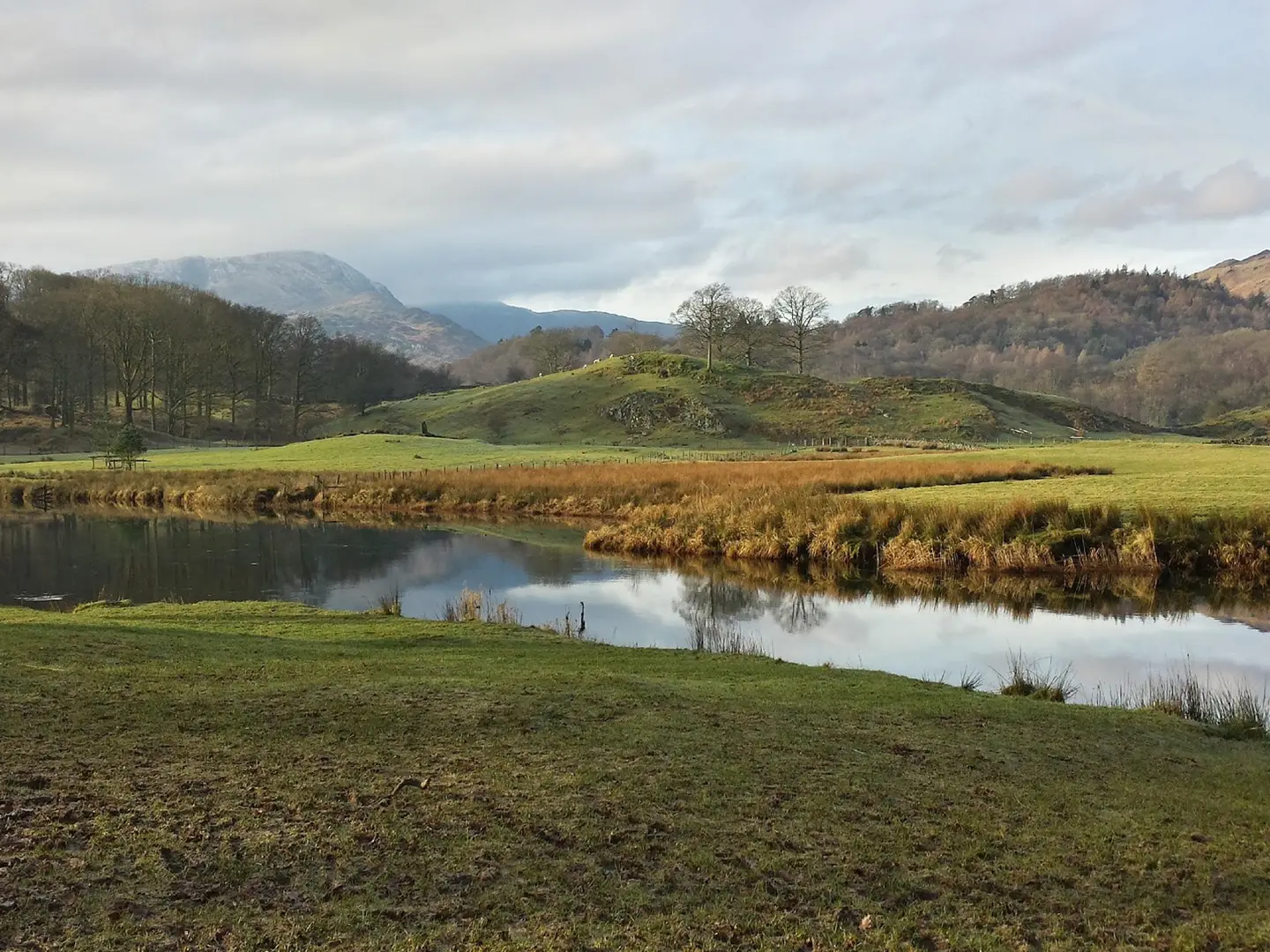
- Borrowdale and Derwentwater: The trail drops through Borrowdale, with oak woodland and crags, then follows the wooded shore of Derwentwater into Keswick.
- Castlerigg Stone Circle: Near Keswick, this Neolithic stone circle is around 5,000 years old and makes a worthwhile short detour from the route.
- High Pike and the Northern Fells: High Pike is the highest point on the Cumbria Way at 658 m, reached in the quieter Caldbeck Fells north of Skiddaw.
- River Caldew to Carlisle: The final stage follows the River Caldew through Dalston into Carlisle, a historic border city with a Norman castle and cathedral.
Challenges to expect
The Cumbria Way is not technically difficult, but the cumulative distance is real: most 5-day itineraries include stages of about 18–24 km. Expect rock-strewn fell paths, muddy field sections, riverside paths and boggy ground after rain. Weather can change quickly on Stake Pass, Skiddaw Forest and High Pike, so carry a map or GPS despite the waymarking. Some remote stretches need careful accommodation planning.
HikeList Score
The Cumbria Way scored 92/100 on HikeList's trail-quality metrics.
See score breakdownHide breakdown
- Ideal length 85
- Balanced challenge 100
- Scenery & wildness 85
- Varied terrain 89
- Accommodation 100
- Food & support 94
- Path quality 98
- Season flexibility 89
Computed from length, challenge, scenery & wildness, terrain variety, accommodation, food & support, path quality and season flexibility.
 United Kingdom
 England
Show more data Show less
- Mountainous
- Forest
- Grassland
- Dirt
- Rocky
- Gravel
- Muddy
- Hotels
- Guesthouses
- Hostels
- Campsites
- Wild Camping Spots
- Family Friendly
- Dog Friendly On Leash
- Restrooms
- Established Campsites
- Picnic Areas
- Potable Water Sources
- Public Transport Access Points
Download Our Full Guide to The Cumbria Way FREE!
Get our comprehensive guide to this hike for free. Save it for later reading or print out at home.
In these collections
Photos from hikers
Taken on the trail by people who've reviewed The Cumbria Way.
The Cumbria Way: The Complete Guide
 i
Image by rwaddilove
i
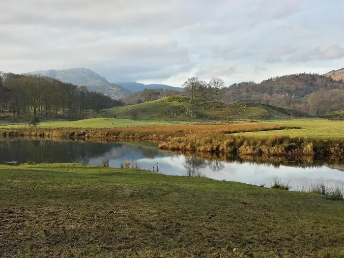
Image by rwaddilove The Cumbria Way is a practical, rewarding south-to-north crossing of Cumbria, linking Ulverston near Morecambe Bay with Carlisle beyond the northern fells. It suits walkers who want a full Lake District journey without committing to a sustained high-ridge route.
The line of the walk is its strength: Coniston Water, Tarn Hows, Great Langdale, Borrowdale, Derwentwater, Keswick and the quieter Caldbeck Fells all come in sequence. On the opening lakeshore miles, Coniston Water adds real depth to the scenery through its links with Arthur Ransome’s Swallows and Amazons and Donald Campbell’s Bluebird records.
Most of the route stays low, using valleys, lakeshores, farmland, woodland and riverside paths, but it is not a soft option. Stake Pass is the main mountain crossing, and the Keswick-to-Caldbeck stage has a high-level option over High Pike or a longer low-level alternative past Whitewater Dash and Skiddaw House.
The walk asks for steady fitness over consecutive 18–24 km days, waterproofs for changeable Lake District weather, and sensible planning for accommodation in places such as Coniston, Keswick and Caldbeck. Navigation is generally straightforward on the waymarked route, but the High Pike option needs confidence in poor visibility.
Logistically, it is one of the easier long Lake District routes to arrange without a car, with rail access at Ulverston and Carlisle and baggage transfer available in the main walking season.
This guide covers the stages, itinerary choices, accommodation, food, transport, terrain and common planning mistakes.
Stage-by-Stage Guide
Stage 1: Ulverston to Coniston — ~24 km
The Cumbria Way starts in Ulverston town centre, at the starting monument at The Gill, before leaving the market town for field paths, country lanes and short road sections. This is a long first day, with roughly 640 m of ascent and enough lowland walking to make mud a real factor even outside winter.
The early miles cross farmland towards Gawthwaite, where the route enters the Lake District National Park. Underfoot, expect field paths, wet gateways, lanes and increasingly rougher tracks as the day rises towards Beacon Tarn.
Beacon Tarn is the first properly upland-feeling point on the walk: open, quiet and often damp underfoot after rain. Beacon Fell, at 255 m, is a short optional detour if the weather is clear, but it adds time to an already full stage.
The final approach to Coniston is one of the best parts of the day. The route drops towards Coniston Water and follows wooded lakeside paths along the western shore, with views across the lake towards Grizedale Forest and ahead to Coniston Old Man and Dow Crag.
Food and water are limited between Ulverston and Coniston. Stock up before leaving Ulverston; Torver and Lowick have off-route options, but both require a diversion and should not be relied on unless planned into the day.
Coniston has a good range of walker services for its size. Food options include a small supermarket, pubs, cafés and Coniston Foodhouse for snacks, sandwiches and packed lunches.
Accommodation in Coniston includes YHA Coniston Holly How, The Crown Inn, The Coniston Inn, the Yewdale Inn, Meadowdore and other B&Bs. Camping options include Coniston Hall campsite and Pier Cottage Caravan Park.
Coniston has no railway station. Bus services link the village with Ambleside and Windermere, where onward rail connections are available, but current timetables should be checked before travelling.
Navigation is generally straightforward, with yellow arrows and wooden waymark posts in the early section. A GPS or OS mapping is still useful around Beacon Tarn, where rougher ground, bracken and wet paths can make the line less obvious in poor weather.
Main warnings for this stage are mud, limited food stops and the length of the day. The Beacon Tarn area can be boggy after rain, and diversions to Torver or Lowick add distance and time.
Stage 2: Coniston to Great Langdale — ~18 km
This is a shorter but varied stage, moving from Coniston through classic central Lake District scenery to the head of Great Langdale. It is not a high mountain day, but there is still around 550 m of ascent spread across repeated climbs and descents.
The route climbs gently out of Coniston towards Tarn Hows, one of the Lake District’s best-known viewpoints. Paths here are generally good, though the area can be busy in summer and at weekends.
Beyond Tarn Hows, the day mixes woodland, parkland, old quarry country and valley paths. Cathedral Cave at Hodge Close, Slater’s Bridge near Little Langdale, Colwith Force and Skelwith Force are the main points of interest before the route reaches Skelwith Bridge.
From Skelwith Bridge, the walking becomes easier and more level around Elterwater and through the Langdale valley. The final miles up Great Langdale give sustained views towards Pike of Blisco, Bow Fell and the Langdale Pikes.
Food and drink are much easier to manage than on Stage 1. Skelwith Bridge has a pub and café options, Elterwater has the Britannia Inn, and Chapel Stile has a small shop and café.
At the end of the stage, Great Langdale has several useful walker bases. The Old Dungeon Ghyll Hotel and New Dungeon Ghyll Hotel both offer food and accommodation, while budget and camping options include Great Langdale Bunkhouse and the National Trust Great Langdale Campsite.
Public transport is available from Great Langdale, but it is a valley-end location rather than a transport hub. Bus 516 links Dungeon Ghyll with Ambleside, with some services continuing or connecting towards Windermere and Kendal; this should be checked before travelling.
Navigation on this stage is usually uncomplicated. The route follows well-used valley and woodland paths, with no major navigational crux in normal conditions.
The main planning issue is accommodation. Great Langdale is popular with walkers and climbers, and places such as the Old Dungeon Ghyll fill quickly in summer and holiday periods.
Stage 3: Great Langdale to Keswick — ~24 km
This is the main mountain-crossing day of the standard five-day itinerary. It links Great Langdale, Stake Pass, Langstrath, Borrowdale, Derwentwater and Keswick, and is long enough to justify an early start.
Many walkers split this stage by staying in Rosthwaite, Stonethwaite or the wider Borrowdale area. Great Langdale to Rosthwaite or Borrowdale is about 14 km, and Borrowdale to Keswick is about 13 km, making this the most natural way to turn the route into a six-day walk.
From Great Langdale, the route follows Mickleden, a clear valley approach beneath the high fells. The climb to Stake Pass is steep and tiring, gaining roughly 300 m from the valley floor to a pass of about 480 m.
Stake Pass is the main exposed crossing on the Cumbria Way. The path is well established, but mist, low cloud or strong wind can make this section much more serious than the valley walking before and after it.
The descent into Langstrath is remote and rougher underfoot, with rocky ground and boggy patches after rain. Black Moss Pot, the Gordon Hallworth Memorial Bridge over Langstrath Beck and Galleny Force are key features before the route trends into Borrowdale.
Rosthwaite and Stonethwaite are the first realistic food and accommodation points after Great Langdale. There is no food or reliable resupply across the early mountain section, so carry enough water and food from the start of the day.
From Borrowdale to Keswick, the walking is gentler and more sheltered. The route passes through oak woodland, old stone walls and valley-bottom paths, with Castle Crag, Grange and the Derwentwater lakeshore giving plenty of interest before the final approach to Keswick.
There are cafés and tearooms around Rosthwaite, Grange and Portinscale, and YHA Borrowdale at Longthwaite can be useful for food as well as accommodation. Keswick has full town services, including supermarkets, cafés, pubs, restaurants and outdoor shops.
If splitting the stage, accommodation options in Borrowdale include YHA Borrowdale, the Royal Oak Hotel in Rosthwaite, Langstrath Country Inn in Stonethwaite, Glaramara Hotel, Yew Tree Farm Guest House and Chapel House Farm campsite. Book well ahead in peak season.
Keswick has the widest accommodation choice on the route. Options include hotels such as the Derwentwater Hotel, Kings Arms and Skiddaw Hotel, hostels including YHA Keswick and Denton House Hostel, many B&Bs, and Keswick Camping and Caravanning Club Site.
Keswick has no railway station, but it is well connected by bus. Services link the town with Penrith for West Coast Main Line trains, and with Grasmere, Ambleside and Windermere; current timetables should be checked before travelling.
Navigation is most important on the Stake Pass section, which is not simply a low-level waymarked valley walk. Carry a map and compass and know how to use them; in hill fog, do not rely on waymarks alone.
Borrowdale and the Derwentwater section are much more intuitive to follow. A short detour to Castlerigg Stone Circle, a roughly 5,000-year-old Neolithic site east of Keswick, is worthwhile if time and energy allow.
The main warnings are the lack of services before Rosthwaite, the exposed crossing of Stake Pass and the total length of the stage. Allow a full day; in typical conditions, this is not a stage to rush late in the afternoon.
Stage 4: Keswick to Caldbeck — ~23 km
This is the hardest stage for many walkers: remote, exposed and with the largest single-day ascent of the route. It leaves Keswick for the quieter Back o’ Skiddaw country, then offers a choice between the high-level route over High Pike and a lower alternative past Whitewater Dash.
The first section is common to both options. The route exits Keswick, climbs by Latrigg for wide views back over Derwentwater, then drops into the wild Glenderaterra valley between Skiddaw and Blencathra.
Glenderaterra Beck leads the route towards Skiddaw House, one of England’s most remote youth hostels. This is an important landmark and a useful potential break point, but it should not be treated as a casual resupply point.
After Skiddaw House, the high-level route heads north across open fell to High Pike, at 658 m, the high point of the Cumbria Way. In clear weather this is a memorable section, with broad moorland, exposed ridges and views towards the Scottish Lowlands.
The high-level route demands proper fell navigation. From around Lingy Hut onwards, and especially around High Pike, paths and trods can be confusing in cloud; from the summit, keep the descent line carefully oriented north towards Caldbeck.
The low-level alternative is the better choice in poor visibility or for walkers who do not want a committing fell day. It uses better-graded access tracks and lower ground past Dash Falls, also known as Whitewater Dash, before continuing through Orthwaite and Longlands towards Caldbeck.
The low route is less exposed and easier to navigate, but it includes more track and road walking after the fell fringe. It is not a bad-weather escape from all effort; it is simply a more conservative and navigationally safer option.
There is no food stop between Keswick and Caldbeck on either variant. Stock up thoroughly in Keswick and carry enough water and food for a long, exposed day.
Caldbeck has useful end-of-stage services, including the Oddfellows Arms, Old Smithy Tearoom, Watermill Café and Kirkland Stores. Opening times can vary, so do not arrive late assuming all services will still be available.
Accommodation in and around Caldbeck includes the Oddfellows Arms, Old Rectory B&B, Howbeck Lodge and Caldbeck Camping, which has camping pods. Skiddaw House can be used as a mid-stage stop by arrangement and should be booked ahead.
Public transport from Caldbeck is very limited. If ending or pausing the walk here, plan a taxi, lift or onward arrangement in advance rather than assuming a simple bus connection.
The key warning on this stage is navigation. In poor visibility, the high-level route over High Pike should only be attempted by walkers confident with map and compass; otherwise, the low-level route is the sensible option.
This is also the most remote-feeling stage of the route. Start early, carry waterproofs and warm layers, and do not underestimate how slow the open fell section can become in wind, cloud or heavy rain.
Stage 5: Caldbeck to Carlisle — ~24 km
The final stage is long but much easier underfoot than the previous day. It leaves the Lake District fells behind and follows a lower, gentler line towards Carlisle, using lanes, paths, riverside tracks and cycleways.
From Caldbeck, the route soon transitions out of the Lake District National Park and picks up the River Caldew. The river becomes the main companion for much of the day, guiding the route through rural and then increasingly suburban surroundings.
This is a stage of pastoral walking rather than mountain drama. Expect woodland, fields, gentle undulations and eventually flatter riverside approaches into Carlisle.
Notable points include Rose Bridge, with an optional detour towards Rose Castle, and Dalston, the most useful mid-stage village. The route also passes Lime House School before the final approach into Carlisle.
Food and water should still be planned properly. Caldbeck is the last certain supply point at the start of the day, while Dalston has shops, cafés and other village services that make it the obvious mid-stage resupply stop.
Dalston opening hours, especially on Sundays, should be checked before relying on them. Carlisle has extensive food options once the walk reaches the city centre.
Carlisle is a substantial city with a wide choice of accommodation. Options include city-centre hotels such as the County Hotel, Crown & Mitre Hotel and Carlisle Station Hotel, budget choices including ibis Carlisle City Centre and The Roadhouse Hotel, plus B&Bs such as Abberley House, Ashleigh House, Cornerways and Warwick Lodge.
Camping is more limited near the city but options include Ratlingate Scout Centre and Cardewlees. Availability and access arrangements should be checked before travelling.
Carlisle railway station is on the West Coast Main Line, with strong onward connections including London, Glasgow, Manchester and Edinburgh. Carlisle bus station also has services to many Cumbrian towns.
Navigation is the easiest of the whole route. The river corridor, paths and cycle tracks make progress straightforward, though urban approaches always require attention at junctions and path changes.
The main warning is that the day can feel longer than expected after the fells. It is not technically difficult, but 24 km still requires steady pacing, especially if catching a train from Carlisle the same day.
Recommended Itinerary
Standard 5-day itinerary
The 5-day schedule is the natural way to walk the Cumbria Way. It keeps the route to a steady sequence of long but manageable days, with overnights in the main service points: Coniston, Great Langdale, Keswick and Caldbeck.
| Day | From | To | Approx. distance | Why this stage makes sense | Services/accommodation notes |
|---|---|---|---|---|---|
| 1 | Ulverston | Coniston | 24 km | A long but logical opening day through farmland past Gawthwaite and on towards Coniston Water. Coniston is the first substantial overnight stop after leaving Ulverston. | Stock up in Ulverston before leaving; there is no meaningful resupply between Ulverston and Coniston. Torver has The Wilsons Arms, but no full walker-service stop. Coniston has shops, pubs, B&Bs, hotels and a YHA hostel. |
| 2 | Coniston | Great Langdale / Dungeon Ghyll | 18 km | A shorter central-Lakes day via Tarn Hows, Skelwith Bridge, Elterwater and Chapel Stile. This gives some recovery after Day 1 before the mountain crossing on Day 3. | Elterwater and Chapel Stile offer useful pub or café stops. Great Langdale has very limited shopping, with accommodation concentrated around New Dungeon Ghyll Hotel, Old Dungeon Ghyll Hotel, the National Trust Great Langdale Campsite and Great Langdale Bunkhouse. Book well ahead, especially at weekends. |
| 3 | Great Langdale / Dungeon Ghyll | Keswick | 24 km | The main mountain day of the standard route, climbing over Stake Pass before descending through Borrowdale and continuing by Derwentwater into Keswick. | Stonethwaite and Rosthwaite are useful intermediate service points and are the obvious places to split the day on a slower itinerary. Keswick is the largest town on the route, with supermarkets, outdoor shops, pubs, restaurants and a wide range of accommodation. |
| 4 | Keswick | Caldbeck | 23 km high-level; about 29 km low-level | The key route-choice day. The high-level line reaches High Pike, the Cumbria Way’s high point at 658 m; the longer low-level alternative passes Whitewater Dash and Skiddaw House. | There is nothing to eat or drink between Keswick and Caldbeck, so carry a full day’s food and water. The High Pike option needs good visibility and confident navigation; in poor weather the lower route is usually the safer choice. Caldbeck has limited services, including a small shop and the Oddfellows Arms; accommodation must be booked ahead. Bus options from Caldbeck are limited and should be checked before travelling. |
| 5 | Caldbeck | Carlisle | 24 km | A gentler final stage following the River Caldew valley through Sebergham, Buckabank, Dalston and into Carlisle. It works well after the more committing northern-fells day. | Dalston has buses and a railway station, making it a useful bail-out or shortened-stage point. Carlisle has full city services, broad accommodation choice and the Market Cross finish. |
Slower 6-day itinerary
A 6-day plan suits walkers who want to reduce the biggest mountain day, allow more time in Borrowdale, or avoid arriving in Keswick late after Stake Pass. The simplest split is between Great Langdale and Keswick, using Stonethwaite or Rosthwaite as the extra overnight.
| Day | From | To | Approx. distance | Why this stage makes sense | Services/accommodation notes |
|---|---|---|---|---|---|
| 1 | Ulverston | Coniston | 24 km | Keeps the standard first stage intact, as Coniston is the first strong overnight base. | Stock up in Ulverston. Coniston is a good resupply and accommodation stop. |
| 2 | Coniston | Great Langdale / Dungeon Ghyll | 18 km | A manageable day into Great Langdale, leaving the Stake Pass crossing for fresh legs. | Great Langdale accommodation is limited and should be booked early. There is no proper village store at Dungeon Ghyll. |
| 3 | Great Langdale / Dungeon Ghyll | Borrowdale / Rosthwaite | About 12 km | Splits the mountain section by crossing Stake Pass and stopping before the long continuation to Keswick. | Stonethwaite and Rosthwaite have pubs, cafés and limited accommodation. Options include the Langstrath Inn at Stonethwaite and accommodation around Rosthwaite such as the Royal Oak and Scafell Hotel. Availability is limited, so book ahead. |
| 4 | Borrowdale / Rosthwaite | Keswick | About 13 km | A shorter day through Borrowdale and along Derwentwater, giving time for a later start or a detour near Keswick. | Keswick is the main resupply point on the whole walk, with supermarkets, gear shops and extensive accommodation. |
| 5 | Keswick | Caldbeck | 23 km high-level; about 29 km low-level | Keeps the northern-fells stage as a full day, with the same weather-dependent choice between High Pike and the lower route via Whitewater Dash. | Carry all food and water needed for the day. Caldbeck has limited accommodation and limited onward transport, so the booking matters. |
| 6 | Caldbeck | Carlisle | 24 km | Finishes on the easier Caldew valley stage into Carlisle. | Dalston can be used to shorten the day if needed. Carlisle has full onward transport and city services. |
Faster 4-day itinerary
A 4-day Cumbria Way is only suitable for very fit, experienced walkers who are comfortable with one very long day and consecutive hard stages. The 5-day itinerary is already a solid undertaking; compressing it turns the route into an endurance walk rather than a relaxed Lake District crossing.
The cleanest 4-day compression is to combine the first two stages, then keep the mountain and northern-fells days intact.
| Day | From | To | Approx. distance | Why this stage makes sense | Services/accommodation notes |
|---|---|---|---|---|---|
| 1 | Ulverston | Great Langdale / Dungeon Ghyll | About 42 km | Combines Ulverston–Coniston and Coniston–Great Langdale, using Coniston as the natural mid-stage break. This is a very long opening day. | Start with full supplies from Ulverston. Coniston is the only substantial service point before Great Langdale. Accommodation at Great Langdale is limited, so this plan is risky without a firm booking. |
| 2 | Great Langdale / Dungeon Ghyll | Keswick | 24 km | Keeps the Stake Pass and Borrowdale stage as a full day rather than trying to combine it with the opening leg. | Stonethwaite and Rosthwaite provide useful refreshment options before Keswick. Keswick is the main place to resupply before the remote Day 3. |
| 3 | Keswick | Caldbeck | 23 km high-level; about 29 km low-level | Retains the most navigationally serious stage as a dedicated day. Choose High Pike only in suitable weather and with confident navigation. | No food or drink between Keswick and Caldbeck. Carry a full day’s food and water. Caldbeck accommodation must be secured in advance. |
| 4 | Caldbeck | Carlisle | 24 km | Finishes with the lower, easier River Caldew stage. | Dalston provides a possible early finish point with onward public transport. Carlisle has full services and mainline rail connections. |
A second fast option is to combine Keswick to Carlisle into one very long final push, but that means about 47 km via the high-level Keswick–Caldbeck line before reaching Carlisle. This is not a sensible choice for most walkers, especially given the lack of services between Keswick and Caldbeck.
Itinerary booking notes
- Book Great Langdale and Caldbeck early. These are the two places where limited accommodation can dictate the whole itinerary.
- Carry food from Ulverston to Coniston on Day 1, and from Keswick to Caldbeck on Day 4. These are the two service gaps that catch out poorly planned schedules.
- If using baggage transfer, make sure each overnight stop is accepted by the operator before booking rooms. Services such as Lake District Baggage Transfer operate seasonally, while Sherpa Van offers Cumbria Way baggage transfer; current prices and availability should be checked before booking.
- The Keswick to Caldbeck stage should not be treated as a fixed high-level day. Make the High Pike or low-level Whitewater Dash decision from the current forecast, visibility and the party’s navigation ability.
Planning the Route
The Cumbria Way is straightforward to follow in concept, but it needs more careful planning than its moderate reputation suggests. The key constraint is not the total distance; it is the spacing of overnight stops, the limited accommodation in several valleys, and two long no-service days.
Plan the walk around beds first, then transport, then food and weather decisions. The route is waymarked, but the upland sections still require proper hill navigation, especially the Keswick-to-Caldbeck high-level option over High Pike.
How many days to allow
The standard itinerary is 5 walking days. That works well for fit walkers who are used to consecutive 18–24 km days and are happy with a full schedule from the start.
Many first-time long-distance walkers are better served by 6 days. A sixth day reduces pressure on the longest stages, gives more flexibility in poor weather, and makes it easier to use limited accommodation in Borrowdale or Dalston.
A slower itinerary is also possible, especially through self-guided holiday operators that arrange accommodation and baggage transfer. These longer schedules usually suit walkers who want shorter daily distances rather than a faster, end-to-end challenge.
Standard stage pattern
The daily stages are largely dictated by where accommodation and services exist. On several days there is little practical choice once committed to the stage, so start times and food carrying matter.
| Stage | Usual section | Planning notes |
|---|---|---|
| 1 | Ulverston to Coniston | A long first day with no food stops en route. Start early and carry lunch. |
| 2 | Coniston to Great Langdale | Shorter on distance, but accommodation in Great Langdale is limited and weekend minimum-stay rules can affect bookings. |
| 3 | Great Langdale to Keswick | Includes the sustained climb over Stake Pass, then Borrowdale and Derwentwater before Keswick. Can be split at Rosthwaite. |
| 4 | Keswick to Caldbeck | The highest-ascent day, with either the high-level High Pike route or the longer low-level option past Whitewater Dash and Skiddaw House. No food between Keswick and Caldbeck. |
| 5 | Caldbeck to Carlisle | Mostly low-level river walking, but still a long final day. Some walkers split it by stopping at Dalston. |
Best ways to split the walk
The most useful 6-day split is to break the Great Langdale-to-Keswick stage in Borrowdale. Staying at Rosthwaite turns the day over Stake Pass into a shorter mountain stage, followed by a more relaxed walk into Keswick.
Another practical split is on the final stage, stopping at Dalston before continuing to Carlisle. This avoids finishing with another long day after the harder Keswick-to-Caldbeck stage.
An extra night in Keswick is the easiest rest-day option because it has the widest range of accommodation, food shops and transport links. Coniston can also work as a slower-paced stop, but Keswick is the most practical place to pause or reorganise plans.
Accommodation planning
Book accommodation before fixing transport tickets. Rosthwaite and Caldbeck should be treated as priority bookings because they have the fewest beds and can sell out early in summer.
Rosthwaite has only a small number of places to stay, including the Royal Oak Hotel, Scafell Hotel, Yew Craggs, Gillercombe B&B and Nook Farm. Caldbeck is also very limited, with options including the Oddfellows Arms, Swaledale Watch Farmhouse B&B, Denton House guesthouse and a small campsite.
Great Langdale needs particular care if arriving at a weekend. New Dungeon Ghyll Hotel, Old Dungeon Ghyll Hotel and the National Trust Great Langdale Campsite may require 2-night minimum stays at weekends, making midweek itineraries easier to book.
For June to August, book at least 2 months ahead; 3–6 months is safer for July and August starts. Some inns require deposits, and cancellation terms vary, so check policies before committing to a tight itinerary.
Food and resupply planning
Do not rely on buying food between Ulverston and Coniston, or between Keswick and Caldbeck. Carry lunch and enough snacks for both of these stages.
Keswick is the best resupply point on the route and the natural place to reset food, fuel and equipment plans. The smaller overnight stops should be treated primarily as places to sleep and eat pre-booked meals, not as guaranteed resupply points.
Carry enough water for each full day, especially on the longer stages and in warm weather. Streams and becks can rise quickly after rain, so wet-weather conditions can affect both pace and crossing difficulty.
Choosing the Keswick-to-Caldbeck variant
The high-level option over High Pike reaches the trail’s highest point and is the more committing mountain choice. It should only be used in poor visibility by walkers who are confident with map and compass and/or GPS navigation.
The lower-level alternative past Whitewater Dash and Skiddaw House is longer, but generally the safer choice in mist, strong wind or marginal conditions. Decide the evening before or on the morning of the stage after checking the Lake District forecast.
In early spring, snow can still affect High Pike and the Caldbeck Fells. In a late winter, the high-level route may not be a sensible option.
Section hiking and transport
The Cumbria Way is practical to section-hike, mainly because Ulverston, Keswick and Carlisle have useful transport links. Ulverston is on the Cumbrian Coast Line, usually reached by changing at Lancaster from the West Coast Main Line, while Carlisle is a major West Coast Main Line station.
Keswick is the best intermediate join or escape point. It has bus links including the 555 via Kendal/Lancaster, X4/X5 from Penrith, and the 554 towards Carlisle; current timetables should be checked before travelling.
Coniston can also be used for section access via the 505 Coniston Rambler towards Ambleside, with onward links by bus or from Windermere. Great Langdale, Rosthwaite and Caldbeck have much more limited or seasonal public transport, so do not base a section plan on those points without checking current services first.
Baggage transfer and supported options
Baggage transfer is available on the Cumbria Way during the main walking season, usually April to October. Lake District Baggage Transfer operates south-to-north between the standard overnight stops, and Sherpa Van also serves the route, including Coniston, Great Langdale, Rosthwaite, Keswick, Caldbeck and Carlisle.
Using baggage transfer makes the route considerably more comfortable because the long stages can be walked with a day sack. Book early for summer starts, especially if accommodation is already tight.
Outside the baggage-transfer season, expect to carry all overnight gear. This changes the difficulty of the walk, particularly over Stake Pass and on the Keswick-to-Caldbeck stage.
Permits, navigation and weather
No permit is required to walk the Cumbria Way. The route follows public rights of way and Open Access land, and there are no entry fees for the Lake District National Park.
Waymarking is generally good, but it is not a substitute for navigation equipment. Carry an OS map or reliable digital mapping, download a GPX track before departure, and be prepared to navigate in rain, clag and poor light.
The Lake District is one of the wettest regions in England, and waterproofs are essential in every season. Check MWIS or Lake District Weatherline before each day’s walk, with particular attention to Stake Pass and the High Pike variant.
Towns, Villages and Overnight Stops
Accommodation planning matters more on the Cumbria Way than the map might suggest. Keswick, Ulverston and Carlisle have plenty of beds, but Great Langdale, Rosthwaite and Caldbeck are genuine pinch-points and should be booked first, especially for late May to August.
For peak summer, aim to book at least two months ahead. Some B&Bs prefer two-night stays, while others can help with walker pick-ups and drop-offs; this can solve awkward logistics if the nearest available bed is off-route. Current prices and minimum-stay rules should be checked before booking, but typical on-route B&Bs sit around £80–£130 per night, with hostel dorm beds often around £30–£40.
Ulverston
Ulverston is the southern start and the best place to stay before beginning the walk. The route starts at The Gill car park, west of the town centre, and the railway station is a short walk from both the centre and the start.
The town has the full range of pre-walk services: a Tesco supermarket for food, pharmacies, independent shops, pubs, cafes and restaurants. Pubs include the Stan Laurel Inn, Kings Arms Hotel, Farmers Arms and Hope & Anchor.
Accommodation is broad by Cumbria Way standards, with guesthouses, hotels, B&Bs and self-catering options. Many walkers arrive the previous evening, buy food for the first day and start fresh the next morning.
Ulverston station is on the Cumbrian Coast Line, usually reached by changing at Lancaster from the West Coast Main Line. There are also buses towards Barrow-in-Furness and Kendal, plus National Express coach connections; current timetables should be checked before travelling.
Gawthwaite
Gawthwaite is a small hamlet on the first stage between Ulverston and Coniston. Treat it as a route marker rather than a service stop.
There are no shops, pubs or accommodation here. The first day should be planned as a self-sufficient walk through farmland and woodland, with food and water arranged before leaving Ulverston.
Coniston
Coniston is the standard first overnight stop, about 24 km from Ulverston. It is one of the better-equipped villages on the route and a useful place to reset after the first long day.
Services include a Co-op convenience store, butcher, bakery, newsagents, cafes and several pubs. The Black Bull Inn, Crown Inn and Yewdale Inn are all practical food-and-drink options for walkers, with the Yewdale Inn particularly convenient for those staying in the village.
Accommodation ranges from B&Bs and guesthouses to hostels. YHA Coniston Holly How is in the village and has a bar and restaurant, while YHA Coniston Coppermines is about 1.25 miles up the fell and is more remote. Bluebird Lodge Guest House is another village option, a short walk from the centre.
Coniston has no regular railway station. Buses run towards Ambleside and Windermere, but services can be seasonal and infrequent, so current timetables should be checked before relying on them. A taxi from Windermere is a practical fallback for access or exit.
Tarn Hows
Tarn Hows sits on the second stage between Coniston and the Langdale area. It is a scenic daytime section rather than a natural overnight stop.
Plan food around Coniston, Elterwater and Great Langdale rather than expecting meaningful resupply here. In poor weather or when running late, it is still important to keep enough food and water for the full Coniston to Great Langdale day.
Skelwith Bridge
Skelwith Bridge is a small hamlet on the route where Langdale Beck meets the River Brathay. It is useful as a mid-stage break on the way from Coniston to Elterwater and Great Langdale.
Chester's by the River is the key stop here, with a riverside cafe setting that works well for lunch or coffee. Accommodation is very limited, so Skelwith Bridge is not a realistic overnight base for most Cumbria Way itineraries.
Elterwater
Elterwater is a small Langdale village and one of the better daytime service stops on the second stage. It has a National Trust car park with public toilets and is a good place to pause before continuing towards Great Langdale.
Brambles Café serves coffee, cakes and light lunches, and the Britannia Inn is a traditional pub with food and occasional rooms. There is also a small Langdale Co-op for basic supplies.
Elterwater Hostel gives the village some walker-friendly overnight capacity, but beds are limited relative to demand. Wainwrights' Inn, in nearby Chapel Stile, is about a five-minute walk from Elterwater and is a classic walker pub with food, real ales and a dog-friendly bar.
Elterwater can work as an alternative stop if Great Langdale is full, but it changes the balance of the following day. Anyone stopping here should check the next morning's distance and the timing of the Stake Pass crossing carefully.
Great Langdale / Dungeon Ghyll
Great Langdale, around Dungeon Ghyll, is the standard second overnight stop and the natural base before the Stake Pass crossing. It is one of the most important accommodation bookings on the whole route.
The Old Dungeon Ghyll Hotel is the classic walkers' stop at the head of the valley, with the Hikers Bar and on-site accommodation. The New Dungeon Ghyll Hotel has en-suite rooms, a Walker's Bar, food and direct fell access.
Food options at the head of the valley are limited beyond the two hotels, and there is no shop. Carry snacks and next-day lunch supplies from earlier on the route if needed, because the following section over Stake Pass and down Langstrath has no services until Stonethwaite.
Public transport into upper Great Langdale is limited and seasonal. Check the current Langdale Rambler or 505 bus timetable before relying on it; for most walkers, this is a walk-in, walk-out overnight stop.
Stake Pass
Stake Pass is not an overnight stop, but it is a key logistical point. It is the main mountain crossing on the standard Cumbria Way and sits between Great Langdale and the Langstrath descent towards Stonethwaite.
There are no shops, cafes, pubs or accommodation on the crossing. Leave Great Langdale with enough food, water and bad-weather clothing for a full upland section before reaching the Borrowdale valley.
Stonethwaite
Stonethwaite is the first settlement reached after descending from Stake Pass into Borrowdale. It is a tiny hamlet, but it can be useful for walkers who want to break up the long Great Langdale to Keswick stage.
The Langstrath Country Inn is the key service here, with en-suite rooms, a drying room, real ales and food. Lunch is normally served daily except Mondays, with afternoon snacks and evening meals, but opening times should be checked before travelling.
There is no shop and no wider set of village services. Sherpa Van serves Stonethwaite as a baggage drop point, making it a workable split-stage overnight if accommodation is available.
Stopping here leaves only about 3 km to Rosthwaite the next morning, so it is more useful as a way to shorten the mountain day from Great Langdale than as a balanced five-day itinerary stop.
Rosthwaite
Rosthwaite is a small Borrowdale village about 3 km beyond Stonethwaite and around 6 miles south of Keswick. It is one of the tightest accommodation points on the Cumbria Way and should be booked early if it forms part of the itinerary.
The Royal Oak Hotel is the main pub and a long-established walkers' hotel, with rooms, a self-catering apartment and bunk-barn accommodation. YHA Borrowdale, at Rosthwaite, is another important option, with hot meals, laundry and dorm beds often from around £39.
Yew Tree Farm in the adjacent Borrowdale Valley offers B&B and tea-room options, and The Flock In Tearoom is useful for sandwiches, soup, tea and coffee. Opening hours can be seasonal, so do not rely on late food without checking ahead.
There is no village shop in Rosthwaite. Buy trail food in Keswick or carry what is needed from earlier stops if staying here before continuing north.
Borrowdale
Borrowdale is the wider valley area between the Stake Pass descent and Derwentwater. For Cumbria Way planning, the practical overnight points are Stonethwaite and Rosthwaite rather than a large village centre.
This is a good section for splitting the standard Great Langdale to Keswick day if the five-day schedule feels too compressed. The trade-off is limited bed availability and no proper resupply until Keswick.
Derwentwater
Derwentwater marks the approach into Keswick after Borrowdale. It is a scenic lakeside section rather than a separate resupply or overnight hub.
Most walkers continue into Keswick for food, accommodation, shops and transport. If time and weather allow, the Keswick launch on Derwentwater is a worthwhile short detour, but it should not replace the practical need to reach Keswick for resupply.
Keswick
Keswick is the main service centre on the Cumbria Way and the standard third overnight stop. It is the best place on the route to restock, replace or repair gear, charge electronics and eat properly before the Northern Fells stage.
The town has Booths supermarket, pharmacies, banks, ATMs, a Post Office and a very large choice of outdoor shops. It also has the widest range of pubs, cafes and restaurants between Ulverston and Carlisle.
Accommodation is broad, including hotels, guesthouses, B&Bs, YHA, independent hostels and campsites. Availability is much better than in Great Langdale, Rosthwaite or Caldbeck, but Keswick still fills during peak summer and holiday periods.
Keswick has no railway station. Bus links run to Penrith, Windermere, Ambleside, Borrowdale, the Caldbeck area and elsewhere, with Penrith the nearest West Coast Main Line rail connection at about 18 miles away. Timetables should be checked before travelling, particularly for onward or escape-route planning.
Baggage transfer operators such as Sherpa Van and Lake District Baggage Transfer serve Keswick. This is also the place to buy lunch and emergency snacks for the following Keswick to Caldbeck stage, which has no intermediate food stops on either route variant.
Castlerigg Stone Circle is a worthwhile detour from the route if time allows. It adds extra walking, so it is best treated as an optional visit rather than built into a tight schedule.
Skiddaw House / High Pike
North of Keswick, walkers choose between the high-level option over High Pike and the longer low-level alternative past Whitewater Dash and Skiddaw House. Neither should be planned as a normal resupply day with cafes or shops en route.
There are no food stops between Keswick and Caldbeck on either variant. Carry lunch, snacks and sufficient water before leaving Keswick.
The High Pike option reaches the Cumbria Way's high point at 658 m and needs confident navigation in poor visibility. In poor weather, the low-level route past Whitewater Dash and Skiddaw House may be the more conservative choice, but it is still a long and remote day with limited services.
Caldbeck
Caldbeck is the standard fourth overnight stop and the most critical booking after Great Langdale and Rosthwaite. It is a small village north of Skiddaw in the Caldbeck Fells, and bed capacity is limited.
The Oddfellows Arms is the main pub-hotel, with en-suite rooms, evening meals, hearty breakfasts and packed lunches for walkers. The Old Rectory Caldbeck adds another B&B option in the village.
The Watermill Café at Priest's Mill serves home-cooked food, Fairtrade tea and coffee and local produce. It normally operates daily from mid-February to 31 October with more restricted winter hours, but opening should be checked before travelling.
Caldbeck has a small village shop stocked with basics, useful for snacks before the final day. There are no food stops between Keswick and Caldbeck, so arrive with the day completed rather than expecting late-stage resupply.
Public transport is very limited, with only occasional services towards Carlisle. In practice, walkers who need to join or leave the route here often rely on accommodation-arranged lifts or a taxi from Carlisle, about 18 miles away.
St Kentigern's churchyard is the burial place of John Peel, the Cumbrian huntsman and folk-song subject. It is a brief local stop rather than a reason to alter the walking schedule.
Sebergham
Sebergham lies on the final stage between Caldbeck and Dalston, along the River Caldew corridor. It is a small hamlet and should not be treated as a service stop.
There are no shops, pubs or accommodation to rely on. Carry what is needed from Caldbeck for the morning section and plan the first meaningful resupply for Dalston.
Buckabank
Buckabank is another small hamlet on the Caldbeck to Dalston stage. It sits within the farmland and river-walking section before the approach to Carlisle.
There are no practical walker services here. Continue with the assumption that the final day is self-supported until Dalston.
Dalston
Dalston is the last substantial village before Carlisle, about 4 miles southwest of the city centre. It is the only realistic resupply point between Caldbeck and Carlisle.
The Co-op on Townhead Road is useful for snacks and drinks and is normally open daily from 7am to 10pm. The village also has the Blue Bell Inn, Bridge End Inn, a chip shop, bakery and cafe.
Most walkers continue through Dalston and finish in Carlisle the same afternoon. It is close enough to the end that stopping here rarely makes sense unless accommodation or personal logistics require it.
B&Bs exist in and around the village, but Dalston is not widely set up as a Cumbria Way overnight hub. Anyone planning to stop here should arrange accommodation in advance rather than arriving speculatively.
Carlisle
Carlisle is the northern finish, with the route entering along the River Caldew corridor through the western suburbs and ending in the city centre around the Market Cross and Greenmarket area. It is the easiest place on the route for onward travel.
The city has a full spread of accommodation, from budget and mid-range hotels near the station and centre to B&Bs and larger chain hotels. Many walkers stay one night to make onward travel easier, though a late-afternoon finish can still allow same-day departure by train.
Carlisle station is a major West Coast Main Line stop, with direct trains to London Euston, Glasgow Central, Manchester and Edinburgh. It is also a junction for the Settle–Carlisle and Cumbrian Coast Lines, making it a strong rail endpoint for a point-to-point walk.
Food and shopping are straightforward, with restaurants, cafes, pubs, takeaways, Lidl and other supermarkets. Carlisle Castle, Carlisle Cathedral and Tullie House Museum are all within easy reach of the station if time allows before travelling home.
Getting to the Start
The Cumbria Way starts in Ulverston, with the official trailhead at The Gill car park on the west side of town, close to the centre. Ulverston railway station is around 5 minutes' walk from the town centre and is the simplest arrival point for most walkers.
If starting the standard 5-day itinerary, aim to reach Ulverston the previous evening rather than on the morning of Day 1. The first stage to Coniston is about 24 km, so a late arrival can make the opening day unnecessarily tight.
By train
Ulverston has its own railway station on the Furness Line, part of the wider Cumbrian Coast Line network, with services operated by Northern. This is the most practical public-transport option for reaching the start.
From the south, the usual route is by West Coast Main Line train to Lancaster, then a Northern service towards Barrow-in-Furness, stopping at Ulverston. Lancaster to Ulverston takes about 40 minutes, with roughly hourly trains during Monday–Saturday daytimes, though the timetable is not a strict clock-face pattern and gaps can vary.
From London, travel on the West Coast Main Line to Lancaster, then change for Ulverston. Total journey times are typically around 3 hours 15 minutes to 4 hours, depending on connections.
From Manchester Airport, some Northern trains run through to Ulverston without a change, taking roughly 1 hour 55 minutes to 2 hours. This makes Manchester the most straightforward airport rail connection for the start of the route.
From the north, Ulverston can be reached from Carlisle via the Cumbrian Coast Line, or by travelling south to Preston or Lancaster and changing there. Carlisle to Ulverston via the coast takes roughly 2 to 2.5 hours.
Train times, engineering works and late-evening connections can affect arrival plans. This should be checked before travelling.
By bus
Bus access to Ulverston is possible, but the train is usually easier for walkers with luggage. Stagecoach Cumbria & North Lancashire services connect Ulverston with nearby towns and parts of the southern Lake District.
Route 6/X6 links Barrow-in-Furness, Ulverston, Newby Bridge, Windermere and Kendal. The X6 operates Monday–Saturday, and the 6 and X6 connect at Ulverston, making this a useful option for walkers approaching via Kendal or the eastern side of Cumbria.
Route 11 also links Barrow and Ulverston, though it is much less frequent. If arriving at Barrow-in-Furness and the train connection to Ulverston is inconvenient, a taxi is a practical fallback.
Bus frequencies, evening services and Sunday/bank-holiday timetables can change. This should be checked before travelling.
By car
Ulverston is reached by road via the A590, around 10 miles north of Barrow-in-Furness. For walkers driving to the start, the main issue is not access but what to do with the car during a linear walk ending in Carlisle.
The Gill car park is the most relevant car park for the Cumbria Way because it is at, or very close to, the official start. It is listed with postcode LA12 7BN, has 43 spaces and no height restriction, and is open 7 days a week, with charges applying from 08:00 to 18:00.
Long-stay parking permits are available at The Gill, including 3-day and 7-day options. Recent listed prices are £15 for 3 days and £30 for 7 days, with hourly parking also available; charges and permit arrangements should be checked with Westmorland and Furness Council before travelling.
Other town-centre car parks in Ulverston include Brewery Street, Buxton Place, Daltongate, Stockbridge Lane and Theatre Street. Private parking options near Ulverston station may also be available, but suitability for a multi-day stay should be checked before booking.
Leaving a car in Ulverston can work well because Carlisle, the finish, has strong rail links. After completing the walk, return from Carlisle to Ulverston by train, allowing for the journey time and any required changes.
A taxi from Barrow-in-Furness to Ulverston is a useful contingency if rail timings do not work. The road distance is about 9–10 miles, the journey is around 16 minutes, and fares are typically about £25–£35; current prices should be confirmed before booking.
From the nearest airport
Manchester Airport is the most convenient international gateway for the Cumbria Way start. Some Northern services run directly from Manchester Airport to Ulverston in about 2 hours, avoiding the need to cross central Manchester with walking luggage.
Another option from Manchester Airport is to connect into the West Coast Main Line via Manchester Piccadilly or use a suitable service towards Lancaster, then change for Ulverston. Timings vary, so through-ticket options and connection times should be checked before travelling.
Liverpool John Lennon Airport is less convenient because there is no direct rail link from the airport. The usual approach is to travel to Liverpool Lime Street, then by train towards Lancaster or Preston and onward to Ulverston, typically taking about 2.5 to 3.5 hours depending on connections.
From London Heathrow or Gatwick, transfer into London, take the West Coast Main Line to Lancaster, then change for Ulverston. Allow around 4 to 5 hours for the full airport-to-start journey.
Where to stay before starting
Ulverston is the best place to stay before beginning the Cumbria Way. Staying in town allows an early start from The Gill and avoids relying on a morning train before the long first stage to Coniston.
Options in and around Ulverston include guesthouses, small hotels, B&Bs, self-catering properties and town-centre rooms. Named options include Church Walk House, Sefton House, Honeysuckle Barn, Bay Horse Hotel, Kings Arms and Gill Garth, with Gill Garth particularly close to the trail start.
Accommodation should be booked ahead in spring, summer and around bank holidays. If using baggage transfer, check that the chosen accommodation can accept and release bags at the required times.
Getting Home from the Finish
Carlisle is one of the easiest long-distance-walk finishes in northern England. The Cumbria Way ends in the city, and Carlisle railway station is central, close to the final approach along the River Caldew and the city-centre streets.
Most walkers who finish around midday or during the afternoon can leave the same day by train. If the final Caldbeck to Carlisle stage has taken longer than expected, or if onward travel involves a late connection, staying in Carlisle is often the simplest option.
By train
Carlisle Citadel station sits in the city centre at Court Square / Botchergate. It is a major West Coast Main Line station with services run by Avanti West Coast, Northern Trains, ScotRail, TransPennine Express, Caledonian Sleeper and Lumo.
The station is staffed, has booking offices open until around 20:00, and has step-free access to all platforms by ramps and lifts. Facilities include waiting rooms, digital displays, a newsagent and a buffet, which makes it practical if arriving tired or wet from the final stage.
| Destination | Typical route from Carlisle | Planning notes |
|---|---|---|
| London Euston | Direct West Coast Main Line services | Fastest trains take about 3 hr 23 min; most take around 3 hr 30 min to 4 hr. There is also a late-evening Caledonian Sleeper to London. |
| Edinburgh Waverley | Direct services via the West Coast Main Line | Around 1 hr 20 min on the fastest trains, with regular daytime services. |
| Glasgow Central | Direct services north | Usually around 1 hr 20 min to 1 hr 40 min, with frequent daytime options. |
| Manchester / Manchester Airport | Direct TransPennine Express services via Preston | Around 2 to 2.5 hr; useful for onward flights from Manchester Airport. |
| Newcastle | Northern Trains via Hexham | Around 1 hr 15 min, useful for walkers heading to the North East. |
| Ulverston / Barrow-in-Furness | Northern Trains on the Cumbrian Coast Line | The key option if a car has been left at the start in Ulverston. Services are typically around hourly. |
| Leeds | Northern Trains via Settle | Useful for Yorkshire-based walkers; service frequency varies by time of day. |
Advance fares can be much cheaper than walk-up tickets, especially for London and long-distance journeys. As with all UK rail travel, Sunday services and late-evening connections can be less frequent, so final-day travel should be checked before travelling.
If a car has been left at Ulverston, the train back along the Cumbrian Coast Line is the normal public-transport solution. Build in enough time for the connection and for the onward drive home, rather than relying on a tight same-evening schedule after a 24 km final day.
Baggage-transfer services such as Lake District Baggage Transfer and Sherpa Van operate on the Cumbria Way during the main season, but walkers should not assume luggage will be collected from the finish point itself. Plan to carry whatever is needed into Carlisle and to the station or hotel.
By bus
Carlisle Bus Station is on Lonsdale Street, a short walk from the railway station. National Express coaches run from Carlisle to major cities, including London Victoria, Birmingham and Manchester.
The coach is usually slower than the train but can be cheaper when booked ahead. London Victoria is typically around 7 to 8 hours by coach, with daytime and overnight options depending on the current timetable.
Coach timetables and fares change, so check National Express before booking accommodation or committing to a finish-day departure. This is particularly important on Sundays, bank holidays and outside the main summer season.
By car/taxi
Carlisle is a practical finish for pick-ups because the trail ends in a city rather than a remote valley. If being collected by car, arrange a clear meeting point in the city centre or at Carlisle railway station rather than trying to meet on the last riverside section.
There is a taxi rank outside Carlisle Citadel station, and several Carlisle operators run 24-hour or late services. Options include Carlisle Taxi Company on 01228 812612 and Carlisle Taxis 24-7-365 on 01228 247365, with other local firms also available.
A taxi is useful if accommodation is not close to the station, if the final stage has left you with an awkward walk across town, or if travelling with a heavy pack. Advance booking is sensible for evening finishes, weekends and busy summer dates.
For point-to-point logistics, many walkers either travel to Ulverston by public transport at the start or leave a car there and return by train from Carlisle. Driving both ends with a private shuttle is possible in principle, but it is rarely as straightforward as using Carlisle’s rail links.
From the nearest airport
Carlisle does not have a commercial passenger airport with scheduled services. Carlisle Lake District Airport is not a practical option for ordinary passenger flights.
Manchester Airport is often the simplest airport connection after the walk because direct trains run from Carlisle to Manchester Airport in around 2 to 2.5 hours. It is also the largest international hub among the practical choices from Carlisle.
| Airport | How to reach it from Carlisle | Best for |
|---|---|---|
| Manchester Airport | Direct train from Carlisle with TransPennine Express | International and domestic flights with the least complicated rail connection. |
| Newcastle Airport | Train to Newcastle via Hexham, then Metro to the airport | North East, domestic and European flights. |
| Edinburgh Airport | Train to Edinburgh Waverley, then tram or bus to the airport | Scotland connections and European flights. |
| Glasgow International | Train to Glasgow Central, then shuttle bus or taxi | Scotland connections and wider flight options. |
Allow generous connection time between the train and flight, especially after a final walking day. Train disruption, wet kit, and the need to collect stored luggage or change clothes can all make tight airport transfers unnecessarily stressful.
Where to stay at the finish
An overnight in Carlisle is not essential for most walkers, but it is useful if finishing late, travelling on a Sunday, or catching an early train the next morning. It also removes pressure from the final Caldbeck to Carlisle stage, which is still a full walking day.
The most convenient accommodation is around the railway station, Botchergate and Warwick Road. Options close to the station include Carlisle Station Hotel opposite the station, ibis Carlisle a short walk away, and Cornerways Guest House on Warwick Road.
There are also B&Bs and guesthouses within easy reach of the station and city centre. Booking ahead is sensible at weekends and during the main walking season.
If there is time before a train, Carlisle’s compact centre is easy to use as a waiting base. Carlisle Castle, Carlisle Cathedral and Tullie House Museum and Art Gallery are all practical short visits, with plenty of pubs and cafés nearby for a post-walk meal.
Which Direction Should You Walk?
The Cumbria Way is normally walked south to north, from Ulverston to Carlisle. That is the traditional direction, the one used by the main route descriptions, and the simplest choice for most independent walkers.
The reverse direction, Carlisle to Ulverston, is perfectly possible and has a few real advantages. It is a minority choice, mainly suited to walkers who prefer to get the least attractive ground out of the way early and finish among the southern Lakes and Morecambe Bay views.
South to north: Ulverston to Carlisle
South to north gives the most straightforward logistics. Ulverston is a manageable starting point on the Cumbrian Coast Line, usually reached by changing at Lancaster onto a Barrow-in-Furness-bound service. Timetables should be checked before travelling, as services are less frequent than those through Carlisle.
Finishing in Carlisle is the major practical advantage. Carlisle is on the West Coast Main Line, with frequent long-distance services to major cities including London, Manchester, Birmingham, Glasgow and Edinburgh. After five consecutive walking days, being able to finish in a large, well-connected city is useful, especially if arrival time is uncertain.
The scenery also builds well in this direction. The route starts with market-town edges, farmland and rolling ground out of Ulverston, then becomes increasingly Lakeland in character through Coniston Water, Tarn Hows, Skelwith Bridge, Elterwater and Great Langdale.
The middle of the walk carries the biggest mountain feel: Stake Pass, Borrowdale, Derwentwater, Keswick and the Northern Fells. The final stage then eases out through Caldbeck, the River Caldew valley and Dalston before entering Carlisle.
The main drawback is the approach to Carlisle. The final miles from Dalston are low-key compared with the Lake District stages, using a flat tarmac or cycle-path approach through the city’s outskirts. It is the one part of the standard direction that can feel anticlimactic after Stake Pass, Borrowdale and the Caldbeck Fells.
North to south: Carlisle to Ulverston
Walking north to south reverses the emotional shape of the route. The less inspiring Carlisle approach is dealt with on day one, while legs are fresh and expectations are lower. The walk then improves steadily as it moves towards Caldbeck, Keswick, Borrowdale, Stake Pass, Great Langdale, Coniston and finally Ulverston.
This direction gives a stronger scenic finish. Instead of ending with urban fringe walking into Carlisle, the final stages keep the Lake District and southern Cumbrian scenery in play for longer, with Ulverston and the Cumbria Way monument providing a more intimate finish.
There are trade-offs. Guidebooks, route notes and the general flow of the waymarking are easiest to follow south to north, so reverse walkers need to pay closer attention at junctions. You are also more likely to be going against the flow of other walkers.
Transport is less convenient at the end. Ulverston has rail access, but it is a smaller station with less flexible onward travel than Carlisle. Ending there is still workable, but return journeys need more careful planning.
Climbs and terrain by direction
There is no decisive terrain advantage either way, but Stake Pass is the one section where direction matters. Northbound walkers climb from Great Langdale and descend towards Langstrath and Borrowdale. Southbound walkers climb from the Langstrath/Borrowdale side, which is the slightly easier ascent, and descend into Great Langdale with the Langdale Pikes ahead.
That gives the reverse direction a small advantage on this particular mountain crossing. It is not enough on its own to outweigh the broader logistical benefits of finishing in Carlisle, but it is worth considering if Stake Pass is a major concern.
The Keswick-to-Caldbeck section also needs direction-aware planning. Whether walked northbound or southbound, the high-level option over High Pike is a more serious upland choice and needs confident navigation in poor weather. The longer low-level alternative past Whitewater Dash and Skiddaw House avoids the high point but should still be treated as a remote fell day.
Weather and prevailing wind
Prevailing winds in Cumbria are generally westerly, so they tend to blow across the line of the Cumbria Way rather than directly into your face in either direction. Wind direction should not be a major factor when choosing northbound or southbound.
The more important weather issue is exposure on the upland sections, especially Stake Pass and the High Pike option between Keswick and Caldbeck. In poor visibility, direction matters less than having proper navigation tools, a realistic day plan and the willingness to take the lower alternative where appropriate.
Accommodation flow
Accommodation works in both directions, but south to north is the easier fit for most itineraries. Ulverston, Coniston, Great Langdale, Keswick, Caldbeck and Carlisle all support the standard stage pattern, though Caldbeck has limited accommodation and should be booked early.
Carlisle makes a particularly practical final night. It has the broadest range of post-walk facilities and the best onward rail connections, so there is less pressure to catch a specific train immediately after finishing.
North to south reverses that advantage. Starting in Carlisle is easy, but finishing in Ulverston gives fewer options for a flexible departure or a comfortable final-night reset before travelling home.
Recommendation
For most walkers, walk the Cumbria Way south to north: Ulverston to Carlisle. It matches the standard route descriptions, keeps navigation simpler, gives a natural build into the Lake District, and ends at the easiest transport hub on the route.
Choose Carlisle to Ulverston only if the scenic finish matters more than transport convenience, or if getting the duller Carlisle outskirts out of the way on day one is a priority. It is a valid direction, but it requires a little more care with navigation and onward travel.
The key expectation to manage is the northbound finish. Carlisle is an excellent practical endpoint, but the final approach from Dalston is not the scenic highlight of the Cumbria Way.
Accommodation Along the Route
The Cumbria Way works well as an inn-to-inn walk, but it is not a route to leave unbooked in the main season. The key overnight stops all have accommodation, yet the supply is uneven: Ulverston, Keswick and Carlisle have strong choice; Great Langdale and Caldbeck are genuine bottlenecks.
Book every night before starting, especially from May to September, on bank-holiday weekends and if any stage ends in Coniston or Great Langdale on a Friday or Saturday. Many properties in those two areas require a two-night minimum at weekends, which can disrupt a five-day itinerary if it is not planned around.
| Place | Accommodation level (good/limited/none) | Best for | Notes |
|---|---|---|---|
| Ulverston | Good | Night before starting; baggage-transfer pick-up | Town-centre B&Bs, guesthouses and hotels. Church Walk House and The Bay Horse Hotel are established options. |
| Coniston | Good | Standard night 1; budget hostel option | B&Bs, inns and YHA Holly How. Weekend two-night minimums are common at private properties. |
| Great Langdale / Dungeon Ghyll | Limited | Standard night 2; direct access to Stake Pass stage | Old Dungeon Ghyll Hotel, New Dungeon Ghyll Hotel, Millbeck Farm and Great Langdale Campsite. One of the main accommodation bottlenecks. |
| Stonethwaite / Rosthwaite / Borrowdale | Limited but useful | Splitting the Great Langdale–Keswick stage into a six-day itinerary | Inns, B&Bs, YHA Borrowdale, camping and pods. Good choice for walkers who do not want a 24 km day over Stake Pass and into Keswick. |
| Keswick | Excellent | Standard night 3; restocking; flexible accommodation | Wide range of hotels, guesthouses, inns and YHA Keswick. Very busy in summer, so still book early. |
| Skiddaw House | Very limited | Optional split of the Keswick–Caldbeck stage | Remote off-grid hostel at 470 m with 20 beds and camping. Accessible only on foot or by mountain bike; advance booking essential. |
| Keswick–Caldbeck low-level alternative | None between ends | Full-day walkers | The low-level alternative bypasses Skiddaw House, so there is no mid-stage accommodation between Keswick and Caldbeck. |
| Caldbeck | Limited | Standard night 4; final rural overnight | Small supply of inn, B&B/guesthouse and camping-style options. This is the most constrained overnight stop for one-night walkers. |
| Carlisle | Excellent | Finish night; onward rail travel | Full city accommodation range, including hotels, B&Bs and chain options near the railway station. |
Ulverston: before the start
Ulverston is the practical place to stay the night before starting. There is a good town-centre spread of B&Bs, guesthouses and hotels, with Church Walk House and The Bay Horse Hotel among the named options used by walkers.
Baggage-transfer services can collect from Ulverston, which makes it a straightforward start for walkers using door-to-door bag movement. There is no specific walker hostel in Ulverston in the supplied accommodation notes; budget travellers often need to compare guesthouse rates or start with the hostel option at Coniston after the first stage.
Coniston: end of stage 1
Coniston has a stronger accommodation base than the more remote valley stops, with B&Bs, inns and YHA Holly How. The hostel is the most flexible budget option, offering dorms, private rooms, camping, glamping pods and tipis, plus self-catering, a licensed bar and drying facilities.
Private options include Oaklands on Yewdale Road, Yew Tree Farm Coniston on Ambleside Road and the Black Bull Hotel on Yewdale Road. Several Coniston properties apply a two-night minimum at weekends, so a Friday or Saturday single-night stay must be checked before booking travel around it.
Great Langdale and Dungeon Ghyll: the main southern bottleneck
Great Langdale is one of the hardest places on the route to secure a single night. It is a popular valley for walkers who are not on the Cumbria Way, and the accommodation supply is relatively small.
The main fixed options are the Old Dungeon Ghyll Hotel, New Dungeon Ghyll Hotel, Millbeck Farm and Great Langdale Campsite. The two Dungeon Ghyll hotels are the most convenient for a direct continuation towards Stake Pass, with walker facilities such as meals, packed lunches and drying space available at the New Dungeon Ghyll.
Great Langdale Campsite has grassy pitches, camping pods, toilet and shower blocks, laundry and drying facilities. It is a useful fallback for campers and pod users, but it also operates minimum-stay rules, so it should not be treated as a guaranteed one-night solution.
Borrowdale: useful if making a six-day itinerary
Stonethwaite, Rosthwaite and the wider Borrowdale area are not on the standard five-night stopping pattern, but they are very useful for splitting the Great Langdale–Keswick stage. This turns the walk into a more comfortable six-day itinerary and avoids making the Stake Pass day one long push all the way to Keswick.
In Stonethwaite, Langstrath Country Inn has en-suite rooms, a bar, evening meals and Wi-Fi, but its changeover restrictions matter: it does not allow check-in on a Monday or check-out on a Tuesday. Knotts View B&B offers continental breakfast and packed lunches, but no Wi-Fi or evening meals. There is also a small campsite in Stonethwaite village.
Rosthwaite and nearby Longthwaite add more options. The Royal Oak, Yew Craggs and YHA Borrowdale are all practical walker stops, with YHA Borrowdale offering dorms, private rooms, camping pods and camping pitches by the River Derwent.
Keswick: the easiest booking point on the route
Keswick has the broadest accommodation choice between Ulverston and Carlisle. It is the safest place to build flexibility into the itinerary, with hotels, guesthouses, inns, B&Bs and YHA Keswick all available in or near the town centre.
Named options include YHA Keswick on Station Road, Keswick Park Hotel, the Kings Arms Keswick and the Skiddaw Hotel. Keswick is also the best resupply point before the northern section, with shops, supermarkets and outdoor gear shops.
Despite the large choice, Keswick still needs early booking in summer. It is one of the busiest towns in the Lake District and accommodation is heavily used by non-Cumbria Way visitors as well as long-distance walkers.
Skiddaw House: the remote mid-stage option
Skiddaw House is the only overnight option between Keswick and Caldbeck on the high-level line. It is an independent hostel and former shooting lodge at 470 m on the flanks of Skiddaw, around 3 miles from the nearest road and accessible only on foot or by mountain bike.
Facilities are deliberately simple. There are 20 beds across four rooms, plus camping, a self-catering kitchen, wood-burning stoves and a small licensed shop operating on a cash-only basis. The building is off-grid, with solar power for lights and hot water; there is no mains electricity, mobile signal, internet or TV, and bedrooms are unheated.
Standard bookings run from Easter to the end of the October half-term, with sole-use hire available year-round. The hostel opens at 5pm daily, and advance booking by email to [email protected] is essential.
Walkers taking the low-level alternative past Whitewater Dash and Skiddaw House should note the practical consequence: there is no overnight stop between Keswick and Caldbeck on that variant, so the stage remains a full-day walk.
Caldbeck: limited supply, book first
Caldbeck is the most constrained standard overnight stop on the Cumbria Way. It is a quiet village on the edge of the Northern Fells, and walkers needing a single night should book it before committing to the rest of the itinerary.
The Oddfellows Arms is on the walking route and offers pub accommodation, meals, a licensed bar, Wi-Fi and dog-friendly rooms. Other options include Swaledale Watch, around 1 mile from the village, Denton House at nearby Hesket Newmarket, and camping in or near Caldbeck.
Caldbeck Glamping Barns may require a two-night minimum, so single-night availability should be checked carefully. If Caldbeck accommodation is full, an off-route stay with a pre-arranged road transfer may be necessary; this should be checked before travelling.
Carlisle: finish-night accommodation
Carlisle has a full city range of accommodation, including budget, mid-range and higher-end hotels, B&Bs, hostels and chain hotels near the railway station. It is the easiest place on the route to arrange a finish-night stay or an early departure the next morning.
Booking is still sensible if arriving on a weekend or during a major local event, but Carlisle is not normally the limiting accommodation point. Most walkers should prioritise securing Great Langdale and Caldbeck first.
Baggage transfer and booking services
Baggage transfer makes the Cumbria Way much easier for inn-to-inn walkers, especially over the longer 18–24 km stages. Sherpa Van and Lake District Baggage Transfer both serve the route in the main walking season, with collection starting from Ulverston and delivery between overnight stops.
Sherpa Van lists accommodation booking as a separate service at £50 per person for 1–7 nights and £100 per person for 8–14 nights, with walkers paying accommodation costs directly. Its standard baggage rate is listed as £17 per bag per move, with Great Langdale to Borrowdale/Stonethwaite listed at £34 per bag because of the longer transfer. Current prices, dates and baggage limits should be checked before booking.
For 2026, Sherpa Van lists its Cumbria Way baggage season as 30 March to 18 October. There is no equivalent winter service in the supplied route information, so out-of-season walkers should assume they may need to carry their own kit unless a current operator states otherwise.
Camping and Wild Camping
The Cumbria Way can be walked as a camping route, but it is not a simple “pitch anywhere” trail. Much of the line runs through valley floors, lakeshore paths, villages, farmland and private land, so most camping itineraries rely on formal campsites at or near the main overnight stops.
A camping pack also changes the difficulty. The route’s 18–24 km days, Stake Pass, and the Keswick-to-Caldbeck fell section feel noticeably harder with a full tent, stove, food and sleep system than with a day sack and baggage transfer.
Formal campsites on or near the route
The easiest camping plan is to use established sites around Coniston, Great Langdale, Borrowdale/Keswick and Caldbeck. Booking ahead is strongly advised in spring and summer, especially at weekends and during school holidays.
Prices, opening dates and booking rules change, so confirm current details before relying on them.
| Route section | Useful camping options | Practical notes |
|---|---|---|
| Start / Ulverston area | Birchbank Camping Site near Ulverston | Useful before starting the walk rather than as an end-of-stage stop. Sheep-farm setting with non-electric and electric pitches. |
| Ulverston to Coniston | Coniston Hall Campsite; Coniston Social Club camping | Coniston Hall is on or very near the Cumbria Way on the western shore of Coniston Water. It is a traditional, no-frills site for tents and motorhomes, with toilets, hot showers, fresh water, a coin-operated launderette and a small shop. It must be booked online; weekend stays may require two nights. Prices have been around £16 per adult plus a vehicle charge, but check current rates. |
| Coniston to Great Langdale | Great Langdale Campsite, National Trust | Directly useful at the end of the Day 2 stage, below the Langdale Pikes. It has informal camping meadows, a shop, and a pub nearby at Old Dungeon Ghyll. Online booking is available and same-day booking may be possible. Current National Trust rates should be checked before travelling. |
| Great Langdale to Keswick | Chapel House Farm Campsite, Stonethwaite; Hollows Farm and Borrowdale Glamping, Grange; sites around Keswick such as Castlerigg Hall, Low Hollows and Kestrel Lodge | Chapel House Farm is a traditional working-farm campsite in Borrowdale, on or very close to the route, with no electric hook-ups; bookings are by email and payment is cash on arrival. Hollows Farm offers non-electric grass pitches by the River Derwent and is open Easter to October. Keswick-area sites work if continuing to the town rather than stopping in Borrowdale. |
| Keswick to Caldbeck | No formal campsite directly on the high-level or low-level fell section | This is the awkward camping stage. Skiddaw House is a bunkhouse option on the low-level variant, not a campsite. Wild camping on suitable high fell ground is the only realistic camping option between Keswick and Caldbeck, and must follow Lake District National Park guidance. |
| Caldbeck / start of final stage | Caldbeck Camping; Wallace Lane Farm | Caldbeck Camping sits directly on the Cumbria Way in the village and has a small number of grass pitches, toilets, showers, washing-up sinks and an information hut with solar charging. It is usually open from early April to late September, with prices around £9 per person per night. Wallace Lane Farm is another Caldbeck/Wigton-area option with tent pitches and glamping. |
| Caldbeck to Carlisle | Camping at Cardewlees, Dalston | A practical option on the final stage near Dalston, before the last approach to Carlisle. The route north of Caldbeck is farmland and riverside walking, so do not plan on wild camping here. |
Wild camping: legality and what is tolerated
Wild camping in England is not permitted without the landowner’s permission. The Lake District National Park is almost entirely privately owned, and camping without permission is trespass.
The Lake District National Park Authority’s position is that responsible wild camping on the high fells is normally tolerated, but only in limited circumstances. It is not acceptable on lake shores, valley bottoms, near roads, near car parks, or close to villages.
For the Cumbria Way, this distinction matters. The low-level sections beside Coniston Water, through Great Langdale, Borrowdale and along the River Caldew are not suitable places to pitch without permission, even where they look convenient at the end of a long day.
Wild camping should be above the highest fell wall, in a small and unobtrusive camp, for one night only. Use one or two tents at most, arrive late, leave early, and leave no trace.
Cumberland and Westmorland & Furness councils issue £100 fixed penalty notices for fly camping in places such as roadsides, shorelines, car parks and other low-lying areas. Public Space Protection Orders also apply in some areas; this should be checked locally if planning to camp anywhere close to a village, road or popular access point.
Where wild camping fits on the Cumbria Way
Wild camping is most realistic only where the trail is already close to open fell or where a deliberate detour uphill is made. That usually means extra ascent and distance after the day’s walking, followed by extra descent the next morning.
The best candidate section is Keswick to Caldbeck, particularly if taking the high-level option over the Northern / Caldbeck Fells. This is also the stage where weather, navigation and exposure matter most, so it is only suitable for walkers comfortable with open fell route-finding in poor visibility.
The low-level Keswick-to-Caldbeck alternative past Whitewater Dash and Skiddaw House is less committing than the High Pike line, but it is still remote. Skiddaw House is a bunkhouse rather than a campsite and can remove the need to wild camp on this stage.
Great Langdale, Borrowdale and the fells around Keswick attract heavy use in good weather and at weekends. If high-ground wild camping is planned, keep well away from valley settlements, popular paths, lake margins and farmed ground.
North of Caldbeck, the route follows the River Caldew through Dalston towards Carlisle. This is agricultural valley-floor walking on private land and is not a realistic wild-camping section.
Bothies and non-camping shelters
Lingy Hut is a very basic shelter near the top of High Pike on the high-level Keswick-to-Caldbeck variant. It is more like a simple wooden bothy with a sleeping platform, spade and visitors’ book than a campsite or booked accommodation.
Do not plan a Cumbria Way itinerary around guaranteed space in Lingy Hut. It is useful as emergency or foul-weather shelter, but it should not be treated as a reserved overnight stop.
Skiddaw House is the key non-camping option on the low-level Keswick-to-Caldbeck variant. It is a remote hostel/bunkhouse at 470 m on the flanks of Skiddaw, accessible only on foot or by mountain bike, with no mains electricity; bring cash, as cards are not accepted.
Water for campers
Formal campsites on the route generally provide fresh water taps. Wild campers should carry a water filter or purification tablets rather than relying on untreated becks.
Natural water is common in the Lake District, but low-level streams in agricultural valleys can be affected by run-off. Higher becks and tarns may look clean, but filtering or treating water remains the sensible approach.
On dry or windy days, do not leave water collection until the final metres before pitching. Suitable high-ground camping areas may not have a convenient water source immediately beside them.
Fire rules and Leave No Trace
Open fires should not be used when wild camping in the Lake District, even where an old fire ring already exists. Use a gas stove, cook carefully, and avoid scorching grass or peat.
Pack out all rubbish, including food scraps, tea bags and used toilet paper. Do not bury litter.
Toilet waste should be buried with a trowel at least 30 m from water sources, paths and the camp. Do not use the edges of becks, tarns, lakeshores or popular rest spots.
Use a dark, low-visibility tent, avoid digging drainage trenches, and keep noise and light to an absolute minimum. The aim is for no one to know the camp was there after departure.
Is a camping-only Cumbria Way itinerary sensible?
A camping-only itinerary is possible, but it suits walkers who are already comfortable with multi-day camping and Lake District weather. The formal-campsite version is far more straightforward than a wild-camping version.
For most campers, the practical plan is to use campsites at Coniston, Great Langdale, Borrowdale or Keswick, and Caldbeck, then treat the Keswick-to-Caldbeck stage as the main logistical challenge. If wild camping is used there, build in time and energy for reaching legal, discreet high-ground terrain.
Camping can make the route considerably cheaper than using B&Bs, inns and hostels, but the saving comes with a heavier pack and less flexibility in bad weather. A lighter approach is to camp on the easier valley stages and use indoor accommodation for the most exposed section if conditions are poor.
Food, Water and Resupply
The Cumbria Way is straightforward to resupply if each long gap is planned properly. Ulverston, Coniston and Keswick are the main places to buy groceries, while Great Langdale, Rosthwaite, Caldbeck and Dalston provide smaller but useful food stops.
The two stages that catch walkers out are Ulverston to Coniston and Keswick to Caldbeck. Both require food to be carried from the start of the day, and Keswick to Caldbeck also needs a conservative water plan because there are no cafés, shops or pubs between the two towns.
Stage-by-stage food and water
| Section | Food availability | Water availability | Notes |
|---|---|---|---|
| Ulverston to Coniston | Load up in Ulverston. No dependable en-route resupply before Coniston; Torver has a village pub/inn that may serve food. | Natural becks may be encountered, but start with enough drinking water. | Treat this as a self-sufficient day. Buy breakfast and lunch in Ulverston before leaving. |
| Coniston to Great Langdale | Good at Coniston; cafés around Skelwith Bridge and Elterwater; key shop and café at Chapel Stile; pubs at Dungeon Ghyll. | Multiple becks in the central Lakes section. | Chapel Stile is the last proper shop before Great Langdale. Check rural opening times. |
| Great Langdale to Keswick | No services over Stake Pass. Rosthwaite has the main mid-stage options; more food later near Grange and Portinscale before Keswick. | Becks on the approach to and descent from Stake Pass; filter or treat natural water. | Carry food from Great Langdale until at least Rosthwaite. Keswick is the best resupply town on the route. |
| Keswick to Caldbeck | None between Keswick and Caldbeck on either the High Pike route or the low-level route past Whitewater Dash and Skiddaw House. | Natural streams/becks only; filter or treat. Carry a full supply from Keswick. | The critical resupply stage. Carry a full day of food and at least 1.5–2 litres of water from Keswick. |
| Caldbeck to Carlisle | Limited until the Bridge End Inn before Dalston, then Co-op and other village services in Dalston; full city services in Carlisle. | The route follows the River Caldew corridor, but drinking water should still be carried or treated if taken from natural sources. | Carry lunch from Caldbeck unless relying on Dalston. The first part of the day has no services. |
Main resupply points
Ulverston is the best place to start well supplied. Booths supermarket, cafés and town-centre food options make it easy to buy breakfast, snacks and a packed lunch before the first 24 km stage.
Coniston has enough grocery provision for a full top-up, including Co-op/Spar options and Coniston Foodhouse for snacks, sandwiches and packed-lunch supplies. This is the right place to prepare for the Coniston to Great Langdale stage.
Chapel Stile is the key resupply point on the second day. The Langdale Co-operative Village Store, incorporating Brambles Café, is useful for essentials before heading into Great Langdale, but as a community-run rural shop its current hours should be checked before relying on it.
Great Langdale / Dungeon Ghyll is more of an evening-meal and breakfast stop than a full resupply point. The Old Dungeon Ghyll Hotel and New Dungeon Ghyll Hotel both serve walkers, and the Great Langdale campsite shop is useful for campers, including morning bread supplies.
Rosthwaite is the key food stop between Stake Pass and Keswick. The Royal Oak Hotel is the village pub, The Flock In Tearoom at Yew Tree Farm serves café food in season, and Rosthwaite village shop is the only shop in Upper Borrowdale.
Keswick is the strongest resupply point on the Cumbria Way. Booths on Tithebarn Street, Tesco on Main Street, plus many cafés, pubs and restaurants, make it the place to buy everything needed for the remote Keswick to Caldbeck stage.
Caldbeck is small but useful at the end of the fourth day. The village shop stocks essentials, The Windmill provides a café option, and the Oddfellows Arms is a traditional inn serving food and drink.
Dalston provides the first proper village resupply late on the final stage. Co-op Food on Townhead Road/Glave Hill Court is listed as opening daily 7am–10pm, but current hours should be checked before relying on it. Carlisle then has full city-level food options.
Long gaps with no dependable food
Plan around these gaps rather than assuming somewhere will appear:
- Ulverston to Coniston: no dependable cafés or shops for the day. Carry lunch and snacks from Ulverston.
- Old Dungeon Ghyll to Rosthwaite: no services across Stake Pass. Carry food and water over the pass.
- Keswick to Caldbeck: no food services at all on either route option. This is the most important carry of the walk.
- Caldbeck to the Bridge End Inn / Dalston: no services for the bulk of the final stage. Carry food from Caldbeck.
Accommodation providers often offer packed lunches if requested in advance. This is particularly useful before the Keswick to Caldbeck stage, where there is no mid-stage back-up.
Water and filtration
Tap water is easy at accommodation, pubs and cafés in the stage towns and villages: Ulverston, Coniston, Great Langdale, Keswick, Caldbeck, Dalston and Carlisle. Fill bottles before leaving each morning, especially before the first, fourth and fifth stages.
The route crosses many becks, rivers and lake-country watercourses, particularly around Langdale, Borrowdale and the River Caldew. Natural water should be filtered or treated, as sheep grazing is widespread and untreated stream water can carry stomach-infection risks including giardia.
Use flowing becks rather than stagnant pools, and avoid collecting water immediately below farmed ground where possible. Becks can rise quickly after rain, especially earlier in the walking season, so water sources are not always as convenient or safe to access as they look on a map.
A practical baseline is to carry at least 1 litre of water on most stages, topping up with a filter where suitable. For exposed or remote sections, especially Stake Pass and Keswick to Caldbeck, start with closer to 2 litres; for Keswick to Caldbeck, 1.5–2 litres should be treated as the minimum in normal conditions, with more in heat.
Skiddaw House on the low-level Keswick to Caldbeck alternative may have basic water, but it is not a resupply point and should not be built into the day without checking ahead. Carry enough from Keswick to be self-sufficient to Caldbeck.
Sundays, evenings and seasonal closures
Small Lake District village shops and cafés can keep short, seasonal or variable hours. Chapel Stile, Rosthwaite and Caldbeck are all useful, but none should be treated like a large-town supermarket.
Sunday openings, early closing and seasonal café hours matter on this route. The Flock In Tearoom at Rosthwaite is seasonal, and Caldbeck’s village services are small-scale, so check current hours before building a food plan around them.
For a standard five-day itinerary, there is no need to carry more than two days of food if resupplying sensibly in Coniston and Keswick. The safest routine is simple: buy lunch before each long stage, carry emergency snacks, and leave Keswick with all food and water needed to reach Caldbeck.
Terrain, Conditions and Difficulty in Practice
The Cumbria Way is moderate in practice because it combines mostly straightforward valley walking with several long days and two more serious upland sections. The standard 5-day itinerary asks for repeated 18–24 km days, so fatigue usually matters more than technical difficulty.
Underfoot, expect a changing mix of field paths, farm tracks, country lanes, lakeshore paths, woodland trails, stony fell paths, moorland, riverside paths and prepared cycleway. Good waterproof footwear is important: this is not a consistently dry, hard-surfaced route, and boggy ground can appear on several stages after rain.
What makes the route feel harder than the map suggests
The total ascent is about 2,975 m over 112 km, which is modest for a Lake District crossing, but the effort is unevenly spread. Stake Pass between Great Langdale and Borrowdale is the main mountain crossing on the standard route, while the Keswick to Caldbeck stage becomes significantly more serious if the high-level High Pike variant is chosen.
The route is waymarked, but waymarking does not remove the need for map-and-compass competence. This is especially true on the Northern Fells, where poor visibility can make the descent from High Pike awkward and potentially serious.
Most walkers will find the easier miles in the valleys, beside Coniston Water, through Borrowdale, around Derwentwater and along the River Caldew. The slower miles come on wet moorland, rocky ground in Langstrath, the climb and descent around Stake Pass, and the rougher high-level ground north of Keswick.
Stage-by-stage terrain summary
| Stage | Main terrain | Practical difficulty |
|---|---|---|
| Ulverston to Coniston | Field paths, farmland, country lanes, moorland around Beacon Tarn, lakeshore paths beside Coniston Water | Long first day with undulating pasture, stiles and boggy moorland after rain |
| Coniston to Great Langdale | Field paths, farm tracks, walled tracks, woodland, riverside bridleway, stony valley paths | Generally one of the gentler days, though with some short steep climbs and rougher hill paths |
| Great Langdale to Keswick | Mickleden track, Stake Pass, Langstrath, Borrowdale woodland, Derwentwater paths and duckboards | The hardest day underfoot: steep climb, rocky descent, remote valley walking and boggy sections |
| Keswick to Caldbeck | Two variants: high-level over High Pike or longer low-level route past Whitewater Dash and Skiddaw House | The high-level route needs confident navigation; the low-level route is longer and has wet field sections plus more road walking |
| Caldbeck to Carlisle | Woodland, farmland, riverside paths along the Caldew, prepared cycleway into Carlisle | The easiest stage: low ascent, generally fast walking and a tarmac final approach |
Ulverston to Coniston: fields, moorland and lakeshore
The first stage leaves Ulverston on field paths and rolling farmland, with short road sections and country lanes around Gawthwaite. Expect stiles, kissing gates and dry-stone wall crossings across the pasture sections.
The ground becomes rougher around Beacon Tarn and Stable Harvey Moss, where the path can be less distinct and boggy after rain. This is not high mountain terrain, but it can slow progress if the ground is saturated.
The descent towards Coniston Water includes occasionally damp paths before the route joins the lakeshore. The path beside Coniston Water is generally good but can be rugged in places, then the approach into Coniston becomes flatter and better graded.
Coniston to Great Langdale: generally easier, but not all smooth
This stage is comparatively gentle, with field paths, farm tracks, walled tracks and short sections of quiet road walking. The route passes through the Tarn Hows, Skelwith Bridge and Elterwater area on mostly well-defined tracks and woodland or riverside paths.
There are still some short steep climbs and several stiles, including stone stiles and awkward step-and-stile combinations. The later approach into Great Langdale uses stony valley paths, so it is not a purely lowland stroll.
The day has around 500 m of ascent, but the gradients are generally manageable. It is a good example of the Cumbria Way’s usual character: varied, scenic, occasionally rough, but not technically difficult in normal conditions.
Great Langdale to Keswick: the key mountain day
From Great Langdale, the route begins easily on the wide, level track through Mickleden. The character changes at Stake Pass, where the path climbs from valley level to around 480 m on a steep, stone-pitched and rough route.
The ascent is well made and the zigzags ease the gradient, but it is still a proper mountain crossing. In poor weather, wind, low cloud and wet stone can make this section feel much more committing than the surrounding valley walking.
The descent into Langstrath uses engineered zigzags before rougher, rockier ground lower down. Around Blea Rock and in parts of Langstrath, footing needs attention and progress can be slower than the distance implies.
Langstrath can also be boggy when wet, with beck crossings using stepping stones or footbridges. From Stonethwaite and Rosthwaite the route becomes more forgiving again, using field paths, walled tracks, Borrowdale woodland and riverside paths.
Near Derwentwater, duckboards help across the boggier ground at Manesty. The final approach to Keswick mixes woodland paths, a short road section and field paths towards Portinscale and Keswick.
Keswick to Caldbeck: choose the variant carefully
This stage has two distinct characters. The high-level route over High Pike is shorter but more exposed and more serious; the low-level route via Skiddaw House and Whitewater Dash is longer and generally less exposed, but still has wet ground and more road walking.
There are no shops or cafés between Keswick and Caldbeck on this stage, so the terrain difficulty is compounded by the remoteness of the middle section. Carry enough food, water and bad-weather clothing from the start of the day.
High-level route over High Pike
The high-level option starts with road walking and a steep ascent towards Gale Road car park, then continues through the Glenderaterra valley on terraced and stony paths towards Skiddaw House. Beyond this, the ground becomes more remote and rougher.
The ascent alongside Grainsgill Beck can be slow, sketchy and wet underfoot. Walkers unused to rough, wet scrambling-type ground may find this section awkward, especially in poor conditions.
From Lingy Hut onwards, navigation becomes important across exposed moorland. High Pike, at 658 m, is the highest point of the Cumbria Way, and the descent off the summit is the one place on the route where the way leaves easily followed paths.
In mist, the descent from High Pike needs a compass bearing and calm route-finding. The line drops over grassy slopes where the path may not be obvious, so this variant should not be treated as a simple waymarked trail in bad visibility.
Low-level route via Whitewater Dash and Skiddaw House
The low-level option avoids the High Pike summit but is longer. It uses a well-graded access track from Skiddaw House and passes Whitewater Dash, where the going is generally good underfoot.
The easier reputation of this variant should not be overstated. Some field sections, especially around the descent towards Little Tarn, can be very wet and unpleasant after rain.
There is also more road walking, particularly between Orthwaite and Caldbeck. This can be faster in poor weather, but it is less satisfying underfoot and can feel tiring late in the day.
Caldbeck to Carlisle: easiest walking of the route
The final stage is the most straightforward underfoot. It has only modest ascent and follows woodland, farmland and riverside paths along the River Caldew through places including Sebergham, Buckabank, Dalston and into Carlisle.
The walking is generally fast and gentle, using well-graded paths, bridleways and prepared cycleway. The final approach into Carlisle is on the Caldew Cycleway, a tarmac route through urban edges including housing and some industrial areas.
This stage can still be muddy in fields after rain, but it lacks the rocky and exposed ground of the middle stages. It is usually a good day for making steady progress, provided legs have recovered from the Northern Fells.
Mud, bog and wet ground
Wet ground is a recurring feature rather than a single obstacle. The main boggier or slower areas are around Beacon Tarn and Stable Harvey Moss, parts of Langstrath after rain, the Manesty area near Derwentwater, the approaches to High Pike, and wet field sections on the low-level Keswick to Caldbeck variant.
Duckboards are in place at Manesty to keep walkers over the worst of the boggy ground. Elsewhere, expect standard Lake District wet-path conditions: soft turf, puddled tracks, churned field entrances and saturated moorland after prolonged rain.
Waterproof boots or robust trail shoes with good grip are strongly advised. Lightweight footwear can work in dry summer conditions, but there are enough wet and rocky sections for flimsy shoes to be a poor choice.
Rocky, steep and exposed sections
Stake Pass is the main sustained climb on the standard route. It is steep but well engineered, with stone pitching and zigzags rather than scrambling.
The descent into Langstrath and the rocky ground around Blea Rock are more awkward underfoot than the climb itself. Poles can help on the descent, especially when carrying a multi-day pack.
The High Pike variant is the most exposed and navigation-sensitive part of the Cumbria Way. In clear weather it is a fine upland crossing; in mist, strong wind or heavy rain it becomes a more serious fell-walking day.
Road walking, gates and livestock
Road walking is generally limited to short sections through villages, between paths and on quiet lanes. The main exceptions are the low-level Keswick to Caldbeck variant, where there is more road walking between Orthwaite and Caldbeck, and the final tarmac cycleway approach into Carlisle.
Farmland sections contain frequent gates, kissing gates, stone stiles, standard stiles and dry-stone wall crossings. These slow the pace, especially on the first, second and final stages.
Sheep are common throughout the route, and some farmland sections include cattle fields or gates with cattle warnings. Dogs should be kept under close control, and extra care is needed around livestock, calves and narrow field exits.
Seasonal conditions
Spring can bring wet ground, lush pasture and variable mountain weather. Even on a low-level route, cold wind and low cloud can affect Stake Pass and the Northern Fells.
Summer gives the best chance of drier paths and longer daylight, but boggy moorland does not disappear after heavy rain. The longer 23–24 km days still need an early enough start, especially if using the High Pike option.
Autumn can be excellent in settled weather, but wet pastures, slippery woodland paths and shorter daylight make the route feel harder. If attempting the route outside the main spring-to-autumn season, winter conditions on Stake Pass and High Pike can change the seriousness of the walk substantially; this should be checked before travelling.
Weather and Best Time to Walk
Best months in brief
The best window for the Cumbria Way is late May to mid-June: long daylight, statistically drier weather, full accommodation season and fewer people than high summer. September is the other excellent choice, with easing accommodation pressure and autumn colour in Borrowdale, around Coniston Water and through the central Lakes.
July and August are perfectly walkable but busier, warmer and more prone to sudden downpours or afternoon thunderstorms on the higher ground. April can work for flexible walkers, but expect wet paths, limited early-season accommodation and possible lingering snow on higher, north-facing ground.
November to March is not recommended for most walkers. Short days, winter conditions on Stake Pass and High Pike, reduced accommodation, closed campsites and no normal baggage-transfer season make a five-day crossing much harder to arrange safely.
| Period | Verdict | What it means on the trail |
|---|---|---|
| April | Viable but marginal | Muddy paths after winter, some accommodation still limited, possible snow on higher ground |
| Late May–mid-June | Best overall | Long days, lower crowd pressure, good accommodation availability, drier statistical window |
| July–August | Good with caveats | Warmest months, busiest villages, book far ahead, thunderstorms possible on fell stages |
| September | Excellent | Quieter, often settled, autumn colour, enough daylight for standard stages |
| October | Possible but tighter | Wetter, muddier, shorter days, baggage transfer usually ending by month-end |
| November–March | Not recommended | Short daylight, snow/ice risk, restricted accommodation and winter hill conditions |
Rain, wind and fell conditions
The Lake District is the wettest part of England, and the Cumbria Way crosses some of its wettest terrain. Rain falls on roughly 200 days a year, and the main fells receive more than 2,000 mm annually; Seathwaite in Borrowdale, close to the Day 3 line, receives about 3,300 mm a year.
The drier ends of the route can give a misleading impression. The Ulverston area averages roughly 860 mm a year and Carlisle about 827 mm, while Keswick is wetter at around 1,470 mm. The central section through Great Langdale, Stake Pass, Borrowdale and Derwentwater is where waterproofs and careful timing matter most.
The wettest and most exposed walking is usually:
- Day 3: Great Langdale to Keswick, especially the climb over Stake Pass and the descent through Borrowdale.
- Day 4: Keswick to Caldbeck, if taking the high-level option over High Pike.
South-westerly winds commonly bring rain into the fells and can funnel through Great Langdale. Fell-top conditions are often several degrees colder than the valleys; with wind chill, a mild 15°C valley day can feel close to 5°C on Stake Pass, High Pike or the Caldbeck Fells.
Low cloud and hill fog are a serious planning issue on Stake Pass and especially on the High Pike variant. The high-level Keswick-to-Caldbeck route is exposed, with limited shelter, and needs confident navigation in poor visibility. The longer low-level alternative past Whitewater Dash and Skiddaw House avoids the summit but is still remote and exposed in bad weather.
Temperatures by season
Spring starts cool. March commonly brings daytime highs of 7–9°C, with nights at or below freezing, while April rises to about 10–13°C. Snow can still affect Stake Pass and High Pike, particularly on shaded or north-facing ground.
May is often one of the most useful walking months, with highs around 14–17°C and snow rare below 600 m by mid-month. June is slightly warmer, around 15–18°C, with nights commonly 8–11°C.
July is usually warmest, with highs around 17–20°C and occasional low-to-mid 20s°C. August remains mild but can bring persistent chilly rain, particularly on the fell stages.
September typically settles to 14–16°C and is comfortable for long-distance walking. October drops to around 10–13°C, with a clear trend towards wetter, muddier and shorter days.
Daylight and stage timing
The standard Cumbria Way stages are long, with several days around 23–24 km. Daylight is therefore a real planning factor, especially if carrying camping gear, walking in poor weather or taking the high-level High Pike option.
| Time of year | Approximate daylight in Cumbria | Planning impact |
|---|---|---|
| Late June | Sunrise about 4.40 am, sunset about 9.45 pm | Very generous margin for long stages |
| Mid-May / late July | Sunrise about 5.15–5.30 am, sunset about 9.15–9.30 pm | Excellent for the standard five-day itinerary |
| Mid-September | Sunrise about 6.30 am, sunset about 7.30 pm | Still comfortable for 18–24 km days |
| Late October | Sunrise about 7.30 am, sunset about 6.00 pm | Feasible but tight for 24 km stages |
| December | About 8 usable daylight hours | Poor fit for the standard itinerary without headtorches and winter skills |
In October, start early and keep the day conservative if the forecast is poor. In winter, the available daylight is too short for most walkers to complete the standard stages safely and comfortably.
Trail surface through the year
In April and May, expect muddy and boggy ground in Langdale and Borrowdale after winter rain. The Coniston Water lakeshore path can also be wet underfoot, and Stake Pass is best treated cautiously until snow has cleared.
In June to August, surfaces are generally firmer, but this is not a dry-weather trail. Boggy ground around Borrowdale and the open fell approaches to Stake Pass and High Pike can remain wet after heavy rain, and the rocky sections on Stake Pass are slippery when soaked.
In September and October, the route becomes muddier again as rainfall increases. Fallen leaves can make rocky paths and woodland sections more slippery, particularly in Borrowdale oak woodland and around the lakeshore sections.
In winter, Stake Pass and High Pike can be under snow or ice. The High Pike variant may require winter hill equipment, including ice axe and crampons, when conditions demand it; walkers without winter mountain skills should not treat it as a normal long-distance path at this time of year.
Accommodation and seasonal services
The main walking season is Easter or late March to the end of October. Most B&Bs, inns, campsites and bunkhouses operate in this window, although individual opening dates vary and should be checked before travelling.
Keswick has the strongest year-round accommodation base, with the YHA open all year and several hotels. Coniston has reasonable choice from April to October but less in winter. Caldbeck is the key bottleneck: accommodation is limited at all times, and some glamping barn options may require a minimum two-night stay.
For July and August weekends, book Coniston, Keswick and especially Caldbeck far ahead; three to six months ahead is sensible for the busiest periods. Late May, early June and September usually give a better balance of weather, daylight and availability.
Baggage transfer is a seasonal service. Operators such as Lake District Baggage Transfer and Sherpa Van normally run on the Cumbria Way from April to October only, so winter walkers should assume they need to carry their own kit unless current arrangements say otherwise.
Midges, ticks and other seasonal irritations
Midges are present in the Lake District but are usually less severe than in Scotland. They are most active from June to August, especially on warm, damp evenings in sheltered places such as woodland, lakeshore and boggy ground. The Coniston Water lakeshore and the Borrowdale/Derwentwater stretch are the most likely places to notice them.
Ticks are a more important health concern. They are active mainly from May to September, particularly in bracken, long grass and woodland edges; Borrowdale oak woods and lowland grassy sections deserve careful checks at the end of the day. Use long trousers or repellent where appropriate and check skin thoroughly after walking.
Clegs, or horseflies, can be an annoyance in July and August, especially on woodland and hedgerow paths. They are not usually a route-defining problem, but lightweight long sleeves can help on warm, still days.
Weather forecasts to use before the fell stages
Check a proper mountain forecast before committing to Stake Pass or the High Pike option. Valley forecasts for Coniston, Keswick or Carlisle can look benign while the higher ground is in cloud, heavy rain or 30 mph-plus wind.
Use these before Stage 3 and Stage 4 in particular:
- Mountain Weather Information Service: https://www.mwis.org.uk/forecasts/english-and-welsh/lake-district
- Met Office Lake District mountain forecast: https://weather.metoffice.gov.uk/specialist-forecasts/mountain/lake-district
If the forecast gives low cloud, strong wind, thunderstorms or heavy rain for the fell tops, the low-level Keswick-to-Caldbeck alternative past Whitewater Dash and Skiddaw House is the more conservative choice than High Pike. On Stage 3, poor weather on Stake Pass should be treated as a mountain-day decision, not just a valley walk in rain.
Safety Notes
The Cumbria Way is not a technical mountaineering route, but it does include two serious fell sections: Stake Pass between Great Langdale and Borrowdale, and the high-level Keswick to Caldbeck option over High Pike. Most safety issues on this route come from long days, fast-changing Lakeland weather, wet ground, poor visibility and over-reliance on phone navigation.
Emergency help
In an emergency in the UK, call 999 or 112 and ask for Police, then Mountain Rescue. Mountain rescue in the Lake District is provided by voluntary teams coordinated through the Lake District Search and Mountain Rescue Association.
If mobile voice signal is too weak, Emergency SMS can be used by texting 999, but it must be registered in advance at emergencysms.net. The what3words app can work offline and may help give emergency services a precise location, but it should not replace map-and-compass navigation.
Once help has been called, stay where you are unless remaining there is unsafe. The international distress signal is six long whistle blasts per minute, repeated each minute.
Mobile signal and navigation
Mobile signal is unreliable across the Lake District fells. It can be particularly patchy around Stake Pass, Langstrath, Borrowdale, the Northern Fells between Skiddaw House and High Pike, and the upper Caldbeck Fells. Walkers also report weak or absent signal around Skelwith Bridge.
Do not rely on a phone as the only navigation tool. Carry a paper OS map and a working compass, and know how to use them before taking the high-level options. A fully charged phone and a power bank are still useful, but phone maps alone are not enough for mist, low cloud or a damaged device.
Useful map coverage includes OS Explorer OL6 and OL4 for the Lake District sections, with Landranger 85 covering the Caldbeck to Carlisle section. Check that any GPX route matches the variant being walked, especially between Keswick and Caldbeck.
Key route hazards by section
| Section | Main safety considerations |
|---|---|
| Ulverston to Coniston | Long first day with farmland, wet ground and livestock. Take care crossing the A5084 near Sunny Bank and on the brief approach section along the A593 into Coniston. |
| Coniston to Great Langdale | Generally less exposed, but wet paths, woodland, lakeshore and field sections can still be slow after rain. Signal can be poor around Skelwith Bridge. |
| Great Langdale to Keswick via Stake Pass | The main mountain crossing on the standard route. Steep, rocky ascent beside Stake Gill, rough ground near the top, and several hours with no road access once committed. Navigation can be difficult in mist. |
| Keswick to Caldbeck — High Pike option | The most exposed and navigationally demanding section. The descent from High Pike needs accurate navigation in poor visibility, and the ground can feel featureless in mist. |
| Keswick to Caldbeck — low-level option | Longer, but significantly safer in poor weather. It passes Whitewater Dash / Dash Falls and Skiddaw House, with wet ground still likely. |
| Caldbeck to Carlisle | Mostly lower-level walking with farmland, riverside paths and quieter roads through Sebergham, Buckabank, Dalston and into Carlisle. Livestock and road awareness remain relevant. |
Stake Pass
Stake Pass is around 481 m and is the main mountain crossing on the standard Cumbria Way. The climb from Great Langdale follows Stake Gill on a steep, stone-pitched path, with rocky and rough ground that becomes more hazardous when wet.
In mist, the path near the top can be indistinct over rocky ground. Once above Great Langdale there is no practical escape route until the route reaches the Borrowdale valley at Rosthwaite, so the decision to continue should be made before committing to the climb.
Check a mountain forecast before leaving Great Langdale. If strong wind, low cloud or heavy rain is forecast, delaying or taking transport out of Langdale is a safer choice; local bus options should be checked before travelling.
High Pike and the Northern Fells
The high-level Keswick to Caldbeck route over High Pike reaches 658 m, the highest point of the Cumbria Way. This is the most exposed and navigationally challenging part of the walk, and it should be treated as a proper fell day rather than a simple waymarked trail stage.
In mist or bad weather, the descent from High Pike requires competent map-and-compass work to avoid leaving by the wrong ridge. Wind, cloud and wet ground can make progress slow, and waymarking can be faded or sporadic between Keswick and Caldbeck.
The Northern Fells are often soft and wet underfoot. The Grainsgill Beck section near Carrock Fell can be slow over wet rocks, and the only practical mid-route escape from the high-level stage is via the Mosedale Road.
In poor visibility or for walkers without confident navigation skills, the low-level route past Whitewater Dash / Dash Falls and Skiddaw House is the safer default. It is longer, but avoids the most serious navigation problems of the High Pike option.
Weather exposure
Lakeland weather can change quickly, especially on open fell sections. Sunshine in Coniston, Great Langdale or Keswick does not guarantee safe conditions on Stake Pass or High Pike.
Check a reliable mountain forecast each morning, such as MWIS or the Met Office Lake District mountain forecast. Pay particular attention to wind speed, cloud base, rain, temperature and visibility for the fell stages.
Even in summer, carry waterproofs, warm layers, hat and gloves for the exposed sections. In hot weather, the long 18–24 km days still require enough water, sun protection and a realistic pace, particularly where there is no quick road escape.
Wet ground, becks and water
Boggy and wet ground is common after rain across the route. It is especially likely around Beacon Tarn and Stable Harvey Moss on Stage 1, Langstrath on Stage 3, and the Northern Fells on Stage 4.
Rocky paths on the ascent and descent of Stake Pass increase the risk of slips and ankle injuries, particularly on loose or wet stone. Trekking poles can help with balance, but careful foot placement matters more than speed.
Natural water is plentiful on much of the route, but it should be filtered or treated before drinking because farming and livestock contamination are real risks. After prolonged rain, assess crossings such as Stake Gill and Grainsgill Beck carefully; do not attempt a ford if the water level looks high.
Livestock and dogs
Cattle are present in fields on several stages, especially around Broughton Beck and Gawthwaite on Stage 1, and near Sebergham, Buckabank and Dalston on the final stage. Sheep are common on open fell sections, and Shetland ponies may be encountered near Broughton Beck.
If cattle approach, stay calm, do not run, and move steadily towards the field edge or exit. Keep dogs on a short lead near livestock, but let go of the lead if cattle charge; the dog can outrun cattle more easily than a person attached to it.
Road walking
Several road sections and crossings need attention. The A5084 near Sunny Bank and the short section on the A593 approaching Coniston require particular care, especially in poor visibility or when walking late in the day.
The lanes near Longlands on the Keswick to Caldbeck stage are quiet but still used by vehicles. The final approach into Carlisle through Dalston and along the riverside is relatively straightforward, but tired walkers should still stay alert on road sections.
Solo hiking
The Cumbria Way is regularly walked solo, but solo walkers should be stricter about planning. Share the full itinerary, overnight stops and expected arrival times with someone before setting off, and agree a daily check-in plan.
Do not assume that lack of signal means a delayed check-in will be understood. Give a responsible contact enough information to know when a missed message is a concern, especially for the Great Langdale to Keswick and Keswick to Caldbeck stages.
If leaving a vehicle at a trailhead or accommodation, leave route details and vehicle information with a reliable contact. This is particularly useful if plans change during the walk.
Daily safety checklist
Before setting off each morning, check:
- The current mountain weather forecast, especially before Stake Pass or High Pike.
- The chosen Keswick to Caldbeck variant: high-level over High Pike or low-level past Whitewater Dash and Skiddaw House.
- That a paper map, compass, whistle, head torch and waterproof layers are packed.
- That the phone is fully charged and a power bank is available.
- That drinking water is sufficient, with a filter or treatment method if topping up from natural sources.
- That someone knows the day’s route, destination and expected arrival time.
- That any transport escape option being relied on is actually running. This should be checked before travelling.
Gear Recommendations
The Cumbria Way is not a sustained high-level ridge walk, but gear choices should be shaped by wet Lake District ground, long consecutive days and two harder upland sections: Stake Pass and, if chosen, the high-level Keswick-to-Caldbeck route over High Pike. Expect a mix of lakeshore paths, farmland, woodland, rocky fell paths, gravel tracks and muddy or boggy ground after rain.
Footwear
Waterproof walking boots are the safest default for most walkers. The route has soft ground even on lower stages, and rougher sections around Stake Pass and the Northern Fells can include chunky rock, mud and stream crossings.
Trail shoes or trail runners can work for experienced walkers in a settled dry spell, especially with a light pack. They are a poorer choice for typical wet conditions unless combined with a good sock strategy, such as waterproof socks or enough dry pairs to change during the day.
Carry at least three pairs of good walking socks. Wool socks are a strong choice because they manage moisture well and stay comfortable across long 18–24 km days.
Gaiters are optional but useful. Low gaiters help through boggy farmland and wet fell paths; full gaiters are worth considering in early season, especially if taking the High Pike variant when snow or saturated ground is possible.
Waterproofs and Warm Layers
A proper waterproof jacket should be packed every day, even on a good forecast. The Lake District is one of England’s wettest regions, and weather can turn quickly on Stake Pass, High Pike and the open northern section.
Waterproof trousers are strongly recommended rather than an optional luxury. They make a major difference during prolonged rain, wet vegetation and boggy ground.
Use a pack cover or, better, a dry-bag liner inside the rucksack. Keep spare layers, electronics and sleeping kit, if camping, inside dry bags.
For insulation, carry a warm layer for stops and evenings. A synthetic insulated jacket is a sensible choice in wet conditions; down is lighter but needs careful protection from moisture. A merino long-sleeve base layer, fleece or light mid-layer, warm hat and gloves are all justified even in summer if taking the exposed High Pike option.
Packs: Inn-to-Inn, Camping and Fast Days
| Walking style | Recommended pack | Route-specific notes |
|---|---|---|
| Inn-to-inn with baggage transfer | 25–35 litres | Enough for waterproofs, warm layer, lunch, snacks, water, first aid, navigation, phone and battery bank. Use a waterproof liner. |
| Self-supported camping | 50–65 litres | Needed for tent, sleeping system, stove, food and extra clothing. Keep total weight controlled; the long daily stages feel harder with a heavy pack. |
| Fast or section hiking | 25–30 litres | Viable in dry, settled conditions with a light load, but still carry waterproofs, insulation, navigation and emergency kit. |
Baggage transfer is available on the route, so many walkers can keep the daily load light. Even with transfer, never send all warm or waterproof clothing ahead: conditions on the fells can deteriorate while you are between villages.
Navigation
The route is waymarked, but navigation gear is still necessary. The main risk areas are Stake Pass in poor visibility and the high-level Keswick-to-Caldbeck route over High Pike, where mist can make the Northern Fells difficult to read.
Carry paper mapping and a compass, not just a phone. The relevant Ordnance Survey Explorer maps are OL4, OL5, OL6 and OL7, which together cover the route.
GPX files are available from the official Cumbria Way route resources and from Walking Englishman. Download maps offline before each stage, as phone signal can be limited in Borrowdale and on the Northern Fells.
A phone running OS Maps, Komoot or similar is useful, but it should be backed up by a power bank and a non-phone navigation option. A 10,000 mAh power bank is usually sufficient for the five-day walk if charging overnight in accommodation.
Water and Food Carry
Carry at least 1.5 litres of water capacity on normal stages. Increase this to 2 litres for the Keswick-to-Caldbeck stage, particularly if using the remote fell route.
Natural water is common in the Lake District, but fell streams should be filtered or treated before drinking. After rain, stream crossings can also be higher than expected, so poles and waterproof footwear help as much as a filter.
Coniston and Keswick are the key resupply points, with supermarkets available; Coniston has a Co-op. Great Langdale and Caldbeck are smaller, so buy lunch and snacks in advance before leaving Coniston or Keswick respectively.
Carry a full day’s snacks plus emergency food. On Day 1, buy a picnic lunch before leaving Ulverston rather than relying on finding food en route.
Trekking Poles
Trekking poles are highly recommended for the Cumbria Way. They help on boggy ground, slippery mud, stream crossings and the steeper descents from Stake Pass and High Pike.
They are especially useful for walkers carrying a camping pack or anyone with knee issues on long descents. If needed at the start, adjustable poles can be bought locally in Ulverston.
Camping-Specific Gear
Campers need a lightweight but weather-capable shelter, a 3-season sleeping bag or quilt, an insulated mat and a simple stove system. A gas canister stove is adequate for normal conditions, with resupply possible in Coniston and Keswick.
A summer lightweight tent is suitable in settled conditions, but shelter choice should still account for wind and rain. For early spring or late autumn, use a warmer sleeping system; sub-zero-rated kit may be needed if camping high or taking the High Pike route in colder conditions.
A water filter is more useful for campers than for inn-to-inn walkers, especially on longer fell sections. Pack food with care before the smaller overnight stops, as shops are not evenly spaced along the route.
Sun, Insects and Small Essentials
Pack sunglasses, sunscreen and a cap. Exposed sections on Stake Pass, High Pike and around Derwentwater can feel much harsher in sun than the route profile suggests.
Insect repellent is worth carrying in summer, particularly for boggy sections and woodland. A cap also helps keep rain off the face on steep descents.
A compact first aid kit should include blister treatment. Also carry a whistle, survival bag or foil bivvy, headtorch and spare batteries or a reliable rechargeable torch.
Seasonal Adjustments
| Season | Gear adjustments |
|---|---|
| Spring | Waterproofs and gaiters are important. Early March conditions may justify microspikes, especially if taking the High Pike variant. |
| Summer | Use lighter layers, but do not drop waterproofs, warm hat or gloves for the exposed fell sections. Carry insect repellent. |
| Autumn | Add a warmer fleece or insulated layer. Expect wetter, boggier paths after rainfall. |
| Winter | Winter is outside the usual season for this route. The high-level Caldbeck variant may require full winter hillwalking equipment, including microspikes or crampons and possibly an ice axe. This should be checked before travelling. |
Budget and Costs
The Cumbria Way can be walked cheaply with camping and hostels, but costs rise quickly if accommodation is left late in Great Langdale, Borrowdale and Caldbeck. All figures below are in GBP and should be treated as planning ranges; check current prices before booking, especially for summer weekends and school holidays.
Typical self-organised budgets
These estimates assume a standard 5-day walk with around 5 nights away, booked independently. They do not include travel to Cumbria from home beyond the Ulverston–Carlisle rail leg, and they assume normal pub/café prices rather than high-end dining.
| Style | Accommodation | Food and drink | Bags | Transport / maps | Likely total |
|---|---|---|---|---|---|
| Budget / camping-hostel | £50–£150 | £100–£150 | £0 | £45–£75 | £200–£375 |
| Mid-range B&B / inn | £200–£325 | £125–£200 | about £85–£120 | £45–£75 | £455–£600 |
| Comfortable B&B / hotel | £300–£450 | £200–£275 | about £100–£120 | £60–£80 | £660–£925 |
A 6-day itinerary usually adds one extra night’s accommodation, one extra day of food, and potentially one extra bag move. That can make the walk easier physically, but it is rarely cheaper.
Accommodation costs
Camping and hostels are the main way to keep costs down. Tent pitches in the Lake District are commonly around £13–£28 per night, with some lower-cost options such as Seathwaite Farm in the Borrowdale area at about £10 per person and Keswick campsites starting from around £17 per night.
Hostel beds can be good value where they fit the itinerary. YHA Coniston Holly How is a useful budget option around Coniston, with dorm beds often around £15–£20 per night when booked ahead. Skiddaw House Hostel, on the low-level Keswick-to-Caldbeck variant, has dorm beds around £30 per night and camping around £10 per person, but it has only 20 beds and operates seasonally from Easter to the end of the October half-term.
For B&Bs, inns and guesthouses, a realistic Lake District planning range is £35–£70+ per person per night for bed and breakfast. Budget rooms may occasionally come in lower, while Keswick and the busier central Lakes can be much more expensive in peak season.
The biggest pressure points are Great Langdale, Borrowdale/Rosthwaite/Stonethwaite and Caldbeck. Great Langdale has limited accommodation around Dungeon Ghyll, Borrowdale is a small valley with limited beds, and Caldbeck is a small village with few options. Book these before committing to the rest of the itinerary.
Food and drink
Pub main courses in the Lake District are commonly around £12–£18. A walker using shops for breakfast/lunch items and eating one pub meal per day should budget roughly £20–£30 per day; a more comfortable food budget with cafés, drinks and fuller evening meals is closer to £40–£55 per day.
Resupply is easiest in Ulverston, Coniston, Keswick and Carlisle. Great Langdale has limited food options around Dungeon Ghyll, and Borrowdale has some facilities around Rosthwaite and Stonethwaite but not the choice of a town.
The Keswick to Caldbeck stage needs particular planning. There are no dependable food or water stops to budget around on the long fell section, so carry lunch, snacks and enough water from Keswick.
Luggage transfer
Door-to-door baggage transfer is available on the Cumbria Way, which is useful if staying in B&Bs and inns. Sherpa Van lists a standard rate of £17 per bag per move, with a £34 per bag charge for the Great Langdale to Borrowdale move because of the long road transfer. The minimum booking is £34, and the bag weight limit is 20 kg.
For a typical 5-day itinerary, budget roughly £85–£120 per person or bag, depending on exact overnight stops and whether any surcharge applies. Campers usually save this cost by carrying their own kit, but that means a heavier pack over Stake Pass and, if chosen, the Northern Fells.
Lake District Baggage Transfer also operates on the Cumbria Way seasonally, generally April to October. Current prices, availability and direction of travel should be checked before booking.
Transport costs
Ulverston and Carlisle are both rail-served, which keeps end-to-end logistics relatively simple. A typical one-way rail fare between Ulverston and Carlisle is around £20–£40 when booked in advance, usually involving a change at Lancaster. Fares vary by booking time and ticket type, so check current prices before committing to a start date.
If leaving a car in Ulverston, town-centre car parks and multi-day parking arrangements should be checked with the relevant parking operator before travelling. A private road transfer back to Ulverston from Carlisle is considerably more expensive; Shepherds Walks lists a return transfer at £250 per group of up to 4 people.
Local taxis can be useful for reaching off-route accommodation or dealing with bad weather, injury or missed connections, but costs depend heavily on distance and availability. Pre-booking is sensible in the smaller valleys, especially around Great Langdale, Borrowdale and Caldbeck.
Maps, guidebooks and planning costs
A dedicated guidebook and waterproof map are worth budgeting for, even though the route is waymarked. The Cicerone Walking the Cumbria Way guide is typically around £15–£20, the Rucksack Readers Cumbria Way guide is £15.99, and the Harvey Cumbria Way waterproof map is usually around £10–£14.
A practical planning allowance for guidebook plus map is £25–£35. This is a small cost compared with accommodation, and it is particularly useful for the Stake Pass crossing and the Keswick-to-Caldbeck variants.
Self-guided package costs
Self-guided packages cost more but remove much of the booking work. They usually include accommodation, baggage transfer, route materials and back-up support, but not travel to the start, lunches, evening meals, personal kit or insurance.
| Operator style | Typical listed price | Includes | Extra costs to allow for |
|---|---|---|---|
| Shepherds Walks Holidays | from £1,089 per person based on 2 sharing | 8 days / 7 nights B&B en-suite, luggage transfer, guidebook/map, emergency back-up | Travel, lunches, evening meals, insurance; single supplement about £490, solo walker supplement about £521 |
| Macs Adventure | from £1,060 per person | 8 days / 7 nights B&B, baggage transfer | Travel, lunches, dinners, kit, insurance |
| Sherpa Van accommodation booking | £50 per person for 1–7 nights booking service | Accommodation booking service | Accommodation is paid separately to the hotels/B&Bs |
Packages are most attractive for walkers who want B&B accommodation in the harder-to-book places without spending time coordinating every night. Independent walkers can usually spend less, but only if accommodation is booked early enough to avoid expensive last-minute rooms.
Luggage Transfer, Guided Tours and Support Services
The Cumbria Way is well suited to walking with a day sack. The standard 5-day itinerary has several long days and two more committing sections — Stake Pass between Great Langdale and Borrowdale, and the Keswick-to-Caldbeck stage over the Northern Fells or via the low-level alternative — where carrying a full pack can make a moderate route feel much harder.
Most support services operate in the main walking season, broadly April to October. Outside that window, expect fewer organised options and plan around self-supported walking, public transport and local taxis.
Luggage transfer on the Cumbria Way
Door-to-door baggage transfer is available on the Cumbria Way, allowing walkers to carry waterproofs, food, water and navigation in a day sack while a main bag is moved between overnight stops. This is the most useful paid support service on the route, especially for walkers using B&Bs, inns, hotels or hostels rather than camping.
Book baggage transfer once accommodation is fixed, because the courier needs accurate collection and delivery addresses. In July and August, book at least 1–2 weeks ahead; earlier is sensible if staying in smaller places such as Great Langdale, Borrowdale or Caldbeck.
| Provider | What to know | Indicative details |
|---|---|---|
| Sherpa Van | Cumbria Way baggage transfer, booked online; also offers accommodation-booking assistance | 2026 rate listed as £17 per bag per move, with a £34 minimum booking; 20 kg weight limit per bag; 30 March–18 October 2026 season; check current dates and prices before booking |
| Lake District Baggage Transfer | Penrith-based baggage operator for the Cumbria Way | Operates south-to-north only, from Ulverston to Carlisle; April–October season; contact [email protected] or 017683 71777 for current prices |
Sherpa Van’s accommodation-booking add-on is listed for 2026 as £50 per person for 1–7 nights, £100 for 8–14 nights and £150 for 15+ nights, with walkers paying accommodation providers directly. These costs can change, so confirm current pricing before relying on them.
The awkward Great Langdale to Borrowdale baggage move
The Great Langdale to Borrowdale/Stonethwaite transfer is the main baggage complication on the route. There is no direct road between these valleys, so vehicles must make a long road diversion via Ambleside and Thirlmere rather than following the walking line over Stake Pass.
This is why Sherpa Van lists the Great Langdale to Borrowdale move at £34 per bag, double the standard £17 per-bag move. Factor this into the total cost before comparing operators or deciding whether luggage transfer is worth it.
This stage should be booked in advance rather than arranged casually the night before. It is also the day when lightening the load matters most for many walkers, because Stake Pass is the principal mountain crossing on the standard route.
Self-guided walking-holiday packages
Self-guided packages suit walkers who want accommodation, baggage transfer and route information arranged together, but do not want to join a guided group. They are usually more expensive than booking independently, but they remove much of the admin on a route where some overnight stops have limited accommodation.
Companies such as Contours Walking Holidays, Macs Adventure, Mickledore Travel, Absolute Escapes, Let’s Go Walking, Walkers Britain, Northwestwalks, Packhorse / C2C Packhorse and Shepherds Walks Holidays offer Cumbria Way self-guided options. Packages typically include pre-booked accommodation, luggage transfer and route notes or digital mapping; inclusions vary, so check exactly what is covered before booking.
| Provider | Typical Cumbria Way offer |
|---|---|
| Contours Walking Holidays | Self-guided holidays at your own pace, including accommodation, luggage transfer and a custom holiday pack; also offers a 2-day Cumbria Way short break option |
| Macs Adventure | Self-guided 7-day and 8-day options, with B&Bs/guesthouses/inns, luggage transfer, digital mapping, smartphone navigation app, GPX and route notes; the 8-day option adds an extra night in Borrowdale Valley; indicative prices are from £845 per person for 7 days and £1,060 for 8 days |
| Mickledore Travel | Self-guided Cumbria Way packages available for 2026/2027; check current itineraries and inclusions |
| Absolute Escapes | Self-guided 5, 6 or 8-day options with hand-picked accommodation and bag transfers |
| Let’s Go Walking | 7-night / 6-day self-guided holiday, listed as 82 miles, with luggage transfer, guidebook and hand-picked en-suite guesthouses, inns or small hotels; season April–15 October; operates either direction; special diets catered for; £85 per person deposit with balance due 6 weeks before departure |
| Walkers Britain | 10-day self-guided option including GPX files, luggage transfers, quality hotels and detailed route notes |
| Northwestwalks | Self-guided packages from around £750 per person plus supplements; treat this as indicative and check current prices |
| Packhorse / C2C Packhorse | Self-guided 6 or 7-day Cumbria Way options with luggage transfer included; packages listed from around £700; the official Cumbria Way website links to Packhorse as a booking partner |
| Shepherds Walks Holidays | Full Cumbria Way self-guided holidays plus a Cumbria Way Highlights option covering 4 days / 3 nights and 27 miles around the Coniston to Keswick section; includes B&B, route maps, Cicerone guidebook, luggage transfers, return transfer to start and emergency phone support; season 1 April–30 September |
Shepherds Walks Holidays lists the Cumbria Way Highlights option at £699 per person, with a £336 solo supplement, £210 single-room supplement and £60 GPS rental. These figures are useful for budgeting but should be checked before booking.
Self-guided packages are most useful for first-time long-distance walkers, solo walkers who want emergency support, and anyone walking in peak summer when accommodation can be tight. Independent hikers who are comfortable booking rooms and arranging baggage transfer directly can often build the same itinerary themselves.
Guided walking options
Fully guided Cumbria Way options are less common than self-guided packages, but they do exist. Secret Hills Walking offers a 5-night guided holiday from Ulverston to Carlisle, with local guides and daily walks of roughly 12–15 miles.
A guided trip suits walkers who prefer company, local interpretation and less responsibility for day-to-day navigation. It is less necessary for confident walkers who are happy navigating a waymarked route and making their own decisions over Stake Pass and the Keswick-to-Caldbeck variants.
Guided holidays should be booked early because group departures and places are limited. Check the operator’s current itinerary carefully, especially whether the route uses the high-level High Pike option or the lower route past Whitewater Dash and Skiddaw House.
Taxis, bail-outs and local support
Taxis are useful on the Cumbria Way for itinerary changes, bad-weather decisions and shortening the final stage. Keswick has good local taxi provision and is the most practical mid-route place to reorganise plans.
From Caldbeck, local taxis can be used for the journey to Carlisle; allow roughly 21 minutes by road and budget around £35–45, subject to current rates. This is useful for walkers who finish at Caldbeck and decide to skip or shorten the final, more road-influenced approach into Carlisle.
Bus service 553 runs from near The Old Smithy Tea Rooms in Caldbeck to Carlisle, with a journey of about 25 minutes and two services daily. Check the current Stagecoach or Traveline timetable before relying on it, especially at weekends or outside the main walking season.
For baggage emergencies or late itinerary changes, contact the baggage operator directly rather than assuming an accommodation provider can solve the problem. Keep phone numbers for the baggage company, the next accommodation and a local taxi firm accessible offline.
Who should use support services?
Luggage transfer is a good choice for walkers who want to enjoy the route with a lighter day sack, anyone not used to carrying a full pack for consecutive 18–24 km days, and walkers who would find Stake Pass or the Northern Fells uncomfortable with 10–12 kg on their back.
It is less necessary for fit hikers who are happy carrying a full load, self-sufficient campers, and very fast walkers completing the route in 3–4 days. Campers should also check whether baggage operators will deliver to their intended overnight stops, as not every informal or remote camping plan will suit a door-to-door courier.
What to book ahead
- Accommodation first: baggage transfer depends on fixed overnight addresses.
- Luggage transfer: book at least 1–2 weeks ahead in peak season, and earlier where possible.
- Great Langdale to Borrowdale transfer: arrange this in advance because the road diversion makes it the most awkward baggage move.
- Self-guided packages: book months ahead for summer dates, especially for small accommodation areas.
- Guided tours: book early because group sizes and departure dates are limited.
- Taxis and buses: check current local details before travelling, especially if using transport to skip the Caldbeck-to-Carlisle stage or as a bad-weather contingency.
Shorter Hikes and Best Sections
The Cumbria Way works well as a shorter trip because its strongest sections sit in the central Lake District. The easiest short breaks are based around Coniston, Great Langdale and Keswick, where public transport and accommodation are most practical.
Arbitrary start and finish points are harder north of Keswick and south of Coniston, where settlements and transport are more limited. For a first taste of the route, the central stages give the best balance of scenery, logistics and manageable walking.
| Best for | Section | Distance | Why choose it |
|---|---|---|---|
| Best day walk | Coniston to Great Langdale | ~18 km | The gentlest full stage, with Tarn Hows, Elterwater and Langdale scenery |
| Best weekend | Coniston to Keswick | ~40–45 km over 2 days | The classic central Lakes section, including Stake Pass and Borrowdale |
| Best 3-day section | Ulverston to Keswick | ~66 km | A strong half-route with good rail/bus access at each end |
| Best longer short trip | Coniston to Carlisle | ~88–89 km over 4 days | Central Lakes plus the quieter northern half and finish in Carlisle |
| Best for beginners | Coniston to Great Langdale | ~18 km | Low-level, well served and the easiest day on the route |
| Best for scenery | Great Langdale to Keswick | ~24 km | Stake Pass, Langstrath, Borrowdale and Derwentwater |
| Best for public transport | Coniston to Keswick | ~40–45 km | Practical bus access at Coniston, Dungeon Ghyll and Keswick |
| Best for villages and accommodation | Coniston to Keswick | ~40–45 km | Coniston, Elterwater, Great Langdale, Rosthwaite and Keswick give the best service spacing |
Best Day Walk: Coniston to Great Langdale
This is the best single-day introduction to the Cumbria Way. It follows Stage 2 of the standard itinerary from Coniston to Great Langdale, finishing at Dungeon Ghyll, and is about 18 km.
The walking is mostly low-level on field paths, farm tracks, walled tracks, woodland paths and riverside bridleway, with only a couple of short steeper sections. It is usually the gentlest day of the full route, making it the strongest choice for less experienced walkers or anyone wanting a scenic day without a major mountain crossing.
Key points along the way include Yewdale, Tarn Hows, Skelwith Bridge, Skelwith Force on the River Brathay, Elterwater and the final approach into Great Langdale beneath the Langdale Pikes. There are more services and escape options here than on the northern stages, but it is still a proper Lake District walk and needs normal hillwalking kit in poor weather.
Transport: Coniston has no direct railway station. Stagecoach 505, the Coniston Rambler, links Coniston with Ambleside and also serves the Hawkshead and Tarn Hows area; it is typically hourly from Easter to November. Blueworks X12 links Ulverston with Coniston via the west shore road, with a limited daily frequency and a flat fare of no more than £3 until at least March 2027; current times and fares should be checked before travelling.
From Dungeon Ghyll, Stagecoach 516, the Langdale Rambler, runs to Ambleside via Elterwater, typically hourly from Easter to November. From Ambleside, onward buses connect towards Windermere, Lancaster and Keswick.
Best Weekend Section: Coniston to Keswick
The best two-day version of the Cumbria Way is Coniston to Keswick, covering Stage 2 and Stage 3. Expect roughly 40–45 km over two days: Coniston to Great Langdale at about 18 km, then Great Langdale to Keswick at about 24 km.
This is the heart of the route. It links Tarn Hows, Skelwith Bridge, Elterwater and Great Langdale with the more mountainous crossing over Stake Pass, then drops through Langstrath, Borrowdale and the Derwentwater lakeshore into Keswick.
The second day is much more committing than the first. Stake Pass, at around 480 m, is the main mountain crossing on the standard Cumbria Way, so navigation, weather and daylight matter more here than on the Coniston to Langdale stage.
Overnight: Great Langdale and Dungeon Ghyll are the natural overnight point. Accommodation should be booked ahead, especially in spring, summer and early autumn. The Old Dungeon Ghyll Hotel is at Dungeon Ghyll, and there are further services in the valley.
Transport: Start by reaching Coniston by bus from Ambleside on Stagecoach 505, or from Ulverston on Blueworks X12 where timings work. Keswick is one of the best-connected places on the route, with Stagecoach 555 towards Lancaster via Windermere and Kendal, and X4/X5 services towards Penrith. Check seasonal timetables before fixing train connections.
Best 3-Day Section: Ulverston to Keswick
For walkers wanting a substantial part of the Cumbria Way without committing to the full five days, Ulverston to Keswick is the strongest three-day option. It covers the southern half of the route: Ulverston to Coniston, Coniston to Great Langdale, and Great Langdale to Keswick, for about 66 km in total.
This option has a clear start and finish for public transport, includes Coniston Water and the central Lakes highlights, and finishes in Keswick rather than continuing into the more remote northern stages. It is a good choice for fit walkers who want variety: farmland and lake country on the first day, the gentler Tarn Hows and Elterwater stage on the second, then Stake Pass and Borrowdale on the third.
The first and third days are both long enough to feel like proper long-distance walking days. Booking accommodation in Coniston and Great Langdale is the key planning constraint.
Transport: Ulverston is on the Cumbrian Coast Line, usually reached by changing at Lancaster from the West Coast Main Line. Keswick has strong bus links, including Stagecoach 555 towards Lancaster and X4/X5 towards Penrith.
Best Longer Short Trip: Coniston to Carlisle
Coniston to Carlisle gives a four-day version of the Cumbria Way, using Stages 2 to 5 and covering roughly 88–89 km. It suits walkers who want the best central Lakes scenery but also want to experience the quieter northern half without walking the opening Ulverston to Coniston stage.
The route runs Coniston to Great Langdale, Great Langdale to Keswick, Keswick to Caldbeck, then Caldbeck to Carlisle. This gives a strong progression from classic Lake District valleys to the Northern Fells and the River Caldew approach into Carlisle.
The main planning point is the Keswick to Caldbeck stage. The high-level variant crosses High Pike at 658 m and needs confident navigation in poor weather. The lower alternative past Whitewater Dash and Skiddaw House is longer but avoids the high point.
Transport: Coniston is reached by bus rather than rail, usually via Ambleside or Ulverston. Carlisle is a major West Coast Main Line station, so the finish is straightforward for national rail connections.
Best Section for Scenery: Great Langdale to Keswick
Great Langdale to Keswick is the most dramatic single stage of the Cumbria Way. It is about 24 km and includes the Langdale Pikes backdrop, the climb over Stake Pass, the descent into Langstrath, Borrowdale woodland, the Jaws of Borrowdale and Derwentwater on the approach to Keswick.
This is not the easiest day, but it gives the strongest mountain-and-valley experience on the standard route. It is the best choice for capable walkers who only have one big day and want the route at its most varied.
Transport: Dungeon Ghyll is served by Stagecoach 516 to and from Ambleside, typically hourly from Easter to November. Keswick has frequent onward bus links, making this one of the more practical linear day walks if the seasonal bus times fit.
Best Section for Beginners: Coniston to Great Langdale
Coniston to Great Langdale is the safest recommendation for beginners because it is relatively short, low-level and well served at both ends. The walking still feels like the Lake District, but it avoids the more serious navigation and exposure of Stake Pass or the High Pike variant north of Keswick.
There are useful stopping points and services around Coniston, Elterwater and Dungeon Ghyll. Beginners should still carry waterproofs, warm layers, food, water and a map or offline navigation, as weather can change quickly even on the lower routes.
Transport: The 505 and 516 bus links make this the easiest Cumbria Way stage to organise without a car during the main walking season. This should be checked before travelling, particularly outside Easter to November.
Best Section for Public Transport: Coniston to Keswick
Coniston to Keswick is the best section for walkers relying on buses. It has practical access at Coniston, an intermediate bus-served overnight at Dungeon Ghyll or Great Langdale, and a strong finish at Keswick.
Coniston is reached by Stagecoach 505 from Ambleside or by Blueworks X12 from Ulverston where the limited timetable fits. Dungeon Ghyll is served by Stagecoach 516 to Ambleside, and Keswick has onward buses towards Lancaster, Windermere, Kendal and Penrith.
This section is also practical for walkers arriving by train, although it needs bus connections at both ends. Windermere station, Lancaster and Penrith are the main rail-linked gateways used for these connections.
Best Section for Villages, Pubs and Accommodation
Coniston to Keswick has the best spacing of villages, pubs and overnight options. It is the most forgiving section for accommodation planning, although advance booking is still strongly advised in peak Lake District periods.
On Stage 2, Coniston has shops, pubs, cafés, a hostel and campsite options. Elterwater has the Britannia Inn, and Dungeon Ghyll has the Old Dungeon Ghyll Hotel and Sticklebarn pub/café.
On Stage 3, Stonethwaite and Rosthwaite provide useful intermediate stops before Keswick. Keswick has the widest range of services on the route, including hotels, guesthouses, hostels, campsites, shops and onward transport.
Best Section for Camping
Camping is possible on the Cumbria Way, but it needs more planning than a B&B-based trip because the route has long stages and some remote sections. For a short camping trip, Coniston to Keswick is the most practical section to investigate first because it stays within the better-served central Lakes corridor and finishes in Keswick, which has campsite options.
Do not assume a pitch will be available at the end of each walking day, especially around Great Langdale in busy periods. Campsites, booking rules and any wild-camping arrangements should be checked before travelling.
The northern half is less convenient for a first camping-based section because Caldbeck has more limited transport and the Keswick to Caldbeck day is committing, particularly if taking the High Pike variant. It is better suited to experienced walkers with firm overnight plans.
Highlights and Points of Interest
The Cumbria Way’s strongest moments come from its variety: a market-town start, long lake margins, central-Lakes valleys, one clear mountain crossing, the quieter Northern Fells and a riverside finish into Carlisle. If time allows, the best places to slow down are Coniston, Great Langdale, Borrowdale, Keswick and Caldbeck, each of which adds useful services as well as character.
Quick picks: where to spend extra time
| If you have extra time | Best use of it |
|---|---|
| Ulverston | Start early enough to see the market-town centre, Stan Laurel connections and the Laurel and Hardy Museum before leaving town. |
| Coniston | Allow time for the Ruskin Museum, the Coniston Water shoreline and views towards Coniston Old Man and Dow Crag. |
| Tarn Hows / Skelwith Bridge / Elterwater | A slower Day 2 gives time for waterfalls, woodland paths and classic central-Lakes scenery. |
| Great Langdale | One of the most memorable overnight stops, with the Langdale Pikes above the valley and walkers’ pubs at Dungeon Ghyll. |
| Borrowdale / Derwentwater | Take time through the oak woods and along the wooded lake shore before reaching Keswick. |
| Keswick | The main resupply and rest-day option, with museums, outdoor shops, cafés, pubs and the Castlerigg Stone Circle detour. |
| Caldbeck | A quiet village with industrial and churchyard history after either the High Pike or Whitewater Dash route. |
| Carlisle | Stay after finishing if you want time for Carlisle Castle, Carlisle Cathedral and a relaxed final night. |
Ulverston: market-town start and Stan Laurel heritage
The Cumbria Way begins in Ulverston’s Gill car park, close to a traditional Cumbrian market-town centre of cobbled streets and a historic market cross. It feels more like a working town than a Lake District honeypot, which makes it a satisfying place to begin the crossing.
Ulverston is also the birthplace of Stan Laurel, born Arthur Stanley Jefferson on 16 June 1890 at Foundry Cottages, now Argyll Street. A plaque marks the site, and the Laurel and Hardy Museum gives a worthwhile local-interest stop before the walk heads north.
Coniston Water and Coniston village
Coniston Water is one of the defining landscapes of the first stage. The Cumbria Way follows this long, slender lake, about 8.7 km / 5.4 miles long, with views towards Coniston Old Man and Dow Crag from the lakeshore.
The lake has strong literary and speed-record associations. Peel Island is linked with Arthur Ransome’s Swallows and Amazons, while Donald Campbell set four successive world water-speed records on Coniston Water in Bluebird K7 between 1956 and 1959, reaching 260.35 mph in May 1959; he was killed on the lake on 4 January 1967 while attempting to exceed 300 mph.
Coniston village is a proper overnight base rather than just a trail stop. The Ruskin Museum covers both Campbell and John Ruskin, the Victorian art critic who lived at Brantwood on the eastern shore, and the village has useful cafés and pubs after the first long day.
Tarn Hows: engineered beauty and Beatrix Potter history
Tarn Hows is one of the most photographed scenes on the route, and it is easy to see why: a heart-shaped tarn set among conifers and woodland, with views towards Wetherlam, the Helvellyn range and the Langdale Pikes. It lies on the stage between Coniston and Great Langdale and is managed by the National Trust.
The tarn is not entirely natural in its present form. It was created in the 1860s when James Garth Marshall of the Monk Coniston estate joined three smaller tarns into one body of water to feed a sawmill, then surrounded it with ornamental woodland planting.
Beatrix Potter bought much of the Monk Coniston estate in 1930 to prevent piecemeal tourist development and later donated much of it to the National Trust. If time allows, the 1.5-mile circular path around Tarn Hows is an easy add-on, though it can be busy in peak periods.
Skelwith Bridge, Elterwater and the waterfalls
The section through Skelwith Bridge, Elterwater and the Brathay valley is classic central-Lakes walking: water, woodland, stone villages and the first strong sense of the Langdale Pikes ahead. It is a good stage to avoid rushing, especially in settled weather.
Skelwith Force, on the River Brathay near Skelwith Bridge, is particularly powerful after rain. Colwith Force, set in woodland upstream, drops around 12–15 metres in total and is a worthwhile short detour if timings allow.
Elterwater is both a small natural lake and a traditional Lakeland village; the name is derived from the Norse for “swan”. Nearby, Slater’s Bridge in Little Langdale is a fine medieval packhorse bridge and one of the most attractive small architectural features near the route.
Great Langdale, the Langdale Pikes and Dungeon Ghyll
Great Langdale is one of the major scenic set-pieces of the Cumbria Way. The valley is broad and glaciated, with the Langdale Pikes rising above the head of the dale and giving the approach to Dungeon Ghyll a strong mountain feel.
The main tops of the Pikes include Harrison Stickle at 736 m, Pavey Ark at 700 m and Pike of Stickle at 709 m. The area also has deep prehistoric significance: stone axes were manufactured around the Pike of Stickle axe factory roughly 6,000 years ago and traded across Britain.
Great Langdale is one of the best places on the route to overnight if accommodation is available. The Old Dungeon Ghyll Hotel is a classic walkers’ pub at the valley head, the New Dungeon Ghyll Hotel also serves walkers, and Dungeon Ghyll Force makes a short local detour near the Old Dungeon Ghyll.
Stake Pass and Langstrath
Stake Pass, at around 480 m, is the main mountain crossing on the standard Cumbria Way. The climb out of Great Langdale is relatively compact but gives the walk its clearest pass-crossing moment, with views back towards the Langdale Pikes and out across high moorland and ridges.
The descent into Langstrath is quieter and more remote in feel. Galleny Force is a notable waterfall in the valley, and the long approach into Borrowdale gives a strong contrast with the busier central-Lakes sections.
Borrowdale, Stonethwaite and Rosthwaite
Borrowdale is one of the most atmospheric valleys on the route, with oak woodland, crags, becks and small settlements clustered below the fells. The Cumbria Way enters from Langstrath and passes Stonethwaite and Rosthwaite before continuing towards Derwentwater.
The valley’s ancient sessile oak woods are a major natural feature. The Borrowdale Yews include trees over 1,500 years old and are celebrated in Wordsworth’s poetry, making this one of the best sections for walkers interested in woodland as well as open fell.
Stonethwaite is a quiet hamlet where Stonethwaite Bridge crosses Stonethwaite Beck; this area is also where the Cumbria Way and Coast to Coast routes meet. Rosthwaite has more practical value for walkers, with a pub, café and limited shop, and sits on the flat alluvial plain where Stonethwaite Beck meets the River Derwent.
Several short diversions add interest if time and energy allow. Millican Dalton’s Cave, near Castle Crag, is associated with the Victorian adventurer who lived semi-permanently there in the early 20th century, while the Bowder Stone near Grange-in-Borrowdale is a famous house-sized boulder, estimated at roughly 2,000 tonnes, just off the main path.
Derwentwater and the approach to Keswick
Derwentwater provides one of the finest arrivals of the whole walk. The Cumbria Way follows the eastern shoreline through National Trust woodland, with views across the broad lake and its wooded islands towards the surrounding fells.
Catbells, at 451 m, rises sharply on the western side of the lake and is one of the most recognisable fell profiles in the area, although it is not on the Cumbria Way itself. The seasonal Keswick Launch operates on Derwentwater, which can be useful for visitors spending extra time around the lake; current services should be checked before travelling.
Castlerigg Stone Circle
Castlerigg Stone Circle is the most important historic detour near Keswick. It stands on an open hill about 1.5 miles east of the town and is one of Britain’s earliest stone circles, built in the late Neolithic period around 4,500–5,000 years ago.
The monument has 38 standing stones in an irregular oval of roughly 30 m diameter, with a further rectangle of 10 stones inside. The stones are local Borrowdale volcanic rock, generally 1–2.5 m high.
Its setting is the main reason to make the detour: the circle has wide views towards Blencathra, the Helvellyn range and the Borrowdale Fells. It is free to visit, open year-round and managed by English Heritage.
Keswick: services, museums and rest-day potential
Keswick is the largest town on the Cumbria Way and the natural place to pause, resupply or split the walk into a more relaxed schedule. It has a broad choice of outdoor shops, cafés, pubs, restaurants and accommodation.
The town also has strong local-interest stops. The Derwent Pencil Museum reflects the area’s graphite history: Cumberland graphite was discovered locally in the 16th century, and the world’s first pencils were made in Keswick.
Keswick Museum and Art Gallery covers Lake District art, geology and natural history, and the Saturday market on Market Square adds another reason to avoid rushing through. For many walkers, Keswick is the most practical rest-day point on the route.
Latrigg, High Pike and the Northern Fells
The high-level Keswick-to-Caldbeck variant climbs via Latrigg, a lower fell above Keswick with broad views over the town and Derwentwater, before heading into the Skiddaw group. This route reaches High Pike at 658 m, the highest point of the Cumbria Way.
High Pike gives the walk a genuine summit day. In clear conditions, views extend south across the Lake District and north towards the Scottish Lowlands, and the quieter Northern Fells feel markedly different from the busier central Lakes.
This variant also passes through the Skiddaw Group SSSI, noted for its Skiddaw Slate geology and upland habitats. It is the more committing option and requires confident navigation in poor visibility; in bad weather, the low-level alternative is the sensible choice.
Whitewater Dash and Skiddaw House: the low-level alternative
The low-level Keswick-to-Caldbeck alternative avoids the High Pike summit and passes Whitewater Dash, also known as Dash Falls. The waterfall drops from the northern flanks of the Skiddaw massif and is one of the main scenic rewards of taking the lower line.
This route also passes Skiddaw House, a notably remote hostel or bothy-style accommodation in England and a possible place to split the stage. Availability and booking arrangements should be checked before travelling.
The high and low variants reunite not far south of Caldbeck. The choice between them should be made on weather, visibility, navigation confidence and daylight, not simply on scenery.
Caldbeck: mills, churchyard history and a quieter finish to the fells
Caldbeck is a quiet Northern Fells village and a good place to slow down after the high ground. Its name comes from the Norse kald and bekkr, meaning “cold stream”.
The village has a long industrial history: the beck powered a sequence of mills for fulling, grain, bobbins, woollen cloth, flax, paper and beer over several centuries. The ruined Howk Bobbin Mill is the key heritage feature.
St Kentigern’s Church is also worth time. Its churchyard contains the grave of John Peel, the Cumbrian huntsman associated with the song “D’ye Ken John Peel”, and Mary Robinson, the “Maid of Buttermere”, whose bigamous marriage to the impostor John Hatfield became a widely reported scandal.
The River Caldew, Dalston and the approach to Carlisle
The final stage follows the River Caldew northwards through lowland farmland and small villages including Sebergham, Buckabank and Dalston. After the fell sections, this flatter riverside walking gives the route a clear sense of transition towards the city.
Rose Castle, near the final stage, is a historic building and former seat of the Bishops of Carlisle, now used as an event venue. It is one of the notable heritage features close to the Caldew valley line.
Carlisle: castle, cathedral and border-city finish
Carlisle gives the Cumbria Way a historically strong finish. The city has been a frontier settlement since Roman times, when it was known as Luguvalium, and its position near the Scottish border shaped much of its later history.
Carlisle Castle is a Norman motte-and-bailey begun in 1092 by William II. It later served as a stronghold in Edward I’s campaigns against the Scots and temporarily held Mary Queen of Scots as a prisoner; it now houses Cumbria’s Museum of Military Life.
Carlisle Cathedral was founded in 1122 and raised to cathedral status in 1133. Its massive East Window is one of the finest examples of flowing decorated Gothic tracery in England, with medieval upper lights dating to around 1350, while the red sandstone exterior gives the building an unusually fortress-like appearance.
Wildlife and natural features to look for
Red squirrels are present in the Lake District, especially in woodland areas around Coniston and Borrowdale. Sightings are never guaranteed, but quiet woodland sections early or late in the day offer the best chance.
Derwentwater is one of the few English waters associated with vendace, one of England’s rarest fish. Ospreys, reintroduced to the Lake District around Bassenthwaite, are sometimes seen near Derwentwater.
On the higher fells and wetter boggy ground, look for specialist plants such as sundew and butterwort. These carnivorous plants are easy to miss, so avoid trampling wet flushes and bog margins where they grow.
Common Mistakes and Planning Tips
Leaving accommodation too late
The biggest practical trap on the Cumbria Way is assuming that every overnight stop has plenty of one-night beds. Great Langdale, especially around Dungeon Ghyll, has limited accommodation, and Caldbeck has only a small number of options. Borrowdale, Stonethwaite and Keswick can also book out weeks ahead in July and August.
Weekend stays are a particular problem because many B&Bs and inns ask for a two-night minimum. The Great Langdale National Trust campsite also has a two-night minimum stay. Walkers who cannot get a single night in Great Langdale often have to stay in Coniston for two nights and arrange taxi transport to and from the trailhead.
Fix: book the whole route before leaving home, not one stage at a time. For July and August, book as early as possible; outside peak season, allow at least 4–6 weeks for Great Langdale and Caldbeck. If dates are fixed, check accommodation before booking trains.
Underestimating food gaps
Several stages have little or nothing on route, and this catches walkers who are used to Lake District day walks with frequent cafés and pubs.
| Stage | Common mistake | Practical fix |
|---|---|---|
| Ulverston to Coniston | Expecting food stops between the two towns. There are no shops, cafés or food stops on the route itself. The Wilson Arms or Torver Inn are around 1 mile off route at Torver. | Leave Ulverston with lunch, snacks and emergency calories. |
| Keswick to Caldbeck | Leaving Keswick without a full day’s food. There is no food or drink between Keswick and Caldbeck. | Stock up in Keswick before departure. |
| Caldbeck to Carlisle | Assuming there will be a village shop or pub stop on the River Caldew section. There are no refreshment stops for the day. | Use the small village shop in Caldbeck and carry enough to reach Carlisle. |
Rosthwaite in Borrowdale no longer has a village shop. It has tearooms and a pub, but it should not be treated as a reliable grocery resupply point.
Fix: carry a full day’s food for Stages 1, 4 and 5, plus quick emergency calories such as flapjack, chocolate or nuts. In March, October and on Sundays, treat small-village food stops as uncertain unless opening hours have been checked for the exact date.
Taking the High Pike variant without the skills or weather for it
The Keswick to Caldbeck stage has two genuine options: the high-level route over High Pike at 658 m, and the longer low-level alternative past Whitewater Dash and Skiddaw House. The high-level option is not just a scenic shortcut; it involves less defined grassy paths, boggy ground and a descent on vague, steep terrain.
The approach around Grainsgill Beck can be very wet even in settled weather. In mist or low cloud, paths can fade quickly and navigation becomes serious.
Fix: take the low-level route if cloud is below about 500 m, visibility is poor, the forecast is deteriorating, or map-and-compass navigation is not a strength. Whitewater Dash is worthwhile in its own right, and the lower route is the better choice in poor conditions. Check the forecast the night before Stage 4, not at the start of the trip.
Relying on waymarks alone
The Cumbria Way is officially waymarked, but the signing is not consistent at every junction. The early Ulverston to Coniston stage crosses farmyards, field paths and stiles where the line can feel bitty, and missing or faded waymarks can cause small but time-consuming errors.
There have also been route updates near Ulverston. Since April 2026, the line near Old Hall Farm is signed via an alternative wooded route through The Gill, while older GPX files and guidebooks may still show the former line through the farmyard. Waymarking improvements with new colour-coded discs are continuing during 2026, but should not be assumed complete everywhere.
Fix: carry a current GPX from the official Cumbria Way website or LDWA, plus proper mapping. The OS Explorer set for the route is OL4, OL5, OL6 and OL7 for the Lake District stages, with sheet 315 covering the Caldbeck-to-Carlisle approach. Check the current route updates before setting off, especially for the Dalston to Carlisle stretch, where riverbank diversions can affect the line.
Planning the five-day itinerary too tightly
The official 112 km / 70 mile figure is a route-line distance. In practice, small detours, accommodation loops and navigation errors can push the walked total higher. A five-day schedule means repeated long days rather than a gentle stroll between villages.
Stage 3 from Great Langdale to Keswick is slow because it crosses Stake Pass, with the climb to around 480 m and a rocky descent towards Borrowdale. Stage 4 can also be a hard day, especially on the high-level High Pike variant, where total ascent is substantial.
Fix: plan on roughly 16 miles a day if walking the route in five days, not a relaxed 14-mile average. Allow 6–8 hours on the tougher days, especially Stages 3 and 4. If that leaves little margin for bad weather, pub opening times or transport, add a sixth day by splitting a stage.
Forgetting the baggage-transfer complication at Great Langdale
Great Langdale sits at the end of a valley road, with no direct road link over Stake Pass to Borrowdale or Stonethwaite. A walker crosses the pass directly; a van has to go the long way round by road.
Baggage-transfer operators such as Sherpa Van may charge a surcharge for moving bags from Great Langdale to Borrowdale, often around £34 per bag. This can be an unwelcome surprise if only the headline baggage price has been budgeted.
Fix: ask specifically about the Great Langdale to Borrowdale transfer cost before booking. This should be checked before travelling, as prices and conditions change. Some walkers carry their own luggage for that stage only and resume baggage transfer afterwards.
Assuming baggage transfer runs all year
Baggage transfer is a useful way to make the Cumbria Way more manageable, but it is seasonal. Sherpa Van and Lake District Baggage Transfer generally operate from around April to October.
Fix: if walking between November and March, plan to carry all luggage or arrange independent taxi transfers. Do not build an off-season itinerary around baggage transfer until availability has been checked directly with the operator.
Using an old guidebook or stale GPX file
The Cumbria Way is a waymarked long-distance path, but its exact line can change. The Ulverston update near Old Hall Farm is one example, and temporary closures or diversions can also affect the northern river sections towards Carlisle.
An older printed guide can still be useful for background and stage planning, but it should not be the final authority for junction-by-junction navigation.
Fix: download a current GPX shortly before the walk and check the route updates page on the official Cumbria Way website. Pay particular attention to the first stage out of Ulverston and the final approach from Dalston into Carlisle.
Not checking small-village opening hours
Coniston and Keswick have strong year-round provision, but smaller places such as Elterwater, Stonethwaite and Caldbeck have limited pubs, tearooms or shops. Rural businesses may close on Sunday afternoons, on Mondays, or during quiet periods outside the main season.
This matters most when accommodation is booked without dinner included, or when a planned café stop is being relied on for lunch.
Fix: check pub, tearoom and shop opening hours for the exact walking dates. In March, October and on Sundays, carry enough food to manage without any intermediate stop.
Booking inflexible travel from Carlisle
Carlisle is a major West Coast Main Line station, so the finish is straightforward compared with many long-distance walks. The mistake is assuming that the final day will end exactly on schedule.
Caldbeck to Carlisle is around 24 km. The River Caldew paths are generally fast, but delays from weather, tiredness, diversions or an early navigation error can push arrival later than expected. Late-afternoon and evening trains can also be more expensive or busy, especially on Fridays.
Fix: avoid a non-flexible same-day ticket if the finish time is uncertain. If Stage 5 is being walked as a full day, the safer plan is to stay overnight in Carlisle and travel the following morning. Carlisle has plenty of accommodation near the station.
Treating the Cumbria Way as a low-level route that needs no mountain preparation
Much of the Cumbria Way is valley, lakeshore, woodland and riverside walking, but the route still crosses exposed fell country. Stake Pass is the main mountain crossing on the standard route, and the high-level High Pike option is more serious again.
The Lake District can be wet and windy in any walking season, including summer. Wet rock on the descent from Stake Pass and cold wind on the northern fells can turn a moderate stage into a hard day.
Fix: check the MWIS or Met Office Mountain forecast before Stage 3 and Stage 4. Carry full waterproofs, including jacket and trousers, plus a warm mid-layer throughout the walk. The forecast for the fells matters more than the general forecast for the nearest town.
Final Advice
The Cumbria Way is best for walkers who want a genuine Lake District crossing without committing to a sustained high-ridge route. It is not technical and it is not a scrambling route, but it still asks for decent fitness, reliable foot care and the ability to keep moving over consecutive 18–24 km days.
It works well for solo walkers, pairs and small groups, particularly those taking on a first multi-day trail. The route has enough variety to stay interesting every day: lakeshore, woodland, glaciated valley, mountain pass, open fell, quiet farmland and riverside walking all feature before Carlisle.
Plan accommodation first
Accommodation is the key thing to organise early. Caldbeck has limited beds, and Borrowdale stops such as Rosthwaite can also fill quickly, especially if splitting the standard five-day itinerary into six days.
Book the smaller overnight places before fixing everything else. Once beds are secured, arrange baggage transfer if using it; operators such as Lake District Baggage Transfer and Sherpa Van cover the Cumbria Way in the main walking season, but availability and prices should be checked before booking.
Food planning also matters. Do not assume every long stage has shops or cafés, particularly on Keswick to Caldbeck and Caldbeck to Carlisle. Carry enough food and water for the full day where services are uncertain.
Best walked as a thru-hike
The route is at its strongest as a south-to-north thru-hike from Ulverston to Carlisle. The progression from the southern Lake District through Coniston, Langdale, Borrowdale, Keswick, the Northern Fells and the Caldew valley is a major part of the experience.
Section hiking is still practical, especially for walkers short on time. Coniston to Keswick is the obvious shorter section, taking in Tarn Hows, Elterwater, Great Langdale, Stake Pass, Borrowdale and Derwentwater.
First-timers should usually walk Ulverston to Carlisle. The traditional direction puts the gentler riverside approach to Carlisle at the end, which is welcome after several long days.
The most rewarding stretch
The physical and scenic heart of the walk is the run from Great Langdale over Stake Pass into Borrowdale, then on through Derwentwater to Keswick. This is where the Cumbria Way feels most like a mountain journey rather than a valley trail.
The following stage to Caldbeck is the other major decision point. The high-level option over High Pike gives the finest fell views and a quieter feel, but it needs confident navigation in poor visibility. The lower route past Whitewater Dash and Skiddaw House is the more conservative choice in poor weather.
Final checks before setting off
Arrive in Ulverston rested. The first day to Coniston is around 24 km, so starting tired or in untested boots is a poor way to begin five consecutive walking days.
Download offline mapping and carry a reliable paper map or backup navigation. Mobile signal can be patchy in Langdale, Borrowdale and the Northern Fells, precisely where navigation and weather decisions matter most.
Check the forecast before Stake Pass and before choosing between the High Pike and low-level Caldbeck alternatives. In settled weather the high route is a highlight; in cloud, wind or poor visibility it can become the hardest navigation of the whole walk.
If time allows, finish with a night in Carlisle rather than rushing straight to a train. The final kilometres through Dalston and into the city are lower-key than the mountain stages, and ending properly in Carlisle makes the long crossing feel complete.
Start in Ulverston near Morecambe Bay and walk north towards Coniston, entering the Lake District landscape of farmland, woodland and fell edges.
Follow the route from Coniston and Coniston Water through the central Lakes, passing Tarn Hows, Skelwith Bridge and Elterwater before reaching Great Langdale.
Cross the route’s main mountain section over Stake Pass, descend into Langstrath and Borrowdale, then continue by Derwentwater to Keswick.
Leave Keswick for the quieter northern section, crossing the Skiddaw Forest and Northern Fells area and reaching High Pike, the highest point of the Cumbria Way.
Follow the River Caldew off the fells through Dalston and on to Carlisle, where the point-to-point walk finishes.
Useful Links
Hand-picked external resources for planning and researching the The Cumbria Way — official trail sites, maps and GPX downloads, baggage transfer and local information. Each link opens in a new tab.
Official & reference
-
 The Cumbria Way (official trail website) cumbriaway.co.uk
The dedicated Cumbria Way website with a stage-by-stage route guide, interactive map, planning advice and a 'getting here' section covering trains and buses to Ulverston and Carlisle.
-
 Cumbria Way - Wikipedia en.wikipedia.org
Encyclopedic overview of the 112 km Ulverston-to-Carlisle route: its five stages, history (devised by the Ramblers in the 1970s, waymarked 2007), terrain and the 658 m high point at High Pike.
Maps & GPX
-
 Cumbria Way - LDWA Long Distance Paths ldwa.org.uk
The Long Distance Walkers Association's authoritative entry for the trail, with grid references, route profile (2,979 m ascent), guidebook/map lists and downloadable GPX, MemoryMap and Tracklogs files.
-
 Cumbria Way map & GPX - Walking Englishman walkingenglishman.com
Free route overview with an interactive map plus downloadable GPX and Google Earth (KMZ) files for the full Ulverston-to-Carlisle walk, handy for loading onto a GPS or phone.
Planning & logistics
-
 Cumbria Way baggage transfer - Lake District Baggage Transfer lakedistrictbaggagetransfer.com
Penrith-based door-to-door luggage transfer (April-October) for the southbound Cumbria Way, with a stage-by-stage breakdown so you can walk each day carrying only a day sack.
-
 Cumbria Way baggage & accommodation - Sherpa Van sherpavan.com
Well-established walker-support operator offering Cumbria Way bag transfers (per-bag, per-move pricing) and optional accommodation booking along the route as an alternative provider.
Local area & national parks
-
 Lake District National Park (official authority site) lakedistrict.gov.uk
Official site of the national park authority that manages most of the Cumbria Way's terrain, with visitor information, safety guidance and details on the protected UNESCO World Heritage landscape.
External links are provided for convenience and are not affiliated with HikeList. Always check official sources for the latest trail conditions before you set out.
Reviews
How would you rate The Cumbria Way?
Tap a star to start your review — you could be the first.