Donausteig (Danube Trail)
How would you rate Donausteig (Danube Trail)?
Tap a star to share your experience and help other hikers.
Donausteig (Danube Trail): A Complete Hiking Guide
HikeList Score
Donausteig (Danube Trail) scored 89/100 on HikeList's trail-quality metrics.
See score breakdownHide breakdown
- Ideal length 73
- Balanced challenge 100
- Scenery & wildness 88
- Varied terrain 100
- Accommodation 91
- Food & support 88
- Path quality 92
- Season flexibility 89
Computed from length, challenge, scenery & wildness, terrain variety, accommodation, food & support, path quality and season flexibility.
The Donausteig is a 450 km, moderate point-to-point trail following the Danube from Passau in Bavaria, Germany, through Linz to Grein in Upper Austria. It takes about 21 days end to end, with official daily stages averaging roughly 19–20 km. This is a low-mountain riverside walk, not a flat tow-path: expect repeated climbs to wooded ridges and viewpoints above the river. It suits fit hikers who want village accommodation, Danube scenery and non-alpine terrain. See more routes in Austria.
Route Overview
The route starts in Passau, the 'City of Three Rivers', where the Inn and Ilz meet the Danube, and runs downstream to Grein in Upper Austria. It is signposted in one direction only: Passau to Grein. Key places include Engelhartszell, the Schlögener Schlinge and Schlögen, Aschach an der Donau, Wilhering, Linz, Mauthausen, the Strudengau gorge district, Bad Kreuzen and Grein. The trail passes through 5 Bavarian and 40 Upper Austrian municipalities, using both banks of the Danube. Accommodation is in hotels, guesthouses and inns, with Donausteig hosts plus optional luggage-transfer and shuttle services. If comparing Austrian itineraries, see the Attersee Circular Trail and Dachstein Rundwanderweg.
How the Donausteig was created
The Donausteig was developed as a joint Bavarian–Upper Austrian project and opened in summer 2010, with its official inauguration on 3 July 2010. It was designed to link Passau, Linz and Grein via a waymarked walking route along both sides of the Danube. The network includes around 4,000 trail signs, 135 start, rest and viewing points, and roughly 41–49 shorter circular Donausteig loops branching from the main trail.
Notable highlights
- Schlögener Schlinge (Danube double bend): A dramatic section where the Danube turns almost 180 degrees twice within a few kilometres. The Schlögener Blick viewpoint is one of the trail’s classic river panoramas.
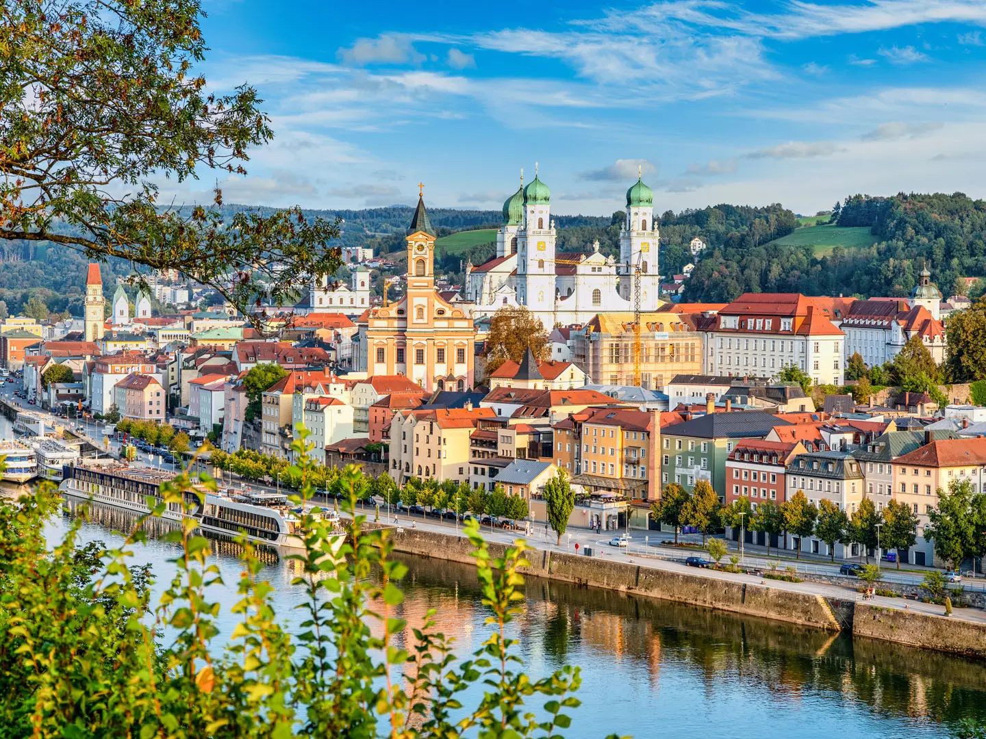
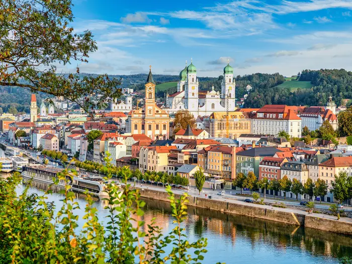
- Passau – City of Three Rivers: The Bavarian trailhead where the Danube is joined by the Inn and Ilz. Its baroque old town makes this one of the most distinctive starts on an Austrian long-distance route.
- Engelhartszell Trappist Abbey (Stift Engelszell): Austria’s only Trappist monastery, passed early on the route. It is known for monk-brewed beer, liqueurs and chocolate.
- Haugstein: At 842 m, this is the highest point of the Donausteig and is promoted as the trail’s 'roof'. It gives wide views over the Danube valley.
- Mauthausen Memorial: A former Nazi concentration camp site above the Danube near Mauthausen. It is a serious, reflective stop rather than a scenic highlight.
- Grein municipal theatre: Installed in the town’s former granary in 1791, it is Austria’s oldest surviving bourgeois secular theatre and stands near the eastern end of the trail.
Challenges to expect
The Donausteig is moderate, but it is not effortless riverbank walking. Most stages include 200–400 m of ascent, with some up to about 850 m, as the route climbs onto wooded ridges above the Danube. Stage lengths vary from roughly 10 to 30 km. Short narrow sections, including the Prinzensteig near Linz, need surefootedness. The route is waymarked downstream only, so Passau-to-Grein is the practical direction.
HikeList Score
Donausteig (Danube Trail) scored 89/100 on HikeList's trail-quality metrics.
See score breakdownHide breakdown
- Ideal length 73
- Balanced challenge 100
- Scenery & wildness 88
- Varied terrain 100
- Accommodation 91
- Food & support 88
- Path quality 92
- Season flexibility 89
Computed from length, challenge, scenery & wildness, terrain variety, accommodation, food & support, path quality and season flexibility.
 Austria
Show more data Show less
- Low Mountain
- River Valley
- Forest
- Riverside
- Forest Paths
- Gravel Tracks
- Farm Tracks
- Surfaced Lanes
- Narrow Trail
- Hotels
- Guesthouses
- Inns
- Family Friendly
- Pet Friendly
- Restrooms
- Water Sources
- Campsites
- Shelters
- Picnic Areas
Download Our Full Guide to Donausteig (Danube Trail) FREE!
Get our comprehensive guide to this hike for free. Save it for later reading or print out at home.
In these collections
Photos from hikers
Taken on the trail by people who've reviewed Donausteig (Danube Trail).
Donausteig (Danube Trail): The Complete Guide
 i
Image by Comofoto
i
Image by Comofoto The Donausteig is a long Danube walk with more bite than a riverside path suggests. From Passau, where the Inn and Ilz meet the Danube, it follows the river downstream through Bavaria and Upper Austria to Grein in the Strudengau.
This is a village-to-village route of wooded ridges, abbeys, river towns and high viewpoints rather than a flat tow-path. The classic images are the Schlögener Schlinge, Stift Engelszell, Stift Wilhering, Linz and the final Danube gorge country around Grein.
It suits walkers who want well-waymarked, non-alpine terrain with indoor accommodation and good valley transport, but still want a proper long-distance challenge. The north and south variants between Passau and Mauthausen mean the route choice needs to be made before booking beds.
What the Donausteig asks for is steady fitness and good planning over many consecutive days. Most stages climb away from the river onto low hills before dropping back to the next town, and a few narrow or steep sections need care.
This guide covers stages, day planning, accommodation, food, transport, terrain and the common mistakes to avoid.
Stage-by-Stage Guide
This stage guide follows the practical south-bank itinerary from Passau to Mauthausen, then the common onward section through Perg, Mitterkirchen im Machland and Grein. The official Donausteig network has 23 stages, plus north- and south-bank variants between Passau and Mauthausen, so exact daily distances, ferry links and accommodation stops should be checked against the current official map before booking.
The route is waymarked downstream from Passau towards Grein. It is not a flat riverside tow-path: expect repeated climbs from the Danube onto wooded ridges, farm tracks and viewpoint paths, with descents back to river villages.
Stage 1: Passau to Kasten an der Donau — approx. 23 km
The opening stage leaves Passau, the Dreiflüssestadt where the Inn and Ilz meet the Danube, and follows the south-route line downstream towards Kasten an der Donau. This is a proper long first day rather than a gentle promenade, with riverside sections balanced by climbing onto low hills above the valley.
Underfoot, expect the standard Donausteig mix: forest paths, gravel and farm tracks, surfaced lanes and village approaches. The first kilometres out of a city require attention to waymarking, especially because the Donausteig is signposted in the downstream direction only.
Passau is the last large service centre before the smaller Danube villages take over, so start with food, water and any pharmacy or gear errands already dealt with. Kasten an der Donau is a small end point; accommodation and evening meals should be arranged in advance, especially outside the busiest summer period.
Passau has excellent rail access via Passau Hauptbahnhof. Kasten has road access and valley transport links may be possible, but local bus, taxi or ferry arrangements should be checked before travelling.
The main planning warning is the route choice: this itinerary commits to the south route. Walkers choosing the north route instead head towards Obernzell and follow a different accommodation and transport pattern.
Stage 2: Kasten an der Donau to Engelhartszell — approx. 18 km
This stage continues through the wooded Danube-side hills towards Engelhartszell, with the river repeatedly dropping in and out of view. The walking remains moderate, but the climbs are enough to make it feel like a low-mountain trail rather than a riverside stroll.
The Haugstein, at 842 m, is the highest point of the Donausteig and lies on an optional or short detour high on the southern route between Passau and Engelhartszell. If included, it adds a more upland feel and gives wide views over the Sauwald and Danube valley; it should not be treated as an automatic part of every itinerary unless the day plan allows for it.
Engelhartszell is an important early stop because of Stift Engelszell, Austria’s only Trappist monastery. The village is also a logical overnight point, with indoor accommodation in the Danube settlement pattern typical of the route.
Carry enough food and water from Kasten unless a planned stop is certain. Transport options in this part of the valley can involve local buses, road transfers or river crossings, and seasonal ferry arrangements should be checked before relying on them.
Navigation is generally straightforward on the waymarked trail, but the Haugstein option requires particular attention: do not add it late in the day without confirming the return to the main line and the remaining distance to Engelhartszell.
Stage 3: Engelhartszell to Wesenufer — approx. 11 km
This is one of the shorter stages in the south-route plan and is useful after the longer first two days. It still follows the Donausteig’s normal rhythm of leaving and rejoining the Danube corridor, so do not assume the low distance means entirely flat walking.
Engelhartszell makes a good resupply point before departure, particularly if accommodation has provided breakfast or a packed lunch. Wesenufer is a small riverside end point, so book accommodation ahead and avoid arriving without a meal plan.
The terrain is a mix of valley paths, forest tracks, minor lanes and local approaches. In wet weather, forested sections can be muddy or slippery underfoot, while surfaced lanes may form part of the day.
Road access exists at both ends, and local public transport or taxi options along the Danube should be checked for the intended date. If a ferry is needed for a chosen variant or accommodation arrangement, operating dates and times should be verified before travelling.
The main navigation point is to stay with the south-route waymarking and not drift onto one of the shorter Donausteig circular loops. The loops are useful local walks but can add unwanted distance to a through-stage.
Stage 4: Wesenufer to Schlögen — approx. 14 km
This stage leads towards one of the Donausteig’s defining landscapes: the Schlögener Schlinge, where the Danube makes dramatic double bends through steep wooded hills. The distance is moderate, but the route is shaped by the terrain above the river rather than by a flat bank-side line.
The classic highlight is the viewpoint area associated with the Schlögener Blick / 4/4-Blick, giving the famous panorama over the Danube loop. Allow time for the viewpoint rather than treating this as a simple transfer stage.
Paths may include narrow woodland sections, gravel tracks, farm lanes and village approaches. After rain, take care on descents through forest, where leaves, roots and mud can make the walking slower than the distance suggests.
Food and water should be organised at Wesenufer and Schlögen, with little assumed between unless already checked. Schlögen has accommodation serving the river and hiking traffic, but the popularity of the Danube loop makes advance booking sensible.
Schlögen has road access and is a recognised Danube stop, but transport options vary by season and timetable. Any ferry or shuttle connection should be checked before travelling.
Stage 5: Schlögen to Aschach an der Donau — approx. 21 km
This is a longer and more substantial stage, leaving the Schlögener Schlinge area and continuing downstream to Aschach an der Donau. Expect a full walking day with repeated changes between higher ground and riverside settlement.
The first part of the day remains strongly influenced by the loop landscape, with some of the route’s best river panoramas around Schlögen. Later, the trail becomes a mixture of wooded slopes, tracks, lanes and approaches to the lower-valley market town of Aschach.
Aschach an der Donau is a historic Danube market town with a long riverfront and is one of the more established overnight stops on this section. It is a better place than smaller villages for accommodation choice, but bookings are still advisable on a long-distance itinerary.
Carry enough water and lunch from Schlögen unless intermediate services have been checked. On warm days, the combination of climbs, woodland humidity and surfaced lanes can make this stage feel longer than the map distance alone.
Road access is available at both ends, with regional valley transport possible but timetable-dependent. Navigation remains well waymarked, but pay attention where local riverside paths, cycle routes and Donausteig loops share parts of the same corridor.
Stage 6: Aschach an der Donau to Eferding — approx. 14 km
This shorter stage moves away from Aschach towards the Eferding area. It is a useful recovery day after the longer walk from Schlögen, although the Donausteig still uses a mix of lanes, tracks and low hills rather than staying entirely beside the river.
The character becomes more settled and agricultural in places, with village approaches and surfaced sections more likely than on the hillier Danube-loop stages. Forest and gravel tracks can still appear, so walking footwear remains preferable to casual shoes.
Aschach is the sensible place to start with supplies. Eferding is a significant nearby stage stop in the route plan, with accommodation and settlement services more likely than in the smallest riverside villages.
Public transport is generally better around larger valley settlements, but exact bus or rail links should be checked before using this as a section-hike access point. Road access at both ends makes taxi or shuttle arrangements realistic where public transport does not fit.
Navigation is normally straightforward, but this is the kind of lower-valley stage where multiple tracks, lanes and local paths can create small route-choice errors. Follow the Donausteig signs rather than the most obvious road or cycle line.
Stage 7: Eferding to Wilhering — approx. 16 km
This stage links the Eferding area with Wilhering, bringing the route closer to Linz while still keeping the Donausteig’s village-to-village feel. Expect a moderate walking day with mixed terrain and some surfaced sections.
Wilhering is an important landmark because of Stift Wilhering, the Cistercian abbey near Linz known for its Rococo abbey church. It is also a practical overnight stop before entering the largest city on the trail.
Food and water are best arranged at the start and end of the day. Between the larger settlements, do not rely on finding open cafés or shops without checking current opening hours.
Wilhering has road access and lies close enough to Linz for onward transport and taxi options to be more realistic than in the remoter Danube sections. Public transport connections should still be checked against the day of the week and season.
As the route approaches the urban fringe, watch for junctions where local walking routes, lanes and access roads meet. The Donausteig is well signed, but small mistakes are easiest where the walking feels least remote.
Stage 8: Wilhering to Linz — approx. 12 km
This is a short approach stage into Linz, the main city and one of the best break points on the Donausteig. The day is not simply urban walking: the trail still uses hillside and woodland terrain on the way into the city.
Near Linz, some short narrow sections such as the Prinzensteig require surefootedness. These are not alpine passages, but they deserve care in wet weather or with a heavy pack.
Stift Wilhering is the key cultural landmark at the start of this stage, while Linz provides the full range of city services at the end. This is the place to deal with laundry, restocking, replacement gear, onward rail connections and any itinerary changes.
Accommodation choice is far broader in Linz than in the small Danube villages. Even so, booking ahead is sensible if the stage falls during a busy city weekend or event period.
Linz Hauptbahnhof is a major rail hub on the Munich/Vienna line, making this the easiest place to start, stop or split the trail. Navigation into a city requires more attention than the distance suggests: keep following the Donausteig signs and do not assume riverside roads or cycle paths are the walking route.
Stage 9: Linz to Enns — approx. 22 km
Leaving Linz, this stage takes the south-route line towards Enns and Lorch. It is a longer day after the short approach into the city, with urban edges gradually giving way to the next run of Danube settlements.
The terrain is mixed: surfaced lanes and urban-fringe paths are likely near Linz, while tracks, field edges, woodland and village links make up the rest of the day. The walking remains moderate, but the distance means an early start is wise if services or accommodation check-in times are fixed.
Linz is the last major service centre before several smaller stages, so leave with lunch, water and any supplies needed for the next day. Enns is a recognised stage end on the south route and has accommodation options, but book ahead as part of the through-walk schedule.
Public transport is strongest at Linz and generally better around Enns than in the smaller riverside villages. Exact train or bus options for section walking should be checked before travelling.
Navigation out of Linz is the main challenge. Follow the downstream Donausteig waymarks carefully through the transition from city to countryside, and make sure the chosen route is the south line towards Enns rather than the north-bank option via Steyregg.
Stage 10: Enns to Mauthausen — approx. 10 km
This is a short linking stage from Enns to Mauthausen, where the north and south route system comes back together near the Danube. Its short distance makes it a practical half day, but do not treat logistics casually because river crossing arrangements may affect the plan.
The terrain is less demanding than the longer hill stages, with a mix of lanes, tracks and settlement approaches. Depending on the exact route and accommodation choice, the Danube crossing or local transfer arrangements need to be understood in advance.
Mauthausen requires a different tone from the scenic stages. The Mauthausen Memorial, the former Nazi concentration camp memorial site on the hill above the Danube, is a serious place of remembrance rather than a sightseeing viewpoint; allow appropriate time and respect if visiting.
Food and water can be arranged at Enns and Mauthausen, but opening hours should still be checked if walking on a public holiday or arriving late. Accommodation is available in the wider Danube settlement network, with advance booking recommended.
Public transport, local buses, ferries and taxis may all be relevant around this short stage. Small Danube ferries are seasonal, so operating dates and times should be checked before relying on a crossing to reach Mauthausen or onward accommodation.
Stage 11: Mauthausen to Perg — approx. 16 km
From Mauthausen the Donausteig continues east into the common section beyond the north/south split. The stage towards Perg moves away from the immediate river corridor in places and returns to the route’s pattern of low hills, tracks and settlement links.
Expect a moderate day on forest paths, gravel or farm tracks, surfaced lanes and local approaches. The walking is not technical, but the cumulative ascent and descent over successive stages remains the main physical demand.
Mauthausen is the sensible place to start with supplies, especially if the day includes a visit to the memorial before walking. Perg is the overnight target and should have accommodation options in the broader Donausteig host network, but availability should be checked before fixing the itinerary.
Road access is available at both ends, and local transport links in the Danube region can support section hiking. Timetables and any transfer between the river and inland accommodation should be checked before travelling.
Navigation is usually uncomplicated, but it is important after Mauthausen to follow the onward Donausteig line rather than accidentally returning towards a bank variant or local loop. The waymarking is one-directional downstream, so walking this stage in reverse is less convenient.
Stage 12: Perg to Mitterkirchen im Machland — approx. 12 km
This is a shorter stage from Perg to Mitterkirchen im Machland. It gives a useful reduction in distance before the final approach to Grein and the Strudengau district.
The walking is moderate and likely to feel more open and settled than the steeper wooded sections near the Danube loops. Expect a practical mix of tracks, lanes and paths rather than continuous riverside walking.
Food and water should be sorted in Perg before departure. Mitterkirchen im Machland is a smaller stage end, so accommodation, dinner and breakfast arrangements should be made ahead rather than left to arrival.
Public transport or taxi support may be possible in the wider valley, but this should be checked before using Mitterkirchen as a start or finish point. Road access makes pre-booked transfers easier than relying on spontaneous options.
Navigation is mainly about staying with the Donausteig through agricultural and village terrain, where several minor roads and tracks may look equally plausible. Mud can be an issue on unsurfaced paths after rain.
Stage 13: Mitterkirchen im Machland to Grein — approx. 16 km
This stage brings the main through-walk to Grein, the official finish of the Donausteig and the gateway to the Strudengau character at the eastern end of the route. It is a moderate final-day distance for walkers finishing in Grein, with enough terrain variation to remain a proper walking stage.
Grein is one of the most rewarding end points on the route, with the Greinburg above the town and Stadttheater Grein, the historic 1791 town theatre. The town lies on the Danube at about 218 m, far below the Haugstein high point reached earlier on the south route.
Carry food and water from Mitterkirchen unless intermediate services have been checked. Grein has more visitor infrastructure than the smallest villages, but accommodation should still be booked ahead, especially if arriving at the end of a multi-day package or during the main April-to-October hiking season.
The main transport warning is important: Grein has no railway station of its own. Finish-day transfers generally use stations across the river or farther down the line, such as the Sarmingstein or Amstetten area, and this should be planned before travelling.
Navigation into Grein is straightforward if following the downstream waymarks, but check the final approach and accommodation location in advance. If continuing to Sarmingstein and Waldhausen, treat Grein as both a finish town and a junction into the Strudengau add-on stages.
Stage 14: Grein to Sarmingstein — approx. 18 km
Although Grein is the official finish of the Donausteig, many itineraries continue through the eastern Strudengau stages around Grein, Sarmingstein and Waldhausen. This stage should therefore be planned as an extension or local finishing arrangement rather than assumed to be part of every end-to-end schedule.
The Strudengau is a narrower Danube gorge district, historically known as a difficult river passage, and the walking reflects the tighter valley landscape. Expect forest paths, tracks, lanes and viewpoints rather than a flat riverside walk.
Grein is the best place to start fully supplied. Sarmingstein is a smaller end point, so accommodation and meals should be booked or checked before committing to the day.
Transport planning matters here because walkers may be finishing, extending or transferring back from the end of the trail. Grein has no railway station of its own, while Sarmingstein is specifically relevant to finish-day transfer planning; exact rail, bus, ferry or taxi options should be checked before travelling.
Navigation should be checked carefully around Grein, where through-route, local Strudengau stages and circular options can overlap. Do not assume that every waymarked local loop continues the long-distance line.
Stage 15: Sarmingstein to Waldhausen im Strudengau — approx. 13 km
The final listed stage in this practical plan continues from Sarmingstein to Waldhausen im Strudengau. Like the previous day, it belongs to the loop-like eastern Strudengau district around the official Grein finish, so the exact use of this stage varies by itinerary.
The stage is shorter but still uses low-mountain terrain, with woodland, tracks, lanes and village approaches. The Stillensteinklamm ravine is one of the notable Strudengau features associated with this eastern end of the Donausteig, and conditions in shaded or wooded sections can be damp after rain.
Food and water should be carried from Sarmingstein unless services have been checked in advance. Waldhausen im Strudengau is a smaller end point, so accommodation and onward transport should not be left open.
Road access and local transport may be available, but the onward plan from Waldhausen needs arranging before arrival. If this is the true end of the walking itinerary, confirm the transfer to the relevant rail or bus connection before travelling.
The main warning is logistical rather than technical: the official point-to-point trail finishes at Grein, while these eastern stages can be arranged in different ways. Check the current official map, the chosen accommodation sequence and any necessary transfers before booking the final nights.
Recommended Itinerary
A realistic Donausteig schedule is built around the official 23-stage structure and usually takes about 21 days end to end. The table below gives a practical south-route itinerary from Passau towards Grein, using the stage towns and approximate distances most useful for booking accommodation and planning daily effort.
This plan follows the Südroute between Passau and Mauthausen, then the common eastern section towards Grein and the Strudengau finish area. If choosing the Nordroute through the Mühlviertel instead, do not mix stages casually: accommodation, ferries and daily distances need checking against the official map before booking.
Standard itinerary — south route via Engelhartszell, Schlögen, Linz and Mauthausen
| Day | From | To | Approx. distance | Why this stage makes sense | Services/accommodation notes |
|---|---|---|---|---|---|
| 1 | Passau | Kasten an der Donau | 23 km | A solid first day out of Passau, following the downstream waymarking onto the south-route line. It is long enough to leave the city behind without overcommitting on day one. | Passau is the best place to arrive by rail and stock up before starting. Book the first night at Kasten an der Donau in advance, as smaller Danube villages have fewer beds than the larger towns. |
| 2 | Kasten an der Donau | Engelhartszell | 18 km | A moderate day into one of the key early stops, with Stift Engelszell at Engelhartszell giving the stage a clear objective. The Haugstein, the Donausteig’s 842 m high point, sits on the southern route in this wider section and is best treated as an optional detour only if time and legs allow. | Engelhartszell is a logical overnight village with visitor services linked to the monastery and the Danube. Check exact routing and any detour timing before committing to the Haugstein. |
| 3 | Engelhartszell | Wesenufer | 11 km | A deliberately short recovery-style stage after the first two longer days. It also gives flexibility if the previous day was extended by viewpoints or the Haugstein detour. | Wesenufer is a smaller riverside stop, so accommodation should be reserved rather than left to chance. This is a useful day for a later start or extra time around Engelhartszell. |
| 4 | Wesenufer | Schlögen | 14 km | A manageable approach to the Schlögener Schlinge, one of the defining landscapes of the route. Keeping the day short leaves time for the classic viewpoints around the Danube loop. | Schlögen is a popular stop because of the river bend and viewpoints. Book early in peak walking season, especially if travelling with luggage transfer. |
| 5 | Schlögen | Aschach an der Donau | 21 km | This is a fuller walking day after the scenic concentration around Schlögen, continuing downstream to a larger historic Danube market town. The distance is sensible for walkers who are now into the rhythm of the trail. | Aschach an der Donau has more of the feel of a service town than the smaller river villages. It is a good place to reset, buy supplies and check onward ferry or transport details if needed. |
| 6 | Aschach an der Donau | Eferding | 14 km | A shorter stage that eases the transition away from the tight river scenery towards the lower valley and the approach to Linz. It works well after the longer day from Schlögen. | Eferding is noted as near the route rather than directly defined as a riverside trailhead, so check the exact accommodation location against the official mapping before booking. |
| 7 | Eferding | Wilhering | 16 km | A moderate day setting up a short final approach into Linz. Stift Wilhering is the natural focus near the end of the stage. | Wilhering is useful because it avoids making the approach to Linz unnecessarily long. Accommodation in or around Wilhering should be checked carefully, as some walkers may prefer to continue by local transport into Linz depending on availability. |
| 8 | Wilhering | Linz | 12 km | A short stage into the main city on the route. This is the best point for a rest afternoon, laundry, resupply or joining/leaving the trail by rail. | Linz Hauptbahnhof is a major rail hub and the most convenient mid-route break point. It is also the easiest place on this itinerary to add a rest day without complicating logistics. |
| 9 | Linz | Enns | 22 km | A longer city-to-town stage continuing east from Linz on the south-route/common-line progression. Some short narrow sections near Linz, including the Prinzensteig, require surefootedness. | Enns / Lorch gives a practical overnight after leaving the Linz area. Start with enough food and water for the day, as urban-edge walking can be less predictable for trailside services than a map suggests. |
| 10 | Enns | Mauthausen | 10 km | A short day into the point where the north and south route lines rejoin near Mauthausen. The shorter distance is useful if visiting the Mauthausen Memorial, which should be treated as a serious memorial site rather than a casual sightseeing stop. | Mauthausen is an important logistical junction on the route. Any river crossing or ferry needed for the exact line into town should be checked before travelling, as small Danube ferries can be seasonal. |
| 11 | Mauthausen | Perg | 16 km | A moderate stage after the emotional and logistical weight of Mauthausen. It moves the itinerary away from the route junction and into the eastern section towards the Machland and Strudengau. | Perg is a sensible overnight with town services. It is a good place to confirm the next two shorter stages and the final approach to Grein. |
| 12 | Perg | Mitterkirchen im Machland | 12 km | A shorter day across the Machland area, keeping the itinerary comfortable before the approach to Grein. This distance also helps if accommodation availability requires a later start or slight adjustment. | Mitterkirchen im Machland is a smaller stop, so book accommodation ahead. If no suitable bed is available, use local transport or taxi options only after checking current services. |
| 13 | Mitterkirchen im Machland | Grein | 16 km | A well-sized final approach to the official finish town of Grein, the main Strudengau destination on the Donausteig. Arriving with time in hand allows for Greinburg and Stadttheater Grein if opening times fit. | Grein has no railway station of its own, so the onward transfer must be planned before arrival. Nearby rail access is across the river or down the line, including the Sarmingstein / Amstetten area; this should be checked before travelling. |
| 14 | Grein | Sarmingstein | 18 km | This extends the itinerary into the Strudengau finish district, where many schedules include additional walking around Grein, Sarmingstein and nearby valleys. Treat it as an add-on if Grein is already the chosen finish. | Sarmingstein is useful for walkers continuing beyond the official finish-town stop. Confirm whether this night is needed before booking, as some itineraries finish in Grein instead. |
| 15 | Sarmingstein | Waldhausen im Strudengau | 13 km | A shorter final Strudengau stage, useful for itineraries that include the Grein–Sarmingstein–Waldhausen district rather than stopping at Grein. The exact end arrangement varies by package and map choice. | Waldhausen im Strudengau should be booked only after deciding whether the route will finish at Grein or include this additional district stage. Finish-day transport should be checked before travelling. |
Slower variant
The slower approach is best for walkers who want shorter days, more time at viewpoints, or a less compressed schedule through the low-mountain sections above the Danube. Use the official 23-stage structure as the planning framework and allow around 21 walking days rather than trying to force the route into a compact schedule.
Good places to add time are Linz, Schlögen and Grein. Linz is the strongest rest-day option because it has major rail access and the best urban services on the route; Schlögen rewards extra time for the Schlögener Schlinge viewpoints; Grein is useful for sorting onward transport because the town itself has no railway station.
This variant also suits anyone using small Danube ferries, because ferry operating dates and times can affect the day’s rhythm. Seasonal ferry details should be checked before travelling.
Faster variant
A faster schedule suits fit walkers who are comfortable with repeated 20–30 km days and do not mind reducing time for monasteries, viewpoints and town stops. It is not the best choice for a first multi-week hike, because the Donausteig’s difficulty comes from cumulative ascent rather than technical ground.
The most obvious consolidations are the shorter paired stages, such as Engelhartszell–Wesenufer and Wesenufer–Schlögen, or Enns–Mauthausen and Mauthausen–Perg. Perg–Mitterkirchen im Machland and Mitterkirchen im Machland–Grein can also be combined by strong walkers, but only if accommodation and transport at the end of the longer day are secure.
Do not build a faster itinerary by assuming the route is a flat Danube tow-path. Many stages climb onto wooded ridges and plateaus above the river, and some short narrow sections require care.
Planning the Route
How many days to allow
Allow around three weeks for an end-to-end Donausteig itinerary. The official network is divided into 23 stages, while many practical itineraries are adjusted to about 21 walking days depending on the chosen bank, accommodation availability and how the final Strudengau section around Grein is arranged.
This is not a route to compress too aggressively. Individual stages are often moderate in distance, but the repeated climbs from the Danube to ridges, plateaus and viewpoints make back-to-back days more tiring than the map profile can suggest. A fast schedule also leaves little flexibility for ferry timings, city logistics in Linz, or a reflective visit to the Mauthausen Memorial.
A slower schedule works well if time allows. Shorter days are especially useful through the Schlögener Schlinge area, around Linz, and in the Strudengau, where viewpoints, abbeys, towns and transport connections can shape the day as much as distance.
Choose the north or south route before booking
The key planning decision is the split between Passau and Mauthausen. The Donausteig uses both banks of the Danube, with a Nordroute and a Südroute that rejoin near Mauthausen, so accommodation, ferries and daily logistics differ depending on the line chosen.
Most self-guided walkers use the south-side line via Kasten an der Donau, Engelhartszell, Wesenufer, Schlögen, Aschach an der Donau, Wilhering, Linz and Enns before Mauthausen. This is also the practical line reflected in many end-to-end itineraries and includes access to the Haugstein area, the highest point of the Donausteig, as an optional or short detour.
The north-side alternative runs through the hillier Mühlviertel via places such as Obernzell, Niederranna, Obermühl, St. Martin im Mühlkreis, Eferding, Wilhering, Linz and Steyregg. It is a valid Donausteig route rather than a minor variation, so do not mix north- and south-bank bookings casually without checking crossing points.
Seasonal Danube ferries can be part of stage logistics, including small cable or bicycle ferries. Their operating dates and times should be checked before travelling, especially if a stage depends on crossing the river to reach accommodation or onward transport.
Let the stage towns shape the itinerary
Daily stages are naturally dictated by river towns, villages and accommodation rather than by wild-camping opportunities. Hotels, Gasthöfe, inns and Donausteig-Wirte hosts are the normal overnight pattern, with campsites only in some places and less useful for a simple end-to-end schedule.
Book the route as a chain of overnight stops, then fine-tune daily distances around ferry links and public transport. The stage towns are close enough in places to create short days, but there are also longer or hillier days where splitting the stage may depend on whether suitable accommodation is available.
Linz is the obvious rest, resupply or restart point. It is the largest city on the route, a major rail hub, and a practical place to pause the walk, replace gear, or split the Donausteig into western and eastern sections.
The final Strudengau section needs particular attention. Grein is the official finish, but itineraries around Grein, Sarmingstein and Waldhausen im Strudengau can be arranged differently, and Grein has no railway station of its own. Finish-day transport should be planned before accommodation is fixed.
Shortening, extending and section hiking
The Donausteig is very suitable for section hiking. Passau and Linz are major rail hubs, and regional trains, local buses, ferries, shuttle services and taxis link many Danube-valley stage towns.
The easiest shortened version is to walk a continuous part of the main line rather than trying to sample isolated viewpoints. Passau to Linz, Linz to Mauthausen, and Mauthausen to Grein all make more practical blocks than repeatedly transferring between small villages.
It is also easy to extend walking time without extending the through-route. The Donausteig network includes about 40–49 shorter circular Donausteig loops, which can be added from selected start, rest and viewing points if a base day or extra night is planned.
Walking both the north and south routes between Passau and Mauthausen is possible only as an extended itinerary, not as the normal point-to-point route. Anyone wanting to cover both banks should treat it as a bespoke plan with additional nights, crossings and transport checks.
What matters most in planning
| Planning item | Why it matters on the Donausteig |
|---|---|
| Route variant | Choose the Nordroute or Südroute between Passau and Mauthausen before booking accommodation. The Haugstein is on the southern route only. |
| Accommodation | Overnight stops are mostly in towns, villages, inns and Gasthöfe. Availability can determine whether a stage is short, standard or long. |
| Ferries and crossings | Some stage links rely on Danube crossings, including seasonal small ferries. Timetables should be checked before travelling. |
| Transport | Passau and Linz are straightforward by rail, but Grein needs advance planning because it has no railway station of its own. |
| Navigation | The trail is well signposted downstream from Passau to Grein, but it is signposted in one direction only. Carry a map or GPX, especially where variants, loops and ferry crossings intersect. |
| Food and water | This is not a wilderness route, but services are not continuous on ridge and forest sections. Carry enough water and food for the full day between planned stops. |
| Weather and underfoot conditions | Rain can make steep or narrow sections slower, including places such as the Prinzensteig near Linz. In warm weather, surfaced lanes and open farmland can feel hotter than the river-valley setting suggests. |
| Permits | Permit planning is not the main constraint on this route; accommodation, transport and ferry logistics matter far more. This should be checked before travelling. |
Navigation approach
The Donausteig is strongly waymarked, with a large signed network of main-route stages, start points, rest points, viewing points and circular loops. That makes it relatively easy to follow in the intended downstream direction from Passau to Grein.
Do not rely on waymarking alone when booking or modifying stages. The north/south split, optional loops, river crossings and the loop-like arrangement near the Strudengau finish all make it important to carry the official map or a reliable GPX track for the exact itinerary being walked.
Walking the route in reverse is less straightforward because the main waymarking is designed downstream only. A reverse itinerary should be treated as a navigation-led plan rather than a simple reversal of the standard stages.
Luggage and support
The Donausteig suits inn-to-inn walking with light daypacks. Luggage transfer is available through providers such as ÖBB door-to-door and Suitcase Butler, and many self-guided packages are built around hotel-to-hotel baggage movement.
Independent walkers should still check that each overnight stop fits the chosen bank and stage order. A baggage service does not remove the need to plan ferries, taxis or end-of-stage transfers, particularly around Mauthausen and the Grein finish.
Towns, Villages and Overnight Stops
Accommodation planning on the Donausteig is strongly affected by the north/south route choice between Passau and Mauthausen. The practical south-route sequence uses Kasten an der Donau, Engelhartszell, Wesenufer, Schlögen, Aschach an der Donau, Eferding, Wilhering and Linz before the common onward section; the north route uses different hill-country stops, including Obernzell and Steyregg.
Most end-to-end walkers use hotels, Gasthöfe and inns rather than camping. The Donausteig-Wirte network is useful when choosing walker-friendly overnight stops, but opening days, dinner service and luggage-transfer arrangements should be checked before booking, especially in smaller villages.
Passau
Passau is the main western trailhead and the easiest place to start without a car. Passau Hauptbahnhof is a major rail hub on the Munich/Vienna line, making it the best place on the route for arrival logistics, last-minute supplies and a buffer night before setting off.
Accommodation choice is wider here than in the small Danube villages, so it suits both a pre-hike overnight and a rest day if travelling a long way to reach the trail. Food, cafés and shops are not usually the limiting factor in Passau; the main planning task is choosing the correct waymarked line out of the city and committing to the north or south route.
The Donausteig is signposted downstream from Passau towards Grein. It is waymarked in one direction only, so anyone walking sections in reverse should carry reliable mapping rather than relying solely on sign orientation.
Obernzell
Obernzell is an early stop on the north-route option out of Passau. It is relevant only if choosing the north-bank/Mühlviertel line rather than the more commonly packaged south route.
As a smaller Danube-side settlement, it is best treated as a pre-booked overnight rather than a place to arrive speculatively. Accommodation and dinner availability should be checked before travelling, particularly outside the busiest summer period.
Transport along the Danube valley is generally possible by a mix of regional services, buses, ferries, taxis and shuttles, but exact links for an Obernzell-based itinerary depend on the chosen stage plan. This should be checked before travelling.
Kasten an der Donau
Kasten an der Donau is the first practical overnight on the south-route itinerary after Passau, reached on a stage of about 23 km. It is a useful stop because it breaks the initial Passau-to-Engelhartszell section into manageable days and keeps the walker on the south-bank line.
Expect a small-village overnight rather than city-level services. Book accommodation ahead, confirm whether an evening meal is available at the property or nearby, and do not rely on extensive shop options after arrival.
This is also a good point to re-check the next day’s route towards Engelhartszell and any optional high-level choices in the Sauwald area. The Haugstein, the Donausteig’s 842 m roof, lies on the southern route between Passau and Engelhartszell as an optional or short detour.
Engelhartszell
Engelhartszell is one of the more important early south-route stops and sits by Stift Engelszell, Austria’s only Trappist monastery. It works well as an overnight because it follows naturally from Kasten an der Donau and precedes the shorter stage to Wesenufer.
Accommodation should still be booked ahead, but Engelhartszell is more than just a trail waypoint. Food and drink are tied to the village and its visitor infrastructure, though opening hours can vary and should be checked before relying on a specific lunch or dinner stop.
The monastery is a worthwhile local visit if timing allows, but walkers should prioritise the logistics of the following short river-valley stage. This part of the trail is still not a flat tow-path; the Donausteig repeatedly climbs away from the Danube.
Wesenufer
Wesenufer is a small Danube settlement and a practical overnight between Engelhartszell and Schlögen. The stage into Wesenufer is short in the south-route plan, so it can be useful after a hillier or more demanding previous day.
Treat Wesenufer as a booking-dependent stop. Confirm accommodation, dinner and breakfast arrangements in advance, and carry any day snacks needed for the next stage rather than assuming broad shop provision.
Its value is mainly logistical: it keeps daily distances sensible before the approach to the Schlögener Schlinge. If using luggage transfer, make sure the provider recognises the exact accommodation and stage order.
Schlögen
Schlögen is one of the key overnight stops on the Donausteig because it sits at the Schlögener Schlinge, the famous double bend in the Danube. It is a strong place to stop if the itinerary allows time for the Schlögener Blick or 4/4-Blick viewpoint.
Accommodation can be in demand because this is one of the trail’s signature locations. Book early in the main hiking season and confirm evening meal options, especially if arriving late after a viewpoint detour.
Local movement around the river bends can involve ferries or seasonal links depending on the exact stage and bank choice. Ferry times and operating dates should be checked before travelling.
Aschach an der Donau
Aschach an der Donau is a historic Danube market town and a typical overnight after the Schlögen section. It is a useful stop because it offers a more substantial riverside base after several smaller settlements.
It should generally be easier to plan food and accommodation here than in the smallest villages, but booking remains sensible on a long-distance itinerary. Confirm dinner arrangements and any luggage-transfer handover details before committing to the next stage.
Aschach also works as a practical break point for walkers section-hiking the western half of the Donausteig. Ongoing transport should still be planned around current regional services rather than assumed on arrival.
Eferding
Eferding is used on the practical south-route itinerary as the next overnight after Aschach an der Donau, with the route passing near or into the town depending on the stage alignment. It is a useful service stop before the approach to Wilhering and Linz.
As a town stop, Eferding is a better place to plan resupply and indoor accommodation than the smaller Danube hamlets. Exact shop, café and restaurant opening hours should still be checked before travelling, particularly on Sundays and public holidays.
Eferding is also relevant to route choice because the north-route description includes the Eferding/Wilhering/Linz corridor. Make sure accommodation bookings match the selected variant and not simply the nearest place with the same stage name.
Wilhering
Wilhering is the natural overnight before Linz on the south-route itinerary and is associated with Stift Wilhering, the Cistercian abbey near the Danube. It is a short final approach from here into the city, making it a useful quieter stop before the main urban section.
Accommodation should be arranged in advance, especially if aiming to stay close to the trail rather than commuting from Linz. Food options and evening service should be checked before booking.
Wilhering is close enough to Linz that some walkers may choose to continue or use transport depending on itinerary and availability. This should be checked before travelling, as the best choice depends on current services and the booked overnight.
Ottensheim
Ottensheim lies on the Danube west of Linz and is one of the places to note when planning the approach to the city. It can be useful as a service or overnight alternative if Wilhering or Linz accommodation does not fit the itinerary.
Because the stage plan uses Wilhering to Linz, Ottensheim is best treated as a flexible nearby stop rather than an assumed stage end. Check exactly how it connects with the chosen Donausteig line and any river crossing needed before booking.
Food, accommodation and transport details should be confirmed in advance. This should be checked before travelling.
Linz
Linz is the main city on the Donausteig and the strongest mid-route logistics hub. Linz Hauptbahnhof is a major rail hub on the Munich/Vienna line, making the city the best place for joining, leaving, taking a rest day or replacing gear.
Accommodation choice is much wider than in the villages, from standard hotels to more central city stays. It is the easiest place on the trail to handle laundry, resupply, onward transport and itinerary changes.
The trail through and near Linz includes some narrower or more careful walking sections, including the Prinzensteig. Do not treat the approach to Linz as purely urban strolling; keep normal hiking footwear and mapping to hand.
Steyregg
Steyregg belongs to the north-route option after Linz and is relevant if walking the alternative line before the routes rejoin near Mauthausen. It is not part of the south-route day plan that goes from Linz to Enns.
Use Steyregg only if the accommodation plan, luggage transfer and maps are aligned with the north-bank variant. Mixing a south-route stage list with a north-route booking can create awkward river crossings and transport gaps.
Accommodation, food and public-transport details should be checked before travelling. Seasonal or local links around the Danube should not be assumed without checking current timetables.
Enns / Lorch
Enns and Lorch form the practical south-route overnight after Linz in the itinerary. This is a useful stop before the shorter stage towards Mauthausen.
As a town-based stop, Enns is more practical for accommodation and food than the smaller riverside villages. Even so, book ahead and confirm arrival times if using luggage transfer or if the day from Linz is likely to run late.
This is also a good place to decide how much time to allow the next day around Mauthausen. The Mauthausen Memorial is a serious Holocaust memorial site, not a scenic diversion, and it requires a different pace and tone from ordinary sightseeing.
Mauthausen
Mauthausen is one of the most important route-planning points because the north and south Donausteig variants rejoin near here. It is also the gateway to the common onward section towards Perg, Mitterkirchen im Machland and Grein.
The town works well as an overnight or itinerary reset point after the variant section. Book accommodation ahead and confirm food options, especially if arriving via a ferry or local transfer.
Small Danube ferries, including cable or bicycle ferries, may be part of stage links around this section; these can be seasonal. Operating dates and times should be checked before travelling.
The Mauthausen Memorial lies on the hill above the Danube near the town. If visiting, allow time and approach it respectfully as a memorial and place of historical responsibility.
Perg
Perg is the next practical overnight after Mauthausen on the common eastern section. It is useful because it breaks the route towards the Machland and Grein into manageable stages.
As an inland/town stop rather than a tiny riverside hamlet, Perg is a sensible place to look for accommodation and services. Exact availability, food opening hours and any luggage-transfer arrangements should still be confirmed before booking.
Perg can also serve as a section-hike access point for the eastern Donausteig, depending on current regional transport. This should be checked before travelling.
Mitterkirchen im Machland
Mitterkirchen im Machland is a practical overnight between Perg and Grein. It keeps the common eastern section at comfortable daily distances and is part of the approach towards the Strudengau.
This is a smaller stop, so pre-booking matters. Confirm whether dinner is available locally or at the accommodation, and carry any snacks needed for the next day rather than assuming extensive shops.
The following stage towards Grein enters the final part of the Donausteig experience, where some itineraries then continue around the Strudengau with Sarmingstein and Waldhausen im Strudengau. Decide before booking whether Grein is the finish or whether the extra eastern stages are included.
Bad Kreuzen
Bad Kreuzen is listed as a near-route place in the eastern section before Grein. It is not a default overnight in the south-route day plan, but it may be relevant for itineraries using additional Strudengau or hill-country stages.
Treat it as a deliberate accommodation choice rather than an automatic trail halt. Check the exact route alignment, walking distance from the Donausteig line, transport options and meal availability before booking.
This should be checked before travelling.
Klam / Burg Clam
Klam and Burg Clam are near-route points in the eastern approach to Grein. They may appeal to walkers adjusting the final stages or using local variants, but they are not shown as a standard overnight in the practical south-route day plan.
Use them only if the day’s distance, accommodation and transport have been planned precisely. Do not assume that a nearby castle or village automatically sits on the main waymarked line for the chosen itinerary.
Accommodation and food details should be checked before travelling.
Grein
Grein is the official finish of the Donausteig and the key overnight at the eastern end of the main route. It is a natural place to book a final night, particularly if planning to visit the Greinburg or Stadttheater Grein after completing the walk.
Accommodation should be booked ahead in the hiking season, as Grein is both a trail finish and a Strudengau destination. Food and evening arrangements should be straightforward compared with smaller villages, but opening days and arrival times should still be confirmed.
Grein has no railway station of its own. Finish-day transport needs advance planning, with onward connections typically involving nearby stations across the river or down the line, such as options in the Sarmingstein/Amstetten area. This should be checked before travelling.
Sarmingstein
Sarmingstein is part of the eastern Strudengau stage area beyond or around Grein, depending on the itinerary. Some walkers use it as part of the Grein-Sarmingstein-Waldhausen arrangement rather than treating Grein as the immediate end of walking.
It can be useful for final-stage logistics and onward transport planning, especially because Grein itself has no railway station. Current connections in the Sarmingstein/Amstetten area should be checked before relying on them.
Accommodation and meal availability should be confirmed before travelling. This is a place where exact itinerary design matters, because the final Donausteig stages can feel more loop-like than a simple point-to-point finish.
Waldhausen im Strudengau
Waldhausen im Strudengau is associated with the eastern Strudengau stages around the finish of the Donausteig. In the plan it follows Sarmingstein, but many walkers will adjust the final days depending on whether they finish in Grein or include the wider district.
It is best planned as a booked overnight or day-stage target, not an improvised add-on after reaching Grein. Confirm the exact route, accommodation, food and return transport before committing to this extension.
For walkers whose main objective is the Passau-to-Grein traverse, Grein is the official finish. Waldhausen im Strudengau is useful when the itinerary deliberately includes the additional eastern Strudengau stages.
Getting to the Start
By train
Passau Hauptbahnhof is the practical trailhead station for the Donausteig. Passau is a major rail stop on the Munich–Vienna corridor, making it the simplest starting point for most walkers arriving from elsewhere in Germany, Austria or beyond.
From the station, allow time to get from the rail area to your accommodation or to the signposted start in Passau. The trail is waymarked downstream from Passau towards Grein, so starting in the correct direction matters; the Donausteig is not waymarked as a two-way route.
If travelling via Linz, connections onward to Passau are straightforward in principle because both cities sit on the main rail corridor. Exact services, journey times and seat reservations should be checked before travelling.
By bus
Bus is usually a secondary option for reaching the start. Local and regional buses serve towns along the Danube valley, but Passau’s rail access is stronger and more reliable for a long-distance start.
If using a bus to reach Passau from a nearby village, hotel or airport rail hub, check the current timetable carefully, especially for evening arrivals, weekends and public holidays. This should be checked before travelling.
By car
Driving to Passau is possible, but it is not the neatest option for an end-to-end walk. The Donausteig is a point-to-point trail finishing in Grein, and Grein has no railway station of its own, so returning to a car left in Passau needs extra planning.
If leaving a vehicle in Passau, arrange long-stay parking in advance through your accommodation or a suitable public car park. Parking rules, maximum stay periods and charges can change, so this should be checked before travelling.
For many walkers, train to Passau and a pre-planned transfer from Grein at the end is simpler than managing a car shuttle. Taxi or shuttle services can help with awkward transfers, but they should be booked ahead rather than assumed on the day.
From the nearest airport
Passau is best treated as a rail-access trailhead rather than an airport-transfer trailhead. If arriving by air, choose an airport with good onward rail links to the Munich–Vienna main line, then continue by train to Passau Hauptbahnhof.
Do not book a tight same-day first stage after a flight unless the rail connection is robust. Flight delays, cross-border rail changes and the need to reach your accommodation can easily make a 20 km-plus first day unrealistic.
Current airport-to-rail connections and onward train times should be checked before travelling.
Where to stay before starting
Staying in Passau the night before starting is the most sensible option. It gives time to arrive by train, buy food or cash if needed, check the first stage details and begin walking the next morning without transport pressure.
Accommodation is available in the city in the usual mix of hotels and guesthouses. For a walking start, choose somewhere either near Passau Hauptbahnhof or within easy reach of the old town and the signed route out of the city.
The first south-route stage commonly heads from Passau to Kasten an der Donau, so an early start is useful. Before leaving Passau, check the north/south route choice, any planned Danube ferry use on later stages, and the current official map for the exact line out of the city.
Getting Home from the Finish
Grein is a smaller Danube town and does not have a railway station of its own, so the finish requires more planning than the start in Passau. Build the final transfer into the itinerary before booking the last night, especially if finishing late, walking an eastern Strudengau variant, or relying on weekend/holiday public transport.
By train
The key point is that the train does not leave directly from Grein. The nearest rail access is across the river or further along the line, with Sarmingstein and the Amstetten area among the practical onward options mentioned for the finish.
Most walkers should plan a short transfer from Grein to a usable station, then connect onwards through the wider Austrian rail network. Linz Hauptbahnhof is the main regional hub on the Donausteig and is useful for onward trains towards Passau, Munich or Vienna.
Do not assume that a late-afternoon finish in Grein will line up neatly with onward rail connections. Train times, station choice and the transfer from Grein should be checked before travelling.
By bus
Local buses serve Danube towns and villages, but they should be treated as timetable-dependent rather than turn-up-and-go transport. Services may be limited in the evening, at weekends or on public holidays.
For public transport, check whether a bus from Grein connects conveniently with a station such as Sarmingstein or an onward hub in the Amstetten area. If the connection is tight, finish early or stay in Grein and travel the next morning.
By car/taxi
A pre-booked taxi or shuttle is the simplest way to leave Grein if the timing matters. This is particularly sensible if you need to reach a specific train, are carrying luggage, or finish after normal bus hours.
Self-guided walking companies and luggage-transfer providers may also be able to arrange a finish-day transfer as part of a package. Prices and availability should be confirmed before booking.
If leaving a car for the whole walk, it is usually more practical to park at or near a major transport point and return there by rail or arranged transfer, rather than assuming easy end-to-end car logistics from Grein. Parking rules and long-stay options should be checked locally before travelling.
From the nearest airport
Grein is not an airport finish. For flights, first get from Grein to a railway station, then route via a major rail hub such as Linz Hauptbahnhof.
Airport choice depends on onward rail connections and flight times, so this should be planned from the rail timetable rather than by distance alone. This should be checked before travelling.
Where to stay at the finish
Staying in Grein is often the easiest finish-day plan. It removes the pressure to match the final stage with limited onward transport, and gives time to visit the Greinburg or the historic Stadttheater Grein without rushing for a connection.
Accommodation in the Donausteig corridor is typically hotels, guesthouses and Gasthöfe, with indoor stays more common than camping. Book ahead in the main walking season, especially if the final itinerary includes the Strudengau stages around Grein, Sarmingstein or Waldhausen im Strudengau.
If the route plan continues beyond Grein on one of the eastern Strudengau stage arrangements, check whether the practical final night is better placed in Grein, Sarmingstein or Waldhausen im Strudengau before committing to onward transport.
Which Direction Should You Walk?
The Donausteig is designed to be walked downstream from Passau to Grein. This is the official point-to-point direction, and the trail is waymarked in that direction only.
For most walkers, that settles the question: start in Passau and finish in Grein. Walking the route in reverse is possible only if you are comfortable navigating without relying on forward-facing waymarks, and it adds avoidable planning friction.
Standard direction: Passau to Grein
Passau is the most practical starting point. It has strong rail access via Passau Hauptbahnhof, the route is signposted out of the city downstream, and accommodation and luggage-transfer itineraries are generally built around the official flow of the trail.
The scenery also works well in this direction. The walk begins at the confluence city of Passau, moves through the early Danube valley stages towards Engelhartszell and Schlögen, passes the major urban break point of Linz, then continues towards Mauthausen, Perg, Mitterkirchen and the Strudengau around Grein.
Finishing in Grein gives the route a clear end point. The town is the official finish of the Donausteig, with the Greinburg above the river and the historic Stadttheater Grein in the centre. The eastern Strudengau stages around Grein, Sarmingstein and Waldhausen can be arranged in slightly different ways, so check the final-day plan before booking accommodation.
Reverse direction: Grein to Passau
The main advantage of walking in reverse is transport at the end: finishing in Passau puts you at a major rail hub. However, Grein itself has no railway station of its own, so starting there requires a planned transfer from nearby rail access across the river or down the line. This should be checked before travelling.
The bigger drawback is navigation. Because the Donausteig is waymarked downstream only, a reverse walk means following maps, GPS and route notes more closely, especially at junctions, river crossings and where the north and south routes split or rejoin.
Accommodation is also simpler in the official direction. The 23-stage structure, self-guided walking packages and luggage-transfer arrangements are generally easier to align from Passau towards Grein than the other way round.
Does direction affect the climbing?
Not in any meaningful way. The Donausteig is a low-mountain riverside trail, not a flat tow-path, and most stages repeatedly climb from the Danube onto wooded ridges, viewpoints and plateaus before dropping back towards villages.
Walking downstream does not remove the work. Over 450 km, the cumulative ascent is the real challenge, and the climbs and descents balance out whichever way the route is walked.
North route or south route?
This is separate from direction, but it matters before booking. Between Passau and Mauthausen the Donausteig divides into a Nordroute and Südroute, then rejoins near Mauthausen.
The practical day plan used by many self-guided walkers follows the south route via Engelhartszell, Schlögen, Aschach an der Donau, Wilhering and Linz before continuing on the common section towards Grein. The north/south choice affects accommodation, daily distances and any river-ferry links, so it should be fixed in advance.
Seasonal Danube ferries, including small cable or bicycle ferries used on some stage links, should be checked before travelling.
Recommendation
Walk the Donausteig from Passau to Grein. It is the official, signposted and most practical direction, with the cleanest accommodation flow and the strongest sense of progression towards the Strudengau finish.
Only consider Grein to Passau if there is a strong transport reason and you are happy navigating the whole route independently with reliable maps or GPS.
Accommodation Along the Route
Overall accommodation pattern
The Donausteig works well as an inn-to-inn walk. The usual overnight setup is hotels, Gasthöfe and small inns in Danube towns and villages, including the quality-checked Donausteig-Wirte host network.
This is not a wilderness or hut-to-hut route. Campsites exist in some places, but most end-to-end walkers should plan around indoor accommodation unless every camping night has been checked in advance.
Self-guided packages with pre-booked hotels and luggage transfer are widely available, and this is one of the easier ways to manage the route if walking for two to three weeks. Independent walkers can also use luggage services such as ÖBB door-to-door or Suitcase Butler, but current coverage, collection times and prices should be checked before booking.
Booking strategy
Accommodation should be booked ahead for the full route, or at least several stages in advance. The recommended walking season runs roughly from April to the end of October, and small riverside villages can have limited bed numbers, especially at weekends and in popular Danube areas such as Schlögen and the Schlögener Schlinge.
The most flexible overnight bases are Passau, Linz and Grein. Passau is the best place to arrive the day before starting, Linz is the obvious rest-day or resupply break, and Grein is the main finish-town base.
Smaller stops such as Kasten an der Donau, Wesenufer, Mitterkirchen im Machland, Sarmingstein and Waldhausen im Strudengau need more care. If a stage-end village is full, the practical solution is usually a taxi, shuttle or short public-transport transfer to a nearby town, then returning to the trail the next morning. This should be arranged before committing to the day’s walk.
The north/south split between Passau and Mauthausen matters for accommodation. The table below follows the practical south-route line via Kasten an der Donau, Engelhartszell, Schlögen, Aschach an der Donau, Wilhering and Linz, then the common route towards Grein. Walkers choosing the north route via Obernzell, Niederranna, Obermühl, St. Martin im Mühlkreis and Steyregg need a separate accommodation plan; do not book from the south-route stage list and assume it will fit.
Main overnight places
| Place | Accommodation level | Best for | Notes |
|---|---|---|---|
| Passau | Good | Start night, late arrival, sorting kit before the first stage | Major trailhead and rail hub. Staying here the night before walking is the simplest option. |
| Kasten an der Donau | Limited | First south-route overnight after Passau | Small riverside stage end. Reserve before starting rather than relying on walk-up availability. |
| Engelhartszell | Limited | Early-route overnight near Stift Engelszell | A useful stage stop on the Danube. Check current room availability and opening dates before fixing the stage. |
| Wesenufer | Limited | Shorter stage planning before Schlögen | Small village stop. Best booked early, particularly if walking at weekends. |
| Schlögen | Limited | Schlögener Schlinge and the classic river-view section | Popular scenic area with limited capacity compared with demand. Book ahead. |
| Aschach an der Donau | Limited | Reset after the Schlögen section | A practical Danube market-town stop. Useful if breaking the route into shorter days. |
| Eferding | Limited | Short stage spacing between Aschach and Wilhering | The route plan uses Eferding as a stage stop; check the exact accommodation location against the trail line before booking. |
| Wilhering | Limited | Pre-Linz night and Stift Wilhering | Good for shortening the approach into Linz. If local rooms are unavailable, Linz is the main fallback, using transport if necessary. |
| Linz | Good | Rest day, resupply, route break, joining or leaving the trail | The strongest accommodation choice on the route after Passau, and the main urban hub. |
| Enns / Lorch | Limited | First overnight after Linz on the south/common line | Check whether the booked room is in Enns, Lorch or nearby, and how it fits the day’s walking line. |
| Mauthausen | Limited | Route rejoin area and visiting the Mauthausen Memorial | The north and south routes rejoin near here. Allow time and plan respectfully if visiting the memorial. |
| Perg | Limited | Machland section overnight | A useful inland town stop after Mauthausen. Booking ahead is still advisable. |
| Mitterkirchen im Machland | Limited | Shorter Machland stage | Small-stage planning matters here; have a confirmed bed or a transfer plan. |
| Bad Kreuzen / Klam area | Limited | Variant planning near the Strudengau approaches | These places sit near the eastern route options rather than as simple main-line city stops. Check exact stage alignment and transfers before booking. |
| Grein | Good | Official finish, extra night before onward travel | Best finish base on the route. Grein has no railway station of its own, so onward transport should be planned in advance. |
| Sarmingstein | Limited | Strudengau extension or loop-style finish arrangement | Useful for itineraries continuing beyond Grein. Accommodation and return transport should be checked before travelling. |
| Waldhausen im Strudengau | Limited | Final Strudengau loop arrangement | Book accommodation together with the next day’s transport plan, as finish logistics vary by itinerary. |
Luggage transfer and awkward gaps
Luggage transfer is a strong fit for the Donausteig because the trail repeatedly climbs from the river to ridges and viewpoints before dropping back to villages. Carrying only a daypack makes the cumulative ascent much more manageable, especially over a two- to three-week itinerary.
Hotel-to-hotel luggage transfer is common in self-guided packages. Independent walkers can use dedicated luggage services where available, but pickup addresses, delivery windows and cross-border arrangements from Bavaria into Upper Austria should be checked before travelling.
Taxi or shuttle transfers can also solve accommodation gaps, particularly where a small village is full or where the chosen lodging sits away from the exact trail line. This is preferable to turning a moderate stage into an unexpectedly long day on a route that is hillier than a flat riverside path.
Camping and Wild Camping
Camping is possible on the Donausteig, but it is not the easiest or most typical way to walk the route. The trail is set up primarily as a village-to-village walk using hotels, Gasthöfe, inns and the Donausteig-Wirte host network, with luggage-transfer packages widely available.
Campsites exist in places along or near the Danube valley, but they are not frequent enough to assume a tent pitch at the end of every stage. Anyone planning to camp should build the itinerary around known campsite locations rather than simply following the standard daily stages from Passau to Grein. This should be checked before travelling.
How practical is camping on the Donausteig?
A camping itinerary works best for flexible walkers who are happy to adjust stage lengths, use public transport where needed, and occasionally stay indoors when no campsite fits the day’s route. The south-bank line from Passau via Engelhartszell, Schlögen, Aschach an der Donau, Wilhering and Linz gives access to frequent river settlements, but that does not mean there is a campsite at each stage end.
The Donausteig also climbs repeatedly away from the river onto wooded ridges, plateaus and viewpoints. A heavier camping pack makes the route noticeably harder, especially on stages with 200–400 m of ascent and on the steeper or narrower sections such as the Prinzensteig near Linz.
For most walkers, the most practical compromise is to camp on selected nights and use guesthouses or inns where campsites are absent. This is also useful in poor weather, as the recommended hiking season runs roughly from April to the end of October and conditions can still be wet, cool or unsettled outside high summer.
Wild camping
Do not plan the Donausteig as a wild-camping route. The trail crosses Germany and Austria, passes through many municipalities, uses private land, forest tracks, farm lanes and riverside settlements, and runs through managed landscapes where informal camping can cause conflict.
Wild-camping rules vary between Bavaria and Upper Austria and may also depend on land ownership, forest regulations, protected areas and local bylaws. Permission from the landowner or an authorised site is the safe approach. If rules are unclear in a particular municipality, they must be checked locally before pitching a tent.
Avoid camping at viewpoints, rest areas, chapels, memorial sites, ferry landings, farmland, riverbanks used by local communities, and woodland away from authorised sites. The Mauthausen Memorial area should be treated with particular respect and is not a place for informal overnighting.
Water and supplies when camping
The Danube is never a good reason to carry less water. Although the route often follows the river valley, many stages climb above the water onto ridges and forested slopes, and safe drinking water should be taken from accommodation, campsites, cafés, shops or public sources where available.
Do not rely on untreated Danube water for drinking. Carry enough for the climbs between villages, especially on warm days and on longer stages of around 20–30 km.
Resupply is generally easier than on remote mountain trails because the Donausteig links towns and villages such as Passau, Engelhartszell, Schlögen, Aschach an der Donau, Linz, Mauthausen, Perg and Grein. Opening hours, food availability and campsite facilities still need checking in advance, especially on Sundays, public holidays and late in the season.
Fires, stoves and low-impact camping
Open fires should not be assumed to be permitted. Forested slopes, farm edges, dry grass and managed riverside areas are poor places for any fire, and local restrictions may apply during dry periods.
Use only established campsite facilities or a stove where it is allowed, stable and safe. Pack out all rubbish, avoid soap or food waste near streams and the river, and leave rest areas and viewpoints clear for day walkers.
If a campsite is full or closed, the correct solution is to continue to accommodation, use public transport to reach a suitable overnight stop, or take a taxi or shuttle where available. Do not treat the long-distance trail signage, benches or Donausteig rest points as permission to camp.
Food, Water and Resupply
The Donausteig is generally straightforward for food and water because it is a village-to-village trail with regular Gasthöfe, inns, cafés and accommodation in the Danube towns. It is not, however, a continuous riverside promenade: many stages climb onto wooded ridges and plateaux where there may be no services until the next village.
Plan each walking day around the start and finish settlement, not around finding food on the hill. Breakfast is usually easiest through accommodation; evening meals are normally taken in inns, Gasthöfe or restaurants in the stage towns. For lunch, carry supplies unless there is a known open café or inn on the exact route.
Resupply strategy
Passau and Linz are the strongest resupply points, with full city services. Larger stage towns such as Aschach an der Donau, Enns, Mauthausen, Perg and Grein are better places to restock than small riverside villages or hill settlements.
Small places such as Kasten an der Donau, Wesenufer, Schlögen, Mitterkirchen im Machland, Sarmingstein and Waldhausen im Strudengau should be treated primarily as accommodation and meal stops unless current shop opening is checked in advance. Rural opening hours can be short, and some cafés, inns and shops may close on rest days or outside the main season.
Sunday and public-holiday closures matter on this route. If a stage falls on a Sunday, buy lunch and emergency food the day before, especially before leaving a larger town. Petrol stations may help in some towns, but they should not be relied on unless their location and opening hours fit the stage.
Water
Carry enough water to complete the day’s walking without depending on natural sources. The trail follows the Danube corridor but often climbs away from the river, and the Danube itself should not be treated as a routine drinking-water source.
Reliable refills are normally at accommodation, cafés, inns and other staffed services. Ask to fill bottles before leaving each morning, and refill at lunch stops whenever possible. Public fountains or taps should only be used where drinking water is clearly indicated; otherwise, treat the water or avoid it.
For typical stages of around 10–22 km, most walkers should start with 1.5–2 litres in mild weather, more in hot summer conditions or on longer ridge stages. Carry extra if walking a 25–30 km variant, if accommodation or food stops are sparse, or if the day includes repeated climbs away from the river.
Natural water from streams, springs or the Danube valley should be filtered, boiled or chemically treated if used. A filter is useful as a backup, but it is not a substitute for starting the day with full bottles.
Section-by-section availability
| Section | Food availability | Water availability | Notes |
|---|---|---|---|
| Passau to Engelhartszell / Kasten an der Donau | Good at Passau; more limited once out on the route, with meals mainly through villages, inns and accommodation. | Fill in Passau and again at accommodation or staffed stops. | Buy the first day’s lunch before leaving Passau, especially if using a variant with fewer village services. |
| Engelhartszell to Schlögen | Food is usually tied to the riverside villages and accommodation stops such as Engelhartszell, Wesenufer and Schlögen. | Refill at accommodation, cafés or inns; do not rely on the river. | Carry lunch or at least a substantial snack, as services between stage points may be limited or seasonal. |
| Schlögen to Linz via Aschach, Eferding, Wilhering and Ottensheim | Better overall availability because the route passes several settlements before reaching Linz. | Regular refill opportunities in towns and at overnight stops, but carry enough for climbs and warm weather. | Linz is the best mid-route place for a full restock, laundry-style admin and replacing trail food. |
| Linz to Mauthausen / Enns | Strong services in Linz; food availability improves again in Enns and Mauthausen, with fewer guarantees between settlements. | Start full from Linz and refill in staffed places. | If visiting the Mauthausen Memorial, plan food and water respectfully and separately from the visit; do not assume services at the memorial will cover a hiking day. |
| Mauthausen to Grein via Perg and Mitterkirchen im Machland | Reasonable in the larger towns, more limited in smaller places. Perg and Grein are the safer resupply points. | Refill at accommodation and town services. | Carry lunch on the quieter rural stages, particularly if walking on a Sunday or public holiday. |
| Grein, Sarmingstein and Waldhausen im Strudengau | Grein is the most useful finish-area resupply point; Sarmingstein and Waldhausen should be checked for current food options. | Fill before leaving Grein or overnight accommodation; use staffed refills where available. | The exact final-day arrangement varies by itinerary, so match food and water planning to the route actually booked. This should be checked before travelling. |
How much to carry
A sensible daily minimum is lunch, high-energy snacks and enough water for the full stage. On short stages this may feel conservative, but it protects against closed inns, seasonal cafés, missed ferry connections or a late arrival at the next village.
For a full end-to-end walk, carry one emergency meal or substantial spare food at all times. This is particularly useful on rural sections, on the north/south variants between Passau and Mauthausen, and during the shoulder months of April and October when opening hours may be less predictable.
Terrain, Conditions and Difficulty in Practice
The Donausteig is best understood as a low-mountain Danube route, not a riverside promenade. Many days begin or end near the river, but the walking repeatedly climbs away from the valley onto wooded ridges, farmed plateaus and viewpoints before dropping back to the next town or ferry point.
The technical difficulty is modest: there is no alpine ground, no scrambling and no special equipment requirement in normal hiking season. The real effort comes from doing repeated 200–400 m climbs over many consecutive days, with some stages rising substantially more, rather than from any single dramatic obstacle.
Underfoot: paths, tracks and lanes
Expect a mixed surface throughout the route:
| Surface | What it means in practice |
|---|---|
| Forest paths | Often pleasant and shaded, but roots, leaf litter and wet timbered sections can become slippery after rain. |
| Gravel and farm tracks | Generally straightforward, though long gradual climbs can feel more tiring than they look on the map. |
| Surfaced lanes | Useful for linking villages and accommodation, but harder underfoot over a long day and hotter in summer. |
| Narrow trail | Shorter sections need more concentration, especially where the path is steep, damp or edged by a drop. |
Road walking is part of the route, mainly on surfaced lanes and village approaches rather than long urban tramps. Good footwear still matters: a light boot or robust trail shoe with grip is more useful than a soft travel shoe, especially on wet forest descents.
Climbs, descents and cumulative fatigue
Most stages are not individually severe, but the Donausteig is long enough for small daily climbs to add up. A walker who is comfortable with 15–20 km on flat ground may still find the route tiring if not used to climbing and descending every day.
The descents deserve as much respect as the ascents. Dropping from viewpoints and ridges back to the Danube can be hard on knees, particularly with a full pack or after several consecutive days.
Stage profiles should be checked before booking accommodation, especially if combining official stages or walking the hillier variants. Do not judge the difficulty from the river-valley setting alone.
Steep, narrow and exposed sections
The Donausteig is not a technical mountain route, but a few short passages require surefootedness. The Prinzensteig near Linz is the clearest example: it includes narrow, steep or exposed ground where care is needed, particularly in wet conditions.
These sections are brief rather than defining the whole trail. Walkers who are comfortable on normal hill paths should manage them, but anyone uneasy on narrow paths with a drop should allow extra time and avoid rushing them in poor weather.
North route, south route and the Haugstein
Between Passau and Mauthausen the trail has a north-bank route and a south-bank route. Both are hilly enough to feel like low-mountain walking, not flat riverbank walking, so the choice should be made for logistics and preferred villages as much as scenery.
The Haugstein at 842 m is the highest point associated with the Donausteig and lies on the southern route above the Sauwald, reached by an optional or short detour between Passau and Engelhartszell. If included, it makes that part of the walk feel more upland than the riverside sections near the Danube.
The north route through the Mühlviertel is also hilly, so choosing the northern option should not be treated as an easy bypass. Accommodation, ferries and stage lengths differ between the two variants; this should be checked before travelling.
Mud, weather and seasonal conditions
The recommended walking season is roughly April to the end of October. Within that window, conditions can still vary sharply between shaded forest, open plateau and riverside towns.
In spring, forest paths and farm tracks are more likely to be wet or muddy, and shaded descents can stay slippery after rain. In summer, the harder parts may be heat and exposure on surfaced lanes or open farm tracks rather than the gradients themselves.
Autumn can be one of the most comfortable times for the route, but wet leaves on wooded paths make descents more treacherous. Shorter daylight also matters if combining stages or walking late after a ferry or accommodation delay.
Winter is outside the normal recommended hiking season. Snow, ice, closed or reduced services and short days can turn otherwise moderate paths into a much more awkward undertaking.
Navigation and waymarking in real conditions
The route is well waymarked and designed as a village-to-village trail, which keeps the navigation burden lower than on a remote mountain route. However, the main waymarking is downstream from Passau to Grein, so walking against the official direction is less convenient.
The practical navigation challenge is usually not route-finding in wilderness, but staying attentive through towns, lane junctions, forest tracks and variant choices. Carrying a current map or GPX track is still sensible, especially where the north and south options, circular Donausteig loops and ferry-linked crossings overlap.
What makes the Donausteig feel harder than expected
The route is often underestimated because it follows the Danube. In practice, the hardest factors are cumulative rather than technical:
- repeated climbs from the river to ridges and viewpoints;
- long descents back to riverside villages;
- mixed surfaces, including hard lanes and slippery forest paths;
- occasional narrow or exposed sections such as the Prinzensteig near Linz;
- variable stage lengths, from short days to stages of around 30 km on the official network;
- logistics around variant choice and seasonal Danube ferries, which can affect how a walking day is paced.
For most reasonably fit walkers, the Donausteig is moderate and manageable. It becomes difficult when treated as a flat river walk, when stages are combined too aggressively, or when wet weather turns the wooded sections into slow, slippery walking.
Weather and Best Time to Walk
The normal hiking season for the Donausteig is roughly April to the end of October. That is the window to use for end-to-end planning, especially if relying on guesthouses, luggage transfer, local buses and seasonal Danube ferries.
This is not an alpine route, but it is also not a flat riverside tow-path. Many stages climb from the Danube valley onto wooded ridges and viewpoints, with the route reaching its highest point at the Haugstein, 842 m, on the southern route. Weather can therefore feel different on the high forest sections than it does in sheltered towns such as Passau, Linz or Grein.
Best months
For most walkers, the best periods are late spring, early summer and early autumn. These months usually give a good balance of usable daylight, open accommodation and more comfortable walking conditions than high summer.
April and October can work well for shorter sections, but they need more cautious planning. Expect cooler mornings, shorter days and a greater chance that small seasonal services, especially Danube cable or bicycle ferries, are running limited timetables or not operating. This should be checked before travelling.
Summer is the easiest period for services, but it can make the exposed lanes, vineyard-like open slopes, riverside sections and city approaches feel hot. Start longer stages early, especially on days of 20–30 km or where the route climbs repeatedly above the river.
Seasonal walking conditions
| Season | What to expect | Planning advice |
|---|---|---|
| Spring | Variable conditions, with cool starts and wetter paths after rain. Forest tracks and narrow sections can be slippery. | Carry waterproofs and allow extra time on ridge-and-descent stages. Check accommodation and ferry operation before relying on them early in the season. |
| Summer | Long daylight and the simplest logistics, but heat can build in the Danube valley and on surfaced lanes. Thunderstorms are possible in settled warm periods. | Start early, carry enough water between villages, and do not plan the longest stages for the hottest part of the day. |
| Autumn | Often a strong walking season, with cooler days and good visibility from viewpoints. Wet leaves can make forest descents and narrow paths slippery. | Useful for fit walkers who want quieter conditions, but daylight reduces quickly later in the season. Book and check services ahead. |
| Winter | Not the intended season for the route. Snow, ice, short daylight, closed or limited accommodation and non-operating ferries can make an end-to-end walk impractical. | Treat winter as a local day-walk season only, not a normal 450 km thru-hike window. This should be checked before travelling. |
Rain, mud and slippery ground
Rain matters more on the Donausteig than the modest altitude suggests. The route uses forest paths, gravel and farm tracks, surfaced lanes and some narrow trail, so a wet day can turn otherwise straightforward stages into slower walking.
Take particular care on steep wooded descents, leaf-covered paths in autumn and short narrow sections such as the Prinzensteig near Linz, where surefootedness is required. Lightweight trail shoes may be fine in dry summer weather, but footwear with reliable grip is the safer choice for a multi-day itinerary.
Heat and water planning
The Danube valley can feel warm in summer, especially where the route follows surfaced lanes or drops into towns and villages. The repeated climbs above the river also make hot days more tiring than the map profile may first suggest.
Plan water around the actual stage towns and villages rather than assuming constant riverside services. Longer stages and variants between Passau and Mauthausen should be checked carefully, particularly if walking the north route or adding the Haugstein detour.
Fog, storms and visibility
River valleys can be prone to low cloud or fog, especially in the cooler parts of the season. This is mainly a navigation and timing issue rather than a technical hazard, because the Donausteig is well waymarked, but viewpoints such as the Schlögener Blick are best enjoyed in clearer weather.
In summer, avoid being on exposed ridges, open farm tracks or viewpoints during thunderstorms. If storms are forecast, shorten the day, start earlier or use one of the Danube towns as a break point.
Daylight and stage timing
The official network is divided into 23 stages, with typical walking days around 19–21 km and some stages up to about 30 km. In April and October, those longer days leave less margin for late starts, long lunches, ferry delays or visits to places such as Stift Engelszell, Linz or the Mauthausen Memorial.
Use the shorter official stages or split days where possible in the shoulder months. In summer, the issue is less daylight and more heat management.
Seasonal services and bookings
The route is well set up for village-to-village walking, with hotels, Gasthöfe, inns and quality-checked Donausteig hosts, plus self-guided packages and luggage transfer. Even so, service availability is seasonal in smaller places.
Small Danube ferries, including cable and bicycle ferries used on some stage links, are seasonal and can be affected by operating dates and timetables. Check current ferry times, accommodation opening days, luggage-transfer arrangements and the Grein finish-day transfer before booking fixed stages.
Safety Notes
The Donausteig is a moderate, well-waymarked low-mountain trail rather than an alpine route, but its main risks come from length, repeated climbs, mixed surfaces and short steep or narrow sections. Treat it as a multi-day hill walk, not as a flat riverside promenade.
Emergency help and mobile signal
The European emergency number is 112 in both Germany and Austria. UK-style 999 should not be relied on here.
Mobile signal should not be assumed everywhere, especially on wooded ridges, in ravines and away from the larger Danube towns. Carry an offline map or GPX track, keep the phone charged, and make sure accommodation details and transport options are available without data.
Route-finding and one-way waymarking
The Donausteig is waymarked downstream from Passau to Grein. If walking sections in reverse, expect navigation to be less intuitive and use a map rather than relying only on signs.
Between Passau and Mauthausen the trail uses separate north-bank and south-bank variants. Choose the variant before booking accommodation, and check any river crossings or seasonal ferries before setting out for the day.
Terrain hazards
Most of the route is on forest paths, gravel and farm tracks, surfaced lanes and some narrow trail. Wet leaves, loose gravel and muddy forest sections can make descents more awkward than the overall difficulty rating suggests.
Shorter steep, exposed or narrow sections need particular care, including the Prinzensteig near Linz. Use poles if helpful, keep space between walkers on narrow ground, and avoid rushing descents late in the day.
Weather, heat and exposure
The route repeatedly climbs away from the Danube onto ridges, plateaus and viewpoints, so conditions can feel more exposed than in the valley towns. Carry waterproofs and a warm layer even in the main hiking season, roughly April to the end of October.
In summer, heat can build on surfaced lanes, open farm tracks and long climbs above the river. Start early on hotter days, carry enough water between villages, and do not assume every small settlement will have an open shop or café.
Road walking and village approaches
Some sections use surfaced lanes and approaches into towns and villages. Where there is no pavement, walk defensively, stay visible, and take extra care on bends, narrow lanes and in poor light.
A small light or reflective item is useful if delays mean finishing near dusk, particularly on road sections or when entering larger places such as Linz.
Danube, ferries and water edges
The trail follows both banks of the Danube and uses river crossings in places. Stay back from steep or slippery river edges, especially after rain, and take care on ferry landings and wet steps.
Small Danube ferries, including cable or bicycle ferries, can be seasonal and may not run in poor conditions or outside operating hours. Ferry times and alternatives should be checked before travelling, not at the riverbank at the end of a long stage.
Livestock, dogs and farmland
This is not a high-pasture mountain route, but the trail does pass through rural areas and along farm tracks. Close gates where required, give animals space, and keep dogs under close control wherever fields, farmyards or village lanes are involved.
Solo hiking
Solo walking is realistic on the Donausteig, especially because the route links regular towns and villages. The main precaution is planning: know the day’s distance, ascent, escape options and accommodation location before leaving in the morning.
Leave a simple itinerary with someone if walking alone, especially on quieter wooded or ridge sections. If fatigue, heat or poor weather makes a stage feel too much, use the Danube valley’s public transport, taxi or shuttle options rather than pushing on late.
Check before setting off each day
- Weather forecast, including thunderstorms, heat and heavy rain.
- Exact stage line and whether it follows the north-bank or south-bank route.
- Ferry operating dates and times where a crossing is needed.
- Accommodation address and latest check-in time.
- Water and food availability before leaving the overnight stop.
- Daylight remaining, especially for longer 20–30 km stages.
- Any narrow or steep sections on the day’s route.
- Finish-day transport from Grein, which has no railway station of its own. This should be checked before travelling.
Gear Recommendations
The Donausteig rewards lightweight, practical kit rather than expedition gear. Most walkers sleep indoors in hotels, Gasthöfe and inns, but the repeated climbs from the Danube to wooded ridges mean a pack that feels fine on the riverside can become tiring by mid-afternoon.
Footwear
Choose comfortable walking shoes or lightweight boots with a grippy sole. The route mixes forest paths, gravel and farm tracks, surfaced lanes and short narrower trail sections, so heavy mountain boots are not necessary for most hikers, but city trainers are a poor choice for wet woodland or steep descents.
Water-resistant footwear is useful in spring and autumn, especially on shaded forest tracks above the river. In warmer summer weather, breathable trail shoes can work well if they have enough cushioning for long days on lanes and compacted surfaces.
A few short sections, including the Prinzensteig near Linz, call for surefootedness. If carrying a full pack or walking after rain, prioritise sole grip over minimal weight.
Waterproofs and layers
Carry a proper waterproof jacket on every stage, even in the main April-to-October walking season. The trail repeatedly leaves the river for ridges and viewpoints, where wind and rain can feel colder than expected despite the modest altitude.
A light waterproof overtrouser or rain skirt is sensible for multi-day walkers. It is less critical for short fair-weather sections from towns such as Linz, but end-to-end hikers should expect at least some wet walking over three weeks.
Pack one warm layer that can be worn during breaks, ferry waits or cool mornings. A fleece or light insulated jacket is enough for typical inn-to-inn itineraries outside winter; the Donausteig is not an alpine route, but the Haugstein reaches 842 m and exposed viewpoints can be breezy.
Navigation
The Donausteig is well waymarked, but navigation still needs planning. The route is signposted downstream from Passau to Grein and splits into north-bank and south-bank variants between Passau and Mauthausen, so the chosen variant should be loaded onto a phone or GPS before setting out.
Carry an offline map or GPX track as a backup to the trail signs. This is particularly useful around towns, forest junctions, ferry links and the eastern Strudengau stages near Grein, Sarmingstein and Waldhausen, where itinerary choices can vary.
A small paper map or printed stage notes are worth carrying if relying mainly on a phone. Batteries drain faster when using mapping, photos and transport apps over long days.
Water and food carry
A normal day capacity of around 1.5–2 litres is usually appropriate for fit walkers in mild conditions, with more in hot summer weather or on longer stages with sustained climbing. The trail links many towns and villages, but do not assume every ridge section has water available.
Carry enough food for the full walking day, especially on shorter-stage itineraries that still climb away from the Danube between settlements. A packed lunch or robust snacks are more reliable than depending on a perfectly timed inn, café or shop stop.
Where a stage depends on a ferry crossing or a small village service, check opening and operating times before relying on them. This should be checked before travelling.
Trekking poles
Trekking poles are useful on the Donausteig, not because the terrain is technical, but because the climbs and descents repeat for hundreds of kilometres. They help on forest descents, wet tracks and longer days with 200–400 m or more of ascent.
Poles are particularly worth carrying for walkers with knee issues, hikers using luggage transfer but still walking every day, and anyone carrying camping gear. Fast section hikers may prefer lightweight folding poles that can be stowed on easier riverside or lane sections.
Power and electronics
A power bank is recommended for anyone using phone navigation, booking apps, camera use or public-transport planning. This is a long, village-to-village trail, but a long day with GPS tracking can flatten a phone before the next accommodation stop.
Use offline maps and save accommodation details, ferry information and onward transport notes before each stage. Grein has no railway station of its own, so finish-day transport plans should not depend on having mobile signal, battery and time to improvise.
Sun, heat and insects
Sun protection matters on open plateaus, surfaced lanes and riverside sections, particularly in summer. Pack a hat, sunglasses and sunscreen, even though much of the walking passes through forest.
Insect repellent is useful in warm weather near the Danube and in wooded areas. Lightweight long sleeves can be more comfortable than relying only on repellent during still evenings or shaded forest stops.
Seasonal extras
In spring and autumn, add a warmer mid-layer, gloves or a thin hat for cool starts and exposed viewpoints. Paths can be damp in forested sections, so spare socks are worth carrying even on inn-based trips.
In high summer, prioritise water capacity, sun cover and breathable clothing. Heat can be more demanding on surfaced lanes and open climbs than the modest elevations suggest.
The recommended walking season is roughly April to the end of October. Outside that period, winter conditions, shorter daylight and reduced seasonal services can change the character of the route significantly; this should be checked before travelling.
Inn-to-inn hikers
Most Donausteig walkers can keep the kit light by staying indoors. A 20–30 litre daypack is normally enough when using luggage transfer, while walkers carrying all personal gear between Gasthöfe may prefer 30–40 litres.
Prioritise quick-drying walking clothes, a waterproof shell, spare socks, a warm layer, simple first-aid items, blister care and reliable navigation. Avoid overpacking town clothes: Passau, Linz and the river towns have services, but unnecessary weight will be felt on the repeated ridge climbs.
If using luggage transfer, carry essentials in the daypack rather than sending everything ahead: waterproofs, warm layer, water, food, medication, documents, phone, power bank and any ferry or accommodation details.
Campers
Camping is possible in places, but the Donausteig is better suited to inn-to-inn walking than to fully independent camping. Campsites are not guaranteed at every stage end, and the route frequently passes through settled river towns, villages and managed countryside.
Campers should plan each night in advance and be prepared for longer or shorter days to reach suitable sites. Campsite availability, opening periods and booking requirements should be checked before travelling.
A lightweight shelter, compact sleep system and minimal cooking setup are preferable to heavy camping loads. The extra pack weight makes the low-mountain climbs noticeably harder, especially on forest ascents away from the Danube.
Fast and section hikers
Fast hikers and day-section walkers can travel very light, but should not treat the Donausteig as a flat riverside promenade. Even short stages can include climbs to viewpoints or wooded ridges, and narrow or steep sections still require proper footwear.
For a single section, carry at least a waterproof jacket, water, snacks, phone with offline map, small first-aid kit and a warm layer if the forecast is unsettled. Poles are optional, but useful if linking longer sections or descending after rain.
Public transport along the valley makes section hiking practical, especially around Passau, Linz and the main river towns, but return logistics and any ferry-dependent crossings should be planned before starting the day.
Budget and Costs
The Donausteig uses the euro throughout: both the Bavarian start around Passau and the Upper Austrian stages are in the eurozone. There is no single fixed trail cost, because most walkers use a mix of hotels, Gasthöfe, inns, local transport, occasional ferries and, for some itineraries, luggage transfer.
Current prices should be checked before booking, especially for accommodation, luggage transfer, taxis, self-guided packages and seasonal Danube ferries.
Main cost drivers
Accommodation is the largest cost on the Donausteig. The route is well suited to indoor village-to-village walking, with hotels, guesthouses, Gasthöfe and inns in the Danube towns and villages, including the quality-checked Donausteig-Wirte network.
Camping can reduce costs where campsites are available, but the trail is not best treated as a continuous campsite-to-campsite route. Most end-to-end walkers should budget for paid indoor accommodation on most or all nights.
Food costs depend heavily on whether accommodation includes breakfast and whether evening meals are taken in inns and restaurants. The practical approach is to book breakfast where possible, carry daytime food, and treat dinner as a separate daily cost unless half-board is clearly included.
Transport costs are usually manageable but should not be ignored. Passau and Linz are major rail hubs, but Grein has no railway station of its own, so the final transfer from Grein needs planning in advance.
Budget styles
| Approach | What it usually looks like on this route | Cost notes |
|---|---|---|
| Budget | Simple rooms in guesthouses or Gasthöfe, shared rooms where available, limited luggage transfer, packed lunches, selective use of buses/trains | Cheapest realistic approach for most walkers, but still accommodation-led rather than wild-camping-led |
| Mid-range | Private rooms in inns or hotels, regular breakfasts, restaurant dinners in stage towns, occasional taxi or shuttle, luggage transfer on selected days | The most typical independent Donausteig budget style |
| Comfortable | Better hotels, shorter stages, rest nights in places such as Linz, daily luggage transfer, pre-booked self-guided package | Highest-cost option, but reduces planning work and makes the long route easier logistically |
Accommodation costs
Plan for around three weeks of accommodation for an end-to-end walk, depending on the chosen north/south variant, rest days and final arrangement around Grein, Sarmingstein and Waldhausen im Strudengau. The official network is arranged as 23 stages, while many practical itineraries take about 21 days.
Book early in smaller river villages such as Engelhartszell, Wesenufer, Schlögen and Mitterkirchen im Machland, where choice can be narrower than in Passau or Linz. Linz is the easiest place to add a rest night, but city pricing may differ from smaller-stage accommodation.
Check exactly what is included before comparing room rates. Breakfast, half-board, tourist taxes, luggage storage and transfer arrangements can change the real cost of a night.
Food and drink
The cheapest food strategy is to use breakfast at accommodation, carry lunch, and reserve restaurant meals for the evening. This is more reliable than assuming every ridge or small village will have convenient daytime food at the time you pass through.
Guesthouses and inns are central to the Donausteig style, so many walkers will naturally spend more on evening meals than on a hut-based or camping route. Where accommodation offers half-board, compare it against local dinner options before booking.
Transport costs
Getting to the trail is straightforward by rail at the start: Passau Hauptbahnhof is a major rail hub on the Munich/Vienna corridor. Linz Hauptbahnhof is also a major hub and is useful for joining, leaving or breaking the route.
The finish needs more care. Grein has no railway station of its own; onward travel normally involves a transfer to a nearby station across the river or down the line, such as the Sarmingstein/Amstetten area. This should be checked before travelling.
Along the route, regional trains, local buses, Danube ferries, small cable/bicycle ferries, shuttle services and taxis can all affect costs. Ferries are useful on some stage links, but operating dates and times are seasonal and should be checked before relying on them.
Taxis, shuttles and contingency money
Keep a separate contingency budget for short taxi or shuttle transfers. This is particularly useful if a ferry is not running, a connection is missed, accommodation is off-route, or a stage needs shortening after bad weather or fatigue.
Taxis are most likely to be needed at the end around Grein, or when linking accommodation that is not directly on the walked line. Agree the fare or ask for an estimate before travel.
Luggage transfer and self-guided packages
Luggage transfer is widely available on the Donausteig through self-guided providers and services such as ÖBB door-to-door and Suitcase Butler. This can be arranged for the whole route or selectively for harder or longer stages.
Self-guided packages usually bundle accommodation, luggage transfer and route material, and may also help with awkward transfers. They cost more than arranging everything independently, but they reduce planning time and make accommodation sequencing easier on a long point-to-point route.
Before booking, check whether the package follows the north route or south route between Passau and Mauthausen, whether the Haugstein stage is included, how the Grein finish transfer is handled, and whether ferry costs are included or paid locally.
Campsites
Campsites exist in places along the Danube, but they should be treated as occasional options rather than the backbone of a full Donausteig budget. The trail is primarily set up for village-to-village walking with indoor accommodation.
If planning to camp, check each stage individually for campsite location, opening dates and distance from the signed route. This should be checked before travelling.
Practical budgeting checklist
Before committing to an itinerary, price the following in EUR:
- Accommodation for every night, including any rest night in Linz or elsewhere.
- Breakfast, half-board or dinner arrangements at each stop.
- Daytime food and drinks between stage towns.
- Rail travel to Passau and onward travel from the Grein area.
- Local buses, ferries, shuttles or taxis used to link stages.
- Luggage transfer, either daily or on selected stages.
- Entry costs for optional visits such as abbeys, castles, museums or theatre tours.
- Contingency money for missed ferries, weather changes or route adjustments.
The key budget decision is not the walking itself, which has no trail fee, but the style of support: independent guesthouse-to-guesthouse walking is the normal middle ground; daily luggage transfer and package booking push the route into a comfortable budget; camping and simple rooms can reduce costs but require more careful stage-by-stage planning.
Luggage Transfer, Guided Tours and Support Services
The Donausteig is well suited to supported walking. It links frequent river towns and villages, uses hotels, Gasthöfe and inns rather than remote huts, and has established self-guided walking packages with hotel-to-hotel luggage transfer. For most independent walkers, the useful services are luggage forwarding, accommodation booking support and occasional taxi or shuttle transfers, rather than full guiding.
Luggage transfer
Luggage transfer is practical on this route because the daily walking is hilly enough for a light daypack to make a real difference. The trail may follow the Danube, but repeated climbs onto ridges and viewpoints mean a full backpack can become tiring over consecutive stages.
Providers such as ÖBB door-to-door and Suitcase Butler offer luggage transport services that can be useful on the Donausteig. Self-guided walking-holiday companies also commonly include hotel-to-hotel bag transfer as part of a package.
Book luggage transfer before starting the trail, especially if walking a multi-day section between Passau, Linz, Mauthausen and Grein. Check the following when booking:
- whether the provider covers every overnight stop on the chosen itinerary;
- whether your route follows the north route or south route between Passau and Mauthausen;
- daily collection and delivery times;
- maximum bag weight and labelling requirements;
- whether border collection from Passau in Germany and delivery into Upper Austria are included;
- what happens on rest days or when staying two nights in the same place.
Prices, delivery rules and coverage vary by provider and season, so current details should be checked before booking.
Self-guided packages
Self-guided packages are the easiest supported format for the Donausteig. They typically suit walkers who want to follow the trail independently each day but prefer accommodation, route notes and luggage transfer to be arranged in advance.
A package commonly includes pre-booked hotels or guesthouses, daily luggage transfer, route information and local support contact details. Some itineraries cover shorter popular sections, while others can be arranged over longer stretches of the Passau–Grein route.
Pay close attention to the exact itinerary before booking. The Donausteig splits into a Nordroute and Südroute between Passau and Mauthausen, and the final Strudengau section around Grein, Sarmingstein and Waldhausen can be arranged in different ways. Accommodation, ferry crossings and transfer needs differ depending on the variant.
Guided walking
A guide is not normally necessary for navigation on the Donausteig. The trail is waymarked downstream from Passau to Grein, and the walking is non-technical, with no alpine terrain.
Guided options may still suit walkers who want a structured group holiday, local interpretation, or extra support with the logistics of the north/south route choice, Danube crossings and the Grein finish. Anyone booking a guided departure should check exactly which stages are included, whether luggage transfer is part of the price, and how the end-of-walk transfer from Grein is handled.
Taxis, shuttles and local support
Taxi and shuttle services are useful for short practical fixes rather than for replacing large parts of the route. They can help with missed ferry connections, bad-weather adjustments, reaching accommodation away from the trail, or arranging the finish-day connection from Grein.
This is particularly important at Grein, which has no railway station of its own. The nearest rail options are across the river or further along the line, so the final transfer should be planned before arrival rather than left to the end of the walk.
Small Danube ferries, including cable and bicycle ferries, form part of some stage logistics. These can be seasonal and timetable-dependent, so operating dates and times should be checked before relying on them.
When support is unnecessary
Fit walkers carrying light overnight gear can walk the Donausteig independently without a package. The route passes regular settlements, accommodation is available in the river towns and villages, and public transport links are good along much of the valley, especially around Passau, Linz and the larger stage towns.
Support becomes more valuable for walkers covering many consecutive stages, those who prefer hotel comfort without carrying luggage, anyone walking during busier holiday periods, and anyone finishing at Grein who wants the onward transfer settled in advance.
Shorter Hikes and Best Sections
The Donausteig works well as a section hike because many stages start or finish in Danube towns and villages with accommodation, local transport or shuttle options. The suggestions below use the practical south-route line from Passau to Mauthausen and the common onward route towards Grein; if choosing the north route instead, rebuild the itinerary around that bank before booking.
Distances are approximate. Exact stage lengths, ferry links and seasonal transport should be checked before travelling.
| Best for | Start → end | Approx. distance | Time needed | Why choose it | Transport notes |
|---|---|---|---|---|---|
| Best day walk | Wesenufer → Schlögen | 14 km | 1 day | A compact stage leading into the Schlögener Schlinge area, with the classic Danube-loop scenery around Schlögen and the Schlögener Blick / 4/4-Blick viewpoint nearby. | Arrange a one-way return by local bus, taxi, accommodation shuttle or other valley transport. This should be checked before travelling. |
| Best weekend section | Engelhartszell → Schlögen | 25 km | 2 days | A strong short introduction to the trail: Stift Engelszell at Engelhartszell, a manageable first stage to Wesenufer, then the approach to the Schlögen loop. | Engelhartszell and Schlögen require local transport planning rather than relying on a major rail hub. Check bus, shuttle, taxi and any relevant ferry timings before booking. |
| Best 3–5 day section | Passau → Schlögen via Kasten an der Donau, Engelhartszell and Wesenufer | 66 km | 4 days | The best short end-to-end sample from the official start: Passau’s riverside trailhead, the early south-bank stages, Stift Engelszell, optional Haugstein detour territory, and the build-up to the Schlögener Schlinge. | Passau Hauptbahnhof is the easiest rail access point on the route. Leaving from Schlögen needs advance planning by local bus, taxi, accommodation shuttle or valley transfer. |
| Best section for scenery | Wesenufer → Aschach an der Donau via Schlögen | 35 km | 2 days | This is the most obvious scenic cut-out: the Danube bends dramatically at Schlögen before the route continues downstream towards the historic riverfront at Aschach an der Donau. | Works best with pre-arranged accommodation and a planned return transfer. Local transport and ferry options vary by season and should be checked before travelling. |
| Best for beginners | Engelhartszell → Wesenufer | 11 km | 1 day | One of the shorter practical stages, with village-to-village walking and no need to commit to a long multi-day block. It is still a low-mountain river-valley walk, so do not expect a flat towpath. | Suitable as a first trial stage if start and finish transport are arranged in advance. Check local bus, shuttle or taxi options before relying on them. |
| Best for public transport | Wilhering → Linz | 12 km | 1 day | A short approach into the route’s main city, with Stift Wilhering before the walk finishes in Linz. It is a sensible choice for walkers who want the simplest onward connections. | Linz Hauptbahnhof is a major rail hub on the Munich/Vienna line. Use local transport or taxi to reach Wilhering, and remember that the Donausteig is waymarked downstream, so Wilhering → Linz is the natural direction. |
| Best for villages and indoor accommodation | Aschach an der Donau → Linz via Eferding and Wilhering | 42 km | 3 days | A comfortable short itinerary with regular stage towns, Gasthöfe-style accommodation options, Stift Wilhering and an easy finish in Linz. Good for walkers who prefer shorter days and indoor stays. | Linz gives the easiest exit. Start access to Aschach an der Donau should be arranged by regional transport, taxi or accommodation transfer; check current options before booking. |
Using the Donausteig loops
For a very short hike, use one of the circular Donausteig loops rather than trying to force a point-to-point stage into a half day. The wider network has about 40–49 signed circular loops linked to towns, viewpoints and rest points along the Danube region.
These loops are the easiest way to sample the landscape without arranging one-way transport. Distances and start points vary, so choose the loop locally from the official map or local tourist information before setting out.
Camping as a short-section strategy
Camping is not the strongest way to section-hike the Donausteig. Campsites exist in places, but most walkers plan the route around hotels, inns and Gasthöfe, including the Donausteig-Wirte host network.
If camping, build the itinerary only after confirming campsite locations, opening dates and transport links for the exact section. This should be checked before travelling.
Highlights and Points of Interest
The Donausteig’s strongest moments come from the repeated contrast between river towns on the Danube and short climbs to wooded ridges and viewpoints above it. If time is flexible, the places below are the best candidates for a slower day, an overnight stop with extra sightseeing, or a short detour.
Passau — three rivers and the Bavarian trailhead
Passau is worth allowing time for before starting the walk. The old town sits where the Inn and Ilz meet the Danube, giving the city its Dreiflüssestadt — “City of Three Rivers” — identity.
The Baroque old town and St Stephen’s Cathedral are the main reasons to arrive early rather than stepping straight onto the trail. It is also the practical place to make final route checks before choosing the north or south route towards Mauthausen.
Stift Engelszell and Engelhartszell
Engelhartszell is one of the first major cultural stops on the south-bank itinerary. Stift Engelszell is Austria’s only Trappist monastery and is known for monk-made beer, liqueurs and chocolate.
For most walkers it is an easy place to justify a longer halt, particularly because it comes early enough in the route to break up the first section out of Passau. Check opening times locally if visiting the monastery facilities is important to the day’s plan.
Haugstein — the roof of the Donausteig
The Haugstein, at 842 m, is the highest point associated with the Donausteig and is promoted as the trail’s “roof”. It sits on the southern route above the Sauwald and gives wide views over the Danube valley.
This matters when planning the route variant: walkers taking the north route between Passau and Mauthausen do not cross the Haugstein. On the south route it is an optional or short detour rather than a feature to assume is automatically included in every itinerary, so check the exact stage line before booking accommodation or luggage transfer.
Schlögener Schlinge — the classic Danube panorama
The Schlögener Schlinge is the signature natural feature of the Donausteig. Here the Danube makes two near-180-degree bends within a few kilometres, squeezed between steep wooded hills.
The Schlögener Blick / 4/4-Blick viewpoint is the classic place to see the loop from above and is one of the most rewarding climbs on the route. If only one viewpoint day is given extra time, this is usually the strongest candidate.
Aschach an der Donau
Aschach an der Donau is a historic Danube market town and a natural overnight stop after the Schlögen section on the south route. Its long riverfront gives a different feel from the higher forest stages, with the route settling back into the lower valley.
It is a good place to plan a less hurried evening rather than treating it only as a bed for the night, especially after the climbs and viewpoints around the Schlögener Schlinge.
Stift Wilhering and the approach to Linz
Stift Wilhering, near Linz, is a Cistercian abbey known for its Rococo abbey church. It is one of the main cultural stops on the approach to the Upper Austrian capital.
The Wilhering–Linz section is comparatively short in many itineraries, so it can work well as a half-day walking stage with time left for the abbey or for an earlier arrival in Linz.
Linz — the main city break on the trail
Linz is the largest city on the Donausteig and the most obvious place for a rest day, resupply, laundry, transport connections or a reset in accommodation. It is the Upper Austrian capital and a former European Capital of Culture on the Danube.
The route includes some narrower trail near Linz, including the Prinzensteig, where surefootedness is useful. Build in enough time here if the city is being used as a logistical break rather than simply another overnight stop.
Mauthausen Memorial
The KZ-Gedenkstätte Mauthausen stands on the hill above the Danube near Mauthausen, where the north and south Donausteig routes rejoin. It is a Holocaust memorial at the site of the former Nazi concentration camp.
This is not a scenic “highlight” in the usual hiking sense and should be treated as a serious, reflective visit. Anyone planning to visit should allow proper time and avoid compressing it into the end of a long walking day.
The Strudengau around Grein, Sarmingstein and Waldhausen
The Strudengau is the narrow Danube gorge district at the eastern end of the Donausteig. Historically it was a treacherous river section, and on foot it gives the final part of the trail a more enclosed, dramatic character than the broader valley stages.
Grein, Sarmingstein and Waldhausen im Strudengau are the key names to note when planning the finish. The Stillensteinklamm ravine is also associated with this district, making the area around the official end more than just a place to leave the trail.
Grein — castle, theatre and finish town
Grein is the official finish of the Donausteig and is known as the “pearl of the Strudengau”. The Greinburg castle stands above the town, and the Stadttheater Grein, dating from 1791, is Austria’s oldest preserved bourgeois town theatre, built into the former town granary.
It is worth avoiding a rushed departure if transport allows. Grein has no railway station of its own, so the finish-day transfer should be planned in advance; this should be checked before travelling.
Quick planning guide to extra time
| If you have extra time | Best places to spend it | Why |
|---|---|---|
| Before starting | Passau | Old town, St Stephen’s Cathedral and the three-river setting before committing to the downstream route. |
| Early south-route stage | Engelhartszell / Stift Engelszell | Monastery visit and a useful cultural stop early in the walk. |
| Best viewpoint priority | Schlögener Blick / 4/4-Blick | The classic panorama over the Schlögener Schlinge. |
| Main rest or logistics day | Linz | Largest city on the trail, strong transport links and services. |
| Reflective historical visit | Mauthausen Memorial | Important Holocaust memorial near the point where the route variants rejoin. |
| Finish with time to spare | Grein and the Strudengau | Greinburg, Stadttheater Grein and the narrow Danube gorge district around the official finish. |
Common Mistakes and Planning Tips
Treating the Donausteig as a flat Danube tow-path
Mistake: Planning stages as if the route simply follows the riverbank. The Donausteig is a low-mountain river-valley trail: it repeatedly climbs from the Danube onto wooded ridges, viewpoints and plateaus before dropping back to villages.
Fix: Plan by time, ascent and surface, not distance alone. Many stages include 200–400 m of climbing, with some much hillier days, and the cumulative effort over 450 km is the main physical challenge of the route.
Not choosing the north or south route before booking
Mistake: Booking accommodation without first deciding which bank to follow between Passau and Mauthausen. The trail splits into a Nordroute and Südroute, with different villages, stage ends and ferry or transfer logistics.
Fix: Choose the variant before reserving beds or luggage transfer. The practical itinerary often follows the south route via Engelhartszell, Schlögen, Aschach an der Donau, Wilhering and Linz, but the north route through the Mühlviertel is a different commitment.
Assuming the Haugstein is on every itinerary
Mistake: Treating the Haugstein, the 842 m high point of the Donausteig, as part of all versions of the trail.
Fix: Check the exact stage line. The Haugstein is on the southern route above the Sauwald, and may require an optional or short detour depending on the itinerary. Walkers taking the north route do not cross it.
Underestimating accommodation logistics in smaller places
Mistake: Leaving guesthouse bookings too late, especially outside Linz and the larger Danube towns. Much of the trail is village-to-village, using hotels, Gasthöfe, inns and Donausteig-Wirte rather than large accommodation hubs.
Fix: Reserve overnight stops in stage order, especially if using luggage transfer. Where a stage ends in a smaller village, check dinner arrangements at the same time as the room booking, as opening days and meal availability can change.
Assuming every village has full resupply
Mistake: Starting each day expecting frequent shops, cafés and long opening hours. The route passes many riverside villages, but services vary by place, weekday and season.
Fix: Carry enough food and water to complete the day comfortably, particularly on ridge sections away from the river. Ask accommodation about the next day’s breakfast, packed lunch options and evening meal before arrival.
Forgetting that ferries can be seasonal
Mistake: Building a stage around a Danube crossing without checking whether the ferry is operating. Small cable and bicycle ferries form part of some stage links, including around the Mauthausen area, and operating dates and times can vary.
Fix: Check ferry timetables before booking linked accommodation or committing to a tight schedule. If a crossing is essential to the stage, have a fallback transfer plan. This should be checked before travelling.
Leaving the Grein finish-day transfer vague
Mistake: Treating Grein like Passau or Linz for rail access. Grein is the official finish, but it has no railway station of its own.
Fix: Arrange the onward journey before setting out for the final stage. The nearest rail options are across the river or further along the line, such as the Sarmingstein or Amstetten area, so the last transfer may need a bus, taxi, shuttle or ferry connection. This should be checked before travelling.
Relying only on waymarks when walking against the official direction
Mistake: Assuming navigation will be equally straightforward in both directions. The Donausteig is waymarked downstream from Passau to Grein, and that is the direction most walkers follow.
Fix: If walking sections in reverse, carry a map, current GPX track or reliable offline navigation. Even on a well-signed trail, junctions are easier when followed in the intended direction.
Mixing up the main trail with the circular loops
Mistake: Accidentally combining the long-distance route with one of the shorter Donausteig loops, or using a GPX track that follows a local circuit rather than the through-route.
Fix: Check that maps and GPX files match the intended Passau–Grein line, the chosen bank between Passau and Mauthausen, and the correct stage end. The network includes about 40–49 circular loops, so naming and waymarks can be confusing if the route file is not checked carefully.
Planning over-long days because the averages look easy
Mistake: Using the average daily distance of roughly 19–21 km as a guarantee that every stage will feel similar. Official stages range from about 10 to 30 km, with very different climbing profiles.
Fix: Keep harder ridge days, hot-weather days and transport-dependent ferry days conservative. Linz is a useful place for a rest day, itinerary reset or section break because it is the main city on the route and a major rail hub.
Not allowing enough time for Linz and Mauthausen logistics
Mistake: Treating Linz and Mauthausen as simple walk-through points. Linz is the route’s main urban hub, while Mauthausen is where the north and south routes rejoin and where many walkers visit the Mauthausen Memorial.
Fix: Use Linz deliberately for laundry, resupply, rail access or a rest day. If visiting the Mauthausen Memorial, allow time and treat it as a serious Holocaust memorial site, not a scenic viewpoint or casual detour.
Ignoring short, narrow or exposed passages
Mistake: Assuming there is no need to think about terrain because the route is non-alpine. While there is no technical mountain ground, some short sections are narrow, steep or exposed, including the Prinzensteig near Linz.
Fix: Wear proper walking footwear and check the forecast before committing to these sections. In wet conditions, take extra care on forest paths, steep descents and narrow trail above the valley.
Booking luggage transfer before fixing the exact itinerary
Mistake: Arranging bag transfer while the stage plan, north/south choice or final Strudengau arrangement is still unsettled.
Fix: Finalise the overnight list first, then book luggage transfer with the same sequence of places. Providers such as ÖBB door-to-door and Suitcase Butler can be useful, but hotel names, dates and access details need to match the walking plan exactly.
Treating the Strudengau finish as a single fixed ending
Mistake: Assuming every itinerary finishes in exactly the same way once Grein is reached. The eastern Strudengau stages around Grein, Sarmingstein and Waldhausen im Strudengau can be arranged in different ways, and some plans feel more loop-like than point-to-point.
Fix: Decide whether Grein is the walking finish, the overnight base, or part of a final Strudengau extension. Confirm the last walking day, accommodation and onward transport together rather than as separate decisions.
Final Advice
The Donausteig is best suited to walkers who want a long, well-waymarked inn-to-inn route with regular towns, river scenery and cultural stops, but who still want a real physical challenge. Treat it as a low-mountain trail above the Danube, not as a flat riverside path: the repeated climbs to forested ridges and viewpoints are what make the 450 km demanding.
The most important planning decision is the route variant between Passau and Mauthausen. Choose the north route or south route before booking accommodation, as the stage towns, ferry links and logistics differ. The south route is the line many self-guided itineraries use, taking in places such as Engelhartszell, Schlögen, Aschach an der Donau, Wilhering and Linz.
Do not leave transport details vague at either end of the walk. Passau and Linz are straightforward rail hubs, but Grein has no railway station of its own, so the finish-day transfer should be arranged in advance. Seasonal Danube ferries and small cable or bicycle ferries can also affect stage planning; operating dates and times should be checked before travelling.
For many walkers, the strongest section is the run through the great Danube bends and viewpoints around Schlögen, followed by the gradual approach through Linz and onward towards Mauthausen and the Strudengau. The Schlögener Schlinge is the classic scenic highlight, while the eastern end around Grein gives the route a more enclosed, gorge-like finish.
The full thru-hike is worthwhile if you have about three weeks and enjoy the rhythm of a long village-to-village journey. It also works very well as a section hike: Passau to Linz, Linz to Grein, or a shorter itinerary around Schlögen and the Strudengau all make practical options, especially with public transport and luggage-transfer services available along much of the valley.
The final recommendation is simple: book the overnight stops early in smaller river villages, carry enough food and water for quieter stages, and keep a reliable map or GPX alongside the waymarks. Walk it downstream as signposted, plan the north/south choice carefully, and allow enough time for both the climbs and the places that deserve a slower, more respectful visit, including the Mauthausen Memorial.
The south-bank route leaves Passau, the City of Three Rivers, along the Danube before climbing over the rural Sauwald plateau and dropping back to the river at Kasten. Forest paths and quiet lanes set the pattern for the days ahead. Passau's rail connections make this the natural place to start.
A rolling stage above the right bank to Engelhartszell, home of Stift Engelszell, Austria's only Trappist monastery, known for its monk-brewed beer and liqueurs. Wooded ridges alternate with open plateau farmland. Village inns provide the overnight stops on this quiet reach.
One of the trail's signature days, working along the wooded valley flank towards the Schlögener Schlinge, where the Danube doubles back on itself twice within a few kilometres. The stage finishes at the small resort of Schlögen at the heart of the meander. Expect several stiff climbs onto viewpoint ridges.
From the great river bend the route continues along the southern slopes to Aschach an der Donau, a pretty riverside market town at the end of the wooded gorge reach. The walking mixes forest trail with riverside stretches as the valley begins to open. Aschach's bridge links the south-bank route with the northern variant.
A shared stage for both route branches, leaving the river to cross the fertile Eferding Basin to the historic little town of Eferding. This is gentler farmland walking, a contrast to the wooded gorge days behind. Shops and guesthouses make resupply easy.
The second shared stage returns towards the Danube at Wilhering, whose Cistercian abbey is famed for its rococo church. Field paths and quiet lanes cross the basin before woodland returns near the river. From Wilhering, a ferry link across to Ottensheim connects with the north-bank route.
A short but characterful stage over the wooded Kürnberg heights into Linz, Upper Austria's capital. The narrow Prinzensteig path along the slope requires surefootedness, the most technical moment on the southern route. The day ends amid the culture and comforts of the state capital.
Leaving the city, the route works east through the outskirts and open country of the Traun-Danube plain to Enns, one of Austria's oldest towns, crowned by its free-standing city tower. The walking is level and fast by Donausteig standards. Good rail links at both ends suit section walkers.
The shortest stage of the trail crosses the Danube to Mauthausen, where the routes from both banks reunite. Above the town stands the Mauthausen Memorial, the former concentration camp site — a serious, reflective visit rather than a scenic one, and worth the extra half-day. The short distance leaves time for it.
A gentle shared stage heading east above the north bank to the district town of Perg. Woodland paths and farm tracks roll over low granite hills on the edge of the Machland plain. Perg has the widest choice of services before Grein.
Easy walking across the flat, fertile Machland to the farming village of Mitterkirchen, close to the river meadows. This is the most level ground on the whole trail, a recovery day before the Strudengau. Accommodation is limited, so book ahead.
The Machland narrows and the hills close in as the route reaches Grein, the pretty riverside town that marks the trail's eastern terminus. Grein's historic town theatre, installed in the former granary in 1791, is Austria's oldest surviving town theatre. Walkers finishing here can connect onwards by rail or bus.
The Strudengau loop begins: a climb out of Grein into the wooded gorge district where the Danube once foamed through feared rapids. High paths give repeated views over the narrowing valley before dropping to the hamlet of Sarmingstein on the river. This is some of the wildest scenery on the Donausteig.
A short, steep stage climbing away from the Danube through forest to Waldhausen im Strudengau, gathered around its prominent former monastery church. The brevity suits a half-day or a late start. Quiet lanes and woodland tracks dominate.
The longest stage of the trail loops back through the hills of the Strudengau via Bad Kreuzen, known for its castle and Kneipp traditions, before descending to Grein to close the circuit. Expect a full day of forest ridges and rural lanes. Trail signs point downstream throughout, so the loop is best walked in this direction.
The parallel north-bank route: from Passau the trail climbs over the wooded heights of the Bavarian Forest rim before descending the steep, near-natural Donauleiten slopes to the market town of Obernzell. It is the longest official stage, with the biggest climbs of the northern branch. Walkers choose either this or the south-bank line for the Passau–Mauthausen reach.
The north-bank route follows the river's wooded flank where the valley narrows below the Rannatal, crossing into Austria on the way to Niederranna. Climbs onto the forested Leiten alternate with riverside stretches. Small guesthouses provide the overnight stops.
Quiet, thinly settled walking along the left bank through hamlets and steep woods to the little landing place of Obermühl. The valley here feels remote, with long forest stretches between villages. Carry snacks and water, as refreshment stops are few.
The route climbs away from the river towards St. Martin im Mühlkreis, on the plateau above the great Schlögen meander reach. Viewpoints along the wooded rim look over the winding Danube far below. Field paths and country lanes lead into the village.
A shortish descent from the Mühlviertel plateau back to the Danube, crossing the river by the Aschach bridge to meet the south-bank route. From here both branches share the stages through the Eferding Basin. Neuhaus castle watches over the crossing high above the river.
Resuming the north bank at the market town of Ottensheim — linked by ferry to Wilhering on the opposite shore — the route climbs through woods above the river before dropping into Linz. City and river views open repeatedly on the final descent. The stage ends amid Linz's old town and Danube promenades.
The trail leaves the state capital over the wooded hills of the left bank, curving around the city's eastern edge to the small town of Steyregg. Despite the urban start, most of the day runs through forest with glimpses over the Danube plain. Rail and bus links make Linz an easy section break.
The final north-bank stage rolls east over granite hills and through riverside woods to Mauthausen, where it rejoins the shared route towards Grein. The Mauthausen Memorial above the town is the reach's essential, sobering visit. From here the shared stages G03 to G08 continue to Grein and the Strudengau.
Useful Links
Hand-picked external resources for planning and researching the Donausteig (Danube Trail) — official trail sites, maps and GPX downloads, baggage transfer and local information. Each link opens in a new tab.
Official & reference
-
 Donausteig hiking trail – official tourism site (Donauregion) donauregion.at
The managing tourism board's (WGD Donau Oberösterreich) official Donausteig hub for the 450 km Passau–Grein trail, with an interactive map, all 23 stages, altitude profiles, free maps and the Donausteig-hosts network.
-
 Donausteig (Danube Trail) – Wikipedia en.wikipedia.org
Detailed encyclopedia overview of the trail's history, 23 stages, highlights (Schlögener Schlinge), circular routes and the full list of municipalities it passes through.
Maps & GPX
-
 Danube Trail – 23 stages on komoot komoot.com
A komoot collection covering the whole Passau-to-Grein route in 23 stages (northern and southern variants), each with a downloadable GPX track, interactive map, distance and elevation data.
Planning & logistics
- Getting there & mobility – Danube Region Upper Austria donauregion.at
Official transport guide for reaching and moving along the trail: train connections to Passau and Linz, local buses, Danube ferries and shuttle/taxi options between stages.
-
 Donausteig self-guided hiking with luggage transfer (OÖ Touristik) wandern.touristik.at
Reputable regional operator offering individual, self-guided Donausteig itineraries (e.g. Passau–Linz) with hotel-to-hotel luggage transfer, useful if you want a booked, baggage-free walk.
External links are provided for convenience and are not affiliated with HikeList. Always check official sources for the latest trail conditions before you set out.
How long is the Donausteig?
The Donausteig is a 450 km trail network along the Danube between Passau, Linz and Grein, divided into 23 official stages that use both banks of the river. Walking everything end to end takes around 21 days, with daily stages averaging roughly 18–20 km. Many hikers instead walk one bank between Passau and Mauthausen and the shared stages on to Grein, which takes about two weeks.
Where does the Donausteig start and finish?
The trail starts in Passau, the Bavarian City of Three Rivers, and finishes downstream at Grein in Upper Austria's Strudengau, with Linz roughly midway. It is signposted in one direction only, downstream from Passau to Grein, so that is the practical way to walk it. Both trailheads and Linz are easy to reach by rail, and the loop of stages around the Strudengau returns to Grein.
Which side of the Danube does the Donausteig follow?
Both. Between Passau and Mauthausen the Donausteig offers a north-bank route of eight stages and a south-bank route of seven, while shared stages link Aschach, Eferding and Wilhering and carry the trail on from Mauthausen to Grein. Bridges at Aschach and Mauthausen and the Wilhering–Ottensheim ferry let walkers switch banks, and the network's 23 stages together make up the full 450 km.
How hard is the Donausteig?
It is a moderate trail — a low-mountain river walk rather than a flat towpath. Most stages climb 200–400 m onto wooded ridges and viewpoints above the Danube, with the biggest days approaching 850 m of ascent and stage lengths from about 7 km to 27 km. A few short, narrow sections such as the Prinzensteig near Linz call for surefootedness, but there is nothing alpine.
What is the highest point of the Donausteig?
The Haugstein, at 842 m the highest summit of the Sauwald plateau on the river's south side, is the highest point of the Donausteig and is promoted as the trail's roof. It offers wide views over the Danube valley. Most of the route runs far lower, on ridges a few hundred metres above the river.
Is the Donausteig waymarked?
Yes — around 4,000 trail signs mark the network, supported by 135 start, rest and viewing points, and free GPX files are available for every stage. Waymarking runs downstream only, from Passau towards Grein, so route-finding against the flow is harder. Around four dozen numbered Donausteig loop walks branch off the main trail for day hikes.
Where do you stay on the Donausteig?
Accommodation is in hotels, guesthouses and inns in the villages and towns along the river, including a network of certified Donausteig hosts geared to walkers' needs. Luggage-transfer and shuttle services can be booked along the route, and Linz adds city hotels at the halfway point. Book ahead for summer weekends, when Danube tourism is at its busiest.
When is the best time to hike the Donausteig?
Spring to autumn is the walking season: April to June brings fresh woodland and mild days, high summer suits early starts as some ridge and meadow sections are exposed, and autumn colours the beech and oak slopes above the river. Winter walking is possible in mild spells but short days and slippery leaf-strewn paths count against it. River mists are part of the scenery in spring and autumn.
Reviews
How would you rate Donausteig (Danube Trail)?
Tap a star to start your review — you could be the first.