Jämtland Triangle
How would you rate Jämtland Triangle?
Tap a star to share your experience and help other hikers.
Jämtland Triangle: A Beginner-Friendly Fjäll Hut Trek
HikeList Score
Jämtland Triangle scored 82/100 on HikeList's trail-quality metrics.
See score breakdownHide breakdown
- Ideal length 70
- Balanced challenge 100
- Scenery & wildness 88
- Varied terrain 94
- Accommodation 58
- Food & support 72
- Path quality 98
- Season flexibility 76
Computed from length, challenge, scenery & wildness, terrain variety, accommodation, food & support, path quality and season flexibility.
The Jämtland Triangle, or Jämtlandstriangeln, is a 47 km hut-to-hut loop in the Jämtland mountains of west-central Sweden, near the Norwegian border. It links STF Storulvån, Sylarna and Blåhammaren mountain stations over 3 days, with many hikers adding a fourth day for rest or a side-trip. The route is moderate: suitable for fit beginners, but still exposed fjäll terrain with wind, rain and fast-changing mountain weather.
Route Overview
The circuit starts and finishes at STF Storulvån mountain station, reached by shuttle bus from Enafors, Åre or Duved, or by car to the Storulvån car park. It can be walked clockwise or anticlockwise; the standard 3-day route goes Storulvån to Sylarna, Sylarna to Blåhammaren, then Blåhammaren back to Storulvån. Expect birch forest near Storulvån, open fell above the treeline, moorland, boardwalks and broad exposed plateaus. If you want a longer Swedish mountain trek afterwards, compare the Abisko to Kebnekaise route; for lower-level Swedish walking, see the Höga Kustenleden High Coast Trail or Bohusleden.
STF Mountain Stations and the Making of the Triangle
The Jämtland Triangle grew out of the Swedish Tourist Association, Svenska Turistföreningen, founded in 1885. STF began bringing walkers into these mountains in 1886, and Sylarna became its first mountain station in 1897 after an earlier cottage opened there in 1890. Storulvån began as a simple rest building in 1900 on the old Handöl–Sylarna route, while Blåhammaren was built in 1912 and rebuilt after a fire in 1923. Linking the three stations created today’s classic beginner-friendly fjäll circuit.
Notable highlights
- Storulvån mountain station: The road-access trailhead and finish point for the circuit, with restaurant, shop, shower and sauna facilities. It is the practical base for sorting food, transport and last-minute kit.
- Sylarna mountain station and the Sylarna massif: Sylarna sits below the jagged Sylan/Sylarna massif. Templet and Storsylen rise above the station, and the optional Storsylen day-trip is much tougher than the standard circuit.
- Blåhammaren mountain station (1,086 m): STF’s highest mountain station in Sweden, set on an exposed plateau with wide views. It is known for its multi-course mountain dinner and high-located sauna.
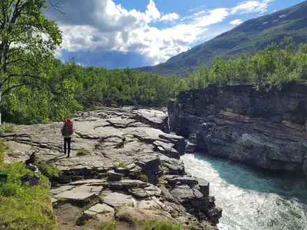
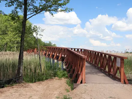
- Boardwalk fell and open plateaus: Long wooden plank sections cross boggy ground and marsh, keeping boots drier and protecting fragile terrain. The open fell is scenic but very exposed in wind and poor weather.
- Ulvåtjärn: A small mountain tarn near Storulvån, often used as a rest or swim stop on the first or final stage.
- Sámi reindeer-grazing land: The route passes through Sápmi, where reindeer herding remains part of the living Sámi culture. Give animals space and avoid disturbing herds.
Challenges to expect
This is not a high-pass trek, but it is still an exposed mountain route. The main challenges are wind, rain, poor visibility, slippery rock when wet and long open sections above the treeline, especially around Blåhammaren. Day 2 is the longest stage at about 18–19 km. Book STF beds and meals ahead in summer; outside the staffed season you need full winter or self-sufficient skills.
HikeList Score
Jämtland Triangle scored 82/100 on HikeList's trail-quality metrics.
See score breakdownHide breakdown
- Ideal length 70
- Balanced challenge 100
- Scenery & wildness 88
- Varied terrain 94
- Accommodation 58
- Food & support 72
- Path quality 98
- Season flexibility 76
Computed from length, challenge, scenery & wildness, terrain variety, accommodation, food & support, path quality and season flexibility.
 Sweden
Show more data Show less
- Mountainous
- Tundra
- Moorland
- Forest
- Dirt
- Rocky
- Boardwalk
- Huts
- Wild Camping Spots
- Family Friendly
- Pet Friendly
- Restrooms
- Water Sources
- Campsites
- Shelters
In these collections
Photos from hikers
Taken on the trail by people who've reviewed Jämtland Triangle.
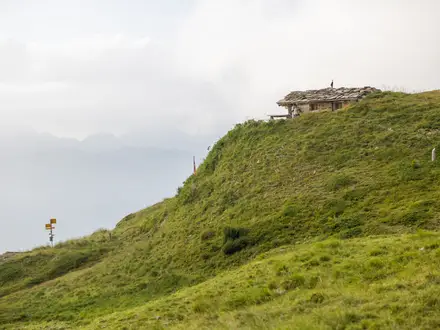
Leave STF Storulvån and walk through mountain birch forest before climbing into open fell above the treeline. The final 3 km are the steepest and hardest part of the day. Allow about 5–7 hours. Sylarna mountain station sits below the Sylarna massif.
The longest stage drops from Sylarna to a river, then rolls across open plateau and moorland towards Blåhammaren. It is exposed to wind and weather, with broad views in clear conditions. Allow about 6–8 hours.
Return to Storulvån on the easiest stage of the circuit. The route is mostly flat or downhill, using boardwalks over boggy ground before dropping back towards the lower valley and the Storulvån trailhead. Allow about 4–5 hours.
Reviews
How would you rate Jämtland Triangle?
Tap a star to start your review — you could be the first.