Carpathian Ridge Trail
How would you rate Carpathian Ridge Trail?
Tap a star to share your experience and help other hikers.
Carpathian Ridge Trail: Făgăraș Ridge Traverse Guide
HikeList Score
Carpathian Ridge Trail scored 83/100 on HikeList's trail-quality metrics.
See score breakdownHide breakdown
- Ideal length 100
- Balanced challenge 80
- Scenery & wildness 98
- Varied terrain 64
- Accommodation 67
- Food & support 65
- Path quality 98
- Season flexibility 76
Computed from length, challenge, scenery & wildness, terrain variety, accommodation, food & support, path quality and season flexibility.
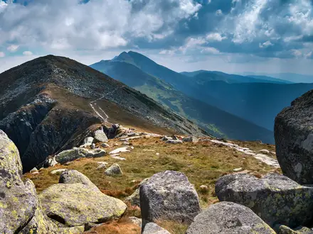
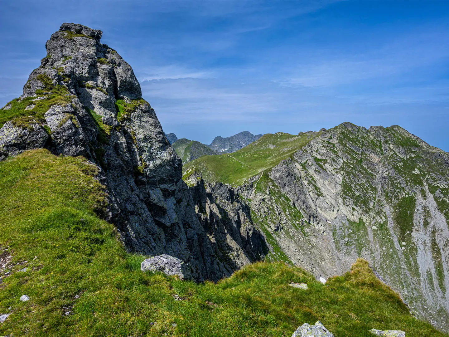
The Carpathian Ridge Trail is HikeList’s name for the Făgăraș Ridge traverse — the red-stripe route along the main crest of Romania’s Făgăraș Mountains, on the Transylvania–Wallachia border. Expect roughly 90–100 km, usually 6–8 days, hard mountain walking and around 5,000 m of ascent. This is a serious high-ridge route for fit, self-sufficient hikers: exposed scrambling, fast-changing weather, long days and limited resupply. See more routes in Romania.
Route Overview
This is a point-to-point traverse, walkable in either direction, between the Turnu Roșu Pass area near Sibiu/Avrig and Plaiul Foii near Zărnești/Brașov. The western approach commonly uses Suru Hut; the eastern end links via Curmătura Zârnei refuge. The red horizontal stripe follows the main Făgăraș crest over Scara, Negoiu, Bâlea Lake, Podragu, Viștea Mare and Moldoveanu. Bâlea Lake, on the Transfăgărășan road, is the key mid-route resupply, accommodation and bail-out point. For a shorter outing in the same area, see Bâlea Lake to Bâlea Waterfall; for another Romanian mountain objective, compare the Bucegi Plateau Circuit.
History of the Făgăraș Crest
The Făgăraș crest has long marked the historic frontier between Transylvania and Wallachia, crossed by shepherds, traders and soldiers. The Transfăgărășan road, which cuts across the route at Bâlea Lake, was built between 1970 and 1974 on Nicolae Ceaușescu’s orders as a strategic military road. The ridge traverse itself is a long-established Romanian mountaineering classic, waymarked with the red stripe and used by generations of hikers.
Notable highlights
- Moldoveanu Peak (2,544 m): Romania’s highest summit, reached from Viștea Mare by a short ridge. It is the headline high point of the traverse and a major reason hikers take on the full crest.
- Negoiu Peak (2,535 m) and Custura Sărății: Negoiu is Romania’s second-highest peak. Custura Sărății is the route’s crux: an exposed, cabled scramble nicknamed the “Three Steps to Death”.
- Bâlea Lake: A glacial lake at about 2,034 m on the Transfăgărășan road. It is the most reliable mid-route stop for food, accommodation, transport and retreat options.
- Podragu Hut and Podragu Lake: A classic staffed cabana beside Podragu Lake, used as a natural staging point for the eastern peaks around Moldoveanu.
- Transfăgărășan road: Romania’s famous high-mountain road crosses the Făgăraș at Bâlea Lake and is generally open only in the snow-free months.
- Wildlife: The range supports chamois, marmots, brown bears and birds of prey, and is an important Carpathian area for large-carnivore conservation.
Challenges to expect
Expect sustained alpine terrain: rock, scree, grassy crest, steep ascents and descents, plus cabled or chained scrambling sections. Custura Sărății near Negoiu is the most technical part. Waymarks can be faded, snow-covered or hard to follow in fog, so carry map, compass and GPS. Huts and refuges can fill, and Bâlea Lake is the only reliable mid-route resupply. For less committing Romanian ridge walking, consider the Babele to Sphinx Rock Trail.
HikeList Score
Carpathian Ridge Trail scored 83/100 on HikeList's trail-quality metrics.
See score breakdownHide breakdown
- Ideal length 100
- Balanced challenge 80
- Scenery & wildness 98
- Varied terrain 64
- Accommodation 67
- Food & support 65
- Path quality 98
- Season flexibility 76
Computed from length, challenge, scenery & wildness, terrain variety, accommodation, food & support, path quality and season flexibility.
 Romania
Show more data Show less
- Mountainous
- Forest
- Rocky
- Dirt
- Huts
- Campsites
- Wild Camping Spots
- Pet Friendly
- Water Sources
- Campsites
- Shelters
Photos from hikers
Taken on the trail by people who've reviewed Carpathian Ridge Trail.
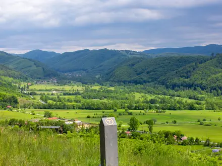
The first day begins with a steep ascent from Turnu Roșu Pass, winding through dense beech and conifer forest before breaking above the treeline. Hikers will steadily climb onto the Făgăraș Ridge, experiencing panoramic views as they approach Suru Hut. Expect frequent switchbacks, moderate elevation gain, and well-marked trails. Suru Hut provides a reliable overnight stop to rest and acclimatize to the terrain.
Leaving Suru Hut, the route continues along the ridgeline, offering a combination of open grasslands and rocky footpaths. Key highlights include passing over Budislavu Peak with its far-reaching vistas. The day ends at Scara Saddle, an exposed area suitable for wild camping, providing wide views over the Carpathian landscape.
This section traverses some of the most rugged terrain, including Scara Peak and the dramatic Custura Sărății ridge. Scrambling is required on certain exposed segments, and weather conditions can affect safety. Descend off the main ridge towards Negoiu Hut, nestled below the imposing Negoiu Peak, where hikers can rest for the night.
Rejoining the main ridge, hikers tackle Negoiu Peak—Romania’s second highest summit—before continuing across several minor peaks. The route is marked by dramatic alpine scenery and occasional snowfields, even in summer. The day concludes at the glacial Bâlea Lake, where accommodation and resupply options are available.
Starting from Bâlea Lake, the trail ascends towards Capra Saddle, traversing rocky outcrops and expansive meadows. Notable sections include traversing the narrow, exposed ridge at Fereastra Zmeilor and passing several glacial tarns. The day generally ends with a wild camp near Capra Saddle, surrounded by prime alpine scenery.
This segment covers some of the most scenic and high-altitude stretches of the ridge, leading over peaks like Arpașul Mare and culminating at Podragu Hut. The trail is a mix of dirt and rocky sections, with the opportunity to spot wildlife along the less-traveled paths and pause at multiple viewpoints.
An iconic day, this section ascends steeply via Viștea Mare to stand atop Moldoveanu Peak—the highest point in Romania at 2544 meters. The route includes narrow ridgelines and short scrambling sections. After enjoying the summit views, descend to a suitable wild camping area or return to a nearby hut for overnight rest.
The final day involves leaving the high ridge, heading gradually down through rocky outcrops and alpine pastures to re-enter forested terrain. The descent offers a change of scenery with opportunities for wildlife spotting as hikers make their way to the trail’s end near Plaiul Foii, completing the Carpathian Ridge traverse.
Reviews
How would you rate Carpathian Ridge Trail?
Tap a star to start your review — you could be the first.