Canal du Midi Towpath
How would you rate Canal du Midi Towpath?
Tap a star to share your experience and help other hikers.
Canal du Midi Towpath: A Flat Long-Distance Walk Across Occitanie
HikeList Score
Canal du Midi Towpath scored 79/100 on HikeList's trail-quality metrics.
See score breakdownHide breakdown
- Ideal length 96
- Balanced challenge 50
- Scenery & wildness 58
- Varied terrain 100
- Accommodation 100
- Food & support 88
- Path quality 70
- Season flexibility 100
Computed from length, challenge, scenery & wildness, terrain variety, accommodation, food & support, path quality and season flexibility.
The Canal du Midi Towpath is a 240 km point-to-point walk and cycle route across Occitanie in southern France, from Toulouse to the Mediterranean near Marseillan and Sète. It is easy underfoot and almost entirely flat, usually walked in about 10 days, or 8–9 days by fitter walkers taking longer stages. This is a good choice for first-time long-distance hikers, families and casual cyclists; the main effort is endurance, heat management and booking accommodation, not climbing.
Route Overview
The route starts in Toulouse at Port de l'Embouchure / Ponts-Jumeaux, where the Canal du Midi meets the Garonne lateral canal, then follows the canal east through the Lauragais, Castelnaudary, the Seuil de Naurouze, Bram, Carcassonne, Trèbes, Homps, Le Somail, Capestang, Béziers and Agde. The canal proper ends at Les Onglous by the Étang de Thau near Marseillan, but through-walkers commonly continue to the Mediterranean port of Sète. Navigation is straightforward: stay with the canal, with occasional minor-road detours where the towpath is interrupted. For another low-gradient French canal route, compare the Burgundy Canal Towpath or the Berry Canal Walk.
History of the Canal du Midi
The Canal du Midi was designed and built by Pierre-Paul Riquet under Louis XIV, with construction from 1667 to 1681. It created a long-sought link between the Garonne system and the Mediterranean, forming part of the “canal of the two seas”. Its key engineering problem was supplying water to the summit at the Seuil de Naurouze, where the watershed divides Atlantic and Mediterranean drainage. The canal was inscribed as a UNESCO World Heritage Site in 1996 for its engineering and landscape design.
Notable highlights
- Toulouse: The “pink city” of warm brick is the western start of the towpath, with the UNESCO-listed Basilica of Saint-Sernin and plenty of services before you set off.
- Seuil de Naurouze (190 m): The canal’s summit and watershed, where water divides between the Atlantic and Mediterranean sides; the Riquet obelisk marks the site.
- Carcassonne: A short detour from the canal reaches the double-walled medieval cité, a UNESCO World Heritage Site and the standout cultural stop on the walk.
- Fonseranes locks, Béziers: This staircase of lock chambers is one of the Canal du Midi’s signature engineering sights, lowering the canal on the approach to the Orb.
- Le Somail: A historic canal hamlet with a humpback bridge and the well-known Le Trouve Tout du Livre second-hand bookshop.
- Mediterranean finish, Marseillan/Sète: The canal reaches the Étang de Thau near Marseillan; most walkers continue to Sète for the port, beaches and open sea.
Challenges to expect
Do not underestimate the distance: the towpath is easy, but 240 km still means repeated long days. Summer heat is the main seasonal challenge, especially in July and August; avoid the hottest midday hours. Surfaces vary from compacted gravel and earth to asphalt, with exposed plane-tree roots and mud after rain in rural sections. Lodging is frequent but often just off-route, so book ahead in peak season.
HikeList Score
Canal du Midi Towpath scored 79/100 on HikeList's trail-quality metrics.
See score breakdownHide breakdown
- Ideal length 96
- Balanced challenge 50
- Scenery & wildness 58
- Varied terrain 100
- Accommodation 100
- Food & support 88
- Path quality 70
- Season flexibility 100
Computed from length, challenge, scenery & wildness, terrain variety, accommodation, food & support, path quality and season flexibility.
 France
Show more data Show less
- Canal Towpath
- Farmland
- Vineyards
- Wetlands
- Urban
- Compacted Gravel
- Earth
- Paved
- Asphalt
- Minor Roads
- Hotels
- Guesthouses
- Hostels
- Campsites
- Stroller Accessible
- Family Friendly
- Pet Friendly
- Restrooms
- Water Sources
- Campsites
- Picnic Areas
Photos from hikers
Taken on the trail by people who've reviewed Canal du Midi Towpath.
Beginning in the vibrant city of Toulouse, the route quickly leaves the urban sprawl behind as you follow the tranquil waterway southeast. The towpath is paved and well-maintained through Toulouse, offering a gentle introduction to the trail. Pass suburban neighborhoods and the occasional lock before arriving in the peaceful village of Montgiscard surrounded by rolling countryside.
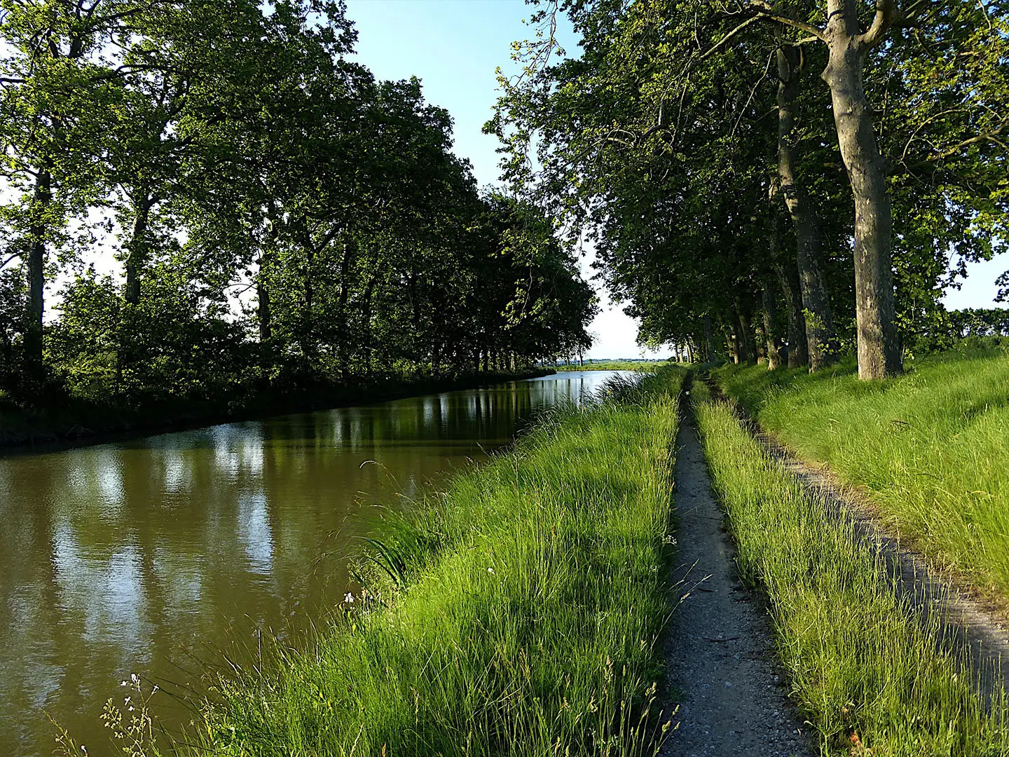
Today, travel along a mix of gravel and dirt pathways beside lines of ancient plane trees. The landscape opens to rural vistas, dotted with farms and villages. The day ends at Castelnaudary, a historic market town renowned for its traditional cassoulet and picturesque Grand Bassin harbor.
Leaving Castelnaudary, the towpath guides you past the Seuil de Naurouze, the historic highest point and summit pond of the canal. The scenery is peppered with locks and charming stone buildings before you approach Bram, a small town with circular streets and quiet ambiance.
Enjoy a scenic and relatively straight stretch as you follow the waterway toward Carcassonne. The highlight of the day is your arrival at this iconic fortified city, with its double ramparts and fairy-tale towers visible from afar. Consider allocating time to explore Carcassonne's remarkable medieval citadel.
Depart Carcassonne and continue along peaceful tree-lined canal banks. Locks and historic structures frequently punctuate this scenic section, and the route is gently undulating. Arrive in Trèbes, a welcoming port town known for its riverside restaurants and relaxed atmosphere.
Passing vineyards and rural landscapes, today's walk is tranquil with long stretches of greenery. Small villages and occasional canal crossings provide points of interest as you make your way to Homps, a lakeside stop famed for its hospitality and opportunities for wine tasting.
Enjoy a comfortable walk under the shade of canal-side trees. The route takes you through more wine country, with occasional glimpses of the Pyrenees in the distance. Reach the picturesque hamlet of Le Somail, noteworthy for its stone bridge, historic inn, and floating book barge.
Continue on gently undulating paths adjacent to wetlands and reed beds, offering wildlife-watching opportunities. Capestang awaits with its impressive collegiate church and scenic village center overlooking the Étang de Capestang, an important canal lagoon.
This section features the beautiful countryside of southern France and a series of historic canal locks. Highlights include the remarkable Fonserannes Locks and the Orb Aqueduct. Finish the day in the vibrant city of Béziers, known for its historic architecture and lively town squares.
The final stretch leads through fascinating wetland areas and the last string of canal locks. As you approach Sète, the route opens to striking views of the Mediterranean coastline. Conclude the journey in this bustling port town, where sandy beaches and fresh seafood mark a memorable finish.
Reviews
How would you rate Canal du Midi Towpath?
Tap a star to start your review — you could be the first.