Liberation Route Europe (Dutch Section)
How would you rate Liberation Route Europe (Dutch Section)?
Tap a star to share your experience and help other hikers.
Liberation Route Europe (Dutch Section): Airborne Trail Guide
HikeList Score
Liberation Route Europe (Dutch Section) scored 80/100 on HikeList's trail-quality metrics.
See score breakdownHide breakdown
- Ideal length 91
- Balanced challenge 50
- Scenery & wildness 68
- Varied terrain 94
- Accommodation 91
- Food & support 88
- Path quality 98
- Season flexibility 89
Computed from length, challenge, scenery & wildness, terrain variety, accommodation, food & support, path quality and season flexibility.
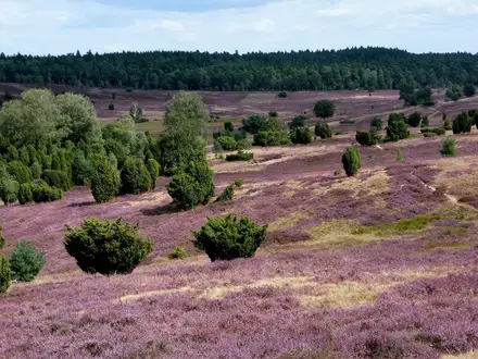
The Liberation Route Europe (Dutch Section) is best understood as the Airborne Trail / Airbornepad Market Garden: a 220 km point-to-point remembrance walk from Lommel in Belgium to Arnhem in the Netherlands. It takes about 10–14 days, following flat lowland terrain through Brabant, Gelderland and Limburg. Underfoot it is easy — quiet roads, forest tracks and heathland — with the main challenge being the sustained distance. It suits hikers who want a waymarked, history-led long-distance trail rather than a wilderness trek.
Route Overview
Walk north from the war memorial / church at Lommel, just over the Belgian border, towards Arnhem’s John Frost Bridge and the Airborne at the Bridge museum. The point-to-point route follows the Allied advance via Joe’s Bridge, Valkenswaard, Eindhoven, Best, Son, Veghel, Grave, Nijmegen, Groesbeek, Driel and Oosterbeek; known official stages include Lommel–Bergeijk, Valkenswaard–Eindhoven and Oosterbeek–Arnhem. It is marked by blue-and-white signs with a white paratrooper, with a guidebook and 14-station stamp card available from OLAT. For other Dutch lowland options compare the Brabantse Kempen Trail, Achterhoekpad or the coastal Dutch Coastal Path.
Operation Market Garden and the Liberation Route
The trail follows Operation Market Garden, the Allied airborne-and-armour attempt of 17–25 September 1944 to seize bridges across the southern Netherlands and open a route into Germany. British, American and Polish airborne forces were involved; the advance succeeded as far as Nijmegen but failed at Arnhem, where the British 1st Airborne Division was overwhelmed at Oosterbeek. The wider Liberation Route Europe began as a Dutch regional initiative in the Arnhem–Nijmegen area in 2008, was inaugurated at Arromanches on 6 June 2014, and became a Council of Europe Cultural Route in 2019.
Notable highlights
John Frost Bridge, Arnhem: The Rhine road bridge known as the “bridge too far”, where British paratroopers held out for several days in September 1944. It is the trail’s emotional finishing point.
Airborne Museum Hartenstein, Oosterbeek: A museum in the former Hartenstein Hotel, used as the British 1st Airborne Division’s headquarters during the Battle of Arnhem. Its exhibits focus on the fighting around Oosterbeek.
Groesbeek Canadian War Cemetery: A Commonwealth war cemetery near the German border, with more than 2,600 servicemen buried there, many of them Canadian. The adjacent National Liberation Museum 1944–1945 covers Market Garden and the wider liberation story.
Joe’s Bridge, near Lommel/Neerpelt: The canal bridge seized intact by the Irish Guards shortly before Market Garden. It marks the jumping-off point for the ground advance and the early liberation monuments on the route.
Valkenswaard–Eindhoven corridor: Stages 2–4 follow “Hell’s Highway”, the single road used by XXX Corps’ armour. Eindhoven was the first major Dutch city liberated, by the US 101st Airborne on 18 September 1944.
Challenges to expect
Do not expect technical hiking: climbing is negligible and the route stays on flat lowland surfaces. The challenge is cumulative — around 220 km, often on roads or firm tracks — so footwear, foot care and pacing matter. Navigation should be straightforward on blue-and-white Airbornepad signs, but carry the guidebook and check stage-town accommodation in advance. There are no refuges; nights are in hotels, guesthouses and B&Bs in populated towns.
HikeList Score
Liberation Route Europe (Dutch Section) scored 80/100 on HikeList's trail-quality metrics.
See score breakdownHide breakdown
- Ideal length 91
- Balanced challenge 50
- Scenery & wildness 68
- Varied terrain 94
- Accommodation 91
- Food & support 88
- Path quality 98
- Season flexibility 89
Computed from length, challenge, scenery & wildness, terrain variety, accommodation, food & support, path quality and season flexibility.
 Netherlands
Show more data Show less
- Flat Lowland
- Forest
- Heathland
- Towns
- Quiet Roads
- Forest Tracks
- Heathland Tracks
- Hotels
- Guesthouses
- B&Bs
- Family Friendly
- Pet Friendly
- Restrooms
- Water Sources
- Campsites
- Picnic Areas
Photos from hikers
Taken on the trail by people who've reviewed Liberation Route Europe (Dutch Section).
Reviews
How would you rate Liberation Route Europe (Dutch Section)?
Tap a star to start your review — you could be the first.