Sussex Border Path
How would you rate Sussex Border Path?
Tap a star to share your experience and help other hikers.
Sussex Border Path: A Complete Hiking Guide
HikeList Score
Sussex Border Path scored 92/100 on HikeList's trail-quality metrics.
See score breakdownHide breakdown
- Ideal length 91
- Balanced challenge 100
- Scenery & wildness 85
- Varied terrain 83
- Accommodation 100
- Food & support 94
- Path quality 98
- Season flexibility 89
Computed from length, challenge, scenery & wildness, terrain variety, accommodation, food & support, path quality and season flexibility.
The Sussex Border Path is a 240 km (around 150-mile) waymarked, point-to-point footpath in southern England, from Thorney Island and Chichester Harbour to Rye. It follows Sussex’s historic inland boundary with Hampshire, Surrey and Kent as closely as public rights of way allow. Allow about 12 days if you are moving briskly, or 12-16 days at a steadier pace. It suits fit lowland walkers who want moderate mileage, varied coastal, downland and Wealden terrain, and navigation without technical mountain ground.
Route Overview
The main line runs west to east, starting with the nine-mile Thorney Island circuit on Chichester Harbour before heading inland via Emsworth. It crosses the South Downs around South Harting, reaches Liphook and the Greensand Ridge, then climbs Blackdown, the 280 m high point of Sussex. From there it continues through Gospel Green, Rudgwick, the Low Weald past Gatwick, East Grinstead, Ashurst, Wadhurst and Bodiam before crossing the Rother/Romney marshes to Rye. It is linear, so plan start and finish logistics accordingly. For the chalk-downland National Trails that frame the Weald to the south and north, compare the South Downs Way and the North Downs Way; for another route crossing the same Wealden country, see The Wealdway.
History of the Sussex Border Path
The Sussex Border Path was devised and first published in 1983 by Ben Perkins and Aeneas Mackintosh, linking existing public rights of way into a continuous route shadowing Sussex’s historic borders. It is not a National Trail: today it is adopted, waymarked and maintained by Sussex Ramblers volunteers. Official route descriptions and GPX files were updated through 2015-2018, including reverse east-to-west directions added in 2018. Walkers drawn to the historic routes of the wider South East may also like the older long-distance line of The Pilgrims' Way.
Notable highlights
Thorney Island and Chichester Harbour (western start): The route begins with a shoreline circuit around Thorney Island beside Chichester Harbour, a protected coastal landscape and important habitat for wading birds and wildfowl.
Blackdown (280 m): This Greensand hill is the highest point in Sussex and the high point of the path, with heather, pine and long views across the Weald towards the South Downs.
The High Weald (National Landscape): The path threads through small fields, deep wooded ghylls, sandstone outcrops and scattered farmsteads in one of the route’s most characterful sections.
Weir Wood Reservoir: A quiet reservoir and local nature reserve below the Ashdown Forest ridge near East Grinstead, useful as a peaceful waterside break and birdwatching spot.
Bodiam Castle (moated medieval fortress): Built in 1385 and now managed by the National Trust, Bodiam Castle sits beside the route in the Rother valley.
Rye (eastern terminus): The walk ends in a preserved hilltop town of cobbled streets and timber-framed houses, a former Cinque Port with the historic Mermaid Inn.
Challenges to expect
The difficulty is cumulative rather than technical: around 3,100 m of total ascent, long lowland days and navigation across fields, woodland tracks, bridleways and quiet lanes. The route is waymarked with a martlet and shown on OS maps, but some sections still need care. Wealden clay becomes heavy after rain, and marsh sections near Rye can be wet. Accommodation is in towns, villages, inns, guesthouses, hotels and campsites; wild camping is not a recognised feature.
HikeList Score
Sussex Border Path scored 92/100 on HikeList's trail-quality metrics.
See score breakdownHide breakdown
- Ideal length 91
- Balanced challenge 100
- Scenery & wildness 85
- Varied terrain 83
- Accommodation 100
- Food & support 94
- Path quality 98
- Season flexibility 89
Computed from length, challenge, scenery & wildness, terrain variety, accommodation, food & support, path quality and season flexibility.
 United Kingdom
 England
Show more data Show less
- Coastal
- Grassland
- Forest
- Dirt
- Gravel
- Muddy
- Hotels
- Guesthouses
- Inns
- Campsites
- Family Friendly
- Pet Friendly
- Restrooms
- Potable Water Sources
- Established Campsites
- Picnic Areas
- Public Transport Access Points
Download Our Full Guide to Sussex Border Path FREE!
Get our comprehensive guide to this hike for free. Save it for later reading or print out at home.
In these collections
Photos from hikers
Taken on the trail by people who've reviewed Sussex Border Path.
Sussex Border Path: The Complete Guide
 i
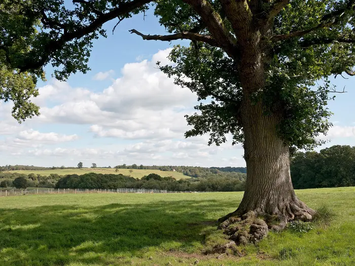
Image by https://pixabay.com/photos/landscape-countryside-meadow-field-4483193/
i
Image by https://pixabay.com/photos/landscape-countryside-meadow-field-4483193/ The Sussex Border Path is a 240 km line across Sussex’s old inland edge, running from the Thorney Island circuit on Chichester Harbour to the hilltop streets of Rye. It suits fit lowland walkers who want a long, varied trail with a strong sense of place, without committing to mountain terrain or a National Trail.
The route moves through Chichester Harbour, the South Downs National Park and the High Weald National Landscape, with the martlet waymark leading through fields, woods, bridleways and quiet lanes. Highlights include the chalk escarpment around South Harting, Blackdown at 280 m, Bewl Water, Bodiam Castle and the final approach into Rye.
Its character changes steadily from harbour shoreline and chalk downland to Greensand heath, wooded commons, Wealden ghylls and the damp Rother valley fringes near the finish. The High Weald gives the eastern half much of its identity: small fields, sandstone, enclosed woodland and repeated short climbs rather than big hills.
This is a moderate walk, but it is not a soft one. Expect 12–16 days for the full route, around 3,100 m of total ascent, muddy Wealden clay after rain, partial waymarking in places and enough field navigation to make a map or GPX essential.
Accommodation and food stops need planning because the path often keeps to villages and rural edges rather than large towns. Wild camping is not a recognised feature of the route, but rail access at places such as Emsworth, Liphook, East Grinstead, Wadhurst and Rye makes it particularly practical for section walking.
This guide covers stages, daily planning, accommodation, food and water, transport, terrain, navigation, gear and common mistakes.
Stage-by-Stage Guide
The stages below are a practical 12-day west-to-east itinerary, not the official sectioning of the Sussex Border Path. The Sussex Ramblers route material divides the path into 18 shorter sections, and those notes are useful for exact mileages and finer navigation. Distances here are approximate and assume the full Thorney Island start; walkers beginning at Emsworth and omitting the circuit shorten the route by about 14.5 km.
Waymarking uses the martlet symbol on green plaques and wooden posts, but it is not consistent enough to rely on alone. Carry OS mapping and a current GPX file throughout, especially in the High Weald and the final East Sussex stages.
Stage 1: Thorney Island / Emsworth to South Harting — approx. 24 km
Route and terrain: This is a long opening day because it includes the 9-mile / 14.5 km Thorney Island circuit before the inland walk to the South Downs. The circuit follows the Chichester Harbour shoreline around the peninsula, with wide harbour views, bird-rich mudflats and open coastal walking beside MoD land at RAF Thorney Island.
Access onto Thorney Island is via the military checkpoint at the Great Deep entrance. No walking permit is required, but walkers must pass a brief identity or voice check before continuing; allow a little extra time and follow posted instructions.
After returning to Emsworth, the route turns north-east through urban fringe, fields and woodland towards Rowland's Castle and the South Downs. The main physical effort comes late in the day with the climb onto the chalk escarpment around Harting Down before descending to South Harting.
Landmarks and highlights: Chichester Harbour National Landscape is the early highlight, with wading birds, wildfowl and broad views across the water; Chichester Cathedral spire may be visible across the harbour. Inland, the path passes near Stansted House and Rowland's Castle before reaching the chalk downland of Harting Down, one of the strongest view points of the western route.
Food, water and accommodation: Emsworth has the best start-point facilities, with shops, cafes, pubs, restaurants and supermarkets. Rowland's Castle is a useful mid-stage stop with pubs and a railway station. South Harting has limited but important village facilities; The White Hart is a key pub-with-rooms option in the village, and accommodation should be booked ahead.
Transport and access: Emsworth station is the practical rail access for the start. Rowland's Castle station provides a useful exit or shorter first day option. South Harting has no rail station; the nearest stations are Rowland's Castle and Petersfield, both around 8 km away by road, so a taxi, lift or pre-arranged collection is often needed.
Navigation and warnings: Take care through the Emsworth urban fringe and around the Thorney Island access point. The South Downs section is generally better signed, but a map remains essential. This is one of the longer days in the suggested itinerary, and the late climb onto the Downs can feel harder with a full pack.
Stage 2: South Harting to Liphook — approx. 16 km
Route and terrain: This stage continues east from the South Downs chalk before gradually changing into wooded combes, commons and the sandier Hampshire/Sussex border country. The walking is less exposed than Stage 1, with field margins, woodland paths and sections through or near Durford Wood, Rake Hanger, Chapel Common and Linchmere Common.
The underfoot character changes during the day: chalk gives way to clay and sandy heathland tracks. In wet weather the wooded sections can be greasy, and some field edges may be muddy.
Landmarks and highlights: Notable points include the isolated medieval chapel near Idsworth in the Chalton area, views around Compton Down, Durford Wood and the heathland of Linchmere Common. Rake is the main small settlement before the approach to Liphook.
Food, water and accommodation: Services are limited between South Harting and Liphook, so carry lunch and enough water from the start. Rake provides a possible small-settlement stop, but should not be treated as a guaranteed resupply point. Liphook has full small-town services and accommodation; the Deers Hut is a well-known pub and hotel option for walkers.
Transport and access: Liss station, on the London Waterloo-Portsmouth line, is a useful exit point if shortening the day. Liphook station is on the same line and is the main rail-served overnight base for this stage.
Navigation and warnings: The route passes through a mix of woodland, commons and field paths, so keep checking the line rather than following the most obvious track. Longmoor military training area is nearby; firing may be heard, but this does not normally affect the path. If using Liss as an alternative end point, plan the off-route link before setting out.
Stage 3: Liphook to Gospel Green via Blackdown — approx. 17 km
Route and terrain: This is the high-point stage of the Sussex Border Path, crossing Blackdown, also signed as Black Down, at 280 m. The route moves through Marley Common and onto National Trust-managed Greensand heathland, where heather, pine, bracken and sandy paths give the day a very different feel from the chalk Downs.
Although the altitude is modest, the walking can be surprisingly slow after rain. Greensand heath and wooded paths can be boggy, and the open areas of Blackdown need careful orientation in mist or poor visibility.
Landmarks and highlights: Blackdown is the highest point in Sussex and one of the route's major highlights. The Temple of the Winds viewpoint gives long views across the Weald towards the South Downs in clear weather. Linchmere Common and the heathland around Blackdown are the main landscape features before the descent towards Gospel Green.
Food, water and accommodation: There are almost no facilities between Liphook and Gospel Green, so leave Liphook with a full day's food and water. Gospel Green is a hamlet with no village shop or pub in the hamlet itself. Many walkers use Haslemere, about 3 km north of Blackdown by road, as a more practical overnight or resupply base.
Transport and access: Haslemere station on the London Waterloo-Portsmouth line is the key transport option near this stage, but it is off-route and requires an arranged pickup, taxi or planned road link. Gospel Green itself has no direct public transport suitable for dependable end-of-day logistics.
Navigation and warnings: A GPX file is strongly recommended for Blackdown and the surrounding commons. Waymarking can be intermittent on the heath, and several paths can look equally convincing. In mist, do not rely on sightlines to hold direction across open heathland.
Stage 4: Gospel Green to Rudgwick — approx. 17 km
Route and terrain: The route now leaves the Greensand country and drops into the Low Weald. Expect a quieter day of wooded countryside, small fields, spring-line valleys and local lanes, with a softer, more enclosed feel than the first three stages.
The walking passes through the River Lox valley and near the line of the historic Wey & Arun Canal. Low Weald paths can become muddy in wet periods, particularly where field paths and wooded tracks hold water.
Landmarks and highlights: Points of interest include the River Lox and its tributary valleys, the Wey & Arun Canal corridor, Alfold Bars and the grounds near Rikkyo School. Near Rudgwick, the disused railway tunnel and the Downs Link walking and cycling route show the line of the former railway.
Food, water and accommodation: Facilities are limited between Gospel Green and Rudgwick, so carry what is needed for the day. Rudgwick is the natural overnight stop; The Kings Head is a key village pub option, with other accommodation possible in or near the village. Book ahead, as places in small Wealden villages can be limited.
Transport and access: Rudgwick no longer has a railway station. Bus services operate along the B2128 towards Horsham, and Horsham is the nearest major rail option at about 12 km by road. A taxi or pre-arranged lift is often the simplest end-of-stage solution.
Navigation and warnings: This is not a technically difficult stage, but it involves many lowland footpath junctions, field boundaries and small lanes. After rain, expect slow going on clay sections. Do not assume every old railway or canal-side track is the Sussex Border Path; check the line carefully.
Stage 5: Rudgwick to Charlwood — approx. 18 km
Route and terrain: This stage continues through the Low Weald before approaching the Gatwick area. The first part is mainly farmland, woodland and riverside walking through country around Okewood Hill and Rusper, with a mix of field paths, lanes and wooded sections.
Later in the day the character changes sharply as the route approaches the River Mole valley and the western edge of Gatwick Airport. Expect more tarmac, airport perimeter surroundings and aircraft noise around the Charlwood, Hookwood and Horley area.
Landmarks and highlights: Rusper is an attractive village stop, and the route crosses or passes historic lines in the landscape including Stane Street, the Roman road. Views towards Leith Hill and the Surrey Hills may open up in places. Charlwood itself is worth time: St Nicholas church has notable medieval wall paintings uncovered during Victorian restoration.
Food, water and accommodation: Rusper may provide pub or village facilities, but rural pubs in this section have changed over time, so do not depend on any single stop without checking before travelling. Charlwood has village pub facilities and some local services. Accommodation in Charlwood and the wider Gatwick/Horley area gives more options than the smaller villages to the west.
Transport and access: Gatwick Airport station and Horley station are both useful transport options near this stage, though not necessarily directly on the line of the path. Charlwood has bus services towards Horley and Horsham. This is a practical stage for section walkers because road and rail access improve markedly near Gatwick.
Navigation and warnings: The approach to Gatwick is one of the least scenic and most awkward parts of the Sussex Border Path. Use OS mapping or GPX around the airport boundary, where bridleways, lanes, urban edges and perimeter infrastructure can be confusing. The River Mole can flood after heavy rain, making low-lying paths muddy or partly submerged.
Stage 6: Charlwood to Copthorne — approx. 16 km
Route and terrain: This stage works through and beyond the Gatwick fringe, with a mixture of lanes, bridleways, suburban edge paths, woodland and meadow. It is not one of the wildest sections of the route, but it is a useful link between the Low Weald and the better walking east of Crawley.
Expect some hard-surface walking and airport-influenced surroundings early on, especially around Hookwood and Horley. The route then becomes more rural again as it heads towards Copthorne and the Crawley Down area.
Landmarks and highlights: Burstow church is passed near the route, and Copthorne marks the Surrey/West Sussex border country. Weir Wood Reservoir lies just south of the broader route corridor near East Grinstead and is a worthwhile nature and birdwatching feature if making a local detour or extending the day.
Food, water and accommodation: Facilities are patchy on the walking line itself, but Copthorne has village services and pubs. Crawley Down has the Royal Oak pub on or near the route corridor. Carry enough food and water to avoid relying on a single pub opening.
Transport and access: Copthorne has bus links towards Crawley, while Crawley Down has buses towards East Grinstead and Three Bridges. Three Bridges station can be reached by using the Worth Way from the Crawley Down area, but this adds an off-route link of around 4-5 km. Plan public transport in advance, particularly on Sundays and evenings.
Navigation and warnings: This is another stage where route-finding matters more than scenery. The path uses a mix of lanes, field edges and rights of way around developed areas, so keep checking junctions. Airport and suburban noise are part of the day, but the walking improves as the route leaves the immediate Gatwick zone.
Stage 7: Copthorne to East Grinstead — approx. 14 km
Route and terrain: A shorter and generally easier stage, this makes a good half-day into East Grinstead or a recovery day after the Gatwick fringe. The walking uses woodland paths, old trackbed sections and the Worth Way, the former Three Bridges-East Grinstead railway now used as a traffic-free walking and cycling route.
Underfoot, the Worth Way gives straightforward progress compared with the field paths of the previous stages. Woodland sections can still be muddy in wet weather, but this is one of the more forgiving days in the itinerary.
Landmarks and highlights: The Worth Way is the main feature, offering easy, sheltered walking into the East Grinstead area. East Grinstead itself is the biggest town on the route since Emsworth, with a historic high street, timber-framed buildings, Sackville College and the town museum.
Food, water and accommodation: East Grinstead is a major resupply and accommodation point, with supermarkets, cafes, restaurants, pubs, hotels and B&Bs. It is one of the best places on the whole route for a rest day, gear replacement or schedule reset. The Worth Way Cafe near the station area is a useful end-of-stage stop.
Transport and access: East Grinstead station gives strong rail access towards London and makes this a natural place to leave or rejoin the Sussex Border Path. Bus links also run towards Crawley, Horsham and Tunbridge Wells. For section walkers, this is one of the most convenient access points on the route.
Navigation and warnings: Navigation is easier than on many stages because of the clear old railway line, but do not assume the Sussex Border Path always follows the most obvious continuous track. Watch for junctions where the route leaves or joins the Worth Way. Shared-use paths can be busy with cyclists, especially near town.
Stage 8: East Grinstead to Groombridge — approx. 18 km
Route and terrain: This stage marks a clear shift into the High Weald National Landscape. The walking becomes more intricate, with small fields, deep wooded ghylls, sandstone outcrops, scattered farmsteads and repeated short climbs and descents.
The route passes through Cowden and crosses the Eden Valley and Kent Water before continuing towards Ashurst and Groombridge. Paths are often enclosed and can be muddy; after rain, Wealden clay makes progress slower than the distance suggests.
Landmarks and highlights: Dry Hill, a 15th-century hill-fort site, and Old Surrey Hall, a 15th-century timber-framed manor, are key historic points. The river valleys, Ashplats Wood and the approach to Groombridge give this stage a strong High Weald character. Groombridge Place, with formal gardens and a historic moated house, is an optional visitor attraction at the end.
Food, water and accommodation: Cowden has the Fountain Inn, a useful pub and food stop. Willett's Farm may offer farm shop or ice cream options in season. Groombridge has pubs, some services and accommodation in and around the village, but advance booking is advisable.
Transport and access: Ashurst station, just over the Kent boundary, is a valuable mid-stage access or bail-out point and lies about 1 km from the route. Groombridge has no mainline railway station; Tunbridge Wells, about 8 km away by road, is the usual rail connection by taxi or bus where available.
Navigation and warnings: The High Weald has many small rights of way, field corners and woodland junctions. Waymarking can be less dependable than in West Sussex, so GPX and OS mapping are important. Mud is the main practical difficulty, particularly after prolonged rain.
Stage 9: Groombridge to Wadhurst — approx. 17 km
Route and terrain: This is one of the most characterful High Weald stages, with wooded ghylls, sandstone outcrops, historic parkland and rolling field paths. The route passes through the Medway headwaters area and around Eridge Old Park before continuing via Boarshead towards Wadhurst.
The terrain is not high, but it is rarely flat for long. Expect repeated small climbs, damp woodland and heavy clay in wet weather.
Landmarks and highlights: Bowles Rocks and Harrison Rocks are notable sandstone outcrops used for climbing, and Eridge Old Park gives the stage a historic landscape feel. Boarshead is a useful settlement before the final approach to Wadhurst. In Wadhurst, the church of St Peter and St Paul is notable for its iron grave slabs, reflecting the Wealden iron industry.
Food, water and accommodation: The Boarshead Inn is a useful pub and accommodation option on the stage. Wadhurst has village services, pubs, a shop and B&B accommodation nearby; The Best Beech Inn is a known accommodation option around 1 km from the village centre. As with other Wealden villages, book ahead rather than assuming walk-up availability.
Transport and access: Eridge station on the Hastings line is 1-2 km from the route and can be used as a mid-stage exit. Wadhurst station, also on the Hastings line, is the key end-of-stage rail link, with connections towards London and Hastings. This is another strong section-walking access point.
Navigation and warnings: The combination of woodland paths, ghylls and field boundaries requires careful navigation. In autumn and winter, fallen leaves can hide muddy ruts and path edges. Allow more time than the distance alone suggests if conditions are wet.
Stage 10: Wadhurst to Hawkhurst via Bewl Water — approx. 18 km
Route and terrain: This is a varied and scenic stage, moving from farmland and woodland to a long waterside section at Bewl Water, then back into High Weald ridges and villages. The route passes Cousley Wood before following the reservoir shoreline for roughly 5-6 km, nearly a third of the day.
The reservoir path is generally straightforward but can feel exposed in wind, with limited shelter along the open water. Away from Bewl Water, expect the usual High Weald mix of fields, woods and lanes, with mud after rain.
Landmarks and highlights: Bewl Water is the largest open water in south-east England and makes an excellent long break point, with birdwatching and broad reservoir views. The route also gives views towards Scotney Castle, then crosses the Union Street ridge, a high point in the eastern part of the route and a watershed between the Medway and Rother. Hawkhurst is split between The Moor, the old village centre, and Highgate, the commercial area on the A268.
Food, water and accommodation: Cousley Wood has the Old Vine pub, and Bewl Water Visitor Centre has the Waterfront Cafe, normally open daily from 9.30am to 4pm; current opening times should be checked before relying on it. Hawkhurst has several pubs, shops, B&Bs and accommodation options, including the Queen's Inn and local B&Bs. Carry extra food and water in case the reservoir cafe is closed or reached outside opening hours.
Transport and access: Hawkhurst has no rail station. Etchingham on the Hastings line is the nearest mainline station by road, around 8 km away. Stagecoach service 349 links Hastings station and Hawkhurst (calling at Bodiam), but current timetables and operating days should be checked before planning a stage end around it.
Navigation and warnings: The Bewl Water section is easier to follow than many field-path stages, but the route away from the reservoir still needs attention. Wind and weather can make the shoreline feel colder than the surrounding countryside. Do not treat Bewl Water's visitor facilities as guaranteed without checking seasonal hours.
Stage 11: Hawkhurst to Bodiam — approx. 15 km
Route and terrain: A shorter but rewarding stage through classic Wealden countryside. The route passes oast houses, hop-growing country, orchards, vineyards and scattered farms before descending towards the Rother valley.
The ground is mostly field paths, lanes and farm tracks, with typical Wealden mud after rain. The shorter distance makes it easier to allow time for Bodiam Castle at the end.
Landmarks and highlights: East Heath oast house, Conghurst Farm and the Kent Ditch, the historic boundary stream between Kent and East Sussex, are key points on the way. The stage finishes beside Bodiam Castle, the moated medieval fortress built in 1385 and now managed by the National Trust. Vineyard views before Bodiam add to the character of the approach.
Food, water and accommodation: Refreshments are limited between Hawkhurst and Bodiam, so carry food and water from the start. At Bodiam, the National Trust cafe at the castle is useful but seasonal opening should be checked. The Castle Inn near Bodiam is the main pub option, and accommodation is limited compared with larger towns.
Transport and access: Bodiam has no mainline railway station. Etchingham station on the Hastings line is around 5 km away by road. Stagecoach service 349 from Hastings towards Hawkhurst stops near the Bodiam Castle car park entrance, and the Kent & East Sussex Railway runs heritage steam trains between Bodiam and Tenterden on a limited or seasonal timetable; current operating days and times should be checked.
Navigation and warnings: Do not rely on the Kent & East Sussex Railway for essential transport unless the timetable fits exactly; it is primarily a visitor attraction. Bodiam Castle is popular and can be busy on summer weekends. Field paths around farms may be muddy and churned after wet weather.
Stage 12: Bodiam to Rye via Northiam and Playden — approx. 20 km
Route and terrain: The final stage is the longest in this 12-day itinerary and follows the Rother valley towards Rye. The day begins with riverside and farmland walking from Bodiam through the widening valley, then passes Ewhurst Green and Northiam before climbing towards Beckley and descending towards the flatter marsh-fringe country near Rye.
Beyond Beckley, the landscape opens into lower watermeadows and marsh-edge paths. The route approaches Rye via Playden and the Royal Military Canal corridor, with the final climb into the hilltop Cinque Port town.
Landmarks and highlights: The River Rother is the organising feature of the day. Great Dixter at Northiam is a major house and garden attraction, with current opening times to be checked if planning a visit. Beckley gives ridge views over the marshes, while Rye provides a strong finish with Mermaid Street, the Mermaid Inn, Ypres Tower, St Mary's church and views across Romney Marsh.
Food, water and accommodation: Services are thin in the first half of the stage, so leave Bodiam with food and water. Ewhurst Green has the White Dog Inn, with food hours that should be checked before travelling, and Northiam has Will's Cafe, popular with walkers. Rye has extensive end-of-route facilities, including cafes, restaurants, pubs, hotels, B&Bs and guesthouses.
Transport and access: Rye station is on the Ashford-Hastings Marshlink line, with rail connections towards Ashford International, Hastings and Eastbourne. Stagecoach buses also link Rye with Hastings on services 100 and 101. Rye is one of the easiest end points on the route for onward travel.
Navigation and warnings: This final stage needs a full day, particularly if conditions are wet or if visiting Great Dixter or Rye's historic centre. The marsh-fringe paths near Rye can be genuinely wet and muddy, especially outside summer. The line near Northiam through a former industrial or sewage area can be confusing and unattractive but is short-lived; follow the map or GPX rather than trying to improvise. Waymarking on the final East Sussex section has historically been patchy, so do not finish the route relying on markers alone.
Recommended Itinerary
The itinerary below is a practical 12-day plan for fit walkers using the main west-to-east Sussex Border Path from Thorney Island / Emsworth to Rye. These are suggested planning stages, not official stage distances; the Sussex Ramblers split the route into 18 sections, which should be used for exact mileages and current route notes before booking accommodation.
Day 1 is the key decision point. Including the full Thorney Island shoreline circuit adds about 14.5 km / 9 miles; many walkers make the logistics easier by starting at Emsworth station instead.
Standard 12-day itinerary
| Day | From | To | Approx. distance | Why this stage makes sense | Services/accommodation notes |
|---|---|---|---|---|---|
| 1 | Thorney Island / Emsworth | South Harting | 24 km / 15 miles | This gets the long harbour start and the first climb from the coastal plain into one substantial day, finishing in the South Downs area. Starting at Emsworth rather than completing the Thorney Island circuit shortens the day considerably. | Emsworth has the nearest railway station for most starts. South Harting has a pub and small shop, but accommodation is limited; Petersfield can work as an off-route overflow base. |
| 2 | South Harting | Liphook | 16 km / 10 miles | A shorter recovery day after the long opening stage, crossing the South Downs escarpment and continuing through Durford Wood towards Hampshire. | Liphook is a practical overnight stop with a railway station, pubs, shops and B&B options. Midhurst or Haslemere can be considered as off-route alternatives if beds are tight. |
| 3 | Liphook | Gospel Green, via Blackdown | 17 km / 10.5 miles | This is one of the strongest walking days, climbing to Blackdown / Black Down, the 280 m high point of the route and the highest point in Sussex. | Gospel Green is only a hamlet with limited services. Many walkers use Haslemere for accommodation and food, reached off route by walking or taxi; there are no services on Blackdown itself. |
| 4 | Gospel Green | Rudgwick | 17 km / 10.5 miles | The route moves through Greensand and early High Weald terrain, with rolling woodland tracks, farmland and quieter lanes. | Services around Alfold Bars are limited. Rudgwick has a pub but limited accommodation, so Cranleigh or Horsham may be needed as off-route bases; this should be checked before travelling. |
| 5 | Rudgwick | Charlwood | 18 km / 11 miles | A steady lowland stage through Okewood Hill and Rusper, with a useful village finish before the Gatwick-edge section. | Rusper has a pub. Charlwood has several pubs, local services and some B&Bs, with wider hotel choice nearby around Gatwick Airport. Carry food and water, as services are not continuous. |
| 6 | Charlwood | Copthorne | 16 km / 10 miles | The path threads between Gatwick Airport and Horley, then continues towards Copthorne, using easier walking in places including the Worth Way corridor. | Horley is the main overflow option for hotels, shops and food. Copthorne has pubs and some accommodation, but check availability before committing to this stop. |
| 7 | Copthorne | East Grinstead | 14 km / 9 miles | A deliberately shorter stage, with easier walking on the Worth Way into East Grinstead. It also gives time for resupply and admin before the High Weald stages. | East Grinstead is one of the best service stops on the whole route, with a railway station, supermarkets, pubs, restaurants, hotels and other town facilities. It is a sensible rest-day base. |
| 8 | East Grinstead | Groombridge | 18 km / 11 miles | The route enters Kent briefly and passes into more wooded Wealden country, with Cowden and Ashurst providing useful intermediate points. | Cowden has a pub and Ashurst has a station nearby. Groombridge has pubs and limited B&B choice; Tunbridge Wells, about 6 km north, is the main overflow option with rail access and more hotels. |
| 9 | Groombridge | Wadhurst | 17 km / 10.5 miles | A classic High Weald day through sandstone country, wooded ghylls and parkland around Eridge Old Park, finishing at a useful rail-access village. | The Boarshead area can work for refreshments. Wadhurst has pubs, small shops, accommodation options and a station on the Hastings line. |
| 10 | Wadhurst | Hawkhurst, via Bewl Water | 18 km / 11 miles | This stage links Wadhurst with the Bewl Water section, giving a clear waterside landmark and a natural village finish. | Bewl Water visitor facilities, including the café, can be seasonal, so do not rely on them without checking. Hawkhurst has pubs, services and accommodation, but no mainline station; Etchingham is the nearest rail option. |
| 11 | Hawkhurst | Bodiam | 15 km / 9 miles | A shorter day into the Rother valley, leaving time for Bodiam Castle if it is open and you want to visit. | Bodiam is very small, with limited accommodation and a pub. Robertsbridge station is an off-route escape option, and the Kent & East Sussex Railway may be an optional extra when running. |
| 12 | Bodiam | Rye, via Northiam and Playden | 20 km / 12.5 miles | A longer final stage across the Rother valley and marsh fringes, passing Northiam, Beckley and Playden before finishing in Rye. | Northiam has pubs and a tea room. The approach to Rye can be wet underfoot in winter and spring. Rye has the best finish services: station, B&Bs, guesthouses, pubs, cafés and restaurants. |
Slower 14–16 day option
A slower schedule suits walkers who prefer shorter days, want more time in the High Weald, or are using public transport to walk the path in sections. It is also the better plan if accommodation availability forces extra off-route transfers.
Useful ways to slow the route down include:
- Split the opening day at Rowland’s Castle, especially if completing the full Thorney Island circuit.
- Add a rest or resupply day at East Grinstead, the strongest mid-route service base.
- Break the High Weald more gently by using rail-access points such as Ashurst or Wadhurst where they fit the walking plan.
- Allow extra time around Bodiam if visiting Bodiam Castle.
- Use the Sussex Ramblers’ 18 official sections as the framework for shorter day walks or a 16-day end-to-end.
This version reduces pressure on accommodation in smaller places such as Gospel Green, Rudgwick, Groombridge and Bodiam, where beds may be limited or off-route transfers may be needed.
Faster 10–11 day option
A faster schedule is only sensible for experienced long-distance walkers who are happy with several long lowland days and have accommodation arranged in advance. It becomes more realistic in long daylight and settled weather, when Wealden clay and the Rye marsh fringes are less likely to slow progress.
Common ways to shorten the itinerary include:
- Start at Emsworth and omit the Thorney Island circuit if the aim is to walk the inland line rather than the full 240 km version.
- Combine South Harting to Gospel Green into one long stage of about 33 km, using Haslemere or another off-route base if needed.
- Combine East Grinstead to Wadhurst into one long stage of about 35 km; this is a serious day and should only be used by very fit walkers.
- Keep East Grinstead, Wadhurst and Rye as anchor points because their rail and town services make logistics much easier.
The faster plan leaves less margin for navigation, mud, closed cafés or pub food not being available. It is best treated as a pre-booked, fair-weather schedule rather than the default way to walk the Sussex Border Path.
Planning the Route
The Sussex Border Path is straightforward to walk in sections, but it needs more planning than its modest height gain suggests. The main constraints are accommodation spacing, village services, public transport gaps and navigation across field paths, woodland and lanes where waymarks are not always enough on their own.
Plan it as a lowland long-distance walk with some surprisingly rural days, not as a continuous town-to-town promenade. Several places on the line have rail access and accommodation, but other useful stopping points are small villages or hamlets where beds, meals and onward transport can be limited.
How many days to allow
Most end-to-end walkers should allow 12–16 days for the main Thorney Island to Rye line. A brisk walker can fit the route into about 12 days, while a more comfortable itinerary is usually closer to 14 days, especially if using accommodation that does not sit exactly on the path.
The Sussex Ramblers route material divides the path into 18 comfortable walking sections. Those sections are useful for exact navigation and day-walk planning, but an end-to-end itinerary often combines some of them depending on where accommodation is available.
| Pace | Typical plan | Best for | Planning note |
|---|---|---|---|
| Brisk | Around 12 days | Fit walkers happy with long lowland days | Expect some 18–24 km days and less flexibility in rural areas. |
| Moderate | Around 14 days | Most end-to-end walkers | Gives more room for detours, rail logistics and wet or muddy ground. |
| Relaxed / section hiking | 16+ days or the official 18 sections | Weekend walkers, shorter days, mixed transport | Often the easiest way to fit the path around trains, buses and accommodation. |
When comparing route notes, be aware that different distances are quoted. The full route from Thorney Island, including the shoreline circuit, is about 240 km / 150 miles; some listings measure from Emsworth and exclude the Thorney Island circuit, giving a shorter total.
Thorney Island or Emsworth start
The headline route starts with the Thorney Island circuit on Chichester Harbour. Most walkers still join conveniently at Emsworth, which is the nearest town and railway station and is the simplest overnight base for the start.
Thorney Island has MOD security gates at the east and west entrances; walkers use the buzzer system rather than arranging a general walking permit. Access arrangements at the gates can change, and at least one gate has had closure issues in recent years. This should be checked before travelling, especially if starting with the full shoreline circuit.
If logistics are tight, starting at Emsworth gives a simpler first day and removes the access uncertainty around Thorney Island. If completing the full route matters, build the harbour circuit into the first day and check the latest Sussex Border Path access notes before setting off.
Accommodation will shape the itinerary
Accommodation is the main planning constraint. Natural overnight bases include Emsworth, Liphook or Haslemere, East Grinstead, the Groombridge / Crowborough area, Wadhurst, Hawkhurst and Rye, but not every village on the route has reliable walker accommodation.
The more rural stretches around Gospel Green, Rudgwick, Charlwood and Bewl Water need particular care. Some walkers may need a short detour, a taxi link, or a nearby fallback town rather than expecting a bed directly on the path.
Rye has an excellent range of places to stay, but it is a popular destination and should be booked well ahead in summer and at weekends. Hawkhurst also works well as an eastern-stage base, although it sits about a mile off route; the Queen’s Inn and other local B&Bs make it a practical stop if booked in advance.
The Gatwick / Horley area gives access to a large supply of airport hotels, which can be useful for a functional night between Charlwood and Copthorne. They are convenient rather than characterful, and the walking route through this area is more about logistics than village-to-village charm.
Wild camping is not a recognised feature of this path. Plan on booked accommodation, campsites where available, or transport links to nearby towns.
Section walking is one of the route’s strengths
The Sussex Border Path is particularly good for section walking. Rail access is strong at both ends and useful in the middle, so it can be walked as weekends, single days or two larger halves.
Useful stations on or close to the route include Emsworth, Rowland’s Castle, Liss, Liphook and Haslemere at the western end; East Grinstead in the middle; Ashurst and Wadhurst on the eastern half; and Rye at the finish. Gatwick Airport station is also useful for the mid-route area because of its mainline connections, though it is not a rural walking base in the usual sense.
The main public transport gap is between the Haslemere / Liphook area and the Gatwick / East Grinstead area. Through Rudgwick, Charlwood and Horley, bus services and car logistics become more important, and rural bus times should not be assumed to suit a walking day. This should be checked before travelling.
A common approach is to split the path into a western half from Emsworth towards East Grinstead and an eastern half from East Grinstead to Rye. East Grinstead works well as a reset point because it has rail access, accommodation and services.
Food and water planning
Do not rely on every village having an open shop or pub at the time you arrive. Village services change, some pubs reduce opening hours, and winter or weekday closures can affect the smaller stops.
Carry enough food and water for a full day between known resupply points, especially across the High Weald and around the more rural eastern sections. Lunch planning matters more here than on trails that pass through large towns every few miles.
Before finalising each day, check the current opening hours of pubs, village shops and cafés at intended stops. This is particularly important for stages around Rudgwick, Gospel Green, Charlwood, Bewl Water and the smaller Wealden villages.
Navigation and route information
The path is waymarked with the Sussex martlet on green plaques and wooden signs, but it is not a National Trail. Waymarking is generally useful, yet signs can be missing, overgrown or turned at field edges, and some sections near Gatwick are more confusing than the broad route line suggests.
Download the latest Sussex Ramblers section descriptions and GPX before walking. Their 18 section descriptions are detailed enough for field-by-field navigation and are more useful than relying on old printed material.
OS Explorer 1:25,000 mapping is strongly recommended; the full route requires eight Explorer sheets. A phone GPX is helpful, but it should not be the only navigation tool on a path with woodland, field boundaries and lowland rights-of-way changes.
Because the trail is maintained by Sussex Ramblers volunteers, surface condition and waymarking can vary more than on a heavily funded National Trail. Use current files rather than an old offline GPX saved years earlier.
Season and ground conditions
April to October is the most practical season for the full route. Spring gives long enough days, mild conditions and good woodland walking; autumn is also excellent in the High Weald, though daylight is shorter.
Winter walking is possible, but it changes the character of the route. Wealden clay becomes heavy after rain, wooded ghylls can stay wet, and the lower ground and marsh fringes near Rye may be slow and muddy.
There are no general seasonal closures of the path itself, but accommodation, pubs and village services may reduce hours outside the main season. In winter and late autumn, build in more time for navigation, mud and shorter daylight.
Shortening, extending and baggage options
The easiest way to shorten the route is to use the rail-served access points rather than trying to force continuous accommodation stages. Emsworth, Liphook, Haslemere, East Grinstead, Wadhurst and Rye are particularly useful for breaking the walk into manageable blocks.
The separate Mid Sussex Link adds about 33 miles / 53 km from East Grinstead south towards the Brighton area boundary. Most walkers complete the main west-to-east path first, then add the link as a separate 2–4 day extension if they want the fuller Sussex Border Path system.
There is no single established baggage-transfer service dedicated specifically to the Sussex Border Path. If walking with luggage support, arrange it directly with accommodation, taxi firms or a self-guided walking operator, and confirm current coverage before booking.
Towns, Villages and Overnight Stops
Accommodation on the Sussex Border Path is a village-and-town affair: pubs with rooms, B&Bs, guesthouses, inns, hotels and some campsites in the wider area. Wild camping is not a recognised feature of this route, so overnight planning should be done before setting off, especially in the smaller Wealden villages.
Rail-served stops are particularly useful for section walkers. The strongest rail bases are Emsworth, Rowland's Castle, Liphook, East Grinstead, Wadhurst and Rye; South Harting, Rudgwick, Charlwood, Groombridge, Hawkhurst, Bodiam and Northiam need more careful bus, taxi or accommodation planning. Train times, bus services and current accommodation availability should be checked before travelling.
Thorney Island and Emsworth
Thorney Island is the western start area of the route, with the path opening on a shoreline circuit beside Chichester Harbour. It is not the practical base for most walkers; Emsworth is the usual gateway town, with the nearest railway station and a full range of pre-walk services.
Emsworth is a strong first-night or start-day base. It has pubs, restaurants, cafés, shops and several B&Bs or small hotels, including Millers House B&B near the station, The Ropemaker, The Emsworth and Kip 23 at JJs near the waterfront. The Railway Inn sits directly opposite the station, making it a convenient meeting point or bad-weather refuge before joining the route.
Emsworth station is on the West Coastway Line, served by Southern. Direct trains run to London Victoria (via Horsham), Brighton, Portsmouth Harbour and Southampton, with several services an hour through the day; current times should be checked before travelling. (Note that Rowland's Castle, Petersfield, Liss, Liphook and Haslemere further along the route are instead on the London Waterloo–Portsmouth Direct line.)
Rowland's Castle
Rowland's Castle comes early on the route after Emsworth and is useful for walkers who want a shorter first section or a railway-based day walk. It sits on the Hampshire/West Sussex border and has its own station on the London Waterloo–Portsmouth Harbour line.
The village has practical services for a modest stop: several pubs, a convenience store, pharmacy and café. The Castle Inn, right by the station, is the obvious pub stop. Monarch's Way, the Staunton Way and the Sussex Border Path all meet here, so it is a well-used walking hub rather than just a commuter village.
It is better treated as a lunch stop, section start or section finish than a major overnight base. Trains normally run roughly hourly to London Waterloo and Portsmouth Harbour, but timetables should be checked before relying on a specific connection.
South Harting
South Harting is the natural overnight stop after the first full west-to-east day from Thorney Island or Emsworth. It lies in the South Downs National Park below the chalk downland section, and is one of the most useful early village stops on the path.
Services are limited, so accommodation and dinner should be planned in advance. The White Hart is the main hub, with pub food, all-day opening from breakfast to dinner, and seven en-suite rooms split between the main building and a converted barn. Dog-friendly rooms are available, making it a practical choice for walkers with dogs.
There is no railway station in South Harting. The nearest rail access is at Petersfield, around 5 km east on the London Waterloo–Portsmouth line, so onward transport may involve a taxi, bus or pre-arranged lift. This should be checked before travelling.
Liphook
Liphook is one of the best early-route bases, particularly after the South Harting to Liphook section. It has its own station on the London Waterloo–Portsmouth line and enough services for a proper resupply.
The village centre is walkable from the station and has pharmacies, takeaways, pubs and other local facilities. Pubs include the Links Tavern, Royal Anchor, Green Dragon and Duke of Cumberland, with the Railway Inn near the station; some pubs in the area offer accommodation. A Sainsbury's superstore is around 1 mile by car from the village centre.
There are no shops or cafés at the station itself, so do not count on platform-side supplies before starting. Liphook is a good place to restock before the quieter Linchmere Common, Marley Common and Blackdown section.
Linchmere Common, Marley Common and Blackdown
This is a quiet, service-light stretch rather than an overnight hub. Linchmere Common and Gospel Green are scattered places with no village shop or pub, and Blackdown itself has no services.
Blackdown, also signed as Black Down, is the high point of the path at 280 m and is National Trust land with heath, pine and open views. It is a superb walking section but a poor place to run short of food or water. Carry what is needed from Liphook or use Haslemere as an alternative base.
Haslemere, just north of the route and around 4 km from Blackdown footpaths, is a practical off-route option for this part of the walk. It has a station on the London Waterloo–Portsmouth line, plus shops, pubs and accommodation.
Gospel Green and Alfold Bars
Gospel Green and Alfold Bars sit on the transition from the Greensand country towards the Low Weald. They are useful route markers, but they should not be assumed to provide reliable accommodation or resupply.
Most walkers will either continue to Rudgwick or arrange accommodation off-route. This is a section where pre-booked rooms and realistic daily mileage matter, because services are thinner than in the rail-served towns.
Rudgwick
Rudgwick is a good mid-route village stop in the Low Weald and works well as an overnight base after the Gospel Green or Alfold Bars area. It has more useful services than many nearby villages, including a grocery shop, post office, doctor's surgery, pharmacy and several pubs.
The Kings Head is a 16th-century village pub, while The Haven is a traditional Sussex inn in a rural hamlet setting. Rudgwick Ales, based at the historic Rudgwick Brickworks, has a shop and bar. Accommodation includes places such as The Coach House, Melbury and holiday rentals, but availability should be checked early.
There is no railway station in Rudgwick. Horsham is the nearest major rail option at around 10 km east, so this stop needs bus, taxi or accommodation logistics. The Downs Link long-distance path also passes through Rudgwick, which can be useful for alternative walking connections or bail-out planning.
Okewood Hill and Rusper
Okewood Hill and Rusper lie on the quieter Low Weald approach towards the Gatwick fringe. Treat them as route settlements rather than dependable overnight bases unless accommodation has been booked in advance.
This part of the route can be slow after wet weather, with Wealden clay becoming heavy and sticky underfoot. Arrival times can slip, so do not plan tight taxi or dinner arrangements immediately after a muddy day.
Charlwood and Horley
Charlwood is a practical overnight stop between Rudgwick and Copthorne, especially because the wider area has accommodation linked to Gatwick Airport. The village itself remains quieter than its surroundings, with a church, green and several pubs, but the route is close to Gatwick flight paths and the atmosphere is more suburban and transport-corridor than remote countryside.
Food options include The Greyhound, The Rising Sun, The Half Moon and Limes Bistro. Accommodation includes hotels and B&Bs, with Stanhill Court and Russ Hill Hotel among the local options. This is a useful place for an early start rather than a characterful rest day.
There is no railway station in Charlwood. Horley, around 4 km north, has rail access and better town services, including supermarkets, cafés and pubs; Gatwick Airport station is another nearby transport option. If Charlwood accommodation is full or expensive, Horley may be the more practical base.
Copthorne and Crawley Down
Copthorne is another useful stop in the Gatwick/M23 corridor, but services are fairly limited compared with East Grinstead. It has a village shop and The Prince Albert pub, and the larger Copthorne Hotel near the M23 junction can suit walkers who prefer a commercial hotel.
There is no station in Copthorne. The nearest rail options are Three Bridges, around 5 km away, or East Grinstead, around 8 km away. If rail access, supermarkets or a wider choice of food matters, East Grinstead is usually the stronger overnight target.
Crawley Down lies between Copthorne and East Grinstead on the route. It can help break the walking, but it is not the main service centre for this section.
East Grinstead
East Grinstead is the key central town on the Sussex Border Path and the best place between Rudgwick and Rye for a restock, rest day or transport reset. It is the largest town on this part of the route and has the broadest range of shops and services.
The historic High Street has independent shops, cafés and bars, while practical resupply is straightforward with Waitrose, Aldi, Sainsbury's, pharmacies, Boots, WH Smith and other high-street facilities. Accommodation includes Cranston House near the station, with higher-end country accommodation available outside town at Gravetye Manor. Pubs and restaurants include The Dorset Arms and Wiremill Lakeside Pub & Inn.
East Grinstead station has regular Southern services to London Victoria and London Bridge, and a taxi rank at the station. The Bluebell Railway also reaches East Grinstead, but it is a heritage railway rather than a normal onward transport link for the route. This is one of the easiest places to leave or rejoin the walk.
Cowden and Ashurst
Cowden and Ashurst sit in the High Weald section between East Grinstead and Groombridge. They are useful names for navigation and section planning, particularly where the route is being split into shorter days.
Ashurst is one of the railway stations on or close to the path, giving section walkers another access point in this part of the route. Local services and accommodation should be checked before building a full overnight plan around either village, as the main established stop for this stretch is Groombridge.
Groombridge
Groombridge is a characterful and useful overnight stop on the Kent/East Sussex border. It is a small village rather than a town, so rooms and dinner should be booked ahead, especially at weekends.
The Crown Inn, on the village green, is the main accommodation and food hub, with B&B rooms in one of the older pubs in the South of England. The Junction Inn is another pub option on the Sussex side at New Groombridge. Shops are limited, so arrive with any essential snacks or breakfast items already sorted unless accommodation includes them.
There is no station in Groombridge village. The nearest rail access is at Tunbridge Wells, around 6 km north-east, or Edenbridge, so taxis or buses may be needed. Groombridge Place sits opposite The Crown and is a useful landmark, but walkers should plan this stop around accommodation availability rather than visitor attractions.
Boarshead, Durgates and Sparrow's Green
The route approaches Wadhurst through smaller High Weald settlements and hamlets, including Boarshead, Durgates and Sparrow's Green. These are not major service centres, but they are useful for positioning near Wadhurst if accommodation in the town is full.
Because this is High Weald country, expect small fields, wooded sections and paths that can be muddy after rain. Waterproof footwear and a realistic pace matter more here than trying to maintain road-walking timings.
Wadhurst
Wadhurst is one of the best eastern-half overnight bases. It is a small market town with strong services, a reliable rail connection and enough food options to make it a comfortable stop after the Groombridge section.
The town has a traditional butcher, baker, ironmonger, post office, bank, gift shop and other local shops. Food options include The White Hart for hearty meals, The Old Vine for a cosy pub setting, and Café Revive for cakes, sandwiches and coffee. Accommodation includes hotels, B&Bs and pub rooms; The Bell Inn at nearby Ticehurst is a boutique pub-hotel option for a treat night.
Wadhurst station is on the Hastings main line, with regular services towards London Charing Cross and Hastings. The station has a coffee van, but the main town services are not all at the platform, so plan supplies before leaving town. Wadhurst is a particularly good choice for section walkers arriving from London.
Cousley Wood and Bewl Water
Cousley Wood lies close to Wadhurst and marks the start of the next quieter section towards Bewl Water and Hawkhurst. It is useful for route planning, but most walkers will base themselves in Wadhurst rather than depend on small-settlement services.
Bewl Water is the major feature of this stage and the largest reservoir in south-east England. The path uses public footpaths skirting the southern shore, making it a scenic walking section, but there are no dependable services at the water's edge. Lamberhurst is nearby to the north for limited services, but this should not replace carrying food and water from Wadhurst.
Hawkhurst
Hawkhurst is one of the better-serviced small towns on the eastern half of the route and a strong overnight base after the Bewl Water section. It sits in Kent close to the Sussex border and has enough facilities for a proper resupply.
The village has two parts: The Moor, with cottages around a large triangular green, and Highgate, where most services are found. Shops include a butcher, chemist, post office, baker, florist, optician, petrol station, Jempsons supermarket, Waitrose and Tesco. There are also country inns with rooms, boutique hotels and B&Bs, plus medical and dental services.
Hawkhurst has no direct train service. The nearest rail options are Staplehurst, around 12 km away, and Etchingham, around 8 km south on the Hastings line, so transport should be planned in advance. For walkers continuing to Bodiam and Rye, Hawkhurst is the last very well-stocked village before the final Rother valley stages.
Bodiam
Bodiam is a small River Rother village dominated by Bodiam Castle. It makes an excellent lunch stop and a possible overnight stop, but it is limited compared with Hawkhurst or Rye.
The Castle Inn, directly opposite the castle entrance, is the classic stop for food, traditional ales and limited rooms. There are some B&B options around the village, including farmhouse-style accommodation, but capacity is not large. The National Trust café at Bodiam Castle is useful when open, but opening hours are seasonal and should be checked before relying on it.
Bodiam station is on the Kent & East Sussex Railway, a heritage steam railway from Tenterden and Northiam. It adds atmosphere to the stop, but it is not a regular transport link to London or the mainline rail network.
Ewhurst Green, Northiam and Beckley
These villages fall on the final approach to Rye and are useful for breaking the Bodiam to Rye day. Northiam is the most practical mid-day stop of the three, with a bakery/teashop, hardware store, two small supermarkets and a fish and chip shop.
Northiam also has pubs including The Three Oaks and The Crown & Thistle, plus a hotel with restaurant and bar overlooking the village green. The Kent & East Sussex Railway has a station at Northiam, but it is a heritage service and should not be treated as normal onward transport to Rye.
Ewhurst Green and Beckley are useful route settlements, but services should be checked before depending on them. Carry enough food and water to reach Rye comfortably, especially if walking this final stage outside peak opening hours.
Playden and Rye
Playden is the last village before the finish at Rye. It is close enough to Rye that most walkers will continue into town, though Playden Oasts Hotel, about 1 mile from Rye centre, can be a practical accommodation option with restaurants, bar and parking.
Rye is the strongest finish-point base on the route and is highly recommended for at least one overnight stay. Accommodation ranges from the historic Mermaid Inn and The Standard Inn to Rye Windmill B&B, Playden Oasts Hotel and holiday cottages. Rye is popular at weekends and in summer, so accommodation should be booked well ahead.
Food and drink options are extensive for a small town. Restaurants include Webbe's at The Fish Café, The Devil in Rye and The Union Rye, while pubs include The Mermaid Inn, The Standard Inn and The Ypres Castle Inn. The old town also has independent shops, galleries and antiques, useful if the walk is being combined with a rest day.
Rye station is just north of the town centre and only minutes from the high street. Trains run towards Ashford International and Hastings, with London St Pancras usually reached by changing at Ashford; services are typically about hourly. Current train times should be checked before fixing onward travel.
Getting to the Start
The official western start is the Thorney Island circuit, beginning at the Sussex-Hampshire county boundary near the River Ems on the edge of Emsworth. In practice, Emsworth is the functional start: it has the nearest railway station, shops and accommodation, and most walkers reach the route on foot from the town.
From Emsworth station, allow about 15–20 minutes to walk south-west towards the start of the circuit near Prinsted. The Thorney Island loop is 9 miles / 14.5 km and takes roughly 3–4 hours, so an early start is sensible if continuing inland the same day.
Thorney Island is an active British Army base. Walkers do not need a permit, but access is through a security gate where you must give your name, address and mobile number via intercom. Keep strictly to the yellow-post waymarked footpath and do not wander off the route.
By train
Emsworth railway station is the best access point for the start. It is on the West Coastway Line, has National Rail code EMS, and is served by Southern services between Brighton and Portsmouth / Southampton.
Typical journey times are practical for a same-day start, although arriving the previous evening is better if walking the full Thorney Island circuit. Emsworth station is about a 5-minute walk from the town centre, with the waterfront a short further walk away.
| From | Typical rail access to Emsworth |
|---|---|
| London Victoria | Direct Southern service via Horsham, roughly hourly; around 1 hr 43 min |
| Brighton | Direct Southern services; under 1 hour |
| Portsmouth & Southsea | Southern services; around 18 min |
| Gatwick Airport | Direct Southern train; around 1 hr 9 min |
Trains run frequently during the day, roughly four times per hour in each direction, but this varies by time and day. Timetables and engineering works should be checked at nationalrail.co.uk before travelling. This should be checked before travelling.
There is no taxi rank at Emsworth station. If a taxi is needed for luggage, late arrival or accommodation away from the town centre, book a local firm in advance.
By bus
Stagecoach South operates buses in the Emsworth area, with local connections to Portsmouth, Havant, Chichester and nearby villages. Traveline South East is the best starting point for current bus times.
There is no scheduled bus to the Thorney Island start of the path. The former local service to Thorney Island no longer runs, so walkers using public transport should travel to Emsworth and walk to the start.
The Bourne Community Bus operates from Thorney Island under a Section 22 licence and is accessible to all, but it is primarily a community service for island residents rather than a reliable trail access option. Current operation should be checked directly if considering it.
By car
Emsworth is reached easily from the A27, the main coastal road between Chichester and Portsmouth. Driving works well for day walks and short sections, but it is awkward for a full west-to-east walk because the car must be retrieved from Emsworth after finishing in Rye.
Emsworth Station car park is on North Street, PO10 7PN, and is managed by APCOA. It is paid parking and may suit a single night or a short section, but it is not ideal for leaving a vehicle for a 12–14 day thru-hike.
For longer stays, paid local options around Emsworth can be found through services such as JustPark, with day rates around £4.50–£4.70, and Emsworth Yacht Harbour offers parking arrangements for customers. Prices, restrictions and maximum stays change, so confirm current parking details before booking.
For an end-to-end walk, the simplest logistics are usually to arrive by train and leave no car at the start. If driving is unavoidable, use a paid long-stay option in or near Emsworth and plan the return from Rye by rail.
From the nearest airport
London Gatwick is the most practical airport for walkers starting the Sussex Border Path. Southern runs direct trains from Gatwick Airport to Emsworth, taking about 1 hr 9 min, with fares varying by time and booking date.
London Heathrow is less convenient for this route. There is no direct train to Emsworth; a typical route is into London, across to London Victoria, then by Southern train to Emsworth, taking roughly 2 hr 30 min in total.
Portsmouth is close to Emsworth for domestic or local access, and Portsmouth & Southsea station has trains to Emsworth in about 18 minutes. A taxi from Portsmouth to Emsworth is around £30–£35 and takes about 12 minutes by car, depending on traffic and pick-up point.
Where to stay before starting
Emsworth is the best overnight base before Day 1. It has B&Bs, guesthouses and small hotels within easy reach of the station, town centre and waterfront.
The Emsworth B&B Hotel is a walker-friendly option in a Victorian villa, with en-suite rooms, free parking, Wi-Fi and breakfast. Other B&Bs and guesthouses are available locally, but availability should be booked ahead in busy periods.
Chichester, about 6 miles east, has a wider hotel choice and rail connections to Emsworth via Barnham. It is a useful fallback if Emsworth accommodation is full, but staying in Emsworth makes the early walk out to Thorney Island simpler.
Arriving the evening before is strongly recommended. The Thorney Island circuit alone is a substantial 9-mile / 14.5 km addition before the route turns inland, and starting early gives more daylight for the military gate formalities and the first full walking day.
Getting Home from the Finish
Rye is one of the easier places to finish the Sussex Border Path without a car. The railway station is close to the town centre, and the main onward choices are the Marshlink train east to Ashford International or west to Hastings and Eastbourne.
The town centre is a short but noticeable uphill walk from Rye station, typically 5–10 minutes. If the final stage from Bodiam has taken longer than expected, staying in Rye is often the simplest option: rail and bus services are limited in the evening, and this is not a 24-hour transport hub.
By train
Rye station (RYE) is on the Marshlink line between Hastings and Ashford International. Trains usually run hourly in each direction, so missing a service can mean a long wait, especially on Sundays or late in the day.
Platform 1 is for services towards Ashford International. Platform 2 is for services towards Hastings and Eastbourne. Late-night services may only run as far as Ashford or Hastings rather than through to Eastbourne, so check the current timetable before relying on a late connection.
| Route from Rye | Typical journey | Best for |
|---|---|---|
| Rye to Ashford International | About 20–25 minutes | Fastest route towards London St Pancras and Kent connections |
| Rye to London St Pancras via Ashford | Roughly 1 hr 05 mins–1 hr 30 mins total | Most practical London route for many walkers |
| Rye to Hastings | About 20 minutes | Connections to London Bridge, Waterloo East and Charing Cross |
| Rye to London via Hastings | Roughly 2 hrs–2 hrs 45 mins total | Useful if heading towards south-east London or the Hastings line |
| Rye to Eastbourne via Hastings | Roughly 50–60 minutes | South coast onward travel |
For London, the quickest common route is usually Rye to Ashford International, then Southeastern High Speed to London St Pancras International. Ashford also gives onward options towards Maidstone, Folkestone, Dover and Canterbury.
For Hastings, London Bridge, Waterloo East or Charing Cross, travel west from Rye and change at Hastings. Advance fares on the Hastings/London route can be lower than walk-up fares, but prices vary; check current fares before booking.
Rye station has ticket machines, covered waiting areas, a station buffet, bicycle storage and a taxi rank outside the front of the station. There are no left-luggage facilities, so do not plan on leaving a pack at the station while spending the day in town.
Always check current train times before the final day. The Marshlink line is a rural, hourly service, and a late finish can quickly turn into a missed connection.
By bus
Buses from Rye are useful for local travel, but they are usually less convenient than the train for getting home after the full route. Stagecoach South East operates most services from the town and station area.
Key routes include the 100 from Rye to Hastings via Winchelsea, Pett Level and Fairlight Cove, and the 101 from Rye to Hastings via the Rye Harbour area. Route 312 links Tenterden and Rye, while route 313 runs between Rye and Camber Sands and is mainly useful for local or seasonal journeys.
Other local and regional services also serve the station area, including routes 292, 293, 326, 342 and 553. Frequencies are limited: main routes may be around one or two buses per hour, with fewer services on Sundays and in the evening.
Use buses as a backup or for local accommodation connections rather than as the default long-distance exit plan. Current times should be checked before travelling, particularly for Sunday finishes.
Flexibus on-demand services may operate in parts of the surrounding rural area and require advance booking. This should be checked before travelling.
By car/taxi
Rye has a taxi rank outside the station, and local operators include Compass Taxis Ltd, A Rye Good Time Taxis and Rye Taxis. A taxi can be useful if the final stage ends late, if accommodation is outside the centre, or if a direct transfer to Ashford or Hastings is preferable to waiting for the next train.
Approximate road transfers from Rye are:
| Taxi/car journey | Typical time / distance |
|---|---|
| Rye to Hastings | About 15 minutes / around 10 miles |
| Rye to Ashford | About 20–25 minutes / around 16 miles |
| Rye to Gatwick Airport | About 1 hr 20 mins / around 50 miles |
If a car was left at the start near Emsworth or Thorney Island, retrieving it is the main logistical problem of the Sussex Border Path. Most end-to-end walkers avoid this by using public transport, arranging a lift or booking a taxi transfer to Ashford before continuing by train.
For a thru-hike with a parked car at the western end, build the retrieval plan before setting off. A same-day finish in Rye followed by a cross-country car recovery can make the final day unnecessarily long.
From the nearest airport
Airports are not especially useful for getting home from Rye unless travelling internationally. The train via Ashford International and London is usually the more practical route for most UK-based walkers.
Lydd Airport is about 9 miles from Rye, but it has very limited scheduled flights and is not a practical general transport option. London Gatwick is more useful for international or long-distance travel, but the journey from Rye is awkward compared with a straightforward rail exit to London.
Gatwick is about 41 miles from Rye, or roughly 1 hr 20 mins by car. By public transport, allow around 2 hrs 15 mins–2 hrs 30 mins depending on connections; routes may involve Ashford, London St Pancras and Thameslink, or travel via Hastings and the south coast.
Heathrow is around 70 miles away and is relevant mainly for international arrivals and departures, not as a normal finish-point connection. London Southend is closer in mileage than Heathrow but has limited airline options.
For most walkers, the best airport strategy is simple: leave Rye by train to Ashford International, continue to London St Pancras, then connect across London as required.
Where to stay at the finish
Rye is a strong overnight finish for the Sussex Border Path. It has a good range of hotels, B&Bs, inns, pubs and restaurants, and staying over removes the pressure of catching the last hourly train after the final stage from Bodiam.
Booking ahead is advisable at weekends, in summer and during busy holiday periods. Rye is a popular destination in its own right, not just a trail finish.
Well-placed options include central inns and guesthouses around the old town, plus accommodation near the station and riverside. The Mermaid Inn on Mermaid Street is the best-known historic option; The Ship Inn, Rye Windmill B&B and The Old Borough Arms are also central choices.
Playden Oasts Inn is in Playden, about 1 mile from Rye centre, and can suit walkers who want to stop just before the final descent into Rye. Playden is the last named waypoint before Rye on the route.
Budget B&Bs are available in and around the town, but prices vary sharply by date. Current availability, luggage storage and check-in times should be confirmed before booking, especially if planning to walk the final stage and travel home the same day.
Which Direction Should You Walk?
Standard direction: west to east
The best direction for the Sussex Border Path is west to east: Thorney Island / Emsworth to Rye. This is the traditional and most commonly described direction, and it gives the route a much stronger practical and psychological shape.
West to east also matches the way many walkers naturally break the path: a coastal opening on Thorney Island and Chichester Harbour, an early crossing of the South Downs near South Harting, then the Greensand ridge and Blackdown before the longer High Weald sections and the final approach through Bodiam, Northiam, Playden and Rye.
The path is supported in both directions, with route descriptions and GPX available from Sussex Ramblers, so walking east to west is entirely possible. It is best treated as a logistical alternative rather than the default choice.
Transport at each end
Both ends work by rail, which makes the Sussex Border Path much easier to plan than many point-to-point trails. Emsworth is the simpler start for most walkers, while Rye is a good finish with onward rail options.
| Direction | Start logistics | Finish logistics | Practical verdict |
|---|---|---|---|
| West to east | Emsworth has strong rail access on the West Coastway Line, including direct services to London Victoria and connections towards Portsmouth and Brighton. Most walkers use Emsworth as the practical start for the Thorney Island end. | Rye has a small but useful station, with London journeys commonly involving a change via Hastings or Ashford International. | The easier, more frequent rail journey is used at the start, when punctuality matters most. Rye still works well as a finish. |
| East to west | Starting at Rye is feasible, but rail journeys are generally less direct. | Finishing at Emsworth gives straightforward onward rail options. | Perfectly workable, but less convenient for many walkers setting out from London or the south coast rail network. |
Train times, staffing and ticketing arrangements should be checked before travelling, especially for early starts, Sunday services and bank holidays.
Scenery progression
West to east gives the route its best sense of progression. The Thorney Island shoreline circuit is a gentle and distinctive opening, with harbour paths before the route turns inland.
The early days then build through the South Downs around South Harting and onto the Greensand country around Liphook, Marley Common and Blackdown. Reaching Blackdown, the highest point in Sussex and the high point of the path, feels like a proper objective rather than an afterthought.
The central and eastern half then carries the strongest character of the walk: High Weald fields, wooded ghylls, sandstone country, reservoirs such as Weir Wood and Bewl Water, and the Rother valley approach via Bodiam. Finishing in Rye gives the trail a memorable final destination, with the historic hill town far more satisfying as an arrival point than as a place to leave on day one.
East to west reverses that arc. It begins strongly in Rye but ends more quietly around the western harbour and Emsworth, which can feel muted after the High Weald and Bodiam sections.
Climbs and underfoot conditions
There is no major climbing advantage either way. This is a moderate lowland route with cumulative ascent rather than mountain-style climbs, and the total height gain is spread across chalk downland, Greensand hills, Wealden lanes, woodland tracks and field paths.
In the west-to-east direction, the bigger early landmarks come fairly soon: the South Downs around South Harting and Blackdown on the Greensand ridge. In the reverse direction, those same climbs arrive late, when legs may be tired but packs may be lighter.
Underfoot conditions matter more than direction. Wealden clay can become heavy after rain, woodland sections can be slow when muddy, and the marsh-fringe approach near Rye can be damp. These factors affect both directions equally.
Weather and wind
South-east England’s prevailing wind is south-westerly. On a route that broadly trends from west to east, this means walkers often have the wind more behind them than in their face.
This is not a reason to force a direction if accommodation or transport works better the other way, but it is a useful tie-breaker. On exposed downland or open field sections, a following wind can make a long day feel noticeably easier.
Accommodation flow
Accommodation works in both directions, but west to east has the better finish. Useful bases include Emsworth, the South Harting / Midhurst area, Liphook or Haslemere, Rudgwick, East Grinstead, Groombridge or Crowborough, Wadhurst, Hawkhurst and Rye.
Walking west to east lets the final nights build towards the more distinctive eastern stops, with Rye offering a strong last-night base. Walking east to west can place the closing stages around more functional accommodation areas, including the Crawley / Gatwick corridor, which is practical but less rewarding as a finale.
Book ahead in smaller villages and be prepared to use short taxi or bus links where accommodation sits off the line. Wild camping is not a recognised feature of this path.
Recommendation
Walk the Sussex Border Path west to east, from Thorney Island / Emsworth to Rye. It is the traditional direction, has the cleaner transport logic, usually benefits from the prevailing south-westerly wind, gives the best scenery progression and ends in the most rewarding place.
Walk east to west only if accommodation, rail fares, dates or section-walking logistics make it more convenient. The route is navigable both ways, but west to east is the stronger choice for a complete end-to-end hike.
Accommodation Along the Route
Accommodation on the Sussex Border Path is perfectly workable, but it is not arranged like a National Trail with a dense chain of walker-focused stops. Expect a mix of pubs with rooms, B&Bs, guesthouses, small hotels and occasional self-catering or glamping options, with several rural gaps where the best overnight base is off the line of the path.
For a continuous inn-to-inn walk, accommodation needs to be planned before the walking dates are fixed. The strongest bases are Emsworth, East Grinstead and Rye, with useful intermediate stops at South Harting, Liphook or Haslemere, Rudgwick, Wadhurst and Hawkhurst. The weakest sections are around Blackdown and Gospel Green, the rural villages between Rudgwick and Charlwood, and the Bodiam area.
Wild camping is not a recognised feature of this route. There are some campsites and rural stays in the wider area, but the path is better suited to B&B, inn and hotel planning than to a tent-based thru-hike.
Best Overnight Bases
Emsworth is the most practical pre-walk base for the western end. It has a good spread of accommodation, a railway station, and easy access to Thorney Island and Chichester Harbour. The Emsworth B&B Hotel is a walker-friendly town option, with further B&Bs, guesthouses and hotels in or near the town.
South Harting is the natural first overnight if walking the Thorney Island and South Downs opening as one longer day. The key accommodation is the White Hart, a country inn in the centre of the village with seven en-suite bedrooms. Because South Harting has limited alternatives, this is one of the first nights to secure; Petersfield is the main backup if local rooms are full.
Liphook is a useful second-stage base because of its station and basic services. Accommodation is more modest than in larger towns, with some pub rooms and B&Bs, while Haslemere gives a stronger fallback for the Blackdown section.
Haslemere is often the practical base for the Blackdown and Gospel Green area. Do not assume there will be accommodation at Gospel Green itself; this is one of the more isolated parts of the route.
East Grinstead is the strongest central base. It has hotels, inns and B&Bs, a railway station, and enough services to make it useful for a restocking night or a section-walking hub. Burghurst Lodge is noted as being on the Sussex Border Path, and Cranston House is another established town option.
Groombridge, Wadhurst and Hawkhurst are the main High Weald overnight points. Each works well, but none has the breadth of accommodation found in East Grinstead or Rye. The Crown Inn at Groombridge, the Greyhound Inn at Wadhurst and the Queen’s Inn at Hawkhurst are useful anchor choices for this stretch.
Rye is the strongest finish base and is worth booking as a final overnight rather than treating only as a transport connection. It has hotels, inns, B&Bs and self-catering, including long-established town-centre options such as the Mermaid Inn, the Standard Inn and the Tea House, plus accommodation just outside the centre such as the Hare & Hounds and Playden Oasts Inn at Playden.
Accommodation Table
| Place | Accommodation level | Best for | Notes |
|---|---|---|---|
| Emsworth | Good | Pre-walk night and western start logistics | Good choice of B&Bs, guesthouses and hotels; railway station; The Emsworth B&B Hotel is a known town option. |
| Rowland’s Castle | Limited | Shorter first-day split or rail access | Small village with pubs and a station, but limited dedicated B&B stock. Havant may be more practical if rooms are unavailable. |
| South Harting | Limited | First major overnight stop after Thorney Island / Emsworth | The White Hart is the key pub-with-rooms option, with seven en-suite bedrooms. Book early; Petersfield is the main backup. |
| Liphook | Limited–moderate | Railway-supported overnight and resupply | Some B&Bs and pub rooms; Haslemere offers more choice nearby if needed. |
| Blackdown / Gospel Green | None | Day section only, unless using an off-route base | Do not rely on finding accommodation at Gospel Green. Haslemere is the practical base for this part of the route. |
| Rudgwick | Limited | Quiet rural overnight between the Greensand and north-west Sussex | The King’s Head and Field Farm B&B are known options. Horsham gives wider backup choice. |
| Charlwood / Rusper / Okewood Hill | Limited | Rural stage break before the Gatwick fringe | Formal accommodation is sparse in the villages. Horley and the Gatwick area provide more reliable beds. |
| Copthorne / Crawley Down | Limited–moderate | Functional overnight near Gatwick | More choice than the rural villages, including B&Bs and airport-area hotels, but the overnight may feel more practical than scenic. |
| East Grinstead | Good | Central hub, restocking, section-walking base | One of the best-served towns on the path, with hotels, inns, B&Bs and a station. Useful if adjusting stages. |
| Groombridge | Limited | High Weald village overnight | The Crown Inn is the main village option. Tunbridge Wells is the nearest broad accommodation fallback. |
| Wadhurst | Limited–moderate | Bewl Water section and rail-supported overnight | The Greyhound Inn and several B&Bs make this a good stop. Wadhurst station is useful for section walkers. |
| Bewl Water / Cousley Wood | Limited | Short stay or self-catering detour | Holiday lets and self-catering are more common than walker B&Bs. Wadhurst or Hawkhurst usually works better for a single-night itinerary. |
| Hawkhurst | Limited–moderate | Main overnight before the Rother valley stages | The Queen’s Inn and Hawkhurst B&B are useful options. Despite being in Kent, it is a natural path base. |
| Bodiam | Very limited | Castle stop and short final-stage split | A few farmhouse B&Bs exist nearby, including around Ewhurst Green and Staplecross. Book early or consider Northiam. |
| Northiam | Limited | Alternative to Bodiam for the penultimate night | Small village with B&B options including Knelle Dower Studio and South Grange Bed and Breakfast. |
| Beckley / Playden | Limited | Last night before Rye or short final approach | Playden Oasts Inn has eight en-suite bedrooms and is about a mile from Rye. Beckley has a small number of B&B options. |
| Rye | Good | Finish night, onward travel and recovery | Strongest eastern accommodation base, with hotels, inns, B&Bs and self-catering. Book early in summer and on bank holiday weekends. |
Booking Strategy
Book the constrained nights first: South Harting, the Blackdown / Gospel Green section, Groombridge, Bodiam and any small-village High Weald stop. These are the places where a single full inn can force a taxi transfer or a major stage adjustment.
Rye, East Grinstead and the Gatwick fringe have more rooms, but they can still be busy. Rye fills quickly in July, August and bank holiday periods, while East Grinstead and the Crawley / Gatwick area can be tight at weekends because of non-walking demand.
For a summer or bank holiday walk, plan on booking at least several weeks ahead, and earlier for South Harting and Rye. In the quieter months, accommodation may be easier to find, but village pubs can reduce opening hours or close on certain weekdays, especially outside the main season. This should be checked before travelling.
Breakfast times also matter on longer stages. If an inn serves late, ask in advance about an early breakfast or a packed breakfast, particularly before the longer days into South Harting, Rye or through the High Weald.
Handling Awkward Gaps
The Sussex Border Path works best when the itinerary is built around accommodation rather than fixed daily mileages. If a village stop is full, the practical solution is usually to stay in a nearby town and use a taxi, bus or rail link to return to the path the next morning.
Haslemere is the main workaround for Blackdown and Gospel Green. Horley and the Gatwick hotel belt help with the Charlwood and Copthorne area. Tunbridge Wells is the broad fallback for Groombridge, while Horsham can help around Rudgwick and Petersfield around South Harting.
Taxi transfers can solve several of these gaps, but they should be booked in advance in rural areas, especially for early morning returns to the trail. Do not assume late-evening taxis will be easy to arrange from smaller villages.
Luggage Transfer and Self-Guided Options
There is no established dedicated baggage-transfer service specifically for the Sussex Border Path. Walkers wanting luggage moved between accommodation should either contact self-guided walking operators that cover southern England or make local arrangements with accommodation providers and taxi firms.
A self-guided package can be useful for this route because the accommodation pattern is uneven. Companies operating UK walking holidays may be able to arrange accommodation, luggage transfer and route notes, but Sussex Border Path coverage varies and should be checked directly before booking.
For independent walkers, the simpler approach is to carry a light overnight kit and use rail-served bases where possible. The route’s good station access at places such as Emsworth, Liphook, Haslemere, East Grinstead, Wadhurst and Rye also makes section-walking considerably easier than committing to every overnight on the path itself.
Camping and Wild Camping
Camping is possible on the Sussex Border Path, but it is not the natural style of this route. This is a lowland English walk through private farmland, villages, managed woodland, the South Downs National Park and the High Weald National Landscape, with accommodation more commonly based around inns, B&Bs, guesthouses and small hotels.
Campsites are scattered rather than evenly spaced for a 12–16 day itinerary. A fully camping-based thru-hike will need careful booking, occasional detours off the path and, in some sections, a night in conventional accommodation.
Wild camping: legal position and reality
Wild camping is not a recognised feature of the Sussex Border Path. In England, camping on land without the landowner’s permission is not legal; the general right of access on foot to open access land does not include a right to camp.
That matters on this route because much of the path crosses working farmland, private woods, village-edge fields and protected landscapes. The South Downs National Park and High Weald National Landscape do not give walkers a right to pitch a tent outside a formal campsite or without permission.
If permission is granted by a landowner, keep it discreet and low-impact: one night only, arrive late, leave early and leave no trace. If asked to move on, do so politely and immediately.
Open fires are strongly discouraged throughout the route area. Use a camping stove only, and avoid disposable barbecues, which scorch grass and increase wildfire risk in dry weather.
Campsites and camping areas along the route
The most practical campsites are around the South Downs section, East Grinstead/Groombridge, Bewl Water and Rye. Some are not directly on the Sussex Border Path, so check the map carefully before booking to avoid adding an awkward road walk at the end of a long day.
| Route area | Camping options and planning notes |
|---|---|
| Emsworth / start area | There are no established campsites immediately at Emsworth. Most walkers starting here use town accommodation or travel in for the first day. |
| South Harting / South Downs | Washcamp and Littleton Farm Campsite are in the South Downs area near Harting/South Harting, but not purpose-built Sussex Border Path campsites. Expect farm or field-style camping and check walking access from the route before booking. |
| Liphook / Haslemere area | Milland Farm, near the village of Milland and near Liphook, offers non-electric tent pitches, with a glamping pod and shepherd’s hut also available. Milland village has the Rising Sun pub and Milland Stores around 0.8 miles away. |
| Rudgwick | Sussex Topiary Campsite is in Rudgwick village within walking distance of The Fox Inn. Woods and Meadow Pop Up Campsite is another rural option near Rudgwick. Availability and opening dates should be checked before travelling. |
| Charlwood / Copthorne / Crawley fringe | This is a difficult camping section. The area becomes more suburban around Horley, Copthorne and Crawley, and most walkers use B&Bs or hotels rather than campsites. |
| East Grinstead area | WOWO Campsite near East Grinstead is a back-to-basics, family-friendly site with an emphasis on campfires. St. Ives Farm near Hartfield and Forest Garden Shovelstrode at Ashurst Wood are other rural or glamping-style options in the wider area. Check access from the Sussex Border Path before committing. |
| Groombridge | Groombridge Place Campsite is one of the more useful camping stops, with flat grassy tent pitches in Groombridge village on the Kent/East Sussex border. It also suits walkers using Groombridge as an overnight base between East Grinstead and Wadhurst. |
| Bewl Water / Wadhurst | Bewl Water Camping near Lamberhurst is one of the strongest camping options on the whole route, sitting very close to where the path passes near the reservoir. It has toilets, showers and washing-up facilities, with 80 tent pitches across three zones. |
| Hawkhurst / Bodiam | Quarry Farm at Bodiam offers adults-only camping and glamping in Bodiam village, close to Bodiam Castle, local shops and pubs. This can work well for the final eastern stages if availability fits the itinerary. |
| Rye / finish area | Hare and Hounds Campsite is close to Rye and offers grass pitches without electric hook-up. Oak Valley Campsite at Pett and Dogwood Camping at Brede are wider-area options near Rye, but both require careful transport or route planning. |
Bewl Water: the most useful dedicated camping stop
Bewl Water Camping is the clearest large campsite close to the Sussex Border Path. It is near Lamberhurst, close to the route as it passes the reservoir, and is particularly useful around the Wadhurst to Hawkhurst section.
The site operates seasonally, with a May–September season listed for 2026. Facilities include toilets, showers and washing-up stations, and the site is dog-friendly.
Published 2026 camping prices are £12–£16 per adult per night, £6–£9 per child, with under-2s free; cars and campervans are charged separately. A two-night minimum booking applies, with check-in in the afternoon and no late arrivals after 8pm. Prices, opening dates and booking rules should be checked before travelling.
Sections where camping is awkward
The opening stretch from Emsworth or Thorney Island towards South Harting is a long first day with limited campsite provision close to the exact line. Many walkers avoid making this a camping night and instead use accommodation around South Harting or nearby villages.
The middle-western section between Rudgwick, Charlwood, Copthorne and East Grinstead is also awkward. There are villages and towns, but not a neat chain of walker-friendly campsites that match the suggested daily stages.
The High Weald section is rural and wooded, but that does not make it suitable for informal camping. Much of the land is private farmland or managed woodland, and the practical answer is to book formal sites, inns or B&Bs.
Water and food for campers
Plan to fill water bottles from accommodation, cafés, pubs and campsite taps rather than from streams. The route crosses agricultural land with livestock, woodland drainage and clay-bottomed streams, so untreated natural water should not be relied on.
Formal campsites provide the most dependable treated tap water. Carry enough for cooking and the next morning if arriving late, as some small rural sites have limited facilities or specific check-in arrangements.
Food resupply is easier in larger places such as Emsworth, Liphook, East Grinstead, Wadhurst, Hawkhurst and Rye, but smaller villages may have limited opening hours. Campers should not assume that every overnight stop has a shop open in the evening.
Seasonal camping considerations
Summer is the easiest season for camping, but small rural sites can fill quickly, especially at weekends and during school holidays. Book pitches ahead rather than relying on turning up at the end of the day.
Spring and autumn can be excellent walking seasons, but expect heavier ground. Wealden clay becomes sticky after rain, wooded ghylls can stay damp, and the marsh-fringe approaches near Rye can be wet underfoot.
Cold nights are still possible outside high summer, particularly on exposed farm campsites and around the South Downs. A lightweight summer sleeping system may not be enough in early spring or late autumn.
Leave No Trace for this route
Use formal campsites wherever possible, or camp only with explicit landowner permission. Do not pitch in fields, woods, commons, reservoir edges or protected landscapes without permission.
Carry out all litter, including food scraps and sanitary waste. Keep noise low near villages, farms and livestock, and avoid blocking gates, tracks or access points.
Use a stove rather than an open fire. Keep dogs under close control on campsites, farmland and near wildlife, and follow any local rules set by the landowner or campsite.
Food, Water and Resupply
The Sussex Border Path is a rural lowland walk, not a serviced National Trail. There are no dedicated trailside water points and no official refreshment infrastructure, so food and water planning depends on villages, pubs, cafés and the larger towns along or close to the route.
Resupply is straightforward in Emsworth, Liphook, East Grinstead, Wadhurst, Hawkhurst, Northiam and Rye. It is much thinner across the Greensand and High Weald sections, where a pub may be the only realistic option and kitchen hours can be short.
Main resupply strategy
Use the larger settlements to buy breakfast supplies, packed lunches and emergency snacks rather than relying on every village having an open shop. The best places to stock up are:
- Emsworth — start-point town services, including a Co-op and independent food shops.
- Liphook — good western resupply, with Waitrose, pubs, cafés and shops.
- East Grinstead — the biggest town on the route, with Sainsbury’s, Aldi, Iceland and a full High Street.
- Wadhurst — strong village resupply, including Jempson’s Local, bakery, butcher, pharmacy and pubs.
- Hawkhurst — good village services, pubs, cafés, independent shops and pharmacy.
- Northiam — useful late-route resupply, with SPAR and Jempson’s Local.
- Rye — full finish-point services, supermarkets, cafés, tearooms, pubs and restaurants.
Between these places, carry enough food for the day. A pub lunch is a useful bonus, but should not be the only plan on Sundays, Mondays or in winter.
Water on the route
There are no reliable dedicated drinking-water points on the Sussex Border Path. Safe refills are normally from accommodation, cafés, pubs, shops, public toilets where potable water is available, and larger towns.
Do not drink untreated water from streams, rivers, reservoirs or field ditches. The route crosses farmland and wooded Wealden valleys where agricultural run-off is a real risk; filtering and treating is essential if natural water is used in an emergency, but it is better to carry enough from the last safe tap.
Pubs and cafés will often refill bottles if asked politely, especially when buying food or a drink. This is particularly useful in villages where there is no shop.
How much to carry
For most moderate-weather stages with a dependable mid-stage pub or shop, 0.75–1 litre of water is usually enough if starting well hydrated and refilling where possible. On dry or uncertain sections, carry 1.5–2 litres plus a packed lunch.
In warm summer weather, add at least 0.5 litres to these amounts. The chalk, heath and open farmland sections can feel exposed, while woodland and clay paths can be slow and tiring after rain.
The key dry stretches are:
- Thorney Island circuit — no services on the island; carry all food and water from Emsworth.
- Liphook to Gospel Green via Blackdown — no services on Linchmere Common, Marley Common or Blackdown.
- Gospel Green to Alfold Bars — very limited early in the day before Rowhook and Rudgwick.
- Bewl Water section — café provision is seasonal and concentrated near the visitor centre, not around the whole reservoir.
- Rudgwick to Charlwood and Charlwood to Copthorne — village services are limited; pubs may be the only realistic option.
Stage-by-stage food and water notes
| Section | Food availability | Water availability | Notes |
|---|---|---|---|
| Thorney Island / Emsworth → South Harting | Emsworth has full town services, including shops, pubs and food outlets. Rowland’s Castle has pubs and basic amenities; Chalton has the Red Lion pub. South Harting has the White Hart and a small village shop/post office with limited hours. | Fill in Emsworth before the Thorney Island circuit. Further refills depend on pubs, cafés or accommodation. | Thorney Island has no services and is MoD land; carry all food and water for the circuit. Do not rely on South Harting’s shop without checking opening times. |
| South Harting → Liphook | Limited through Durford Wood and Rake, though Rake has the Flying Bull pub. Liphook has Waitrose, pubs, cafés and shops. | Start full from South Harting. Refill opportunities are mainly at pubs and then in Liphook. | Liphook is one of the best western resupply points and is a good place to prepare for the Blackdown stage. |
| Liphook → Gospel Green via Blackdown | No services across Linchmere Common, Marley Common or Blackdown. Gospel Green is a hamlet with no services. | No reliable drinking-water points on the heath and woodland section. | Carry a packed lunch and 1.5–2 litres from Liphook. This is the longest service-dry stretch on the western half of the path. |
| Gospel Green → Rudgwick | Very limited early on around Alfold Bars. The Chequers Inn at Rowhook is the main pub option before Rudgwick, which has the King’s Head and the Milk Churn. | Refill options are limited until a pub or accommodation is reached. | Carry food from the previous overnight stop if staying near Gospel Green. Book evening meals in Rudgwick where possible. |
| Rudgwick → Charlwood | Okewood Hill has no useful services. Rusper has pubs, but current opening and food hours should be checked before relying on them. Charlwood has the Half Moon pub and limited village services. | Refill at accommodation or pubs; do not use streams untreated. | This is a carry-lunch stage unless pub opening times are known. A small stream near Horsegills Wood is not a safe drinking source untreated. |
| Charlwood → Copthorne | Horley, close to Gatwick, has supermarkets, cafés, pubs and takeaways if used as a resupply detour or route-adjacent stop. Copthorne has the Cherry Tree pub and basic village services. | Better refill options around Horley and Copthorne than on many rural stages. | The Gatwick/Horley area has more food options than the surrounding villages, including airport-area services, but exact routing and detours should be checked before travelling. |
| Copthorne → East Grinstead | Crawley Down has village shops and the Royal Oak pub. East Grinstead has full supermarket and High Street services. | Refill in Crawley Down if using local shops or pubs, then fully in East Grinstead. | East Grinstead is the main place to stock up before the quieter High Weald sections. |
| East Grinstead → Groombridge | No services around Weir Wood Reservoir. Cowden has the Fountain Inn. Groombridge has the Crown Inn and limited village shopping. | Carry water from East Grinstead; refill at Cowden or Groombridge if open. | Do not assume reservoir-side facilities. Groombridge Place has a café as part of the visitor attraction, but access and opening should be checked before relying on it. |
| Groombridge → Wadhurst | Boarshead is a hamlet; the Boar’s Head pub status should be checked locally. Wadhurst has the White Hart, the Greyhound, Jempson’s Local, a bakery, butcher and pharmacy. | Refill opportunities are limited until Wadhurst unless pubs are open. | Wadhurst is the strongest resupply point in the East Sussex section and a good place to restock properly. |
| Wadhurst → Hawkhurst via Bewl Water | Bewl Water has a seasonal visitor centre café near the dam, typically operating in the main visitor season. Cousley Wood has no confirmed services. Hawkhurst has pubs, cafés, independent shops and pharmacy. | Carry enough water from Wadhurst for the reservoir section. Do not rely on water around Bewl Water. | Check Bewl Water café opening before travelling. Most of the reservoir perimeter has no food or drink facilities. |
| Hawkhurst → Bodiam | Ewhurst Green has the Rose & Crown. Bodiam has the Castle Inn, Bonney’s Coffee Shop, Lime Wharf Café, seasonal Bodiam Boating Station refreshments and the National Trust castle café. | Refill in Hawkhurst, then use pubs or cafés if open. | Bodiam has several options, but many are seasonal or daytime-only. Check opening hours if arriving late. |
| Bodiam → Rye via Northiam and Playden | Northiam has SPAR and Jempson’s Local, plus pubs and tea rooms. Beckley has the Rose & Crown; Playden has the Peace and Plenty. Rye has full food, café, pub, restaurant and supermarket services. | Northiam is the key mid-stage refill and resupply point before Rye. | Northiam is a useful place to buy lunch for the final approach. Rye is excellent for a finish meal and onward supplies. |
Sunday, Monday and seasonal closures
Rural shops along the Sussex Border Path often have restricted Sunday hours, and some close for part of the day. Pub kitchens in small villages may stop serving after lunch or close on Monday evenings.
The highest-risk places to rely on without checking are the smaller villages and hamlets: South Harting, Gospel Green, Alfold Bars, Rusper, Charlwood, Cowden, Groombridge, Boarshead, Cousley Wood, Ewhurst Green, Beckley and Playden. This should be checked before travelling.
Bewl Water and Bodiam Castle cafés are seasonal, and Bodiam’s other refreshments are more reliable in the main visitor season than on quiet winter weekdays. For dependable seven-day resupply, plan around Liphook, East Grinstead, Wadhurst, Hawkhurst, Northiam and Rye.
Terrain, Conditions and Difficulty in Practice
The Sussex Border Path is moderate because it is long, varied and often muddy, not because it is steep or technical. There is no mountain ground, scrambling or sustained exposure, and the high point at Blackdown (Black Down) is only 280 m. The practical challenge is keeping a steady pace over 240 km of field paths, woodland tracks, bridleways, quiet lanes and clay-based Wealden ground.
The total ascent of about 3,100 m is spread across many small climbs rather than concentrated into one hard section. Most walkers will find the repeated field crossings, stiles, route-finding and heavy mud more tiring than the hills themselves.
Terrain by Section
| Section | Terrain in practice | Main difficulty |
|---|---|---|
| Thorney Island to Emsworth and Rowland's Castle | Flat harbour shoreline, gravel and tarmac perimeter path, then gentle farmland and lanes inland | Exposed wind on the shoreline; some wet field edges after rain |
| Chalton and South Harting | Chalk downland and the South Downs escarpment, with open turf and wide views | Greasy chalk in wet weather; a reasonably steep descent towards South Harting |
| Liphook, Linchmere Common, Marley Common and Blackdown | Heathland, sandy tracks, woodland paths, sunken droveways, roots and stony ground | Uneven woodland surfaces and muddy hollows, especially around Blackdown |
| Rudgwick to East Grinstead | Low Weald farmland, woods, bridleways, lanes, farm drives and suburban-edge paths | The muddiest part of the route, with heavy Wealden clay and more navigation through lanes and field paths |
| East Grinstead to Groombridge, Wadhurst and Hawkhurst | High Weald fields, ghyll woodland, sandstone, reservoirs and rolling farm country | Frequent small ups and downs, stiles, muddy pastures and careful navigation |
| Hawkhurst to Bodiam, Northiam, Playden and Rye | Eastern High Weald, then flatter Rother valley and marsh-fringe walking near Rye | Wet grass, damp river margins, overgrown summer vegetation and potentially boggy ground after rain |
Path Surfaces Underfoot
Most of the route uses public rights of way rather than engineered trail. Expect a changing mix of grass field paths, woodland tracks, bridleways, farm drives, compacted gravel, dirt lanes and short tarmac sections.
The easiest surfaces are the firm tracks around the Thorney Island shoreline in dry weather, the chalk and heathland sections in settled summer conditions, and the Forest Way between East Grinstead and Groombridge. The Forest Way is a flat, wide, surfaced former railway line and gives a noticeable break from the more fiddly field and woodland walking either side.
The hardest surfaces are the clay paths of the Low Weald and High Weald. Wealden clay is heavy after rain and can cling to boots, slow progress and make even short stages feel harder than their distance suggests. This is particularly relevant from Rudgwick towards East Grinstead and again through the High Weald sections towards Wadhurst and Hawkhurst.
Around Blackdown, the going is more uneven than difficult. Sandy tracks, sunken lanes, tree roots, stones and muddy woodland hollows require attention, but there is no scrambling or technical rock.
Road Walking and Suburban Edges
There is more road walking than many walkers expect from the map, especially between Rudgwick and East Grinstead and around Charlwood, Hookwood, Horley, Copthorne and the Gatwick fringe. This is generally on quiet lanes, farm drives and short residential sections rather than prolonged busy-road walking.
These tarmac sections can be useful in winter because they give relief from mud, but they also make navigation more broken. Road junctions, driveways, field entrances and suburban paths can be less obvious than a single continuous countryside track, so do not treat the lowland sections as navigationally automatic.
Climbs, Descents and Exposure
The biggest single-feeling climb comes where the route reaches the chalk edge of the South Downs around Chalton and South Harting. The descent from the ridge towards South Harting is fairly steep by the standards of the route and needs care when the chalk is wet.
Blackdown is the highest point of the Sussex Border Path, but it is not a mountain-style ascent. The climb is modest, with woodland and heathland paths leading to a broad summit area of heather, bracken, bilberry, pine and sandy tracks.
The High Weald is more tiring than its elevations imply. Instead of long climbs, it gives repeated short rises and dips through small fields, wooded ghylls and stream valleys. These constant changes of rhythm can be draining late in the day, especially in wet conditions.
Exposure is limited. The most open sections are the Thorney Island shoreline and the chalk downland around Harting Down, where wind and weather are felt more directly and shelter can be limited for short stretches.
Mud, Wet Ground and Flood-Prone Sections
Mud is one of the defining practical issues on this path. In dry spells the Sussex Border Path can feel like a straightforward lowland walk; after rain it becomes much slower, especially on clay field paths and woodland tracks.
The Low Weald between Rudgwick, Charlwood, Horley, Copthorne and East Grinstead is the section most likely to be heavy underfoot. Expect sticky clay, standing water in gateways and churned woodland tracks after prolonged rain.
The High Weald also holds water well, particularly on pasture paths and in wooded ghylls. Waterproof boots are strongly recommended outside prolonged dry summer weather, and gaiters are useful in winter and early spring.
Near Rye, the route becomes flatter and lower beside the Rother valley and marsh fringes. Damp grass paths and riverside tracks can be wet or boggy after rain, even when the hillier sections are passable.
After heavy rain, allow for possible wet ground or diversions around the River Mole near Gatwick. This should be checked before travelling.
Stiles, Gates, Fences and Field Walking
Stiles are a real feature of the route, particularly through the High Weald. Many are traditional wooden Sussex stiles over field boundaries, so progress can be stop-start on sections with frequent small fields.
Gate replacements are gradually reducing the number of stiles, especially in parts of the western half, but walkers should not assume a stile-free route. This matters for anyone walking with a dog, carrying a heavy pack, or managing knee or hip issues.
The route crosses many agricultural fields and pastures. Keep to the line of the right of way, leave gates as found, and be ready for narrow field-edge paths where crops, long grass, nettles or brambles reduce the walking width in summer.
Seasonal Conditions
Spring is one of the best times for the route: woodland sections are attractive, temperatures are moderate and many paths begin to firm up. April and May can still be muddy on Wealden clay after wet weather.
Summer gives the firmest going on chalk, heath and field paths, but vegetation becomes a factor. Lesser-used paths, especially towards the eastern end near Rye, can have nettles, brambles and long grass in July and August.
Autumn remains very walkable, but leaf fall can hide roots and make woodland descents slippery. From October onwards, clay sections usually become heavier and daily distances should be planned more conservatively.
Winter is possible but significantly harder. Expect mud, standing water, greasy chalk, damp marsh-fringe paths near Rye and slower progress across fields. Waterproof boots are essential, and gaiters are sensible for the clay-heavy sections.
Snow is not a normal planning factor at these elevations, but frost can occur in January and February, including on Blackdown and exposed heathland paths. Frozen ruts and thawing clay can both be awkward underfoot.
Navigation Difficulty
The Sussex Border Path is waymarked with the martlet symbol, but waymarking is not continuous enough to rely on alone. Fingerposts, discs and signs are helpful in many places, but field exits, woodland junctions and suburban-edge sections can still be easy to miss.
Navigation is generally simpler on the Forest Way and on open chalk or heathland tracks. It becomes more demanding in the Low Weald and High Weald, where the route uses many field paths, wooded rights of way, lanes and small junctions.
A current OS map or mapping app with the route loaded is strongly recommended, and a GPX track is useful for checking field exits and road crossings. The route is not technically difficult, but poor navigation can turn a moderate day into a long one.
Weather and Best Time to Walk
Best months for a through-walk
The strongest walking window for the Sussex Border Path is late April to September, with May and September the most reliable choices for a full end-to-end itinerary. The route is low-level, but the mix of chalk, Greensand, woodland, Wealden clay and low-lying ground near Rye makes surface conditions more important than altitude.
May is especially good: it is typically the driest month in Sussex, with mild temperatures, long days and spring woodland at its best. Bluebells are a realistic highlight on Blackdown and in the High Weald ghylls from mid-April into May.
June to August gives the longest daylight and warmest conditions, with Sussex daytime temperatures commonly around 18–22°C at their summer peak. This is also the busiest booking period for B&Bs, inns and campsites, particularly around bank holidays and school-holiday weekends.
September is one of the best practical months. Days are still long enough for normal stages, temperatures are usually comfortable, accommodation pressure eases, and the High Weald begins to turn towards autumn colour.
| Period | Verdict | What it means on the trail |
|---|---|---|
| Late April–May | Best | Bluebells, improving ground, long enough days, generally drier conditions |
| June–August | Very good | Warmest weather and longest daylight, but book accommodation well ahead |
| September | Best | Pleasant temperatures, fewer people, good daylight, early autumn colour |
| March–April | Acceptable | Walkable, but cool, changeable and often muddy after wet spells |
| October | Acceptable with care | Shorter days, more mud, fog risk in valleys and marshland |
| November–January | Avoid for a full through-walk | Short days, high rainfall, heavy Wealden clay, reduced rural accommodation |
| February | Possible for sections | Cold, wet and muddy; better for selected day walks in settled weather |
Weather to expect
Sussex has a temperate maritime climate, so the main planning rule is simple: rain can arrive in any month. A waterproof jacket and waterproof overtrousers belong in the pack even when the forecast looks settled.
Temperatures are usually modest rather than extreme. Across East and West Sussex, typical monthly highs range from around 9°C in February to about 20–21°C in August. Heat is still a consideration in July and August, especially on exposed chalk and Greensand sections where shade is limited in places.
Rainfall is highest in late autumn, with November the wettest month in East Sussex at around 115 mm. May is typically the driest month, at roughly 53 mm, which is a major reason it suits this route so well.
Snow is rare, but not impossible. Blackdown, at 280 m, is the highest point of the path and is more likely than the surrounding lowlands to see a light covering in cold spells. Frost, ice on shaded tracks and fog are more realistic winter issues than deep snow.
Daylight and stage planning
The route is commonly walked in stages of roughly 14–24 km. In summer that leaves plenty of margin; in winter the same distances can become awkward once mud, navigation and short daylight are added.
| Month / period | Approximate daylight in southern England | Planning implication |
|---|---|---|
| June solstice | Sunrise about 4:45 am, sunset about 9:25 pm | Very generous margin for long days and late finishes |
| April | Sunrise about 6:20 am, sunset about 7:50 pm | Good for normal stages if starts are not too late |
| September | Sunrise about 6:40 am, sunset about 7:30 pm | Still comfortable for most stages |
| October | Sunrise about 7:30 am, sunset about 6:15 pm | Start early; muddy ground can slow progress |
| December | Sunrise about 8:00 am, sunset about 3:55 pm | Full stages require early starts and efficient navigation |
In spring and autumn, check sunset times before fixing accommodation or transport. The final Rother valley and marsh-fringe sections towards Playden and Rye can be disorientating after dark, especially in mist or low cloud.
Trail surface by season
Underfoot conditions vary sharply along the route. The South Downs chalk behaves very differently from the Wealden clay, and this should influence footwear, pace and daily mileage.
| Route section | Ground type | Weather effect |
|---|---|---|
| Thorney Island / Emsworth to South Harting | Harbour edge, field paths and chalk downland | Chalk generally drains well, but exposed flints on eroded tracks can be hard underfoot |
| South Harting to Liphook and Blackdown | Greensand ridge, heathland and woodland | Sandy and gritty open ground dries faster, but sunken woodland paths can stay muddy for months |
| Rudgwick to Hawkhurst | High Weald fields, ghylls, woodland, sandstone and clay | The slowest wet-weather section; Wealden clay becomes sticky, heavy and slippery |
| Bodiam to Rye | Rother valley and marsh fringes | Low-lying ground can be wet and boggy even outside winter; fog and mist are common in autumn and early winter |
The High Weald is the section where wet weather most affects progress. Wealden clay can become cold, sticky and heavy after rain, turning ordinary field paths into slow going. Local Sussex mud terms such as clodgy for muddy field paths, pug for sticky yellow clay and slurry for saturated mud are all relevant here.
Dry summer clay brings a different problem. It can bake hard and crack, leaving uneven ruts that are tiring underfoot, particularly after several consecutive long days.
Waterproof boots are strongly recommended from October to May and remain sensible in summer for the High Weald and the approach to Rye. Lightweight trail shoes may be comfortable in a dry spell, but they are a poor choice after prolonged rain.
Summer heat, water and sun
Summer is straightforward compared with winter, but it still needs planning. Exposed chalk near the South Downs and open Greensand sections around Blackdown can feel hot in midday sun, while woodland shade in the High Weald can make conditions humid rather than cool.
Carry sun protection, especially in June, July and August. Water planning also matters: there can be gaps of 8–10 km without an obvious refill point in places, so do not rely on finding water casually between villages.
Blackdown is often at its best in late July and August when the heather is in flower, provided the ground is dry. Bewl Water and other waterside sections can also be good summer breaks, but they do not remove the need to carry enough water for the walking day.
Ticks and biting insects
Tick awareness is important on this route from late March through October. Risk is highest in woodland, heathland, long grass and bracken, particularly around Blackdown, the High Weald ghylls and rough field margins.
East Sussex and the South Downs are among the higher-risk areas for Lyme disease in England and Wales. Wear long trousers, choose light-coloured clothing so ticks are easier to spot, use repellent containing DEET, and check skin carefully after each day.
Dogs should also be checked after woodland and heathland sections. Ticks should be removed promptly with a proper tick remover, not crushed or pulled with fingers.
Accommodation and seasonal availability
Accommodation demand is highest from Easter through September, especially on May bank holidays and in July and August. Book several months ahead for a summer through-walk, particularly where daily stages end in smaller villages rather than larger towns.
Rural B&Bs, pubs and small guesthouses may reduce services or close for periods between November and March. Winter section walkers should not assume that every usual stopping point has food or accommodation available. This should be checked before travelling.
Is the Sussex Border Path realistic in winter?
The path is technically walkable in winter because there is no mountain terrain and the highest point is only 280 m. That does not make it a good winter through-walk.
From November to January, the combination of short daylight, high rainfall, waterlogged clay, fog in the Rother valley and possible frost on Blackdown makes the route much slower and less enjoyable. A 14–18 km day can feel significantly harder when every field edge is churned and every woodland hollow is wet.
Winter is better suited to selected day walks in settled weather, using the route’s rail access at places such as Emsworth, Liphook, East Grinstead, Wadhurst and Rye. For a continuous end-to-end walk, late spring to early autumn is the far better choice.
Safety Notes
The Sussex Border Path is a moderate lowland route rather than a mountain walk, but it still needs proper safety planning. The main risks are navigation lapses in woodland and field systems, road walking, livestock, mud, ticks, hot weather, and the special access rules around military land.
Emergency help
In an emergency in the UK, call 999 or 112. For a serious incident away from roads or buildings, call 999 and ask for Police, who coordinate search and rescue in England.
For non-emergency medical advice, call NHS 111. Keep a small first-aid kit accessible, including blister treatment, a tick remover, any personal medication, and a charged phone with emergency contacts stored offline.
Mobile signal and remote-feeling sections
Mobile coverage is generally good in larger places such as Emsworth, Liphook, East Grinstead, Wadhurst, Hawkhurst and Rye, but it can be patchy in the central High Weald. Expect weaker signal in deep wooded ghylls and off-road sections between Rudgwick, East Grinstead and Wadhurst.
Do not rely on mobile data for navigation in the High Weald. Download offline mapping before each stage, carry a power bank, and keep the day’s route available as a GPX or offline map layer.
The quietest-feeling stretches are around the Greensand ridge and Blackdown / Gospel Green area, and parts of the inner High Weald. Solo walkers should share a daily plan and check in at the end of each stage.
Navigation risk
The path is waymarked with the Sussex martlet on green plaques and wooden signs, but signing is not continuous enough to follow blindly. In wooded and rural sections, signs may be easy to miss, and a wrong track in the High Weald can add time quickly.
Carry the relevant OS Explorer 1:25,000 mapping as a backup, even if using a phone. A downloaded GPX from the official Sussex Border Path site or another route-planning app is highly advisable, especially because this is not a National Trail and maintenance standards vary by section.
Thorney Island access rules
Thorney Island is an active MOD Army base, and the Sussex Border Path follows the coastal perimeter route only. Walkers must give personal details at the remotely operated security gate using the intercom before entering.
Stay strictly on the designated path marked by yellow posts. The island interior is a prohibited place under the National Security Act 2023, and CCTV monitors path compliance.
Do not proceed if red flags or red lamps are displayed at boundary markers. Check the Sussex Border Path website for current access status before setting out; this should be checked before travelling. Allow enough daylight for the full Thorney Island circuit, which is about 9 miles / 14.5 km.
Longmoor Range near Liphook and Rake
The route passes near Longmoor Ranges, a live-firing range west of Liphook. Walkers may hear firing in this area, but the Sussex Border Path uses public rights of way around the danger area rather than through it.
Do not enter any range area marked by red flags by day or red lamps by night. Range boundaries are marked by red-and-white poles. Stick to the waymarked route.
Firing times can be checked before walking this section at: gov.uk/government/publications/south-east-training-estate-firing-times. SE Operations can also be contacted on 07484 516900, or by email at [email protected].
Road walking and crossings
The Sussex Border Path includes more tarmac and concrete than the map may suggest. Some lanes are quiet, but the cumulative road walking makes visibility and traffic awareness important.
The most awkward road section is around Charlwood, Hookwood, Horley, Copthorne and the Gatwick Airport area. Expect roundabouts near the North Terminal transit area, motorway-proximity walking, and several busy road crossings where traffic noise can make judging vehicles harder.
Further east, take particular care at A264 and A21 crossings. Where road walking is unavoidable, use the verge where available and face oncoming traffic on the right-hand side of the road. A bright outer layer or high-visibility item is sensible in rain, poor light or road-heavy stages.
Livestock and dogs
Cattle, sheep and horses are common throughout the route. Walk calmly through fields, give livestock space, and avoid getting between cows and calves. Young cattle may approach in groups; keep moving steadily and do not run.
Dogs should be on leads through livestock fields and near ground-nesting bird habitat. This is especially important around Chichester Harbour and Thorney Island, where waders and wildfowl are part of the protected coastal environment.
Close gates behind you. If walking with a dog, plan how to manage stiles, gates and livestock fields before entering them, especially when walking solo.
Mud, weather and exposure
There is no technical mountain ground on the route, and the high point at Blackdown (280 m) is a benign heathery summit rather than a hazardous peak. The challenge is more often underfoot: Wealden clay becomes heavy after rain, and deep mud can hide roots, ruts and uneven steps.
The South Downs crossing near South Harting is open and can be windy, though it has no serious exposure. Check the forecast before committing to long open sections, particularly in cold, wet or windy weather.
Near Rye, the route crosses low-lying river valley and marsh-fringe terrain. These sections can be wet after rain, and prolonged wet weather can make the final approach slow or awkward. Fog can also reduce visibility in the low Rother valley.
Heat, water and dehydration
Hot weather is a genuine risk on this route. Long stretches cross open farmland, chalk and Wealden country with limited shade, and summer heat can make moderate stages feel much harder.
Carry enough water for the whole stage, with 1.5–2 litres capacity a sensible baseline in warm conditions. Refill where possible in towns and villages, and do not rely on rural streams without proper purification.
In hot weather, start early, reduce pace, and watch for headache, dizziness, cramps, nausea and unusual fatigue. In cold or wet weather, carry an extra layer and waterproofs even on lowland stages, as long muddy days can become tiring quickly.
Ticks and Lyme disease
Ticks are a significant practical issue on the Sussex Border Path. The route crosses suitable tick habitat on heathland around Blackdown and Linchmere Common, in High Weald oak and birch woodland, and along bracken-edged paths.
Ticks are most active from March to October, which overlaps with the route’s main walking season. Wear long trousers where vegetation is high, use insect repellent, and check yourself, children and dogs after every stage.
Remove ticks promptly with a tick-removal tool or fine-tipped tweezers, without squeezing the body. A circular bull’s-eye rash appearing up to a month after a bite can be an early sign of Lyme disease; seek medical advice promptly via a GP or NHS 111.
Before setting off each day
Use this short safety check before each stage:
| Check | Why it matters |
|---|---|
| Weather forecast | Open chalk, exposed farmland, mud and low-lying Rye sections all change quickly with weather. |
| Offline maps / GPX | Waymarking is variable, especially in woodland and field systems. |
| Charged phone and power bank | Signal can be patchy in the High Weald, so battery reserve matters. |
| Route shared with someone | Particularly useful on solo stages and quieter High Weald sections. |
| Thorney Island access | Check current status before walking the island circuit. |
| Longmoor firing times | Important when passing near Liphook and Rake. |
| Water carried | Do not assume reliable rural refills between villages. |
| Tick remover packed | The route crosses high-risk tick habitat throughout. |
Gear Recommendations
The Sussex Border Path is a lowland route, but it is not a trainer-and-light-jacket walk for most of the year. Gear choices should be driven by three things: slippery chalk near the South Downs, heavy High Weald clay from the central stages onwards, and wet ground on the Rother valley and marsh fringes approaching Rye.
For most walkers, the best set-up is a light long-distance walking kit with reliable waterproofs, proper navigation and footwear that can cope with mud rather than speed alone.
Footwear
Waterproof walking boots are the safest all-round choice for the full route. Leather or waterproof fabric boots with a lugged sole handle the High Weald clay, wet field edges, woodland tracks and the damp ground near Rye far better than lightweight road-style footwear.
The chalk downland around South Harting can be firm and easy in dry weather, but becomes very slippery when wet. Good grip matters here, especially on descents and on the chalk escarpment.
In a dry summer, experienced walkers may be comfortable in stiff trail shoes for selected sections. For a continuous end-to-end walk, boots are still the more dependable option because the route spends many days on muddy field paths, ghylls and clay-heavy woodland.
Break in footwear before starting. Several stages are long enough for new boots to cause serious blister problems, particularly the opening day from Thorney Island or Emsworth towards South Harting.
Use merino or synthetic walking socks rather than cotton. Short ankle-height gaiters are strongly recommended after rain, on the High Weald sections, and for the wetter ground approaching Rye.
Waterproofs and Clothing Layers
A waterproof jacket should be carried on every stage, including in summer. The route is not mountainous, but sustained rain, wet crops, muddy field paths and exposed sections on the open chalk and heath can make a day uncomfortable very quickly.
Waterproof trousers are recommended in autumn, winter and spring, and on any summer day with heavy rain forecast. They are particularly useful where the path crosses long grass, overgrown field margins and muddy Wealden tracks.
Carry a fleece or light insulated layer for cool starts, rest stops and evenings. Spring and autumn walkers should take a more substantial warm layer, especially when days are short and there is less margin for delays.
Sun protection is still needed. A sun hat and sunscreen are useful on the open South Downs sections near South Harting and across the heathery Greensand ridge around Blackdown.
Navigation
Do not rely only on waymarks. The Sussex Border Path is waymarked with the martlet symbol on green plaques and wooden signposts, but marking can be inconsistent in farmland and woodland, especially through the central High Weald.
Carry a map-based navigation system and know how to use it. The strongest approach is to use OS mapping, the Sussex Ramblers route descriptions and a GPX track together, rather than treating any one of them as enough on its own.
Useful navigation kit includes:
| Item | Route-specific use |
|---|---|
| OS Explorer mapping at 1:25,000 | Best detail for rights of way, field boundaries, woods, lanes and village access |
| Printed Sussex Ramblers route descriptions | Practical day-by-day guidance, especially where field paths and junctions are unclear |
| GPX on phone or GPS device | Useful for checking position quickly in woods, farmland and around missed turns |
| Compass | Sensible backup for woodland and poor-visibility sections |
| Waterproof map case or waterproof map editions | Particularly useful in winter, spring and prolonged rain |
The full route is covered by multiple OS Explorer sheets, including OL8, OL33, OL34, 125, 135, 136, 146 and 147. End-to-end walkers using paper maps should plan this carefully in advance rather than trying to buy sheets stage by stage.
A phone is useful, but woodland, battery drain and poor weather make it a poor single point of failure. A power bank is strongly recommended for anyone using a phone for GPX navigation.
Rucksack and Pack Weight
Most walkers use accommodation rather than camping, so a compact rucksack is enough. For inn-to-inn walking, a 25–35 litre pack should carry waterproofs, spare layer, food, water, first aid, navigation, phone, power bank and personal essentials.
A sensible loaded target for inn-to-inn walkers is roughly 6–10 kg. Keeping the pack well under 15 kg will make the repeated field paths, stiles and muddy sections much easier.
Campers need a much larger pack, typically 55–70 litres, because tent, sleeping bag, sleeping mat and cooking kit add most of the weight. Campsites are limited and not available on every stage, so camping should be planned around known overnight options rather than assumed day by day.
Wild camping is not a recognised feature of this path.
Water and Food Carry
For most stages, carry 1.5–2 litres of water. This is usually enough for daytime walking, but summer heat, exposed chalk and heath sections, and longer gaps between services can make the higher end of that range sensible.
Do not assume every village has convenient supplies at the point where the path passes through. The route crosses many small settlements, lanes and field systems, and some sections through the High Weald and between places such as Rudgwick and Charlwood can feel surprisingly quiet.
Carry lunch and reliable snacks each day unless a food stop has been planned in advance. Fast walkers and section hikers should be especially careful not to base the day around an unplanned pub or shop stop that may be off-route, closed or too late in the stage. This should be checked before travelling.
Trekking Poles
Trekking poles are useful but not essential. There is no mountain terrain, and many walkers will manage without them in dry conditions.
They are most valuable on wet chalk near South Harting, slippery High Weald clay, descents towards the Rother valley near Bodiam, and muddy woodland tracks after rain. They can also help balance when negotiating the many stiles and uneven field edges, though they need to be managed carefully around gates and livestock.
First Aid, Foot Care and Small Essentials
A small first aid kit should include blister treatment. Long repeated stages on wet ground make foot care one of the most important parts of the kit, especially for walkers doing the route continuously.
Also carry:
- blister plasters or dressings
- a charged phone and power bank
- headtorch, especially from October to March
- spare dry socks on wet days
- basic repair items such as tape or a bootlace
- personal medication and any allergy treatment needed
A headtorch is not just for campers. Short daylight in autumn and winter can leave slower walkers finishing in fading light, particularly if navigation takes longer than expected in woodland or farmland.
Insects, Ticks and Sun Protection
Insect repellent is useful in summer, particularly in the wooded ghylls of the High Weald and near still water such as Bewl Water and Weir Wood Reservoir. Midges and mosquitoes can be irritating on warm, still days.
Ticks are a real consideration in bracken, long grass and woodland edges. Long trousers, checking legs after walking and dealing with bites promptly are sensible precautions, particularly through the High Weald.
Sunscreen and a hat are worth carrying on clear days. The most exposed sections are the open chalk around South Harting and the heath and ridge ground around Blackdown.
Gear by Walking Style
| Walking style | Best gear approach |
|---|---|
| Inn-to-inn end-to-end | Waterproof boots, 25–35 litre pack, reliable waterproofs, spare layer, paper or digital OS mapping, GPX, blister kit and power bank. No sleeping bag, stove or mat needed. |
| Camper | Full backpacking kit with 55–70 litre pack, tent, sleeping bag, mat and cooking kit. Plan carefully because campsites are limited and not evenly spaced. Keep weight under control for muddy stiles and clay paths. |
| Fast or section hiker | Lightweight kit is possible in settled weather, but do not cut navigation or waterproofs. Carry enough food and water for the full day, especially where transport timings or village services are uncertain. |
Seasonal Adjustments
Spring usually means mud, wet vegetation and changeable temperatures. Waterproof boots, gaiters, waterproof trousers and a warm layer are all worth carrying.
Summer allows a lighter pack, but not no waterproofs. Add sun hat, sunscreen, insect repellent and enough water capacity for exposed downland and heath sections.
Autumn is classic boot-and-gaiter season on this route. The High Weald can be beautiful but muddy, and daylight shortens quickly, so a headtorch and warm layer should be standard.
Winter walking is possible for experienced lowland walkers, but expect heavy clay, short days and wet fields. Waterproof map protection, a dependable headtorch, warmer insulation and conservative daily distances become more important.
Budget and Costs
The Sussex Border Path is not an expensive mountain expedition, but it is not a cheap hostel-to-hostel trail either. Most end-to-end walkers should budget around B&Bs, inns, pub meals and occasional taxis, with costs rising sharply in popular places such as Rye and where accommodation is away from the line of the path.
All figures below are approximate in GBP and should be checked before booking, especially rail fares, room rates and seasonal prices.
Typical daily costs
| Cost item | Budget approach | Mid-range approach | Comfortable approach |
|---|---|---|---|
| Accommodation | £75–£110 per night | £100–£140 per night | £120–£180 per night |
| Food and drink | £20–£30 per day | £35–£50 per day | £50–£65 per day |
| Local taxis / transfers | £0–£10 per day if used sparingly | £5–£15 per day | £10–£20+ per day |
| Navigation / guide costs | £0–£30 total | £30–£70 total | £70–£100 total |
Accommodation prices are usually per room rather than per person, so two people sharing can reduce the nightly cost significantly. Solo walkers should expect the Sussex Border Path to feel relatively expensive compared with routes that have hostels or bunkhouses.
Accommodation costs
A realistic solo B&B or inn budget is £75–£110 per night, with rural Sussex rooms commonly around £70–£150 per room including breakfast. Basic rooms can occasionally be found for less, but they should not be relied on at every stage.
Rye is one of the more expensive places on the route. Budget-to-mid options are often around £80–£120 per night, while historic inns can be much higher, with top-end rooms around £195–£203 or more. Book Rye early, particularly for weekends and summer dates.
There is no dedicated hiker hostel infrastructure on the Sussex Border Path, and no bothy-style accommodation. Some campsites exist in the wider area, but camping is not a dependable end-to-end strategy because the route does not have a continuous chain of trail campsites at convenient stage points. Wild camping is not a recognised feature of this path.
Food and drink
Most stage-end places have at least a pub, shop or other food option, including Emsworth, South Harting, Liphook, Rudgwick, East Grinstead, Groombridge, Wadhurst, Hawkhurst and Rye. The thinner rural sections around Gospel Green and Alfold Bars need more care: carry lunch and snacks rather than assuming there will be a convenient stop.
A typical Sussex pub main course is around £14–£20. Lighter bar food, sandwiches or baguettes are more likely to fall around £8–£13. A pint in a rural Sussex pub is commonly around £4.50–£5.50.
For daily food budgeting, allow around £20–£30 if using shops for breakfast/lunch extras and having a simple pub meal in the evening. A more relaxed café lunch plus pub dinner and a drink is more likely to cost £35–£50 per day. A comfortable food budget with sit-down lunches, two-course dinners and drinks is around £50–£65 per day.
Transport to and from the route
Most walkers joining at Emsworth can use rail to reach the start area. From London, budget roughly £25–£45 for a single journey to Emsworth depending on the booking window and ticket type, with cheaper advance fares sometimes available. Emsworth is on the Portsmouth-line side of the route, with changes commonly made at Havant.
From Rye, trains run via Ashford International or via the Hastings/Tonbridge corridor towards London. A single journey to London is typically around £15–£30 with advance fares, or around £25–£50 for walk-up off-peak fares. Railcard users may reduce many eligible fares by a third.
For a London-based end-to-end walk, a sensible total rail budget is £50–£100 for travel to Emsworth and home from Rye. Travellers coming from elsewhere in the UK should price the through-ticket before fixing accommodation dates, as long-distance rail fares vary considerably.
Local taxis and off-route accommodation
The Sussex Border Path passes through rural areas where the nearest available room may be 1–2 miles off the route. Short taxi transfers in rural Sussex are often around £8–£20, but availability can be limited in the evening.
If relying on taxis, book them when booking accommodation rather than trying to arrange them after arriving tired at a village pub. A few short transfers can be useful; daily taxi use will quickly add a noticeable amount to the total cost.
Maps, GPX and guide material
The official Sussex Border Path walk descriptions and GPX files are free to download from the Sussex Border Path / Sussex Ramblers website. These are the best low-cost planning resource for the route.
The path is not covered by a current Cicerone guidebook. The main dedicated book is Walking the Sussex Border Path by David Bathurst, which may need to be bought second-hand; typical used prices are around £5–£15 when available.
For Ordnance Survey mapping, buying all the required paper Explorer sheets can cost around £70–£100. Many walkers will find an OS Maps app subscription cheaper, especially when combined with downloaded GPX files, but phone navigation should be backed up with enough battery capacity and an offline map.
Luggage transfer and walking-holiday packages
There is no established single baggage-transfer system dedicated specifically to the Sussex Border Path. General luggage-transfer companies may operate in Sussex, but coverage for this exact route should be checked directly before booking.
Where luggage transfer is available, typical UK costs are around £23–£35 per bag per day. Over a 12- to 14-day walk, that can add roughly £320–£490 for one bag, before any accommodation or food costs.
Self-guided walking-holiday operators may be able to arrange accommodation and luggage movement for comparable southern England walks, but Sussex Border Path coverage should be checked directly. If available, a packaged 12- to 14-day itinerary is likely to be much more expensive than booking independently, roughly £2,000–£3,500+ per person depending on accommodation grade and inclusions.
Attractions and optional costs
Most of the route’s main landscapes, including Chichester Harbour, the South Downs and the High Weald, are accessed by public paths and do not require an entry fee. Bodiam Castle is the main paid attraction directly relevant to the route; adult entry is commonly around £10–£13, with National Trust members entering free.
National Trust annual membership is unlikely to be worthwhile solely for Bodiam, but it may make sense if combined with other visits before or after the walk.
Example total budgets for a 12-day end-to-end walk
These estimates assume an independently booked walk using B&Bs or inns rather than camping. Add extra nights proportionally if taking 14–16 days, or reduce accommodation costs where two people share a room.
| Budget style | Assumptions | Approximate total |
|---|---|---|
| Budget | Cheapest practical B&Bs, shop lunches, simple pub meals, low-cost navigation, limited taxis | £1,325–£1,400 |
| Mid-range | Reliable B&Bs, café lunches, pub dinners, some taxis, modest map/guide spend | £2,080–£2,200 |
| Comfortable | Better inns, more flexible food choices, fuller map spend, more taxi flexibility | £2,880–£3,100 |
For most independent walkers, the biggest variable will be accommodation. Booking early, sharing rooms and avoiding peak summer weekends in popular places will do more to control the budget than trimming small daily food costs.
Luggage Transfer, Guided Tours and Support Services
The Sussex Border Path has far less commercial support than National Trails such as the South Downs Way, the Coast to Coast or the Cotswold Way. It is maintained by Sussex Ramblers volunteers rather than being built around a dedicated walking-holiday infrastructure, so most walkers organise it independently.
That is not a problem for many itineraries. The route has useful rail access at or near places such as Emsworth, Rowland's Castle, Liss, Liphook, Haslemere, East Grinstead, Ashurst, Wadhurst and Rye, which makes section walking and self-arranged accommodation easier than on more remote long-distance paths.
Luggage transfer
There is no widely established, Sussex Border Path-specific luggage-transfer service covering every stage as a named product. If walking end-to-end with overnight stops, the practical approach is to contact a regional luggage-transfer company before booking accommodation and check whether each planned stop can be served.
| Service | Useful for | Key details |
|---|---|---|
| Luggage Transfers Ltd | Bespoke luggage transfer across West Sussex and East Sussex | Operates in the counties crossed by the route, though the Sussex Border Path is not listed as a named supported trail. They can deliver to B&Bs, guesthouses, inns and pubs, and may meet at train or bus stations. From £23 per day; 20 kg allowance per bag; £250 insurance per bag; operating season 1 March–31 October. Collection is by 9am, with delivery targeted by 4.30pm, or 5pm in peak season. Contact directly to confirm coverage for your exact accommodation stops before booking. |
For this path, luggage transfer is most useful if walking continuous multi-day sections through places such as South Harting, Liphook, Rudgwick, East Grinstead, Groombridge, Wadhurst, Hawkhurst and Rye. It is less necessary if using the railway to walk the route in day sections or weekends.
If using a luggage service, book accommodation first only after checking that the transfer company can reach every overnight stop. Rural stages and off-route accommodation can complicate collections, especially where the path passes through smaller villages or scattered Wealden settlements rather than larger towns.
Self-guided walking holidays
Packaged Sussex Border Path holidays are limited compared with the South Downs Way. Self Guided Travel has a dedicated Sussex Border Path page and describes the trail as suitable for weekend or week-long walking holidays, but current package details, dates and prices should be checked directly before relying on it.
Contours Walking Holidays is a major UK self-guided walking specialist and offers southern England walking holidays, typically including accommodation, luggage transfers and route notes. The Sussex Border Path is not a standard listed product, so it is best treated as a possible custom enquiry rather than an off-the-shelf booking.
Other self-guided walking companies may offer Sussex or South Downs holidays without following the Sussex Border Path itself. Check the exact route carefully before booking: a Sussex walking package may use the South Downs Way, the Seven Sisters or other local routes instead of the Sussex Border Path.
Guided and fully supported options
Fully guided end-to-end Sussex Border Path trips are not a normal feature of this route. Walkers wanting a guide, arranged accommodation and luggage support should expect to request a bespoke itinerary rather than choose from many fixed departures.
A guided or supported package may suit walkers who prefer not to handle route planning, accommodation gaps, taxi links or luggage logistics. Independent walkers with good map-reading skills will usually find self-planning more flexible and often simpler, especially when using rail-served points such as Emsworth, Liphook, East Grinstead, Wadhurst and Rye.
Taxi transfers and off-route accommodation
Local taxis are often the most practical support service on the Sussex Border Path. They are useful for reaching accommodation away from the line, shortening a stage, returning to a railway station, or dealing with awkward public-transport gaps in the High Weald.
| Area | Taxi options noted for planning | Typical use |
|---|---|---|
| Emsworth | Veezu — 02392 511111 | Start logistics from Emsworth, Thorney Island access, station transfers and local accommodation links. |
| East Grinstead | Western Cars; Friends Cars | Mid-route transfers around East Grinstead, Crawley Down, Cowden, Ashurst and nearby accommodation. Western Cars operates 24/7. |
| Rye | Compass Taxis Rye — 07542 428 182 | Finish logistics, local transfers around Rye, Playden and nearby accommodation. |
Taxi availability should be checked before travelling, particularly for early starts, Sunday travel and rural pick-ups. In smaller places, pre-booking is safer than assuming a car will be available at short notice.
When support is worth booking
Support services are worth considering if walking the full 240 km in one continuous trip, especially with longer daily stages and heavy gear. Luggage transfer can make the clay, woodland and field-path sections more comfortable after rain, and taxis can keep accommodation choices realistic where villages have limited beds.
For weekend and day-section walkers, support is often unnecessary. The route’s rail access means many sections can be planned around stations, with only occasional taxi links needed for less convenient stage ends.
Shorter Hikes and Best Sections
The Sussex Border Path is especially strong as a section-walking route. Useful rail access points include Emsworth, Rowland's Castle, Liphook, Haslemere, East Grinstead, Ashurst, Wadhurst and Rye, with buses filling some gaps between villages.
For exact short-stage mileages, the Sussex Ramblers' official Sussex Border Path website is the key planning resource: it divides the route into 18 downloadable walk descriptions in both directions, with a GPX zip. Bus times, heritage railway operating days and taxi availability should always be checked before travelling, especially on Sundays.
| Best for | Section | Approx distance | Main appeal |
|---|---|---|---|
| Best day walk | Hawkhurst to Bodiam | 15 km / 9 miles | One of the most attractive eastern sections, finishing at Bodiam Castle |
| Best weekend | East Grinstead to Wadhurst via Groombridge | 35 km / 22 miles | High Weald walking with good rail access at both ends |
| Best 3–5 day break | Liphook to East Grinstead | 65 km / 40 miles | Blackdown, Greensand heath, Low Weald farmland and varied villages |
| Best for beginners | South Harting to Liphook | 16 km / 10 miles | A shorter, moderate stage on field paths and woodland tracks |
| Best coastal / harbour start | Emsworth to South Harting | 24 km / 15 miles | Chichester Harbour, Thorney Island option and South Downs escarpment |
| Best High Weald scenery | Wadhurst to Hawkhurst via Bewl Water | 18 km / 11 miles | Reservoir-side walking, ghylls, hop gardens and sandstone country |
| Best historic finish | Bodiam to Rye | 20 km / 12.4 miles | Castle, River Rother valley, Northiam and the finish in Rye |
Best day walk: Hawkhurst to Bodiam
Start: Hawkhurst
End: Bodiam
Distance: about 15 km / 9 miles
This is a compact, rewarding slice of the eastern Sussex Border Path. The route drops towards a stream tributary past Conghurst Farm, continues through attractive Kent-edge countryside and approaches Bodiam with the castle appearing across a vineyard.
Bodiam Castle is the obvious finish: a moated medieval fortress built in 1385 and now cared for by the National Trust. Admission charges and opening times change, and winter opening can be restricted, so check the National Trust before making the castle central to the day.
For access, Hawkhurst is served by buses from the Tunbridge Wells and Tenterden areas. At the finish, Robertsbridge station is the nearest mainline railhead, roughly 5 miles south of Bodiam (Etchingham, on the same Hastings line, is a similar distance); a taxi is often the practical link and should be booked or checked in advance. The Kent & East Sussex Railway also operates near Bodiam as a heritage railway, but it is not a regular commuter service.
Best weekend section: East Grinstead to Wadhurst via Groombridge
Start: East Grinstead
Overnight: Groombridge
End: Wadhurst
Distance: about 35 km / 22 miles over two days
This is the most convenient two-day High Weald section. A practical split is East Grinstead to Groombridge, then Groombridge to Wadhurst, giving two easy-to-moderate days in wooded, rolling country.
The walking enters the High Weald National Landscape, with wooded ghylls, sandstone rocks and parkland around Eridge Old Park. Harrison's Rocks and Bowles Rocks are nearby sandstone outcrops, making this a particularly good choice for walkers who want the High Weald character without committing to the full route.
East Grinstead is a major rail access point with London services. Wadhurst has its own station on the Hastings line, while Groombridge is close to Eridge station, around 2 miles away; taxis are often the simplest link. The Spa Valley Railway also serves Groombridge as a heritage option, but operating days should be checked before relying on it.
Best 3–5 day section: Liphook to East Grinstead
Start: Liphook
End: East Grinstead
Distance: about 65 km / 40 miles
This is the strongest short-break version of the route for walkers wanting variety. It takes in Blackdown, the highest point in Sussex at 280 m, then continues through Greensand heath, Low Weald farmland and the gradual approach towards the High Weald.
Natural stopping points include Gospel Green, Rudgwick, Charlwood and the Copthorne area, depending on daily mileage and available accommodation. Rudgwick gives a useful village stop, while Charlwood has historic village interest including St Nicholas Church.
The honest compromise is the Gatwick-side stretch around Charlwood, Hookwood, Horley and Copthorne, which is less scenic than the Downs, Blackdown or the High Weald sections. It is still useful for a continuous 3–5 day traverse because both ends have strong rail logistics: Liphook and nearby Haslemere in the west, and East Grinstead in the east.
Best section for beginners: South Harting to Liphook
Start: South Harting
End: Liphook
Distance: about 16 km / 10 miles
This is one of the better introductions to the Sussex Border Path because it is a relatively short, moderate stage without technical difficulty. Expect field paths, woodland tracks and quiet rural walking rather than steep or exposed ground.
South Harting has village facilities including The White Hart and a small shop, while Liphook has a railway station. Bus links from Petersfield to South Harting make the start workable, but current timetables should be checked before travelling.
Best coastal and South Downs start: Emsworth to South Harting
Start: Emsworth, with the option to include the Thorney Island circuit
End: South Harting
Distance: about 24 km / 15 miles, before any variation in how the Thorney Island circuit is handled
This is the best section for walkers who want the distinctive western opening of the route. Thorney Island gives a shoreline circuit in Chichester Harbour, with wading birds, wildfowl and open harbour scenery, while the inland continuation climbs towards the chalk escarpment of the South Downs before South Harting.
Many walkers start at Emsworth because it is the nearest town and railway station to the western end. South Harting has limited accommodation, so book ahead if staying overnight. For a day walk, buses can link South Harting with Petersfield for onward rail travel, but this should be checked before travelling.
Best High Weald scenery: Wadhurst to Hawkhurst via Bewl Water
Start: Wadhurst
End: Hawkhurst
Distance: about 18 km / 11 miles
This is one of the strongest single-day scenery choices in the eastern half. The route passes Bewl Water, a large reservoir with peaceful waterside walking and good birdwatching potential, then continues through characteristic Wealden country.
Expect a mix of reservoir shore, wooded ghylls, hop-growing landscapes and sandstone terrain. Underfoot conditions can be heavy after rain, especially where Wealden clay holds water.
Wadhurst has a station on the Hastings line, making the start straightforward. Hawkhurst is served by buses from the Tunbridge Wells area, but services should be checked carefully for the planned day and direction of travel.
Best historic finish: Bodiam to Rye
Start: Bodiam
End: Rye
Distance: about 20 km / 12.4 miles
This is the best final-day section for walkers who want history and a strong finish. It starts beside Bodiam Castle, follows the Rother valley and passes through Northiam before reaching Playden and Rye.
The final miles are gentler and more open than the central High Weald, with flat riverside walking and marsh-fringe conditions near Rye that can be wet. Northiam gives a useful village stop, with The Bell in the village centre.
For access to Bodiam, Robertsbridge station is the usual railhead, with a taxi onward to the route. Rye has a railway station and a wide choice of accommodation, pubs and restaurants, making it the easiest eastern place to finish a section walk.
Best for public transport
The most reliable section-walking plan is to build stages around railheads rather than remote villages. Liphook, Haslemere, East Grinstead, Wadhurst and Rye are the most useful access points for longer sections.
For a straightforward weekend, East Grinstead to Wadhurst is the cleanest public-transport option: rail in at East Grinstead, walk via Groombridge, then leave by rail from Wadhurst. For a single day, Hawkhurst to Bodiam is excellent walking, but it needs bus and taxi planning rather than a simple station-to-station setup.
Buses serve many villages, but frequencies can be limited, particularly on Sundays. Traveline South East should be used for current bus times, and taxis are often the practical bridge between railway stations and trailheads, especially Robertsbridge to Bodiam and Eridge to Groombridge.
Best for villages and accommodation
For overnight logistics, East Grinstead to Wadhurst via Groombridge is the most practical short section because it combines rail access with B&B and inn options around the overnight stop. It also avoids needing to depend entirely on small village accommodation at both ends.
Emsworth to South Harting is appealing at the western end, but South Harting has limited accommodation and should be booked ahead. Rye is the strongest accommodation finish on the whole route, with plenty of choice for walkers ending at the eastern terminus.
Camping on shorter sections
Wild camping is not a recognised feature of the Sussex Border Path. There is no obvious “best camping section” in the way there might be on a more remote trail.
Walkers planning to camp should use recognised campsites where available and build stages around confirmed bookings. This is particularly important in the High Weald and around the smaller villages, where turning up without accommodation is a poor strategy.
Highlights and Points of Interest
The Sussex Border Path is strongest when treated as a sequence of changing landscapes rather than a single scenic set-piece. The best places to slow down are the harbour start, the South Downs escarpment, Blackdown, the High Weald reservoirs and ghylls, Bodiam, and the finish at Rye.
Thorney Island and Chichester Harbour
The route begins with the 9-mile circuit around Thorney Island, a distinctive opening through Chichester Harbour National Landscape. This is one of the UK’s important coastal wildlife areas, with wintering wading birds and wildfowl, plus breeding seabirds in summer.
Look out for species such as ringed plover, grey plover, redshank, black-tailed godwit, dunlin, curlew and oystercatcher. Around Marker Point, at the southern tip of the island, seal sightings are possible, and nearby Pilsey Island adds sandflats, mudflats, shingle and saltmarsh to the wider harbour landscape.
Thorney Island is MOD-controlled and has a different feel from a normal public coastal path. There is also a Norman church at West Thorney and the remains of a former Second World War RAF airfield; current access arrangements should be checked before travelling.
Harting Down and South Harting
After leaving the coast and crossing inland country, the path reaches the chalk of the South Downs around South Harting. Harting Down is one of the largest areas of ancient chalk downland in National Trust care and is a Site of Special Scientific Interest.
This is one of the best early viewpoints on the route, with broad views north over the Weald and south across the Downs. Chalk paths usually drain better than the clay sections later in the walk, so this can feel noticeably firmer underfoot even after damp weather.
In season, the downland supports wild herbs, pyramidal orchids and butterflies including Duke of Burgundy fritillary and Grizzled Skipper. South Harting itself is a useful village pause, with traditional pubs including the Ship Inn and the White Hart.
Blackdown / Black Down
Blackdown, also signed and managed as Black Down, is the high point of the Sussex Border Path at 280 m. It is also the highest point in Sussex, on the Greensand ridge west of Haslemere.
The character changes here: heather, pine and wavy hair grass give the hill a wilder feel than much of the surrounding lowland route. The Temple of the Winds viewpoint is the key stopping point, with wide views across the Weald and towards the South Downs.
The hill is National Trust land and forms part of the Wealden Heaths National Nature Reserve. Ancient sunken lanes and drove ways on the approach add historical interest, and footpaths also link with the Greensand Way.
The High Weald National Landscape
The High Weald is the most characterful central and eastern part of the walk. Expect small fields, scattered farmsteads, narrow sunken lanes, sandstone ridges and deep wooded ghylls rather than long open horizons.
The ghylls are especially atmospheric in spring, when ancient woodland can be carpeted with bluebells. Underfoot, this is also where mud becomes more of a planning issue: Wealden clay can be heavy after rain, and progress may be slower than the mileage suggests.
There are several local-interest features through this wider section. The route briefly follows Stane Street, the Roman road between London and Chichester, near Wattlehurst Farm, and passes close to sandstone outcrops such as Harrison’s Rocks and Bowles Rocks near Eridge, both known as climbing sites.
Weir Wood Reservoir
Near East Grinstead, Weir Wood Reservoir gives a quiet waterside contrast to the woodland and farmland walking. It is a Local Nature Reserve and has been a Site of Special Scientific Interest since 1966.
More than 230 bird species have been recorded here, including kingfisher, reed bunting, whitethroat, grey heron, cormorant and great crested grebe. The bird hide off Legsheath Lane is the most useful viewing point for walkers with time to pause.
Groombridge
Groombridge is one of the more attractive village stops on the eastern half of the trail, sitting around the Kent and Sussex border. Its village green and tiled cottages make it a good place to slow down rather than rush through.
The Crown Inn, dating from around 1585, is a notable historic pub with links to the 18th-century Groombridge Gang of smugglers. Nearby Groombridge Place and Eridge Old Park add further interest if an overnight stop or shorter walking day allows time off-route.
Bewl Water
Bewl Water is the largest area of inland water in south-east England and one of the most memorable open landscapes on the route. The Sussex Border Path follows a substantial stretch beside the reservoir, giving wide views that contrast with the enclosed High Weald lanes and woods.
The reservoir is also a strong birdwatching stop, with species including grey heron, coot, great crested grebe, kingfisher and tufted duck. Main visitor facilities, including café and toilets, are at the principal facilities area rather than evenly spread around the reservoir, so do not rely on services appearing exactly when needed.
Bodiam Castle and the River Rother
Bodiam Castle is the standout historic monument of the walk. Built in 1385 by Sir Edward Dallingridge with royal permission from Richard II, it sits beside the River Rother in the valley and is directly convenient for the route.
The square-plan castle, spring-fed moat and largely preserved exterior make it an obvious place to spend extra time. The gatehouse contains an exceptionally rare surviving medieval wooden portcullis, and the site is managed by the National Trust with visitor facilities; opening times and admission details should be checked before travelling.
Rye
Rye is a fitting finish: a preserved hilltop Cinque Port above the marsh and Rother valley fringes. Its cobbled streets, timber-framed buildings and Georgian houses make it worth planning more than a hurried departure.
Mermaid Street is the classic walk-through, lined with medieval and Georgian buildings, and the Mermaid Inn has origins in the 12th century, with the current building dating from 1420. Other worthwhile stops include the Church of St Mary the Virgin, with its working clock dating to 1561, and Rye Castle’s Ypres Tower.
For walkers with another half-day, Rye Harbour Nature Reserve lies nearby on the Romney Marsh and River Rother estuary landscape. It is a strong birdwatching extension, but it is separate from completing the Sussex Border Path itself.
Common Mistakes and Planning Tips
Relying on waymarks alone
The Sussex Border Path is waymarked with the martlet symbol, but it is not a National Trail and the consistency of signing varies. East Sussex field and woodland sections are the most likely places to lose the line, especially where signs are faded, hidden by summer growth or missing at field edges.
Fix: carry proper mapping as well as a GPS track. OS Explorer mapping at 1:25,000 is the best scale for field boundaries, woods and minor lanes, and the official Sussex Border Path website provides downloadable route descriptions and GPX files for its 18 sections. Use the written descriptions as a backup when the trodden line disappears across farmland.
Using old GPX files or printed directions
The route has diversions and access changes from time to time, including around construction works, field paths and managed access points. A GPX file saved months earlier may send you towards a closed gate or an outdated line.
Fix: download the latest GPX and route notes from the official Sussex Border Path website shortly before departure. Check its problems and closures information before setting off, particularly if walking a section that depends on field paths, estate access or the Thorney Island start.
Underestimating Thorney Island
The Thorney Island circuit is not just a scenic warm-up before the main west-to-east walk. It adds about 9 miles / 14.5 km and passes around an active MoD site, where public access is through security gates and walkers may need to give details by intercom.
Access arrangements can change, and gate timings matter. Combining the island circuit with the onward walk to South Harting makes a long first day of roughly 24 km, with the South Downs climb still to come.
Fix: read the current MoD access guidance on the official Sussex Border Path website before travelling. Allow around 3.5–4.5 hours for the island circuit alone, start early, and consider staying in or near Emsworth before beginning if the first day would otherwise be rushed.
Planning stages that are too long
The route is moderate rather than mountainous, but the total effort builds. Around 3,100 m of ascent is spread across 240 km, and the High Weald repeatedly adds short climbs, muddy descents and slow field navigation.
The 12-day schedule is a brisk plan, not a comfortable default for every walker. Some days are deceptively tiring, including the Thorney Island to South Harting opening stage and the rolling Wadhurst to Hawkhurst section via Bewl Water.
Fix: use the official 18-section structure if daily distance or pace is uncertain. A 14-day-plus plan gives more margin for wet ground, slower navigation and transport connections, especially in the High Weald.
Leaving accommodation too late
The Sussex Border Path does not have the booking infrastructure of better-known National Trails. Rural accommodation is limited in parts of the High Weald, especially between East Grinstead and Groombridge and through the Wadhurst, Bewl Water and Hawkhurst area.
Weekend availability can be tight because many sections are reachable from London by train. Friday and Saturday nights are the highest-risk bookings.
Fix: book accommodation before leaving home rather than relying on finding a bed each day. Natural overnight areas include Emsworth, South Harting, Liphook, Rudgwick, East Grinstead, Groombridge or Crowborough, Wadhurst, Hawkhurst, Northiam and Rye, but distances between beds may not match ideal walking stages.
Assuming every village has food and drink
Several places on the route are hamlets or small settlements rather than reliable resupply stops. Chalton, Durford Wood, Gospel Green, Okewood Hill, Cousley Wood, Beckley and Playden should not be treated as guaranteed food stops, and pub opening hours in rural Sussex can be limited.
Sunday evenings are a particular risk, and some pubs close after lunch. A planned pub stop is only useful if it is open when you arrive.
Fix: carry a full day’s food on the more rural stages and at least 1.5 litres of water, more in warm weather. Use larger places such as Emsworth, Liphook, East Grinstead, Wadhurst, Hawkhurst and Rye for resupply, and check pub and shop hours each morning.
Wearing footwear for dry paths when the Weald is wet
The High Weald sections can be slow and heavy after rain. Wealden clay becomes claggy, slippery and boot-sucking, particularly through fields, woods and ghylls from the Rudgwick and Okewood Hill area eastwards.
The final approach towards Rye also crosses low-lying Rother valley and marsh-fringe ground, which can stay damp underfoot even outside prolonged bad weather.
Fix: choose waterproof boots with good grip if walking after rain, in autumn, winter or early spring. Trekking poles are useful on clay slopes and churned bridleways. The most reliable walking window is generally April to October, with the driest conditions usually easier than winter mud.
Treating open-field navigation as obvious
Some agricultural sections have no clear worn line across the ground. A waymark at the far side of a field may not be visible from the entry point, and a small error can put you on the wrong field edge, farm track or lane.
Fix: do not rely on compass direction alone without checking the map detail. Use the official field-by-field descriptions alongside OS mapping or GPS, especially through East Sussex and the High Weald where field boundaries, woods and small lanes make navigation fiddly.
Forgetting the transport gaps in the middle
Rail access is good at the start, finish and several section points, but it is uneven along the whole route. Rudgwick, Charlwood, Okewood Hill, Hookwood and Copthorne are not rail-served, so a bad-weather exit or injury escape may not be simple.
Buses serve many villages but may be infrequent, and services should not be assumed late in the day or on Sundays. The linear nature of the path also makes car logistics awkward unless lifts, taxis or public transport are planned in advance.
Fix: identify the practical exit point before each day’s walk. Key rail planning points include Emsworth, Liphook or Haslemere, East Grinstead, Ashurst, Wadhurst and Rye. Save a local taxi number for rural stages and check bus times before travelling.
Under-planning the finish at Rye
Rye has a railway station, but it is not the same as finishing beside a major mainline hub. Journeys commonly involve changing via Ashford or Hastings, and evening and Sunday options can be more limited.
Finishing late after the Bodiam, Northiam and Playden stage can leave little margin for food, ticketing and onward travel.
Fix: check train times before booking the final walking day. If the last stage is likely to be slow, consider staying overnight in Rye and travelling home the next morning, particularly after a weekend finish.
Final Advice
Who the Sussex Border Path suits best
The Sussex Border Path is best for fit lowland walkers who want a long, varied route without mountain terrain or technical difficulty. It suits walkers who already enjoy the South Downs or High Weald and want a broader, more committing challenge across several landscapes.
It is also a strong choice for section hikers. Rail access at places such as Emsworth, Liphook, Haslemere, East Grinstead, Ashurst, Wadhurst and Rye makes weekends and short breaks realistic without needing to manage a car at both ends.
It is less suitable for anyone seeking high-mountain drama, constant waymarking or a fully serviced National Trail experience. Family and dog-friendly sections are possible, but the whole route still demands stamina, navigation and sensible daily planning.
The main thing to plan carefully
Accommodation is the key constraint. This is not a National Trail, so the spread of B&Bs, inns and pubs is thinner than on routes such as the South Downs Way; book ahead, especially for summer weekends and bank holidays.
Transport also needs attention on the less rail-served parts of the route. Places around Gospel Green, Charlwood and the Gatwick fringe can require taxis, buses or longer walks to reach accommodation or a station; this should be checked before travelling.
Before setting off, check the Sussex Ramblers Sussex Border Path site for current route notes, diversions, downloadable descriptions and GPX files. The path is maintained by volunteers, and occasional signage gaps or local changes are part of the reality of walking it.
The most rewarding part
The High Weald section from around Rudgwick through East Grinstead, Groombridge, Wadhurst, Hawkhurst and Bodiam is the most characterful stretch for many walkers. Expect small fields, ancient hedgerows, wooded ghylls, sandstone and scattered farmsteads rather than big open upland walking.
Blackdown (Black Down), at 280 m, is the clearest single high point, both literally and visually. Its heath, pine and views across the Weald towards the South Downs give the route one of its strongest landscape moments.
The eastern finish is also worth allowing time for. Bodiam Castle beside the Rother valley is a natural pause before the final approach through Northiam, Beckley and Playden to Rye, where the town rises above the marsh-fringe fields with a proper sense of arrival.
Through-hike or section hike?
Both approaches work well. A continuous 12–16 day walk gives the best sense of progression: Chichester Harbour, chalk downland, Greensand, High Weald, Rother valley and Rye all link into one long west-to-east journey.
Section hiking is just as valid, and may be the most practical option for many walkers. The official Sussex Ramblers route is divided into 18 day walks, and the rail network makes it realistic to complete the path over weekends or short breaks.
A useful compromise is to split the route into two longer trips: a western half from Emsworth towards East Grinstead, then an eastern half from East Grinstead to Rye. This reduces accommodation pressure and makes transport planning easier than trying to force the whole route into one holiday.
Final checks and warnings
Do not rely on the martlet waymarks alone. They are helpful but partial in places, so carry OS Explorer mapping or a downloaded GPX file and know how to use it.
Ground conditions matter more than the modest height profile suggests. Wealden clay becomes heavy and sticky after rain, especially from October to March, and the marshy approach near Rye can stay wet even in otherwise dry weather.
Waterproof footwear is strongly recommended, and gaiters are worthwhile in wet seasons. The final miles should not be treated as a road-shoe stroll just because the route is nearing Rye.
Staying overnight in Rye is a good final decision if time allows. It gives space to enjoy the cobbled lanes, the medieval Mermaid Inn, Rye Castle Museum and the church tower views before taking the train home.
Useful Links
Hand-picked external resources for planning and researching the Sussex Border Path — official trail sites, maps and GPX downloads, baggage transfer and local information. Each link opens in a new tab.
Official & reference
- Sussex Border Path (official Sussex Ramblers site) sussexborderpath.co.uk
The path's own website, maintained by the Sussex Ramblers who waymark the route. It breaks the trail into eighteen sections with free downloadable walk descriptions in both directions, a downloadable GPX zip, and details of the Mid Sussex Link.
-
 Sussex Border Path - Wikipedia en.wikipedia.org
Concise overview of the 150-mile route from Thorney Island to Rye, its history (devised 1983 by Perkins and Mackintosh), the martlet waymarking and the Mid Sussex Link spur.
Maps & GPX
-
 Sussex Border Path - LDWA Long Distance Paths ldwa.org.uk
The Long Distance Walkers Association record for the trail, with distance and ascent stats, the full list of OS Landranger and Explorer sheets needed, interactive web mapping and downloadable route files.
-
 Sussex Border Path - Walking Englishman (route, maps and GPS) walkingenglishman.com
A detailed route guide with a stage-by-stage description, interactive Google/OpenStreetMap maps, downloadable GPX and Google Earth KMZ files, and planning statistics such as distance, ascent and suggested number of days.
-
 Sussex Border Path - GPS-Routes (OS map and GPX download) gps-routes.co.uk
Downloadable GPX and Memory Map files for the full Thorney Island to Rye route, plus an Ordnance Survey and OpenStreetMap viewer, elevation profile and nearby points of interest.
Local area & national parks
-
 High Weald National Landscape highweald.org
Official site for the protected High Weald landscape that the path threads through in its central wooded sections, with visitor information, self-guided walks and an interactive map of attractions and nature reserves.
-
 Chichester Harbour Conservancy conservancy.co.uk
The managing authority for Chichester Harbour National Landscape, where the path starts with its Thorney Island circuit; useful for getting-there details, ferries/water taxis, parking and the protected coastal habitats.
External links are provided for convenience and are not affiliated with HikeList. Always check official sources for the latest trail conditions before you set out.
Reviews
How would you rate Sussex Border Path?
Tap a star to start your review — you could be the first.