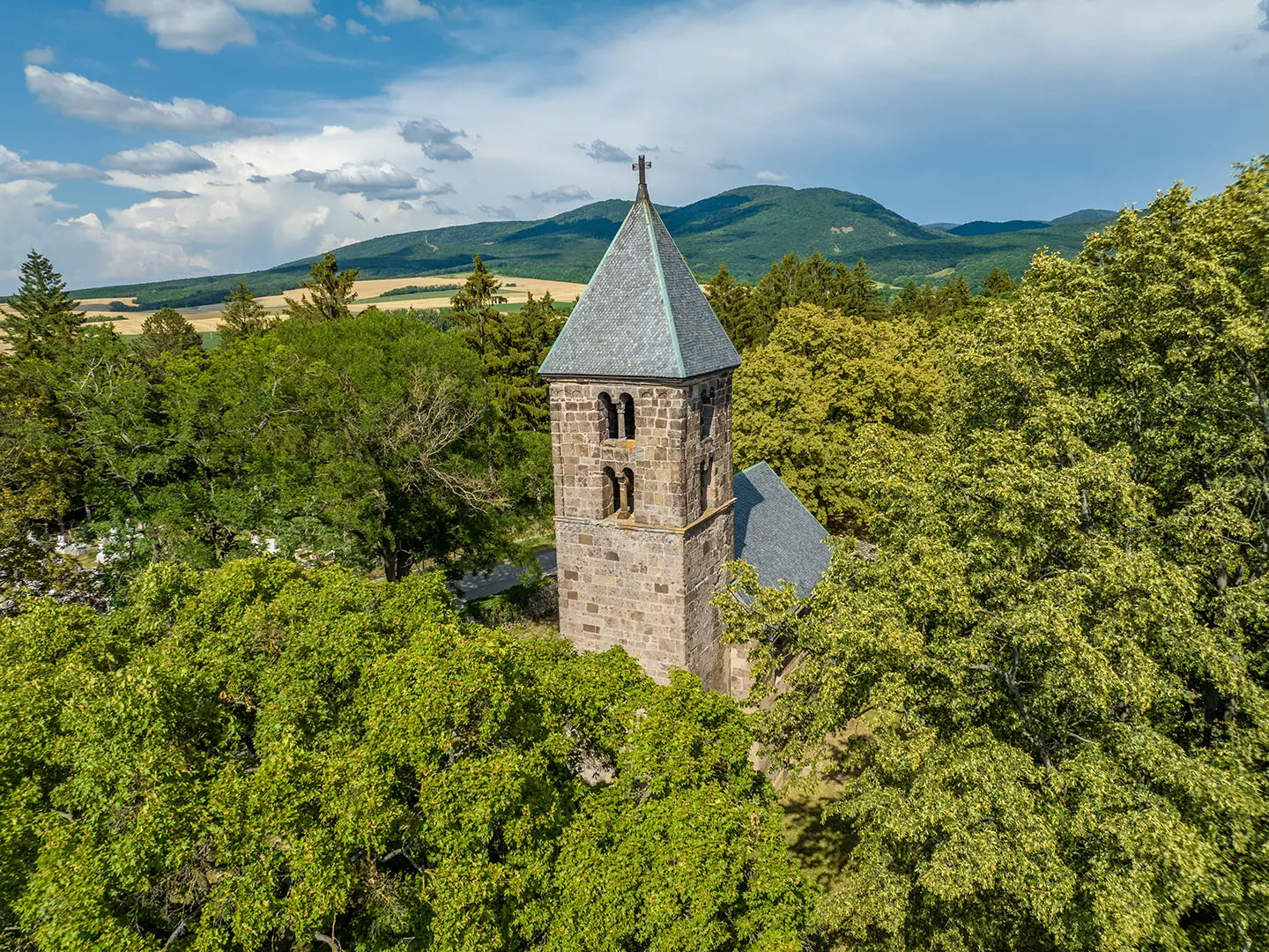
Börzsöny Mountains Trail
How would you rate Börzsöny Mountains Trail?
Tap a star to share your experience and help other hikers.
Börzsöny Mountains Trail: A Full-Day Ridge Traverse
HikeList Score
Börzsöny Mountains Trail scored 82/100 on HikeList's trail-quality metrics.
See score breakdownHide breakdown
- Ideal length 55
- Balanced challenge 100
- Scenery & wildness 98
- Varied terrain 71
- Accommodation 75
- Food & support 81
- Path quality 98
- Season flexibility 63
Computed from length, challenge, scenery & wildness, terrain variety, accommodation, food & support, path quality and season flexibility.
The Börzsöny Mountains Trail is best understood as a representative day hike in northern Hungary, not a single official long-distance trail. This 21 km point-to-point traverse crosses the forested volcanic range north of the Danube Bend, climbing Nagy-Hideg-hegy and Csóványos, the Börzsöny’s highest summit at 938 m. Expect a moderate but sustained mountain day, usually 6–8 hours moving, with about 944 m of ascent. It suits fit hikers who want a serious Budapest-accessible route through Duna-Ipoly National Park.
Route Overview
The documented 21 km traverse runs point-to-point from Nagybörzsöny over Nagy-Hideg-hegy and Csóványos to Diósjenő; Királyrét is also a major trailhead for routes onto the same central ridge. The hike links forest dirt paths, stony sections, steep climbs, open meadow viewpoints and high beech and oak woodland. Diósjenő has rail access, while Királyrét is reached by the historic narrow-gauge forest railway from Kismaros, with train and bus connections from Budapest. This is not a branded official trail: the Börzsöny has 30+ colour-blazed routes, plus the National Blue Trail and the Börzsönyi Kéktúra. For other Hungarian mountain and karst walking, compare the Bükk National Park Trail and Aggtelek National Park Trail.
Forests, Mining and Forest Railways
The Börzsöny is an extinct, eroded volcanic range and the westernmost block of the North Hungarian Mountains. Its forests and ore shaped local history: Nagybörzsöny was a medieval gold, silver and iron mining town, with mines recorded from 1312, and tellurium was first identified in Börzsöny ore in 1789. From 1893, narrow-gauge forest railways expanded across the mountains for timber work and later tourism. Much of the range is now protected within Duna-Ipoly National Park.
Notable highlights
- Csóványos (938 m): The highest summit in the Börzsöny, topped by a steel lookout tower about 22–23 m tall. In clear conditions the 360-degree view takes in the Danube Bend, the Pilis, the Ipoly valley and, in winter, sometimes the High Tatras.
- Nagy-Hideg-hegy (~864 m): A high, breezy ridge with open viewpoints, a tourist house and a small ski centre. It is one of the key high points on the traverse.
- Királyrét: A popular green-valley trailhead served by the Királyrét narrow-gauge forest railway, running since 1893. It is a practical access point for day hikes into the central Börzsöny.
- Nagybörzsöny: A historic mining town on the western flank of the range, linked with medieval gold, silver and iron mining. It is also associated with the first identification of tellurium in local ore.
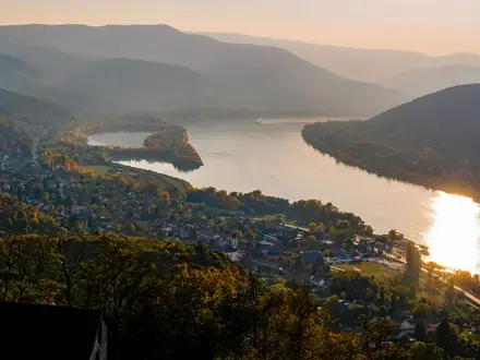
- Danube Bend viewpoints: The higher ridges give repeated panoramas towards the Danube Bend, the Ipoly valley and the neighbouring Pilis range.
- Börzsöny forest railways: The mountains once had more than 200 km of narrow-gauge forest railways. The surviving Királyrét and Szob–Nagybörzsöny lines remain useful heritage attractions for walkers.
Challenges to expect
The main difficulty is the cumulative climbing: the route gains about 944 m, with sustained ascents to Csóványos and several sharper rises. Paths are mostly forest dirt with rocky or stony sections, and they can become muddy and slippery after rain. Navigation matters because this is a network of colour-blazed paths, not one official trail. In spring and autumn, sudden fog and rain can reduce visibility on the ridges.
HikeList Score
Börzsöny Mountains Trail scored 82/100 on HikeList's trail-quality metrics.
See score breakdownHide breakdown
- Ideal length 55
- Balanced challenge 100
- Scenery & wildness 98
- Varied terrain 71
- Accommodation 75
- Food & support 81
- Path quality 98
- Season flexibility 63
Computed from length, challenge, scenery & wildness, terrain variety, accommodation, food & support, path quality and season flexibility.
 Hungary
Show more data Show less
- Mountainous
- Forest
- Dirt
- Rocky
- Stony
- Huts
- Guesthouses
- Campsites
- Family Friendly
- Pet Friendly
- Water Sources
- Campsites
- Shelters
Photos from hikers
Taken on the trail by people who've reviewed Börzsöny Mountains Trail.
What is the National Blue Trail in Hungary?
The National Blue Trail is Hungary’s most famous long-distance hiking route, stretching over 1,100 kilometers from Írottkő Mountain on the Austrian border to Hollóháza near the Slovakian border. It passes through diverse landscapes, connecting many of Hungary’s scenic regions, including the Börzsöny Mountains, and is marked with distinctive blue and white trail signs.
Is there good hiking in Hungary?
Yes, Hungary offers excellent hiking opportunities with a network of well-marked trails through scenic landscapes such as forests, hills, and national parks. The Börzsöny Mountains Trail is a prime example, featuring diverse terrain, natural beauty, and accessible routes for hikers of various skill levels.
What is the most famous natural sight in Hungary?
The most famous natural sight in Hungary is Lake Balaton, known as the "Hungarian Sea." It is the largest freshwater lake in Central Europe and a popular destination for hiking, swimming, and water sports.
What is the long distance trail in Hungary?
The long-distance trail in Hungary is the National Blue Trail, which spans over 1,100 kilometers across the country and connects many of Hungary's most notable natural and cultural sites, including the Börzsöny Mountains.
What is the highest point in Hungary?
The highest point in Hungary is Kékes Mountain, which rises to 1,014 meters above sea level and is located in the Mátra mountain range.
Where to hike around Budapest?
Around Budapest, popular hiking areas include the Buda Hills, Pilis Mountains, and the Börzsöny Mountains Trail. These regions offer well-marked trails, scenic forests, and beautiful viewpoints within easy reach of the city.
Reviews
How would you rate Börzsöny Mountains Trail?
Tap a star to start your review — you could be the first.