Walensee Panorama Trail
How would you rate Walensee Panorama Trail?
Tap a star to share your experience and help other hikers.
Walensee Panorama Trail: Lake Cliffs, Waterfalls and Quinten
HikeList Score
Walensee Panorama Trail scored 82/100 on HikeList's trail-quality metrics.
See score breakdownHide breakdown
- Ideal length 55
- Balanced challenge 100
- Scenery & wildness 82
- Varied terrain 94
- Accommodation 74
- Food & support 88
- Path quality 98
- Season flexibility 89
Computed from length, challenge, scenery & wildness, terrain variety, accommodation, food & support, path quality and season flexibility.
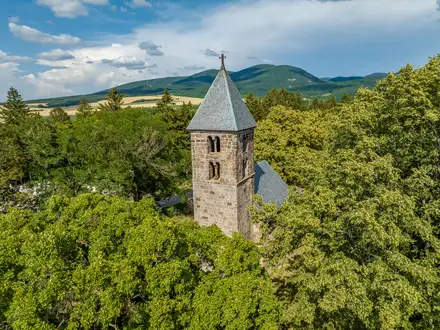
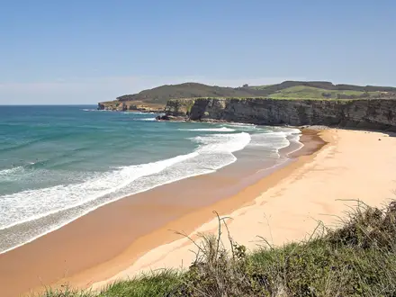
The Walensee Panorama Trail is a 21 km, one-day, point-to-point hike on the steep, car-free north shore of Walensee in eastern Switzerland. It links Weesen and Walenstadt via Betlis, the Seerenbach Falls, Quinten and Au, beneath the limestone wall of the Churfirsten. Expect a moderate Swiss mountain-hiking route around T2: well waymarked, but narrow, uneven, locally steep and exposed. It suits fit day hikers wanting lake views, waterfall side trips, boat options and no overnight commitment.
Route Overview
Walk west to east from Weesen to Walenstadt, or reverse it; Quinten is the usual midpoint. From Weesen the route follows the north shore towards Fli and Betlis, with an optional visit to the Seerenbach Falls and Rinquelle before the narrow cliff path to Quinten. The eastern half continues via Au to Walenstadt, with some gravel-road walking on the approach. Both ends are on public transport, and boats stop at Weesen, Betlis, Quinten, Au and Walenstadt, so you can shorten the walk or return by ship. For higher Swiss panorama routes, compare the Davos to Arosa Panorama Trail or the Aletsch Glacier Panorama Trail.
A Road-Free Shore Shaped by Footpaths and Boats
Quinten and the north shore of Walensee have never had a road, so the lake path and boat services have long been the practical access routes. The sheltered, south-facing slopes around Quinten have supported viticulture and fruit growing for generations. Seerenbach Falls and the Rinquelle karst spring became natural curiosities for visitors; the falls were widely, but incorrectly, promoted as Switzerland’s highest until corrected in 2009. Today the shore path forms part of the signposted St. Gallen and SwitzerlandMobility hiking network around Walensee.
Notable highlights
- Seerenbach Falls (about 585 m total): A three-tier waterfall near Betlis, with cascades of about 50 m, 305 m and 190 m. It is the third-highest waterfall in Switzerland, and the 305 m middle drop is among the highest free-falling cascades in the world. Spring brings the strongest flow; from around mid-August the Seerenbach can run low or dry.
- Rinquelle: A powerful karst spring beside the Seerenbach Falls and one of the largest in Europe. Its cave system has been explored back into the mountain, but the ultimate water source remains unknown.
- Quinten: A tiny, road-free hamlet reached only on foot or by boat. Its mild microclimate supports vineyards, figs, kiwifruit and palms, and hikers will find lakeside restaurants and an honesty shop.
- Churfirsten: The seven-peaked limestone ridge rising above the north shore of Walensee. It forms the dramatic wall above the route for much of the day.
- Walensee: A deep, fjord-like Alpine lake between the Churfirsten and the Glarus Alps. Its turquoise water is visible for most of the traverse.
- Betlis: A small shore settlement and boat stop near Weesen. It is the gateway to Seerenbach Falls and the start of the narrow cliff path towards Quinten.
Challenges to expect
The route is moderate rather than technical, but do not treat it as a flat lakeside stroll. Expect uneven dirt and gravel paths, forest, meadow, vineyard terraces, rocky cliff sections and short exposed passages, especially between Betlis and Quinten. Sturdy footwear is advised and the trail is not suitable for buggies. In hot weather the south-facing shore can feel warm; in spring, wet paths near the falls may be slippery. For a tougher multi-day Swiss option, see the Alpine Pass Route (Route 6).
HikeList Score
Walensee Panorama Trail scored 82/100 on HikeList's trail-quality metrics.
See score breakdownHide breakdown
- Ideal length 55
- Balanced challenge 100
- Scenery & wildness 82
- Varied terrain 94
- Accommodation 74
- Food & support 88
- Path quality 98
- Season flexibility 89
Computed from length, challenge, scenery & wildness, terrain variety, accommodation, food & support, path quality and season flexibility.
 Switzerland
Show more data Show less
- Forest
- Mountainous
- Lakeside
- Vineyards
- Cliffs
- Dirt
- Gravel
- Rocky
- Hotels
- Guesthouses
- Family Friendly
- Pet Friendly
- Restrooms
- Water Sources
- Campsites
- Picnic Areas
Photos from hikers
Taken on the trail by people who've reviewed Walensee Panorama Trail.
Reviews
How would you rate Walensee Panorama Trail?
Tap a star to start your review — you could be the first.