Dee Valley Way
How would you rate Dee Valley Way?
Tap a star to share your experience and help other hikers.
Dee Valley Way: Corwen to Llangollen in a Day
HikeList Score
Dee Valley Way scored 78/100 on HikeList's trail-quality metrics.
See score breakdownHide breakdown
- Ideal length 55
- Balanced challenge 100
- Scenery & wildness 68
- Varied terrain 100
- Accommodation 66
- Food & support 88
- Path quality 92
- Season flexibility 63
Computed from length, challenge, scenery & wildness, terrain variety, accommodation, food & support, path quality and season flexibility.
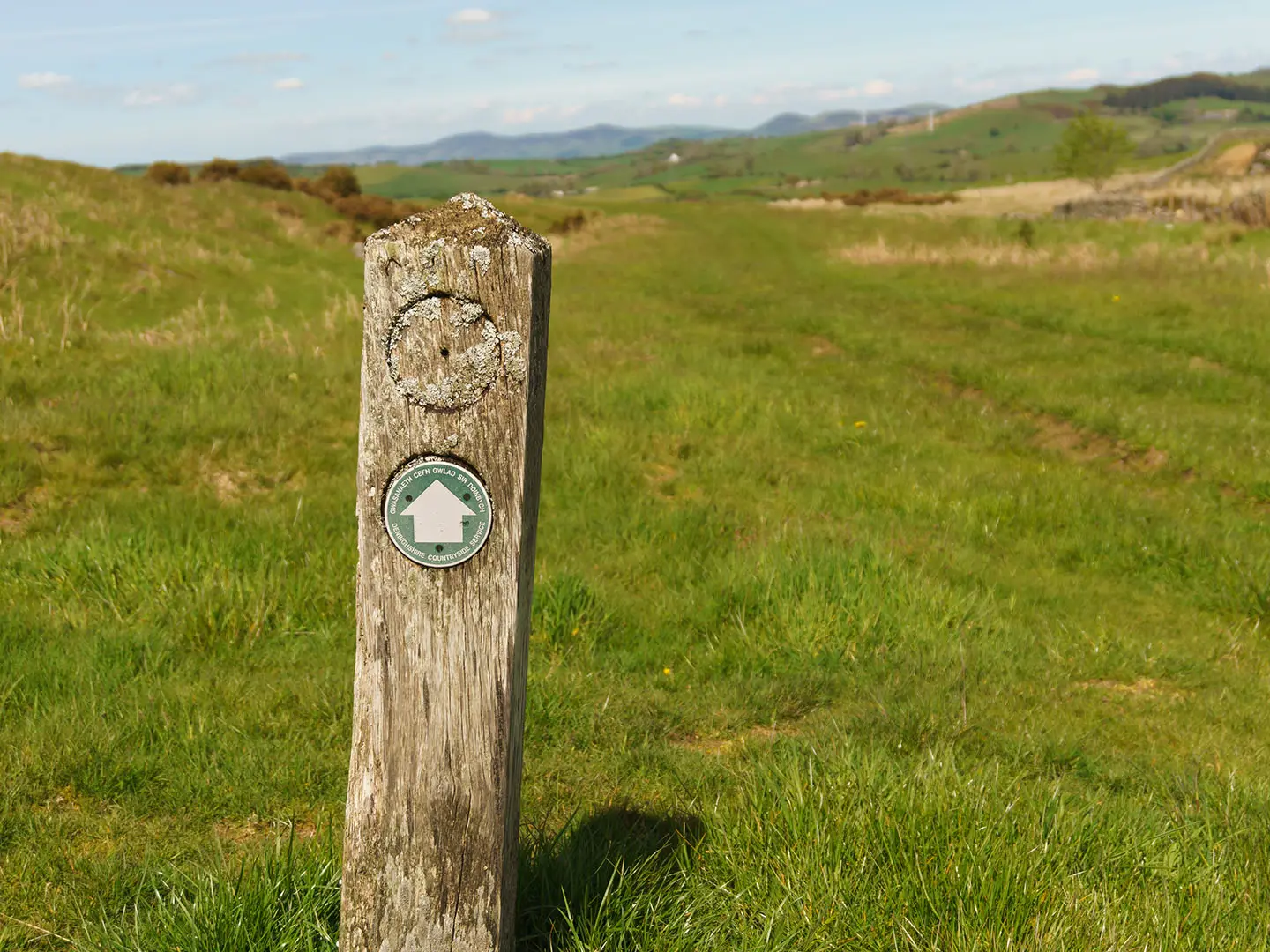
The Dee Valley Way is a 21 km point-to-point day walk in north-east Wales, linking Corwen and Llangollen through the Clwydian Range and Dee Valley National Landscape. It follows the northern side of the River Dee, mixing lanes, field paths, hillside tracks, open moorland and a level canal towpath finish. The route is moderate overall, but doing it in one push is demanding, with about 625 m of ascent and a high point around 400–414 m.
Route Overview
The official direction starts in Corwen, crosses Corwen Bridge over the River Dee and climbs to Caer Drewyn hillfort before heading east via Carrog. It then crosses the moorland of Bwlch y Groes / Mynydd Bychan, skirts Cwm Tydi and descends to Rhewl, where there is a riverside pub. The final approach passes Llantysilio / Landynan, reaches Horseshoe Falls and the head of the Llangollen Canal near Berwyn, then follows the towpath into Llangollen. Corwen and Llangollen are both on the A5 and linked by regular bus and the heritage Llangollen Railway, making this linear walk practical in either direction.
History of the Dee Valley Way
The Dee Valley Way is a waymarked regional trail developed and maintained by Denbighshire County Council / Denbighshire Countryside Service. It links the historic market towns of Corwen and Llangollen along the north side of the Dee valley, passing ancient and industrial landmarks in a short distance: Caer Drewyn Iron Age hillfort, medieval bridges and churches, and Thomas Telford’s early 19th-century Horseshoe Falls and Llangollen Canal engineering.
Notable highlights
- Caer Drewyn hillfort: An Iron Age hillfort above Corwen with a large dry-stone rampart. It gives wide views over the Dee and Alwen confluence and is linked in legend with Owain Glyndwr.
- River Dee / Afon Dyfrdwy: The trail shadows the Dee valley for much of the day. The river rises at Llyn Tegid near Bala and is known for salmon, grayling and rich valley wildlife.
- Carrog and the Llangollen Railway: Carrog is a station on the heritage Llangollen Railway. It can help with one-way logistics or let walkers combine part of the route with a preserved train journey.
- Horseshoe Falls: A curved weir on the Dee built by Thomas Telford in 1808 to feed the Llangollen Canal. It marks the canal head before the easy towpath finish.
- Llangollen Canal towpath: The final level stretch follows the canal into Llangollen, within the UNESCO World Heritage Pontcysyllte Aqueduct and Canal corridor.
- Longer Welsh hiking options: If you want a bigger Welsh itinerary after this day walk, compare it with the Beacons Way, the Anglesey Coastal Path or the shorter Aber Falls Walk.
Challenges to expect
The distance is modest, but the full route is still a long hill day: about 21 km with roughly 625 m of ascent. Expect repeated climbs, rougher hill sections, stiles and exposed moorland around Bwlch y Groes / Mynydd Bychan. Navigation is helped by clear waymarking, but the upland ground can be boggy in winter. Food and drink options are mainly at the towns, with Rhewl mid-route.
HikeList Score
Dee Valley Way scored 78/100 on HikeList's trail-quality metrics.
See score breakdownHide breakdown
- Ideal length 55
- Balanced challenge 100
- Scenery & wildness 68
- Varied terrain 100
- Accommodation 66
- Food & support 88
- Path quality 92
- Season flexibility 63
Computed from length, challenge, scenery & wildness, terrain variety, accommodation, food & support, path quality and season flexibility.
 United Kingdom
 Wales
WalesShow more data Show less
- Valley
- Hillside
- Upland Moorland
- Canal
- Quiet Lanes
- Field Paths
- Hillside Tracks
- Rough Moorland
- Canal Towpath
- Guesthouses
- Pubs
- Family Friendly
- Pet Friendly
- Restrooms
- Water Sources
- Campsites
- Picnic Areas
Photos from hikers
Taken on the trail by people who've reviewed Dee Valley Way.
Reviews
How would you rate Dee Valley Way?
Tap a star to start your review — you could be the first.