Bükk National Park Trail
How would you rate Bükk National Park Trail?
Tap a star to share your experience and help other hikers.
Bükk National Park Trail: Bükk Plateau Day Hike Guide
HikeList Score
Bükk National Park Trail scored 86/100 on HikeList's trail-quality metrics.
See score breakdownHide breakdown
- Ideal length 55
- Balanced challenge 100
- Scenery & wildness 98
- Varied terrain 64
- Accommodation 100
- Food & support 88
- Path quality 98
- Season flexibility 89
Computed from length, challenge, scenery & wildness, terrain variety, accommodation, food & support, path quality and season flexibility.
The “Bükk National Park Trail” is not one official named route: it is best treated as a representative 21 km, 1-day moderate loop on the Bükk Plateau in northern Hungary. Starting from Szilvásvárad, the hike follows waymarked forest and karst paths through the Szalajka Valley, climbs onto the Bükk-fennsík, and can include Istállós-kő. It suits walkers wanting a full mountain day without technical scrambling, but with real distance, around 600 m of ascent and careful navigation.
Route Overview
Most hikers start and finish in Szilvásvárad, the western gateway to Bükk National Park. The classic approach heads up the Szalajka Valley past the Veil (Fátyol) Waterfall, then climbs through beech forest towards Istállós-kő and the high karst plateau. A fuller circuit can continue across open meadows such as Nagy-mező before returning towards Szilvásvárad; Bánkút is another common plateau objective. The narrow-gauge Szilvásvárad forest railway runs up the lower valley and can shorten the return. This is a representative loop, not a dedicated waymarked trail; point-to-point crossings to Bánkút or Lillafüred also exist. Nearby options include Eger Castle to Szépasszony Valley and the karst walking of Aggtelek National Park Trail.
Bükk National Park and Ice Age Caves
Bükk National Park was founded in 1977 as Hungary’s third national park and protects forested limestone mountains, caves and karst systems. The range has a long human record: caves including Istállós-kő and Szeleta have yielded Palaeolithic tools and Ice Age animal remains, with the Szeleta finds giving their name to the Szeletian culture. Szilvásvárad is also known for Lipizzaner horse breeding.
Notable highlights
- Szalajka Valley: The main approach from Szilvásvárad, with a stream, trout ponds and the open-air Forestry Museum along the valley floor. It is the easiest way to begin the climb towards the plateau.
- Veil (Fátyol) Waterfall: A tufa cascade in the Szalajka Valley, where water spreads over roughly 17 limestone steps. It is a short, worthwhile stop before the steeper forest paths begin.
- Istállós-kő and its cave: The summit above Szilvásvárad is 958 m and is the Bükk’s second-highest peak. Its cave is important for Palaeolithic finds and Ice Age fauna.
- Bükk Plateau (Bükk-fennsík): A high karst tableland of beech forest, dolines, swallow-holes and meadows such as Nagy-mező. This is the core high-level section of the day.
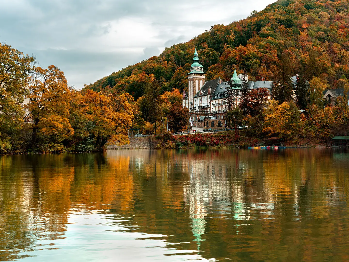
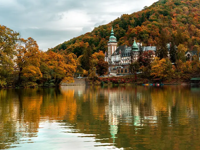
- Lillafüred and Lake Hámori: The eastern gateway to the Bükk, with Lake Hámori, the Palace Hotel and the Szinva waterfall. It is a scenic finish for longer point-to-point crossings.
- Szilvásvárad forest railway: A narrow-gauge line running up the lower Szalajka Valley. It is useful if you want to shorten the walk back to the village.
Challenges to expect
Expect a moderate but sustained day: around 21 km, about 600 m of ascent, stony karst paths, rooty forest sections and mud after rain. There is no single “Bükk National Park Trail” blaze, so use the coloured-stripe waymarks with a good map. Winter snow and ice are common on the plateau, making spring to autumn the better season. For longer Hungarian waymarked walking, compare the Alföld Blue Trail or Börzsöny Mountains Trail.
HikeList Score
Bükk National Park Trail scored 86/100 on HikeList's trail-quality metrics.
See score breakdownHide breakdown
- Ideal length 55
- Balanced challenge 100
- Scenery & wildness 98
- Varied terrain 64
- Accommodation 100
- Food & support 88
- Path quality 98
- Season flexibility 89
Computed from length, challenge, scenery & wildness, terrain variety, accommodation, food & support, path quality and season flexibility.
 Hungary
Show more data Show less
- Mountainous
- Forest
- Dirt
- Rocky
- Hotels
- Lodges
- Huts
- Campsites
- Hostels
- Family Friendly
- Pet Friendly
- Restrooms
- Water Sources
- Campsites
- Shelters
- Picnic Areas
Download Our Full Guide to Bükk National Park Trail FREE!
Get our comprehensive guide to this hike for free. Save it for later reading or print out at home.
Photos from hikers
Taken on the trail by people who've reviewed Bükk National Park Trail.
Bükk National Park Trail: The Complete Guide
 i
Image by Bernadett
i
Image by Bernadett The Bükk National Park Trail is a flexible mountain day in Northern Hungary, usually built as a loop from Szilvásvárad into the limestone heart of Bükk National Park. It suits walkers who want more than a valley stroll: beech forest, karst paths, a high plateau and a real summit, without scrambling or technical ground.
The gentlest start follows Szalajka-völgy (Szalajka Valley) past trout ponds, the open-air Forestry Museum and Fátyol-vízesés (Veil Waterfall). From Gloriett-tisztás (Gloriett Glade), the walk changes character as paths climb towards Istállós-kői-barlang (Istállós-kő Cave) and the forested summit of Istállós-kő.
Higher up, the route reaches the Bükk-fennsík (Bükk Plateau), a karst tableland of old beech woods, dolines and open meadows such as Nagy-mező (Great Meadow). Longer variants can push towards Bánkút or cross towards Lillafüred, but the classic Szilvásvárad circuit returns to the same village.
This is not one officially named, single-blazed trail, so the exact line depends on the coloured-stripe paths chosen. A full plateau loop is a moderate but sustained day of roughly 20–22 km with about 600 m of ascent, stony and rooty sections, possible mud after rain, and navigation that deserves a proper map.
This guide covers route stages, timings, accommodation, food, transport, terrain and the common mistakes to avoid.
Stage-by-Stage Guide
The Szilvásvárad circuit is best treated as four planning sections within one long walking day, not as separate overnight stages. There is no single official Bükk National Park Trail blaze: the route is assembled from Hungary’s coloured-stripe waymark network, so the exact line and distance vary with the paths chosen. Carry a proper Bükk hiking map and do not rely on the stage names alone for navigation.
Stage 1: Szilvásvárad to Fátyol-vízesés / Gloriett-tisztás — approx. 5 km
This is the easiest and most accessible part of the route, following Szalajka-völgy (Szalajka Valley) up from the western gateway village of Szilvásvárad. The walking is on a graded valley path and forest-railway corridor rather than open mountain ground, making it a gentle start before the steeper climb to the plateau.
The stage passes the Szalajka-völgy trout ponds, the Szabadtéri Erdei Múzeum (Open-air Forestry Museum), and Fátyol-vízesés (Veil Waterfall), a 17 m tufa cascade over limestone steps. Gloriett-tisztás (Gloriett Glade), the upper terminus of the Szilvásvárad kisvasút (narrow-gauge forest railway), is the natural break point before the cave and summit climb.
Food and water planning should be done in Szilvásvárad before setting out. Do not rely on regular resupply once the walk leaves the village and heads for the plateau; any seasonal valley facilities should be checked before travelling.
Accommodation is concentrated back in Szilvásvárad, where there are hotels, guesthouses, holiday apartments and a campsite. This first stage is normally not used as an overnight stop.
Public transport access is strongest at the start of the walk. Szilvásvárad has a railway station and the Szilvásvárad-Szalajkavölgy halt near the valley mouth, with connections via Eger; buses from Eger also serve Szilvásvárad. The kisvasút runs roughly 5 km up the valley to Gloriett-tisztás and can be useful for shortening the lower-valley walking, but operating dates and times should be checked before travelling.
Navigation is straightforward by Bükk standards because the valley is linear and well defined. The main planning decision is whether to walk the valley both ways or use the forest railway for one lower section. After rain, expect damp and muddy patches even on the easier valley paths.
Stage 2: Gloriett-tisztás to Istállós-kő via Istállós-kői-barlang — approx. 4 km
From Gloriett-tisztás the character changes quickly from valley walking to a steeper forest climb. The path to Istállós-kői-barlang (Istállós-kő Cave) is short but steep, and the onward route gains height through beech forest towards Istállós-kő.
Istállós-kői-barlang is one of the key landmarks of the route: a triangular-mouthed cave with important Palaeolithic finds, including cave-bear bones, stone and bone tools, and a hearth. Above it, Istállós-kő reaches 958.1 m and is the highest point on this Szilvásvárad loop, as well as the Bükk’s second-highest peak.
Underfoot, expect rooty forest sections and stony karst paths rather than technical ground. There is no scrambling, but this stage is a sustained climb and feels much more like mountain walking than the Szalajka Valley approach.
There should be no assumed food, water or shelter on this section. Carry what is needed from Szilvásvárad, especially in warm weather, because the climb comes early enough in the day to punish a late start or underfilled bottle.
There is no public transport access on this stage once above Gloriett-tisztás. Accommodation is not a practical consideration at the summit; walkers normally continue across the plateau and return to Szilvásvárad, or link onwards towards Bánkút on a longer high-level route.
Navigation needs more attention here than in the valley. The route leaves the obvious valley corridor and joins the coloured-stripe path network, so identify the correct onward waymark before starting the climb. In wet conditions the cave path and forest ascent can be slippery with mud, leaves and exposed roots.
Stage 3: Istállós-kő to Bükk-fennsík / Nagy-mező — approx. 6 km
This is the core high-level section of the walk, crossing the Bükk-fennsík (Bükk Plateau) after the ascent to Istállós-kő. The landscape broadens into high karst country: old beech forest, open meadows, dolines and swallow-holes, with the plateau ringed by the limestone Bükk rocks.
Nagy-mező (Great Meadow) is the main landmark on this stage, a broad open plateau meadow known for spring wildflowers and karst depressions. Bánkút, a small plateau settlement with a ski base and mountain lodge, is a common high-circuit objective or turning point on fuller versions of the loop.
The walking is moderate rather than technical, but the plateau should not be underestimated. Paths can be stony, muddy after rain and less enclosed than the forested climb below. In winter, snow and ice are common on the plateau and Bánkút functions as a small ski area, so winter conditions require equipment and judgement beyond a normal three-season day walk.
Food and water availability on the high plateau is limited. Bánkút has a mountain lodge/ski-base, but opening arrangements and services should be checked before travelling if relying on it. Most walkers should carry a full day’s food and enough water from Szilvásvárad.
Accommodation on or near this section is limited compared with the gateway villages. Bánkút has a mountain lodge and there are tourist rest houses on the plateau, but they should not be assumed available without advance planning. For the standard loop, Szilvásvárad remains the practical overnight base.
No public transport crosses the high plateau. This matters for section-hiking and bail-out planning: once committed to the plateau circuit, the realistic plan is to continue to the chosen descent or to a pre-arranged finish such as Bánkút on an extended variant.
Navigation is the main issue on this stage. The Országos Kéktúra (National Blue Trail) crosses the Bükk plateau on its blue-stripe blaze, but the Szilvásvárad circuit may also use other coloured-stripe paths depending on the chosen line. Check every junction against a map, especially around open meadow tracks and any optional diversion towards Bánkút.
Stage 4: Bükk-fennsík to Szilvásvárad — approx. 6 km
The final section descends from the Bükk-fennsík back towards Szilvásvárad and closes the loop. After the open high plateau, expect a return to forested paths, with stony karst ground and rooty sections underfoot before the easier lower-valley walking.
This stage is where fatigue can make a moderate route feel harder. The descent is not technical, but wet roots, mud and loose stones demand care, particularly after rain or in autumn leaf fall. In winter, icy shaded sections can persist on the plateau and upper forest paths.
There are no dependable food or water stops to plan around on the descent. If the route rejoins the Szalajka Valley near Gloriett-tisztás, the kisvasút may be useful for shortening the final lower-valley return to Szilvásvárad, subject to operating season and timetable.
Szilvásvárad has the best end-of-walk logistics, with hotels, guesthouses, holiday apartments and a campsite. It is the sensible base for the representative loop, especially because high-plateau shelter is limited and public transport does not cross the plateau.
For onward travel, use Szilvásvárad’s railway station or the Szilvásvárad-Szalajkavölgy halt near the valley mouth, with rail connections via Eger. Buses and trains from Eger serve Szilvásvárad, and Eger is linked by train to Budapest-Keleti with a change at Füzesabony. Current MÁV and Volánbusz times should be checked before travelling.
Navigation on the descent should be decided before leaving the high plateau, because several coloured-stripe routes can link the plateau with Szilvásvárad and the Szalajka Valley. Do not assume that every downhill path returns to the village by the intended line. A map, the correct waymark colours and enough daylight are the key safeguards for finishing the loop cleanly.
Recommended Itinerary
The most practical way to walk the representative Bükk National Park circuit is as a full-day loop from Szilvásvárad, with accommodation before and after in the village. Exact distance varies with the coloured-stripe paths chosen, so carry a current Bükk hiking map and check official mapping before booking anything that depends on timings.
Standard itinerary — full Szilvásvárad plateau loop
This is the best option for fit day-walkers who want the full mountain route: Szalajka-völgy (Szalajka Valley), Fátyol-vízesés (Veil Waterfall), Istállós-kői-barlang (Istállós-kő Cave), Istállós-kő and the Bükk-fennsík (Bükk Plateau). Allow a long day of around 6–8 hours for the full circuit.
| Day | From | To | Approx. distance | Why this stage makes sense | Services/accommodation notes |
|---|---|---|---|---|---|
| 1 | Szilvásvárad, at the Szalajka Valley mouth | Fátyol-vízesés / Gloriett-tisztás (Gloriett Glade) | ~5 km | This is the natural warm-up: a graded valley approach past the trout ponds, the Szabadtéri Erdei Múzeum (Open-air Forestry Museum) and the waterfall before the route steepens. | Szilvásvárad has hotels, guesthouses, holiday apartments and a campsite. The Szilvásvárad-Szalajkavölgy railway halt is close to the valley mouth. The kisvasút (narrow-gauge forest railway) runs up to Gloriett-tisztás and can shorten the lower-valley return; operating season and times should be checked before travelling. |
| 1 | Gloriett-tisztás | Istállós-kő summit via Istállós-kői-barlang | ~4 km | This is where the walk changes from valley path to mountain route. The cave is a worthwhile stop, then the path climbs to Istállós-kő, the 958.1 m high point of this loop. | Do not rely on services once above the valley floor. Carry water, food, waterproofs and navigation. |
| 1 | Istállós-kő | Bükk-fennsík / Nagy-mező (Great Meadow) | ~6 km | This gives the route its plateau character: beech forest, karst ground, dolines and open meadow sections. Navigation matters here because the route links separate coloured-stripe paths rather than following one named blaze. | High-plateau shelter is limited. Bánkút is an optional high-circuit objective with a mountain lodge/ski-base, but only include it if your mapped line and daylight allow. |
| 1 | Bükk-fennsík | Szilvásvárad | ~6 km | The final section completes the loop with the descent from the plateau back towards Szilvásvárad. It is best not to leave this too late, as tired legs and poor light make waymark navigation slower. | Finish back in Szilvásvárad for accommodation and transport. No public transport crosses the high plateau, so the loop avoids needing an end-of-day transfer. |
Slower variant — two nights in Szilvásvárad
This suits walkers arriving from Budapest, Eger or Miskolc who want a less rushed plan, mixed-ability groups, or anyone unsure about committing to the full plateau circuit immediately after travelling.
| Day | From | To | Approx. distance | Why this stage makes sense | Services/accommodation notes |
|---|---|---|---|---|---|
| 1 | Szilvásvárad | Szalajka-völgy, Fátyol-vízesés and Gloriett-tisztás, returning to Szilvásvárad | ~7.4 km return for the valley educational trail | This covers the easiest and most popular lower-valley section without the pressure of a full mountain day. It also gives time to check waymarks, weather and forest-railway times for the next day. | Stay in Szilvásvárad. The kisvasút may be useful if operating; check current hours before relying on it. |
| 2 | Szilvásvárad | Istállós-kő, Bükk-fennsík / Nagy-mező and return to Szilvásvárad | Check official mapping before booking | With the valley already visited, the second day can focus on the climb, the summit and the plateau. If using the kisvasút to reach or leave Gloriett-tisztás, the walking distance changes. | Stay again in Szilvásvárad or depart after the walk if transport times allow. MÁV and Volánbusz times should be checked before travelling. |
Faster or shorter variant — valley walk only, or railway-assisted day
This is the right choice for families, poor-weather days, late starts or walkers who do not want the navigation and exposure of the plateau. It is not the full high-level Bükk circuit.
| Day | From | To | Approx. distance | Why this stage makes sense | Services/accommodation notes |
|---|---|---|---|---|---|
| 1 | Szilvásvárad | Szalajka-völgy to Fátyol-vízesés / Gloriett-tisztás and back | ~7.4 km return; 2–3 hours | This gives a compact version of the route with the trout ponds, Forestry Museum, waterfall and wooded valley, while avoiding the long climb to Istállós-kő and the plateau navigation. | Easy to combine with arrival or departure via Szilvásvárad. The forest railway can shorten the return if running; check current operating season and timetable. |
| 1 | Gloriett-tisztás, if reached by kisvasút | Istállós-kő and selected plateau paths, returning to Szilvásvárad | Check official mapping before booking | This can reduce lower-valley mileage while still giving a mountain day, but it should only be planned around confirmed forest-railway times and a clear mapped route. | Do not plan this as a guaranteed shortcut unless the kisvasút is operating. Carry full hill gear; the plateau remains a proper mountain environment even if the valley approach is shortened. |
Longer point-to-point crossings to Bánkút or Lillafüred are separate plans rather than the standard loop. They can be rewarding, but distances, waymarks, accommodation and onward transport need checking carefully before booking because no public transport crosses the high plateau.
Planning the Route
The main planning decision is which version of the walk to do. There is no single officially named or blazed “Bükk National Park Trail”, so the route is built by linking Hungary’s coloured-stripe waymarks between Szilvásvárad, Szalajka-völgy (Szalajka Valley), Istállós-kő, the Bükk-fennsík (Bükk Plateau) and, on longer options, Bánkút or Lillafüred.
Most walkers should treat the classic Szilvásvárad plateau circuit as a full-day mountain walk rather than a short tourist stroll. The lower valley to Fátyol-vízesés (Veil Waterfall) is easy to plan as a half-day outing, but the plateau loop needs an early start, a proper map and enough daylight for navigation on forest and karst paths.
How many days to allow
For the representative Szilvásvárad loop, allow one full day on the hill. It is not naturally split into overnight stages because it starts and ends in the same village and the high plateau has limited shelter and services.
A slower two-day visit can work well if the first day is used for the Szalajka-völgy educational trail, Fátyol-vízesés, the Open-air Forestry Museum and the kisvasút (narrow-gauge forest railway), leaving the longer climb to Istállós-kő and the plateau circuit for a separate day. This is often a better plan for mixed groups, families or anyone arriving in Szilvásvárad late in the day.
Longer point-to-point crossings to Bánkút or Lillafüred require more careful planning. Accommodation and transport options are concentrated at the gateways, while Bánkút has a mountain lodge/ski-base rather than a full village range of services.
Choosing a route option
| Option | What it suits | Key planning notes |
|---|---|---|
| Szalajka-völgy only | Easy half-day walking, families, poor-weather fallback | Follows the lower valley to Fátyol-vízesés and Gloriett-tisztás. The kisvasút can shorten the return when operating; check current season and hours before relying on it. |
| Full Szilvásvárad plateau loop | Fit walkers wanting the main mountain circuit | Plan for a long day with the climb via Istállós-kői-barlang and Istállós-kő, then a high-level section across the Bükk-fennsík and Nagy-mező before returning to Szilvásvárad. |
| Plateau loop with Bánkút | Walkers wanting a longer high-level objective | Bánkút is a useful high-plateau landmark and possible turning point, but services are limited compared with Szilvásvárad or Lillafüred. |
| Point-to-point to Lillafüred | Strong walkers or section hikers crossing the Bükk | This changes the logistics completely: transport must be arranged at both ends, and no public transport crosses the high plateau. Times for MÁV trains and Volánbusz buses should be checked before travelling. |
Shortening and extending the walk
The easiest way to shorten the day is to stay in the Szalajka-völgy rather than climbing to the plateau. The valley route alone still gives access to the trout ponds, Fátyol-vízesés and Gloriett-tisztás without committing to the longer forest climb and high karst terrain.
The kisvasút between Szilvásvárad and Gloriett-tisztás can also reduce time and effort on the lower valley section. Do not build a tight itinerary around it without checking current operating dates and hours.
Extensions are made by adding more plateau walking towards Nagy-mező, Bánkút or, on a much bigger traverse, Lillafüred and Hámori-tó (Lake Hámori). Because the route is a network walk rather than a fixed trail, extra distance depends entirely on which coloured-stripe paths are linked.
Section hiking practicality
Section hiking is practical in a limited sense, but not in the way it would be on a long-distance trail with frequent trailheads. Szilvásvárad and Lillafüred are the logical access points; the plateau itself is not served by public transport crossing the high ground.
A useful approach is to base in Szilvásvárad and walk separate loops or out-and-back sections over two days. Using Lillafüred as the eastern base makes sense for walkers planning a separate crossing or exploring the Miskolc side, but it is not part of the standard Szilvásvárad loop.
Accommodation planning
For the loop, accommodation is simplest in Szilvásvárad. The village has hotels, panzió guesthouses, holiday apartments and a campsite, and it avoids the need for onward transport after a long day.
Lillafüred has more hotels and pensions, including the historic Hotel Palota by Hámori-tó, but it is mainly relevant for point-to-point crossings or a separate stay on the eastern side of the Bükk. On the plateau, Bánkút and tourist rest houses offer more limited options, so overnight plans there should be booked and checked carefully in advance.
Food and water
Carry the day’s food from Szilvásvárad unless accommodation or a planned stop has been arranged elsewhere. The lower valley is the busy tourist part of the route, but the high plateau should be treated as a self-sufficient mountain section.
Do not assume reliable food or water once above Gloriett-tisztás. In warm weather, the open meadow sections around Nagy-mező can feel more exposed than the forested approach, while after rain the stony and rooty paths can be slower than expected.
Navigation priorities
Navigation is the main practical issue on this hike. There is no dedicated “Bükk National Park Trail” blaze; you must follow the Hungarian coloured-stripe waymark system and know which colours link the day’s chosen line.
The Országos Kéktúra (National Blue Trail) crosses the Bükk plateau on Section 23 and is marked with the blue-stripe blaze, but it is only one part of the wider network. Carry a proper Bükk hiking map, use the Hungarian place names as signposted, and check the junctions carefully around the plateau and forest descents.
Transport planning
Public transport works well for reaching the gateways, but not for moving across the high plateau. Szilvásvárad has a railway station and the Szilvásvárad-Szalajkavölgy halt near the valley mouth; Eger has bus and rail links to Szilvásvárad, and Eger is reached by train from Budapest-Keleti with a change at Füzesabony.
From the east, Lillafüred is the gateway near Miskolc. For any point-to-point route finishing at Bánkút or Lillafüred, check both outward and return transport before committing to the walk, as missing the last connection can be a serious problem. Current MÁV and Volánbusz times should be checked before travelling.
Weather, season and access checks
Late April to October is the most straightforward planning window. Spring and autumn are especially good for the beech forest and plateau meadows, but rain can leave karst paths muddy and rooty forest sections slippery.
Winter is a different proposition. Snow and ice are common on the plateau, and Bánkút operates as a small ski area, so winter walkers should plan for colder high-ground conditions rather than valley weather in Szilvásvárad.
Before travelling, check the Bükki Nemzeti Park Igazgatóság information for any current trail restrictions or closures, especially in strictly protected areas. This should be checked before travelling.
Towns, Villages and Overnight Stops
The representative Bükk National Park circuit is normally walked as a long day from Szilvásvárad, so most hikers do not need an overnight stop on the route itself. Overnight planning is mainly about choosing a practical base, then carrying enough food, water and bad-weather kit for the plateau.
Do not plan the high Bükk-fennsík (Bükk Plateau) as if it were a serviced hut-to-hut route. Accommodation and shelter are limited away from the gateways, public transport does not cross the high plateau, and any food or opening hours above the valley should be checked before travelling.
Szilvásvárad
Szilvásvárad is the main base for the classic loop. The route starts from the mouth of Szalajka-völgy (Szalajka Valley), reached from the village centre and the Szilvásvárad-Szalajkavölgy railway halt, then returns to the same village at the end of the circuit.
This is the best overnight stop for the standard walk. Accommodation includes hotels, guesthouses (panzió), holiday apartments and a campsite, giving the widest choice directly on the route. Booking ahead is sensible in the main walking season and around local holiday periods.
Szilvásvárad is also the practical place to organise food and last-minute supplies before going up to the plateau. Shop, café and restaurant availability can vary by season and day of the week, so this should be checked before travelling; in any case, carry a full day’s food rather than relying on plateau services.
Transport is straightforward by Bükk standards. Szilvásvárad has its own railway station, plus the Szilvásvárad-Szalajkavölgy halt at the valley mouth; trains run from Eger, and buses from Eger take about 40 minutes. Eger is reached by train from Budapest-Keleti with a change at Füzesabony. Verify current MÁV and Volánbusz times before travel.
Szalajka-völgy (Szalajka Valley)
Szalajka-völgy is the easy lower-valley approach from Szilvásvárad towards the waterfall, the Gloriett-tisztás (Gloriett Glade) and the climb to Istállós-kő. It is not an overnight base in the usual sense, but it is the most useful low-level section for pacing the day.
The valley contains several key stopping points: the trout ponds (pisztrángos tavak), the Szabadtéri Erdei Múzeum (Open-air Forestry Museum), Fátyol-vízesés (Veil Waterfall) and the upper Gloriett-tisztás area. These are good places for short breaks before the steeper forest climb begins.
The Szilvásvárad kisvasút (narrow-gauge forest railway) runs for about 5 km up the valley to Gloriett-tisztás and can shorten the lower-valley return. Its operating season, timetable and fares should be checked before travelling, especially outside the main summer period.
Do not depend on valley facilities for a full walking day unless they have been checked in advance. The route becomes more committing beyond Gloriett-tisztás, so water, food and clothing should already be sorted before leaving Szilvásvárad.
Gloriett-tisztás and Istállós-kői-barlang
Gloriett-tisztás is the upper end of the forest railway and the transition point between the gentler valley approach and the steeper paths towards Istállós-kői-barlang (Istállós-kő Cave) and Istállós-kő. It is a useful rest and decision point: continue upwards only if there is enough daylight, weather and energy for the plateau circuit.
This is not a normal overnight stop. Treat it as a daytime landmark, not a service point, and do not assume food, accommodation or transport beyond the narrow-gauge railway. If using the railway to shorten the day, confirm the last return service before setting off up the valley.
Bükk-fennsík and Nagy-mező
The Bükk-fennsík (Bükk Plateau) is the high-level core of the walk, with forest, karst ground, dolines and open meadows such as Nagy-mező (Great Meadow). It gives the route its mountain character, but it is also the section where services become sparse and navigation matters most.
For the standard Szilvásvárad loop, this is not an overnight zone for most walkers. The sensible plan is to carry everything needed for the day and return to accommodation in Szilvásvárad. Snow and ice are common on the plateau in winter, and mud can linger after rain, so timing and equipment matter more here than in the valley.
There is no public transport across the high plateau. If extending the route or attempting a point-to-point crossing, the onward accommodation and exit transport should be arranged before starting.
Bánkút
Bánkút is a small plateau settlement and ski base, often used as an optional objective or turning point on fuller high-circuit variations. It sits high on the Bükk-fennsík, close to Nagy-mező, and is one of the few named service points on the plateau.
Accommodation is limited compared with the gateway villages. Bánkút has a mountain lodge/ski-base, and there are tourist rest houses (turistaház) on the plateau, but capacity and opening arrangements should be checked before travelling. It is not a place to reach late in the day without a booking.
Food availability at Bánkút should also be treated as limited and seasonal unless confirmed in advance. Walkers using Bánkút as part of a longer crossing should still carry enough food and water to be self-sufficient between the gateways.
Because no public transport crosses the high plateau, Bánkút is not a simple bail-out point in the way a valley town would be. Any plan to finish, stay or be collected there needs to be organised in advance.
Lillafüred and Hámori-tó
Lillafüred, beside Hámori-tó (Lake Hámori), is not on the classic Szilvásvárad loop. It matters for longer eastbound point-to-point crossings of the Bükk, where it forms a practical finishing area on the Miskolc side.
It is a strong overnight option for those extending beyond the representative loop. Lillafüred has hotels and pensions, including the historic Hotel Palota by Lake Hámori, and offers more settlement-based comfort than the high plateau. Accommodation should be booked ahead if finishing a crossing there.
Lillafüred is about 12 km from Miskolc, making it a useful eastern gateway. Transport from Miskolc to Lillafüred, and onward travel after a crossing, should be checked before travelling.
Eger and Miskolc
Eger and Miskolc are not overnight stops on the walking route itself, but they are the main nearby access towns. Eger is the more direct public-transport gateway for Szilvásvárad, with buses taking about 40 minutes and trains about 50 minutes to Szilvásvárad.
Miskolc is the main access point for Lillafüred and the eastern side of the Bükk. It is useful if planning a point-to-point crossing rather than the Szilvásvárad loop.
For walkers arriving from Budapest, Eger is reached by train from Budapest-Keleti with a change at Füzesabony. Current train and bus times should be checked with MÁV and Volánbusz before booking accommodation around a walking day.
Getting to the Start
The practical start for the classic loop is Szilvásvárad, at the mouth of Szalajka-völgy (Szalajka Valley). The most convenient access point is the village centre or the Szilvásvárad-Szalajkavölgy railway halt, which sits close to the valley entrance.
By train
Szilvásvárad is on the MÁV rail line from Eger. Trains from Eger to Szilvásvárad take about 50 minutes, with the Szilvásvárad-Szalajkavölgy halt useful for starting directly at the valley mouth.
From Budapest, travel by train from Budapest-Keleti to Eger, changing at Füzesabony. Build in enough time for the connection onward to Szilvásvárad, especially if aiming to start walking the same day.
MÁV timetables should be checked before travelling. This matters because the full plateau loop is a 6–8 hour mountain day, and a late arrival in Szilvásvárad can leave too little daylight for the high circuit.
By bus
Buses run from Eger to Szilvásvárad and take about 40 minutes. For many walkers, Eger is the simplest public-transport hub before reaching the trailhead.
From Miskolc, the more natural eastern access is Lillafüred, around 12 km away, but that is relevant mainly for longer point-to-point crossings rather than the standard Szilvásvárad loop. To start the loop from Szilvásvárad, travelling via Eger is usually the cleaner public-transport approach.
Volánbusz times should be checked before travelling. Also check the final return options before committing to any longer crossing towards Bánkút or Lillafüred, as public transport does not cross the high plateau.
By car
Driving gives the most flexibility for an early start from Szilvásvárad and is especially useful if staying in the village the night before. The loop returns to Szilvásvárad, so no end-to-end vehicle shuttle is needed for the representative circuit.
Parking arrangements at or near the Szalajka-völgy entrance can change with season and visitor pressure. Long-stay parking availability and any charges should be checked before travelling.
Do not rely on using a car to solve logistics on the high plateau itself. Public transport does not cross the plateau, and a point-to-point walk ending at Bánkút or Lillafüred needs a separate return plan.
From the nearest airport
International walkers will usually connect through Budapest, then continue overland by train from Budapest-Keleti towards Eger, changing at Füzesabony, before taking the onward train or bus to Szilvásvárad. Airport-to-station transfer times in Budapest should be allowed for when planning same-day travel.
If arriving late in the day, it is more practical to overnight in Eger or Szilvásvárad rather than attempt the plateau loop immediately. Current rail and bus connections should be checked before booking flights around a tight walking schedule.
Where to stay before starting
Szilvásvárad is the best place to stay before the standard loop. The village has hotels, guesthouses (panzió), holiday apartments and a campsite, and staying here allows an early start up Szalajka-völgy without needing a morning connection from Eger.
Eger is the main nearby transport hub and works well if arriving by train from Budapest, but it adds a bus or train transfer to Szilvásvárad before walking. That is manageable for the shorter Szalajka Valley walk, but less ideal for the full plateau circuit unless transport times line up early.
Lillafüred has hotels and pensions, including the historic Hotel Palota by Hámori-tó (Lake Hámori), but it is the eastern gateway rather than the start of the Szilvásvárad loop. It is better suited to longer Bükk crossings finishing on the Miskolc side.
The Szilvásvárad kisvasút (narrow-gauge forest railway) runs about 5 km up Szalajka-völgy to Gloriett-tisztás (Gloriett Glade) and can shorten the lower-valley section or the return. Its operating season and daily timetable should be checked before travelling.
Getting Home from the Finish
For the representative loop, the finish is back in Szilvásvárad, so leaving the trail is straightforward compared with a high-plateau finish. The main practical issue is timing: the full plateau circuit is a long 6–8 hour mountain day, and public transport times should be checked before travelling.
If choosing a point-to-point variant to Bánkút or Lillafüred, plan the exit before committing to the route. Public transport does not cross the high Bükk-fennsík (Bükk Plateau), so a finish at Bánkút is much less convenient than finishing back in Szilvásvárad or down at Lillafüred.
By train
Szilvásvárad has its own railway station, and the Szilvásvárad-Szalajkavölgy halt is close to the mouth of Szalajka-völgy (Szalajka Valley), where the walk starts and finishes. Trains connect Szilvásvárad with Eger in roughly 50 minutes.
For Budapest, travel first to Eger, then continue by train towards Budapest-Keleti, changing at Füzesabony. Current MÁV times should be checked before travelling, especially if finishing late in the day or hiking outside the main visitor season.
The Szilvásvárad kisvasút (narrow-gauge forest railway) is useful only inside the valley, running between the lower Szalajka-völgy area and Gloriett-tisztás (Gloriett Glade). It can shorten the final valley walk back, but it is not a mainline onward transport option and its operating season and hours should be checked before relying on it.
By bus
Buses run between Szilvásvárad and Eger, taking about 40 minutes. This is often the simplest onward route if the bus time fits the end of the walking day.
From Eger, onward connections are available towards Budapest and other regional destinations. Volánbusz times should be checked before travelling, as evening and weekend services can be the limiting factor on a one-day hike.
If finishing a longer crossing at Lillafüred, onward travel is normally via Miskolc, about 12 km away. Exact local connections from Lillafüred to Miskolc should be checked before travelling.
By car/taxi
For the standard loop, a car-based plan is simple because the route returns to Szilvásvárad. This avoids the need to synchronise the end of a long plateau day with the last usable bus or train.
For point-to-point variants, do not assume there will be easy transport from the high plateau. Bánkút has a lodge and ski-base, but no public transport crossing the plateau is available, so any taxi or pickup should be arranged in advance.
A late finish is best treated conservatively. If the descent back to Szilvásvárad runs into the evening and public transport no longer works, stay locally rather than planning an uncertain onward journey.
From the nearest airport
No airport is directly useful for the trailhead or finish. The practical public-transport approach is to travel through Budapest, continue by train from Budapest-Keleti to Eger with a change at Füzesabony, then take the train or bus to Szilvásvárad.
Flight-linked journeys need a generous buffer. Delays on arrival, the transfer across Budapest, and the final Eger–Szilvásvárad connection can make a same-day onward plan fragile; current rail and bus times should be checked before booking.
Where to stay at the finish
Szilvásvárad is the best place to stay after the standard loop. It has hotels, guesthouses (panzió), holiday apartments and a campsite, and staying overnight removes pressure from the final descent and transport connection.
For a point-to-point finish on the eastern side, Lillafüred has hotels and pensions, including the historic Hotel Palota by Hámori-tó (Lake Hámori). This is more practical than trying to exit from Bánkút late in the day.
On the plateau, Bánkút has a mountain lodge/ski-base and there are tourist rest houses, but high-plateau accommodation is limited. Availability should be checked before travelling, and it should not be treated as a fallback unless booked or clearly operating.
Which Direction Should You Walk?
Standard direction: Szilvásvárad → Szalajka-völgy → Istállós-kő → Bükk-fennsík → Szilvásvárad
The most practical direction for the representative loop is to start in Szilvásvárad and walk up Szalajka-völgy (Szalajka Valley) first, passing the trout ponds, Szabadtéri Erdei Múzeum (Open-air Forestry Museum), Fátyol-vízesés (Veil Waterfall) and Gloriett-tisztás (Gloriett Glade) before climbing to Istállós-kői-barlang (Istállós-kő Cave) and Istállós-kő.
This gives the day a sensible progression: easy valley walking first, then the steeper forest climb, then the high Bükk-fennsík (Bükk Plateau) and Nagy-mező (Great Meadow) section once the legs are warmed up. It also puts the most popular lower-valley sights early in the day, before they are likely to feel like an anticlimax after the plateau.
The climb is generally better this way. The lower approach uses the valley floor and forest-railway corridor before the steeper path to the cave and summit, so the hardest ascent does not begin immediately from the village. In reverse, the short steep cave path is likely to be taken downhill towards Gloriett-tisztás, which can be less comfortable on tired legs, especially if the path is muddy after rain.
Reverse direction: Szilvásvárad → plateau first → Istállós-kő → Szalajka-völgy → Szilvásvárad
The reverse direction can work, especially for walkers who want to reach the high plateau earlier in the day. It may suit a hot summer day if an early start is used to gain height before the warmest part of the afternoon, though the route is largely forested and there is no reliable directional weather advantage.
The main drawback is psychological and navigational. Starting with the plateau side means tackling the less obvious high-level navigation sooner, before the route has settled into the clear Szalajka-völgy approach. Because there is no single “Bükk National Park Trail” blaze, you must be confident following the coloured-stripe waymark network from the start.
The reverse does give a gentle final run-out down Szalajka-völgy, with the possibility of using the Szilvásvárad kisvasút (narrow-gauge forest railway) from Gloriett-tisztás if it is operating. Current operating season and times should be checked before travelling.
Transport, accommodation and finish logistics
For the standard Szilvásvárad loop, transport is the same in either direction because the walk starts and finishes in the same village. Szilvásvárad has rail access, including the Szilvásvárad-Szalajkavölgy halt near the valley mouth, and buses and trains connect via Eger; current MÁV and Volánbusz times should be checked before travelling.
Accommodation flow also favours neither direction on the loop. Most walkers base in Szilvásvárad and carry only day-walking kit, rather than relying on limited high-plateau accommodation.
For longer point-to-point crossings towards Bánkút or Lillafüred, direction should be chosen around accommodation and onward transport rather than scenery alone. Public transport does not cross the high plateau, so any non-loop itinerary needs more careful planning.
Recommendation
Walk the loop in the standard direction: Szilvásvárad → Szalajka-völgy → Fátyol-vízesés → Gloriett-tisztás → Istállós-kői-barlang → Istállós-kő → Bükk-fennsík / Nagy-mező → Szilvásvárad.
This direction gives the cleanest build-up, the easiest start, the better uphill line to Istállós-kő and the most straightforward use of the valley and forest railway as a late-day fallback. Reverse direction is viable, but it is better reserved for walkers with a specific reason to reach the plateau early and the confidence to navigate the high-level waymarks from the outset.
Accommodation Along the Route
Accommodation planning for the Bükk National Park Trail is straightforward if you treat it as a Szilvásvárad-based day walk. The representative loop returns to the same village, so most walkers book one or two nights in Szilvásvárad and walk with a daypack.
The high plateau is different: accommodation is sparse, distances between services are awkward, and there is no continuous chain of villages across the Bükk-fennsík (Bükk Plateau). For longer crossings towards Bánkút or Lillafüred, book the overnight stops before fixing the walking itinerary.
| Place | Accommodation level | Best for | Notes |
|---|---|---|---|
| Szilvásvárad | Good | Main base for the classic loop; easiest logistics | Hotels, panzió-style guesthouses, holiday apartments and a campsite. Best choice for walking the Szalajka-völgy (Szalajka Valley), Fátyol-vízesés (Veil Waterfall), Istállós-kő and the plateau as a day circuit. |
| Szalajka-völgy / Gloriett-tisztás | None | Day-walk access only | The valley has visitor sights and the kisvasút (narrow-gauge forest railway), but it should not be treated as an overnight stop. Return to Szilvásvárad or continue onto the plateau. |
| Bükk-fennsík / Nagy-mező | None to very limited | Self-sufficient daytime walking | The plateau has forest, meadows and karst terrain rather than village accommodation. Do not rely on finding a bed, food or a sheltered stop here without a specific booking. |
| Bánkút | Limited | High-plateau overnight on longer variants | Bánkút has a mountain lodge / ski-base and tourist-rest-house style accommodation. Capacity is limited and winter ski periods or good-weather weekends can fill quickly. |
| Lillafüred | Good | Finish or start for point-to-point crossings | More hotels and pensions cluster around Lillafüred and Hámori-tó (Lake Hámori), including the historic Hotel Palota. Useful for crossings to the Miskolc side, not for the standard Szilvásvárad loop. |
| Eger or Miskolc | Good, but off-route | Backup town bases | Practical if Szilvásvárad or Lillafüred are full, or if combining the walk with public transport. They are not trail stops, so timetable planning matters. |
Best base: Szilvásvárad
For the classic ~21 km loop, Szilvásvárad is the most practical overnight stop. Staying here avoids carrying overnight kit onto the plateau and gives the simplest start from the Szalajka Valley mouth.
Accommodation choice is mixed, from hotels and guesthouses to apartments and camping. Book ahead for summer, autumn-colour weekends and holiday periods, especially if arriving without a car or needing to stay close to the valley entrance.
Staying on the plateau
Bánkút is the main high-level accommodation option, but it should be treated as limited rather than flexible. It works for walkers linking a longer plateau route or breaking a crossing, but not as a casual fallback if the day runs late.
The rest of the Bükk-fennsík has very little practical hiker accommodation. Carry food, water and warm layers for the plateau section, and do not plan the route around finding services at Nagy-mező or between waymarked junctions.
Lillafüred for point-to-point routes
Lillafüred is the sensible eastern overnight stop if extending beyond the Szilvásvárad loop. It has a stronger accommodation base than the plateau itself and is useful for routes finishing by Hámori-tó (Lake Hámori) on the Miskolc side.
This changes the walk from a simple loop into a crossing, so transport and luggage planning become more important. There is no public transport across the high plateau, so onward connections from Lillafüred or transfers back to Szilvásvárad should be planned before setting out.
Booking strategy
For a normal day hike, book Szilvásvárad for the night before and, if travelling a long way afterwards, the night after as well. This removes pressure from the descent and avoids depending on late public transport after a 6–8 hour mountain day.
For a crossing via Bánkút or to Lillafüred, secure the overnight accommodation first, then build the route around it. Plateau beds are limited, and winter conditions can coincide with ski-area demand at Bánkút.
Current opening periods, prices and payment arrangements should be checked before booking. Hungary uses Hungarian forint (HUF / Ft), and smaller guesthouses or plateau accommodation may have more limited payment options than large hotels.
Luggage transfer, taxis and inn-to-inn practicality
This is not a classic inn-to-inn route with daily accommodation at regular intervals. The best version for most walkers is a fixed-base trip from Szilvásvárad, carrying only day-walking gear.
A private taxi may help with awkward point-to-point logistics between gateways, but availability and costs should be checked before travelling. Do not assume organised luggage transfer exists for this route unless arranged directly with accommodation providers or a local operator.
Wild camping or informal overnighting on the plateau should not be used as a planning shortcut. The route lies inside Bükk National Park, and any camping or bivouac arrangements must comply with current local rules; this should be checked before travelling.
A representative full-day circuit from Szilvásvárad follows the Szalajka Valley past the Veil Waterfall, climbs through forest towards Istállós-kő, reaches the Bükk Plateau and returns to the village. Exact distance varies by chosen waymarks; the forest railway can shorten the lower-valley return.
Useful Links
Hand-picked external resources for planning and researching the Bükk National Park Trail — official trail sites, maps and GPX downloads, baggage transfer and local information. Each link opens in a new tab.
Official & reference
- Szalajka Valley educational trail — Bükki Nemzeti Park Igazgatóság (official) bnpi.hu
The national park directorate's own page for the Szalajka-völgy nature trail — the walk's opening section — with trail length, the ten interpretive stations, the Fátyol waterfall, Forestry Museum and Istállós-kő cave, plus visitor rules for the protected area.
- Szalajka Valley tour — Szilvásvárad tourism (official) szilvasvarad.hu
The village's official English visitor guide to the Szalajka Valley approach: trout ponds, Veil (Fátyol) Waterfall, the open-air Forestry Museum, Gloriett glade and the path up to the Istállós-kő cave.
Maps & GPX
- A Bükk tetején — Természetjáró (MTSZ) route with map and GPX termeszetjaro.hu
The Hungarian Hikers' Association portal's 8.3 km circuit from the Gloriett glade over Istállós-kő and the plateau rim, with interactive map, elevation profile and GPX download — the core climb of the fuller Szilvásvárad loop (in Hungarian).
-
 OKT-23 Szarvaskő–Putnok — Országos Kéktúra (National Blue Trail) section kektura.hu
The official National Blue Trail page for the section that crosses the Bükk via Bélapátfalva and Bánkút, with GPX download and stamp points. Useful for extending the loop into a plateau crossing — and for its warning that Bánkút is the plateau's only water source.
Planning & logistics
- Szilvásvárad Forest Railway — official kisvasút page szilvasvarad.hu
The narrow-gauge forest railway running almost 5 km up the Szalajka Valley to the Gloriett glade since 1908, with the restored steam engine Szilvi. Handy for shortening the valley leg; timetable and current HUF fares are linked from the page.
Local area & national parks
-
 Bükk National Park — Wikipedia en.wikipedia.org
Encyclopaedic overview of Hungary's third national park (founded 1977): the forested karst plateau between Szilvásvárad and Lillafüred, its caves, geology and protected beech forests.
- Istállós-kő — Wikipedia en.wikipedia.org
Background on the loop's 958 m high point, the Bükk's second-highest peak, and its Palaeolithic cave — including why the range's surveyed highest point (Szilvási-kő, 960.7 m) lies elsewhere on the plateau.
External links are provided for convenience and are not affiliated with HikeList. Always check official sources for the latest trail conditions before you set out.
Is the Bükk National Park Trail an official waymarked trail?
No — there is no single blazed 'Bükk National Park Trail'. The name describes a representative day loop stitched together from Hungary's coloured-stripe waymark network around Szilvásvárad, using paths such as the green and blue stripe-and-symbol routes towards Istállós-kő, while the blue-stripe Országos Kéktúra (National Blue Trail) crosses the plateau on its Szarvaskő–Putnok section. Carry a proper Bükk hiking map or GPX track and follow the coloured waymarks between features rather than expecting one continuous blaze.
How long does the Bükk National Park Trail loop take?
The full representative loop from Szilvásvárad over Istállós-kő and the Bükk-fennsík (Bükk Plateau) is about 21 km with roughly 600 m of ascent, a sustained day of about 6 to 8 hours' walking. A shorter alternative is the Szalajka-völgy (Szalajka Valley) educational trail to the Fátyol waterfall and back, about 3.7 km each way and 2 to 3 hours in total. The narrow-gauge forest railway can trim the valley section at either end of the day.
How hard is the Bükk National Park Trail?
It is a moderate hike with no technical or scrambling ground, but the distance makes it a genuine mountain day: stony karst paths, rooty beech-forest climbs and mud after rain, with around 600 m of height gain. The lower Szalajka Valley is easy, level and family-friendly as far as the Fátyol waterfall; the plateau section is longer, quieter and needs a map, proper footwear and water. On the high plateau there are no reliable water sources apart from Bánkút, so carry enough for the whole day.
Where does the Bükk National Park Trail start and how do you get there?
The loop starts and finishes in Szilvásvárad, the western gateway to the national park, entering the Szalajka-völgy (Szalajka Valley) from the village. Szilvásvárad is reached from Eger by bus in about 40 minutes or by train in about 50 minutes, with the Szilvásvárad-Szalajkavölgy halt right by the valley mouth; from Budapest-Keleti take the train towards Eger with a change at Füzesabony. No public transport crosses the high plateau itself, so check current MÁV and Volánbusz timetables before travelling.
What is the highest point on the Bükk National Park Trail?
The highest point on the classic Szilvásvárad loop is Istállós-kő at 958 m, the second-highest summit of the Bükk, climbed through beech forest above the famous Palaeolithic cave of the same name. The range's very highest ground — around 961 m, with Szilvási-kő (960.7 m) surveyed as the top of the Bükk since 2014 — lies elsewhere on the plateau, away from this circuit. The plateau is Hungary's highest tableland, so the loop still gives the country's best high-level walking.
When is the best time of year to hike in Bükk National Park?
Late April to October is the best window for the Bükk National Park Trail loop. Spring brings wildflowers to the plateau meadows such as Nagy-mező, summer offers shady beech forest, and autumn colours the woods spectacularly. Snow and ice are common on the plateau in winter — Bánkút even operates as a small ski base — so the high circuit is best avoided then.
Do you need a permit or pay a fee to hike the Bükk National Park Trail?
No permit is needed and walking the waymarked trails is free. The area is a protected national park, so stay on the designated paths, leave plants and wildlife undisturbed and carry litter out, as the park directorate requests. Attractions along the way — the forest railway, the Forestry Museum and village sights — charge their own fares and entry prices in Hungarian forint (HUF), so bring some cash or a card for those.
Can you use the Szilvásvárad forest railway to shorten the hike?
Yes — the narrow-gauge kisvasút has run up the lower Szalajka Valley since 1908 and covers almost 5 km from the valley mouth to Gloriett-tisztás (Gloriett glade), from where the climb to the Istállós-kő cave and summit begins. Riding it one way saves the flattest section and is a highlight in its own right, with the restored steam engine Szilvi hauling some services. It is seasonal and popular, so check the current timetable and HUF fares on the official Szilvásvárad site.
Reviews
How would you rate Bükk National Park Trail?
Tap a star to start your review — you could be the first.