Andros Route
How would you rate Andros Route?
Tap a star to share your experience and help other hikers.
Andros Route: A Complete Hiking Guide
HikeList Score
Andros Route scored 86/100 on HikeList's trail-quality metrics.
See score breakdownHide breakdown
- Ideal length 94
- Balanced challenge 100
- Scenery & wildness 78
- Varied terrain 100
- Accommodation 74
- Food & support 74
- Path quality 78
- Season flexibility 76
Computed from length, challenge, scenery & wildness, terrain variety, accommodation, food & support, path quality and season flexibility.
The Andros Route is a 100 km waymarked thru-hike across Andros in the Cyclades, Greece, usually walked north to south in 10 days. It follows historic stone-paved footpaths, walled lanes and dirt tracks from the Gavrio area to the Dipotamata gorge above Ormos Korthiou. The grade is moderate, with hard-feeling sections where the route climbs and descends steeply through the island’s mountainous interior. It suits fit hikers who want village-to-village walking, coastal sections and a less crowded Greek island trail.
Route Overview
This is a point-to-point route, officially starting at Frousei above the port of Gavrio and finishing in the Dipotamata gorge above Ormos Korthiou. It can be walked in reverse, but the standard sequence runs north to south through or near Gavrio, Batsi, Arni, Vourkoti, Apoikia, Menites, Chora, Paleopolis and Korthi. In 2015 it became the first trail on a European island to be certified a Leading Quality Trail – Best of Europe by the European Ramblers Association. The 10 official sections cross central mountain ranges and do not all finish in villages with accommodation, so overnight planning often uses nearby settlements rather than strict stage ends. Gavrio is the island’s port and the practical northern gateway. If comparing Greek island hikes, the Fira to Oia Trail is much shorter, while the E4 Trail on Crete is a larger island traverse.
Historic Footpaths of Andros
The Andros Route is stitched from a centuries-old kalderimi network that once linked villages, terraced farmland, watermills, monasteries and harbours through the Byzantine and Venetian/Ottoman periods and the island’s later shipowning prosperity. Many paths fell into disuse before restoration work began in the 1990s, with 12 routes and 85 km signposted in 1997. Since 2012, the volunteer organisation Andros Routes has systematised, cleared and waymarked the wider network to European standards.
Notable highlights
- Chora (Andros Town): The island capital sits on a marble-paved spur and makes a natural mid-route rest, food and resupply stop. Look for neoclassical shipowners’ mansions, a Venetian castle ruin and the Museum of Contemporary Art.
- Menites springs: A shaded green hamlet known for cold spring water flowing from marble lion-head fountains beneath plane trees. It is one of the best cooling stops on the central route.
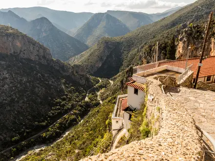
- Panachrantou Monastery: A fortress-like monastery high on the slopes of Mount Petalo, traditionally founded around 960 AD. The approach involves a steep climb, rewarded by wide valley and sea views.
- Apoikia and the Sariza spring: Apoikia is a mountain village on the central section of the route. Its Sariza mineral spring has been bottled and sold across Greece since 1929.
- Pythara waterfalls: A lush ravine biotope near Apoikia and Vourkoti, where a stream forms small waterfalls and pools. It is reached by a short detour and is greenest in spring.
- Dipotamata gorge: A Natura 2000-protected gorge above Ormos Korthiou, known for its old watermills and open-air eco-museum feel. The southern stages descend through it toward the finish.
Challenges to expect
Expect repeated steep climbs and descents on stone-paved paths, walled lanes, dirt tracks and short asphalt sections. The crossing of Mount Petalo is a demanding part of the route, and some remote stretches have limited water and shade. Summer heat can be harsh; winter brings rain and strong winds on the ridges. Waymarking is red-and-white throughout, but accommodation spacing means stages need planning. For a bigger mainland-style challenge, compare the E4 Greek Section.
HikeList Score
Andros Route scored 86/100 on HikeList's trail-quality metrics.
See score breakdownHide breakdown
- Ideal length 94
- Balanced challenge 100
- Scenery & wildness 78
- Varied terrain 100
- Accommodation 74
- Food & support 74
- Path quality 78
- Season flexibility 76
Computed from length, challenge, scenery & wildness, terrain variety, accommodation, food & support, path quality and season flexibility.
 Greece
Show more data Show less
- Mountainous
- Coastal
- Ravines
- Terraced Hillsides
- Stone Paved
- Dirt Tracks
- Cement Paved Lanes
- Asphalt
- Hotels
- Guesthouses
- Family Friendly
- Pet Friendly
- Water Sources
- Campsites
Download Our Full Guide to Andros Route FREE!
Get our comprehensive guide to this hike for free. Save it for later reading or print out at home.
In these collections
Photos from hikers
Taken on the trail by people who've reviewed Andros Route.
Andros Route: The Complete Guide
 i
Image by TETYANA
i
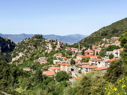
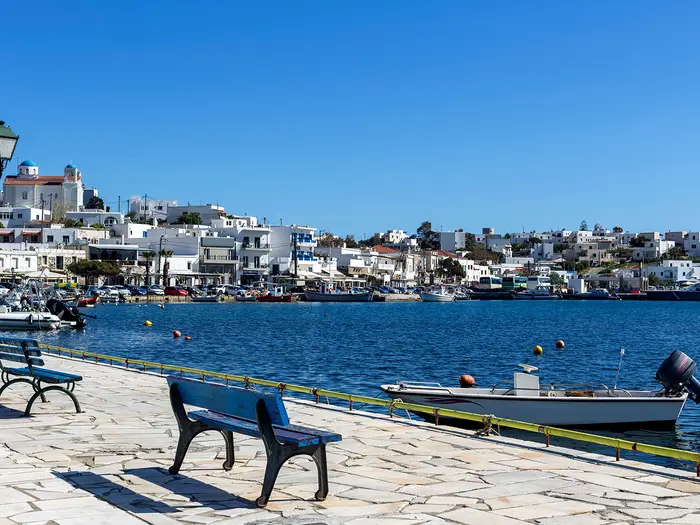
Image by TETYANA The Andros Route is a 100 km village-to-village traverse of Άνδρος (Andros), the northernmost Cycladic island, linking the Frousei valley above Γαύριο (Gavrio) with the Δίποταμα (Dipotamata) gorge above Όρμος Κορθίου (Ormos Korthiou). It is a Greek island walk with real mountain character: stone kalderimi, walled lanes, spring-fed ravines, terraced hillsides and long views over the Aegean.
Its appeal is the contrast between wild interior stages and practical village stops. The line passes places such as Μπατσί (Batsi), Άρνη (Arni), Βουρκωτή (Vourkoti), Απoίκια (Apoikia), Μένητες (Menites) and Χώρα / Άνδρος (Chora / Andros town), with watermills, springs, dovecotes and old mule paths giving the route its structure.
This is not a beach-holiday stroll with a few footpaths added on. The red-and-white waymarking is generally a major strength, and the trail is certified as a Leading Quality Trail – Best of Europe, but the island’s central mountains still mean repeated steep climbs and descents.
Fit walkers who enjoy independent, inn-to-inn hiking will get the most from it. The main planning issues are uneven accommodation spacing, limited water and shade on remote stages, and the need to avoid treating high summer heat casually.
This guide covers stages, daily planning, accommodation, food, transport, terrain and the common mistakes to avoid.
Stage-by-Stage Guide
The Andros Route’s official numbering is not a perfectly linear village-to-village chain. Stages 5 and 6 form a Paleopolis/Batsi link, and Stage 7 restarts from Απoίκια (Apoikia), so accommodation planning often differs from the stage list. Use the stage notes below as route-planning guidance, then match them to where beds, buses and transfers are actually available.
Distances are approximate. Red-and-white paint waymarks are used throughout, but the terrain is still mountainous and a current Andros Routes map or offline navigation is strongly recommended.
Stage 1: Frousei (above Γαύριο / Gavrio) to Γαύριο (Gavrio) / Scholi junction — 13 km
The opening stage begins in the Frousei watermill valley inland of Γαύριο (Gavrio), the island’s ferry port. It is a good introduction to Andros underfoot: old stone paths, bridges, walled lanes and sections of rougher track through a greener valley than many first-time Cyclades walkers expect.
The main landmark is the Frousei watermill valley itself, with old stone watermills and historic path infrastructure. The route then works down towards the coast and the port area around Γαύριο (Gavrio), where onward transport and services are easiest to arrange.
Food, water and accommodation: Γαύριο (Gavrio) is one of the main practical bases on the route, with accommodation and ferry-linked services. Do not rely on food or drink being available once away from the port area; start with enough water, especially outside spring.
Transport and access: Γαύριο (Gavrio) is the island’s ferry gateway, reached by car ferry from Ραφήνα (Rafina). KTEL Androu buses link Γαύριο (Gavrio) with Μπατσί (Batsi), Χώρα / Άνδρος (Chora / Andros town) and Όρμος Κορθίου (Ormos Korthiou), with timetables tied to ferry arrivals; current times should be checked before travelling.
Navigation and warnings: The route is waymarked, but the official start lies inland of the port, so plan how to reach the Frousei trailhead from Γαύριο (Gavrio). Expect uneven stone surfaces and possible loose footing on older path sections. In warm weather this is already a stage where an early start is sensible.
Stage 2: Γαύριο (Gavrio) / Scholi junction to Μπατσί (Batsi) — 7 km
This is a shorter northern stage, linking the Gavrio side of the island with Μπατσί (Batsi). It is less demanding in distance than the central mountain days, but still uses the characteristic mix of kalderimi, walled paths, dirt tracks and short asphalt sections.
The key historic feature on this flank is the Πύργος του Αγίου Πέτρου, the Hellenistic Tower of Agios Petros, one of the best-preserved ancient towers in the Aegean. The stage also gives the first strong sense of the island’s terraced slopes and coastal-to-interior transitions.
Food, water and accommodation: Μπατσί (Batsi) is a useful overnight stop with rooms, studios and holiday accommodation. Carry water from the start; do not assume reliable services between Γαύριο (Gavrio) and Μπατσί (Batsi).
Transport and access: Both Γαύριο (Gavrio) and Μπατσί (Batsi) sit on the main island bus corridor. This makes the stage one of the easier sections to shorten, skip or use for arrival-day logistics if ferry times require it.
Navigation and warnings: Waymarking is red-and-white, but keep attention at junctions where old lanes, access tracks and asphalt meet. The short distance can be misleading in hot conditions, as shade may be limited compared with the greener ravines and villages.
Stage 3: Μπατσί (Batsi) to Άρνη (Arni / Arnas) — 9 km
This stage leaves the coast-facing accommodation belt and climbs into the more rural interior. It is one of the points where the Andros Route starts to feel like a mountain walk rather than a coastal island path.
Underfoot, expect stone-paved mule paths, walled lanes, rougher stony ground and dirt tracks. The gradients become more serious as the route moves towards Άρνη (Arni), with terraces, dry-stone walls and occasional wider views back towards the Aegean.
Food, water and accommodation: Άρνη (Arni) is an interior village, but accommodation and services are more limited than in Γαύριο (Gavrio), Μπατσί (Batsi), Χώρα / Άνδρος (Chora / Andros town) or Όρμος Κορθίου (Ormos Korthiou). Beds at or near the stage end should be booked ahead, and availability should be checked before travelling. Carry food and enough water for the full day.
Transport and access: Road access exists to interior villages, but regular public transport options for this stage are not as straightforward as the main Gavrio–Batsi–Chora–Ormos corridor. Taxi or accommodation transfer arrangements may be needed; this should be checked before travelling.
Navigation and warnings: The climb from the Batsi side can be hot and exposed in settled weather. Loose stones on older kalderimi and descents require care, particularly when tired or carrying a multi-day pack.
Stage 4: Άρνη (Arni / Arnas) to Απoίκια (Apoikia) — 10 km
This is one of the most important mountain stages on the route, crossing the flanks of the Petalo–Kouvara massif, Andros’s highest ground. The trail does not summit Mount Kouvara itself, but it reaches the high central landscape where the route feels most remote.
The stage passes through the high interior around Άρνη (Arni) and Βουρκωτή (Vourkoti), with oak and walnut woods, steep gradients and wide Aegean views in clearer weather. Near the Apoikia/Vourkoti area, the signed detour to the Πυθάρα (Pythara) waterfalls leads into a lush spring-fed ravine, greenest in spring.
Απoίκια (Apoikia) is known for the Sariza spring, whose mineral water has been bottled and sold across Greece since 1929. It is one of the most useful natural water landmarks on the route, though walkers should still start the day carrying sufficient water.
Food, water and accommodation: This is not a stage for relying on cafés or shops en route. Carry lunch and water from Άρνη (Arni), and treat Απoίκια (Apoikia) accommodation as limited unless already booked. Some itineraries use Χώρα / Άνδρος (Chora / Andros town) as the practical overnight base instead.
Transport and access: Βουρκωτή (Vourkoti) and Απoίκια (Apoikia) are road-accessible villages, but public transport details for this mountain section should be checked before travelling. Pre-arranged taxis or guesthouse transfers can be useful if accommodation is not at the official stage end.
Navigation and warnings: This is a key stage for carrying a proper map, sun protection and extra water. The path is waymarked, but the central mountains are more remote, with fewer easy exit options than the coastal stages. Avoid attempting this section in high summer heat unless starts are very early and water carriage is conservative.
Stage 5: Απoίκια (Apoikia) to Παλαιόπολη (Paleopolis) — 15 km
At around 15 km, this is one of the longer official stages. It links the green mountain-village side of Απoίκια (Apoikia) with the west-coast historic site of Παλαιόπολη (Paleopolis), crossing a varied mix of lanes, stone paths, tracks and village approaches.
This is also the part of the route where many walkers make practical use of Χώρα / Άνδρος (Chora / Andros town), the island capital and the natural mid-route resupply stop. Χώρα has marble-paved streets, neoclassical shipowners’ mansions, a ruined Venetian castle and the Goulandris Museum of Contemporary Art, but for hikers its main value is food, accommodation, transport and the chance to reset supplies.
Παλαιόπολη (Paleopolis), the ancient capital, sits on a steep hillside above the sea. A long stone stairway descends towards the archaeological site and coast; if visiting, allow extra time and energy rather than treating it as part of a quick stage finish.
Food, water and accommodation: Χώρα / Άνδρος (Chora / Andros town) is the best resupply point associated with this part of the route. Accommodation at Παλαιόπολη (Paleopolis) itself should not be assumed; many hikers need to plan an overnight in Χώρα, Μπατσί (Batsi) or another available base. This should be checked before travelling.
Transport and access: Χώρα / Άνδρος (Chora / Andros town) is on the KTEL bus network linking Γαύριο (Gavrio), Μπατσί (Batsi) and Όρμος Κορθίου (Ormos Korthiou). Transport for Παλαιόπολη (Paleopolis) specifically should be checked before relying on it.
Navigation and warnings: Because this stage interacts with the official route’s less-linear section, check carefully how Stage 5 fits the itinerary being walked. The long distance, steep hillside terrain around Παλαιόπολη (Paleopolis) and possible heat make it a poor day to under-carry water.
Stage 6: Παλαιόπολη (Paleopolis) to Μπατσί (Batsi) — 12 km link stage
This is an official link stage rather than a straightforward continuation south across the island. It connects Παλαιόπολη (Paleopolis) back towards Μπατσί (Batsi), so it can feel like a loop or repositioning day depending on the itinerary.
The walking remains typical of Andros: stone paths, terraced slopes, dirt tracks and short asphalt sections. The west-facing side of the island gives broader coastal context, with the route moving between historic hillside settlement and the more serviceable Batsi area.
Food, water and accommodation: Μπατσί (Batsi) is the practical accommodation and service point at the end of the stage. Carry food and water from the start, as the link nature of the stage should not be treated as a guarantee of facilities en route.
Transport and access: Μπατσί (Batsi) is on the main bus corridor to Γαύριο (Gavrio) and Χώρα / Άνδρος (Chora / Andros town). This makes Stage 6 useful for walkers piecing together sections by public transport, though exact bus times should be checked before travelling.
Navigation and warnings: The main planning warning is itinerary confusion: Stage 6 does not naturally lead into Stage 7 on foot without repositioning, because Stage 7 starts again from Απoίκια (Apoikia). Check the map and accommodation sequence before booking non-refundable rooms.
Stage 7: Απoίκια (Apoikia) to Μένητες (Menites) — 9 km
Stage 7 restarts from Απoίκια (Apoikia), so most walkers need to have deliberately planned the transfer or overnight sequence that brings them back here after the Paleopolis/Batsi link. From Apoikia, the route continues through the greener central village landscape towards Μένητες (Menites).
Μένητες (Menites) is one of the best cooling stops on the Andros Route, known for cold spring water flowing from marble lion-head fountains beneath plane trees. The surrounding terrain is shaded and green by island standards, though the day still includes the usual climbs, descents and stone surfaces.
The Panachrantou Monastery sits on or adjacent to the Chora–Menites–Petalo trail network rather than being a simple guaranteed point on the exact stage line. It is a steep high-slope objective with wide valley and sea views, and should be treated as an additional route choice unless the day plan specifically includes it.
Food, water and accommodation: Μένητες (Menites) has notable spring water, but accommodation at the stage end may be limited. Χώρα / Άνδρος (Chora / Andros town) is the more robust nearby service and resupply base for many itineraries. Room availability and any transfer plan should be checked before travelling.
Transport and access: Μένητες (Menites) is an interior village, so do not assume the same level of bus convenience as the main island corridor. If staying elsewhere, arrange transport in advance.
Navigation and warnings: Watch for junctions with the wider Andros trail network, especially if considering Panachrantou Monastery or other variants. The waymarks are good, but this is not a stage for following signs casually without knowing which numbered route or variant is intended.
Stage 8: Μένητες (Menites) to Βραχνού (Vrachnou) — 8 km
This shorter stage continues through the central-southern interior, moving away from the well-known spring village of Μένητες (Menites) towards Βραχνού (Vrachnou). The distance is modest, but the route still sits in steep Andros terrain rather than easy lowland walking.
Expect old stone paths, walled lanes, rougher stony descents and dirt-track sections. The landscape remains terraced and rural, with the possibility of wide views from higher ground when the route opens out.
Food, water and accommodation: Βραχνού (Vrachnou) should be treated as an official stage point rather than a guaranteed overnight base. Carry food and water for the full stage, and arrange accommodation in advance at Βραχνού (Vrachnou), Χώρα / Άνδρος (Chora / Andros town), Όρμος Κορθίου (Ormos Korthiou) or another practical base. This should be checked before travelling.
Transport and access: Road access and taxi arrangements may be possible, but regular public transport for this specific stage end is uncertain. Check before committing to a plan that depends on being collected at Βραχνού (Vrachnou).
Navigation and warnings: Because the stage is short, it is tempting to combine it with neighbouring sections. That can work for fit walkers, but only if water, heat and the location of the night’s accommodation are planned carefully. Loose stone underfoot remains the main practical issue.
Stage 9: Βραχνού (Vrachnou) to Όρμος Κορθίου (Ormos Korthiou) — 10 km
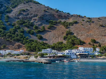
Stage 9 takes the route down towards the southern coastal side of Andros and the bay of Όρμος Κορθίου (Ormos Korthiou). After the central interior stages, this is a useful transition back towards a village with clearer accommodation and transport options.
The walking is still varied: terraced valleys, old mule paths, stone walls, dirt tracks and possible short asphalt sections. As the route descends, views open towards the Korthi side of the island and the southern coastline.
Food, water and accommodation: Όρμος Κορθίου (Ormos Korthiou) is one of the named accommodation centres on the route. It is the sensible service base for the final Dipotamata stage, but rooms should still be booked ahead in the walking season. Carry water from Βραχνού (Vrachnou), as services between the two should not be assumed.
Transport and access: Όρμος Κορθίου (Ormos Korthiou) is on the KTEL network linking it with Χώρα / Άνδρος (Chora / Andros town), Μπατσί (Batsi) and Γαύριο (Gavrio). This makes it the best southern transport base for finishing or reversing the route.
Navigation and warnings: Take care on descents into the Korthi area, particularly where old stone paths become loose or polished. In hot weather, the drop to the coast can feel harder than the distance suggests, so avoid leaving this stage too late in the day.
Stage 10: Όρμος Κορθίου (Ormos Korthiou) to Δίποταμα (Dipotamata) gorge — 7 km
The final official stage is short but distinctive, focused on the Δίποταμα (Dipotamata) gorge above Όρμος Κορθίου (Ormos Korthiou). In north-to-south route planning, this is the closing landscape of the Andros Route: a Natura 2000-protected ravine with old watermills and an open-air eco-museum feel.
The gorge is one of the route’s signature water-and-stone sections. Expect uneven stone surfaces, old path structures, ravine walking and shaded pockets rather than the open high-mountain feel of the central stages.
Food, water and accommodation: Use Όρμος Κορθίου (Ormos Korthiou) as the practical food, water and accommodation base. Do not rely on facilities inside the gorge itself, and carry what is needed even though the distance is short.
Transport and access: Όρμος Κορθίου (Ormos Korthiou) is the main road and bus-access point for this end of the trail. If finishing at a specific point in or above Δίποταμα (Dipotamata), arrange the return to accommodation or onward transport in advance; this should be checked before travelling.
Navigation and warnings: Ravine terrain can make progress slower than the kilometre figure suggests, especially on old stonework or loose sections. Waymarking remains red-and-white, but check the exact start and finish logistics for the day, as many walkers will be staying in Όρμος Κορθίου (Ormos Korthiou) rather than at the gorge itself.
Recommended Itinerary
The practical way to plan the Andros Route is around the official ten-stage structure, then adjust overnights around the villages that actually have accommodation. Several signed stage-ends are not natural overnight stops, and the official sequence includes a Paleopolis–Batsi link and a restart from Απoίκια (Apoikia), so booking and transfers need more attention than the daily distances suggest.
Standard 10-stage itinerary
| Day | From | To | Approx. distance | Why this stage makes sense | Services/accommodation notes |
|---|---|---|---|---|---|
| 1 | Frousei, above Γαύριο (Gavrio) | Γαύριο (Gavrio) / Scholi junction | 13 km | A logical first walking day from the northern trailhead through the Frousei watermill valley towards the island’s ferry gateway. It is a useful shakedown before the route turns inland and becomes more mountainous. | Γαύριο (Gavrio) is the main arrival point by ferry and has the best practical access at the north end. If starting directly after arriving by ferry, check timings carefully before committing to the full stage. |
| 2 | Γαύριο (Gavrio) / Scholi junction | Μπατσί (Batsi) | 7 km | A short day that keeps the opening section manageable and allows time for the coastal approach towards Μπατσί (Batsi). It also gives flexibility after a late arrival on Andros. | Μπατσί (Batsi) is one of the more practical overnight stops on the northern half. This is a good point to buy food and water before the route heads into quieter country. |
| 3 | Μπατσί (Batsi) | Άρνη (Arni / Arnas) | 9 km | The route now leaves the easier coastal logistics and climbs into the island’s greener interior. Keeping this as a separate day helps avoid rushing the transition into the central hills. | Άρνη (Arni) is an interior village, so accommodation and food options should be arranged in advance. Some walkers may need to use nearby accommodation and arrange a lift or taxi; this should be checked before travelling. |
| 4 | Άρνη (Arni / Arnas) | Απoίκια (Apoikia) | 10 km | This is one of the key mountain stages, crossing the high central ground around the Petalo–Kouvara massif and the Βουρκωτή (Vourkoti) area before descending towards Απoίκια (Apoikia). The distance is modest, but the gradients and exposure to weather make it a serious day. | Carry sufficient water, especially outside spring. Απoίκια (Apoikia) is a practical overnight choice and is known for the Sariza spring; accommodation should still be booked ahead. |
| 5 | Απoίκια (Apoikia) | Παλαιόπολη (Paleopolis) | 15 km | This is the longest official stage and gives a full day across varied Andros terrain, linking the mountain villages with the ancient capital area at Παλαιόπολη (Paleopolis). Start early in warm weather. | Παλαιόπολη (Paleopolis) is not as straightforward a service base as the larger coastal villages. Check accommodation before booking this as an overnight; otherwise plan a transfer or overnight in a nearby village with rooms. |
| 6 | Παλαιόπολη (Paleopolis) | Μπατσί (Batsi) link stage | 12 km | This link stage completes the official western loop back towards Μπατσί (Batsi). It is useful for walkers following the signed route in full rather than only taking the most direct north–south line. | Μπατσί (Batsi) is again a practical overnight stop. Because this stage creates a loop/backtrack in the official sequence, check how it fits with the next day’s restart from Απoίκια (Apoikia). |
| 7 | Απoίκια (Apoikia) | Μένητες (Menites) | 9 km | The official route restarts from Απoίκια (Apoikia) and continues towards Μένητες (Menites), one of the route’s best cooling stops thanks to its spring water and shade. | This day needs careful logistics if Day 6 ended in Μπατσί (Batsi). Arrange the return to Απoίκια (Apoikia) before setting out; this should be checked before travelling. |
| 8 | Μένητες (Menites) | Βραχνού (Vrachnou) | 8 km | A shorter day through the central-southern interior, useful after the more complicated middle section of the route. It keeps the approach to Όρμος Κορθίου (Ormos Korthiou) manageable. | Βραχνού (Vrachnou) is a small inland stop, so do not assume beds or meals will be available. Book ahead or arrange to stay in a nearby village with transport back to the route. |
| 9 | Βραχνού (Vrachnou) | Όρμος Κορθίου (Ormos Korthiou) | 10 km | This stage brings the route down towards the south-east coast and the main service base near the finish. It is a sensible overnight before the final Dipotamata gorge section. | Όρμος Κορθίου (Ormos Korthiou) has accommodation options and is the natural southern base for the final stage. Check bus times if leaving the island soon after finishing. |
| 10 | Όρμος Κορθίου (Ormos Korthiou) | Δίποταμα (Dipotamata) gorge | 7 km | A short final stage through the Natura 2000 Dipotamata gorge and its old watermill landscape. The shorter distance allows time to deal with onward travel from the southern end. | There is no reason to assume full services at the gorge itself. Most walkers should plan around Όρμος Κορθίου (Ormos Korthiou) for accommodation and onward transport. |
Slower variant: 10 walking days plus buffer time
This is the best option for walkers arriving by ferry, hiking in warmer weather, or wanting time in Χώρα / Άνδρος (Chora / Andros town), Απoίκια (Apoikia), Μένητες (Menites) or Όρμος Κορθίου (Ormos Korthiou) without rushing transport connections.
Add at least one non-walking or short-transfer day around the middle of the route, where the official stages loop via Παλαιόπολη (Paleopolis), Μπατσί (Batsi) and Απoίκια (Apoikia). This makes accommodation planning easier and reduces the risk of being forced into a long, hot transfer day.
Use this version if:
- ferry arrival or departure times do not line up cleanly with walking days;
- accommodation is unavailable at smaller inland stage-ends;
- the forecast is hot, particularly for the central mountain stages;
- you want time for Χώρα / Άνδρος (Chora / Andros town) or short detours such as the Πυθάρα (Pythara) waterfalls near Απoίκια (Apoikia) / Βουρκωτή (Vourkoti).
Faster variant: 8–9 walking days
A faster itinerary is realistic for fit walkers travelling light, but it should be built from current mapping and accommodation availability rather than assumed from the table alone. The short official stages — especially Γαύριο (Gavrio) / Scholi junction to Μπατσί (Batsi) at 7 km and Όρμος Κορθίου (Ormos Korthiou) to Δίποταμα (Dipotamata) at 7 km — are the obvious places to save time.
Do not combine the central mountain stages casually. The distances look moderate, but the route has repeated steep climbs and descents, remote stretches, limited shade and around 4,800 m of total ascent overall.
Use this version if:
- you are already comfortable with consecutive mountain walking days;
- you can carry enough water for longer combined sections;
- all accommodation and transfers have been fixed before arrival;
- you have checked official mapping before booking, especially around the Παλαιόπολη (Paleopolis) loop and the restart from Απoίκια (Apoikia).
Direction of travel
The route can be walked in either direction. The itinerary above follows the signed northern-start logic from Frousei / Γαύριο (Gavrio) towards Δίποταμα (Dipotamata) and Όρμος Κορθίου (Ormos Korthiou), but reversing the walk is straightforward if ferry times, accommodation or luggage transfers work better that way.
When reversing the route, do not simply reverse the accommodation list without checking the middle stages. The official stage pattern around Παλαιόπολη (Paleopolis), Μπατσί (Batsi) and Απoίκια (Apoikia) still needs deliberate planning.
Planning the Route
Allow enough time for the mountain days
Most walkers should plan the Andros Route over 9–10 walking days, especially if following the official stage structure closely. The daily distances are not long on paper, but the route gains and loses height repeatedly, often on stone kalderimi, loose descents, walled lanes and exposed dirt tracks.
A faster 8-day schedule can work for fit walkers travelling light in spring or autumn, but it leaves less margin for heat, slow footing and transport connections. This is not a route that rewards rushing in high temperatures; shorter days are useful when the path crosses the central Petalo–Kouvara mountains around Άρνη (Arni) and Βουρκωτή (Vourkoti).
Arrival and departure days should be planned separately from walking days. Andros has no airport, so the ferry from Ραφήνα (Rafina) to Γαύριο (Gavrio), onward bus timings and the final return from Όρμος Κορθίου (Ormos Korthiou) all need to fit the walking plan.
Do not treat the 10 official stages as a simple hotel-to-hotel chain
The Andros Route is waymarked as a continuous red-and-white trail, but its official numbered stages are not a perfectly clean north-to-south accommodation itinerary. Stages around Παλαιόπολη (Paleopolis), Μπατσί (Batsi) and Απoίκια (Apoikia) include link or loop logic, and some stage-ends do not have practical overnight options.
For planning purposes, build the route around the main places where rooms and services are more likely: Γαύριο (Gavrio), Μπατσί (Batsi), Άρνη (Arni), Βουρκωτή (Vourkoti) / Απoίκια (Apoikia), Χώρα / Άνδρος (Chora / Andros town), Μένητες (Menites) and Όρμος Κορθίου (Ormos Korthiou). The exact overnight pattern may require adjusted starts and finishes, or short local transfers where accommodation spacing does not match the official stages.
A practical plan should reconcile three things before booking:
| Planning point | Why it matters on Andros |
|---|---|
| Official stage distances | Useful for understanding the signed route, but not always aligned with beds. |
| Accommodation locations | Several official stage-ends have no rooms, so overnights dictate the real itinerary. |
| Bus/taxi options | KTEL Androu links Γαύριο (Gavrio), Μπατσί (Batsi), Χώρα / Άνδρος (Chora / Andros town) and Όρμος Κορθίου (Ormos Korthiou), but timings should be checked before travelling. |
| Water and shade | The central mountain stages are the least forgiving in hot weather. |
Direction: north-to-south or south-to-north
The official stage numbering starts in the Frousei valley above Γαύριο (Gavrio) and works south towards Δίποταμα (Dipotamata) above Όρμος Κορθίου (Ormos Korthiou). This direction is simple if arriving by ferry at Γαύριο (Gavrio) and starting soon after arrival.
The route can also be walked in reverse. A south-to-north plan may suit walkers who want to finish at the ferry port side of the island, but it depends on getting to Όρμος Κορθίου (Ormos Korthiou) or the southern trail area at the start. Current bus and taxi options should be checked before travelling.
Accommodation should be booked before the walk
Accommodation is in small hotels, guesthouses, studios and apartments rather than huts. The supply is uneven, and the smaller inland villages cannot be treated like large trail towns with guaranteed walk-in availability.
Book ahead in the walking season, then shape the walking days around the confirmed rooms. Χώρα / Άνδρος (Chora / Andros town) is the natural mid-route resupply and recovery point, while Γαύριο (Gavrio), Μπατσί (Batsi) and Όρμος Κορθίου (Ormos Korthiou) are important logistical anchors at the coast.
Where a stage-end has no accommodation, the sensible options are to continue to the nearest village with rooms, arrange a local transfer, or base for more than one night and walk a section as a day stage. This should be settled before committing to ferry times.
Food, water and heat are more important than mileage
Daily food planning should be conservative. Carry lunch and snacks rather than assuming every village or stage-end will have open services, particularly outside the busiest visitor periods or on the more remote central stages.
Water planning matters most between the higher inland villages and ridge crossings. Andros has famous springs at places such as Απoίκια (Apoikia) and Μένητες (Menites), but springs and cafés should not be used as the only water plan for a full day in warm weather.
High summer heat is the main seasonal hazard. In spring and autumn, the route is far more manageable, with better walking temperatures and greener valleys; in hot conditions, start early, carry more water than the map distance suggests and avoid turning the mountain stages into long forced marches.
Navigation is straightforward, but still needs preparation
The Andros Route is well waymarked with red-and-white paint blazes and sits within a wider restored network of numbered paths. That wider network is a strength for day walks and detours, but it also means junctions should be read carefully.
Carry an offline map or GPS track as well as paying attention to the waymarks. The official Andros Routes information should be checked before travelling for current path condition, diversions and any updates to the signed network.
Shortening, section hiking and add-ons
Section hiking is practical because the island bus links the main settlements of Γαύριο (Gavrio), Μπατσί (Batsi), Χώρα / Άνδρος (Chora / Andros town) and Όρμος Κορθίου (Ormos Korthiou), with taxis and car or scooter hire available from Γαύριο (Gavrio). The limitation is that not every inland trailhead is equally convenient by public transport.
A shorter trip can be built around selected stages from a fixed base, especially near the better-served villages and towns. This works well for walkers who want the kalderimi, ravines and mountain scenery without committing to the full crossing.
Extensions are best chosen from the wider Andros Routes path network. Sensible additions include signed nearby features such as the Πυθάρα (Pythara) waterfalls near Απoίκια (Apoikia) / Βουρκωτή (Vourkoti), or monastery and mountain-side routes around Χώρα / Άνδρος (Chora / Andros town), Μένητες (Menites) and Mount Petalo.
Mount Kouvara is a separate off-route ascent from Βουρκωτή (Vourkoti), not part of the Andros Route itself. It should only be added with enough daylight, water and suitable weather.
Key checks before booking
Before fixing the itinerary, check:
- Rafina–Γαύριο (Gavrio) ferry times and current fares.
- KTEL Androu bus times between Γαύριο (Gavrio), Μπατσί (Batsi), Χώρα / Άνδρος (Chora / Andros town) and Όρμος Κορθίου (Ormos Korthiou).
- Accommodation availability in the villages needed for the chosen stage plan.
- Current Andros Routes path updates, maps and any diversions.
- Weather forecasts, especially heat on the central mountain stages.
- Whether any planned detours, such as Πυθάρα (Pythara), Παναχράντου Monastery or Mount Kouvara, fit safely into the day.
Permits are not the main planning constraint on this walk; accommodation, transport, water and heat are. Any current local access notices should still be checked before travelling.
Towns, Villages and Overnight Stops
Accommodation planning is the main logistical challenge on the Andros Route. The route is village-to-village in character, but the official stage-ends do not all have reliable accommodation, and the signed 10-stage sequence includes loops and restarts rather than a simple chain of nightly stops.
For most walkers, the practical overnight bases are Γαύριο (Gavrio), Μπατσί (Batsi), Απoίκια (Apoikia) or nearby interior villages, Χώρα / Άνδρος (Chora / Andros town), Μένητες (Menites) if rooms are available, and Όρμος Κορθίου (Ormos Korthiou). Rooms should be booked ahead in the walking season, especially if relying on small village guesthouses or studios.
Outside Γαύριο (Gavrio), Μπατσί (Batsi), Χώρα / Άνδρος (Chora / Andros town) and Όρμος Κορθίου (Ormos Korthiou), do not assume shops, evening meals or onward transport will be available. This should be checked before travelling.
Frousei (above Γαύριο / Gavrio)
Frousei is the official northern trailhead, set in the watermill valley inland from Γαύριο (Gavrio). It is a place to start walking rather than a practical overnight base.
There is no accommodation or service information for Frousei, so most hikers should sleep in Γαύριο (Gavrio) and arrange the start around that. Carry what is needed for the first stage before leaving the port area.
Γαύριο (Gavrio)
Γαύριο (Gavrio) is the island’s ferry port and the most practical northern base for the route. Ferries arrive here from Ραφήνα (Rafina) on the Attica mainland, and taxis plus car or scooter hire are available from the port.
It is a sensible arrival-night stop before starting from Frousei, and also a useful place for adjusting plans if ferry times, heat or late arrival make an immediate walk impractical. Accommodation is available in the Gavrio area, but book ahead rather than assuming a room on arrival.
The island bus operated by KTEL Androu links Γαύριο (Gavrio) with Μπατσί (Batsi), Χώρα / Άνδρος (Chora / Andros town) and Όρμος Κορθίου (Ormos Korthiou), with services timed around ferry arrivals. Current timetables should be checked before travelling.
Μπατσί (Batsi)
Μπατσί (Batsi) is the first major coastal overnight base south of Γαύριο (Gavrio). It sits after the short Gavrio–Batsi stage and is also involved in the official Paleopolis–Batsi link stage, which is one reason the numbered stages do not form a clean linear overnight plan.
Batsi is one of the better accommodation bases on the route, with small hotels, guesthouses, studios and apartments among the options. It works well as a first proper walking-night stop, or as a backup base if accommodation in the interior is awkward.
The KTEL Androu bus links Batsi with Gavrio, Chora and Ormos Korthiou. Food and shop options are more likely here than in the interior villages, but opening times and seasonal availability should be checked before travelling.
Άρνη (Arni / Arnas)
Άρνη (Arni) is an interior mountain village reached after the climb out of Μπατσί (Batsi). It marks the move from the coastal approach into the higher, quieter central part of Andros.
This is a useful overnight point for breaking the mountain crossing, but accommodation is limited and should be secured before committing to the stage plan. If no room is available, walkers need to adjust the itinerary around another base or arrange a transfer; this should be checked before travelling.
Do not treat Arni as a guaranteed resupply point. The following central mountain sections have limited water and shade, so carry enough food and water from the previous reliable stop.
Βουρκωτή (Vourkoti)
Βουρκωτή (Vourkoti) lies in the high central mountains around the Petalo–Kouvara massif, on or close to the route’s most remote terrain. It is also the logical village for walkers considering the separate off-route ascent of Mount Kouvara; the Andros Route itself does not summit the peak.
Accommodation and food availability should be checked before travelling. Vourkoti can be useful as a staging point only if rooms and meals are arranged in advance.
The Πυθάρα (Pythara) waterfalls are a signed detour in the Vourkoti–Apoikia area and are at their greenest in spring. Treat the detour as an addition to the day, not as a substitute for planning water and food on the main route.
Απoίκια (Apoikia)
Απoίκια (Apoikia) is a key mountain village and official stage point, known for the Sariza spring. It is a practical place to pause after the high central walking and before the route drops towards the Chora and Paleopolis side of the island.
Accommodation may be possible in or around Apoikia, but capacity is limited compared with the coastal settlements. Book ahead and check whether evening food is available before choosing it as an overnight stop.
Apoikia is also important because the official stage pattern restarts here after the Paleopolis/Batsi link section. When building a real walking itinerary, use the village as a practical hub rather than following the stage numbers blindly.
Μένητες (Menites)
Μένητες (Menites) is a shaded inland village famous for cold spring water running from marble lion-head fountains beneath plane trees. It is one of the best cooling and water stops on the southern half of the route.
It can work as an overnight stop if accommodation is available, but this should be booked in advance. If rooms are not available, nearby larger bases such as Χώρα / Άνδρος (Chora / Andros town) may be more practical, depending on the day’s route and transfers.
Do not rely on Menites as a full resupply point without checking current services. Its value to hikers is as a cool, shaded break and as a natural staging place between the Chora/Apoikia side and the route towards Vrachnou and Ormos Korthiou.
Χώρα / Άνδρος (Chora / Andros town)
Χώρα / Άνδρος (Chora / Andros town) is the island capital and the natural mid-route resupply stop. It has accommodation and is one of the main settlements linked by the KTEL Androu bus network.
For independent walkers, Chora is the safest place to plan a rest night, laundry, food shopping and itinerary adjustments. It is also a practical base if nearby interior accommodation is full or if hot weather forces a shorter walking day.
The town sits on the route network rather than functioning as a simple official stage-end in the numbered sequence, so check the exact path line and daily connection being used. The Museum of Contemporary Art and the old sea-spur town are worthwhile if a rest afternoon is built into the schedule.
Παλαιόπολη (Paleopolis)
Παλαιόπολη (Paleopolis) is the ancient capital area, built into a steep hillside above the sea. The official route includes a Paleopolis stage and a link stage back towards Μπατσί (Batsi), which can complicate a straightforward end-to-end itinerary.
Accommodation and food availability in Paleopolis should be checked before travelling. Many walkers may find it more practical to treat it as a walking objective within a wider itinerary based around Batsi, Chora or another arranged overnight.
The long stone stairway down towards the archaeological site and coast adds interest but also effort. Factor this into the day rather than assuming Paleopolis is an easy roadside stop.
Κόχυλου (Kochylou)
Κόχυλου (Kochylou) is one of the southern villages on the approach towards the Korthi side of the island. It is relevant for route-finding and staging, but there is no evidence that it is a dependable accommodation base.
Do not plan to overnight here unless a room has been booked directly. Food, water and transport availability should be checked before travelling.
Βραχνού (Vrachnou)
Βραχνού (Vrachnou) is an official stage-end between Μένητες (Menites) and Όρμος Κορθίου (Ormos Korthiou). It sits in the southern interior, before the route drops towards the Korthi bay.
This is exactly the type of stage-end where independent walkers should be cautious: do not assume there are beds, shops or evening food. Arrange accommodation or a transfer before using Vrachnou as the end of a day.
If no overnight is available, the practical plan is usually to continue the itinerary around a confirmed base, commonly Όρμος Κορθίου (Ormos Korthiou) or another booked village stay. This should be checked before travelling.
Όρμος Κορθίου (Ormos Korthiou)
Όρμος Κορθίου (Ormos Korthiou) is the main southern coastal base for the route. It is the logical overnight stop before or after the final Dipotamata gorge stage.
Accommodation is available here, making it one of the safer places to build into the itinerary. It is also on the KTEL Androu bus link with Γαύριο (Gavrio), Μπατσί (Batsi) and Χώρα / Άνδρος (Chora / Andros town), though current schedules should be checked before travelling.
For many walkers, Ormos Korthiou is the best place to finish the trip logistically: sleep by the southern bay, then use bus or taxi arrangements for onward travel back towards Gavrio and the ferry.
Δίποταμα (Dipotamata gorge)
Δίποταμα (Dipotamata) is the final gorge section above Όρμος Κορθίου (Ormos Korthiou), not a village overnight stop. The route descends through this Natura 2000-protected ravine of old watermills before finishing towards the Korthi side of the island.
There is no accommodation or service information for the gorge itself. Carry water and snacks from Ormos Korthiou or the previous confirmed stop, and arrange the end-of-walk logistics before setting out.
Most hikers should treat Dipotamata as the route finish and overnight in Όρμος Κορθίου (Ormos Korthiou), or use pre-arranged transport onwards. This should be checked before travelling.
Getting to the Start
By train
There is no rail access to Άνδρος (Andros), and the trail starts on an island with no railway. The practical approach is to travel to Ραφήνα (Rafina) on the Attica mainland, then take the ferry to Γαύριο (Gavrio), the island’s port.
If arriving in Athens by train, plan the onward journey to Rafina separately rather than assuming a direct rail connection. This should be checked before travelling.
By bus
The standard public-transport approach is ferry plus island bus. Ferries run from Ραφήνα (Rafina) to Γαύριο (Gavrio), with a crossing of roughly 2 hours; operators include Golden Star Ferries, and a foot-passenger fare is on the order of €19 one way. Current sailing times and fares should be checked before booking.
Once on Andros, KTEL Androu buses link Γαύριο (Gavrio), Μπατσί (Batsi), Χώρα / Άνδρος (Chora / Andros town) and Όρμος Κορθίου (Ormos Korthiou), with services timed around ferry arrivals. This is useful both for reaching accommodation before the first walking day and for later repositioning on the point-to-point route.
The official northern start is not the ferry quay itself but the Frousei watermill valley inland above Γαύριο (Gavrio). Check the current bus timetable and local taxi options before relying on public transport to reach the exact trailhead.
By car
Ραφήνα (Rafina) is the mainland ferry port for Andros, and the crossing to Γαύριο (Gavrio) is by car ferry. Taking a vehicle can make pre- and post-walk transfers easier, but the Andros Route is a point-to-point trail, so a car left at Γαύριο (Gavrio) will need to be retrieved after finishing near Δίποταμα (Dipotamata) and Όρμος Κορθίου (Ormos Korthiou).
For most walkers, a car is more useful for arrival logistics than for the walking days themselves. Island buses, taxis and car or scooter hire are available from Γαύριο (Gavrio), but long-stay parking arrangements at Rafina, Gavrio or accommodation should be checked before travelling.
From the nearest airport
The nearest practical airport is Athens airport on the Attica mainland, which is close to Ραφήνα (Rafina) compared with central Athens. From there, the key connection is the Rafina–Γαύριο (Gavrio) ferry.
Build in a margin between flight arrival and ferry departure, especially if arriving late in the day or outside the main holiday season. Ferry timetables, onward transport to Rafina and the final transfer from Γαύριο (Gavrio) to the Frousei trailhead should all be checked before travelling.
Where to stay before starting
Γαύριο (Gavrio) is the most practical pre-walk base because it is the ferry gateway and the nearest settlement to the official Frousei start. Staying here also gives time to buy food, sort water and arrange a taxi or local transfer to the trailhead if needed.
Μπατσί (Batsi) is another useful nearby overnight option on the northern part of the route, but it is better suited if the first day’s logistics have already been planned. Accommodation on Andros is unevenly spaced, and some official stage-ends have no beds, so book ahead in the walking season rather than relying on arrival-day availability.
Getting Home from the Finish
The north-to-south Andros Route finishes in the Δίποταμα (Dipotamata) gorge above Όρμος Κορθίου (Ormos Korthiou), not at the island’s ferry port. Plan the final day as a two-step exit: first get from Ormos Korthiou back across Andros to Γαύριο (Gavrio), then take the ferry from Gavrio to Ραφήνα (Rafina) on the Attica mainland.
Do not assume a same-day connection will work if you finish late. Bus times, ferry times and seasonal frequencies change, and this should be checked before travelling.
By train
There is no train service on Andros. The nearest practical rail connections are on the Athens mainland side, after taking the ferry from Γαύριο (Gavrio) to Ραφήνα (Rafina).
For most walkers, the useful homeward chain is:
| Step | Route | Notes |
|---|---|---|
| 1 | Δίποταμα (Dipotamata) / Όρμος Κορθίου (Ormos Korthiou) to Γαύριο (Gavrio) | Use the island bus where timings fit, or arrange a taxi/transfer. |
| 2 | Γαύριο (Gavrio) to Ραφήνα (Rafina) | Car ferry, roughly 2 hours. Operators include Golden Star Ferries. |
| 3 | Ραφήνα (Rafina) onward | Continue to Athens, Athens airport or other mainland transport. Connections should be checked before travelling. |
By bus
KTEL Androu is the island bus operator. The bus network links Όρμος Κορθίου (Ormos Korthiou), Χώρα / Άνδρος (Chora / Andros town), Μπατσί (Batsi) and Γαύριο (Gavrio), with services generally arranged around ferry arrivals and departures.
This makes bus the natural low-cost way out from the finish, but it is timetable-dependent. Services can be limited outside the main season and may not suit a late finish from the Δίποταμα (Dipotamata) gorge. Check the current KTEL Androu timetable before fixing ferry tickets or accommodation.
If the bus connection to Γαύριο (Gavrio) is early, build in enough time to walk out of the gorge, collect luggage if stored at accommodation, and reach the stop in Όρμος Κορθίου (Ormos Korthiou). If the only workable ferry leaves before a sensible bus connection, stay locally or arrange a private transfer.
By car/taxi
A taxi or pre-arranged transfer is the simplest option if the bus timetable does not line up with the ferry from Γαύριο (Gavrio). It is also the safest plan for groups, walkers finishing in the afternoon, or anyone with an early mainland connection the next day.
Taxis and vehicle hire are available from Γαύριο (Gavrio). For pickup at Όρμος Κορθίου (Ormos Korthiou) or near the trail finish, arrange the journey in advance through accommodation or a local operator. Availability and prices should be checked before travelling.
Hiring a car or scooter from Γαύριο (Gavrio) can work for walkers using the wider Andros trail network, but it is less convenient for a point-to-point traverse unless luggage transfers or a shuttle plan are already organised.
From the nearest airport
Andros has no airport. The nearest practical airport is Athens, reached via the mainland port of Ραφήνα (Rafina), which is near Athens airport.
The usual departure sequence is:
- Finish at Δίποταμα (Dipotamata) / Όρμος Κορθίου (Ormos Korthiou).
- Travel by bus, taxi or pre-arranged transfer to Γαύριο (Gavrio).
- Take the ferry from Γαύριο (Gavrio) to Ραφήνα (Rafina), roughly a 2-hour crossing.
- Continue from Rafina to Athens airport or Athens.
Foot-passenger ferry fares from Ραφήνα (Rafina) to Γαύριο (Gavrio) are on the order of €19 one way, but current fares and sailing times should be confirmed before booking. Allow generous buffer time before any flight, especially outside peak season or in windy weather, when ferry schedules can be disrupted.
Where to stay at the finish
Όρμος Κορθίου (Ormos Korthiou) is the practical place to stay after finishing at the Δίποταμα (Dipotamata) gorge. It has accommodation options and avoids forcing a rushed onward journey after the final stage.
Staying overnight is usually the better plan if the final day ends late, if the bus to Γαύριο (Gavrio) has already gone, or if the next suitable ferry is the following morning. It also gives a useful buffer before travelling across the island to the port.
Accommodation on Andros is unevenly spaced and should be booked ahead in the walking season. If reversing the route and finishing in Γαύριο (Gavrio), the homeward logistics are simpler because the ferry port is already at the end of the walk.
Which Direction Should You Walk?
Standard direction: north to south
The clean default is to walk north to south, from the Frousei valley above Γαύριο (Gavrio) towards Δίποταμα (Dipotamata) above Όρμος Κορθίου (Ormos Korthiou). This matches the official northern-start stage numbering and starts close to the island’s ferry gateway at Γαύριο (Gavrio).
For an independent walker, this direction is the most straightforward to understand on the ground: arrive by ferry at Γαύριο (Gavrio), arrange the start at Frousei, then work progressively through Μπατσί (Batsi), Άρνη (Arni), Βουρκωτή (Vourkoti), Απoίκια (Apoikia), Μένητες (Menites), Χώρα / Άνδρος (Chora / Andros town) and onward to the southern end. The finish through the Δίποταμα (Dipotamata) gorge also gives the route a strong final stage rather than simply ending at the ferry port.
The main logistical drawback is departure. After finishing near Όρμος Κορθίου (Ormos Korthiou), you still need to return to Γαύριο (Gavrio) for the ferry, using the island bus, a taxi or a pre-arranged transfer. KTEL Androu links Γαύριο (Gavrio), Μπατσί (Batsi), Χώρα / Άνδρος (Chora / Andros town) and Όρμος Κορθίου (Ormos Korthiou), but current timetables should be checked before travelling.
Reverse direction: south to north
Walking south to north is also valid and is used by some self-guided itineraries. In this direction, you arrange transport from Γαύριο (Gavrio) to the Όρμος Κορθίου (Ormos Korthiou) / Δίποταμα (Dipotamata) end at the start of the trip, then walk back towards the ferry port area.
The practical advantage is a simpler final travel day. Finishing in or near Γαύριο (Gavrio) puts you close to the Rafina ferry, which can be useful if the ferry schedule is tight or if you want to avoid a long transfer after the final walk.
The trade-off is that the trip begins with the more awkward transfer. If the ferry arrives late in the day, getting from Γαύριο (Gavrio) to the southern trail end and starting the route smoothly may need an extra night or a pre-booked taxi. This should be checked before travelling.
Does one direction make the walking easier?
There is no decisive gradient advantage either way. The Andros Route crosses a mountainous interior with repeated steep climbs and descents whichever direction you choose, especially around Άρνη (Arni), Βουρκωτή (Vourkoti), Απoίκια (Apoikia) and the Petalo–Kouvara massif.
The bigger issue is not direction but timing. Spring and autumn are the sensible seasons; in hot weather, the remote central stages with limited water and shade need early starts and careful water planning. Do not choose direction expecting a reliable weather or wind advantage.
Loose stony descents and old stone kalderimi can be tiring in either direction. If knees are a concern, build in shorter days around the central mountain sections rather than relying on northbound or southbound travel to solve the problem.
Accommodation and stage flow
Accommodation spacing is uneven, and several official stage-ends do not have convenient beds. In practice, walkers often overnight in the nearest village with rooms and adjust the day plan around Γαύριο (Gavrio), Μπατσί (Batsi), Χώρα / Άνδρος (Chora / Andros town), Όρμος Κορθίου (Ormos Korthiou) and the few interior villages with available accommodation.
This matters more than direction. Northbound and southbound itineraries can both work well, but rooms should be booked ahead in the walking season, and the official numbered stages should not be treated as a perfect accommodation plan.
Recommendation
For most independent hikers, walk north to south: Frousei / Γαύριο (Gavrio) to Δίποταμα (Dipotamata). It follows the official northern-start logic, begins at the island’s arrival port area, and gives a memorable finish through the Dipotamata gorge.
Choose south to north if ferry-departure logistics are the priority and you prefer to end near Γαύριο (Gavrio). In that case, arrange the initial transfer to Όρμος Κορθίου (Ormos Korthiou) or Δίποταμα (Dipotamata) before committing to the itinerary.
Accommodation Along the Route
Accommodation is one of the main planning constraints on the Andros Route. The trail works well as an inn-to-inn walk, but not if the 10 official stages are treated as a simple list of guaranteed overnight stops.
The strongest bases are Γαύριο (Gavrio), Μπατσί (Batsi), Χώρα / Άνδρος (Chora / Andros town) and Όρμος Κορθίου (Ormos Korthiou), where walkers can expect the best choice of small hotels, guesthouses, studios and apartments. Interior villages such as Άρνη (Arni), Βουρκωτή (Vourkoti), Απoίκια (Apoikia) and Μένητες (Menites) are much more limited, and some official stage-ends should not be assumed to have beds.
Book ahead in the walking seasons, especially if following a fixed day-by-day itinerary. Availability can be uneven, and a single closed or full guesthouse in the interior may require a taxi transfer or a reshaped walking day.
Best overnight bases
| Place | Accommodation level | Best for | Notes |
|---|---|---|---|
| Frousei valley above Γαύριο (Gavrio) | None | Trailhead only | The official northern start is inland of the port. Most walkers overnight in Γαύριο (Gavrio) before or after this section rather than trying to stay at the valley itself. |
| Γαύριο (Gavrio) | Good | Arrival night, ferry buffer, northern logistics | The island’s ferry gateway and the most practical base for starting or finishing at the northern end. Useful if ferry times do not line up neatly with the first walking day. |
| Μπατσί (Batsi) | Good | Coastal overnight, flexible staging | One of the easier places to base a night because it has a stronger accommodation choice than the interior villages. Also useful where the official route’s Paleopolis/Batsi link affects the itinerary. |
| Άρνη (Arni / Arnas) | Limited | Positioning for the central mountain crossing | A valuable overnight location if rooms are available, but capacity should be treated as limited. Book before relying on it. |
| Βουρκωτή (Vourkoti) | Limited | High central section, Pythara waterfall area | Useful for breaking up the mountain stages, but do not assume multiple options. This should be checked before travelling. |
| Απoίκια (Apoikia) | Limited | Central-route overnight near the Sariza spring | A logical stop on the signed route, but with less choice than the coastal towns. If beds are unavailable, a transfer to a larger base may be needed. |
| Μένητες (Menites) | Limited | Quiet interior stop, shorter walking day | Good for splitting the Chora–Korthi side of the route if accommodation is available. Book specifically rather than turning up. |
| Χώρα / Άνδρος (Chora / Andros town) | Good | Mid-route resupply, rest night, itinerary reset | The natural mid-route service stop, with the best scope for adding a rest day, replacing kit, eating properly and reorganising the second half of the walk. |
| Παλαιόπολη (Paleopolis) | Limited | Western loop positioning | Accommodation should not be assumed to be plentiful. Many itineraries handle this part of the route by returning to a stronger base or using a transfer. |
| Κόχυλου (Kochylou) / Βραχνού (Vrachnou) | Limited | Southern interior staging | Treat these as planning-sensitive stops. If there is no suitable room, the practical solution is usually to continue or transfer to Όρμος Κορθίου (Ormos Korthiou). This should be checked before travelling. |
| Όρμος Κορθίου (Ormos Korthiou) | Good | Southern base, final nights, Dipotamata access | The best accommodation base for the southern end and the Δίποταμα (Dipotamata) gorge stage. |
| Δίποταμα (Dipotamata) gorge | None | Finish point only | The gorge is a walking objective, not an overnight base. Plan the final night in Όρμος Κορθίου (Ormos Korthiou) or arrange onward transport. |
Planning an inn-to-inn itinerary
A practical inn-to-inn itinerary usually follows the village logic rather than the official stage numbers exactly: Γαύριο (Gavrio) → Μπατσί (Batsi) → Άρνη (Arni) / Βουρκωτή (Vourkoti) → Απoίκια (Apoikia) or Χώρα / Άνδρος (Chora) → Μένητες (Menites) / southern interior → Όρμος Κορθίου (Ormos Korthiou).
The official Andros Route includes stages that loop or reconnect, including the Παλαιόπολη (Paleopolis) and Μπατσί (Batsi) section, so accommodation planning should be reconciled with the actual line being walked. Do not book rooms solely by matching one bed to each numbered official stage.
For independent walkers, the safest approach is to secure the scarce interior nights first, then fill in the easier coastal and town nights around them. If Άρνη (Arni), Βουρκωτή (Vourkoti), Απoίκια (Apoikia), Μένητες (Menites) or Βραχνού (Vrachnou) cannot be booked, build in a taxi transfer to or from a larger base rather than stretching a mountain day beyond a comfortable length.
Transfers, luggage and awkward gaps
Taxis are the main practical fix for awkward accommodation gaps, especially in the central and southern interior. The island bus links Γαύριο (Gavrio), Μπατσί (Batsi), Χώρα / Άνδρος (Chora) and Όρμος Κορθίου (Ormos Korthiou), but timetables are tied partly to ferry movements and should not be assumed to suit every walking stage.
Some self-guided Andros Route packages structure the walk over 8–10 walking days and may arrange accommodation around the uneven village spacing. Whether luggage transfer is included, or available separately for an independent booking, should be checked before travelling.
Walkers carrying their own kit should keep the pack light enough for steep stone kalderimi climbs and descents. The route is not technically difficult, but repeated ascent, heat and rough stone surfaces make heavy luggage a poor choice.
Booking timing
Spring and autumn are the best walking seasons and also the periods when trail-focused accommodation can be in demand. High summer is less attractive for hiking because of heat, but coastal accommodation may still be busy for general island tourism.
Opening dates, minimum stays and current availability can vary between small family-run properties, studios and apartments. Confirm rooms directly before committing to ferry tickets and daily stages.
Camping and Wild Camping
The Andros Route is best planned as a village-to-village walk using rooms, studios and guesthouses rather than as a camping trek. Accommodation is unevenly spaced, but the established logistics are built around overnighting in places such as Γαύριο (Gavrio), Μπατσί (Batsi), Άρνη (Arni), Απoίκια (Apoikia), Χώρα / Άνδρος (Chora / Andros town) and Όρμος Κορθίου (Ormos Korthiou), with transfers or adjusted stages where needed.
Formal campsites
Do not assume there will be formal campsites on or beside the Andros Route. No campsite-based itinerary should be booked without checking current local options before travelling.
If camping is important, contact local accommodation providers, the municipality or Andros walking information points before departure and ask specifically about legal places to pitch. This should be checked before travelling.
Wild camping and legality
Wild camping rules and local enforcement on Andros should be checked locally before travelling. Do not pitch unless it is clearly permitted by the landowner or the relevant local authority.
Much of the route crosses terraced farmland, walled paths, village approaches, ravines and mountain grazing land. These are not empty public spaces, even when they feel remote. Gates, walls, orchards, springs and water channels should be treated as private or working land unless permission has been given.
The Δίποταμα (Dipotamata) gorge is a Natura 2000-protected ravine and is not a suitable place to camp. The same cautious approach applies around spring-fed biotopes such as the Πυθάρα (Pythara) waterfalls area near Βουρκωτή (Vourkoti) and Απoίκια (Apoikia): visit, but do not camp, wash or leave waste there.
Does the route suit camping?
Only partly. Daily distances are not long, but the trail is mountainous, with repeated steep climbs and descents on stone kalderimi, walled lanes, tracks and loose stony sections. Carrying a full camping load makes the central mountain days around Άρνη (Arni), Βουρκωτή (Vourkoti) and the Petalo–Kouvara flanks noticeably harder.
Water and shade are also uneven. Andros is well-watered by Cycladic standards, with springs and green ravines, but the remote central stages have limited water and shade, and summer heat is the main hazard. A camping plan that depends on finding streams or fountains late in the day is risky.
If you do camp with permission
The most practical approach is to arrange a legal pitch in advance near a village, rather than look for a wild site at the end of the walking day. Villages give access to water, food, buses or taxis, and a clear point of contact if weather, heat or route changes affect the plan.
Avoid camping in:
- the Δίποταμα (Dipotamata) gorge and other protected ravines;
- cultivated terraces, orchards, gardens and enclosed fields;
- beside springs, fountains, streams, watermills or irrigation channels;
- on stone-paved kalderimi, mule paths or narrow walled lanes;
- near monasteries, churches, archaeological remains or village cemeteries;
- exposed ridges in strong wind or heat.
A low-impact permitted pitch should be away from houses, paths and water sources, used for one night only, and left with no visible trace.
Water, cooking and fire
Carry enough water for the full day before leaving each village, especially on the higher and more remote central sections. Reliable resupply should be planned around settlements and known village springs such as Απoίκια (Apoikia) and Μένητες (Menites), not around seasonal streams.
Do not light fires. The route crosses dry, windy, terraced countryside and high-summer fire risk is a serious concern. Use a stove only where it is legal, safe and permitted, and avoid stove use altogether in dry grass, woodland, ravines or windy conditions.
Pack out all rubbish, including food scraps, gas canisters, toilet paper and hygiene waste. Human waste should be buried well away from paths, springs, streams, terraces and buildings, or packed out where burial is not appropriate.
Seasonal considerations
Spring and autumn are the sensible seasons for a camping attempt. Spring brings greener valleys and more comfortable walking temperatures, while autumn usually avoids the worst heat.
High summer is a poor choice for camping on this route. Shade is limited on some stages, water planning becomes more critical, and carrying camping kit increases heat stress on the steep climbs and descents.
Food, Water and Resupply
The Andros Route is a village-to-village walk, but it is not a continuous chain of services. Food is straightforward in the larger coastal and island-capital stops — Γαύριο (Gavrio), Μπατσί (Batsi), Χώρα / Άνδρος (Chora / Andros town) and Όρμος Κορθίου (Ormos Korthiou) — and much less predictable in the small interior villages.
Plan each walking day as if lunch must be carried. This is especially important on the central mountain stages around Άρνη (Arni), Βουρκωτή (Vourkoti), Απoίκια (Apoikia), Μένητες (Menites) and Βραχνού (Vrachnou), where accommodation and services are unevenly spaced and some official stage-ends have no beds or reliable food supply.
Food strategy
Use the main settlements for proper resupply. Γαύριο (Gavrio) is the ferry gateway and a sensible place to buy initial supplies; Μπατσί (Batsi) is the next useful coastal stop; Χώρα / Άνδρος (Chora / Andros town) is the natural mid-route resupply point; and Όρμος Κορθίου (Ormos Korthiou) is the main food stop near the southern end.
Away from these places, do not assume a village shop, café or taverna will be open when you arrive. Rural and seasonal opening hours can be irregular, and Sunday or shoulder-season closures can affect small settlements. This should be checked before travelling, especially if accommodation is not providing dinner or breakfast.
For most days, carry:
- lunch for the trail;
- high-energy snacks for steep climbs and hot descents;
- an emergency spare meal or substantial snack on the remoter central stages;
- breakfast supplies if leaving early from a small village or apartment-style accommodation.
UK-style pubs are not part of the planning picture here. Food stops, where available, are more likely to be cafés, tavernas, bakeries or small shops in the larger settlements, but exact opening hours should be checked locally.
Water strategy
Andros is greener and better watered than many Cycladic islands, with spring-fed ravines and notable village springs at Απoίκια (Apoikia) and Μένητες (Menites). Even so, the route has remote, exposed sections with limited water and shade, and summer heat is the main hazard.
Start each day with enough water to finish the stage without relying on an unplanned refill. For typical spring or autumn conditions, most walkers should begin with at least 2 litres; on hot days, exposed climbs or the central mountain stages, 3 litres or more is a safer starting point. In high summer, the route is significantly harder to manage because shade and dependable refill points are limited.
Use accommodation, village fountains, cafés and shops as the primary refill points. The Sariza spring at Απoίκια (Apoikia) and the cold spring water at Μένητες (Menites), where water runs from marble lion-head fountains beneath plane trees, are key places to refill and cool down.
Do not rely on streams, ravines, waterfalls or watermill channels as drinking water without treatment. If taking water from a natural source, filter or chemically treat it, and avoid stagnant or livestock-affected water. In dry periods, some minor flows may be reduced or absent.
| Section | Food availability | Water availability | Notes |
|---|---|---|---|
| Frousei valley above Γαύριο (Gavrio) → Γαύριο (Gavrio) | Carry food from Γαύριο (Gavrio); do not expect services at the Frousei trailhead. | Refill before starting; the valley is green and watermill-lined, but natural water should not be treated as a guaranteed drinking source. | If starting straight after arriving by ferry, buy supplies in Γαύριο (Gavrio) before heading inland. |
| Γαύριο (Gavrio) → Μπατσί (Batsi) | Good planning section for resupply at both larger coastal settlements. | Refill in Γαύριο (Gavrio) and again in Μπατσί (Batsi). | A shorter stage, but still carry lunch/snacks if walking outside normal food-service hours. |
| Μπατσί (Batsi) → Άρνη (Arni) | Limited once away from Μπατσί (Batsi); carry lunch and spare snacks. | Start full from Μπατσί (Batsi); do not depend on mid-stage services. | This begins the more rural, uphill interior walking. Accommodation and food should be arranged in advance. |
| Άρνη (Arni) / Βουρκωτή (Vourkoti) → Απoίκια (Apoikia) | One of the more remote mountain sections; carry all daytime food. | Carry a full supply from the overnight stop. Απoίκια (Apoikia) is an important refill point, known for the Sariza spring. | Limited shade and water make this a section where heat management matters. The Πυθάρα (Pythara) waterfalls are not a substitute for planned drinking water. |
| Απoίκια (Apoikia) → Χώρα / Άνδρος (Chora / Andros town) and Παλαιόπολη (Paleopolis) options | Χώρα / Άνδρος (Chora / Andros town) is the best mid-route resupply stop. Smaller places are less reliable. | Refill at Απoίκια (Apoikia), accommodation and town services; carry enough for any Paleopolis out-and-back or loop-style day. | The official stage pattern is not a clean linear chain here, so match food shopping to the actual itinerary being walked. |
| Χώρα / Άνδρος (Chora / Andros town) / Μένητες (Menites) → Βραχνού (Vrachnou) | Resupply in Χώρα / Άνδρος (Chora / Andros town) before committing to smaller inland villages. Carry lunch. | Μένητες (Menites) is one of the best water stops, with cold spring water from marble lion-head fountains. | Do not assume food at Βραχνού (Vrachnou) unless booked accommodation specifically provides it or advises otherwise. |
| Βραχνού (Vrachnou) → Όρμος Κορθίου (Ormos Korthiou) | Limited before Όρμος Κορθίου (Ormos Korthiou); carry food for the day. | Start with a full water load; refill reliably again at Όρμος Κορθίου (Ormos Korthiou). | This is a day to be self-sufficient until the coastal settlement. |
| Όρμος Κορθίου (Ormos Korthiou) → Δίποταμα (Dipotamata) gorge | Buy food in Όρμος Κορθίου (Ormos Korthiou) before the final stage. | Refill before leaving; do not rely on gorge water without treatment. | The Δίποταμα (Dipotamata) gorge is a watermill ravine, but it should be treated as a walking highlight rather than a dependable drinking-water source. |
Terrain, Conditions and Difficulty in Practice
Underfoot: stone paths, lanes and rough descents
The Andros Route is mostly a restored mountain-path route rather than a wilderness traverse. Expect a mixture of old stone-paved kalderimi, walled field lanes, dirt tracks and short asphalt links, with the best-preserved sections giving fast, secure walking when dry.
The harder footing comes on loose stony descents, broken cobbles and rougher mountain paths where concentration matters more than technical skill. Smooth marble or stone flagging can also become slippery after rain, around springs, and in shaded ravines.
This is not a scrambling route. There is no technical or exposed ground on the standard trail, but trekking poles are useful for the repeated descents, especially with a multi-day pack.
Climbs and descents: the real source of difficulty
The route’s difficulty comes from cumulative ascent and descent rather than any single obstacle. Around 4,800 m of total climbing is spread across the crossing, so even short stages can feel demanding when they involve a steep valley-to-ridge climb followed by a long stony descent.
The central mountain sections around Μπατσί (Batsi), Άρνη (Arni), Βουρκωτή (Vourkoti) and Απoίκια (Apoikia) are the most serious in practice. Here the trail crosses the flanks of the Petalo–Kouvara massif, Andros’s highest ground, but it does not go to the summit itself.
The climbs are generally walkable rather than technical, but they can be sustained and hot. Fitness, pacing and water management matter more here than specialist mountain skills.
Where the walking feels easiest and hardest
| Part of the route | What to expect in practice |
|---|---|
| Frousei valley and Γαύριο (Gavrio) approach | Green valley walking with old watermill paths, stonework and a descent towards the coast. Footing is varied but not especially technical. |
| Γαύριο (Gavrio) to Μπατσί (Batsi) | Coastal-side and hillside walking with stone paths, tracks and short road/asphalt sections. Usually a gentler introduction than the central mountains. |
| Μπατσί (Batsi) to Άρνη (Arni) and onwards towards Βουρκωτή (Vourkoti) / Απoίκια (Apoikia) | The toughest terrain and most remote feel: bigger climbs, higher ground, stonier paths, less shade and more commitment between villages. |
| Απoίκια (Apoikia), Μένητες (Menites) and Χώρα / Άνδρος (Chora / Andros town) | More settled walking with access to villages, springs and resupply points, though climbs and stone lanes still continue. |
| Παλαιόπολη (Paleopolis) area | Steep hillside terrain above the coast, including stone steps and descents that can be hard on knees. |
| Όρμος Κορθίου (Ormos Korthiou) and Δίποταμα (Dipotamata) gorge | Ravine walking through the Natura 2000 gorge landscape, with old watermills and stone paths. Take care on shaded or damp stone. |
Roads, tracks and waymarking
The route is well waymarked with red-and-white paint blazes, and its Leading Quality Trail status reflects a maintained, coherent walking line. That does not mean the surface is uniform: the trail constantly changes between cobbled mule paths, dirt tracks, walled lanes and brief asphalt sections.
Road walking is not the character of the route, but short asphalt and village-access sections are part of the day-to-day experience. A map, GPS track or the latest Andros Routes information is still sensible, especially where the wider numbered trail network creates junctions and alternatives. Current path status and diversions should be checked before travelling.
Water, shade and heat
Water and shade are unevenly distributed. Springs and lush ravines are a feature of Andros, especially around places such as Απoίκια (Apoikia), Μένητες (Menites) and the Pythara waterfalls area, but the central mountain stages can still be dry, exposed and slow.
High summer heat is the main hazard on this route. The same stony climbs that feel moderate in spring or autumn can become hard and potentially unsafe in strong sun, particularly where there is limited shade between villages.
Carry enough water for the longest remote section of the day rather than relying on the next spring or café. Availability of seasonal services and water points should be checked before travelling.
Seasonal conditions
Spring is usually the most forgiving season underfoot and the greenest time in the ravines and valleys. Vegetation, running water and cooler temperatures make the walking more comfortable, although damp stone can be slippery after rain.
Autumn is also a good walking season, with cooler conditions than summer and generally more manageable heat on the climbs. After dry periods, expect dustier tracks, harder ground and more need to carry water.
High summer is not recommended for most walkers. The route has no technical mountain hazards, but heat, glare, limited shade and steep stone climbs can turn otherwise moderate days into hard ones.
Livestock, walls and field boundaries
Much of the route passes through a traditional terraced landscape of dry-stone walls, old lanes and cultivated or formerly cultivated ground. The walking is often channelled between walls rather than across open fell-style country.
Specific gate, stile or livestock arrangements can change with local land use. Follow the waymarks, leave any gates as found, and avoid cutting corners across terraces or walled plots.
Weather and Best Time to Walk
Best season
The Andros Route is best planned for spring or autumn. These seasons give the best balance of walkable temperatures, greener valleys and more manageable conditions on the exposed mountain stages between Μπατσί (Batsi), Άρνη (Arni), Βουρκωτή (Vourkoti) and Απoίκια (Apoikia).
Spring is the greenest time on Andros. The ravines, springs and watermill valleys are at their best then, including the Frousei valley, the Πυθάρα (Pythara) waterfalls detour and the shaded water stops around Μένητες (Menites).
Autumn is also a good walking season, especially for hikers who want to avoid the strongest summer heat. Expect the island to be drier underfoot than in spring, so carry enough water and do not rely on shade on the central stages.
High summer: possible, but not recommended
High summer is the main season to avoid for a full end-to-end walk. The route has around 4,800 m of ascent, repeated steep climbs and descents, and long stretches on stone kalderimi, walled lanes and open dirt tracks where heat builds quickly.
The central mountain stages are the main concern. Between Άρνη (Arni), Βουρκωτή (Vourkoti) and Απoίκια (Apoikia), services are limited, shade can be sparse, and water planning becomes a safety issue rather than a comfort detail.
If walking any section in hot weather, start early, reduce the day’s objective if needed, carry more water than usual and avoid pushing through the hottest part of the afternoon. A short official stage can still feel hard when the sun is on the stone paths and there is little shelter.
Rain, wind and underfoot conditions
The trail is not technical, but wet stone can change the character of the walk. Old kalderimi, marble-flagged sections and loose stony descents can become slippery after rain, especially on the steeper village approaches and ravine paths.
Wind is a normal planning factor on an exposed Cycladic island route. The high ground around the Petalo–Kouvara massif and open ridges can feel much cooler and more tiring in strong wind than the sheltered valleys and coastal settlements.
After heavy rain, allow extra time in ravines and on descents. The route passes through spring-fed valleys and gorges, including Δίποταμα (Dipotamata), so current path condition and any local diversion should be checked before travelling.
Winter walking
The Andros Route is not usually treated as a winter trekking route. There is no technical terrain, but the island’s mountainous interior, exposed high sections and uneven accommodation spacing make winter a less straightforward choice than spring or autumn.
A winter crossing may be possible for experienced, self-sufficient walkers, but it needs flexible planning. Current weather, accommodation opening, bus services, ferry times and any path issues should be checked before travelling.
Daylight and daily timing
The official stages are relatively short in kilometres, but the route is slow in places because of repeated ascent, rough stone surfaces and steep descents. Do not plan days by distance alone.
In the recommended spring and autumn seasons, start early enough to finish mountain stages in daylight with a margin for route-finding pauses, café or water stops, and transport connections. This is especially important where the practical overnight village is not exactly at the official stage end.
Accommodation and seasonality
Accommodation is spread unevenly along the route, with most reliable options in places such as Γαύριο (Gavrio), Μπατσί (Batsi), Χώρα / Άνδρος (Chora / Andros town) and Όρμος Κορθίου (Ormos Korthiou). Some official stage-ends have no beds, so the walking season requires advance booking and careful day planning.
Spring and autumn are the sensible seasons for village-to-village logistics. Outside the main walking periods, room availability, food options, buses and ferry-linked services may be more limited. This should be checked before travelling.
Safety Notes
The Andros Route is a waymarked walking trail rather than a technical mountain route, but it still crosses a steep, remote island interior with serious heat exposure. The main risks are dehydration, slow progress on loose stone descents, weather changes on the central high ground and limited services between villages.
Emergency help and communications
Use 112 for emergency assistance in Greece. Save the number before starting, and keep your phone charged; a small power bank is sensible on the longer central stages.
Do not assume continuous mobile signal in the ravines, terraced valleys and higher inland sections around Άρνη (Arni), Βουρκωτή (Vourkoti) and the Petalo–Kouvara massif. Carry an offline map or GPX, know the next village or road access point, and leave your day plan with your accommodation if walking alone.
Heat, sun and water
High summer heat is the biggest safety issue on this route. Spring and autumn are the sensible walking seasons; in hot weather, start early, avoid long exposed climbs in the middle of the day and shorten stages rather than pushing on dehydrated.
Carry enough water for the whole stage, especially on the remote central mountain sections where shade and reliable services are limited. Springs and fountains at places such as Απoίκια (Apoikia) and Μένητες (Menites) are useful cooling and refill points, but do not plan a day around an uncertain water source without checking locally before setting off.
Do not drink from streams, pools or waterfall basins in ravines such as Πυθάρα (Pythara) or Δίποταμα (Dipotamata) unless the water has been treated. These are valuable natural sites, not dependable drinking-water points.
Weather and exposure
The route crosses the flanks of Andros’s highest mountains, with open sections, steep climbs and exposed ridgelines. Even outside summer, wind, low cloud or sudden rain can make navigation and footing harder on stone paths.
Check the forecast each evening and again in the morning before committing to a high or remote stage. In spring and autumn, carry a light waterproof and an insulating layer as well as sun protection; conditions can change quickly between sheltered valleys and the higher ground.
Underfoot hazards
Much of the walking is on old stone kalderimi, walled lanes, dirt tracks and loose stony descents. These surfaces can be slow, uneven and slippery when wet, particularly on downhill sections into ravines or terraced valleys.
Use walking shoes or boots with good grip rather than smooth-soled trainers. Trekking poles are useful for the repeated descents and for keeping balance on rough stone, especially with a multi-day pack.
Road sections and village approaches
The route includes short asphalt sections and approaches into villages such as Γαύριο (Gavrio), Μπατσί (Batsi), Χώρα / Άνδρος (Chora / Andros town) and Όρμος Κορθίου (Ormos Korthiou). Walk facing traffic where there is no pavement, keep visible on bends, and avoid using headphones on narrow roads.
If a stage has to be cut short, buses link the main settlements of Γαύριο (Gavrio), Μπατσί (Batsi), Χώρα / Άνδρος (Chora / Andros town) and Όρμος Κορθίου (Ormos Korthiou), with taxis also available from Γαύριο (Gavrio). Current timetables should be checked before travelling and again before relying on a same-day connection.
Animals and rural land
The route passes through working rural landscapes, walled fields and village paths. Livestock is not a major technical hazard, but give any animals space, avoid getting between animals and young, and pass dogs calmly without running or waving poles.
Close any gate or barrier as found, stay on the waymarked path and avoid cutting across terraces or cultivated land. This protects both the route and local access agreements.
Solo walking
Solo walking is realistic for a fit, well-prepared hiker because the route is waymarked, but it should not be treated casually. The central stages have fewer people, fewer services and longer stretches where a simple ankle injury could become a serious problem.
If walking alone, carry more water than the minimum, keep an offline map available, and tell your accommodation where you are heading. If the weather is poor, visibility is low or heat is building early, use a shorter village-to-village day rather than forcing the full stage.
Check before setting off each day
Before leaving your accommodation, check:
- the weather forecast, especially heat, wind and rain;
- current path conditions or diversions on the Andros Routes network;
- water availability and the next reliable refill point;
- whether there is food or a shop at the next overnight stop;
- bus or taxi options if you need to shorten the day;
- your phone battery, offline map and emergency contacts;
- that you have enough daylight for the planned distance and ascent.
The red-and-white waymarking is a major strength of the Andros Route, but it is not a substitute for planning. On this trail, safe days are usually the result of early starts, conservative water carrying and avoiding the hottest or most exposed hours.
Gear Recommendations
The Andros Route is not a technical trek, but it is a proper mountain walk on stone-paved kalderimi, walled lanes, dirt tracks, short asphalt sections and loose stony descents. Gear should be chosen for repeated climbing and descending, strong sun, limited shade on central stages, and the uneven spacing of villages and services.
Footwear
Wear grippy hiking shoes, approach shoes or lightweight boots with a sole that handles smooth stone, loose rock and dry dirt. The old kalderimi can be hard underfoot and descents are often more tiring than the daily distances suggest.
Trail-running shoes can work for fit walkers with light packs, especially in dry spring or autumn conditions. Avoid casual trainers, sandals as primary footwear, or anything with a smooth sole.
If carrying a heavier pack or walking the full route over 8–10 days, lightweight boots or supportive hiking shoes are the safer choice. Blister care is worth carrying, as the combination of stone paths, heat and repeated descents can be punishing.
Clothing and Weather Protection
Spring and autumn are the best walking seasons, but the island’s central mountains still need proper layers. Carry a light waterproof jacket, even if the forecast looks settled, and add a warm layer for the higher stages around Άρνη (Arni), Βουρκωτή (Vourkoti) and the Petalo–Kouvara flanks.
A sun hat, sunglasses and high-factor sun cream are essential. Much of the route has exposed stretches, and high summer heat is the main hazard on Andros; if walking outside the ideal seasons, start early and plan conservatively.
Long sleeves or light trousers can be useful for sun protection and scratchy vegetation on narrower paths. In spring, greener ravines and spring-fed areas may also mean more insects, so repellent is sensible.
Water and Food Carry
Do not plan the route as if every stage has reliable mid-walk services. Villages such as Απoίκια (Apoikia) and Μένητες (Menites) are known for springs, but the more remote central mountain stages have limited water and shade.
Carry enough water for a full day between villages, with extra capacity in warm weather. On exposed days, water management is more important than saving pack weight.
Food carry can stay simple for inn-to-inn walkers, but take lunch and emergency snacks each day. Several official stage-ends do not have accommodation, and the practical overnight plan often shifts to nearby villages, so shops and tavernas should not be assumed at every finishing point. Opening times and current services should be checked before travelling.
Navigation
The route is well waymarked with red-and-white paint and is certified as a Leading Quality Trail – Best of Europe, but navigation kit is still necessary. Carry an offline map on a phone, plus a power bank; do not rely on mobile signal in the interior.
Before setting out, download current route information and check for path changes or diversions with Andros Routes. This matters because the official 10 stages include some loops and backtracking, while many practical itineraries link the main villages in a more linear way.
A paper map or printed stage notes are useful backup, especially for section hikers joining and leaving the route by bus, taxi or village accommodation transfers.
Trekking Poles
Trekking poles are strongly recommended if knees are sensitive, if carrying a multi-day pack, or if walking the route south-to-north or north-to-south in full. The total ascent is around 4,800 m, and the loose stone descents can be harder than the climbs.
Poles are particularly useful on the higher central stages around Άρνη (Arni) and Βουρκωτή (Vourkoti), and on long descents towards coastal villages or ravines.
For Inn-to-Inn Walkers
Most walkers should pack light and use village accommodation rather than carrying camping equipment. A 25–35 litre daypack or light multi-day pack is usually enough if luggage transfers are arranged; without transfers, keep the overnight kit minimal.
Prioritise water capacity, sun protection, spare socks, waterproof shell, warm layer, first-aid/blister kit, phone navigation and a power bank. Accommodation is unevenly spaced, so booking ahead is more important than carrying extra “just in case” items.
For Campers
The Andros Route is primarily a village-to-village trail, not a route with clearly spaced camping infrastructure. Campers should not assume there are convenient campsites or acceptable wild-camping places on or near each stage. This should be checked before travelling.
If camping is part of the plan, keep the shelter system light and be prepared to carry more water and food between settlements. The extra weight makes supportive footwear and trekking poles more important on the stone descents.
For Fast and Section Hikers
Fast walkers and section hikers can move with a smaller pack, but should not strip out essentials. Even short stages can feel serious in heat, on exposed ridges, or when the route climbs away from villages into the central mountains.
Carry water, sun protection, a windproof or waterproof layer, offline navigation, a power bank and a headtorch if relying on late buses, taxis or ferry-linked transport. KTEL Androu links key places such as Γαύριο (Gavrio), Μπατσί (Batsi), Χώρα / Άνδρος (Chora / Andros town) and Όρμος Κορθίου (Ormos Korthiou), but current timetables should be checked before travelling.
Budget and Costs
The Andros Route is best budgeted as a village-to-village guesthouse walk rather than a hut, campsite or wild-camping trip. The main costs are accommodation, meals, the Rafina–Γαύριο (Gavrio) ferry, and any island buses or taxis needed to make the stage logistics work.
Prices on Andros vary by season, room type and how early accommodation is booked. Confirm current prices before booking, especially if walking in the main spring or autumn hiking windows.
Main cost items
| Cost item | What to allow for |
|---|---|
| Ferry to Andros | The Rafina–Γαύριο (Gavrio) car ferry takes roughly 2 hours. A foot-passenger fare is on the order of €19 one way, so allow roughly €38 return before any mainland travel to Rafina. Check current ferry timetables and fares before travelling. |
| Accommodation | Budget for small hotels, guesthouses, studios or apartments in places such as Γαύριο (Gavrio), Μπατσί (Batsi), Χώρα / Άνδρος (Chora / Andros town) and Όρμος Κορθίου (Ormos Korthiou), plus any interior villages used in the itinerary. Several official stage-ends have no beds, so the cheapest theoretical itinerary may not be the most practical one. |
| Food and drink | Allow for breakfast, packed lunches, evening meals and extra water/snacks before the more remote central stages. Χώρα / Άνδρος (Chora / Andros town) is the natural mid-route resupply stop, but smaller villages should not be treated as guaranteed full-service resupply points without checking ahead. |
| Island buses | KTEL Androu links Γαύριο (Gavrio), Μπατσί (Batsi), Χώρα / Άνδρος (Chora / Andros town) and Όρμος Κορθίου (Ormos Korthiou), with services timed around ferry arrivals. Current fares and timetables should be checked before travelling. |
| Taxis | Taxis are useful if accommodation availability forces a transfer away from an official stage-end, or if reversing/shortening a section. Pre-arrange where possible, particularly for interior villages and early starts. Prices depend on distance and timing, so confirm locally before relying on them. |
| Luggage transfer | Self-guided operators sell Andros Route itineraries over roughly 8–10 walking days. If using a package, check whether luggage transfer is included, optional or unavailable on particular stages. |
| Campsites | Do not build the budget around campsites unless a current, legal campsite or permitted camping arrangement has been arranged in advance. This should be checked before travelling. |
Budget approaches
| Style | Best for | Cost strategy |
|---|---|---|
| Budget independent | Walkers carrying their own kit and keeping transfers minimal | Travel as a foot passenger, use island buses where they fit the timetable, book simple rooms early, and choose an itinerary that avoids unnecessary taxi repositioning. This approach still needs a realistic accommodation budget because the route is not set up as a cheap hut-to-hut or campsite trail. |
| Mid-range independent | Most self-planned walkers | Book private rooms or studios in the main overnight villages, eat locally, and allow for occasional taxis where stage ends and accommodation do not line up neatly. This is often the most practical balance on Andros. |
| Comfortable / organised | Walkers wanting fewer logistics | Use a self-guided package or pre-arranged accommodation plan, add rest nights in places such as Μπατσί (Batsi), Χώρα / Άνδρος (Chora / Andros town) or Όρμος Κορθίου (Ormos Korthiou), and budget for taxis or luggage arrangements where offered. Package prices vary by inclusions and should be compared carefully before booking. |
Building a realistic trip total
For a full Andros Route itinerary, calculate the trip budget as:
- 9–11 accommodation nights × current room rate, depending on arrival/departure days and rest days.
- 9–10 walking days of food plus travel-day meals.
- Rafina–Γαύριο (Gavrio) ferry at about €19 each way for a foot passenger, subject to current fares.
- Island buses or taxis for any transfers between Γαύριο (Gavrio), Μπατσί (Batsi), Χώρα / Άνδρος (Chora / Andros town), Όρμος Κορθίου (Ormos Korthiou) and outlying stage points.
- Optional package costs if booking a self-guided itinerary rather than arranging rooms and transfers independently.
The biggest saving is usually not on food or ferry fares, but on avoiding last-minute accommodation problems. Book village rooms ahead, then fit bus and taxi plans around confirmed beds rather than assuming every official stage-end has somewhere to stay.
Luggage Transfer, Guided Tours and Support Services
Luggage transfer
Do not assume the Andros Route has a fixed, public baggage-transfer system like some major mainland trails. Luggage movement is best arranged either as part of a self-guided walking package, through pre-booked taxis, or with help from accommodation hosts where they are willing to coordinate local transfers.
This matters because accommodation is unevenly spaced. Some official stage-ends are not practical overnight bases, so walkers often sleep in Γαύριο (Gavrio), Μπατσί (Batsi), Χώρα / Άνδρος (Chora / Andros town), Όρμος Κορθίου (Ormos Korthiou) or selected interior villages, then use short transfers to make the walking days work.
If arranging luggage independently, confirm the following before booking rooms:
- whether bags can be moved between each night’s accommodation;
- whether the next accommodation will accept bags before check-in;
- how transfers work around Άρνη (Arni), Βουρκωτή (Vourkoti), Απoίκια (Apoikia), Μένητες (Menites) and Βραχνού (Vrachnou), where logistics can be less straightforward;
- what happens if a walking day is shortened because of heat, illness or weather;
- whether the quoted price is per bag, per transfer or per vehicle.
Carry enough in the daypack to be self-sufficient between villages: water, sun protection, food, waterproof layer, first-aid items, phone power and navigation. Even with luggage transfer, the central mountain stages should not be treated as lightweight strolls.
Self-guided walking packages
Self-guided packages are the easiest way to remove the main planning friction on Andros. Companies such as One Foot Forward offer self-guided Andros Route trekking itineraries, and tour platforms such as 10Adventures list Andros hiking itineraries with day-by-day routing.
A typical self-guided package may include accommodation booking, luggage transfer, route notes or GPX-style navigation support, and local transfers where the overnight village does not sit neatly on the official stage line. Exact inclusions vary, so check current details before booking.
This option suits walkers who want to hike independently but do not want to solve the island’s uneven accommodation spacing themselves. It is also useful if walking in spring or autumn when services are open but schedules, room availability and transfer arrangements still need to be planned carefully.
It is less necessary for experienced walkers who are comfortable booking accommodation directly, using KTEL Androu buses between Γαύριο (Gavrio), Μπατσί (Batsi), Χώρα / Άνδρος (Chora / Andros town) and Όρμος Κορθίου (Ormos Korthiou), and arranging occasional taxis. Independent walkers should still book rooms ahead in the walking season.
Guided tours
Guided walking is useful if the priority is interpretation, group logistics or confidence on remote mountain stages rather than navigation. The route is well waymarked with red-and-white markings, so a guide is not essential for competent hikers, but a guided arrangement can simplify transfers, luggage, accommodation and decision-making in hot or unsettled conditions.
When booking any Andros “tour”, check whether it is fully guided, self-guided, or a hybrid package with only transfers and support. Also check group size, daily walking distances, whether luggage transfer is included, and whether the itinerary walks the route north-to-south from Γαύριο (Gavrio) or reverses it from the Όρμος Κορθίου (Ormos Korthiou) end.
Taxis, buses and local support
KTEL Androu buses link the main settlements, including Γαύριο (Gavrio), Μπατσί (Batsi), Χώρα / Άνδρος (Chora / Andros town) and Όρμος Κορθίου (Ormos Korthiou), with services timed around ferry arrivals. They are useful for arrival and departure logistics, but they should not be relied on as the only solution for every stage-end without checking the current timetable.
Taxis are available from Γαύριο (Gavrio), and are often the practical fallback for missed buses, off-route accommodation, early starts, heat-shortened days or luggage movement. For remote central stages, arrange any taxi pick-up in advance rather than assuming one can be found at short notice.
Car or scooter hire from Γαύριο (Gavrio) can help non-walking companions or section-hikers, but it is not usually needed for a continuous inn-to-inn walk if accommodation, buses and occasional taxis are planned properly.
What to book ahead
Book these items before arriving on Andros:
- ferry travel from Ραφήνα (Rafina) to Γαύριο (Gavrio), checking current sailing times and fares;
- accommodation in the main overnight villages;
- any luggage-transfer arrangement;
- taxis for awkward stage starts or finishes;
- any self-guided or guided package, especially in spring and autumn walking periods.
For independent hikers, the key support decision is simple: either carry everything and use buses/taxis sparingly, or pre-arrange luggage movement for the full route. Leaving it until arrival risks losing flexibility on the very stages where support is most useful.
Shorter Hikes and Best Sections
The Andros Route works well as a section hike because several of its most useful trail towns are also on the island bus line: Γαύριο (Gavrio), Μπατσί (Batsi), Χώρα / Άνδρος (Chora / Andros town) and Όρμος Κορθίου (Ormos Korthiou). Interior trailheads such as Άρνη (Arni), Βουρκωτή (Vourkoti), Απoίκια (Apoikia), Μένητες (Menites) and Βραχνού (Vrachnou) are less straightforward, so plan on taxis, accommodation transfers or a hired vehicle where buses do not fit.
Distances below follow the official stage distances where they are available. The official stage pattern includes loops and restarts rather than one perfectly tidy linear chain, so exact start points, current path status and transport times should be checked before travelling.
| Best for | Section | Approx. distance | Why choose it | Transport notes |
|---|---|---|---|---|
| Best day walk | Όρμος Κορθίου (Ormos Korthiou) to Δίποταμα (Dipotamata) gorge | 7 km | The shortest high-value taste of the route: a Natura 2000 ravine, old watermills and the open-air eco-museum feel of the final gorge section. Good if time is limited but you still want one of the route’s signature landscapes. | Ormos Korthiou is on the island bus network linking Gavrio, Batsi, Chora and Ormos Korthiou. For the gorge end, return on foot or arrange a taxi/transfer; this should be checked before travelling. |
| Best weekend section | Frousei valley above Γαύριο (Gavrio) to Μπατσί (Batsi) | 20 km over 2 walking days | A practical first slice of the trail after arriving by ferry: Frousei watermills, stone bridges, the Gavrio approach and the Gavrio–Batsi flank with access to the Πύργος του Αγίου Πέτρου (Hellenistic Tower of Agios Petros) area. It gives a real Andros feel without committing to the remote central mountains. | Ferries arrive at Gavrio from Rafina. Gavrio and Batsi are both on the island bus line; a taxi or transfer may be needed to reach the Frousei trailhead above Gavrio. |
| Best 3–5 day section | Μπατσί (Batsi) to Όρμος Κορθίου (Ormos Korthiou), via Άρνη (Arni), Απoίκια (Apoikia), Μένητες (Menites) and Βραχνού (Vrachnou) | About 46 km using the listed stage distances | The strongest compact version of the whole route: coastal village start, high interior crossing, spring-fed ravines, mountain settlements and a finish towards the Korthi side of the island. It includes the tougher, more rewarding middle of the trail, so it suits fit walkers rather than casual day hikers. | Batsi and Ormos Korthiou are on the bus network. Interior overnight logistics are the limiting factor: several signed stage ends have limited or no accommodation, so book rooms and transfers before committing to daily stages. |
| Best section for mountain scenery | Άρνη (Arni) to Απoίκια (Apoikia), via the high central section around Βουρκωτή (Vourkoti) | 10 km | This is the route’s most mountainous character in a single day, crossing the flanks of the Petalo–Kouvara massif through the high central interior. It is also the best section to pair with the signed detour to the Πυθάρα (Pythara) waterfalls near Apoikia/Vourkoti, especially in spring. | Arni, Vourkoti and Apoikia are not the easiest places for casual bus-based walking. Arrange a taxi, transfer or accommodation pick-up, and carry enough water for the exposed and remote parts. |
| Best for beginners | Γαύριο (Gavrio) / Scholi junction to Μπατσί (Batsi) | 7 km | The most manageable official stage length, with services at both ends and less commitment than the inland mountain stages. It is still a proper stony island walk, so start early in warm weather and do not treat it as a beach-path stroll. | Gavrio and Batsi are linked by the island bus, with services generally arranged around ferry arrivals. Check the current KTEL Androu timetable before travelling. |
| Best for public transport | Γαύριο (Gavrio) to Μπατσί (Batsi), or Όρμος Κορθίου (Ormos Korthiou) to Δίποταμα (Dipotamata) gorge | 7 km each, depending on exact start | These are the simplest sections to fit around the island’s main transport spine because they start or finish in settlements named on the bus network. They are also good choices if staying in Gavrio, Batsi, Chora or Ormos Korthiou and using one day for the trail. | Buses link Gavrio, Batsi, Chora and Ormos Korthiou, but frequency varies with ferry times and season. For any trailhead away from those settlements, use a taxi or pre-arranged transfer. |
| Best for villages and accommodation | Απoίκια (Apoikia) to Μένητες (Menites), based around Χώρα / Άνδρος (Chora / Andros town) | 9 km | A shorter green interior section with two of the route’s classic spring villages: Sariza spring at Apoikia and the lion-head fountains under plane trees at Menites. Chora is the natural accommodation and resupply base nearby, with the island capital’s shops, rooms and museums. | Chora is on the island bus route; Apoikia and Menites logistics may require taxis or accommodation transfers. Do not assume a convenient bus at either end without checking current timetables. |
Camping and very low-budget section hiking
The Andros Route is better suited to village-to-village walking than camping. The practical accommodation pattern is small hotels, guesthouses, studios and apartments in Gavrio, Batsi, Chora / Andros town, Ormos Korthiou and some interior villages, with several official stage ends not matching places with beds.
There is no camping-based itinerary to recommend from the established route logistics. If considering camping or bivouacking, local rules, landowner permission and water availability should be checked before travelling.
Highlights and Points of Interest
The Andros Route is strongest where its walking, water and old island infrastructure overlap: spring-fed ravines, stone-paved kalderimi, terraced valleys, watermills and high mountain villages. If time is limited, the places most worth building extra margin around are Χώρα / Άνδρος (Chora / Andros town), the central mountain section around Άρνη (Arni), Βουρκωτή (Vourkoti) and Απoίκια (Apoikia), and the final descent through Δίποταμα (Dipotamata) gorge.
Key highlights from north to south
| Highlight | Why it matters | Planning note |
|---|---|---|
| Frousei watermill valley above Γαύριο (Gavrio) | The northern trailhead passes through a green valley with old stone watermills and bridges before reaching the port area at Γαύριο (Gavrio). | A good first taste of the island’s water-powered past; do not rush the start if walking north to south. |
| Πύργος του Αγίου Πέτρου (Hellenistic Tower of Agios Petros) | A well-preserved circular Hellenistic tower on the Γαύριο (Gavrio)–Μπατσί (Batsi) flank, and one of the best-surviving ancient towers in the Aegean. | Worth allowing time for on the northern stages, especially if ancient sites are a priority. |
| Μπατσί (Batsi) | A useful coastal stop between the northern port and the inland mountain stages. | Practical for accommodation and services before the route turns into more demanding interior terrain. |
| Άρνη (Arni) and the central mountain crossing | One of the most memorable mountain sections, crossing the flanks of the Petalo–Kouvara massif, Andros’s highest ground, through oak and walnut woods with broad Aegean views. | This is a highlight but also one of the more serious sections: expect steeper climbing, remoter walking and more exposure to heat. The route crosses the high mountain flanks but does not summit Mount Kouvara. |
| Βουρκωτή (Vourkoti) and Πυθάρα (Pythara) waterfalls | A lush, spring-fed ravine biotope near Απoίκια (Apoikia) and Βουρκωτή (Vourkoti), with small falls and pools. | The waterfalls are on a short signed detour and are greenest in spring. Add time if visiting rather than treating this as a through-walk day. |
| Απoίκια (Apoikia) and the Sariza spring | A mountain village associated with Sariza mineral water, bottled and sold across Greece since 1929. | A logical place to pause on the high central part of the walk, especially in warm weather. |
| Μένητες (Menites) | A shaded green hamlet known for cold spring water flowing from marble lion-head fountains beneath plane trees. | One of the best cooling stops on the route; useful for breaking up the approach towards Χώρα / Άνδρος (Chora / Andros town). |
| Χώρα / Άνδρος (Chora / Andros town) | The marble-paved island capital on a sea spur, with neoclassical shipowners’ mansions, a ruined Venetian castle and the Museum of Contemporary Art. | The best place on the route to spend extra time for food, resupply, culture and a rest day. Check museum opening times before planning around a visit. |
| Μονή Παναχράντου (Panachrantou Monastery) | A fortress-like monastery high on the slopes of Mount Petalo, traditionally founded around 960 AD, with wide valley and sea views. | It sits on or adjacent to the Chora–Menites–Petalo trail network rather than being a simple guaranteed pass-through on every itinerary. Treat it as an extra climb or near-route objective and check the day’s routing before committing. |
| Παλαιόπολη (Paleopolis) | The ancient capital, built into a steep hillside above the sea, with a long stone stairway down towards the archaeological site and coast. | Best for walkers who enjoy historic landscapes and do not mind extra descent and ascent around the coast-facing hillside. |
| Δίποταμα (Dipotamata) gorge | A Natura 2000-protected ravine above Όρμος Κορθίου (Ormos Korthiou), lined with old watermills and an open-air eco-museum feel. | A strong finale when walking north to south. Allow enough daylight to enjoy the gorge rather than treating the last stage as a short transfer. |
Landscape and route character to watch for
The route’s most distinctive feature is its restored network of old stone kalderimi. These cobbled mule paths link walled fields, spring-fed valleys, terraced slopes and inland villages, and they are a major part of the walk’s appeal rather than just a surface underfoot.
Cycladic dovecotes, dry-stone terraces and old water infrastructure appear repeatedly along the route. The Frousei and Δίποταμα (Dipotamata) watermill landscapes are the clearest examples, but smaller traces of the same rural history recur throughout the walk.
The central high-ground around Άρνη (Arni), Βουρκωτή (Vourkoti) and the Petalo–Kouvara massif gives the biggest sense of scale. It is also where extra preparation matters most: carry sufficient water, start early in warm weather and do not underestimate the climbs just because daily distances look modest.
Best places to spend extra time
Χώρα / Άνδρος (Chora / Andros town) is the most useful rest or half-rest stop. It combines accommodation, resupply, historic streets, sea views and the Museum of Contemporary Art, making it the easiest place to slow down without complicating logistics.
Απoίκια (Apoikia), Βουρκωτή (Vourkoti) and Μένητες (Menites) are the best choices for walkers who want the greener side of Andros: springs, ravines, shade and mountain-village atmosphere. In spring, the Πυθάρα (Pythara) waterfalls are especially worth the short detour.
Παλαιόπολη (Paleopolis) and Δίποταμα (Dipotamata) gorge suit walkers more interested in archaeology and historic landscapes. Both involve steep terrain, so they reward unhurried pacing rather than a rushed end-of-day arrival.
Common Mistakes and Planning Tips
Treating the 10 official stages as a simple linear itinerary
The Andros Route is signed as 10 official stages, but the numbered stages are not a clean north-to-south chain. The Παλαιόπολη (Paleopolis) and Μπατσί (Batsi) sections create a loop/backtrack pattern, and stage 7 restarts from Απoίκια (Apoikia).
Fix: plan around the practical village-to-village line between Γαύριο (Gavrio), Μπατσί (Batsi), Άρνη (Arni), Βουρκωτή (Vourkoti), Απoίκια (Apoikia), Χώρα / Άνδρος (Chora / Andros town), Μένητες (Menites), Όρμος Κορθίου (Ormos Korthiou) and Δίποταμα (Dipotamata). Use the stage numbers as a waymarking and distance framework, not as the only accommodation plan.
Booking accommodation too late, or only at official stage-ends
Accommodation is unevenly spaced. Several official stage-ends have no beds, while rooms are concentrated in places such as Γαύριο (Gavrio), Μπατσί (Batsi), Χώρα / Άνδρος (Chora / Andros town), Όρμος Κορθίου (Ormos Korthiou) and a few interior villages.
Fix: book village rooms before committing to daily distances, especially in the walking seasons. Where a signed stage ends away from accommodation, adjust the day around the nearest realistic overnight base rather than forcing the official stage structure.
Underestimating the central mountain days
The route is well waymarked and non-technical, but it is not a casual island stroll. The crossing around Άρνη (Arni), Βουρκωτή (Vourkoti) and the Petalo–Kouvara massif includes repeated steep climbing and descending, with loose stone, old kalderimi and limited shade.
Fix: keep the mountain stages conservative, start early in warm weather and allow time for slow descents on stone-paved paths. The total ascent is about 4,800 m, so short kilometre figures can still make tiring days.
Carrying too little water on the remote sections
Andros is unusually well-watered for the Cyclades, but that does not mean water is available whenever it is needed. The central mountain stages can be remote, hot and exposed, with limited water and shade between villages.
Fix: fill up before leaving each village, especially before the Άρνη (Arni), Βουρκωτή (Vourkoti) and Απoίκια (Apoikia) mountain sections. Do not rely on springs or cafés being available at exactly the right point in the day.
Assuming every village is a reliable resupply point
Χώρα / Άνδρος (Chora / Andros town) is the natural mid-route resupply stop, but the smaller interior villages should not be treated as guaranteed food stops. Opening hours and seasonal availability can affect what is practical on the day.
Fix: carry lunch and emergency snacks whenever leaving a main village. Plan food around the known larger bases rather than assuming each stage-end will have an open shop or taverna.
Walking in high summer without adapting the plan
Summer heat is the main hazard on this route. The problem is not technical terrain, but steep climbs, reflective stone paths, long exposed sections and limited shade in the middle of the day.
Fix: spring and autumn are the best seasons. If walking in warmer periods, start early, avoid the hottest hours, carry more water than usual and be prepared to shorten a day rather than pushing through heat stress.
Relying only on waymarks
The red-and-white waymarking is a major strength of the Andros Route, and the trail is certified as a Leading Quality Trail – Best of Europe. Even so, junctions, village lanes, detours and old paths can still cause mistakes, especially where the wider Andros trail network intersects the main route.
Fix: carry an up-to-date map or digital navigation alongside the waymarks. Before travelling, check the Andros Routes information for current path conditions, diversions and the latest route notes.
Confusing the route with the summit of Mount Kouvara
The Andros Route crosses the flanks of Andros’s highest mountains around the Petalo–Kouvara massif, but it does not tag the summit itself. The Mount Kouvara high point is a separate off-route ascent from Βουρκωτή (Vourkoti).
Fix: treat any Kouvara summit attempt as an extra mountain objective, not part of the standard Andros Route. Add time, navigation margin and water if including it.
Starting or finishing without sorting local transport
The island has no airport. Access is by ferry from Ραφήνα (Rafina) to Γαύριο (Gavrio), and the island bus links Γαύριο (Gavrio), Μπατσί (Batsi), Χώρα / Άνδρος (Chora / Andros town) and Όρμος Κορθίου (Ormos Korthiou), with services often tied to ferry arrivals.
Fix: check the current Rafina–Gavrio ferry timetable, fares and KTEL Androu bus times before booking flights or accommodation. The final section ends at Δίποταμα (Dipotamata) gorge above Όρμος Κορθίου (Ormos Korthiou), so plan how to return from the southern end to Γαύριο (Gavrio) for the ferry.
Forgetting that the northern trailhead is inland of the port
The official northern start is in the Frousei watermill valley above Γαύριο (Gavrio), not simply on the ferry quay. Arriving at the port and assuming the trail starts immediately can create an awkward first morning.
Fix: build in the short local transfer or approach to Frousei when planning the first day. If staying in Γαύριο (Gavrio), clarify the start logistics before setting out.
Using outdated distances or GPX tracks without checking them
The Andros Route sits within a much larger restored network of waymarked paths, and daily itineraries vary between the official stages and operator-style village plans. Old files can send walkers onto a version that does not match the current preferred line or accommodation logic.
Fix: use current Andros Routes information, match it against the red-and-white waymarks on the ground, and reconcile any GPX with the actual overnight stops being booked. This should be checked before travelling.
Final Advice
The Andros Route is best suited to reasonably fit walkers who want a quiet Greek-island trail with real mountain walking, village overnights and reliable waymarking, rather than a casual coastal stroll. The daily distances are modest, but the repeated climbs and descents on stone kalderimi, loose stony paths and walled lanes make it a proper multi-day hike.
The main planning task is accommodation. Some official stage-ends do not have convenient beds, so the practical itinerary often needs to be built around rooms in Γαύριο (Gavrio), Μπατσί (Batsi), Απoίκια (Apoikia), Χώρα / Άνδρος (Chora / Andros town), Μένητες (Menites), Όρμος Κορθίου (Ormos Korthiou) and nearby villages rather than following the numbered stages too literally. Book ahead in the walking season, and check current KTEL Androu bus and Rafina–Γαύριο (Gavrio) ferry times before committing to travel days.
The most rewarding walking is in the green interior: the high ground around Άρνη (Arni), Βουρκωτή (Vourkoti) and Απoίκια (Apoikia), the spring-fed ravines, the shaded water stops at Μένητες (Menites), and the final descent through Δίποταμα (Dipotamata) gorge. These sections are also where water, shade and escape options need the most thought, especially outside the cooler months.
As a full thru-hike, the route works well for walkers who enjoy linking villages and seeing the island change from port valleys to high ridges, old terraces and southern ravines. It is also excellent as a section hike: the wider Andros path network and bus links between Γαύριο (Gavrio), Μπατσί (Batsi), Χώρα / Άνδρος (Chora / Andros town) and Όρμος Κορθίου (Ormos Korthiou) make it possible to walk selected stages from a fixed base, though schedules should be checked before travelling.
Spring and autumn are the safest and most enjoyable seasons. High summer heat is the biggest avoidable risk on this route: start early, carry more water than the village spacing suggests, and do not rely on every spring or café being available at the exact moment it is needed. With sensible timing and a carefully booked itinerary, the Andros Route is one of the strongest choices in Greece for an independent walker wanting a signed, mountainous island crossing without technical terrain.
The route opens in the Φρούσσαι (Frousei) watermill valley inland of the port, a green ravine of restored stone watermills and old packhorse bridges. Stone kalderimi and walled lanes descend gradually to Γαύριο (Gavrio), the island's ferry gateway and the practical northern trailhead. Gavrio has the main harbour, shops and bus links, so it is the logical place to stock up before heading into the mountains.
A short stage climbs away from Γαύριο (Gavrio) on stone paths and walled lanes before dropping to the resort bay of Μπατσί (Batsi). The well-preserved circular Hellenistic Tower of Άγιος Πέτρος (Agios Petros), one of the best-surviving ancient towers in the Aegean, stands on the hillside inland of this section. Batsi is the largest resort on the west coast, with plentiful rooms, tavernas and a bus stop, making it a comfortable early base.
The trail turns inland and climbs steeply from Μπατσί (Batsi) through terraced valleys, dovecotes and running water toward the high village of Άρνη (Arni), set among oak and walnut woods on the flanks of the central massif. This is one of the more demanding ascents on the walk. Fill water bottles in Batsi, as the climb is long and exposed in places.
A high mountain stage crosses the flanks of the Πέταλο–Κουβάρα (Petalo–Kouvara) massif, Andros's highest ground at around 994 m, with wide Aegean views before descending past Βουρκωτή (Vourkoti). A short signed detour reaches the Πύθαρα (Pythara) waterfalls, a lush spring-fed ravine greenest in spring, before the day ends at Απoίκια (Apoikia), whose Σάριζα (Sariza) mineral water has been bottled since 1929. The path crosses the flanks of the peaks rather than tagging the summit, which is a separate off-route climb from Vourkoti.
The longest stage branches west off the central spine, descending long stone kalderimi through terraces and ravines to the sea at Παλαιόπολη (Paleopolis), the ancient capital of Andros built into a steep hillside above the water. A long stone stairway drops to the archaeological site and shore. At 15 km with a big descent this is a full day, so start early and carry water, as shade is limited on the lower slopes.
This western loop climbs north from Παλαιόπολη (Paleopolis) back through coastal hills and old field lanes to Μπατσί (Batsi), completing the route's detour to the ancient capital. Terraced slopes open sea views to the west for much of the way. Because the official numbering loops out to Paleopolis and back, walkers short on time sometimes visit Paleopolis on a shorter out-and-back and pick up the southbound line again at Απoίκια (Apoikia).
Back on the central spine, the route contours south from Απoίκια (Apoikia) through green, well-watered country to Μένητες (Menites), a shaded hamlet famous for cold spring water pouring from marble lion-head fountains beneath plane trees. The island capital, Χώρα / Άνδρος (Chora / Andros town), with its neoclassical mansions and ruined Venetian castle, lies a short way east and is the natural mid-route resupply stop. The fortress-like Μονή Παναχράντου (Panachrantou Monastery), traditionally founded around 960 AD, sits high on the Petalo slopes nearby and can be reached by a steep signed climb.
A quieter stage threads terraced hillsides, stone dovecotes and dry-stone walls to link Μένητες (Menites) with the hamlet of Βραχνού (Vrachnou) in the island's south. Stone paths and dirt tracks roll across increasingly open country with widening views toward the southern coast. Services thin out south of Chora, so carry food and water for the day.
The trail descends through terraces and old lanes toward the sheltered bay of Όρμος Κορθίου (Ormos Korthiou), the main settlement of southern Andros, with rooms, tavernas and a bus link. Some sections are steep and stony underfoot on the drop to the coast. Ormos Korthiou is the logical southern base and the last village with reliable accommodation before the final gorge stage.
The closing stage climbs from Όρμος Κορθίου (Ormos Korthiou) into the Δίποταμα (Dipotamata) gorge, a Natura 2000-protected ravine lined with restored watermills that has the feel of an open-air eco-museum and marks the trail's southern end. A stream, stone bridges and old milling channels accompany the path through dense greenery. This short but scenic finale is well served by buses from Ormos Korthiou back to Chora and Gavrio for onward ferries.
Useful Links
Hand-picked external resources for planning and researching the Andros Route — official trail sites, maps and GPX downloads, baggage transfer and local information. Each link opens in a new tab.
Official & reference
- Andros Route — the continuous 100 km trail (Andros Routes, official) androsroutes.gr
The official Andros Routes page for the continuous 100 km through-hike, listing the ten waymarked stages with distances, walking times and difficulty, plus maps and route condition notes. This is the primary planning resource for the full trail.
- Day Hikes on Andros — the wider waymarked network (Andros Routes, official) androsroutes.gr
The volunteer trail body's index of the wider restored network of numbered day routes across the island. Useful for building shorter variants, rest-day walks or alternative links between the main stage villages.
Planning & logistics
- KTEL Buses in Andros & Schedules (Andros Secrets) androssecrets.com
Current KTEL Androu bus routes and timetables linking Gavrio, Batsi, Chora and Ormos Korthiou. Essential for reaching trailheads and returning from stage-ends, as services are timed to the ferry arrivals at Gavrio.
- Self-guided Andros Route trekking itinerary (One Foot Forward) onefootforward.gr
A self-guided operator itinerary with day-by-day distances, walking times and ascent/descent figures and village overnights. Helpful for gauging a realistic daily plan even if walking the route independently.
- Andros Island Hiking Tour — day-by-day stages (10Adventures) 10adventures.com
A day-by-day Andros hiking tour breakdown with per-stage distances and elevation. Handy for cross-checking daily effort and the villages used as overnight bases when planning the walk.
Local area & national parks
- Hiking Trails — The Routes of Andros Island (Andros Secrets) androssecrets.com
A clear English overview of the Andros footpath network, its restoration history and the individual signed routes, with context on the island's Leading Quality Trail – Best of Europe certification.
-
 Andros, Greece — island geography and history (Wikipedia) en.wikipedia.org
Encyclopaedic background on Andros — its mountainous, well-watered interior, climate, villages and long maritime history — for context on the landscapes the trail crosses.
External links are provided for convenience and are not affiliated with HikeList. Always check official sources for the latest trail conditions before you set out.
How long is the Andros Route and how many days does it take?
The Andros Route runs about 100 km (62 miles) across the island of Άνδρος (Andros), from the Φρούσσαι (Frousei) valley above Γαύριο (Gavrio) in the north to the Δίποταμα (Dipotamata) gorge above Όρμος Κορθίου (Ormos Korthiou) in the south. It is divided into ten official waymarked stages and is typically walked over about eight to ten days, with rest or travel days often added. The daily stages are short, mostly 7 to 15 km, but several include steep mountain climbs.
How hard is the Andros Route?
The Andros Route is graded moderate, with some genuinely hard sections. There is no technical or exposed ground and the waymarking is good, but the mountainous interior brings repeated steep ascents and descents on stone kalderimi, walled lanes, dirt tracks and short asphalt, with roughly 4,800 m of total ascent over the full trail. The remote central mountain stages have limited water and shade, so summer heat is the main hazard for walkers.
Where does the Andros Route start and finish?
The official Andros Route begins in the Φρούσσαι (Frousei) watermill valley inland of the port of Γαύριο (Gavrio), the island's ferry gateway, and finishes by descending the Δίποταμα (Dipotamata) gorge above Όρμος Κορθίου (Ormos Korthiou) in the south. It is a point-to-point trail usually walked north to south, though it can be reversed, and several tour operators walk it south to north from Ormos Korthiou.
When is the best time of year to hike the Andros Route?
Spring and autumn are the best seasons for the Andros Route. Spring brings green hillsides, flowing springs and the Πύθαρα (Pythara) waterfalls at their fullest, while autumn offers warm, settled walking once the summer heat has eased. High summer is best avoided on the exposed central mountain stages, where heat and limited shade are the real difficulty, and winter can bring rain and strong winds on the ridges.
How is the Andros Route waymarked and is it easy to follow?
The trail is waymarked to a high standard with red-and-white paint blazes and signposts, with markers rarely more than a few minutes apart along the way. In 2015 the Andros Route became the first trail on a European island to be certified a Leading Quality Trail – Best of Europe by the European Ramblers' Association. Even so, some stages are remote, so carrying a map or a downloaded GPS track as backup is sensible.
Where do you stay on the Andros Route, and is camping needed?
The Andros Route is walked village to village, staying in small family-run hotels, guesthouses, studios and apartments in settlements such as Γαύριο (Gavrio), Μπατσί (Batsi), Χώρα / Άνδρος (Chora / Andros town) and Όρμος Κορθίου (Ormos Korthiou). Beds are spaced unevenly and several official stage-ends have no rooms, so overnights are often taken in the nearest village with accommodation and the day plan adjusted around them. Booking ahead in the spring and autumn walking seasons is strongly advised.
How do you get to Andros and reach the start of the trail?
There is no airport on Άνδρος (Andros), so the island is reached by car ferry from Ραφήνα (Rafina) on the mainland near Athens to the port of Γαύριο (Gavrio), a crossing of roughly two hours. From Gavrio the KTEL Androu island buses link Γαύριο (Gavrio), Μπατσί (Batsi), Χώρα (Chora) and Όρμος Κορθίου (Ormos Korthiou), with services timed to ferry arrivals, and taxis and car or scooter hire are also available. This makes it straightforward to reach the start of the Andros Route above Gavrio and to return from the southern finish at Ormos Korthiou.
Are dogs allowed and is the Andros Route suitable for families?
There is no fee to walk the Andros Route, which follows public footpaths, kalderimi and lanes and is dog-friendly, though the steep, remote mountain stages and summer heat call for care with water and paw protection on hot stone. Shorter, gentler sections around the villages and coast suit families and less experienced walkers, while the high central stages over the Petalo massif are better for fit hikers. Carry plenty of water on the exposed interior stages whatever the pace.
Reviews
How would you rate Andros Route?
Tap a star to start your review — you could be the first.