Mourne Wall Challenge
How would you rate Mourne Wall Challenge?
Tap a star to share your experience and help other hikers.
Mourne Wall Challenge: A 33 km Mournes Endurance Loop
HikeList Score
Mourne Wall Challenge scored 68/100 on HikeList's trail-quality metrics.
See score breakdownHide breakdown
- Ideal length 55
- Balanced challenge 44
- Scenery & wildness 98
- Varied terrain 77
- Accommodation 49
- Food & support 58
- Path quality 98
- Season flexibility 89
Computed from length, challenge, scenery & wildness, terrain variety, accommodation, food & support, path quality and season flexibility.
The Mourne Wall Challenge is a 33 km circular mountain walk in the Mourne Mountains, County Down, south-east Northern Ireland. Usually done in one very long day, it follows the historic Mourne Wall over high, rocky summits with about 2,600 m of ascent. This is an expert-level hill day for fit walkers with strong navigation skills, not a casual trail. It is listed here under Ireland, though the full route lies in Northern Ireland, UK.
Route Overview
Most walkers start and finish at Carrick Little car park near Annalong/Silent Valley and go clockwise, climbing Slieve Binnian first and finishing over Slieve Donard. Some start from Donard Park in Newcastle instead; either way, it is a loop and returns to the same trailhead. The wall is the main navigational handrail, passing peaks including Slieve Muck, Carn Mountain, Slieve Loughshannagh, Slieve Meelbeg, Slieve Meelmore, Slieve Bearnagh, Slieve Commedagh and Slieve Donard. There is no transport needed between ends, but parking choice matters. For less severe Irish walking, compare the coastal Causeway Coast Way or the longer Dingle Way.
Why the Mourne Wall was built
The Mourne Wall is a dry-stone granite wall built by hand between 1904 and 1922 by the Belfast City and District Water Commissioners. It enclosed the roughly 9,000-acre catchment of the Silent Valley and later Ben Crom reservoirs, helping keep livestock away from Belfast’s water supply. Stonemasons worked seasonally using locally quarried granite. Today the wall is both the route’s historic centrepiece and its most useful line of navigation across the high Mournes.
Notable highlights
- Slieve Donard (850 m): The highest mountain in Northern Ireland and the high point of the circuit. Its summit has a granite shelter tower where the wall reaches the top, plus Neolithic burial cairns.
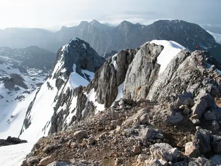
- The Mourne Wall: A hand-built dry-stone granite wall running about 31.4 km over 15 summits. It gives the Challenge its line, character and main navigation feature.
- Slieve Bearnagh: Known for dramatic granite tors and a short, rocky, hands-on section. It is one of the most distinctive summits on the circuit.
- Slieve Binnian: Usually the first major climb from Carrick Little on a clockwise round. Its granite-tor ridge gives wide views over the Annalong valley and the sea.
- Silent Valley Reservoir: The reservoir landscape the wall was built to protect. Its dam and visitor park sit on the south side of the range.
- Ben Crom Reservoir: A steep-sided upper reservoir enclosed by central Mourne peaks, giving one of the most striking mountain views on the route.
Challenges to expect
Expect a very strenuous endurance day: steep climbs and descents, loose and rocky paths, boggy moorland, faint or pathless sections, and short scrambly ground on granite tors. There is no formal waymarking beyond following the wall, and mist can make navigation serious. Carry map, compass, GPS, food and water. For another tough summit-focused day, see the Galtymore Ascent.
HikeList Score
Mourne Wall Challenge scored 68/100 on HikeList's trail-quality metrics.
See score breakdownHide breakdown
- Ideal length 55
- Balanced challenge 44
- Scenery & wildness 98
- Varied terrain 77
- Accommodation 49
- Food & support 58
- Path quality 98
- Season flexibility 89
Computed from length, challenge, scenery & wildness, terrain variety, accommodation, food & support, path quality and season flexibility.
Show more data Show less
- Mountainous
- Moorland
- Rocky
- Dirt
- Boggy
- Loose
- Wild Camping Spots
- Pet Friendly
- Water Sources
- Campsites
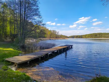
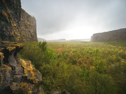
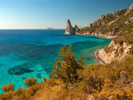
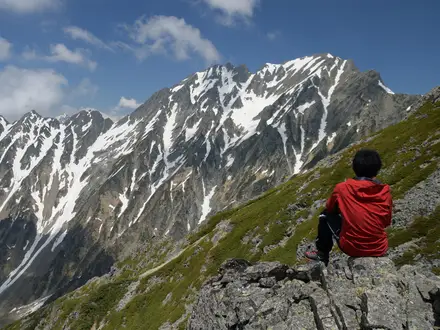
Photos from hikers
Taken on the trail by people who've reviewed Mourne Wall Challenge.
A long clockwise loop from Carrick Little car park is the common approach: climb Slieve Binnian, follow the wall across the central Mourne summits including Slieve Bearnagh and Slieve Commedagh, then finish over Slieve Donard before returning to the start. Fit, experienced hillwalkers typically take 10-14 hours.
Reviews
How would you rate Mourne Wall Challenge?
Tap a star to start your review — you could be the first.