Cilento Coast Trail
How would you rate Cilento Coast Trail?
Tap a star to share your experience and help other hikers.
Cilento Coast Trail: Coastal Hiking in Campania
HikeList Score
Cilento Coast Trail scored 83/100 on HikeList's trail-quality metrics.
See score breakdownHide breakdown
- Ideal length 63
- Balanced challenge 100
- Scenery & wildness 98
- Varied terrain 83
- Accommodation 74
- Food & support 81
- Path quality 80
- Season flexibility 76
Computed from length, challenge, scenery & wildness, terrain variety, accommodation, food & support, path quality and season flexibility.
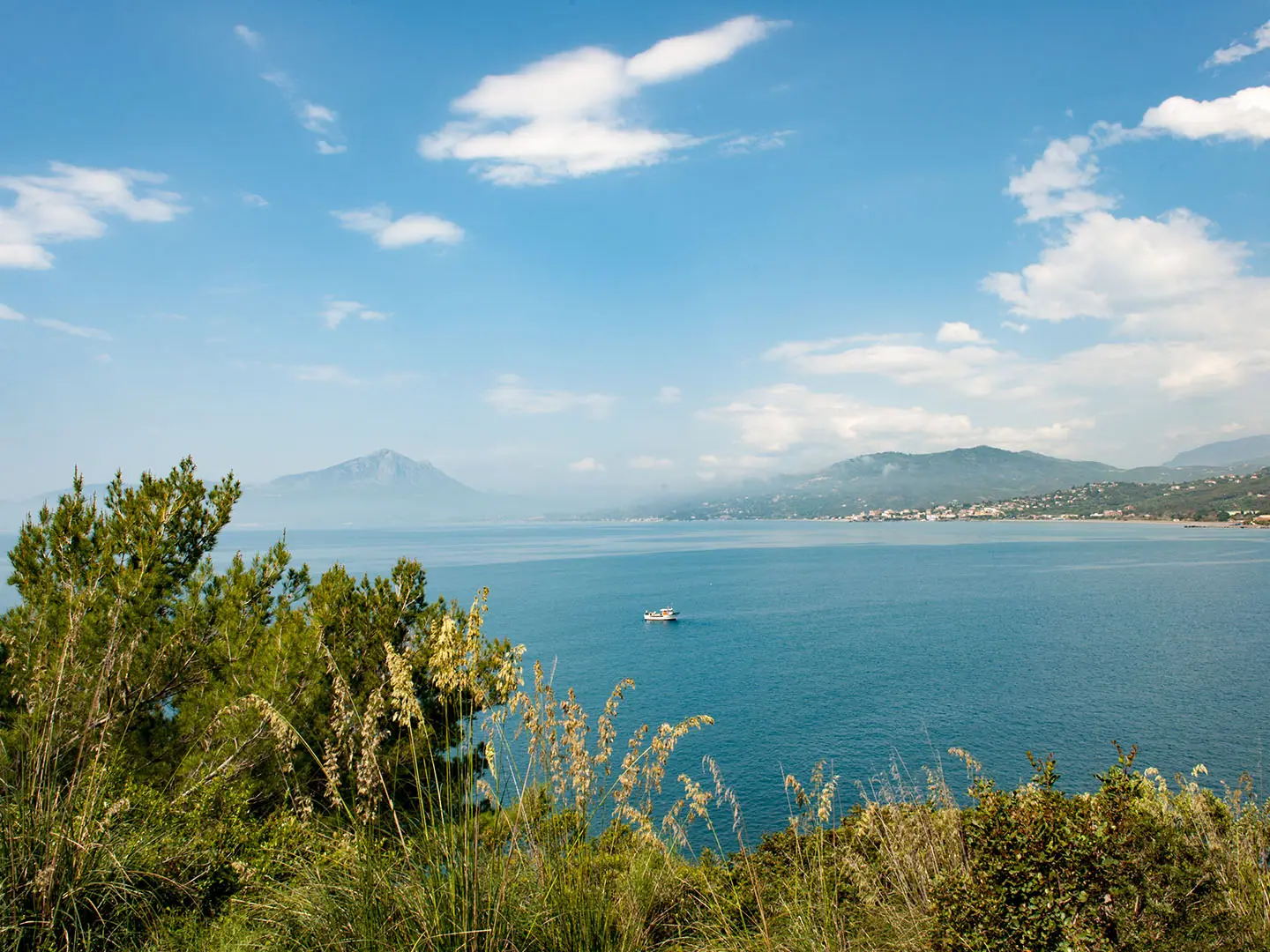
The Cilento Coast Trail is a 36 km, 2-day moderate coastal walk in southern Italy, following the Tyrrhenian shore of Campania inside the Cilento, Vallo di Diano e Alburni National Park. It suits hikers who want village-to-village walking, sea views, fishing harbours and rocky headlands without a high-mountain itinerary. The route is best treated as a partly waymarked coastal path rather than a single official numbered trail, with dusty tracks, stony paths, short paved sections and repeated low climbs over headlands.
Route Overview
This is a point-to-point coastal walk, most firmly supported between Agropoli or Santa Maria di Castellabate in the north and Acciaroli in the south. The line passes San Marco di Castellabate, Punta Licosa, Ogliastro Marina and Agnone, and can be walked in either direction. Expect a mix of CAI-marked sections, local signs and route-note or GPS navigation rather than one continuously blazed trail. Paestum lies just north of Agropoli, while Pioppi and Velia/Elea sit further along the coast. For other Italian coastal walking, compare the Cinque Terre Coastal Trail, the Amalfi to Ravello Circuit or the island-hopping Aeolian Islands Trek.
Ancient Cilento, Watchtowers and the Mediterranean Diet
The Cilento coast has deep Greek roots: Poseidonia, now Paestum, and Elea, now Velia, were founded here in antiquity and remain key archaeological sites. Later, Saracen and Barbary pirate raids shaped the defensive coastline, with stone watchtowers and hilltop settlements such as Castellabate. The national park was established in 1991 and inscribed by UNESCO in 1998 with Paestum, Velia and the Certosa di Padula. In the 1950s, Ancel Keys studied diet and longevity around Pioppi and Acciaroli, helping define the Mediterranean Diet.
Notable highlights
- Punta Licosa: A rocky, pine- and olive-clad headland south of San Marco di Castellabate, protected as part of a marine reserve. The walk here gives the route its classic mix of headland paths, sea views and myth linked to the siren Leucosia.
- Castellabate: A medieval hilltop village above Santa Maria and San Marco di Castellabate, with a castle that gives the town its name. It is a worthwhile detour for old streets, views and a contrast to the fishing harbours below.
- The Greek temples of Paestum: Just north of Agropoli, Paestum preserves major Doric temples built by Greek colonists. It is ticketed separately, but it is the obvious cultural add-on at the northern end of the walk.
- Acciaroli and Pioppi: These fishing villages are closely associated with Ancel Keys and the research behind the Mediterranean Diet. Pioppi also has a Museum of the Mediterranean Diet.
- Coastal watchtowers: Stone towers on headlands such as Punta Tresino and near the bays mark the historic need to warn villages of pirate raids. They are useful landmarks as well as part of the route’s coastal character.
Challenges to expect
The main challenges are cumulative distance, heat and navigation rather than altitude. The path stays close to sea level but still gains about 700 m in repeated short climbs over headlands. Surfaces include dusty dirt, stony tracks, rock and short paved lanes. Waymarking is only partial, so carry reliable route notes or GPS. July and August are hot, exposed and crowded; spring and autumn are better for walking.
HikeList Score
Cilento Coast Trail scored 83/100 on HikeList's trail-quality metrics.
See score breakdownHide breakdown
- Ideal length 63
- Balanced challenge 100
- Scenery & wildness 98
- Varied terrain 83
- Accommodation 74
- Food & support 81
- Path quality 80
- Season flexibility 76
Computed from length, challenge, scenery & wildness, terrain variety, accommodation, food & support, path quality and season flexibility.
 Italy
ItalyShow more data Show less
- Coastal
- Hills
- Forest
- Dirt
- Rocky
- Paved
- Hotels
- Guesthouses
- Family Friendly
- Pet Friendly
- Water Sources
- Campsites
- Picnic Areas
In these collections
Photos from hikers
Taken on the trail by people who've reviewed Cilento Coast Trail.
Reviews
How would you rate Cilento Coast Trail?
Tap a star to start your review — you could be the first.