Westweg
How would you rate Westweg?
Tap a star to share your experience and help other hikers.
Westweg: Black Forest Thru-Hike from Pforzheim to Basel
HikeList Score
Westweg scored 90/100 on HikeList's trail-quality metrics.
See score breakdownHide breakdown
- Ideal length 90
- Balanced challenge 84
- Scenery & wildness 90
- Varied terrain 94
- Accommodation 100
- Food & support 88
- Path quality 80
- Season flexibility 89
Computed from length, challenge, scenery & wildness, terrain variety, accommodation, food & support, path quality and season flexibility.
The Westweg is a roughly 285 km point-to-point hike through Germany’s Black Forest, running north to south from Pforzheim to Basel. Most hikers take 12–13 days, with daily stages of about 15–30 km. It suits fit walkers who want a classic Germany long-distance trail: waymarked forest paths, ridges, high moorland, valley crossings and a serious cumulative ascent of about 8,500 m. The grade is hard overall because of the length, climbing and some steep sections.
Route Overview
The Westweg starts in Pforzheim, the “gold city” on the northern edge of the Black Forest, and finishes in Basel, Switzerland, on the Rhine. It crosses the Enz, Murg and Kinzig valleys, passing places such as Dobel, Forbach, Unterstmatt, Hausach and Titisee. Near Titisee, after roughly stage 8–9, the trail splits: the western variant is the classic high route via Feldberg, Belchen and Hochblauen/Blauen, while the quieter eastern variant goes via Herzogenhorn and the open farmland of the Dinkelberg. The route is marked by the red diamond on a white background. For other German long-distance options, compare the Goldsteig, Eifelsteig and Albsteig.
Westweg history: Germany’s first waymarked long-distance trail
The Westweg was created in 1900 by the Baden section of the Schwarzwaldverein, the Black Forest Society. It is regarded as Germany’s first waymarked long-distance footpath and became a model for later European hiking routes. Its red-diamond waymark is part of that heritage. Today the Westweg also forms part of the European long-distance path E1 and carries “Top Trail of Germany” status, as well as the Qualitätsweg Wanderbares Deutschland certification.
Notable highlights
- Feldberg (about 1,493 m): The highest summit in the Black Forest and the Westweg’s high point. It lies on the western variant and gives wide views, with the Alps visible in clear weather.
- Lake Titisee: A popular glacial lake where the Westweg crosses adjoining moorland. This is also the key split between the western and eastern variants to Basel.
- Belchen (1,414 m): A rounded summit on the western variant and one of the Black Forest’s well-known viewpoints. It adds to the harder, higher character of the classic western line.
- Hornisgrinde and Mummelsee: Hornisgrinde is the highest peak of the northern Black Forest, while nearby Mummelsee is a dark glacial tarn associated with local legend. Together they form a memorable early section.
- Source of the Danube area: The trail passes through the high central Black Forest near the Danube headwaters and the European watershed at the Martinskapelle, around 1,094 m.
- Black Forest National Park: The route skirts or crosses protected Black Forest National Park terrain, with extensive spruce and fir forest typical of the northern section.
Challenges to expect
Expect a long, sustained walk rather than a technical route. The main challenge is endurance: about 285 km, 12–13 days and roughly 8,500 m of cumulative ascent. Surfaces vary between unmade paths, asphalt and farm or forest tracks. Higher sections, especially around Feldberg, can hold snow and ice in winter, so the best season is late spring to autumn. Wild camping is restricted, so plan accommodation ahead.
HikeList Score
Westweg scored 90/100 on HikeList's trail-quality metrics.
See score breakdownHide breakdown
- Ideal length 90
- Balanced challenge 84
- Scenery & wildness 90
- Varied terrain 94
- Accommodation 100
- Food & support 88
- Path quality 80
- Season flexibility 89
Computed from length, challenge, scenery & wildness, terrain variety, accommodation, food & support, path quality and season flexibility.
 Germany
Show more data Show less
- Forest
- Mountainous
- Moorland
- Valley
- Vineyard Hills
- Dirt
- Gravel
- Paved
- Hotels
- Guesthouses
- Mountain Inns
- Hostels
- Family Friendly
- Pet Friendly
- Restrooms
- Water Sources
- Campsites
- Shelters
- Picnic Areas
Download Our Full Guide to Westweg FREE!
Get our comprehensive guide to this hike for free. Save it for later reading or print out at home.
In these collections
Photos from hikers
Taken on the trail by people who've reviewed Westweg.
Westweg: The Complete Guide
 i
Image by Birgit Reitz-Hofmann
i
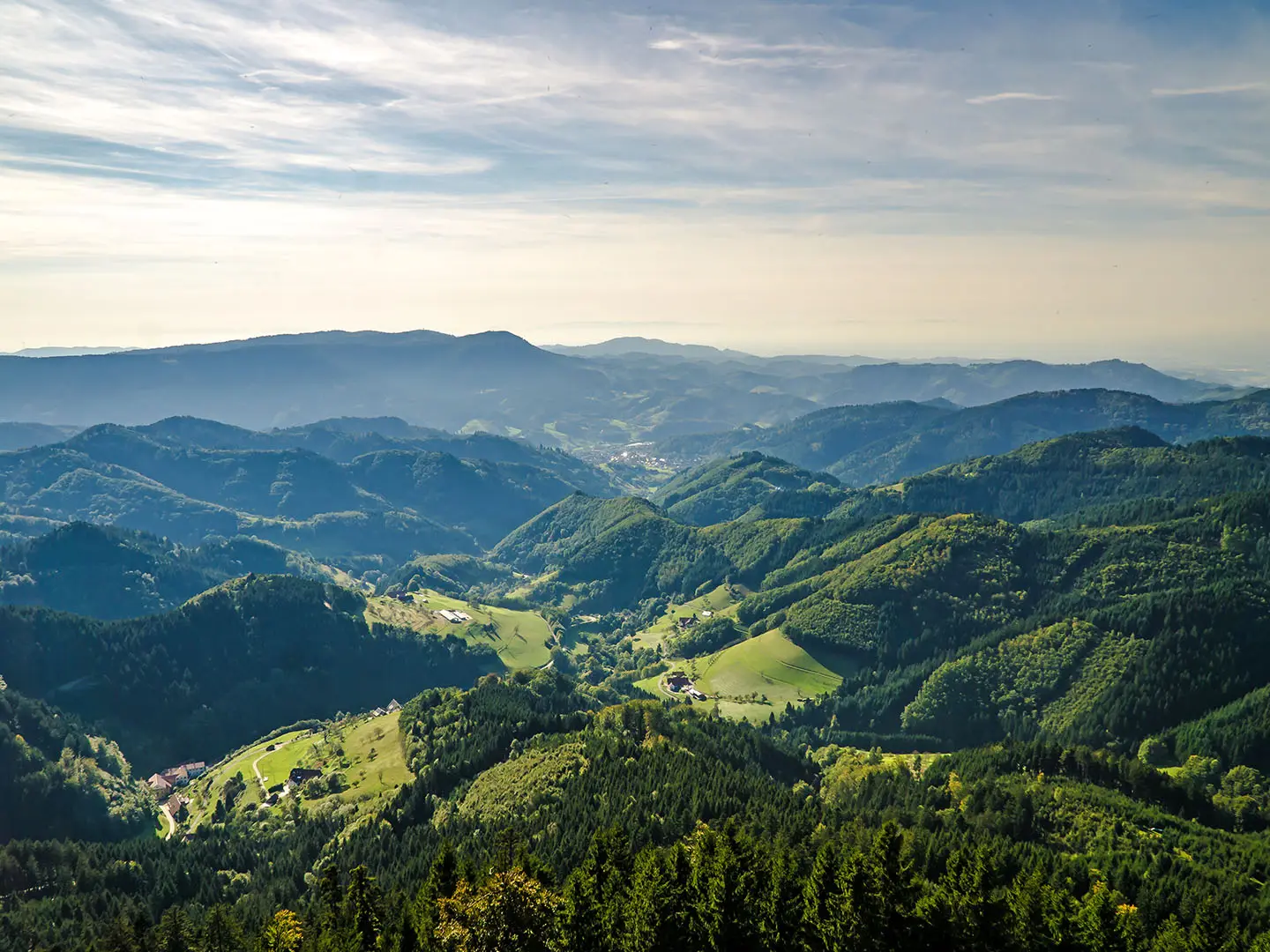
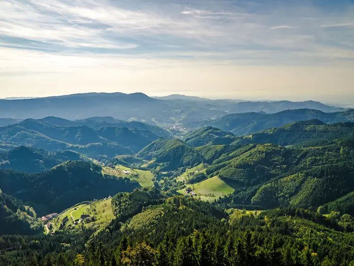
Image by Birgit Reitz-Hofmann The Westweg is the classic north–south traverse of the Black Forest: a 285 km red-diamond route from Pforzheim (Kupferhammer) to Basel. It is Germany’s oldest waymarked long-distance footpath, created in 1900, and still feels like a proper end-to-end journey rather than a stitched-together touring route.
The walking is a sustained Höhenweg of forest ridges, high moorland, rounded summits and deep valley crossings. North of Titisee it builds through places such as Dobel, Forbach, Hornisgrinde, Mummelsee, Alexanderschanze and Hausach before reaching the higher southern Black Forest.
After Titisee the route splits: the Westvariante takes the classic high line over Feldberg, Belchen and Hochblauen / Blauen towards Kandern, while the quieter Ostvariante crosses the Herzogenhorn and Dinkelberg. Both finish in Basel on the Rhine, with rail access at each end and useful Black Forest train links for section walkers.
This is not an alpine or technical trail, but it is a hard long-distance walk. Expect roughly 12–13 days of repeated climbs, some 15–30 km stages, about 8,000+ m of total ascent, exposed high sections that can hold snow into spring, and accommodation that needs planning because wild camping is not permitted in Baden-Württemberg.
This guide covers stages, daily planning, accommodation, food, transport, terrain and the common mistakes to avoid.
Stage-by-Stage Guide
The stages below follow the classic western variant of the Westweg from Pforzheim to Basel. Distances are approximate and should be treated as planning figures rather than exact GPS measurements, especially where accommodation choices shift the start or finish of a day.
Stage 1: Pforzheim to Dobel — approx. 26 km
Character and terrain: The Westweg begins at Pforzheim-Kupferhammer on the southern edge of Pforzheim, then climbs away from the Enz-side urban fringe into the northern Black Forest. Expect a mixed first day of forest paths, gravel tracks, occasional meadow sections and some asphalt as the route settles into its ridge-walking rhythm.
Places and highlights: The early climb passes the Hoheneck ruins before the red-diamond waymark leads south into quieter wooded country. Pforzheim is the last large town before the trail commits to the hills, so it is the best place to arrive fully supplied.
Food, water and overnight: Stock up in Pforzheim before starting, as mid-stage options should not be relied on without checking current opening times. Dobel is an established overnight halt with indoor accommodation options such as hotels, Gasthöfe and guesthouses; book ahead in the main walking season.
Access and navigation: Pforzheim has rail access via Pforzheim Hauptbahnhof, with regional and S-Bahn services from Karlsruhe and Stuttgart. From the station, allow time to reach the official start at Kupferhammer. Dobel has road access, but onward bus options should be checked before travelling.
Watch for: This is a full-length first day, not a gentle warm-up. Do not underestimate the combination of town-edge navigation, the initial climb and 26 km on mixed surfaces.
Stage 2: Dobel to Forbach — approx. 26 km
Character and terrain: This is another long northern Black Forest stage, mainly through forested ridge and valley country. Underfoot, expect the usual Westweg mix of woodland path, gravel track and some surfaced lanes, with sections that can be muddy after sustained rain.
Places and highlights: The day works deeper into the northern Black Forest before dropping towards Forbach in the Murg valley. The contrast between high, enclosed forest and the valley settlement is part of the stage’s character.
Food, water and overnight: Start with enough food and water for the day unless current opening times along the route have been checked. Forbach offers a more practical overnight base than the higher ridge stops, with indoor accommodation options in or near the village.
Access and navigation: Valley settlements are generally easier for public transport and road access than high ridge inns, but current local train and bus times should still be checked before relying on them. Navigation is usually straightforward on the red diamond, but there are many forest-track junctions where a map or GPX track remains useful.
Watch for: The long distance and descent towards the valley can make this a tiring day even without technical ground. In wet weather, woodland sections may be slippery or churned.
Stage 3: Forbach to Unterstmatt — approx. 20 km
Character and terrain: Although shorter than the first two stages, this is a serious climbing day as the route leaves the Murg valley and regains the high northern ridge. The terrain is predominantly forested, with tracks and paths rising through wooded slopes.
Places and highlights: The major landmark is the Schwarzenbach-Talsperre, the large reservoir above Forbach set among forested hills. It is one of the most memorable engineered landscapes on the northern Westweg.
Food, water and overnight: Carry enough supplies from Forbach, as the stage crosses more remote upland terrain. Unterstmatt is a ridge stop rather than a large village, so accommodation and meals should be arranged in advance and opening days checked.
Access and navigation: Unterstmatt has road access, but mountain bus services can be infrequent. This should be checked before travelling, particularly if using Unterstmatt as a start, finish or escape point.
Watch for: The main difficulty is the climb from the valley and the fact that services thin out on the ridge. Weather can feel markedly cooler and more exposed once height is regained.
Stage 4: Unterstmatt to Zuflucht / Alexanderschanze — approx. 24 km
Character and terrain: This is one of the key high northern Black Forest stages, crossing exposed ridge terrain as well as forest and heath-like Grinden. The walking remains non-technical, but the sense of height and weather exposure increases.
Places and highlights: The route takes in the Hornisgrinde area, the highest summit of the northern Black Forest, and the Mummelsee, a dark glacial tarn below the ridge. It also passes through or close to Black Forest National Park terrain, with old spruce and fir forest on the northern ridge.
Food, water and overnight: Do not assume reliable food or drink between named hubs unless opening times have been checked. Accommodation at or near Zuflucht and Alexanderschanze is on the high ridge and should be booked well ahead.
Access and navigation: Zuflucht and Alexanderschanze are road-accessed ridge locations, but public transport is less flexible than in the valleys. Check current bus times before planning a short day, late arrival or escape.
Watch for: Hornisgrinde and the open ridge can be cold, windy and misty, and may hold snow or ice outside the main season. In poor visibility, stay disciplined with the red-diamond waymarks and do not rely only on obvious tracks.
Stage 5: Zuflucht to Hausach — approx. 28 km
Character and terrain: This is a long stage from the high northern ridge down to Hausach in the Kinzig valley. It combines sustained forest walking, ridge sections and a significant descent into the valley.
Places and highlights: Kniebis is the main named settlement on the route before the trail continues towards Hausach. The day marks a major transition from high ridge walking to one of the Westweg’s deep valley crossings.
Food, water and overnight: Carry a full day’s supplies unless current services at Kniebis or elsewhere on the stage have been checked. Hausach is a practical overnight stop with better access to accommodation and resupply than the ridge locations.
Access and navigation: Hausach is a valley town, making it a more convenient place for transport connections than the high passes, although current rail and bus details should be checked before travelling. Navigation is generally clear, but the long descent and forest-track network still require attention.
Watch for: This is one of the longer days in the schedule. The descent into the Kinzig valley can be hard on knees, especially after rain or with a heavy pack.
Stage 6: Hausach to Wilhelmshöhe — approx. 21 km
Character and terrain: After the Kinzig valley, the Westweg climbs back towards the central Black Forest heights. The day is shorter on paper than several others, but the climb out of Hausach makes it a demanding stage.
Places and highlights: This is less about a single landmark and more about regaining the high route after the valley crossing. Expect a gradual return to forested Höhenweg terrain, with a mix of paths, tracks and occasional surfaced sections.
Food, water and overnight: Hausach is the sensible place to restock before leaving the valley. Wilhelmshöhe is a high-stage overnight point rather than a large service centre, so accommodation and an evening meal should be booked in advance.
Access and navigation: Once above Hausach, access becomes more limited again. If joining, leaving or shortening the route around Wilhelmshöhe, check current road and bus options before committing to the plan.
Watch for: The main trap is treating this as an easy day because of the distance. The climb back from the Kinzig valley is part of the Westweg’s cumulative endurance test.
Stage 7: Wilhelmshöhe to Kalte Herberge — approx. 23 km
Character and terrain: This stage continues across the high central Black Forest, with forest, open upland sections and broad ridge walking. The surface mix remains varied, with unmade paths, gravel and farm tracks, and some asphalt.
Places and highlights: The key landmark is Martinskapelle, near the Danube source area, where the Westweg crosses the European watershed between the Rhine/North Sea and Danube/Black Sea systems. This is one of the most distinctive geographical points on the whole trail.
Food, water and overnight: Carry enough food and water from the start unless current openings along the stage have been checked. Kalte Herberge is a recognised Westweg overnight stop, but high-route accommodation is limited and should be reserved ahead.
Access and navigation: Road access exists at some high-route points, but public transport can be sparse. This should be checked before travelling, especially outside peak season or at weekends.
Watch for: Exposed upland sections can be wet, windy and cold even when the valleys are mild. Mist can make the high forest and moorland feel more complex, so keep a map or GPX available alongside the waymarks.
Stage 8: Kalte Herberge to Hinterzarten / Titisee — approx. 26 km
Character and terrain: This is a long central-to-southern Black Forest stage leading towards the popular Titisee and Hinterzarten area. Expect forest, high moorland, meadow and track walking as the route approaches the lake district of the southern Black Forest.
Places and highlights: Lake Titisee is the main landmark, and the adjoining high moorland gives a different feel from the darker northern forest. The Kurhaus at Titisee is the important route decision point where the Westweg divides into western and eastern variants.
Food, water and overnight: Hinterzarten and Titisee have a wider choice of accommodation and services than many ridge stages. This is a sensible place to resupply, sort laundry if needed, and confirm bookings for the southern high stages.
Access and navigation: Hinterzarten and Titisee are served by the Höllentalbahn / Dreiseenbahn network, making this one of the easiest places on the route to join, leave or take a rest day. Current timetables should still be checked before travelling.
Watch for: Do not miss the variant split at Titisee. The stages described from here follow the western variant over Feldberg, Belchen, Hochblauen / Blauen and Kandern; choosing the eastern variant requires a different accommodation and stage plan.
Stage 9: Titisee to Feldberg — approx. 17 km
Character and terrain: This is a shorter stage, but it climbs onto the highest ground of the Westweg. The western variant leads from the Titisee area towards Feldberg, the highest summit of the Black Forest at 1,493 m.
Places and highlights: Feldberg is the high point of the entire route, with open subalpine grassland and wide views towards the Rhine plain, the Vosges and, in clear weather, the Alps. It is one of the defining days of the western Westweg.
Food, water and overnight: Start from Titisee or Hinterzarten with supplies, as weather and opening times can affect plans on the high ground. Feldberg is a resort area with indoor accommodation options nearby, but beds should still be booked in advance, especially in busy seasons.
Access and navigation: The wider Feldberg area is served by Black Forest public transport, including the Dreiseenbahn at Feldberg-Bärental, but links to the walking route and accommodation should be checked carefully. Do not assume that a railway stop removes the need for local transfers or walking time.
Watch for: The short distance can be misleading. Feldberg is exposed, can be windy, and may hold snow or ice into spring; poor visibility can make the open summit area harder to navigate.
Stage 10: Feldberg to Wiedener Eck — approx. 22 km
Character and terrain: This is a high southern Black Forest stage on the western variant, moving from Feldberg towards the Belchen area and onward to Wiedener Eck. The day combines open high ground, forest and ridge walking, with repeated climbs and descents.
Places and highlights: Belchen, at 1,414 m, is the major highlight and one of the finest viewpoint summits on the Westweg. In clear conditions, the panorama across the southern Black Forest and beyond is a major reward for the effort.
Food, water and overnight: Treat this as a high-stage day and carry enough food and water unless current mountain inn openings have been checked. Wiedener Eck is a ridge/pass overnight stop with thinner accommodation choice than Titisee or Basel, so booking ahead is important.
Access and navigation: Wiedener Eck has road access, but mountain bus services can be limited. Current timetables should be checked before using it as an entry, exit or support point.
Watch for: Weather exposure remains a real factor on Feldberg, Belchen and the connecting high ground. Snow, ice, strong wind and low cloud are all more consequential here than on the lower forest stages.
Stage 11: Wiedener Eck to Kandern — approx. 33 km
Character and terrain: This is the longest stage in the 12-day western-variant schedule and should be taken seriously. It leads from the high Black Forest towards the gentler vineyard country of the Markgräflerland, with forest, tracks, paths and more lower-level walking as the route descends south-west.
Places and highlights: Hochblauen / Blauen, around 1,165 m, is the key summit and the southernmost high lookout on the western variant. From there, the route trends down towards Kandern and the vineyard hills approaching the Rhine.
Food, water and overnight: Carry substantial food and water, as the length of the day leaves little margin if services are closed or off-route. Kandern is the overnight base at the end of the stage, with indoor accommodation to be booked ahead.
Access and navigation: Kandern has road access and is a more convenient end point than the high ridge stops, but onward public transport should be checked before travelling. On a long day, a reliable map or GPX track is useful for maintaining pace through forest and lower-level junctions.
Watch for: The main warning is distance. At 33 km, this stage can be the hardest day of the route even though the trail is no longer on the highest ground; start early and avoid depending on unconfirmed mid-stage services.
Stage 12: Kandern to Basel — approx. 26 km
Character and terrain: The final stage leaves Kandern and crosses the lower, gentler country between the Black Forest and the Rhine before finishing in Basel. Compared with the high ridge days, expect more settlement influence, vineyard hills, tracks and surfaced sections on the approach to the city.
Places and highlights: The western variant reaches Basel via the Wolfsschlucht before the route completes its north-to-south traverse at the Rhine. The finish in Basel is a major contrast to the forest and high moorland of the preceding days.
Food, water and overnight: Start with enough for the day from Kandern, then expect full city services at the finish in Basel. Costs in Basel are in Swiss francs (CHF), unlike the German stages where euros are used.
Access and navigation: Basel is a major rail hub, with Basel SBB and Basel Bad Bf providing onward connections. The urban approach requires more attention than the forest stages, as waymarks, streets and junctions can be easier to miss when the walking feels nearly finished.
Watch for: Fatigue and complacency are the main risks on the final day. Allow enough time for the border-city finish, onward rail plans and any accommodation check-in in Basel.
Recommended Itinerary
The itinerary below follows the standard 12-day Westvariante from Pforzheim to Basel, using the practical stage pattern in the route data. This is the classic high southern line over Feldberg, Belchen and Hochblauen / Blauen to Kandern before the final approach to Basel.
Distances are approximate. Exact daily mileage can change with the overnight address used, local diversions and whether you follow the western or eastern variant after Titisee, so check official mapping before booking accommodation.
Standard itinerary: 12 days on the Westvariante
| Day | From | To | Approx. distance | Why this stage makes sense | Services/accommodation notes |
|---|---|---|---|---|---|
| 1 | Pforzheim | Dobel | 26 km | A full opening day from the northern edge of the Black Forest, with the official start at Pforzheim-Kupferhammer and the first sustained climb onto the ridge. | Pforzheim has rail access via Pforzheim Hbf. Dobel is a sensible first indoor overnight; book ahead rather than assuming late availability. |
| 2 | Dobel | Forbach | 26 km | Keeps momentum through the northern Black Forest and brings the route down towards the Murg valley, one of the first major valley crossings of the walk. | Forbach is a useful valley overnight after two long opening stages. This is a good place to check weather and timing before the higher northern ridge. |
| 3 | Forbach | Unterstmatt | 20 km | Shorter on paper, but useful because the route climbs back from the valley and passes the Schwarzenbach-Talsperre area before gaining the higher ridge. | Unterstmatt is a high-stage stop rather than a large town. Accommodation choice is thinner here, so reserve well in advance. |
| 4 | Unterstmatt | Zuflucht / Alexanderschanze | 24 km | A classic northern-ridge day taking in the Hornisgrinde / Mummelsee area and protected Black Forest National Park terrain. | Overnight options around Zuflucht / Alexanderschanze are limited compared with resort towns. Confirm the exact overnight location before setting the day’s finish. |
| 5 | Zuflucht | Hausach | 28 km | A long stage that carries the route south from the high northern ridge towards the Kinzig valley, with a major descent into Hausach. | Hausach is an important valley stop after several ridge-based nights. It is a natural point to reset before the climb back out on Day 6. |
| 6 | Hausach | Wilhelmshöhe | 21 km | A more moderate distance after the long descent to Hausach, but still a serious day because the route climbs back from the valley onto the central Black Forest heights. | Wilhelmshöhe is a ridge-stage overnight. Treat accommodation as essential logistics, not something to leave until arrival. |
| 7 | Wilhelmshöhe | Kalte Herberge | 23 km | A steady central Black Forest stage crossing high country around Martinskapelle and the European watershed near the Danube source area. | Kalte Herberge is another practical high-level halt. Food and bed availability should be checked before travelling, especially outside the busiest summer period. |
| 8 | Kalte Herberge | Hinterzarten / Titisee | 26 km | This stage brings the route into the southern Black Forest resort area, where the trail approaches Titisee and the point where the variants divide. | Hinterzarten and Titisee have better accommodation choice than many ridge stops. They are also served by the Höllentalbahn / Dreiseenbahn network, making this one of the better access or rest points. |
| 9 | Titisee | Feldberg | 17 km | A deliberately shorter day before or onto the highest ground. On the Westvariante the route heads for Feldberg, the high point of the Westweg at 1,493 m. | Accommodation around the Feldberg area should be booked ahead. The Höllentalbahn / Dreiseenbahn serves Feldberg-Bärental, but onward local transport and mountain buses can be infrequent, so check timetables before relying on them. |
| 10 | Feldberg | Wiedener Eck | 22 km | A demanding southern high-route day over exposed upland terrain, with the Westvariante continuing towards the Belchen area and the southern Black Forest heights. | Wiedener Eck is a pass-stage overnight with fewer choices than Titisee or Hinterzarten. Weather can be more consequential here because the route is high and open. |
| 11 | Wiedener Eck | Kandern | 33 km | The longest day in this schedule, carrying the route over the southern high ground towards Hochblauen / Blauen before descending towards the Markgräflerland and Kandern. | Start early and avoid underestimating this stage. If 33 km is too much, split it with an additional booked overnight on or near this section where available; check official mapping before booking. |
| 12 | Kandern | Basel | 26 km | A final full day from the vineyard hills and the Wolfsschlucht approach into Basel on the Rhine, completing the point-to-point crossing of the Black Forest. | Basel has major rail connections at Basel SBB and Basel Bad Bf. Costs in Basel itself are in Swiss francs, not euros. |
Slower variant: 13–14 days
A 13- or 14-day itinerary suits walkers who prefer shorter days, want more margin for bad weather on the high sections, or are not comfortable with repeated 25 km-plus stages. The most obvious place to add time is the southern Westvariante, especially around Feldberg, Wiedener Eck, Hochblauen / Blauen and Kandern, where the standard itinerary includes the 33 km Wiedener Eck to Kandern stage.
A slower schedule can also split one of the long northern or central days, such as Pforzheim to Dobel, Dobel to Forbach, Zuflucht to Hausach or Kalte Herberge to Hinterzarten / Titisee, but intermediate accommodation must be planned carefully. This should be checked before travelling.
This version is best for hikers carrying a full pack, anyone walking outside peak summer daylight, and those who want a safer buffer if snow, ice, heat or thunderstorms affect the exposed high ground.
Faster variant: 11–12 days
Fit, experienced long-distance walkers sometimes complete the Westweg in 11–12 days. The 12-day table above is already brisk, with several stages around 26–28 km and one 33 km day, so an 11-day plan should only be considered by walkers comfortable with long mountain days on consecutive dates.
The safer way to go faster is not to rely on vague shortcuts, but to book longer linked stages using official mapping and confirmed accommodation. Avoid compressing the high southern section unless the weather is settled and the overnight logistics are clear.
Eastern variant after Titisee
At Titisee, the Westweg splits. The table above follows the Westvariante, the classic high route over Feldberg, Belchen and Hochblauen / Blauen to Kandern.
The Ostvariante is usually walked in 13 stages and reaches its high point on the Herzogenhorn before continuing towards the Dinkelberg and Basel. It is a valid alternative for walkers wanting the quieter eastern line, but daily stops and accommodation should be planned from current official mapping rather than adapted blindly from the Westvariante table.
Planning the Route
How many days to allow
Most walkers should plan the Westweg as a 12- to 13-day walk, depending on pace and which southern variant is chosen. The classic western line is commonly planned in 12 stages, while the eastern variant is often walked in 13.
Fit long-distance walkers can compress the route into 11–12 days, but that leaves little margin for bad weather, tired legs or awkward accommodation availability. A steadier 13–14 day plan is more comfortable if you want shorter days, extra time around Titisee or Hinterzarten, or a buffer before the higher southern stages.
The Westweg is not a route that rewards under-planning. The waymarking is strong and the terrain is non-technical, but the repeated climbs out of deep valleys and the sustained ridge walking make back-to-back long days tiring.
Let accommodation shape the itinerary
Daily stages on the Westweg are strongly influenced by where beds are available. The route passes through towns and resorts, but it also spends long periods on high forest ridges where accommodation is concentrated at passes, mountain inns and small settlements.
This matters most around places such as Unterstmatt, Zuflucht / Alexanderschanze, Wilhelmshöhe, Kalte Herberge and Wiedener Eck, where the next realistic overnight option may not be close if everything is full. Around Hinterzarten, Titisee and the resort areas there is generally more choice.
Wild camping is not permitted in Baden-Württemberg, so the route should be planned as an indoor-accommodation hike using hotels, Gasthöfe, Pensionen, Berggasthöfe, hostels or Naturfreundehäuser. Book the high-stage nights well ahead, especially in the main walking season and at weekends.
Choosing the western or eastern variant
The route splits near Titisee / Hinterzarten, with both variants continuing to Basel.
| Variant | Best for | Planning implications |
|---|---|---|
| Westvariante | The classic high-level finish over Feldberg, Belchen and Hochblauen / Blauen, then down through Kandern towards Basel | Usually planned in 12 stages. It includes the Westweg high point on Feldberg at 1,493 m and has exposed high sections where weather matters. |
| Ostvariante | A quieter southern line over the Herzogenhorn and the Dinkelberg | Often planned in 13 stages. The high point is Herzogenhorn at 1,415 m rather than Feldberg. Accommodation and transport logistics should be checked carefully before fixing dates. |
Decide on the variant before booking anything south of Titisee. The two lines use different overnight points and are not interchangeable without replanning.
Shortening, extending and section hiking
Shortening the Westweg is usually done by walking selected sections rather than by cutting corners on a continuous traverse. The public transport network in the Black Forest makes section hiking practical, especially where regional trains and buses connect the valleys and resort towns.
The Höllentalbahn / Dreiseenbahn is particularly useful around Hinterzarten, Titisee and Feldberg-Bärental. Both ends are straightforward by rail, with Pforzheim Hauptbahnhof for the start area and Basel SBB / Basel Bad Bf for the finish.
Mountain bus services can be infrequent, especially for ridge and pass locations, so escape plans should not rely on turning up and hoping for a convenient connection. Current timetables should be checked before travelling.
Adding days is easier than removing them. Extra time is useful around Titisee / Hinterzarten, before the Feldberg section, or as a weather buffer for the higher southern Black Forest.
Food and water planning
Do not assume that every stage has reliable shops or cafés at convenient intervals. Towns and resort areas give good resupply opportunities, but some ridge stages pass through forest, high moorland and small pass settlements where services may be limited or seasonal.
A practical approach is to start each day with enough food for lunch and snacks, plus enough water for the full stage if intermediate stops are uncertain. Accommodation hosts may be able to provide packed lunches, but this should be arranged in advance rather than assumed on arrival.
The most important resupply mindset is simple: stock up when passing larger places such as Forbach, Hausach, Hinterzarten, Titisee, Kandern and the resort areas, and treat the high ridges as comparatively thin on services.
Navigation and route information
The Westweg is well waymarked with the red diamond on a white background. In normal conditions, navigation is usually straightforward, but a map, offline GPX track or guidebook is still sensible.
This is especially important in forest sections with many tracks, around variant junctions, and on exposed high ground such as Hornisgrinde and Feldberg where mist, snow patches or bad weather can make signs harder to follow. Live trail diversions should be checked before setting off.
Weather and season planning
The route is best planned from late spring through autumn. Although the Black Forest is not alpine in a technical sense, high sections can be exposed and may hold snow or ice outside the main season.
Build flexibility into the itinerary around the higher days, especially Hornisgrinde, Feldberg, Belchen and Hochblauen / Blauen. A clear forecast can make these stages outstanding; poor visibility, strong wind or lingering snow can make them much slower and more demanding.
Permits and baggage
No special hiking permit is needed for the Westweg, but accommodation planning is essential because wild camping is not allowed in Baden-Württemberg. If using luggage transfer, coverage and collection points should be checked before booking, particularly for high ridge accommodation and the chosen southern variant.
KONUS guest-card buses may be useful during the hike where participating accommodation provides the card, but eligibility and current transport rules vary by stay. This should be checked before travelling.
Towns, Villages and Overnight Stops
The Westweg is normally planned around fixed indoor accommodation rather than camping. Wild camping is not permitted in Baden-Württemberg, and the high-ridge stages have fewer beds than the larger resort towns, so accommodation should be booked ahead, especially around Unterstmatt, Alexanderschanze, Zuflucht, Wilhelmshöhe, Kalte Herberge, Feldberg and Wiedener Eck.
The notes below follow the main north-to-south line used by the 12-stage Westvariante itinerary. After Titisee, the Westweg splits: the Westvariante continues over Feldberg, Belchen, Wiedener Eck, Hochblauen / Blauen and Kandern, while the Ostvariante takes a quieter line over the Herzogenhorn and Dinkelberg before also finishing in Basel.
Pforzheim (Kupferhammer)
Pforzheim is the northern gateway to the Westweg. The official start is at Pforzheim-Kupferhammer on the southern edge of the city, where the red-diamond waymark leads out towards the Black Forest.
This is the best place to arrive the day before starting if travelling from outside the region. Pforzheim has the widest choice of pre-walk services on the route: accommodation, food, shops and onward transport.
Pforzheim Hauptbahnhof is on rail lines from Karlsruhe and Stuttgart, with frequent regional and S-Bahn services. Allow time to get from the station to Kupferhammer before starting the first full stage to Dobel.
Dobel
Dobel is the usual first overnight stop after the opening stage from Pforzheim, roughly 26 km into the walk. It works well because it breaks the initial climb out of the northern Black Forest edge into a manageable first day.
Expect the practical accommodation pattern of a Black Forest village: hotels, Gasthöfe or guesthouses rather than a large town-style choice. Book ahead rather than assuming a bed will be available on arrival.
Food options should be treated as village-scale. If arriving late, check meal times with the accommodation before travelling.
Forbach
Forbach is the standard second-stage stop after Dobel and sits below the high forest country that follows. It is a useful valley overnight before the climb towards the Schwarzenbach-Talsperre and Unterstmatt.
As a stage village, it is a sensible place for accommodation, food and resupply compared with the more limited ridge stops immediately ahead. It is also a good point to reassess weather and timing before committing to the higher northern ridge sections.
Transport links beyond the main named rail hubs on the route should be checked before relying on them. Mountain and valley connections can be useful for section hikers, but timetables may be infrequent.
Schwarzenbach-Talsperre
Schwarzenbach-Talsperre is a major route landmark rather than a primary overnight base. The trail passes the large reservoir above Forbach on the way towards Unterstmatt.
Do not plan this as a guaranteed resupply point. Carry enough food and water from Forbach for the stage unless current facilities have been checked in advance.
It is most useful as a navigation and timing marker on the climb through forested slopes. In poor weather, it also helps break up what can otherwise feel like a long, enclosed forest stage.
Unterstmatt
Unterstmatt is a high-stage stop on the northern Black Forest ridge and the usual overnight after the stage from Forbach. It is one of the places where booking matters: accommodation is more limited than in the larger towns.
Expect mountain-pass style services rather than a full village. Check evening meals, breakfast times and packed-lunch availability when booking, as the next stage continues through high terrain towards Hornisgrinde, Mummelsee, Alexanderschanze and Zuflucht.
Public transport in these higher areas can be sparse. If using Unterstmatt as a start, finish or escape point, current bus options should be checked before travelling.
Hornisgrinde / Mummelsee
Hornisgrinde and Mummelsee are key landmarks between Unterstmatt and the Alexanderschanze / Zuflucht area. Hornisgrinde is the highest peak of the northern Black Forest, with Mummelsee just below it.
This is a place to think of primarily as a daytime stop rather than the main planned overnight for a standard itinerary. There may be visitor services around the lake area, but walkers should not depend on them for full resupply without checking current opening times.
The ridge can be exposed in poor weather, and snow or ice can linger on high sections outside the main season. Carry layers and enough food to continue if cafés or facilities are closed.
Alexanderschanze
Alexanderschanze is a practical high-route staging point close to Zuflucht and Kniebis. Some itineraries end the fourth stage around Alexanderschanze rather than Zuflucht, depending on accommodation availability.
It is best treated as part of a small cluster of ridge overnight options rather than a large service centre. Beds can be limited, so it is wise to search Alexanderschanze, Zuflucht and Kniebis together when planning this night.
For transport, do not assume frequent onward buses from the ridge. This should be checked before travelling, particularly outside peak holiday periods.
Zuflucht
Zuflucht is a common overnight stop after the stage from Unterstmatt and a practical base before the long stage to Hausach. It sits on the high northern ridge section where accommodation choices are thinner.
Confirm accommodation, meals and any packed lunch in advance. The following day to Hausach is one of the longer standard stages, so starting well fed and with food carried is important.
Zuflucht also works as a planning alternative to Alexanderschanze or Kniebis if one of those places is full. The key is to keep the next day’s distance realistic rather than chasing the exact named stage end.
Kniebis
Kniebis lies close to the Alexanderschanze / Zuflucht area and can be useful as an alternative overnight or resupply point, depending on the exact accommodation found. It is not always the named stage end, but it belongs to the same practical planning zone.
If accommodation at Zuflucht or Alexanderschanze is unavailable, Kniebis may help keep the itinerary intact. Check the walking distance back to the Westweg line and the next day’s distance before booking.
Transport and bus frequency in the high Black Forest should be checked before relying on Kniebis as a section start or exit point.
Hausach
Hausach is one of the most important valley stops on the Westweg. It normally follows the long stage from Zuflucht and comes before the climb back up towards Wilhelmshöhe.
This is a good place to prioritise a proper rest, laundry where available, food and resupply. Compared with the ridge stops, Hausach is a more substantial overnight base and a useful point for adjusting the itinerary.
It also makes sense as a section-break location because it sits in a valley rather than on an exposed high pass. Current public transport options should still be checked before booking travel around a section hike.
Wilhelmshöhe
Wilhelmshöhe is the usual overnight after the stage from Hausach. It is a high-stage stop rather than a large settlement, so accommodation planning is important.
Expect limited choice and book early. Confirm whether an evening meal is available, as there may not be many alternatives within easy walking distance after a full day on the trail.
This stop positions walkers well for the next stage towards Martinskapelle and Kalte Herberge, crossing the central Black Forest high country and the European watershed area.
Martinskapelle
Martinskapelle is an important route landmark near the Danube source area and the European watershed. It is not usually the main overnight stop in the standard stage plan, but it is useful for orientation between Wilhelmshöhe and Kalte Herberge.
Treat it as a daytime waypoint rather than a guaranteed place for accommodation or resupply. Carry enough food and water for the full stage unless current facilities have been checked.
The area marks a significant transition in the central Black Forest. In poor visibility, keep close attention to the red-diamond waymarks and carry reliable navigation.
Kalte Herberge
Kalte Herberge is the standard overnight after the stage from Wilhelmshöhe and before the walk towards Hinterzarten or Titisee. It is another ridge or pass-style stop where accommodation is limited compared with the resort towns further south.
Book this night well ahead, particularly in the main walking season. Confirm dinner, breakfast and packed-lunch options, as the next stage is a full day into the southern Black Forest resort area.
For section hikers, any bus or onward transport from Kalte Herberge should be checked before travelling. Do not assume the same level of frequency found in the larger valley and lake towns.
Hinterzarten
Hinterzarten is one of the most useful service stops on the southern half of the Westweg. It sits near the point where the route approaches the Titisee area and is commonly used as an overnight alternative to Titisee.
Accommodation choice is generally better here than on the high ridge: hotels, guesthouses and other walker-friendly options are typical of the resort areas. It is a good place for a more comfortable night, food, supplies and itinerary repairs.
Hinterzarten is served by the Höllentalbahn / Dreiseenbahn network, making it one of the better public-transport points for joining, leaving or section-hiking the route. Current timetables should still be checked before travelling.
Titisee
Titisee is a major planning point on the Westweg. The Kurhaus at Titisee is where the western and eastern variants split, so accommodation here is useful if deciding between the Feldberg / Belchen high route and the quieter eastern line.
This is one of the best-served places on the route for accommodation, food and general visitor services. It is also a sensible rest or half-rest location if the northern and central stages have taken more energy than expected.
Titisee is served by the Höllentalbahn / Dreiseenbahn network, which makes it a strong access point for section hikers. Because it is popular, accommodation can still book up in busy periods.
Feldberg
Feldberg is the high-point area of the Westvariante and one of the most important places to plan carefully. The western route climbs into the highest ground of the Black Forest, with open, exposed terrain that can hold snow and ice outside the main season.
Accommodation is available in the wider Feldberg resort area, but walkers should book ahead rather than assuming space. The stage into or around Feldberg is shorter in the standard itinerary than some earlier days, but the altitude and weather can make it more serious than the distance suggests.
Feldberg-Bärental is served by the Höllentalbahn / Dreiseenbahn network, giving this area valuable transport access. Check current train and bus connections before using it as a start, finish or emergency exit.
Belchen
Belchen is a major summit on the Westvariante between Feldberg and Wiedener Eck. It is best treated as a high mountain waypoint rather than the default overnight stop in the standard 12-stage plan.
Carry food and weather protection for this section. Even though the Westweg is not technically alpine, the exposed high ground can be cold, windy and poor in visibility.
Accommodation planning should normally focus on the stage-end areas around Feldberg and Wiedener Eck rather than assuming a bed on the summit line. Any current services near Belchen should be checked before relying on them.
Wiedener Eck
Wiedener Eck is the standard overnight after the Feldberg-to-Wiedener Eck stage on the Westvariante. It is a practical high-pass stop before the long southern push towards Hochblauen / Blauen and Kandern.
This is one of the nights that should be booked well in advance. Confirm dinner and breakfast arrangements, because the following stage to Kandern is long in the standard itinerary.
Transport options from high passes can be limited. If planning to leave or join the route at Wiedener Eck, current bus connections should be checked before travelling.
Hochblauen / Blauen
Hochblauen / Blauen is the southernmost high summit on the Westvariante and a key landmark before the descent towards Kandern and the Markgräflerland vineyards. It is a natural timing point on the long stage from Wiedener Eck to Kandern.
Do not treat it as a guaranteed resupply or overnight unless current facilities have been checked and booked. The standard stage is long, so carry enough food and water to reach Kandern.
This section marks the change from the high forested Black Forest into gentler vineyard country approaching the Rhine. Weather can still be exposed on the summit, even when the lower country feels warm.
Kandern
Kandern is the final German overnight on the Westvariante before Basel. It is a useful and logical stop after the long stage from Wiedener Eck, giving walkers a shorter, clearer final day into Switzerland.
Accommodation and food are more practical here than on the high ridge immediately before it. It is a good place to clean up, sort onward travel plans and prepare for the final approach via the Wolfsschlucht towards Basel.
The final stretch crosses from Germany into Switzerland, so remember that costs in Basel will be in Swiss francs rather than euros. If using public transport from Kandern or nearby rather than walking on, current connections should be checked before travelling.
Basel
Basel is the finish of the Westweg and the main transport hub at the southern end. The western variant arrives via Kandern and the Wolfsschlucht, while the eastern variant reaches the city via the Dinkelberg.
Basel has extensive accommodation, food and onward travel options, but it is in Switzerland, so hotels, meals and local transport are priced in Swiss francs. Book accommodation in advance if finishing at a busy time or arriving late after the final stage.
Basel SBB and Basel Bad Bf give strong rail connections for onward travel, including international routes. Check which Basel station suits the onward journey before booking tickets, as the city has more than one major rail hub.
Getting to the Start
By train
Pforzheim is the practical railhead for the Westweg. The city has its own main station, Pforzheim Hauptbahnhof (Pforzheim Hbf), with frequent regional and S-Bahn services on lines from Karlsruhe and Stuttgart.
The official start is not at the main station itself. The Westweg begins at Pforzheim-Kupferhammer on the southern edge of town, where the red-diamond waymark leads south past the Hoheneck ruins towards the Black Forest.
Allow time to get from Pforzheim Hbf to Kupferhammer before beginning the first stage to Dobel, which is about 26 km. Local transport or a short taxi transfer may be the simplest option if arriving on the morning of day one. This should be checked before travelling.
By bus
Local bus connections may be useful for reaching Pforzheim-Kupferhammer from Pforzheim Hbf or from accommodation in town, but the exact routes and timings should be checked before travelling.
Do not assume an early-morning bus will line up neatly with the first stage. If starting with a full walking day to Dobel, build in a margin or arrange a taxi to the trailhead.
By car
Driving to the start is possible, but the Westweg is a point-to-point route finishing in Basel, so a car at Pforzheim creates an end-of-walk return journey. Public transport is usually simpler for walkers completing the whole trail.
If driving, use Pforzheim as the planning base rather than assuming there is suitable long-stay parking at Kupferhammer. Long-stay parking rules, security and any charges should be checked before travelling.
A practical car-based plan is to park in Pforzheim, walk to Basel, then return by rail to Pforzheim. Current rail connections, journey times and ticketing should be checked before committing to this.
From the nearest airport
There is no trailhead airport at Pforzheim. For international arrivals, the most straightforward approach is to choose an airport with good rail connections into the German rail network, then travel on to Pforzheim via Karlsruhe or Stuttgart.
Airport-to-rail connections, late arrivals and Sunday or public-holiday services should be checked before travelling. If landing late, staying overnight in Pforzheim before starting is usually more reliable than trying to reach Kupferhammer and begin walking the same day.
Where to stay before starting
Pforzheim is the best place to stay before beginning the Westweg. It has the main rail station, gives the simplest access to the official start at Kupferhammer, and avoids adding travel stress before the long first stage to Dobel.
Accommodation on or near the southern side of town can reduce the morning transfer to the trailhead. If staying near Pforzheim Hbf, allow time for the local connection or taxi to Kupferhammer before setting off.
The first day is already a full walking stage, so an early start is sensible. Arriving in Pforzheim the evening before is the most straightforward option for walkers carrying full kit or relying on public transport.
Getting Home from the Finish
By train
Basel is the easiest place on the Westweg to leave by public transport. The city is a major rail hub, with services from Basel SBB and Basel Bad Bf giving onward connections within Switzerland, into Germany and beyond.
Check which Basel station your onward ticket uses before booking accommodation or heading across the city after the finish. Basel SBB is the main Swiss station; Basel Bad Bf is also useful for German rail connections. Timetables and platform arrangements should be checked before travelling.
For hikers returning to the start, plan the journey from Basel back towards Pforzheim Hbf using mainline rail connections. Pforzheim is on railway lines from Karlsruhe and Stuttgart, but the exact routing from Basel depends on the current timetable and ticket type.
If finishing late after the final stage from Kandern to Basel, do not assume that every long-distance connection will still be convenient the same evening. Basel is a good place to break the journey overnight if the last day has run long, if weather has slowed progress, or if an onward international train would require a tight connection.
By bus
Local onward travel within Basel is best treated as a city-transport matter rather than a trail logistics problem. Use local public transport or a taxi to reach Basel SBB, Basel Bad Bf or your accommodation after leaving the Westweg finish area.
Bus and local transport details are timetable-dependent and should be checked before travelling. This is especially important on Sundays, public holidays and in the evening, when connections may be less convenient.
By car/taxi
Because the Westweg is a point-to-point route from Pforzheim to Basel, leaving a car at the finish only makes sense if the return to the start has been planned in advance. Most walkers will find rail more practical than trying to retrieve a car after walking 285 km south through the Black Forest.
Taxis are the sensible fallback inside Basel if you finish tired, arrive in poor weather, or need to reach a station or hotel without navigating local transport. Any taxi or local transport costs incurred in Basel will generally be in Swiss francs (CHF) rather than euros.
If arranging a private pick-up, be clear whether the meeting point is at the actual Westweg finish, a nearby city landmark, Basel SBB, or Basel Bad Bf. Basel is a busy urban finish, so an exact meeting point avoids unnecessary confusion at the end of a long final day.
From the nearest airport
Basel has practical onward travel options for international hikers, but flight routes, airport access and cross-border ticketing vary by season and carrier. This should be checked before travelling.
For many walkers, the most reliable plan is to treat Basel SBB or Basel Bad Bf as the main onward hub, then book rail or local transport to the chosen airport from there. Allow a buffer if connecting from the final day on foot to an evening flight, particularly if walking the full Kandern to Basel stage on the same day.
Where to stay at the finish
Basel is a sensible place to book a final night, especially after completing the full Westweg rather than trying to continue immediately by train. It gives a margin for a late finish, wet gear, delayed transport, or a celebratory meal after the final stage.
Accommodation in Basel is Swiss-priced, so budget in CHF for hotels, food and local transport at the finish. If cost is a concern, compare options before committing to the final itinerary, but avoid relying on a same-day long-distance departure unless the rail connection is secure.
Staying near Basel SBB or Basel Bad Bf is the most practical choice for an early onward train the next morning. If the next move is back into Germany, check which station gives the simplest departure before booking the room.
Which Direction Should You Walk?
The Westweg is best walked north to south, from Pforzheim (Kupferhammer) to Basel. This is the official and traditional direction: the route begins on the southern edge of Pforzheim, marked by the red diamond, and runs down the length of the Black Forest before finishing on the Rhine in Basel.
Reverse walking is possible, but it is less natural for planning and gives a weaker sense of progression. Most stage descriptions, accommodation patterns and mental landmarks are easier to follow southbound, especially around the Titisee split between the Westvariante and Ostvariante.
Why north to south works best
Southbound, the route builds logically. It starts from the northern edge of the Black Forest at Pforzheim, climbs onto the forested ridges around Dobel and Forbach, crosses the northern high ground around Hornisgrinde and Mummelsee, then continues through the central Black Forest towards Titisee.
The biggest scenery comes later rather than immediately. On the western variant, Feldberg, Belchen and Hochblauen / Blauen arrive in the final third of the walk before the descent through Kandern and the Markgräflerland towards Basel. That gives the route a strong long-distance shape: town edge, deep forest, high ridge, open southern summits, vineyards, Rhine city.
Transport also works well in this direction. Pforzheim has a Hauptbahnhof with rail links from Karlsruhe and Stuttgart, making it a straightforward place to reach at the start. Basel is a major rail hub, so finishing there gives excellent onward options rather than leaving a more awkward journey for the end.
What changes if you walk south to north?
A Basel-to-Pforzheim walk is logistically possible because both ends have rail access and the Black Forest has regional train links, including the Höllentalbahn / Dreiseenbahn around Hinterzarten, Titisee and Feldberg-Bärental. Mountain bus services can be infrequent, however, so any reverse itinerary still needs careful timetable checking.
The main downside is psychological and practical. Walking northbound means leaving Basel and the Rhine behind immediately, then tackling the southern high ground early. If following the western variant, the Kandern to Wiedener Eck section is one of the longer standard legs, and in reverse it comes very near the beginning rather than after a week of walking fitness.
Northbound also makes the scenic arc feel less satisfying. The high southern summits arrive early, then the walk gradually returns through the central and northern forest ridges to finish at Pforzheim, which is convenient but less dramatic than arriving in Basel after crossing the whole Schwarzwald.
Are the climbs easier one way?
Neither direction avoids the work. The Westweg is a sustained Höhenweg with about 8,000+ m of total ascent, and the main challenge is repeated climbing over many days rather than any single technical ascent.
Southbound starts with a substantial first day from Pforzheim to Dobel and includes steep valley crossings such as the Enz, Murg and Kinzig sections. Northbound simply reverses the same climbs and descents, and can make the southern high stages feel abrupt at the start. For most walkers, the southbound direction gives a better warm-up before the highest terrain around Feldberg, Belchen and the southern Black Forest.
Weather and exposure
There is no strong route-specific reason to choose a direction for prevailing wind. The more important point is altitude and season: high sections such as Hornisgrinde and Feldberg are exposed and can hold snow and ice outside the main season.
Whichever way you walk, late spring to autumn is the practical window, and high-stage weather should be checked before committing to each day. A reverse itinerary does not make the exposed sections easier or safer.
Accommodation flow
Accommodation planning generally favours the standard southbound itinerary because the common stage sequence runs Pforzheim, Dobel, Forbach, Unterstmatt, Zuflucht / Alexanderschanze, Hausach, Wilhelmshöhe, Kalte Herberge, Hinterzarten / Titisee, Feldberg, Wiedener Eck, Kandern and Basel. Beds are available in towns, Gasthöfe, Pensionen, Berggasthöfe and a few hostels or Naturfreundehäuser, but choice is thinner on some ridge stages.
Reverse walking is workable if every overnight stop is booked in advance, but it gives no clear accommodation advantage. Wild camping is not permitted in Baden-Württemberg, so the direction should be chosen around confirmed indoor beds rather than hoping to improvise on the high sections.
Recommendation
Walk the Westweg north to south, from Pforzheim to Basel. It is the traditional direction, fits the standard stage structure, gives the best scenery progression, places the highest and most memorable southern summits later in the walk, and ends with the satisfying arrival at Basel and the Rhine.
Only walk south to north if transport, accommodation availability or a wider travel plan makes it significantly easier. For most independent hikers, Pforzheim to Basel is the cleaner, more rewarding and more practical choice.
Accommodation Along the Route
The Westweg works well as an inn-to-inn hike. The normal pattern is a run of hotels, Gasthöfe, Pensionen, Berggasthöfe and occasional hostels or Naturfreundehäuser, rather than camping or hut-style dormitory hiking.
Wild camping is not permitted in Baden-Württemberg, so accommodation is not optional planning on this route. High-stage beds should be booked well ahead, especially where the overnight point is a ridge pass or small settlement rather than a town.
Where accommodation is easiest
The strongest choice is in the larger towns and resort areas. Pforzheim, Hausach, Hinterzarten, Titisee, Kandern and Basel are the easiest places to build around, with Hinterzarten and Titisee especially useful because they sit at the southern Black Forest resort hub and near the point where the Westweg variants split.
These are also the best places to insert a rest night, shorten a stage, or recover from bad weather. Hinterzarten, Titisee and Feldberg-Bärental are served by the Höllentalbahn / Dreiseenbahn network, which also makes this part of the route more flexible for section-hikers.
Where beds are limited
The more awkward nights are the high-ridge stages: Unterstmatt, Zuflucht / Alexanderschanze, Wilhelmshöhe, Kalte Herberge, Feldberg and Wiedener Eck. These are exactly the places where a tired walker most needs the booking to be secure, because alternatives can involve a descent off the ridge or a transfer.
Do not rely on simply arriving and finding a room at these stops. Weekends, holiday periods and the main walking season can tighten availability, and some mountain accommodation has limited capacity or may not suit every itinerary. This should be checked before travelling.
Main overnight planning points
| Place | Accommodation level (good/limited/none) | Best for | Notes |
|---|---|---|---|
| Pforzheim | Good | Pre-hike night and early start logistics | The official start is at Pforzheim-Kupferhammer on the southern edge of town, so allow time to reach the trailhead from the main town or station area. |
| Dobel | Good | Standard first-night stop | A practical stage end after the opening day from Pforzheim. Book ahead if walking at weekends. |
| Forbach | Good | Valley overnight and reset before the northern ridge | Useful after the Dobel stage and before the climb towards Schwarzenbach-Talsperre and the higher forest sections. |
| Unterstmatt | Limited | High-ridge overnight | A key constrained stop. Reserve before committing to the stage plan. |
| Hornisgrinde / Mummelsee area | Limited | Shortening or reshaping the northern ridge stages | Treat as a limited high-location option rather than a town base. Availability and opening should be checked before travelling. |
| Zuflucht / Alexanderschanze / Kniebis | Limited | Northern ridge stage end | These small high-route locations are useful but not flexible. Have a confirmed bed, not just a rough plan. |
| Hausach | Good | Valley town, resupply and possible rest night | One of the most useful accommodation anchors in the middle of the route, especially after the long stage from Zuflucht. |
| Wilhelmshöhe | Limited | High-stage overnight between Hausach and Kalte Herberge | Important for keeping the central stages manageable. Alternatives may require leaving the line. |
| Martinskapelle / Kalte Herberge | Limited | Central Black Forest ridge and watershed section | Beds near the route are limited; this is a stage to book early rather than improvise. |
| Hinterzarten | Good | Rest night, transport access and southern Black Forest logistics | One of the best-supported places on the route, with rail access via the Höllentalbahn / Dreiseenbahn network nearby. |
| Titisee | Good | Resort accommodation, variant decision point and rest night | The Westweg splits at the Kurhaus in Titisee into the Westvariante and Ostvariante, so do not book beyond here until the chosen line is fixed. |
| Feldberg | Good, but limited high on-route | High-point stage on the Westvariante | The wider resort area has more options than remote ridge stops, but accommodation close to the walking line should still be booked ahead. |
| Wiedener Eck | Limited | Westvariante overnight after Feldberg / Belchen | A constrained high-pass stop. If full, a transfer may be needed. |
| Kandern | Good | Final German overnight before Basel on the Westvariante | A practical last-stage base after the descent from Hochblauen / Blauen towards the Markgräflerland. |
| Basel | Good | Finish night and onward travel | The route ends in Switzerland; accommodation and local costs in Basel are in Swiss francs (CHF), not euros. |
| Eastern variant via Herzogenhorn / Dinkelberg | Limited / variable | Quieter alternative line to Basel | Overnight patterns differ from the Westvariante and may use different stage bases. Book the eastern line separately rather than assuming the western-stage accommodation plan will fit. |
Booking strategy
For a continuous 12–13 day traverse, book the constrained ridge nights first, then fill in the towns. The critical reservations are usually the small high-stage stops rather than the larger resort or valley towns.
A sensible order is:
- Fix the variant south of Titisee: Westvariante via Feldberg, Belchen, Wiedener Eck, Hochblauen / Blauen and Kandern, or Ostvariante via the Herzogenhorn and Dinkelberg.
- Secure Unterstmatt, Zuflucht / Alexanderschanze, Wilhelmshöhe, Kalte Herberge and Wiedener Eck if using the Westvariante.
- Add the easier town nights at Pforzheim, Dobel, Forbach, Hausach, Hinterzarten / Titisee, Kandern and Basel.
- Check cancellation terms, evening meal availability and latest check-in times, especially at smaller mountain inns.
Luggage transfer and off-route transfers
The Westweg can be walked with luggage transfer, and companies such as Schwarzwald Gepäcktransport offer Westweg baggage services. Stage coverage, collection rules, luggage limits and exact accommodation eligibility should be confirmed before booking.
Taxi transfers can help if a ridge stop is full or if a walker wants a shorter day with an overnight in a valley town. This is most useful on the thinner high sections, but it needs arranging in advance; mountain bus services can be infrequent, so public transport should not be assumed as a late-day fallback.
For independent walkers carrying everything, the route remains straightforward to organise as an inn-to-inn hike, provided accommodation is booked before the high-stage gaps become a problem.
Camping and Wild Camping
The Westweg is best planned as an inn-to-inn walk rather than a camping trek. The standard stages are built around towns, villages, ridge hotels, Gasthöfe, Berggasthöfe, Pensionen, hostels and Naturfreundehäuser, and the high-stage accommodation should be booked ahead, especially around the thinner ridge sections.
Wild camping is not permitted in Baden-Württemberg, which covers the German section of the route. Do not plan to bivvy discreetly in the forest, on the Grinden heath ridges, near lakes such as Mummelsee or Titisee, or on open high ground around Hornisgrinde, Feldberg, Belchen or Hochblauen / Blauen.
Campsites and practical camping options
Commercial campsites may exist in the wider Black Forest and around some resort or lake areas, but the Westweg is not designed around a continuous chain of on-route campsites. Without confirmed campsite bookings, a tent does not solve the accommodation problem and may simply add weight to a hard, 285 km high-route walk.
If camping is important, plan each night individually before committing to the route. Expect possible detours off the red-diamond line, extra road walking or short public-transport links, and check opening dates, booking rules and whether one-night backpacking stays are accepted before travelling.
| Camping approach | Practicality on the Westweg |
|---|---|
| Wild camping | Not permitted in Baden-Württemberg; do not use as a plan. |
| Commercial campsites | Possible only where independently arranged; do not assume they sit on each stage. |
| Mixed camping and indoor nights | More realistic, but still needs careful booking and may require detours. |
| Indoor accommodation only | The standard and most reliable way to walk the Westweg. |
Protected areas, private land and fires
Parts of the route pass through sensitive Black Forest environments, including national park terrain, high moorland, forest ridges and open summit areas. These are not suitable places for informal camping, campfires or late-evening “stealth” stops.
Stay on marked paths where required, respect closures and diversions, and do not camp on private farmland, forest clearings or beside reservoirs and lakes without explicit permission. Fires should not be lit unless there is a clearly permitted, designated facility; local fire restrictions can change quickly in dry periods and should be checked locally.
Water and cooking
Do not plan the Westweg as a wild-water camping route. Reliable water planning should be based on towns, villages, accommodation, staffed mountain inns and other legitimate services along the stage, not on untreated streams or lakes.
Carry enough water for the full day, particularly on the higher and more exposed sections such as Hornisgrinde, the central ridge, Feldberg, Belchen and the southern ridges towards Kandern. If using a stove at a legal campsite, check the site’s current rules; stove use may be restricted in dry conditions or protected areas.
Seasonal considerations
A camping load makes the Westweg noticeably harder. The trail already involves long daily stages, roughly 8,000+ m of cumulative ascent, steep valley climbs and exposed high sections that can hold snow and ice outside the main season.
Late spring to autumn is the normal walking window, but campsite opening seasons, high-ground weather and water availability must all be checked before travelling. In poor weather, indoor accommodation is not just more comfortable; it is often the safer and more practical choice on this route.
Food, Water and Resupply
The Westweg is not a wilderness food-carrying route, but it does have long ridge stages where shops and cafés cannot be assumed during the walking day. The safest pattern is to eat breakfast at your accommodation, carry a full day’s lunch and snacks, and treat any open Gasthof, café or mountain inn as a bonus rather than the core of the plan.
Food is easiest at the ends and in the larger trail towns and resorts: Pforzheim, Forbach, Hausach, Hinterzarten / Titisee, Kandern and Basel. Choice is also generally better around the southern Black Forest resort areas than on the more isolated high-ridge stages.
On ridge and pass overnights such as Unterstmatt, Zuflucht / Alexanderschanze, Wilhelmshöhe, Kalte Herberge, Feldberg and Wiedener Eck, food is more dependent on the accommodation or mountain inn where you are staying. Book dinner where possible and ask about a packed lunch the evening before, especially before 20–30 km stages.
Water and drinks
Start each day with bottles filled at your accommodation. Cafés, Gasthöfe and mountain inns are useful refill points when open, but opening hours can be seasonal and rural services may close for rest days.
Natural water is present in the Black Forest landscape — streams, reservoirs and lakes such as Mummelsee and Titisee — but it should not be relied on as an untreated drinking supply. If taking water from natural sources, filter or treat it, and avoid assuming that reservoirs or lakes are suitable or accessible for drinking water.
For most stages, carrying around 1.5–2.5 litres is sensible, with more in hot weather, on exposed high sections such as Hornisgrinde, Feldberg, Belchen and Hochblauen / Blauen, or where the day’s route stays away from villages for several hours. Refill whenever there is a reliable opportunity rather than waiting until bottles are nearly empty.
Closures and timing
Sunday and public-holiday trading can affect food planning in Germany, particularly in smaller places. Rural shops, cafés and accommodation kitchens may also have limited or seasonal opening hours. This should be checked before travelling, and again locally the evening before each stage.
Do not leave resupply until late in the day if arriving in a small village or ridge pass. On longer stages, buy lunch before setting out or arrange a packed meal through your accommodation.
| Section | Food availability | Water availability | Notes |
|---|---|---|---|
| Pforzheim to Dobel | Best at Pforzheim before starting; Dobel has overnight services, but do not assume daytime resupply on the route. | Fill in Pforzheim / accommodation; refill at open services in Dobel. | Start with lunch and snacks for the full first day. |
| Dobel to Forbach | Limited during the walking day; Forbach is the key resupply point at the end of the stage. | Carry enough from Dobel; refill in Forbach. | A long stage with no guaranteed food stop unless pre-checked. |
| Forbach to Unterstmatt via Schwarzenbach-Talsperre | Food is best organised in Forbach before leaving; Unterstmatt is a ridge/pass overnight where food depends on open accommodation or inns. | Fill in Forbach; natural water around forest and reservoir areas should be treated if used. | Arrange dinner and next-day food at Unterstmatt where possible. |
| Unterstmatt to Zuflucht / Alexanderschanze via Hornisgrinde and Mummelsee | Possible seasonal or tourist services around Mummelsee, but do not build the day around them without checking hours. | Carry enough from Unterstmatt; refill only at open businesses. Natural sources need treatment. | Exposed high ground makes water planning important in heat or poor weather. |
| Zuflucht / Alexanderschanze to Hausach | Sparse ridge logistics until the descent to Hausach. | Start full from accommodation; Hausach is the reliable end-of-day refill point. | One of the longer practical food-carry days. Pack lunch before leaving. |
| Hausach to Wilhelmshöhe | Hausach is the main resupply point before climbing back onto the Höhenweg; Wilhelmshöhe is a high-stage overnight. | Fill in Hausach; refill at your overnight stop. | Buy extra snacks in Hausach if the following stages are not fully catered. |
| Wilhelmshöhe to Kalte Herberge via Martinskapelle | Limited; rely on breakfast, packed lunch and your Kalte Herberge accommodation for evening food. | Fill before departure; treat any natural water. | High central Black Forest terrain with few reliable mid-stage services. |
| Kalte Herberge to Hinterzarten / Titisee | Food improves markedly on arrival in Hinterzarten / Titisee. | Carry enough from Kalte Herberge; refill at the resort towns. | Good place to reset food supplies before the southern variant stages. |
| Titisee to Feldberg | Titisee is a strong resupply point before the Westweg variants and high ground. Feldberg services may be seasonal or tied to accommodation. | Fill in Titisee; carry enough for exposed high terrain. | After Titisee the route splits into Westvariante and Ostvariante; check food options on the exact line being walked. |
| Feldberg to Wiedener Eck via Belchen | Food is limited and dependent on mountain inns or booked accommodation. | Fill at Feldberg; refill only where services are open. | Carry lunch and reserve snacks; high, exposed ground can increase water needs. |
| Wiedener Eck to Kandern via Hochblauen / Blauen | Long stage with limited guaranteed food until Kandern; any inn or café on the way should be treated as a bonus unless checked. | Start full; refill at open services; natural sources should be filtered or treated. | This is the longest stage in the standard Westvariante outline, so carry a full food day. |
| Kandern to Basel | Kandern is the last German trail town before the final approach; Basel has full city services but costs are in CHF once in Switzerland. | Fill in Kandern; Basel is the reliable finish-point refill. | Carry enough for the day and avoid depending on final-stage opening hours. |
Terrain, Conditions and Difficulty in Practice
The Westweg is a hard walk in practice because it is long, hilly and sustained, not because it is technically difficult. The route is a classic Höhenweg: it spends long periods on the Black Forest’s high ridges, then repeatedly drops into deep wooded valleys before climbing out again.
There is no scrambling, no alpine climbing and no technical exposure in the mountaineering sense. Fit long-distance walkers with good footwear, stamina and basic navigation confidence should find the terrain manageable, but the cumulative load over 12–13 days is substantial.
Underfoot: paths, tracks and asphalt
Expect a mixed German long-distance trail surface rather than a narrow mountain footpath throughout. The Westweg uses unmade forest and meadow paths, gravel and farm tracks, and stretches of asphalt; roughly a quarter is unmade path, around a sixth asphalt, and the remainder mainly tracks.
The forest-track sections are often efficient underfoot and help with steady daily progress. They can also become tiring because they encourage long, continuous walking without much variation, especially on the 25–30 km stages.
The unmade sections are generally good but can be wet or muddy after rain. High moorland and Grinden areas are more sensitive to poor weather than the lower forest tracks, so waterproof footwear and gaiter-friendly trousers are useful outside dry summer conditions.
Asphalt is part of the route and should be factored into footwear choice. A boot or shoe that is comfortable on hard surfaces matters as much as grip for mud, because several stages include road, village, farm-track or surfaced approach sections.
Climbs, descents and cumulative ascent
The Westweg’s ascent is often quoted at around 8,000+ m overall, depending on variant and measurement. That is the real physical difficulty: not one huge climb, but many repeated ascents and descents across nearly 285 km.
The northern and central sections include demanding valley crossings, especially around the Enz, Murg and Kinzig systems. These are where the route stops feeling like an easy ridge walk and becomes a repeated climb-out-of-the-valley itinerary.
Early in the walk, the trail climbs from Pforzheim-Kupferhammer towards the higher northern Black Forest, with substantial days to Dobel and Forbach. The Forbach to Unterstmatt stage is shorter on paper but still involves serious climbing from the Murg valley towards the high northern ridge.
The long stage from Zuflucht to Hausach is another important effort point. It combines distance with the descent towards the Kinzig valley, which can be hard on knees and feet before the route climbs again on the following day towards Wilhelmshöhe.
In the south, the western variant becomes higher and more open, with the classic summits of Feldberg, Belchen and Hochblauen / Blauen before the descent towards Kandern and Basel. The eastern variant is quieter but still reaches serious Black Forest height on the Herzogenhorn.
High ground, exposure and weather
The Westweg is not exposed in the cliff-edge sense, but the higher ridges are open enough for weather to matter. Hornisgrinde, the Feldberg area and the southern high summits can be windy, colder and more changeable than the valleys.
Feldberg, at 1,493 m, is the highest point of the Black Forest and the high point of the western variant. The eastern variant’s high point is Herzogenhorn at 1,415 m. Both are high enough for conditions to feel significantly more severe than in the towns below.
Snow and ice can remain on the high sections outside the main walking season, particularly into spring. If starting early or late in the year, the condition of Hornisgrinde, Feldberg, Belchen and Herzogenhorn should be checked before travelling.
Mist can also make the red-diamond waymarks harder to follow on open ground and at junctions, even though the Westweg is generally very well signed. A map, GPX track or offline navigation app is sensible backup, especially where bad weather combines with tiredness late in a stage.
Mud, forest conditions and wet ground
After rain, the main inconvenience is mud and saturated ground rather than river crossings or technical hazards. Forest paths, meadow sections and high moorland can all become slower and messier, while gravel tracks remain more straightforward.
The Black Forest is heavily wooded, so damp surfaces can linger in shaded areas. Roots, leaf litter and steeper descents can become slippery, particularly on the wooded valley drops.
There are no tidal issues, sea cliffs or coastal-style hazards on this route. Waterside sections are limited to inland features such as reservoirs, lakes and the Rhine at Basel, and they do not define the technical difficulty of the walk.
Livestock, fences and access obstacles
Livestock fields, stiles and frequent fence negotiations are not a major defining feature of the Westweg. The route is better understood as a waymarked forest, ridge, meadow and track walk, passing through towns, resorts, ridge passes and vineyard hills towards the Rhine.
Normal countryside access features may occur, but they are not the reason the walk is graded hard. The effort comes from distance, ascent, long days and weather exposure on the higher ground.
Seasonal difficulty
Late spring, summer and autumn are the normal walking seasons. Summer usually gives the simplest underfoot conditions, though the long daily distances still require early starts and enough water and food between overnight stops.
Spring can be much more variable. Lower forest and valley sections may be walkable while the higher ridges still hold snow or ice, especially around Hornisgrinde and Feldberg.
Autumn can be excellent for long-distance walking, but shorter daylight and wet forest paths make timing more important. A 28–33 km stage is a different proposition when surfaces are damp and daylight is limited.
What makes the Westweg feel harder than it looks
The waymarking and lack of technical terrain can make the Westweg appear straightforward on paper. In practice, the difficulty builds through repetition: long stages, hard surfaces, daily climbing, descents into valleys, and another ridge to regain the next morning.
The hardest days are not always the highest ones. A lower valley stage with a steep climb, wet forest paths or a long asphalt finish can be as draining as an open summit day.
The best preparation is not technical climbing experience, but the ability to walk 20–30 km on consecutive days while carrying a full daypack. Strong feet, reliable waterproofs and realistic stage planning matter more here than specialist mountain equipment.
Weather and Best Time to Walk
The Westweg is best treated as a late-spring to autumn hike, with the most reliable conditions once the high ridges have cleared of snow and before early winter weather returns. It is not technically alpine, but it spends long periods on exposed Black Forest heights, including Hornisgrinde, Feldberg, Belchen and the Herzogenhorn on the eastern variant, where weather can feel much more severe than in the valleys.
The key planning issue is the contrast between sheltered forest and open high ground. A day can begin in still woodland, climb into cold wind or fog on a ridge, then finish with a long descent into a warmer valley. Waterproofs, warm layers and gloves are sensible even in the main season, especially for the higher stages around Hornisgrinde, Martinskapelle, Titisee, Feldberg and Belchen.
Seasonal conditions
| Season | What to expect | Planning advice |
|---|---|---|
| Spring | Lower forest stages may be walkable, but the high sections can still hold snow and ice into spring. Wet paths, mud and cold ridge winds are realistic. | Do not assume the whole route is clear just because Pforzheim, Hausach or Titisee are snow-free. Check current high-level conditions before committing to the full traverse. |
| Summer | Generally the easiest season for a continuous end-to-end walk, with longer daylight for the 20–30 km stages. Heat can build on lower sections, open tracks and the vineyard hills approaching Kandern and Basel. | Start early on long days, carry enough water between services, and be ready for sudden rain or thunderstorms on exposed ridges. Accommodation should still be booked ahead on the high-stage nights. |
| Autumn | Often a good walking season, with cooler temperatures and fewer hot lowland sections. Weather becomes less predictable, daylight shortens, and fog can affect navigation on the high moorland and ridge sections. | Build in more conservative daily timings, especially on the longer stages such as Zuflucht to Hausach and Wiedener Eck to Kandern. Check accommodation opening days before relying on a remote overnight stop. |
| Winter | The Westweg is not a realistic standard thru-hike in winter. Snow and ice can affect the high Black Forest, daylight is short, and some services may be limited. | Only consider winter sections with appropriate winter hill skills, equipment and current local information. A full winter traverse should not be planned as a normal backpacking itinerary. |
Rain, mud and trail surface
The Westweg is well waymarked and generally straightforward underfoot, but it is not a dry-weather-only forest track. The route uses a mix of unmade forest and meadow paths, gravel and farm tracks, plus some asphalt; after rain the unmade sections can become wet, muddy and slippery.
The high moorland and Grinden sections can hold water, while forest paths may have wet roots and churned surfaces after prolonged rain. Waterproof footwear is useful, but so is a realistic pace: a 26 km stage on damp ground can take much longer than the same distance in dry summer conditions.
Wind, fog and exposure
The exposed high points are the main weather risk. Hornisgrinde, Feldberg, Belchen, Herzogenhorn and Hochblauen / Blauen are rounded rather than technical summits, but they are open enough for wind, low cloud and sudden temperature drops to matter.
Fog is particularly relevant because the Westweg is a waymarked route: the red diamond is excellent in normal visibility, but poor visibility can still make junctions slower and easier to miss. Carry a map or offline navigation, and avoid relying only on being able to see the next waymark across open ground.
Heat, water and long days
Summer heat is most noticeable on exposed tracks, asphalt stretches and the lower southern approach through the Markgräflerland vineyard hills towards Kandern and Basel. The Westweg also has several long days, with typical stages around 15–30 km and some longer variants depending on overnight choice.
In hot weather, water planning matters. Do not assume that every ridge section has frequent services, especially between smaller accommodation hubs and mountain inns. Fill up when passing towns, villages and staffed inns, and check opening times before relying on a lunch stop.
Accommodation and season timing
Because wild camping is not permitted in Baden-Württemberg, weather planning is tied closely to accommodation planning. Nights are normally spent in hotels, Gasthöfe, Pensionen, Berggasthöfe, hostels or Naturfreundehäuser, with thinner choice on some ridge stages than in places such as Titisee, Hinterzarten and the resort areas.
In the main walking season, high-stage beds should be booked well ahead. Outside the main season, opening days and seasonal closures become more important; this should be checked before travelling, especially for mountain inns and smaller overnight stops.
Insects and ticks
The Westweg passes through extensive forest, meadow and high grassland, so ticks should be treated as a normal outdoor precaution in the Black Forest. Use repellent where appropriate, check skin and clothing after walking, and take particular care after breaks in grass or woodland edges.
Biting insects are usually a nuisance rather than a route-defining issue, but they can be more noticeable around damp woodland, lakes and reservoirs such as Mummelsee, Titisee and Schwarzenbach-Talsperre in warm weather.
Safety Notes
The Westweg is not a technical mountain route, but it is a long, sustained Höhenweg with repeated climbs, remote forest sections and exposed high ground. Most safety issues come from fatigue, weather, navigation errors and committing to long stages without enough food, water or daylight.
Emergency help and communication
Dial 112 for emergency services in both Germany and Switzerland. When calling, give the nearest signed place name, the fact that you are on the Westweg, your direction of travel, and GPS coordinates if available.
Do not assume continuous mobile signal. The Black Forest has good infrastructure, but wooded valleys, high ridge sections and more remote forest tracks can still leave gaps in coverage. Carry an offline map or GPX, and make sure the day’s route is available without data.
Solo hikers should leave a simple plan with someone else, especially for the longer and higher stages. Include the intended overnight stop and any likely escape points by train or bus.
Weather, exposure and snow
The exposed high sections are the main weather hazard. Hornisgrinde, Feldberg, Belchen, Herzogenhorn and Hochblauen / Blauen can be windy, cold and disorientating in poor visibility, even when lower towns feel mild.
Snow and ice can remain on the high sections outside the main summer season, particularly around Hornisgrinde and Feldberg. In spring and late autumn, check conditions before committing to the high route; if snow, ice or strong winds are forecast, be ready to shorten the day, wait, or use public transport to leave the ridge.
Summer heat can also be a problem, particularly on long asphalt or farm-track stretches and the lower southern approach through vineyard country towards Kandern and Basel. Start early in hot weather, carry more water than usual, and do not rely on every ridge inn or village service being open when needed.
Navigation and remote sections
The Westweg is well waymarked with the red diamond on a white background, but waymarks are not a substitute for navigation. Fog, forestry work, snow cover, fallen trees or temporary diversions can make the route harder to follow.
Carry a map, GPX track or reliable offline navigation app, and check the next day’s route before setting off. Pay particular attention after Titisee, where the route splits into the western and eastern variants; taking the wrong branch can put you on a different high route towards Basel.
Some sections are relatively committing because accommodation and services are thinner on the ridge. Avoid starting long stages late, especially the longer days such as Zuflucht to Hausach, Kalte Herberge to Hinterzarten / Titisee, and Wiedener Eck to Kandern.
Road walking and mixed surfaces
The Westweg includes forest paths, meadow paths, gravel tracks, farm tracks and asphalt. A portion of the route is on or beside roads and surfaced lanes, so wear visible clothing in poor light and take extra care at bends, village edges and road crossings.
After rain, unmade forest and meadow paths can be muddy or slippery. Descents into and climbs out of the deep valleys, including the Enz, Murg and Kinzig crossings, can be tiring late in the day, so poles and footwear with good grip are useful.
Water, lakes and reservoirs
There are no tide, ferry or river-ford hazards on this route. The main waterside features are places such as Schwarzenbach-Talsperre, Mummelsee, Titisee and the Rhine at Basel.
Treat reservoir, lake and river edges with normal caution, especially in cold, wet or icy weather. Do not rely on natural water as a safe drinking source; plan drinking water around accommodation, villages and known services, and carry enough for long ridge sections.
Livestock, forestry and protected areas
The route uses meadow paths and farm tracks in places, so normal countryside care applies around animals: keep distance, do not feed livestock, close gates where required, and give cattle space if encountered. Dogs should be kept under close control where animals, wildlife or busy paths are present.
In forested sections, follow any temporary closure or diversion signs. Forestry work, storm damage and national park restrictions can affect access at short notice. In the Black Forest National Park, stay on marked paths and respect local signs protecting sensitive habitats.
Daily checks before setting off
Before each stage, check:
- the day’s weather forecast, especially wind, thunderstorms, snow, ice and heat;
- current trail diversions or closures;
- whether your accommodation and evening meal are secured;
- opening times for food stops where the stage depends on them;
- water availability and how much to carry;
- daylight hours for the full stage distance and ascent;
- the nearest public-transport escape points, remembering that mountain buses can be infrequent;
- phone battery, offline maps and power bank charge.
The safest Westweg itinerary is a realistic one: start early, keep daily distances manageable, and adjust plans before fatigue or weather turns a straightforward ridge walk into a problem.
Gear Recommendations
The Westweg is a long, sustained Höhenweg rather than a technical mountain route, so gear should prioritise endurance, weather protection and repeat-day comfort. Expect a mix of forest paths, meadow tracks, gravel, farm roads and asphalt, with wet ground after rain and exposed high sections around Hornisgrinde, Feldberg, Herzogenhorn and Belchen.
Footwear
Choose footwear that can handle both rough forest paths and long track/asphalt sections. Lightweight walking boots or robust trail shoes both work, but they need good cushioning, reliable grip on mud and wet roots, and enough support for repeated 20–30 km days.
Waterproof footwear is useful in spring and autumn, and after sustained rain when forest and meadow sections become muddy. In warm summer weather, breathable trail shoes can be more comfortable, but only if they are already proven over long back-to-back days.
A heavier boot is sensible if carrying a full pack, walking in the shoulder seasons, or tackling high sections when lingering snow or ice is possible. Whatever the choice, avoid starting the Westweg in new footwear: the cumulative distance and asphalt sections are hard on feet.
Waterproofs and warm layers
Carry proper waterproofs, not just a light shower jacket. The route spends long periods on ridges and high open ground, where getting wet can become a problem quickly even though the Black Forest is not alpine in a technical sense.
A good setup for most walkers is:
- waterproof jacket with a hood;
- waterproof trousers or equivalent leg protection;
- warm mid-layer for exposed summits and cool evenings;
- light hat and gloves outside settled summer conditions.
Feldberg reaches 1,493 m on the Westvariante, and the high ridges can feel markedly colder than the valley towns. In spring, high sections may still hold snow and ice; in autumn, shorter days and colder starts make warm layers more important.
Navigation
The Westweg is well waymarked with the red diamond on a white background, but that should not be the only navigation tool. Carry an offline map app or GPS track, plus either a paper map, guidebook or reliable printed backup.
This matters most in forested sections, poor visibility on the high ridges, and around the Titisee/Hinterzarten area where the Westvariante and Ostvariante split. Make sure the chosen GPX or map matches the variant being walked after Titisee.
A phone used for navigation should have offline mapping downloaded before leaving each overnight stop. Mobile signal should not be relied on as the only way to access route information.
Water and food carry
The Westweg is usually walked inn-to-inn, but services are not evenly spaced. Choice is good around resort areas such as Hinterzarten and Titisee, while some high ridge stages have thinner options and should be treated more self-sufficiently.
Start each day with enough water for several hours of walking. In warm weather, a capacity of around 2 litres is a sensible minimum for many hikers, with more needed by those who drink heavily or walk slowly on hot exposed sections.
Carry lunch or substantial snacks whenever the next stage crosses high forest or ridge terrain before reaching the next overnight place. Do not assume that every pass, lake or summit area will have food available when needed; opening times and seasonal closures should be checked before travelling.
Trekking poles
Trekking poles are strongly recommended for many walkers on the Westweg. The route’s difficulty is cumulative: repeated climbs and descents, including the deep valley crossings around the Enz, Murg and Kinzig, can wear down knees and calves over 12–13 days.
Poles are also useful on muddy forest paths, wet descents and any lingering snow or ice on high ground. Rubber tips are worth carrying if using poles extensively on asphalt and hard tracks.
Electronics and power
A power bank is a practical item on this route, especially if using a phone for GPS navigation, accommodation messages and public transport checks. It is also useful on longer stages where navigation use may be continuous for much of the day.
Carry charging cables where they are easy to access at overnight stops, and recharge whenever possible. If relying on digital maps, keep the phone protected from rain and cold, as battery performance drops in poor weather.
Sun, insects and small essentials
Sun protection is needed on open high moorland, Grinden, summit grassland and the southern vineyard hills approaching the Rhine. Pack sunglasses, sun cream and a hat even if much of the route is forested.
In warm months, insect repellent can be useful around forest, meadow, lake and moorland sections. A small first-aid kit should include blister treatment, as foot care is one of the main practical issues on a 285 km trail with repeated long days.
A head torch is sensible even for inn-to-inn walkers. Long stages, late starts, bad weather or a missed waymark can push arrival close to dusk, particularly in autumn.
Inn-to-inn hikers
Most Westweg walkers should pack for indoor nights rather than camping. A moderate pack with spare walking clothes, waterproofs, warm layers, toiletries, charging kit and a simple set of evening clothes is enough for most itineraries.
Because wild camping is not permitted in Baden-Württemberg, there is usually no reason to carry a tent, sleeping mat or stove on a standard Westweg itinerary. Book beds ahead on the high-stage sections and keep the pack light enough for repeated ascent.
Luggage transfer is available through operators such as Schwarzwald Gepäcktransport, but coverage, route variants and current arrangements should be checked before booking. Even with baggage transfer, carry waterproofs, insulation, water, food, navigation and emergency essentials during the walking day.
Campers
A camping-based Westweg is not the normal planning model. Wild camping is not permitted in Baden-Württemberg, so carrying camping gear only makes sense if the itinerary is built around legal campsites or other permitted overnight options. This should be checked before travelling.
Do not plan to pitch discreetly in forest, on high moorland or beside lakes. The practical Westweg approach is to sleep indoors in Gasthöfe, Pensionen, Berggasthöfe, hostels or Naturfreundehäuser, especially on the higher ridge stages.
Fast and section hikers
Fast hikers and section walkers can trim weight, but should not strip out weather protection. The high ground may be exposed, wet or cold even when the valley forecast looks benign.
For single-stage days, carry the same core hill kit: waterproof shell, warm layer, offline navigation, water, food, phone, power reserve and head torch if there is any chance of a late finish. Sections linked by public transport should be planned around current train and bus times, as mountain bus services can be infrequent.
Budget and Costs
The Westweg is not a cheap wild-camping thru-hike. Because wild camping is not permitted in Baden-Württemberg and the route is built around towns, Gasthöfe, Pensionen, Berggasthöfe and resort accommodation, the main cost is indoor accommodation for 12–13 nights.
Most route costs are in euros. The final night, meals or onward travel in Basel are in Swiss francs (CHF), and Basel is usually the most expensive place on the itinerary.
Indicative total budget
The figures below are broad planning allowances for an independent walker completing the route in 12–13 days, excluding international travel to Pforzheim and home from Basel. Current prices vary by season, room type, availability and whether breakfast is included, so confirm current prices before booking.
| Style | Typical approach | Daily on-route allowance | 12–13 day walking budget |
|---|---|---|---|
| Budget | Hostels, Naturfreundehäuser and the simplest available Pension or Gasthof rooms; supermarket and bakery food where possible | €75–€110 | €900–€1,430 |
| Mid-range | Private rooms in Pensionen, Gasthöfe and modest hotels; breakfast plus a simple evening meal | €120–€180 | €1,440–€2,340 |
| Comfortable | Better hotels or mountain inns, private rooms throughout, restaurant meals, more drinks and taxi contingency | €190–€280+ | €2,280–€3,640+ |
Solo walkers should budget towards the upper end because private single rooms often cost more per person than a shared twin or double. Prices can also rise in popular resort areas such as Hinterzarten, Titisee and Feldberg, and where accommodation is thin on high-ridge stages.
Accommodation costs
Accommodation is the largest expense. The Westweg uses a mix of hotels, Gasthöfe, Pensionen, Berggasthöfe, hostels and Naturfreundehäuser, with better choice in larger places and resort areas, and fewer options around some ridge-stage stops.
As a practical planning range, allow roughly:
| Accommodation type | Typical planning range |
|---|---|
| Hostel or Naturfreundehaus bed, where available | €30–€60 per person |
| Simple Pension or Gasthof room | €60–€110 per person, often more for solo occupancy |
| Hotel or popular mountain/resort accommodation | €90–€170+ per person |
| Basel hotel night | Budget separately in CHF |
Breakfast is often included in German guest accommodation, but not always. Check this when booking, as buying breakfast separately every morning noticeably changes the daily food budget.
High-stage beds should be booked well ahead, especially around weekends, holiday periods and the southern Black Forest resort areas. Leaving bookings late can force a more expensive room, a taxi transfer to a valley, or a shorter/longer stage than planned.
Food and drink
Food costs depend heavily on whether lunch is bought from shops before leaving town or taken in cafés, inns and restaurants along the route. The high ridge sections do not always give frequent resupply, so carrying lunch and snacks is both cheaper and safer.
Typical daily allowances are:
| Food style | Daily allowance |
|---|---|
| Budget: supermarket/bakery lunch, basic dinner, limited café stops | €25–€40 |
| Mid-range: breakfast included, packed lunch, Gasthof dinner | €40–€70 |
| Comfortable: regular cafés, restaurant meals and drinks | €70+ |
Basel meals and drinks should be budgeted in CHF and are likely to cost more than comparable stops on the German stages.
Transport to and from the route
Pforzheim has its own Hauptbahnhof with rail links from Karlsruhe and Stuttgart, while Basel is a major rail hub with Basel SBB and Basel Bad Bf. Fares vary too much by booking time, train type and start country to give a reliable fixed figure, so check current rail prices before committing to dates.
Local public transport can help with section-walking, rest days or bail-outs. The Höllentalbahn and Dreiseenbahn serve useful southern Black Forest points including Hinterzarten, Titisee and Feldberg-Bärental, and KONUS guest-card buses may reduce local transport costs when issued by participating accommodation. Mountain bus services can be infrequent, so check current timetables rather than assuming a cheap escape from every ridge stage.
Taxis and contingency costs
Taxis are not normally needed for a well-planned end-to-end walk, but they are a sensible contingency item. Missed buses, poor weather on high sections, illness, or fully booked ridge accommodation can all create a need for a transfer to or from a valley town.
Taxi costs can rise quickly in rural mountain areas, particularly for long valley transfers or evening journeys. Get a quote before setting off, and do not build a tight budget that depends on regular taxi use.
Camping costs
Camping is not a reliable way to reduce the cost of the Westweg. Wild camping is not permitted in Baden-Württemberg, and the standard route is planned around indoor overnight stops rather than a continuous chain of campsites.
Anyone wanting to camp legally would need to plan specific off-route or near-route sites in advance and check whether the stages still work. This should be checked before travelling.
Luggage transfer
Schwarzwald Gepäcktransport offers Westweg luggage transfer. Prices depend on the number of bags, the number of stages and the exact overnight points, so check current tariffs before booking.
Daily luggage transfer is best treated as a significant comfort upgrade rather than a small incidental cost. It can make the long stages more manageable, but it also reduces flexibility because overnight stops must align with the transfer arrangement.
Guided and self-guided packages
The Westweg is well waymarked and can be walked independently, so a guided trip is not necessary for competent long-distance hikers. Self-guided packages may be useful for walkers who want accommodation and luggage transfer arranged together, but they usually cost more than booking beds and transport independently.
Compare packages by what is actually included: number of nights, breakfast, evening meals, luggage transfer, route notes, emergency support and any transport at the start or finish. Basel costs should be checked carefully, as Swiss accommodation and meals may be priced separately in CHF.
Luggage Transfer, Guided Tours and Support Services
Luggage transfer
Luggage transfer is useful on the Westweg because the route is long, hilly and usually walked over 12–13 consecutive days. Carrying only a daypack makes the sustained climbs out of the Enz, Murg and Kinzig valleys, and the high southern stages around Feldberg and Belchen, much more manageable.
Schwarzwald Gepäcktransport offers luggage transfer for the Westweg. Coverage, accepted overnight stops, bag limits, collection times and prices should be checked directly before booking, especially if using non-standard stages or taking the Ostvariante after Titisee.
A baggage service suits walkers who have pre-booked accommodation every night and are staying in hotels, Gasthöfe, Pensionen, Berggasthöfe or similar indoor accommodation. It is less useful for hikers who want maximum flexibility, because luggage transfer normally depends on fixed overnight addresses and advance reservations.
Before committing to luggage transfer, check these points:
- whether every planned overnight stop is covered, including high-stage locations such as Unterstmatt, Zuflucht / Alexanderschanze, Wilhelmshöhe, Kalte Herberge, Feldberg and Wiedener Eck;
- whether the chosen route after Titisee is the Westvariante via Feldberg, Belchen, Hochblauen / Blauen and Kandern, or the Ostvariante via the Herzogenhorn and Dinkelberg;
- whether delivery to Basel is included, and whether any final-stage arrangements or Swiss costs are treated differently;
- maximum bag weight, labelling requirements and latest booking deadlines;
- what happens if accommodation changes because of weather, illness or a missed stage.
Even with baggage transfer, walkers should carry waterproofs, warm layers, food, water, navigation, headtorch and any medication. The Westweg has long ridge sections where the main bag will not be accessible during the day.
Self-guided walking holidays
A self-guided package can remove much of the administration from the Westweg. These trips typically bundle accommodation booking, route notes or GPX files, luggage transfer and local support contact details, while leaving you to walk independently each day.
This option is particularly sensible for walkers travelling from abroad, anyone with limited German, or those walking in busy holiday periods when accommodation in smaller ridge locations can be tight. It is also useful if the itinerary needs to be shaped around the Westvariante or Ostvariante split at Titisee.
Package itineraries may not follow the exact stage pattern used by independent hikers. Some use different overnight points, shorten or lengthen particular days, or build in rest days around places such as Hinterzarten, Titisee or Feldberg. Check the daily distances, ascent and overnight locations carefully rather than booking on total trip length alone.
Current prices, departure dates, inclusions and cancellation terms vary by operator and season, so these should be checked before booking. Pay particular attention to single-room supplements, baggage-transfer limits, meals included, and whether transport to Pforzheim-Kupferhammer or away from Basel is included.
Guided tours
Fully guided Westweg trips are more restrictive than self-guided walking holidays and may run only on set dates, if available. They suit walkers who prefer a group structure, want a German-speaking or English-speaking guide to manage day-to-day decisions, or are less confident with navigation, weather judgement and public-transport fallbacks.
For experienced long-distance walkers, a guide is usually unnecessary. The Westweg is well waymarked with the red diamond, has established accommodation stops and is not technical or alpine. The main challenges are endurance, weather exposure on the high sections and keeping to a realistic schedule.
If booking a guided trip, check the group size, language, variant after Titisee, included luggage support, bad-weather policy for exposed sections such as Hornisgrinde, Feldberg and Belchen, and how missed stages are handled.
Taxis and local transfers
Taxis are most useful as a contingency rather than a core part of the Westweg. They can help with short transfers between accommodation and the trail, escaping a stage in poor weather, or reaching a rail station if injury or illness forces a change of plan.
Availability can be limited in smaller Black Forest settlements and on high ridge stages, so taxis should not be treated like an on-demand city service. Ask accommodation hosts to help arrange local transfers where needed, and book ahead rather than waiting until the morning of departure.
Public transport is often the better first option where it exists. Pforzheim and Basel are rail hubs, and the southern Black Forest has useful train links around Hinterzarten, Titisee and Feldberg-Bärental via the Höllentalbahn / Dreiseenbahn. Mountain bus services can be infrequent, so current timetables should be checked before relying on them.
When support services are worth it
Support services are worth considering if the priority is comfort, certainty and reduced pack weight. They are especially helpful for older walkers, mixed-ability groups, hikers travelling during busy periods, and anyone wanting to keep the 12–13 day schedule without carrying a full multi-day load.
Independent hikers with strong fitness, light kit and good planning skills can walk the Westweg without paid support. The key is to book beds ahead, understand the transport escape points, carry proper hill kit, and avoid overloading the pack on the longer 25–30 km days.
Shorter Hikes and Best Sections
The Westweg works well as a section hike because many stage ends are towns, resorts, passes or valley settlements rather than remote camps. Distances below follow the practical Westvariante stage pattern and are approximate; weather, diversions and accommodation choices can change the exact walking day.
| Best for | Start → end | Approx. distance | Why choose it | Transport notes |
|---|---|---|---|---|
| Best single day | Titisee → Feldberg | 17 km | The shortest listed Westweg stage and the most direct way to experience the southern high Black Forest. It reaches the Feldberg, the highest summit of the Black Forest at 1,493 m, with open subalpine ground and big views in clear weather. | Titisee and Feldberg-Bärental are served by the Höllentalbahn / Dreiseenbahn corridor. If finishing away from the station area, local onward transport should be checked before travelling. |
| Best weekend section | Kalte Herberge → Hinterzarten / Titisee → Feldberg | 43 km over 2 days | A strong two-day section linking high central Black Forest terrain with Lake Titisee and the Feldberg. It gives a clear sense of the route’s ridge character without committing to the full trail. | Hinterzarten, Titisee and Feldberg-Bärental have useful rail access. Access to Kalte Herberge is more dependent on local or mountain buses, which can be infrequent; check current timetables before booking. |
| Best 3–5 day section | Titisee → Feldberg → Wiedener Eck → Kandern → Basel | 98 km over 4 days | The classic southern finale on the Westvariante, taking in Feldberg, Belchen, Hochblauen / Blauen, the descent towards the Markgräflerland vineyards and the finish at Basel on the Rhine. It is one of the most rewarding short versions for fit walkers. | Titisee has rail access and Basel is a major rail hub. Intermediate exits from high passes and Kandern rely on local public transport, so check current bus and rail connections stage by stage. |
| Best northern Black Forest section | Forbach → Unterstmatt → Zuflucht / Alexanderschanze → Hausach | 72 km over 3 days | A compact, demanding sample of the northern Westweg: the Schwarzenbach-Talsperre above Forbach, the Hornisgrinde and Mummelsee area, Black Forest National Park terrain and the long drop to Hausach. | This section crosses high ground where bus services can be sparse. Treat Forbach and Hausach as the practical valley anchors, but check current public transport before relying on same-day connections. |
| Best scenery per kilometre | Titisee → Feldberg → Wiedener Eck | 39 km over 2 days | A high, view-focused section with Lake Titisee, the Feldberg and the onward Westvariante towards Belchen. It is shorter than continuing to Kandern but still gives the open southern Black Forest feel. | Titisee is the simplest rail approach. Wiedener Eck is a pass rather than a major transport hub, so onward bus or taxi options should be checked before travelling. |
| Best for beginners to the Westweg | Titisee → Feldberg | 17 km | This is still a mountain day, not an easy lowland stroll, but it is the most manageable listed stage by distance and has good nearby resort infrastructure. Walk it only in settled conditions, as Feldberg is exposed and can hold snow or ice outside the main season. | Use the Titisee / Feldberg-Bärental rail corridor where possible. Build in time for local connections and do not assume frequent mountain buses. |
| Best for accommodation choice | Kalte Herberge → Hinterzarten / Titisee | 26 km | A useful one-stage section ending in one of the better-served accommodation areas on the route. Hinterzarten and Titisee have more choice than many high-ridge stops, which makes this a practical short break or recovery point. | Rail access is strongest at Hinterzarten and Titisee. Kalte Herberge access is more limited and should be checked before travelling. |
Notes on choosing a shorter Westweg section
For the easiest logistics, favour sections that start or finish around Hinterzarten, Titisee or Feldberg-Bärental, as these are served by the Höllentalbahn / Dreiseenbahn network. Basel is also straightforward for ending a longer section, with Basel SBB and Basel Bad Bf giving onward rail connections.
For the best mountain scenery, the southern Westvariante from Titisee over Feldberg, Belchen and Hochblauen / Blauen is the strongest choice. It is also exposed, so it needs proper hill clothing and a weather window rather than light sightseeing kit.
For a quieter, forest-heavy Black Forest experience, the northern section from Forbach through Unterstmatt and Zuflucht / Alexanderschanze to Hausach is a good alternative. It is more committing in transport terms and has several sustained climbs and descents, so it suits hikers who are already comfortable with full walking days.
Camping on shorter sections
Wild camping is not permitted in Baden-Württemberg, so there is no recommended wild-camping version of the Westweg. Plan short sections around hotels, Gasthöfe, Pensionen, Berggasthöfe, hostels or Naturfreundehäuser, and book high-stage beds early where accommodation is thin.
Highlights and Points of Interest
The Westweg’s strongest highlights are spread along the full length of the route, but the most obvious places to slow down are the high northern ridge around Hornisgrinde, the central watershed near Martinskapelle, Titisee/Hinterzarten, and the southern summits after the route splits into western and eastern variants.
Pforzheim (Kupferhammer) and the northern start
Pforzheim is the Westweg’s urban starting point and is known as the Goldstadt — the Gold City — for its jewellery and watchmaking heritage. The official trail start is at Pforzheim-Kupferhammer on the southern edge of town, where the red-diamond waymark begins leading into the Black Forest.
The early route climbs past the Hoheneck ruins, giving a quick transition from town edge to wooded walking. Pforzheim is worth a little extra time if travel logistics allow, but most walkers treat it mainly as the practical start rather than a rest-day stop.
Schwarzenbach-Talsperre and the Forbach area
Above Forbach, the route reaches the Schwarzenbach-Talsperre, a large reservoir set among forested slopes. It is one of the first major landscape features of the walk and makes a clear change from the lower northern approach into deeper Black Forest terrain.
This section is also useful for understanding the Westweg’s character: long forest tracks, valley crossings and steady height gain rather than short scenic viewpoints alone.
Hornisgrinde and Mummelsee
Hornisgrinde is the highest peak of the northern Black Forest, at about 1,164 m, and one of the major early high points of the route. In clear weather it gives broad views from the northern ridge, including towards the Rhine plain.
Just below the summit lies Mummelsee, a dark glacial tarn closely associated with local legend. This is one of the most recognisable natural landmarks on the Westweg and a good place to allow extra time, especially if the weather is clear on the high ground.
Black Forest National Park
The Westweg skirts and crosses terrain within Nationalpark Schwarzwald, Germany’s protected national park area in the northern Black Forest. Expect old spruce and fir forest, exposed ridge sections and a more remote feel than the busier resort areas further south.
The national park sections are not technically difficult, but weather can feel more severe on the open ridge. In poor conditions, this is one of the places where the route’s excellent waymarking should still be backed up with a map or GPS track.
Alexanderschanze, Zuflucht and Kniebis
The high ridge around Alexanderschanze, Zuflucht and Kniebis is a classic Westweg section: forest, pass-like clearings and long-distance walking rather than a single dramatic summit. It is one of the stretches where accommodation and onward transport should be planned carefully, as the trail stays high and services are more spaced out than in the valley towns.
For walkers interested in the feel of a traditional German Höhenweg, this part of the route is one of the defining sections.
Hausach and the central valley crossing
Hausach marks a major descent into the Kinzig valley area before the Westweg climbs again towards the central Black Forest. It is a useful overnight and resupply point, and it provides a clear psychological break between the northern ridge and the more sustained central and southern highlands.
The approach and exit from Hausach are also a reminder that the Westweg is not simply ridge walking: the repeated valley descents and climbs are a major part of the route’s difficulty.
Martinskapelle and the European watershed
Around Martinskapelle, the Westweg crosses the European watershed near the Danube source area. Water falling on one side ultimately drains towards the Rhine and the North Sea; on the other, towards the Danube and the Black Sea.
This is one of the most interesting geographical points on the trail and worth pausing for, even if the landscape itself is understated compared with Feldberg or Belchen. The area sits high in the central Black Forest, around 1,094 m, and can feel exposed in poor weather.
Hinterzarten, Titisee and the route split
Hinterzarten and Titisee form one of the best places on the Westweg to spend extra time. The area has stronger accommodation and transport options than many ridge stops, and the Höllentalbahn / Dreiseenbahn rail links make it one of the easiest points for joining, leaving or taking a rest day.
Lake Titisee is a popular glacial lake in the southern Black Forest, and the Westweg crosses adjoining high moorland here. The Kurhaus at Titisee is the key decision point where the Westweg divides into the Westvariante and Ostvariante.
Feldberg — high point of the Westvariante
On the western variant, Feldberg is the highest summit of both the Westweg and the Black Forest, at 1,493 m. It is one of the route’s outstanding viewpoints, with open subalpine grassland and wide views across the Rhine plain towards the Vosges and, in clear weather, the Alps.
This is a place to build flexibility into the schedule if possible. Mist, wind, snow or ice can remove much of the reward and make the high ground feel serious, while a clear day makes Feldberg one of the defining moments of the walk.
Belchen — one of the finest southern viewpoints
Belchen is another major summit on the Westvariante, at 1,414 m, and is widely regarded as one of the best panoramic points in the southern Black Forest. Its rounded profile and open summit make it a natural highlight after the Feldberg stage.
For many walkers, the sequence of Feldberg, Belchen and Hochblauen is the scenic climax of the western route. These are also exposed high sections, so extra time is best used when the forecast is settled rather than in low cloud.
Herzogenhorn — high point of the Ostvariante
The quieter eastern variant reaches its high point on Herzogenhorn, the Black Forest’s second-highest peak at 1,415 m. It has a large summit cross and broad views, offering a strong alternative to the classic western line over Feldberg and Belchen.
Choose the Ostvariante if a slightly quieter finish over the Dinkelberg appeals more than the best-known western summit chain. Both variants finish in Basel, but they offer different final impressions of the southern Black Forest.
Hochblauen / Blauen and the descent towards the Rhine
Hochblauen / Blauen, at about 1,165 m, is the southernmost high summit of the western variant. It is an inn-topped lookout over the Markgräflerland, the Rhine valley and, on clear days, the Swiss Alps.
This is the point where the Westweg begins to feel as though it is leaving the high Black Forest behind. The terrain gradually softens towards vineyard hills and the Rhine corridor.
Kandern and the Markgräflerland vineyards
Kandern is a useful and attractive late-route stop on the Westvariante before the final approach to Basel. The surrounding Markgräflerland vineyards give a noticeably different character from the high spruce and fir ridges earlier in the walk.
This is one of the best places to slow down if the goal is to enjoy the transition from mountain forest to the warmer Rhine-side landscape rather than treating the last stages simply as a march to the finish.
Basel and the Rhine finish
The Westweg ends in Basel, a Swiss city on the Rhine and a major rail hub. The western variant reaches the city via Kandern and the Wolfsschlucht, while the eastern variant approaches via the Dinkelberg.
Basel is the obvious place to add a final night, especially if onward rail connections are easier the following day. Remember that costs in Basel are in Swiss francs (CHF) rather than euros.
Common Mistakes and Planning Tips
The Westweg is straightforward to follow but easy to underestimate. Most problems come from treating it as a well-serviced lowland walk rather than a long Höhenweg with big cumulative ascent, thin high-ridge accommodation and weather-exposed summits.
| Common mistake | Practical fix |
|---|---|
| Leaving high-stage accommodation too late. Beds are not evenly spread, especially around ridge passes and smaller overnight points such as Unterstmatt, Alexanderschanze / Zuflucht, Wilhelmshöhe, Kalte Herberge and Wiedener Eck. Wild camping is not permitted in Baden-Württemberg, so there is no simple fallback. | Book the constrained nights first, then build the rest of the itinerary around them. Titisee, Hinterzarten and the resort areas usually give more choice, but the high-stage beds should still be reserved well ahead in the main walking season. |
| Planning the route as “only 285 km” and ignoring the ascent. The Westweg has no scrambling, but roughly 8,000+ m of total ascent over 12–13 days is a serious endurance load. Valley crossings such as the Enz, Murg and Kinzig sections create long climbs back to the ridge. | Plan by effort, not distance alone. A 20–24 km high-ridge day after a steep valley climb can feel harder than a longer, lower stage. Avoid stacking the longest days back-to-back unless fitness and weather are both reliable. |
| Underestimating the long days near the southern end. The standard western line includes a demanding Wiedener Eck to Kandern stage of about 33 km, followed by another substantial day into Basel. | Decide in advance whether to keep the classic stage pattern or split the longest day. If splitting, check accommodation and onward transport before committing, as practical options vary. |
| Forgetting the Titisee split. After the Kurhaus at Titisee the Westweg divides into the Westvariante and Ostvariante. The western route is the classic high line over Feldberg, Belchen and Hochblauen / Blauen to Kandern; the eastern route is quieter and reaches its high point on the Herzogenhorn before continuing towards the Dinkelberg. | Choose the variant before booking the southern half. Do not mix accommodation from one variant with GPX files or stage notes for the other. Both finish in Basel, but the walking, overnight points and transport options differ. |
| Assuming the red diamond removes the need for navigation. The rote Raute waymarking is excellent, but forestry work, diversions, bad weather, snow patches and busy resort areas can still make mistakes possible. | Carry an up-to-date map or offline mapping app as well as following the waymarks. Download GPX files before travelling, and check for current trail diversions close to departure. |
| Using outdated GPX tracks without checking changes. The Westweg is old, popular and well maintained, but local re-routes and closures can still affect a day. | Treat GPX as a planning tool, not the sole authority. Cross-check the current red-diamond signs on the ground and check the Schwarzwaldverein / Westweg information before relying on a saved track. |
| Expecting every village or pass to have food available. The route passes towns, resorts, Gasthöfe and mountain inns, but services are uneven on the high ridge. Small places may have limited opening hours, and Sunday or seasonal closures can affect resupply and meals. | Carry enough food for the current day plus an emergency reserve. Book evening meals with accommodation where possible, and check opening days for shops, inns and cafés before depending on them. This should be checked before travelling. |
| Not carrying enough water on ridge stages. The Westweg crosses forests, moorland, rounded summits and high passes rather than following a continuous valley. Services are not always placed where a walker wants them. | Start each stage with enough water for a full walking day unless a reliable refill point has been checked. Refill whenever an open accommodation, restaurant or confirmed public water point is available. |
| Treating Feldberg, Hornisgrinde and Belchen as ordinary forest hills. These high, open sections are exposed by Black Forest standards. Snow and ice can linger into spring, and wind or poor visibility can make navigation and pacing harder. | Check the mountain forecast, not just the nearest town forecast. Carry warm layers, waterproofs and gloves outside high summer, and be prepared to shorten or adjust a stage if conditions on the high ground deteriorate. |
| Starting too early in the year with summer kit. The Westweg is best treated as a late-spring to autumn route. High sections such as Hornisgrinde and Feldberg can hold snow and ice outside the main season. | Match kit and stage plans to conditions. In spring, check current snow conditions before committing to the exposed high sections; in autumn, allow for shorter daylight and cooler evenings on the ridge. |
| Relying on public transport without checking times. Pforzheim and Basel are easy railheads, and the Black Forest has useful regional rail links including the Höllentalbahn / Dreiseenbahn around Hinterzarten, Titisee and Feldberg-Bärental. Mountain buses, however, can be infrequent. | Check current train and bus times before finalising escape points or section-hike logistics. KONUS guest-card bus use can be helpful where available, but coverage and conditions should be checked with accommodation before relying on it. |
| Forgetting that the finish is in Switzerland. The route ends in Basel, where costs such as hotels, meals and onward Swiss rail travel are in Swiss francs rather than euros. | Keep enough flexibility for the final day and finish arrangements. If staying in Basel or taking Swiss transport, check prices and ticketing separately from the German part of the walk. |
| Assuming luggage transfer will fit any custom itinerary. Luggage transfer can be useful on a route with repeated 20–30 km days, but coverage depends on the operator, overnight points and variant. | If using baggage transfer, arrange it before booking non-standard stage splits. Companies such as Schwarzwald Gepäcktransport serve the Westweg, but current coverage, booking terms and prices should be checked before travelling. |
| Overpacking because accommodation is indoors. Indoor nights reduce camping weight, but long climbs make unnecessary load noticeable. At the same time, the exposed high sections still need proper hill kit. | Pack for a supported long-distance mountain walk: light overnight gear for Gasthöfe and guesthouses, but full waterproofs, insulation, navigation backup, headtorch and enough food and water for long ridge days. |
Final Advice
The Westweg is best suited to fit, self-reliant walkers who are comfortable with repeated 20–30 km days, large cumulative ascent and long stretches of forest and ridge between services. It is not a technical mountain route, but it is too sustained to treat as an easy first long-distance hike.
The single most important planning task is accommodation. Wild camping is not permitted in Baden-Württemberg, and beds can be limited on the higher ridge stages around places such as Unterstmatt, Zuflucht / Alexanderschanze, Wilhelmshöhe, Kalte Herberge, Feldberg and Wiedener Eck. Book the high-stage nights before fixing transport, especially in the main walking season.
Also decide early between the Westvariante and Ostvariante after Titisee. The Westvariante is the classic high line over Feldberg, Belchen and Hochblauen / Blauen towards Kandern; the Ostvariante is quieter and reaches its high point on the Herzogenhorn before continuing via the Dinkelberg. Both finish in Basel, but they shape the final days very differently.
The most rewarding walking comes when the route breaks out onto the open high Black Forest ridges: Hornisgrinde and Mummelsee in the north, the watershed around Martinskapelle, and the southern summits around Feldberg, Belchen and Hochblauen / Blauen. These sections are also where weather matters most, with exposed ground and the possibility of snow or ice outside the main season.
As a full thru-hike, the Westweg has a strong sense of progression: from Pforzheim on the northern edge of the Black Forest, through deep valleys and high forest, to the Rhine at Basel. It also works well as a section hike because rail links and Black Forest public transport make many stages accessible, particularly around Hausach, Hinterzarten, Titisee and Feldberg-Bärental. Mountain buses can be infrequent, so current timetables should be checked before travelling.
For most walkers, late spring to autumn is the sensible window. Carry proper hill clothing even in settled weather, keep a buffer for tired legs or poor conditions, and avoid underestimating the accumulated ascent. The red-diamond waymarking is excellent, but the Westweg rewards walkers who plan like it is a serious multi-day Höhenweg rather than a simple forest stroll.
The route begins at the gold city of Pforzheim, winding out through hilly forest landscapes. Hikers follow the Enz river before climbing steadily through pine woods and small meadows, culminating at the tranquil spa town of Dobel. This section is a fitting introduction, combining gentle climbs and panoramic Black Forest views.
This day traverses a high plateau, passing by the striking Schwanner Warte observation tower and several lakes. Scenic forest paths lead to the descent into the Murg Valley, finishing at the village of Forbach with its famous wooden bridge and traditional timber-frame houses.
Leaving Forbach, hikers follow steep ascents through spruce and fir forest to reach higher elevations. The route visits the impressive Schwarzenbach Dam and skirts along the edges of the Black Forest National Park, concluding the day near the resort area of Unterstmatt.
This section follows sweeping ridgelines and wide-open moorlands, passing the heights of Hornisgrinde, the highest point in the northern Black Forest. Marvel at views over the Rhine plain and trek through protected nature zones before arriving at Alexanderschanze, near an historic military road.
Descending from the highlands, the trail alternates between forested ridges and deep valleys. The route passes through the village of Kniebis before dropping down to the Kinzig Valley and winding into Hausach, a historic town with castle ruins and Black Forest traditions.
Travel via wooded slopes and small hamlets with frequent elevation changes. Panoramic viewpoints and quiet mixed forests give way to the high plateau around Wilhelmshöhe, often dotted with grazing cattle and wildflowers in late spring and summer.
Today’s walk leads past the village of Hinterzarten and enters the southern Black Forest. Hikers pass through coniferous forests and open clearings before arriving at the picturesque glacial lake, Titisee, a popular spot for rest and recreation.
Climb steadily from Titisee into the heart of the high Black Forest. This section features impressive ascents through mixed woodland, culminating at Feldberg, the highest peak on the trail. The surroundings are characterized by alpine meadows and expansive mountain views.
From Feldberg, the trail traverses open ridges and forest corridors down to the broad valleys around Bernau. The route is interspersed with charming villages and rolling farmland, with frequent glimpses of distant Alpine summits.
Today, the path winds through secluded forest landscapes and smaller upland meadows before descending into the valley settlements near Menzenschwand. Waterfalls and lush greenery abound in this region, particularly in late spring.
Hikers ascend to the heights of Blauen, another notable Black Forest summit, via a route of mixed woodland and panoramic clearings. The section ends at the inn and lookout atop Blauen, a renowned viewpoint over the surrounding region and the faint outline of the Swiss Alps on clear days.
Descend through the dense southern forest and rocky paths to the vineyards and rolling lowlands near Kandern. The trail offers contrasting scenery as the high mountains give way to the gentler landscapes approaching the edge of the Black Forest.
On the final day, follow a mostly descending path through woodland, open country, and rural villages into Switzerland. The Westweg concludes at the vibrant city of Basel, marking the successful end to this iconic traverse of the Black Forest.
Useful Links
Hand-picked external resources for planning and researching the Westweg — official trail sites, maps and GPX downloads, baggage transfer and local information. Each link opens in a new tab.
Official & reference
-
 Westweg – Schwarzwaldverein (official trail authority) westweg.de
The official Westweg homepage run by the Schwarzwaldverein, the club that created and maintains the trail. Offers the stage planner, overview maps, downloadable hiking maps and the official stamp/badge scheme.
-
 Westweg – Schwarzwaldverein trail page schwarzwaldverein.de
The managing body's detailed page for the Westweg, with a stage-by-stage breakdown (including the western and eastern variants after Titisee), a downloadable PDF overview map and a link to their digital tour portal.
-
 Westweg – Wikipedia en.wikipedia.org
Encyclopaedic overview of Germany's first waymarked long-distance trail: history, the red-diamond waymark, route description, the Feldberg fork into western and eastern variants, and its place in the European E1 path.
Maps & GPX
-
 Westweg 12 stages on komoot komoot.com
The full Westweg split into 12 downloadable stages (Pforzheim to Basel, ~288 km) with interactive maps, distances, elevation profiles and difficulty ratings for each leg, exportable as GPX for navigation.
-
 Westweg GPX, maps and statistics – Walking Englishman walkingenglishman.com
A dedicated planning page with a downloadable GPX route file and Google Earth KMZ, embedded and open-source maps, full distance/ascent statistics and a recommended Kompass map for the trail.
Planning & logistics
-
 Schwarzwald Gepäcktransport – Westweg luggage transfer schwarzwaldgepaecktransport.de
A baggage-transfer service covering the Westweg and its eastern variant (e.g. Hinterzarten/Titisee to Weil am Rhein or Basel), so you can walk with just a daypack while your luggage is moved between accommodations.
Local area & national parks
-
 The Westweg Trail – Germany Travel (national tourist board) germany.travel
The official German National Tourist Board's English-language guide to the Westweg, with route basics, the 12 legs, elevation range, terrain breakdown and regional highlights like Lake Titisee and Feldberg.
-
 Nationalpark Schwarzwald (Black Forest National Park) nationalpark-schwarzwald.de
Official site of the Black Forest National Park, whose protected terrain the Westweg skirts in its northern section. Covers visitor centres, ranger-led hikes, themed trails and the area's wildlife and forest landscape (English version available).
External links are provided for convenience and are not affiliated with HikeList. Always check official sources for the latest trail conditions before you set out.
Reviews
How would you rate Westweg?
Tap a star to start your review — you could be the first.